Embed Size (px)
Citation preview
Massachusetts’ Rivers Response to Tropical
Storm IreneCarrie Banks, Division of Ecological
Restoration
Credit: NASA/NOAA GOES Project
Wednesday, June 6, 2012

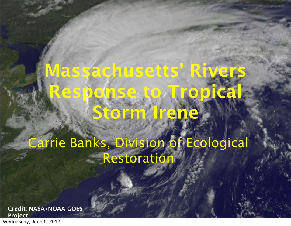
Ford Brook, Bug Hill Road, Ashfield
Source: You Tube
Wednesday, June 6, 2012

Ford Brook, Bug Hill Road, Ashfield
Source: You Tube
Wednesday, June 6, 2012
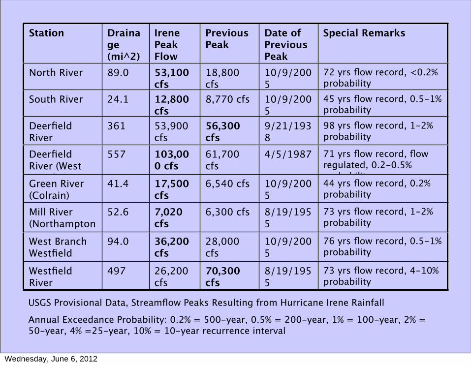
Station Drainage (mi^2)
Irene Peak Flow
Previous Peak
Date of Previous Peak
Special Remarks
North River 89.0 53,100 cfs
18,800 cfs
10/9/2005
72 yrs flow record, <0.2% probability
South River 24.1 12,800 cfs
8,770 cfs 10/9/2005
45 yrs flow record, 0.5-1% probability
Deerfield River (Charlemont)
361 53,900 cfs
56,300 cfs
9/21/1938
98 yrs flow record, 1-2% probability
Deerfield River (West Deerfield)
557 103,000 cfs
61,700 cfs
4/5/1987 71 yrs flow record, flow regulated, 0.2-0.5% probability
Green River (Colrain)
41.4 17,500 cfs
6,540 cfs 10/9/2005
44 yrs flow record, 0.2% probability
Mill River (Northampton)
52.6 7,020 cfs
6,300 cfs 8/19/1955
73 yrs flow record, 1-2% probability
West Branch Westfield River
94.0 36,200 cfs
28,000 cfs
10/9/2005
76 yrs flow record, 0.5-1% probability
Westfield River (Westfield)
497 26,200 cfs
70,300 cfs
8/19/1955
73 yrs flow record, 4-10% probability
USGS Provisional Data, Streamflow Peaks Resulting from Hurricane Irene Rainfall
Annual Exceedance Probability: 0.2% = 500-year, 0.5% = 200-year, 1% = 100-year, 2% = 50-year, 4% =25-year, 10% = 10-year recurrence interval
Wednesday, June 6, 2012
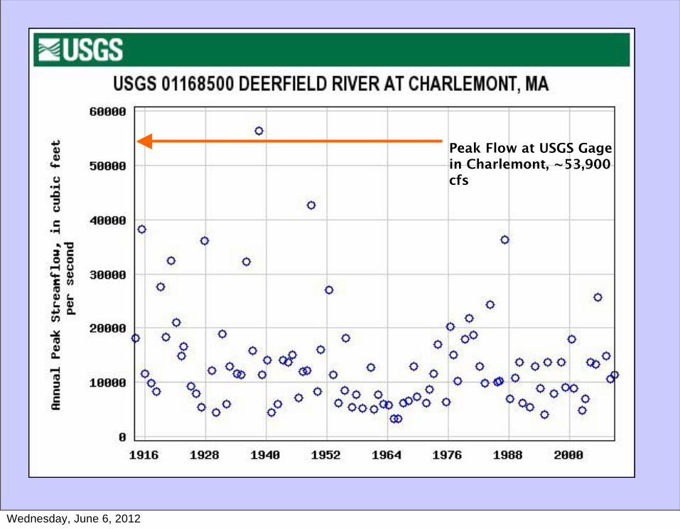
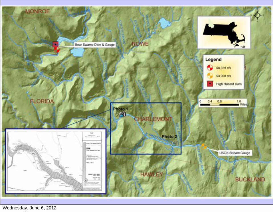
Peak Flow at USGS Gage in Charlemont, ~53,900 cfs
Wednesday, June 6, 2012
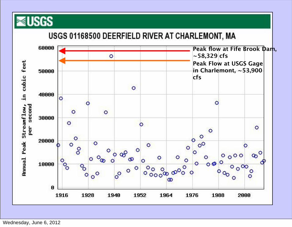
Peak flow at Fife Brook Dam, ~58,329 cfsPeak Flow at USGS Gage in Charlemont, ~53,900 cfs
Wednesday, June 6, 2012
Wednesday, June 6, 2012
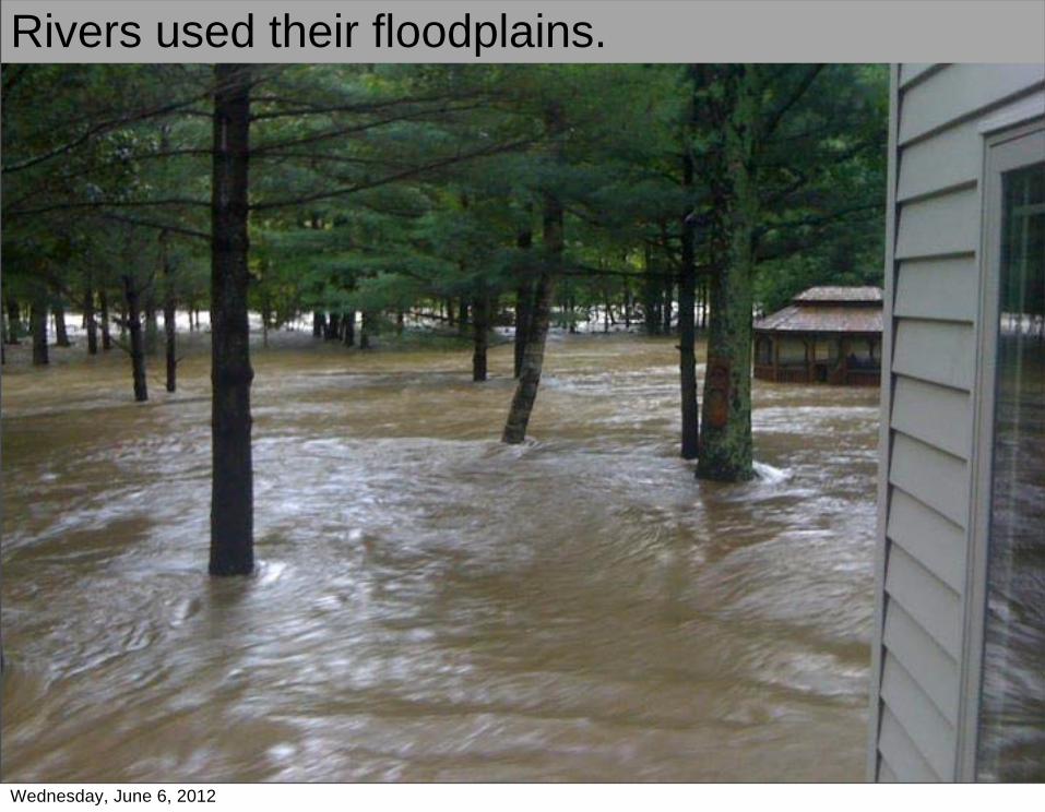
Rivers used their floodplains.
Wednesday, June 6, 2012
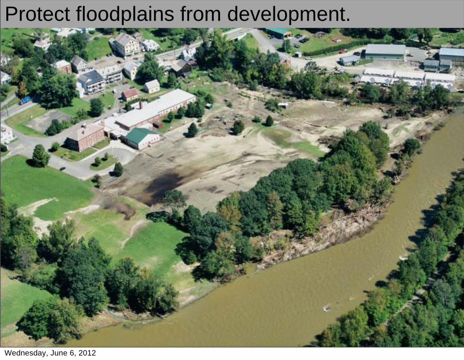
Protect floodplains from development.
Wednesday, June 6, 2012
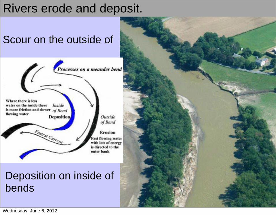
Scour on the outside of
Deposition on inside of bends
Rivers erode and deposit.
Wednesday, June 6, 2012

Deerfield River, Charlemont
Wednesday, June 6, 2012
Wednesday, June 6, 2012
Wednesday, June 6, 2012
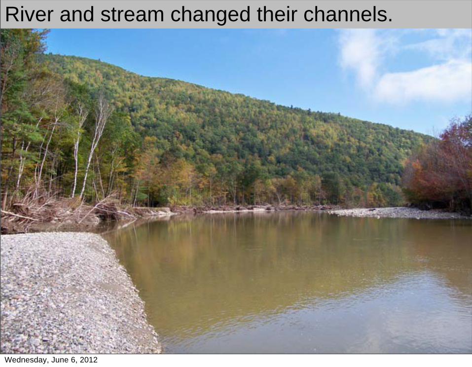
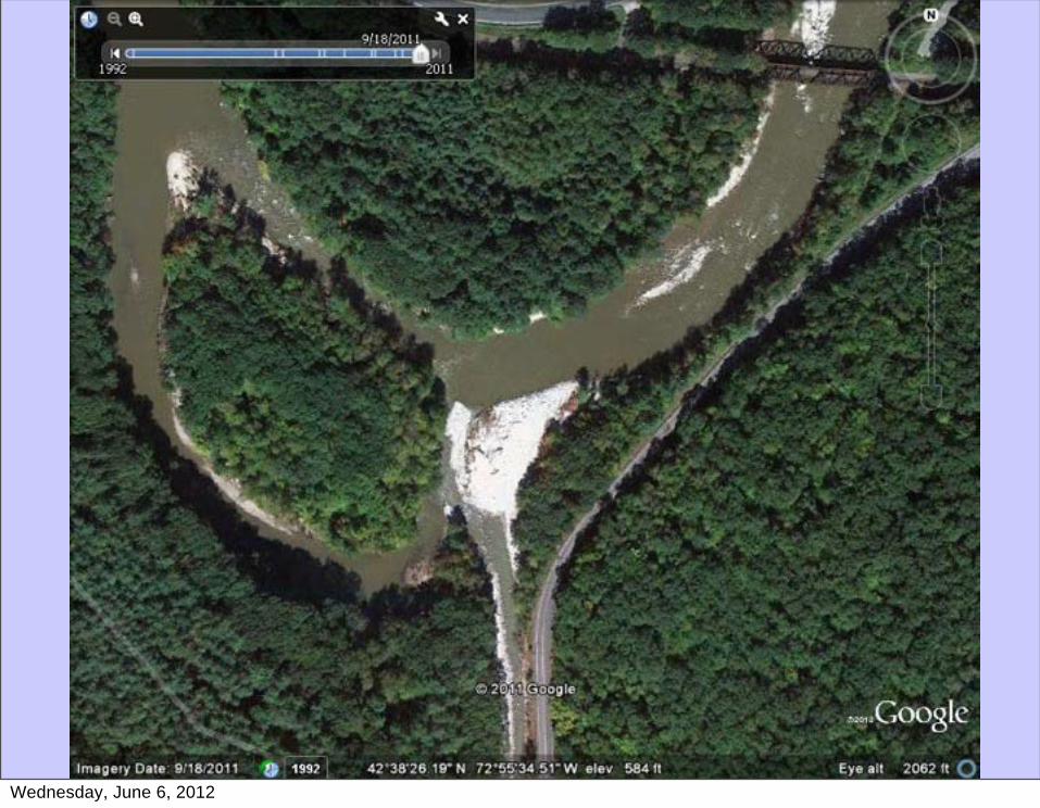
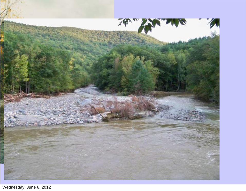
River and stream changed their channels.
Wednesday, June 6, 2012
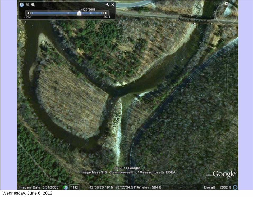
Wednesday, June 6, 2012
Wednesday, June 6, 2012

Wednesday, June 6, 2012
Wednesday, June 6, 2012
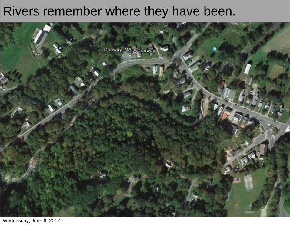
Rivers remember where they have been.
Wednesday, June 6, 2012

Rivers remember where they have been.
Wednesday, June 6, 2012
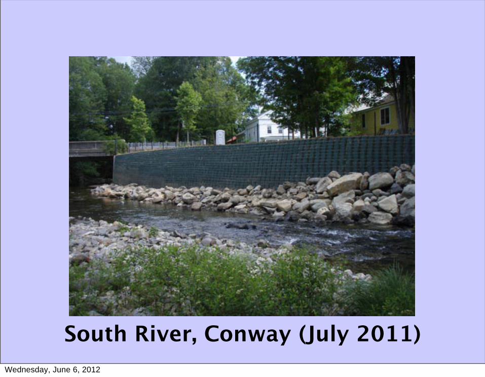
South River, Conway (July 2011)Wednesday, June 6, 2012
Wednesday, June 6, 2012
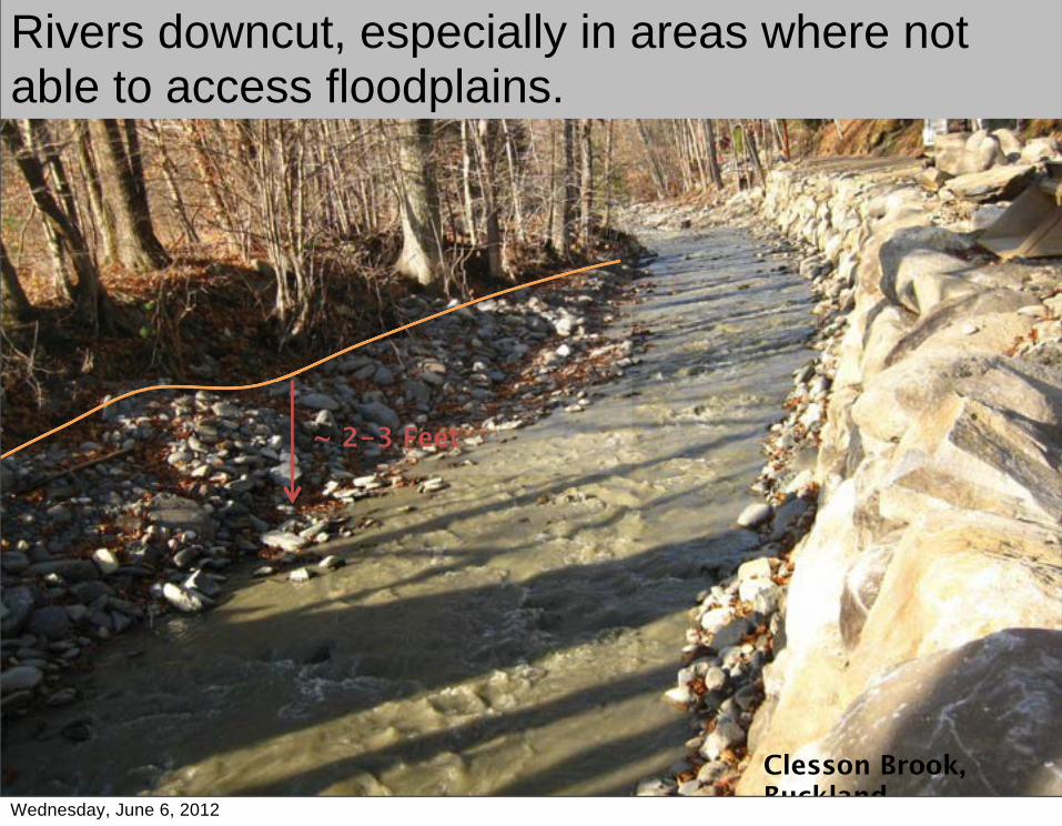
Rivers downcut, especially in areas where not able to access floodplains.
Clesson Brook, Buckland
~ 2-3 Feet
Wednesday, June 6, 2012
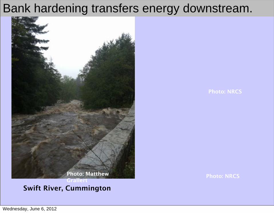
Swift River, Cummington
Photo: Matthew Grallert
Photo: NRCS
Photo: NRCS
Bank hardening transfers energy downstream.
Wednesday, June 6, 2012
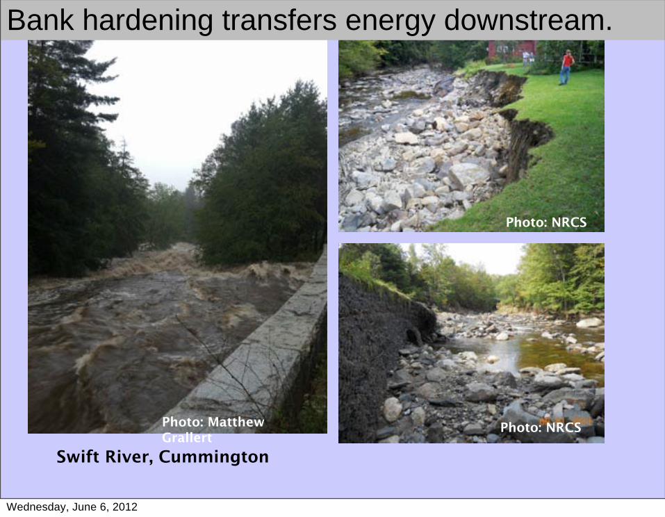
Swift River, Cummington
Photo: Matthew Grallert
Photo: NRCS
Photo: NRCS
Bank hardening transfers energy downstream.
Wednesday, June 6, 2012
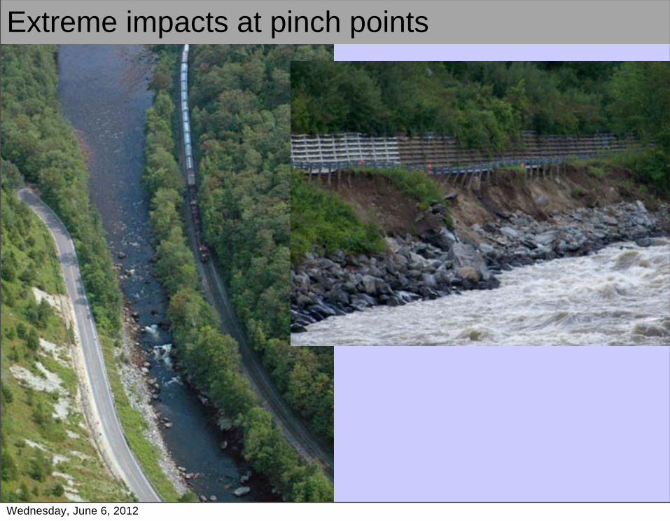
Extreme impacts at pinch points
Wednesday, June 6, 2012
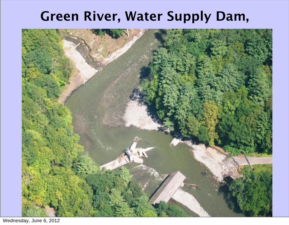
Green River, Water Supply Dam,
Wednesday, June 6, 2012
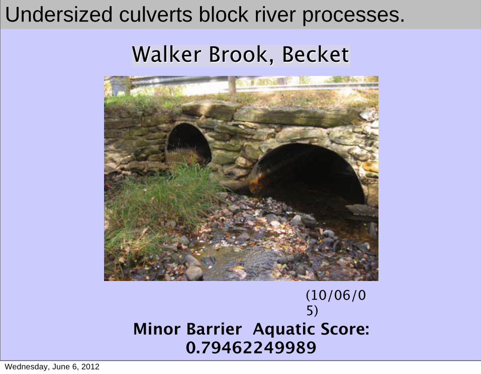
Walker Brook, Becket
(10/06/05)
Minor Barrier Aquatic Score: 0.79462249989
Undersized culverts block river processes.
Wednesday, June 6, 2012
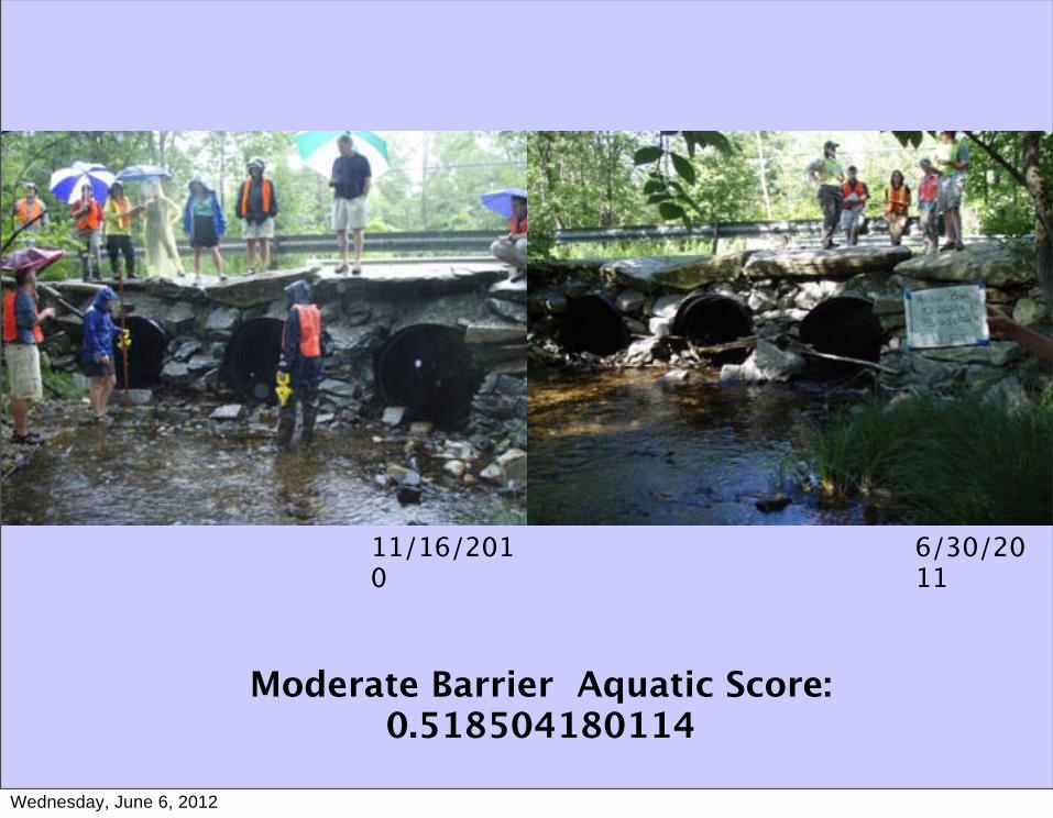
11/16/2010
Moderate Barrier Aquatic Score: 0.518504180114
6/30/2011
Wednesday, June 6, 2012
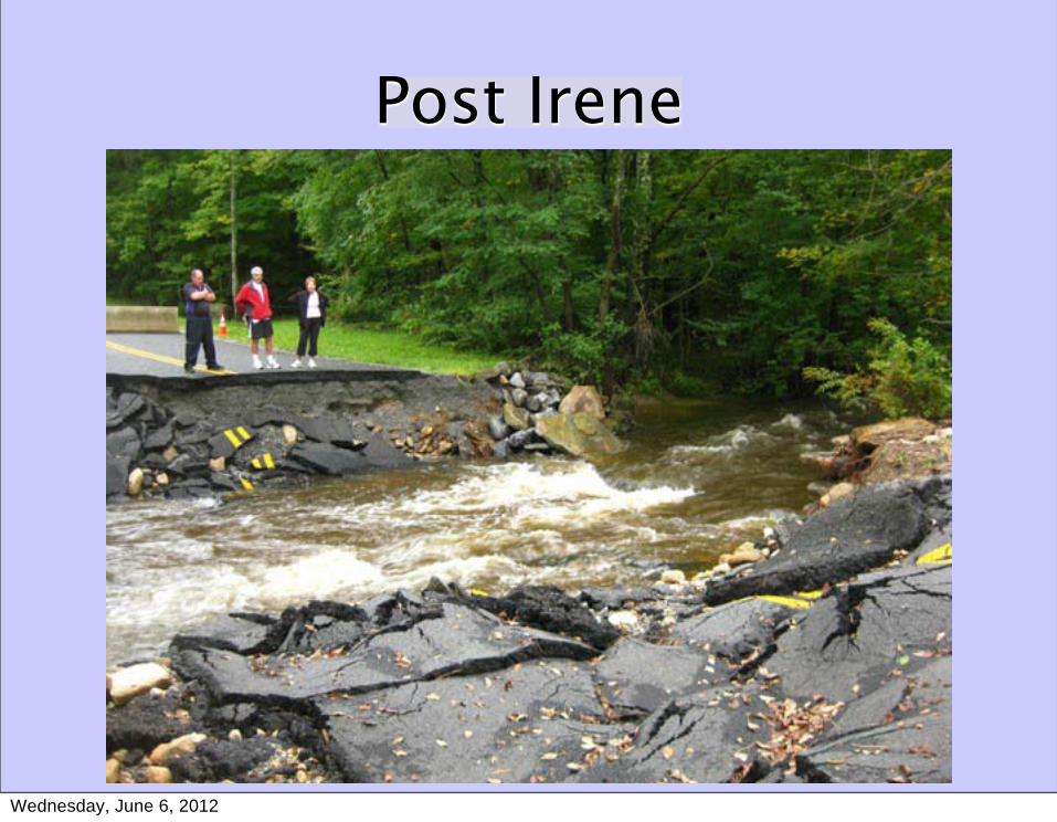
Post Irene
Wednesday, June 6, 2012
Wednesday, June 6, 2012
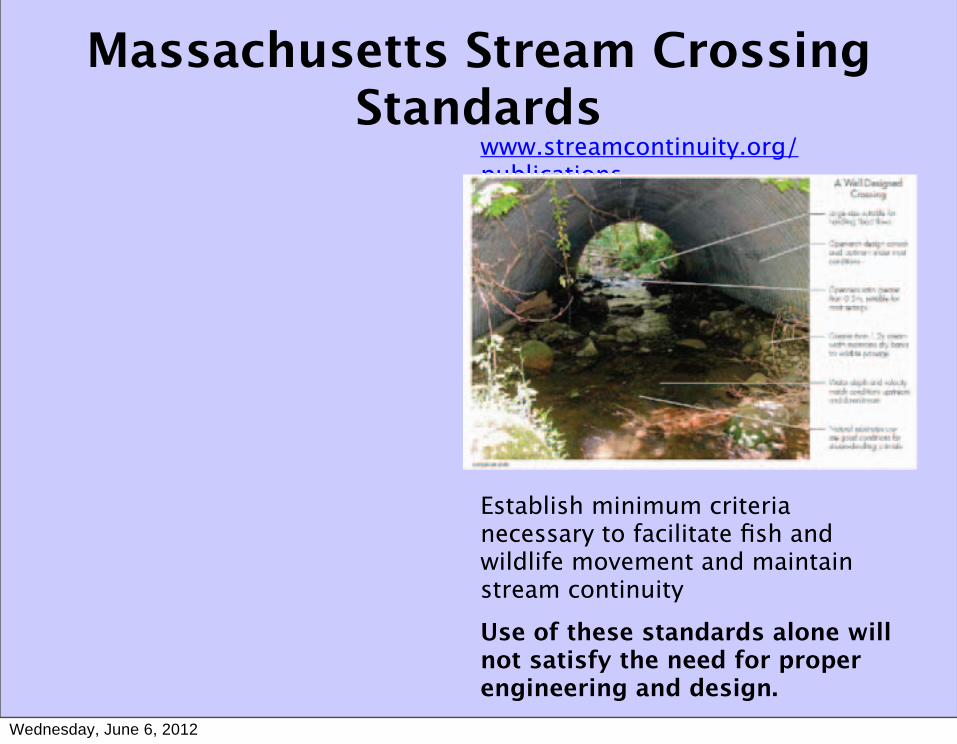
Massachusetts Stream Crossing Standards
www.streamcontinuity.org/publicationspublications
Establish minimum criteria necessary to facilitate fish and wildlife movement and maintain stream continuityUse of these standards alone will not satisfy the need for proper engineering and design.
Wednesday, June 6, 2012
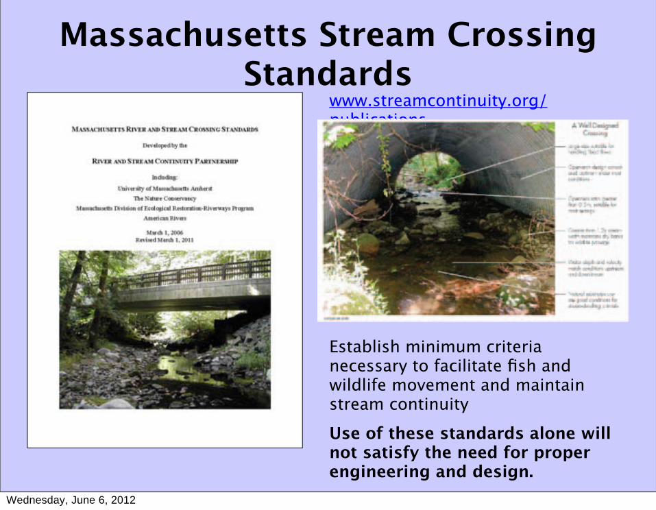
Massachusetts Stream Crossing Standards
www.streamcontinuity.org/publicationspublications
Establish minimum criteria necessary to facilitate fish and wildlife movement and maintain stream continuityUse of these standards alone will not satisfy the need for proper engineering and design.
Wednesday, June 6, 2012
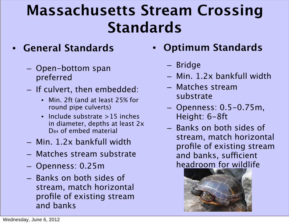
• General Standards
– Open-bottom span preferred
– If culvert, then embedded:• Min. 2ft (and at least 25% for
round pipe culverts)• Include substrate >15 inches
in diameter, depths at least 2x D84 of embed material
– Min. 1.2x bankfull width– Matches stream substrate– Openness: 0.25m– Banks on both sides of
stream, match horizontal profile of existing stream and banks
• Optimum Standards– Bridge– Min. 1.2x bankfull width– Matches stream
substrate– Openness: 0.5-0.75m,
Height: 6-8ft– Banks on both sides of
stream, match horizontal profile of existing stream and banks, sufficient headroom for wildlife
Massachusetts Stream Crossing Standards
Wednesday, June 6, 2012
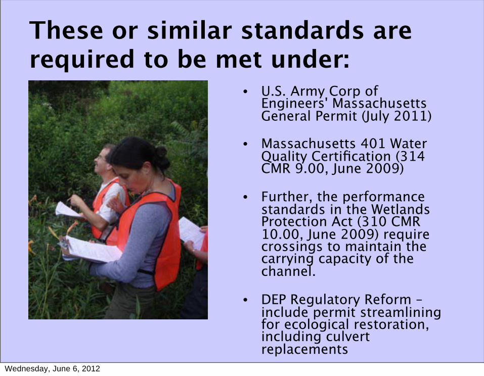
These or similar standards are required to be met under:
• U.S. Army Corp of Engineers' Massachusetts General Permit (July 2011)
• Massachusetts 401 Water Quality Certification (314 CMR 9.00, June 2009)
• Further, the performance standards in the Wetlands Protection Act (310 CMR 10.00, June 2009) require crossings to maintain the carrying capacity of the channel.
• DEP Regulatory Reform – include permit streamlining for ecological restoration, including culvert replacements
Wednesday, June 6, 2012
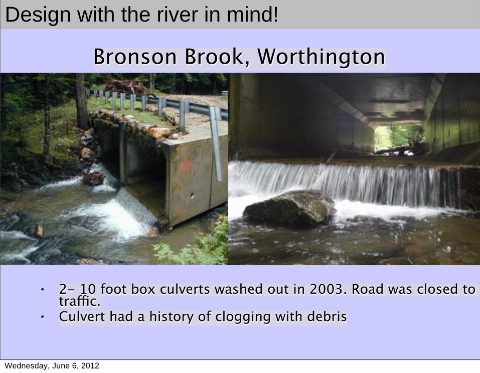
• 2- 10 foot box culverts washed out in 2003. Road was closed to all traffic.
• Culvert had a history of clogging with debris
Bronson Brook, Worthington
Design with the river in mind!
Wednesday, June 6, 2012
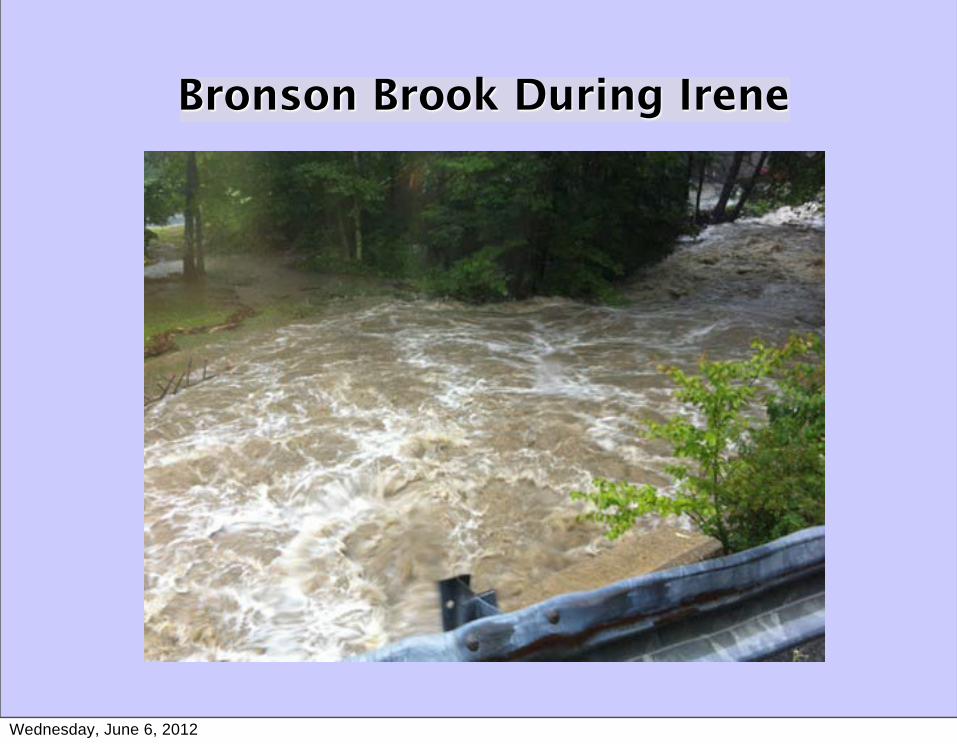
Bronson Brook During Irene
Wednesday, June 6, 2012
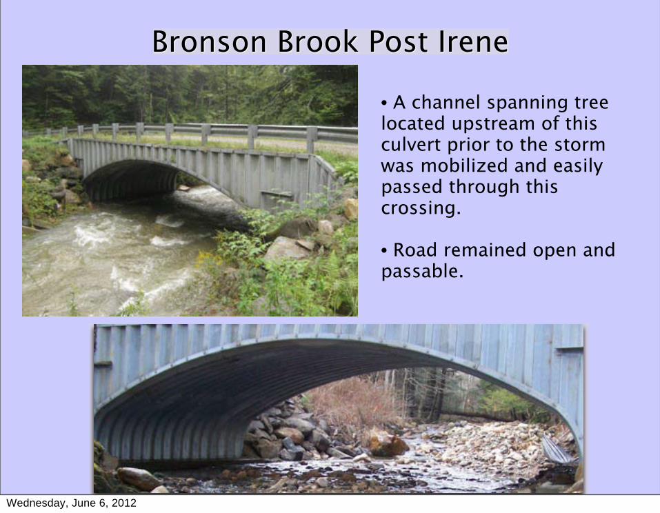
Bronson Brook Post Irene
• A channel spanning tree located upstream of this culvert prior to the storm was mobilized and easily passed through this crossing.
• Road remained open and passable.
Wednesday, June 6, 2012
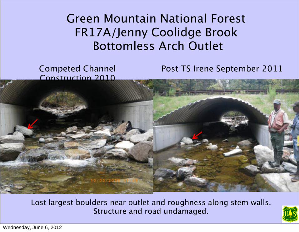
Green Mountain National ForestFR17A/Jenny Coolidge Brook
Bottomless Arch Outlet
Competed Channel Construction 2010
Post TS Irene September 2011
Lost largest boulders near outlet and roughness along stem walls. Structure and road undamaged.
Wednesday, June 6, 2012
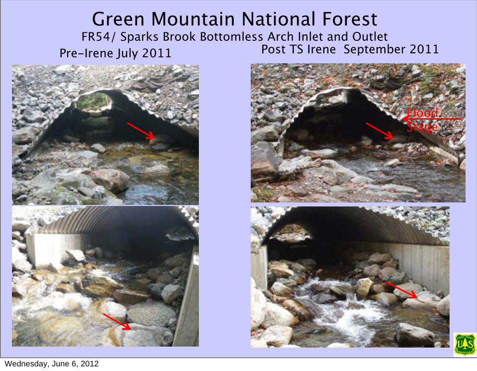
Green Mountain National ForestFR54/ Sparks Brook Bottomless Arch Inlet and Outlet
Pre-Irene July 2011 Post TS Irene September 2011
Flood Stage
Wednesday, June 6, 2012
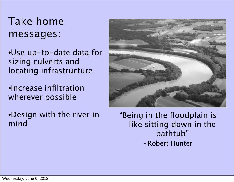
“Being in the floodplain is like sitting down in the
bathtub” ~Robert Hunter
Take home messages:•Use up-to-date data for sizing culverts and locating infrastructure
•Increase infiltration wherever possible
•Design with the river in mind
Wednesday, June 6, 2012


![IRENE Reflections on Weathering the Storm...IRENE: Reflections on Weathering the Storm | 10 [Far Left] A survivor stands outside one of the many flood distribution centers established](https://img.pdfslide.us/doc/110x75/5f368b2d55801712fa3d9b60/irene-reflections-on-weathering-the-storm-irene-reflections-on-weathering-the.jpg)