Embed Size (px)
Citation preview

Massachusetts Heritage Landscapes
a g u i d e t o i d e n t i f i c a t i o n a n d p r o t e c t i o n
Reading the Land
M A S S A C H U S E T T S D E P A R T M E N T O F C O N S E R V A T I O N A N D R E C R E A T I O N
H E R I T A G E L A N D S C A P E I N V E N T O R Y P R O G R A M
P R E P A R E D B Y P A L
C U LT U R A L R E S O U R C E M A N A G E M E N T C O N S U LT A N T S
“A rich and beautiful book
is always open before us.
We have but to learn to read it.”
Landscape. John Brinckerhoff Jackson. 1951
Massachusetts Heritage Landscapes
a g u i d e t o i d e n t i f i c a t i o n a n d p r o t e c t i o n
Reading the Land

2
123
4
Contents IntroductionPurpose of the GuideHeritage Landscapes DefinedPast Initiatives Value of Heritage LandscapesPreservation Issues
Heritage Landscape Inventory Pilot Project in Southeastern Massachusetts Pilot Study Area and ObjectivesProject EvolutionDiscoveries
Create a Heritage Landscape Program in Your CommunityEvery Community Needs a Heritage Landscape ProgramLearn About Heritage LandscapesDevelop Partnerships The InventoryEvaluate the Significance of Heritage LandscapesDistribute Survey FormsPlan to Preserve —The Next Step
Planning and Decision-MakingKnow and Understand Heritage LandscapesEducate the Community’s CitizensBuild Community Support Plan for PreservationKnow Preservation Strategies Key State, Regional, and Local Agencies and OrganizationsEpilogue —Looking Forward
AppendicesSuggested ReadingsContacts DCR Heritage Landscape Inventory Program Fact SheetSample Introduction LetterHeritage Landscape Survey ChecklistHeritage Landscape Inventory Pilot Project — Surveyed Landscapes
Photographs by PAL and DCR, except as otherwise noted.
3
14
21
33
42

3
ch
apter
on
e
1R
eading the Land, Massachusetts Heritage Landscapes: A Guide to
Identification and Protection celebrates the beauty and character inherent
in the landscapes of every community. This rich legacy is sometimes
as obvious as a breathtaking scenic vista. At other times the value is
obscured by layers of vegetation or construction, or concealed by lack of recognition of
a pattern or plan. Heritage, or cultural, landscapes is a broad term for the special places
created by human interaction with the environment that help define the character of a
community and reflect its past. The story told by the physical record of the history, inter-
woven with the natural environment, becomes clear as our ability to read the landscape
increases. The study of heritage landscapes reveals habits, concerns, and lifestyles of
those who came before us and shaped the environment we know. Recognition of
heritage landscapes and their meaning becomes the presence of our past.
Local government officials, preservation advocates, conservation activists, and citizens
who are enthusiastic about preserving local community character will find information
in this Guide to assist the process of recognizing, understanding, and protecting local
heritage landscapes. Once we have identified important landscapes, we must consider
the vulnerabilities of these fragile resources and the preservation opportunities available
to protect them. The three sequential preservation phases of identification, evaluation,
and protection are addressed in this Guide. The recently completed Heritage Landscape
Inventory Pilot Project in southeastern Massachusetts provides examples of heritage
landscapes and decision-making situations.
The far-reaching goal of the Heritage Landscape Inventory Program of the
Massachusetts Department of Conservation and Recreation (DCR) is to lay the ground-
work at the local level for an integrated planning approach to preservation of the overall
“… a landscape is not a natural feature of the environment, but a synthetic space, a man-made
system of spaces superimposed on the face of the land, functioning and evolving according
to natural laws, but to serve a community— for the collective character of the landscape is one
thing that all generations and all points of view have agreed upon.”
Discovering the Vernacular Landscape. John Brinckerhoff Jackson. 1984:8
Introduction
Purpose of the Guide

4
intr
od
uc
tion
cultural landscape: the historic, scenic, and environ-mental qualities that define each community andregion. Through the identification of heritagelandscapes, public officials and citizens will gainan understanding and appreciation of the broadrange of historic and natural landscapes that arecentral to the identity of their communities. Theprocess of gathering and using the informationwill bring together different constituencies andprovide a framework for future conservation andpreservation planning.
Heritage Landscapes DefinedHeritage landscapes are dynamic and evolving,reflecting the relationship between human cultureand history, and the natural ecology that influencedland use and development of an area. Four principalcategories of heritage landscapes exist: historicvernacular landscapes, historic designed landscapes,historic sites, and ethnographic landscapes.
Landscapes often fit into more than one heritagelandscape category. For example, a ceremonial siteon tribal lands may be a historic site as well as anethnographic landscape. A river valley of contiguousfarms is a historic vernacular landscape, and mayalso contain an estate with a historic designedlandscape of formal gardens. A scenic road may bea designed parkway with historic vernacular land-scape components along the edges and in the vistas.Many town commons are as much historic ver-nacular landscapes as they are historic designed
landscapes. Recognizing and understanding thisoverlap of categories is an important element of theidentification and evaluation process.
In addition to representing one or more heritagelandscape categories, heritage landscapes can en-compass numerous landscape types. For example, aheritage landscape may include multiple contiguouselements such as a road, as well as farms, residences,and burial grounds along its route. Each landscapetype may be associated with any of the four heritagelandscape categories. A residential landscape maybe a designed subdivision or a collection of farm-steads arranged in a linear fashion along a countryroad forming a vernacular landscape. The frequencyand distribution of landscape categories and typesilluminates land use patterns and the history of acommunity or region.
Many heritage landscapes also have scenic char-acteristics, or notable picturesque elements, thatare usually associated with natural landscapes.Heritage landscapes with scenic characteristicsreveal the history of land use and ecology; andthey are both visual assets as well as natural andcultural resources. These heritage landscapesoften are large and may encompass several typesof landscapes. Boundaries may be difficult todefine, particularly for heritage landscapes withscenic vistas, such as ocean dunes, beaches, forests,river valleys, and geologic formations.
Past InitiativesMassachusetts is a longtime national leader in theidentification and preservation of important land-scapes. The picturesque quality of Massachusetts’landscapes has been recognized for generations,however, the first formal statewide recognitionoccurred in 1929 when a Governor’s Committeecommissioned Charles W. Eliot II to prepare astatewide landscape inventory. In 1933, landscapearchitect Bradford Williams for The Trustees ofReservations (TTOR) identified the most valuablescenic areas in the Commonwealth. This study was
Betty’s Neck, Assawompsett PondComplex
The Assawompsett Pond Complex inLakeville, Middleborough, Freetown andRochester is a series of freshwater pondsand important adjacent land formations,rich in natural and cultural resources, witha long history stretching back 10,000 yearsto the earliest periods of Native Americanoccupation. This natural, agricultural, andarchaeological landscape with significantscenic qualities is comprised of six intercon-nected ponds and adjacent land in Lakeville,Middleborough, Rochester and Freetown,demonstrating that water resources requireattention from constituents of neighboringcommunities. This fact is compounded bythe ownership of much of the complex bythe cities of New Bedford and Taunton forwhich the ponds are a main part of theirwater supply. The complexity of this richhistorical and natural heritage landscape isunique and worthy of preservation in thecontext of continued planning and develop-ment pressures from adjacent towns andfrom the cities that own the water supply.Long Pond, one of the six ponds, is used forrecreational activities, which presents yetanother set of complex management issues.Lakeville and Middleborough treasure thePond Complex and the land peninsula ofBetty’s Neck for their natural beauty andfor the rich archaeological potential of thearea. In short, the number of pressures islarge, as is the number of constituents toadvocate for the landscape that has beenrecognized by the inventory process.

5
ch
apter
on
e
Tremont Advent ChristianCampmeeting Association, Marion
Ethnographic landscapes are a collection of resources regarded as culturally associatedwith a particular group of people. Examplesinclude Native American reservations,religious or ceremonial sites, and contempo-rary settlements associated with a specificcultural or ethnic group.
Horseshoe Pond, Wareham
Historic vernacular landscapes reflecteveryday lives and activities. They are thelargest category of heritage landscapes.Nearly every landscape without a formaldesign is vernacular. Examples includearchaeological sites, rural farmsteads, towncenters, cranberry bogs, mill complexes,maritime ports, and shipyards.
Unity Close, Easton
Historic designed landscapes were plannedand laid out using a recognized style or tradition of landscape architecture. Examplesinclude civic spaces, parks, gardens, cemeteries, institutional grounds, campuses,estates, planned communities, and parkways.
Council Oak, Dighton, historic view
Tree succumbed to disease, vandalism, stormdamage, and age in fall of 2002.
Historic sites are landscapes that derive theirimportance from an association with a historic event, activity, or person. Examplesinclude battlefields, burial grounds, andbirthplaces or homes of a president or otherimportant person.
preservation constituencies, the CommunityPreservation Initiative was established to preserveand enhance the quality of life across theCommonwealth. The work of the Initiative, com-munity-based and organized by watershedsthroughout the state, was the model adopted forDCR’s Massachusetts Heritage LandscapeInventory Program.
The Massachusetts Heritage Landscape InventoryProgram was launched in partnership with interestedpublic and private organi-zations and is overseenby a Statewide AdvisoryCommittee that includesrepresentation from DCR,MHC, and two privatenon-profit organizations,PRESERVATION Mass (formerly HistoricMassachusetts, Inc.) and TTOR. The June 1999publication of an important report, Conservingour Common Wealth: A Vision for the MassachusettsLandscape, published by the Land ConservationCenter of TTOR, provided a precedent for examin-ing the statewide context of heritage landscapesincluding threats and conservation efforts.
the first statewide effort at listing the range oflandscape types and was accompanied by a call topreserve this rich heritage.
Fifty years passed before two distinctly differentinventory efforts revisited the concept of landscapeinventory in the early 1980s. In 1982, DCR under-took the Massachusetts Landscape Inventory,which built on the earlier work of TTOR andidentified large-scale scenic landscapes. The otherinitiative, a survey of 10 public landscapesdesigned by the Olmsted firm, was conducted by apublic-private partnership led by the MassachusettsAssociation for Olmsted Parks involving theFrederick Law Olmsted National Historic Site, theMassachusetts Historical Commission (MHC), theBeacon Hill Garden Club, and the HubbardEducational Trust. The resulting report, Olmstedin Massachusetts: the Public Legacy (1983), a pilotproject for a national inventory, stimulatedstatewide interest and support for the preservationof public parks.
Recently planners and policy makers have rec-ognized the need for an integrated approach tosurvey all types of landscapes as a critical tool forcommunity planning. One of the first steps takenby Robert Durand while Secretary of Environ-mental Affairs was the formation of theMassachusetts Community Preservation Initiativein 1999. In response to growth pressures and strong
Heritage Landscape Definition and Categories Heritage landscapes are special places created by human interaction with the natural environment.
Heritage landscapes convey aspects
of our shared history that forge
our cultural identity.
Rav
en L
ittle
river
, pho
togr
aphe
r

6
intr
od
uc
tion
Value of Heritage LandscapesThe everyday value of heritage landscapes hasbeen reinforced across the Commonwealth by citi-zens in many communities who voice concernsabout the preservation of community character.Reasons stated for living in a particular region orcommunity nearly always refer to aspects of thelandscape—the scenic qualities of rural farms, thepastoral character of village centers, the sight andsounds of a river passing over a waterfall, thewaves of the sea lapping on a rocky coastline, orthe bustle of a thriving city streetscape. Heritagelandscapes are all around us, giving form to ourlives. The intrinsic value of heritage landscapesprovides lasting personal value as memories forresidents and visitors and is captured as places ofthe heart that evoke specific past events or nostalgia
A R C H A E O L O G I C A L
PrehistoricHistoric
A G R I C U LT U R A L
Farm Complex Truck/MarketDairy OrchardCranberry BogViticultureFarm LandWall/Fence/Structure
B U R I A L
Burial Ground or SiteCemetery
C I V I C
Village or Area within a CommunityPoundStreetscapeGrounds of Public BuildingsCommemorative
C O M M E R C I A L
Central Business District
E T H N O G R A P H I C
Religious/Ceremonial Site
Ethnic Settlement
I N D U S T R I A L
MillFactoryMill/Factory VillageMineQuarryPortHarborShipyard
HERITAGE LANDSCAPE TYPES
for a bygone era. These landscapes convey aspectsof our shared history that forge our cultural identity.Heritage landscapes also reflect ecological and envi-ronmental conservation concerns, affect the realestate market, and attract tourism and recreation.
Heritage landscapes provide each communitywith its own unique sense of place. Once we beginto look with an informed view, we see the wealthof knowledge that such landscapes convey aboutour community’s past, the emotional connectionmany have to certain places, and how this awarenesscan improve our communities and our lives.
Preservation IssuesCitizens throughout the Commonwealth recognizethe need to preserve the unprotected heritagelandscapes that are an asset to the character andvitality of their community. This acknowledgmentis generating interest in and support for preservationopportunities. However, more work needs to bedone in educating residents about heritage land-scapes, recognizing threats to heritage landscapes,and building frameworks for their preservation.
The Heritage Landscape Inventory Programaddresses a general lack of understanding andconcern about the significance of heritage land-scapes that continues to exist despite many pastand ongoing landscape initiatives. The gap resultsfrom our sometimes limited ability to read thecharacteristics of heritage landscapes, which arefrequently complex and not easily recognized. Wealso have a tendency to view cultural, natural, andscenic qualities as separate entities. They are not,however, independent. These qualities intertwineto create the special place that we may take forgranted and not truly see, even though we know itas an integral part of a community. Can we inter-pret how topographic features, including water,terrain, and soils, have significantly influencedland use patterns, particularly in prehistoric andearly historic period settlements? The breathtakingview from a mountaintop or over the sand dunes iseasily understood; but what can help us recognizehidden evidence of historical development withinthose landscapes? What do we not understandabout the industrial ruin with a collapsing dam, orthe overgrown fields of an abandoned farm?
The particular nature of landscapes can makethem difficult to understand, and the apparentlycontinuous presence of a heritage landscape may
I N S T I T U T I O N A L
SchoolCollege CampusMuseumReligiousSocial/Medical
M I L I TA RY
BattlefieldFort
N AT U R A L
River/EstuaryLake/PondWetlandTopography/GeologyForestBeach
O T H E R
Non-classifiable Places of the HeartVista
R E C R E AT I O N A L /O P E N S PA C E
CommonTraining FieldParkGarden Resort Active RecreationFairgrounds
R E S I D E N T I A L
EstateNeighborhood
T R A N S P O RTAT I O N
RoadBoulevard/ParkwayTrailRailroadWaterwayBridge
Crane Farm, Norton
� � � � � � � � � � � � � � � � � � � � � � � � � � � � � � � � � � � � � � � � � � � � � �

7
ch
apter
on
e
Crane Farm, Norton
Layering of land use is evident in a farm-stead heritage landscape that may includearchaeological sites, an eighteenth-centuryfarmhouse, mid-nineteenth-century barns,and twentieth-century agricultural patternsand building types demonstrating theimpact of new technology.
Titicut Green, Middleborough
Layering of land use is evident in a villagecenter laid out at the intersection of roadsthat once were Native American trails,around a green or common that was partof an eighteenth-century land grant, withdwellings and institutional buildings representing two centuries of construction.
Village Cemetery, Rehoboth
Cemeteries and burial grounds reveal decadesof history in every community and period of development. Cemeteries follow naturalor modified topography and are usuallylocated in relatively rock-free soils. A cemeterymay contain eighteenth-century burials and the archaeological site of a long-gonemeetinghouse, surrounded by elaboratemonuments, entrance gates, and a chapelreflecting nineteenth- and twentieth-centuryaesthetics and attitudes toward death.
Dodgeville, Ten Mile River, Attleboro
Water features such as coastal areas, rivers,lakes, and ponds have influenced transport-ation, settlement patterns, food production,land fertility, and power for industrializationthroughout all periods of development.
Route 105, Rochester
Initial settlers took the path of least resistancein laying out roads, following the terrainand, often, existing Native American routes.Later, improved road-building technologylinked town centers and industrial nodes ina transportation network increasingly dictatedby efficiency rather than natural features.
Assonet Cedar Swamp, Lakeville
Natural resources such as woodland, bogiron, and fertile soils influenced the locationof agricultural settlements, industry, residentialneighborhoods, and civic centers.
Natural and Historic Features in Heritage Landscapes
Heritage landscapes embody a layering of natural and historic
elements and reflect the relationship of those factors over time.
Village Cemetery, Rehoboth Titicut Green, Middleborough
Route 105, Rochester
Assonet Cedar Swamp, Lakeville
Dodgeville, Ten Mile River, Attleboro

8
intr
od
uc
tion
lead to an assumption that it will be ever present inits current form. The essential elements of a countryroad lined with cow pastures and fields of cornmay appear unchanged over the last century. We arelulled into assuming that it is an enduring part of thelocal cultural landscape. The town common ringedby eighteenth- and nineteenth-century buildings—church, town hall, and library—may look like a permanent fixture, immune to alteration.Landscapes that have limited access and visibility,such as old mill remnants or riverbanks lined withsalt marsh hay on private property with no publicroad, may generate no communal knowledge oftheir existence or significance. In fact, landscapesare dynamic, changing natural and cultural systemsin which integrity and significance are linked totransformation through time. Yet, sharp differencesexist between the inevitable and evolutionarychanges inherent in a heritage landscape and theintrusive impact of an external force at odds withthe character of that landscape.
Lack of access or interest can keep a propertyout of community focus and afford some protection.Generally however, it is difficult to gain the commu-nity support necessary to preserve an unrecognizedheritage landscape in the event that somethingoccurs or is planned that may have a negative effecton the property. The more communities recognizeand understand threats, the better equipped theywill be to counter with appropriate preservationtechniques. The Heritage Landscape InventoryProgram seeks to inform citizens about the valuesand vulnerability of the character-defining featuresthat make a community special.
Threats to Heritage Landscapes
Pressures that can threaten the preservation ofheritage landscapes may be imminent or long-term.The most common threats to heritage landscapesrelate to lack of knowledge or concern, type ofownership and stewardship, planning and develop-ment potential, environmental issues, deteriorationand neglect, lack of secure long-term protectivemechanism, or a combination of pressures. A threatto one landscape may not endanger another andsome pressures are more immediate than others;therefore it is important to recognize the contextand issues surrounding each heritage landscape
and every potential threat. In basic terms, theunprotected landscape is one that does not have along-term legal mechanism in place to preserve thequality of the resource.
Ownership and stewardship influence access,visibility, and advocacy and are key aspects thatcontribute to the future of character-definingheritage landscapes in a community. Landscapes inprivate ownership without long-term legal protec-tion may be vulnerable in the future for economicand social reasons. A farm in service today maynot be economically viable tomorrow, or the nextgeneration may not choose to farm the land in thefuture. An estate that retains its designed landscapeand scenic qualities may not be sustained by thenext generation, particularly if the heirs no longerremain in the area. There may be no advocatesbecause of a lack of access and visibility, and littleknowledge of these landscapes.
A publicly or institutionally owned heritagelandscape may appear to be in good hands, butmay not be protected in the long term. The ownermay have no long-term management, use, orpreservation plan for the property, or sufficientfunds to preserve the resource. A community mayacquire a property—a farm or an estate—for itsheritage landscape value. If no plan is in place, andno legal covenants and restrictions on future useexist, the same legislative body that elected toreceive or purchase the property also may elect tochange the use of the property to one incompatiblewith the resource. A school or a hospital in a campussetting may close, which could lead to a new usethat is incompatible with the heritage landscape inwhich the institution exists today. The use of acemetery is not likely to change, but the budgetof the municipality may not support currentmaintenance needs, threatening the future pre-servation of the landscape.
Planning and development possibilities arepressures experienced everywhere and can alterany resource that is not permanently protectedagainst such threats. Potential or imminentdevelopment pressures are informed by manyvariables such as the economy; soil conditions;transportation options; and local, state and federalregulations. A heritage landscape may be sub-
COMMON THREATS TO
HERITAGE LANDSCAPES
Lack of Knowledge or Concern
Ownership and Stewardship
Planning and Development
Environmental Changes
Deterioration and Neglect
Lack of Long-Term ProtectiveMechanism

9
ch
apter
on
e
Wankinco River, Wareham
The Wankinco River and its tributariesextend roughly north-south through thecenter of Wareham. The upstream areasinclude portions of a large and regionallysignificant Pine Barrens, which is one offour on the eastern seaboard. In addition toits value as a natural resource, the WankincoRiver is connected to the industrialand agricultural history of southeasternMassachusetts. With excellent waterpow-er and proximity to interior towns ofPlymouth County, Wareham became acenter for iron-related industries in thenineteenth century. A transportation canalwith two locks linked two nineteenth-century mills. By the end of the late nine-teenth century, cranberry bogs became afixture within the Wankinco River landscape.
Redway Plain, Rehoboth
Redway Plain, owned by the Town ofRehoboth, is a highly visible open fieldadjacent to the Village Cemetery and valuedby the community for its historical associa-tions and as an open space with scenicqualities. The Plain once was part ofRedway Farm and was used as a trainingground during the Revolutionary War.Pressures are related in part to the town’sinterest in additional recreational facilities.Soccer fields with a structure such as anequipment or maintenance shed have beenproposed for this open space. This recre-ational use would require grading to levelthe playing fields and possibly result in theneed for parking. Clearly this would alterthe pastoral view across Redway Plain andchange the feeling and ambiance of the area.Building an advocacy group to countersuch a conversion sometimes can be chal-lenging when there are conflicting intereststhat address community needs.
Powder House Graveyard, West Brigewater
The Powder House Graveyard, also knownas the Matfield Street Cemetery, in WestBridgewater is a well-documented smallmunicipal burial ground with strong associ-ations to the families who occupied theneighborhood in the eighteenth and nine-teenth centuries. The general character ofthe burial ground has been well preservedbut severe biological growth threatens thestones, many of which have become largelyunreadable. This deterioration poses animminent threat to the historical and artisticrecord of the headstones. The failing mortarin the front wall also poses a potential hazard.Lastly, many of those headstones locatedclosest to the street are leaning dangerouslyforward. The town lacks the funds and tech-nical expertise to undertake more substantialpreservation treatments.
During the twentieth century, Warehambecame a leading cranberry distributioncenter. The construction of cranberry bogson the river significantly altered the river’snatural setting. Currently, 1,000 acres ofprivately owned cranberry bogs are locatedadjacent to the river’s banks, for whichthere is only limited access. Preservationconcerns for the Wankinco River are cen-tered on the possibility of large-scaledevelopment that would affect 6,000 acresin three towns and would halt generationsof cranberry farming as well as threaten thearchaeology of the ironworks. Environ-mental and development pressures arebrought to bear by the largest developmentproject proposed in New England to date.
Gre
g G
uim
ond
of S
RP
ED
D, p
hoto
grap
her

10
intr
od
uc
tion
Drift Road, Westport
Drift Road is a scenic road that runs alongthe west side of the East Branch of theWestport River for approximately 7 miles.The northern end of the road begins in thehistoric village of the Head of Westport,comprised of several industrial sites, aschoolhouse, a town landing, and historicresidences. Whaling was the principal indus-try in Westport until 1875, when petroleumwas discovered. Many of the residences alongDrift Road near the Head of Westport andat Westport Point date from the first three-quarters of the nineteenth century. With thedemise of the whaling industry, Westport’seconomy focused on agriculture and fishing.This shift is well represented by the historicbuildings, outbuildings, fields, and stonewalls along Drift Road. Drift Road isunique, as it offers two different types ofsettings; a riverine-agricultural setting andopen scenic vistas that are part of the riveron the northern section, and the densewoods that line the road obscuring earlydwellings and the river on the southern end.Major threats to Drift Road include pressurefor residential subdivisions.
stantially altered by residential, recreational, utility,or commercial development that is spurred byeconomic benefits. Traffic volume and patternsaffect the use of land in a newly laid out subdivisionor at the town center where a once scenic roadbecomes a through route.
Environmental changes that impact heritagelandscapes may be related to regulations or tonatural conditions. An invasive plant, such as purple
Native American Occupation
12,000 Before Present –1500 a.d.Archaeologists document 12,000 years of prehistoricNative American occupation of the region. Settlementwas based on hunting and collecting along and acrosswaterways, then shifted to coastal habitation. Largepopulations lived in nucleated settlements and devel-oped complex social ties, with language, kinship, ideology, and trade linking groups across the northeast.
DD EE VV EE LL OO PP MM EE NN TT AA LL TT II MM EE LL II NN EE OO FF MM AA SS SS AA CC HH UU SS EE TT TT SS
European Contact
1500 –1620 Native Americans favored seasonal sites near water, linked by trail networks.Groups coalesced into tribes known as Massachusett,Mohegan, Nauset, Nipmuck, Pennacook, Pequot,Pocumtuck, Pokanoket, Narragansett, andWampanoag. European explorers and traders brought new material goods, ideas, and diseases.
loosestrife growing at the edge of a millpond orriver shore, may be picturesque today. However,the invader can drive out native plants and changethe local ecology, creating a large threat to thefuture retention of that water source. Erosionalong shorelines or from man-made fissures suchas dirt bike paths can threaten the integrity ofarchaeological sites and landscape topography. Themanagement and maintenance of the water control
11
ch
apter
on
e
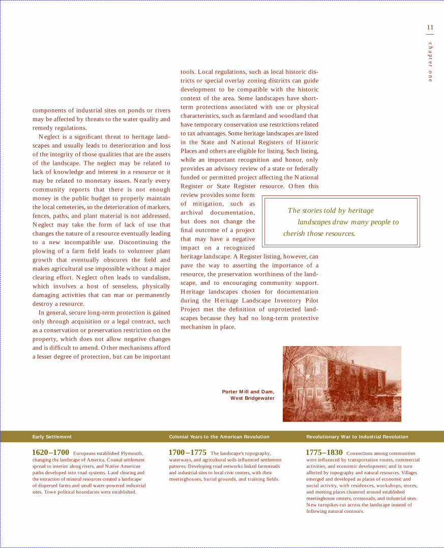
components of industrial sites on ponds or riversmay be affected by threats to the water quality andremedy regulations.
Neglect is a significant threat to heritage land-scapes and usually leads to deterioration and lossof the integrity of those qualities that are the assetsof the landscape. The neglect may be related tolack of knowledge and interest in a resource or itmay be related to monetary issues. Nearly everycommunity reports that there is not enoughmoney in the public budget to properly maintainthe local cemeteries, so the deterioration of markers,fences, paths, and plant material is not addressed.Neglect may take the form of lack of use thatchanges the nature of a resource eventually leadingto a new incompatible use. Discontinuing theplowing of a farm field leads to volunteer plantgrowth that eventually obscures the field andmakes agricultural use impossible without a majorclearing effort. Neglect often leads to vandalism,which involves a host of senseless, physicallydamaging activities that can mar or permanentlydestroy a resource.
In general, secure long-term protection is gainedonly through acquisition or a legal contract, suchas a conservation or preservation restriction on theproperty, which does not allow negative changesand is difficult to amend. Other mechanisms afforda lesser degree of protection, but can be important
tools. Local regulations, such as local historic dis-tricts or special overlay zoning districts can guidedevelopment to be compatible with the historiccontext of the area. Some landscapes have short-term protections associated with use or physicalcharacteristics, such as farmland and woodland thathave temporary conservation use restrictions relatedto tax advantages. Some heritage landscapes are listedin the State and National Registers of HistoricPlaces and others are eligible for listing. Such listing,while an important recognition and honor, onlyprovides an advisory review of a state or federallyfunded or permitted project affecting the NationalRegister or State Register resource. Often thisreview provides some formof mitigation, such asarchival documentation,but does not change thefinal outcome of a projectthat may have a negativeimpact on a recognizedheritage landscape. A Register listing, however, canpave the way to asserting the importance of aresource, the preservation worthiness of the land-scape, and to encouraging community support.Heritage landscapes chosen for documentationduring the Heritage Landscape Inventory PilotProject met the definition of unprotected land-scapes because they had no long-term protectivemechanism in place.
Early Settlement
1620–1700 Europeans established Plymouth,changing the landscape of America. Coastal settlementspread to interior along rivers, and Native Americanpaths developed into road systems. Land clearing andthe extraction of mineral resources created a landscapeof dispersed farms and small water-powered industrialsites. Town political boundaries were established.
Revolutionary War to Industrial Revolution
1775–1830 Connections among communitieswere influenced by transportation routes, commercialactivities, and economic development; and in turnaffected by topography and natural resources. Villagesemerged and developed as places of economic andsocial activity, with residences, workshops, stores,and meeting places clustered around establishedmeetinghouse centers, crossroads, and industrial sites.New turnpikes cut across the landscape instead offollowing natural contours.
Colonial Years to the American Revolution
1700 –1775 The landscape’s topography, waterways, and agricultural soils influenced settlementpatterns. Developing road networks linked farmsteadsand industrial sites to local civic centers, with theirmeetinghouses, burial grounds, and training fields.
The stories told by heritage
landscapes draw many people to
cherish those resources.
Porter Mill and Dam, West Bridgewater

12
intr
od
uc
tion
Preservation Opportunities
The Heritage Landscape Inventory Pilot Projectestablished that heritage landscapes are highly variedand endure all around us, that they do have valueto individuals and communities, and that a criticalneed exists for their preservation. The stories toldby heritage landscapes draw many people to cherishthose resources. Protection of these qualities isimportant in preserving the past and maintainingthe sense of place for the future. The significanceof the studied heritage landscapes, combined withthe community interest and support for this project,demonstrate the need for the preservation of theselandscapes, and provide encouragement to continuethe program across the Commonwealth. Each her-itage landscape identified in the Heritage LandscapeInventory Pilot Project, for example, has been doc-umented and is now in position to be preserved.
Preservation should focus not only on protectingthe physical characteristics of a heritage landscape
but also on retaining theoriginal use or a compatibleuse, which often is theessence of the landscape. Afarm, for example, is notjust open space or a broadexpanse of fields that
define the visual character of the community; italso is defined by the use of those fields as animalpastures or for growing crops. If the original use
cannot be sustained, then a new compatible usethat supports the character and qualities of thelandscape should be considered.
The diversity of heritage landscapes, in terms oftheir physical characteristics and historical andpresent uses, provides opportunities to engagebroad constituencies in the process of recognizingand preserving these rich cultural resources. Thekey participant is the owner, whether public orprivate; every effort should be made to engage theowner throughout the preservation process. It iseasy to identify issues affecting nearly all heritagelandscapes that are of interest and concern to variousmunicipal boards and commissions. The localhistorical commission, whose mission is to identify,evaluate, and protect local historic resources, has alarge stake in identifying and preserving heritagelandscapes. Most land use issues concern the localplanning board and the conservation commission.Many issues are of concern to the local parks andrecreation board, water department, and board ofhealth. To engage each of these groups that overseesspecific parts of the full range of land use issues isto develop a complete picture of the context and tounderstand the way in which the various featuresof the overall landscape are woven together.Adding to this, any special interest constituen-cies such as a historical society, a land trust,
Early Industrialization
1830 –1870 Industrialization, with a shiftfrom water to steam power, accelerated settlement.Urban centers evolved near road, rail, and coastalshipping transportation routes with concentrations ofcommercial activity, residential development, andindustrial expansion. Greater demands for housingand institutional services developed at an urban scalewith a social hierarchy.
Industrial Growth to World War I
1870 –1915 Railroad and streetcars, as well astechnological changes such as electric service, guidedindustrial expansion and suburbanization. Faster overlandtransportation channeled growth to interior towns andcities. Urban centers continued to expand with industries,parks, and densely developed suburban neighborhoods.Cranberry cultivation expanded, and summer resortsshaped coastal and inland landscapes.
World War I through World War I I
1915–1945 Increased mobility and majoreconomic shifts wrought havoc on industrial commu-nities. Survivors possessed a diversified economicbase. Agricultural production increased, particularlydairy and poultry farming, orchards, and cranberrycultivation. The automobile brought new roads andcommercial development. Summer resorts, recreation,and tourism grew with interests in historical sites andthe preservation of natural resources. Commuter andsuburban residential expansion concentrated aroundcities, larger towns, resort communities, and beganalong rural roads.
The opportunity to preserve
heritage landscapes lies in
uniting the various constituencies
South Middleborough,Middleborough

13
ch
apter
on
e
Elmwood Center, East Bridgewater
Elmwood Center, an assemblage of resi-dences, a cemetery, and a few institutionaland commercial properties, is centered onthe village’s principal crossroads just southof the larger commercial East BridgewaterTown Center. While the former post office,church, and firehouse are at the BedfordStreet and East Street-West Street intersec-tion, the predominant character is the inter-mittent rows of modest-sized cottages. Asection of Bedford Street south of the inter-section, lined with cottages having evensetbacks and rhythmic uniformity, standsout not only for its architectural significance,but also as a scenic streetscape. This stretchof Bedford Street and its adjacent crossstreets offer a visual relief for motoriststraveling on the congested thoroughfare.Ownership and development pressures areissues that can adversely affect this heritagelandscape. The town’s need to accommo-date through-traffic, the closing of the postoffice branch, and individual owners needfor property often are not consistent withthe preservation of the character of thisheritage landscape.
Suburbanization, Sprawl, and Preservation
1945–Present Highway construction, commuterrail service, and a postwar building boom spurred theabandonment of urban centers for suburbia. Suburban-ization absorbed large tracts of land for residential subdivisions and commercial strip development alongmain roads. Few local zoning restrictions existed tocontrol the quantity and arrangement of growth. Thou-sands of acres of once open space were lost. Historicand natural resources preservation interest and regulations grew at the local, state, and federal level.
neighborhood associations, and friends groups isto provide the opportunity to think broadly andact coherently to preserve heritage landscapes.
The future use of a heritage landscape, which isembedded in the reason for preservation, will helpto define advocates for the resource. Preservationof the town center may serve economic develop-ment, which will be of interest to business ownersas well as local residents. Preservation of a river
corridor may attract conservation activists, recre-ational users such as boating enthusiasts, hikers,and wildlife advocates as well as business ownersto support the tourism or the recreational activities.Much of the opportunity to preserve heritage land-scapes lies in uniting the various constituencies andbuilding partnerships so that heritage landscapesbecome part of the vision for each and everycommunity in the Commonwealth.

14
pilot in
vento
ry
Millis
Norfolk
Medfield
Walpole
Norwood
CantonRandolph
Braintree
Weymouth
Hingham Scituate
Franklin
Wrentham Foxborough
MansfieldPlainville
North Attleborough
Attleboro
Norton
Taunton
Raynham
Bridgewater
Easton
SharonStoughton Avon
Brockton
Holbrook
Abington
Whitman
RocklandHanover
Norwell
Marshfield
Pembroke
Duxbury
Carver
Middleborough
Lakeville
BerkleyDightonRehoboth
Seekonk
Swansea
Somerset
Fall River
Freetown
Acushnet
New Bedford
DartmouthWestport
Fairhaven
Mattapoisett
Marion
East Bridgewater
West Bridgewater
Hanson
Halifax
Plympton
Kingston
Rochester
Wareham
Falmouth
Tisbury
West Tisbury
Gosnold
Plymouth
Miles150 5 10
Southeastern MassachusettsI N D I C AT E S WAT E R S H E D B O U N D A R I E S
PA R T I C I PAT I N G C O M M U N I T I E S

15
ch
apter
two
2Heritage Landscape Inventory Pilot Project in
Southeastern Massachusetts
“Where is the oak tree marked with an H? Where is said wall? And where does it all begin?
To know a place, to know the real map of the world, you have to get out onto the land and walk.”
Trespassing. John Hanson Mitchell. 1999:59
The primary objective of the Heritage Landscape Inventory Pilot Project
was to develop a methodology for documenting heritage landscapes
throughout the Commonwealth. After testing and refining that
process in southeastern Massachusetts, this Guide introduces the
Heritage Landscape Inventory Program.
Three southeastern Massachusetts watersheds—Taunton River, Buzzards Bay, and
Narragansett Bay/Mount Hope—formed the focus area for the Heritage Landscape
Inventory Pilot Project. They were selected as the pilot project region following a series
of community-wide buildout studies and Community Preservation Initiative meetings
that recognized increased growth pressures across the Commonwealth. These studies
and meetings confirmed that southeastern Massachusetts is the fastest growing region in
the state, and that little of the region’s land is shielded from this rapid development
through long-term protection.
Following the Massachusetts Department of Conservation and Recreation’s (DCR)
selection of a consultant team to complete the work, 15 municipalities in the three
southeastern Massachusetts watersheds were chosen to be part of the pilot study. These
communities were selected through a competitive application process, and the number
of inventoried landscapes in each community was determined by the size and scope of
the resources balanced with an equal distribution of funds.
The pilot inventory focused on heritage landscapes that were not currently systemati-
cally documented and protected by a long-term mechanism. Therefore, specific evaluation
criteria guided the selection of landscapes for intensive survey. The criteria related to the
character and condition of the heritage landscape, the threats to its future preservation,
HERITAGE LANDSCAPE
SELECT ION CRITER IA
Range of landscape categories and types sought
Threats to the landscape
Integrity of the landscape
Community’s understanding of and interest in the landscape
Landscape’s ability to convey its significance through interpretation
Pilot Study Area and Objectives

16
pilot in
vento
ry
the level of community recognition of the land-scapes, and the potential for public educationthrough interpretation of the landscape. Based onthese criteria, many highly significant and visibleheritage landscapes in participating communitieswere not studied in the survey because they werealready identified, evaluated, and protected. A listof the 57 inventory forms encompassing approxi-mately 75 heritage landscapes that were preparedin the Heritage Landscape Inventory Pilot Projectis in the Guide Appendices.
Project EvolutionA quick review of the Heritage LandscapeInventory Pilot Project in southeastern Mass-achusetts will provide other communities withinspiration to initiate their own studies. Once thisprocess was completed in the study area, theappropriateness and efficiency of the proceduresused were reviewed. Chapter 3 provides moredetailed direction about how to proceed with aheritage landscape inventory in your community.
The inventory process has two major parts: thereconnaissance survey and the intensive survey.The community, assisted by the consultant team,completed the initial collection of information inthe reconnaissance survey, which yielded a largepreliminary list of heritage landscapes for possiblestudy. The smaller group of landscapes selected forintensive survey was derived from this preliminary
list. The consultant team completed the intensivesurvey, which provided more detailed informationabout each of the selected landscapes and an evalu-ation of their significance.
Reconnaissance Survey
Each community appointed a local project coordi-nator (LPC), usually a staff member of the localconservation commission, planning board, parksor forestry director, or a town manager. The LPC
formed a local committee drawing on the interestand expertise of various land use boards andcommittees and interested parties. As instructedby DCR, each local committee was directed toidentify at least 10 heritage landscapes in thecommunity, for a total of approximately 150 land-scapes identified in the pilot project. The selectedlandscapes represented a broad range of types oflandscapes that are part of the community character,and that were not permanently protected or pre-
Thompson Street, Middleborough
The pastoral settings of the farms alongThompson Street surrounded by abundantpastureland and agricultural fields, displayone of the best-preserved agricultural land-scapes in the region. Continued agriculturaluse of the farms helps to preserve thisimportant heritage landscape, which iscomprised of a dairy farm, a poultry farm,two horse farms, a few flower and vegetablemarket garden farms, nearby cranberrybogs, and an 1845 schoolhouse, that has beenused as a 4-H Club since 1942.
Taunton Copper Works, Norton
The Taunton Copper Works is an archaeo-logical site that is significant as an earlysupplier of ship hull sheathing and for theproduction of coin blanks for the U.S.Mint. The complex system of waterpowerwith power canals along the Wading River,ruins of processing sites, and waste disposalsites is on private property. Despite itsimportance to the early American copperindustry, this landscape is practically un-noticed in the community.
Taunton Copper Works, Norton
Lower Taunton River, Dighton
The lower Taunton River flows south toNarragansett Bay and represents a complexvernacular landscape that can be best viewedin southern Dighton. Eighteenth-to twentieth-century resources along the wide and brackishLower Taunton River represent agriculture,salt haying, shipbuilding, navigation, andcommerce activities. The Corman ShipyardHistoric District and the Dighton WharvesHistoric District, both National Registerdistricts, were thriving shipbuilding estab-lishments through the eighteenth and nine-teenth centuries. Today the wharves are usedfor recreational boating, and the areas main-tain a residential character. The BristolCounty Agricultural High School, establishedin the early twentieth century, maintainsexpansive agricultural fields overlooking theriver. The 1896 Berkley-Dighton Drawbridgeis an important transportation connectionacross the river with substantial impact onthe community’s character because of itscapacity limitations.

17
ch
apter
two
served. The consultants met with the LPC andthe committee to learn about the character of thelandscapes, the threats to those landscapes, andany other sensitivity issues. Discussions about thelandscapes and other regional issues continuedwhile the consultants visited the landscapes withthe LPC and committee members.
The consultants developed a historic context forthe region, suggested other landscapes whereappropriate, and assisted the LPC and the committeein choosing three to five landscapes for intensivesurvey documentation. The historic context forsoutheastern Massachusetts used the MassachusettsHistorical Commission’s (MHC) Historic andArchaeological Resources of Southeast Massachusetts,town reconnaissance reports, open space plans,master plans, and other texts that provided infor-mation about the general trends that contributedto forming the heritage landscapes that remain inthis region today. The consultants prepared a briefreconnaissance report for each participatingcommunity presenting the results of this projectphase. Each community summary noted theplanning issues, recounted the site visits, and rec-ommended the heritage landscapes for intensivesurvey. These were provided to the LPC for thecommunity’s review. A synthesis report submittedto DCR included a methodology statement, historiccontext, and the community summaries.
In the pilot study some communities consideredcategories and types of landscapes, while others
Palmer River, Rehoboth
The Palmer River in Rehoboth is a multi-faceted river corridor with a wealth ofarchaeological, agricultural, industrial,natural, and recreational heritage landscapeproperty types. Roads offer vistas of theriver and the adjacent scenic farmland, pro-viding access to working farms, industriallocations, recreation sites, and a late-eigh-teenth-century burial ground. Extendingfrom Shad Factory Pond southerly towardthe Rhode Island border, the picturesquearea is defined by the natural beauty of theriver and the working farms lining BarneyAvenue and Mason Street. The OrleansManufacturing Company industrial millsite at the edge of Shad Factory Pond, aswell as brick kilns and sawmills off MasonStreet provide archaeological evidence ofmanufacturing. The 1925 South SeekonkGun Club, the 1958 Rumford Hunting andFishing Club, and excellent fishing sitesenrich the area.
Dry Pond Cemetery, Stoughton
The Dry Pond Cemetery in Stoughton, avernacular landscape, is the second oldestburial ground in the town. Dry PondCemetery was laid out in two parts, theoriginal cemetery established circa 1749,and a new section established in 1976. Theoriginal cemetery is a small cohesive unitwith a diverse collection of burial markersdating from the mid-eighteenth centurythrough the twentieth century. It is theburial place of many of the Dry Pondneighborhood’s early citizens.
Lower Taunton River, Dighton
chose specific sites. For instance, cemeteries, a typeof heritage landscape found in all communities,were listed as a group or individually, cemetery bycemetery. Another resource type that was lookedat both broadly and specifically was the scenicroad. One community listed all the scenic roads,each with a variety of scenic qualities, while anothercommunity was interested in understanding andpreserving a specific road that retains a high degreeof agricultural character.
Rivers presented far broader study and manage-ment issues than most other landscape types. Onecommunity listed all three rivers as one heritagelandscape type worthy of study. Several commu-nities listed one river corridor, which in oneinstance also ran through adjacent communitiesparticipating in the pilot study. The magnitudeand complexity of the river corridors presentedchallenges for which the intensive surveymethodology had to be adjusted.
Intensive Survey
Once the list of heritage landscapes for intensivesurvey was finalized, the LPC prepared packets ofmaterials including historic maps, locations ofresearch material, and present-day assessors’ mapsof the properties to be surveyed. The LPC also

18
pilot in
vento
ry
Capron Park, Attleboro
J. S. Martin of Providence designed CapronPark in 1901 on land donated by theCapron family. Martin and Hall, architects,designed the Capron Park Casino in 1902.The landscape architectural firm of OlmstedBrothers was consulted in the 1910s and1920s regarding the Soldiers Monumentand the Spanish War Memorial and may haveoffered some advice on the park as a wholeat that time. New structures and featureswere added in the 1910s and 1930s, and newplantings were installed after the hurricaneof 1938. Major distinguishing features of the40-acre park include the curvilinear road andpath system, the plantings, the pond, a largenumber of memorials, and seven buildings,six of which are in the zoo complex.
sent an information letter to the property ownerswhere access was an important part of the inventory.The intensive survey work, carried out by theconsultant team in each of the 15 communitiesworking with the LPC and the committee, involvedsite visits, photography, research, and writing todocument the cultural and natural elements of the57 selected heritage landscapes on MHC inventoryforms. Key resource persons in many communitiesattended the site visits and were available forassistance. The team also conducted documentaryresearch and informant interviews. Research reliedon both historical sources traditionally consulted,and also utilized materials such as master plans,open space plans, and environmental studies withwater quality, soils, and wildlife information.
The team adapted the MHC survey methodologyfor the intensive inventory and recorded the heritagelandscapes on standard MHC forms. In most in-stances the Area Form format was used to conveythe description and history of a large area or broadrange of resources. Even a single farm with multipleoutbuildings and surrounding agricultural landwas described on an Area Form. The descriptionand statement of historical significance of each areaemphasized the overall landscape features thatunified an area, and was supported with maps andphotographs. The survey form integrated thecultural and natural features giving primaryemphasis to the landscape and less emphasis tobuildings and structures, in contrast to theapproach in traditional building-based inventories.Nearly all the landscape categories and types dis-cussed in Chapter 1 were represented in the in-ventoried heritage landscapes. This work shedslight on the value of the landscapes that communitiesare striving to preserve.
National Register of Historic Places Eligibility Evaluation
An evaluation of the significance of inventoriedheritage landscapes helps define exactly what char-acteristics are valued and worthy of preservation.Different significance standards exist at the local,state, and national levels. A commonly used frame-work is the evaluation of significance that assessesthe eligibility of a historic cultural resource for list-
19
ch
apter
two
ing in the National Register of Historic Places(National Register). The National Register ismaintained by the National Park Service and is thenation’s official list of buildings, structures, sites,objects, and districts that are deemed worthy ofpreservation. Other standards can be established toassess the value of the resource in the community,as is the case for local historic districts and locallandmarks, or even at the national level, as forNational Historic Landmarks.
For the Heritage Landscape Inventory PilotProject, the consultant team evaluated the signifi-cance of each intensively surveyed heritage land-scape and its potential eligibility for inclusion inthe National Register. In some instances individualproperties and districts that comprised or werewithin the surveyed heritage landscapes alreadywere listed on the National Register. However,National Register listings that occurred before1990 generally did not account for the landscapefeatures in the description or the significancestatement. Nearly all of the landscapes studiedwere recommended as eligible, in part or as awhole, for listing in the National Register by theconsultants. This inventory project showed thatmany of the resources studied are eligible because ofthe landscape features that unify the area, physicallyand historically, providing an important context inwhich to understand the rich heritage they convey.
DiscoveriesThe heritage landscape pilot study demonstratedthat a wealth of natural and cultural landscapesexists in every community and that, for the mostpart, the residents are aware of their existence andinterested in their identification, evaluation, andpreservation. In fact, requests for planning assistancesurfaced even in the reconnaissance survey. Thesetopics form the basis for discussion in Chapter 4of the Guide.
The approximately 75 heritage landscapes thatwere documented in the 57 forms in the pilot studyrepresent a range of landscape types and categories.Many were multifaceted and crossed types and cat-egories. Landscape types that recurred in nearlyevery town included farms, scenic roads, villagecenters, industrial site ruins, and water with its
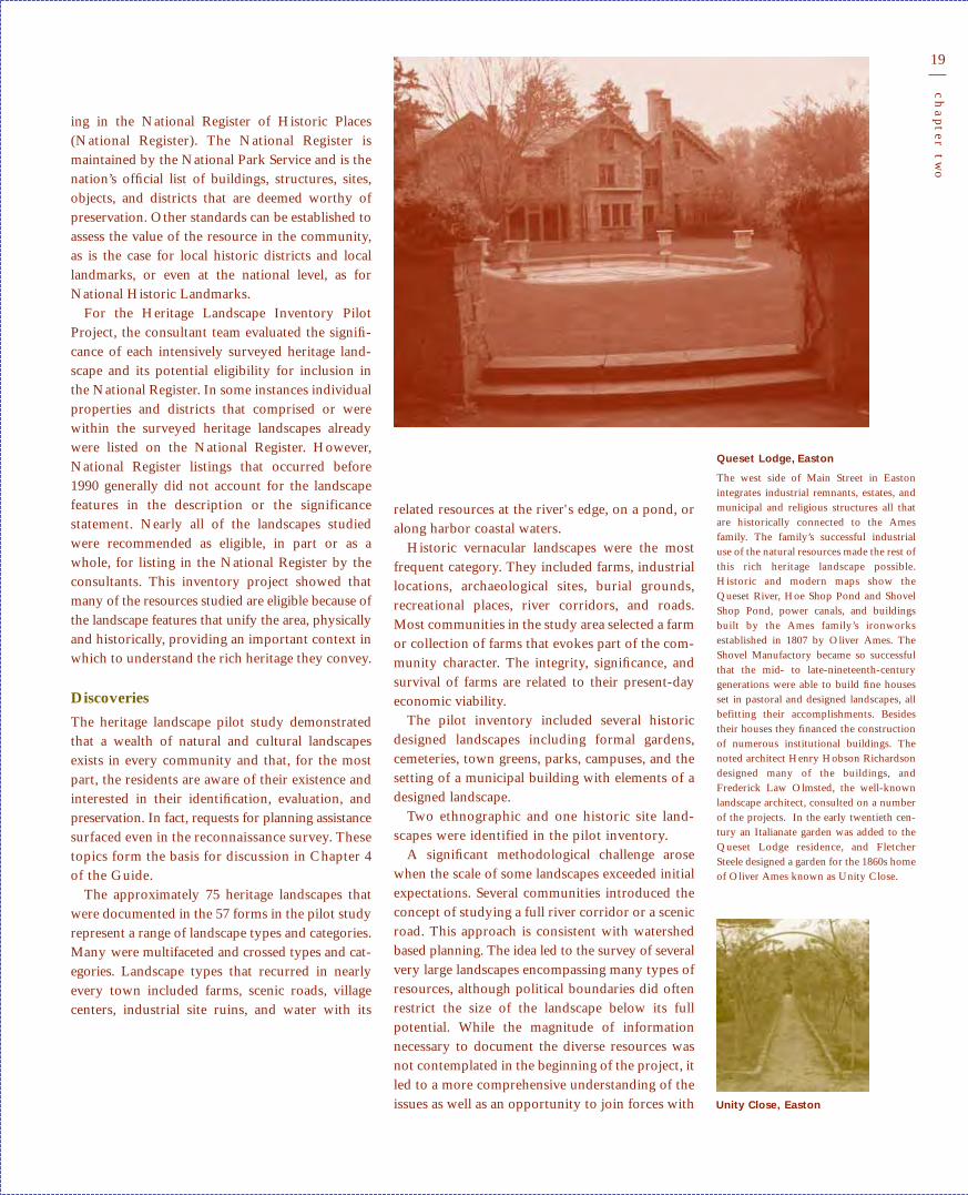
Queset Lodge, Easton
The west side of Main Street in Eastonintegrates industrial remnants, estates, andmunicipal and religious structures all thatare historically connected to the Amesfamily. The family’s successful industrialuse of the natural resources made the rest ofthis rich heritage landscape possible.Historic and modern maps show theQueset River, Hoe Shop Pond and ShovelShop Pond, power canals, and buildingsbuilt by the Ames family’s ironworksestablished in 1807 by Oliver Ames. TheShovel Manufactory became so successfulthat the mid- to late-nineteenth-centurygenerations were able to build fine housesset in pastoral and designed landscapes, allbefitting their accomplishments. Besidestheir houses they financed the constructionof numerous institutional buildings. Thenoted architect Henry Hobson Richardsondesigned many of the buildings, andFrederick Law Olmsted, the well-knownlandscape architect, consulted on a numberof the projects. In the early twentieth cen-tury an Italianate garden was added to theQueset Lodge residence, and FletcherSteele designed a garden for the 1860s homeof Oliver Ames known as Unity Close.
related resources at the river's edge, on a pond, oralong harbor coastal waters.
Historic vernacular landscapes were the mostfrequent category. They included farms, industriallocations, archaeological sites, burial grounds,recreational places, river corridors, and roads.Most communities in the study area selected a farmor collection of farms that evokes part of the com-munity character. The integrity, significance, andsurvival of farms are related to their present-dayeconomic viability.
The pilot inventory included several historicdesigned landscapes including formal gardens,cemeteries, town greens, parks, campuses, and thesetting of a municipal building with elements of adesigned landscape.
Two ethnographic and one historic site land-scapes were identified in the pilot inventory.
A significant methodological challenge arosewhen the scale of some landscapes exceeded initialexpectations. Several communities introduced theconcept of studying a full river corridor or a scenicroad. This approach is consistent with watershedbased planning. The idea led to the survey of severalvery large landscapes encompassing many types ofresources, although political boundaries did oftenrestrict the size of the landscape below its fullpotential. While the magnitude of informationnecessary to document the diverse resources wasnot contemplated in the beginning of the project, itled to a more comprehensive understanding of theissues as well as an opportunity to join forces with Unity Close, Easton

20
pilot in
vento
ry
TACCA, Marion
The Tremont Advent Christian Camp-meeting Association in Marion is nestled onthe shores of Hammett Cove at the northernend of Sippican Harbor. The campmeetinggrounds were established in 1905 for a placein which Advent Christians came to worship.They set up tents and built small gable frontcottages as well as other necessary buildingsaround the pine grove. This campmeetingboasts a long record of summer meetingsevery year for the last 150 years in theTremont part of Wareham and nearly 100years at this location. The feeling of this sitealong with the physical evidence of anintact ethnographic landscape conveys theongoing history of this spiritual community.
Council Oak, Dighton, 2001
The Council Oak tree in Dighton and sur-rounding field traditionally was a meetingground for subtribes of the WampanoagNative American tribe. In 1663, Europeansettlers purchased the land that becameDighton from King Philip at this spot.Only the large trunk and one branch of the500-year old oak tree remained during thesurvey, and in the fall of 2002 even thosesuccumbed to age, vandalism, and stormdamage. The tree was a symbol of the richNative American traditions of the area.
many different constituencies. Furthermore, thismethod clearly pointed out the reliance of one partof a system on another. For example, the relationshipof a dam upstream to the natural and historicresources below the dam was better understood.
The pilot study was organized in three water-sheds, with participating communities from eachone; however, the survey work did not necessarilystrictly follow the watershed approach. The surveystructure was dictated in part by the distributionof the participating communities within the water-sheds and their geographic proximity to oneanother. Several river corridors passed throughmore than one community. When selected forintensive survey, a river corridor was surveyed inall of the participating communities through whichit passes, however, stretches in neighboring, non-participating communities were not addressed. Itwas clear, however, that life on the river in anadjacent town would have an impact on nearby
communities. Three communities included Route105, a regional state road with many historic andscenic qualities, in their reconnaissance lists, but thecorridor was not reviewed as a whole, or surveyedintensively. The need for adjacent communitiesthat share a common resource to communicate andplan together for preservation was confirmed. Thisalso underscored the need of town boards to worktogether, given the range of resources and concernsrevolving around the preservation of each landscape.It was not possible to differentiate, beyond gener-alities, among the three watersheds or to drawsimilarities other than overall planning issues. Thislack of conclusions about the overall character ofeach watershed was partly because the study of scat-tered sections in each watershed did not draw acomplete picture of any one of the three watersheds.
The pilot inventory generated a wealth of valuableinformation including the history, ecology, andcurrent planning conditions in each of the com-munities and watersheds investigated. All of theheritage landscapes studied help tell the story ofthe development of southeastern Massachusettsfrom the seventeenth to the twenty-first centuryand provide a basis for the participating commu-nities to make informed planning decisions. Inaddition, the experience has provided valuablelessons that communities can use in undertakinginventories of their special places.

21
ch
apter
thr
ee3Create a Heritage Landscape Program in Your Community
Modern life threatens the future of nearly all of the
Commonwealth’s heritage landscapes, and examples disappear
every day. The buildout studies and numerous meetings of the
Community Preservation Initiative confirm the vulnerability of
once plentiful heritage landscapes. Every community perceives that the rate of
change has accelerated through the last quarter of the twentieth century. Citizens
speak out about development pressures in each region of Massachusetts. These forces
bring increased traffic volumes and changes in traffic patterns; open space is lost to
new residential and commercial construction in rural areas and to urban sprawl
around cities. The loss of agricultural land through development also becomes an
environmental concern, when measured by the increase in water consumption,
necessary waste disposal, and the need for improved infrastructures. The introduction
of new utilities, including telecommunication towers, windmills, and hydroelectric
facilities, can potentially alter important landscapes. One of the most telling barom-
eters of the accelerating rate of change over the last 25 years is the rapid increase in
transportation routes, particularly highway development, and the recent reintroduc-
tion of commuter rail service. Environmental concerns also affect heritage landscapes,
including the deterioration of water quality, the destructive nature of invasive species,
and the removal of dams and factories along rivers.
Every community encompasses a variety of heritage landscapes; these landscapes are
best known to local citizens. A heritage landscape program in your community will
publicly recognize these special places and features of your surroundings. It will provide
a basis for generating community support for the preservation of significant heritage
landscapes. The first steps are to establish a Heritage Landscape Committee and prepare
“What are the natural features which make a township handsome? A river, with its waterfalls
and meadows, a lake, a hill, a cliff, or individual rocks, a forest, and ancient trees standing
singly. Such things are beautiful; they have a high use which dollars and cents never represent.
If the inhabitants of a town were wise, they would seek to preserve these things…for such
things educate more than any hired teachers or preachers.”
Henry David Thoreau. 1861
Every Community Needs a HeritageLandscape Program

22
cr
eate a
her
itage la
nd
sca
pe pro
gr
am
by learning about heritage landscapes. The nextstep, the inventory, which is the basis upon whichyou will build the advocacy and protection, hastwo distinct steps: the reconnaissance survey, fol-lowed by the intensive survey with evaluation. Afterthe inventory has been completed, set priorities forpreservation and disseminate the information toyour fellow citizens and officials to build the highlevel of interest necessary to preserve the specialplaces in your community.
In all likelihood, implementing the program inyour community will need some funding. Theamount will depend upon the extent to which youplan to use the services of a consultant and the
types of community out-reach and publications youplan to produce as part ofeducating the public aboutthe heritage landscapes.The two agencies that youwill contact for technicalassistance, the Department
of Conservation and Recreation (DCR) and thePreservation Planning Division at theMassachusetts Historical Commission (MHC), mayalso offer grant programs to assist your communityin financing the program. Funds available throughthe Community Preservation Act, if passed in yourcommunity, can also be utilized.
Learn About Heritage Landscapes The Suggested Readings section in the GuideAppendices recommends key reading materialsthat introduce the vocabulary and concepts of
heritage landscapes and their preservation. Someessential background and technical texts forpreparing and undertaking a heritage landscapeinventory are mentioned here.
Preserving Cultural Landscapes, a collection ofessays describing cultural, heritage, vernacular, andethnographic landscapes defines useful terms.Discovering the Vernacular Landscape explains themeaning of “vernacular” and discusses ways inwhich local culture is reflected in the landscape.Conserving our Common Wealth: A Vision forthe Massachusetts Landscape, prepared by theLand Conservation Center of The Trustees ofReservations (TTOR) in June of 1999 is animportant booklet on the Massachusetts land-scape and served as a springboard for the HeritageLandscape Inventory Program. Each member of aHeritage Landscape Committee should have acopy of this booklet, which is available on theTTOR web site listed in the Contacts section ofthe Guide Appendices.
The MHC’s Survey Manual and RegionalReports provide guidance on survey methodolo-gies and summarize historical development pat-terns in the state. The National Park Service (NPS)offers excellent general resources including theidentification, evaluation and protection of designedand rural landscapes, traditional cultural properties,cemeteries and burial grounds.
Local history materials will aid in understandingthe development of the community and in definingthe types of landscapes to expect during the survey.Familiarity with historic maps and historic photo-graphs of your community will help the surveyorto anticipate land use patterns in the surroundinglandscape. A review of the Heritage LandscapeInventory Pilot Project in southeastern Mass-achusetts, outlined in Chapter 2 of this Guide, willprovide valuable examples of landscape types andcompleted MHC inventory forms.
Develop PartnershipsThe establishment of an effective Heritage LandscapeCommittee (Committee) and the ultimate successof the Heritage Landscape Inventory Program inyour community will be related to the involvementof a broad representation of the community. The
The ultimate success of the
Program will be related to
broad community representation
Old Graveyard, West Bridgewater

23
ch
apter
thr
ee
program is a local initiative; therefore, be sure towelcome anyone who wants to participate. Parti-cipants can involve a wide-ranging constituencywith local, regional, and state representation.
The Committee should include representationfrom the full range of groups concerned with landuse issues in order to offer a comprehensive viewof heritage landscapes. Members of the Committeewill become the ambassadors of the program. Theexperiences of the community, the types of heritagelandscapes that represent the character of the com-munity, the threats to the landscapes, and a generalconsensus of features that are worthy of preserva-tion will be determined by the Committee. For thisreason a balanced and broad-based Committee is animportant ingredient for the success of the program.
The Committee may include representatives(staff and members) of municipal boards, commis-sions and committees, as well as delegates of localorganizations such as historical societies, trusts,and neighborhood groups. Local residents know-ledgeable about local history and ecology, or localprofessionals in a related field, should be identi-fied. They can be an important addition to theCommittee membership, or may provide volunteer
HERITAGE LANDSCAPE INVENTORY STEPS
Learn about heritage landscapes and past inventories
Establish a heritage landscapes committee
Build support from citizens and elected officials
Explore possible funding and technical assistanceoptions
Consider engaging a consultant for the inventory
Conduct the survey (reconnaissance, followed by intensive inventory)
Evaluate the significance of the surveyedlandscapes
Establish goals for future inventory work
Set priorities for preservation planning based onknown or anticipated threats
Share the information in the community, region, and state
SUGGESTED HERITAGE LANDSCAPE
COMMITTEE MEMBERS
Community Preservation Committee
Conservation Commission
Forestry Department
Historical Commission
Historic District Commission
Historical Society
Interested Citizens
Local Experts in Related Fields
Local Historic Preservation Trust
Local Land Trust or Conservancy
Local Native American Tribes
Local Neighborhood Organization
Master Plan Committee
Open Space Planning Committee
Parks & Recreation Board/Commission
Planning Board or Commission
Regional Watershed Association
Selectman/Alderman
POTENT IAL INVENTORY PART IC IPANTS
Adjacent Communities
Consultants
Department of Conservation and Recreation
Heritage Landscape Committee
Interested Citizens
Local Project Coordinator
Massachusetts Historical Commission
Native American Representatives
Property Owners
Regional Planning Agency
� � � � � � � � � � � � � � � � � � � � � � � � � � � � � � � � � � � � � � � � � � � � � � � � � � � � � � � � � � � � � � � � � � � � � � � � � � � � � � � � � � � � � � � � � � � � � � � � � � � � � � � � � �
Bridgewater, 1879

24
cr
eate a
her
itage la
nd
sca
pe pro
gr
am
services during the survey or review processes. It ishelpful if at least one member of the Committee isa municipal employee who has access to variousmunicipal agencies, the rules and regulationsgoverning the use of land, and materials such asassessor’s maps and other records. Each Committeeshould assign a Local Project Coordinator (LPC).The LPC, in effect, heads the Committee and shouldbe responsible for gathering input and organizingexisting documentation about landscapes.
Depending upon the expertise and time of theCommittee members and the budget available forthe project, committee members may complete theinventory or hire a professional consultant toprovide technical assistance. Some communitiesmay seek the expertise of a consultant for certaintasks such as assisting in the selection of land-scapes, recommending ways in which to considereach landscape, or consulting in the evaluationprocess. Other communities may turn the entireproject over to a consultant. In all instances, it isof utmost importance to engage the Committeeand the community in the selection of the land-scapes to be documented.
The Department of Conservation andRecreation administers the Heritage Landscape
Inventory Program in Massachusetts. As youbegin, contact DCR for useful background materi-als, guidance on how to proceed, and copies ofcompleted heritage landscape forms showing theappropriate breadth and depth of research andwriting. The Department also conducts a variety ofongoing Historic Landscape Preservation programsthat may be able to provide further technicalassistance on specific landscape types. The MHC
has all the information gathered through previoussurveys, National Register of Historic Places(National Register) listings, and MHC-sponsoredgrants programs for properties in your community.Neighboring communities and regional planningagencies may be invited to participate, as heritagelandscapes by their very nature are not limited bypolitical boundaries and often require the interestand concern of more than one municipality.
The Inventory
Identify Heritage Landscapes —Reconnaissance Survey
The Reconnaissance Survey is a broad-brush over-view of the natural and historic features that makeup the heritage landscapes of each community.The list generated from this part of the surveyprocess should be a preliminary and inclusive list,based on a clear set of criteria. The criteria used tomeasure potential heritage landscapes will justifythe selections made and ensure a list that reflects therange of landscapes and preservation needs in thecommunity. The criteria developed for the pilotproject can be amended and revised as appropriatefor your community.
Selecting heritage landscapes that convey yourcommunity’s character is easy and fun if theCommittee is properly prepared. Prior to the recon-naissance survey it is critical to review backgroundinformation, and to understand the scope and
Survey Fieldwork
RECONNAISSANCE SURVEY
Preparation
Be clear on the goals of the inventory
Review available literature on heritage landscapes
Become familiar with the range, categories, and types of heritage landscapes
Review the primary historical and land use themes in the community
Review existing MHC survey forms for the community
Review National Register nominations for the community
Review existing natural and cultural resources planning documents
Review any existing lists of landscapes
Review the Criteria for Selection of Heritage Landscapes
Choose a large-scale map on which to locate landscapes
Review a land-use map of your community.
Establish and understand the scope and goal of the program
Predict the range of landscape types that may be present and their general location
Making the List
Meet to gather ideas and discuss suggestions
Consult with knowledgeable historians and Native Americans
Make a comprehensive list
Conduct site visits
Refine list by priorities for intensive survey
� � � � � � � � � � � � � � � � � � � � � � � � � � � � � � � � � � � � � � � � � � � � � � � � � � � � � � � � � �
RECONNAISSANCE SELECT ION CRITER IA
Type of landscape
Threats to the landscape
Integrity of the landscape
Public understanding and appreciation of the landscape
Access
� � � � � � � � � � � � � � � � � � � � � � � � � � � � � � � � � � � � � �

25
ch
apter
thr
ee
goal of the program, selection criteria, and thepotential types and locations of landscapes.Study area and management issues can reachbeyond boundaries of one community and includea variety of landowners, thus you may considerteaming with adjacent communities to study over-lapping resources.
Consider the organization and classification ofresources while generating the reconnaissancesurvey list. You will want to ask the followingquestions: Will you list all landscapes, such ascemeteries or roads, or just select one specificexample? Is there a large notable landscape thatwill incorporate multiple landscape types such asa scenic road paralleling a river, farms with buildingsand agricultural fields, and archaeological sites suchas ruins of a waterpowered industrial complex orNative American sites? Will any landscapes crossmunicipal borders to neighboring communities?
Try to have all members of the Committeeassembled to proceed with preparing a comprehen-sive reconnaissance list, since important featuresare recognized during a lively discussion with avariety of viewpoints. Once you are familiar withthe criteria for selecting landscapes, and havedetermined the scope and goal of your localproject and the range of resource potential inyour community, brainstorm to prepare a list oflandscapes and discuss why each landscape meetsthe criteria. Be sure to get input from local histori-ans and representatives of local Native Americantribes if they are not able to serve on theCommittee. Consider holding a public meeting tosolicit input from the community at large.
You probably will limit the survey to thoselandscapes that are unprotected by a long-termlegal mechanism. However, do include propertiesthat truly elicit the community character thatyou wish to preserve. A protected landscape thatcontinues to top the list of significant heritagelandscapes deserves to be highlighted for itsimportance and preservation value.
After you have prepared a comprehensivereconnaissance list of all the landscapes that youwish to document, visit each site or area, prefer-ably as a Committee, and discuss what you see ateach property or collection of properties.Although the data collection will occur in the inten-sive survey, the reconnaissance survey site visits areopportunities to make initial contacts with owners
Fieldwork on the Nemasket River
and to take slides of the landscapes, which can beused in any public informational programs thatyou plan in the future. If owners are not certainwhether to participate, explanations about theprocess and goals may be helpful. As you developyour plan for intensive survey you may be able touse the slides to inform any Committee membersthat were unable to attend the site visits.
Following the site visits you will prepare theintensive survey plan, including a refined listwith priorities for further study. The initialreconnaissance list should be prioritized or nar-rowed to perhaps 10–15 landscapes for the initialintensive survey. You may want to rank the her-itage landscapes in a matrix to reflect types, signif-icance, imminence of threats, status of information,and visibility in the community. The immediateintensive survey project may not be able to encom-pass all the landscapes identified during the recon-naissance, in which case you may want to developa phased approach. A key unprotected, vulnerable,and highly significant landscape, which already hasbeen documented, can remain on the reconnaissancesurvey list but be eliminated from the intensive sur-vey. Try to have a range of types and scales repre-sented in the landscapes on your intensive surveylist, particularly in the first phase of a multiphasedproject. A variety will be helpful in building interestand preparing models for future survey work.

26
cr
eate a
her
itage la
nd
sca
pe pro
gr
am Collect Detailed Information —
Intensive Survey
The intensive survey of the Heritage LandscapeInventory Program involves collection ofdetailed descriptive and historical backgroundinformation about each selected heritage land-scape in order to prepare MHC inventory formsdocumenting the appearance, history, organiza-tion, primary natural and cultural features, andboundaries of the heritage landscapes. Before youbegin the Intensive Survey, review the MHC SurveyManual for the recommended general surveymethodology. This Guide should always be used inconjunction with the Survey Manual when docu-menting landscapes. Communities and consultantsshould discuss landscapes with DCR to determinewhich types of MHC inventory forms are mostappropriate to use. A checklist of intensive surveyinformation is provided in the Guide Appendices.
Preparing for fieldwork entails collecting per-tinent maps, existing inventory forms, andNational Register nominations, as well as assem-bling the necessary field items. Make a list orstandard data form of basic information that youwill gather during the fieldwork; this will serve asthe basis for formal data sheets attached to the finalinventory form. If the number of the street addressis not shown on each parcel of your town’s asses-sor’s maps, take the time to annotate the maps.This information is invaluable when working inthe field particularly if your assessor’s maps do nothave building footprints. Often it is difficult totranslate the parcel lines of the map into the fieldwithout that added information.
Prior to fieldwork, the LPC will contact eachproperty owner of the heritage landscapes to bedocumented. In some instances, permission toaccess a property will be required. The contact
should include an invitation for the propertyowner to participate in the inventory process andplanning. The cooperation of property owners willbe an important result of effective ambassadorsrepresenting the Heritage Landscape InventoryProgram. A sample introduction letter is includedin the Guide Appendices.
Fieldwork can be one of the most enjoyableparts of the project, especially if you can pick asunny clear day to view those character-definingfeatures of your community. Generally, a teamapproach of two persons working together is abenefit, especially for larger, more complex land-scapes. Juggling the paraphernalia, recording thedata about the heritage landscapes, and piecingtogether the maps, the facts, and the history oftenare easier and more productive when working withsomeone else, and certainly more fun.
One person easily can document a small land-scape, such as a cemetery or a single site, while twoor more persons may better handle a far-reaching,multifaceted landscape. Long complex river cor-ridors or scenic roads with a variety of resourcetypes and distant vistas may lend themselves toadditional expertise to interpret the field information.Some field data may be best gathered from a boat,canoe, or kayak. The experience of navigating ariver is far different than the view from the shoreand affords greater access to and appreciation ofthe natural and cultural resources.
Safety factors should be considered when plan-ning fieldwork. A second person is recommendedwhen a vehicle will be operated along the side of aroad. The driver can concentrate on traffic condi-tions while the surveyor records and photographsthe landscape. Safety vests, bright colored clothing,and cell phones are useful.
Fieldwork begins by viewing the subject area.Drive and walk around the entire site. Become
Elmwood Center, East Bridgewater
Blackinton Park, Attleboro
East Branch of the Westport River, Westport

27
ch
apter
thr
ee
BOUNDARIES
Define the boundaries, which may be assmall as a significant feature, such as a rockor a tree or as large as the vista from a hilltop or across a swamp, lake, or harbor.Boundaries generally relate to assessor’smaps lot lines, municipal limits, visual barrierssuch as a modern highway or a change inland use, and historical association. In someinstances the boundaries may be changedonce additional information is gathered.
OVERALL CONTEXT AND CHARACTER
Describe the overall context and character of the landscape, which is the essence or the reasons that it is characterized as a keyfeature in the community. The contextdescribes the immediate surroundings, theneighborhood, adjacent land uses and thebroader landscape whether it be a villagecenter, a civic center, a rural farming region,or an industrial center. Character makes a place special in a community and emergesfrom topography and natural features suchas water features, vegetation types, scenicqualities, and man-made structures.
U N I F Y I N G F E AT U R E S
Identify any unifying features or uniquecharacteristics, which are generally man-madeand refer to land use. Often they are formalor informal edges of a property or collectionof properties, and make appropriate bound-aries for the surveyed landscape. They mayalso be found intermittently throughout alandscape. Stone walls, fences, and hedgesmay define the house lot on a farm andmark the surrounding pastures or they mayestablish the boundaries of an estate, acemetery, or a campus. Waterways often tietogether industrial complexes, or can be afeature that holds together a larger areaencompassing a wide range of resources. A tree line may provide a canopy over a roador define an agricultural field.
Heritage Landscape Descriptive Information
ARRANGEMENT OF FEATURES
Describe the arrangement of features withina landscape, which tells the story of the useand historical development of the landscape.The assemblage of buildings around a towncommon or on a campus, the relationship offarm buildings and farmland to one another,the linear arrangement of nineteenth-andearly-twentieth-century commercial centers,or the curvilinear arrangement of featuresand circulation patterns in a park all conveyinformation about the use and design of the landscape.
NATURAL AND VEGETATIVE FEATURES
Describe the natural and vegetative featuresthat are essential parts of the character of thelandscape. Natural features such as coastalharbors, rivers, streams, and lakes informedthe historical use of land and continue toinfluence development today. Ponds may benatural or man-made as the result of damm-ing of rivers to capture the waterpower for industry and agriculture. Vegetation in fields, forests, salt marshes, cedar swamps,orchards, and gardens contribute to the scenic quality of the landscape and provideinformation about the use of the land.
BUILDINGS AND STRUCTURES
Describe buildings and structures in the landscape. They are the man-made features that enrich the story of historic land use. The dates, types, styles, and materials ofthese features illuminate the periods ofdevelop-ment and contribute to the scenicquality of a landscape. Structures such as mill ponds, dams, and mill buildings or ruinstell about the industrial history of a site. The nature of roads such as width, surfacematerials, curbs, walls, drainage, bridges,and plantings conveys a feeling about anarea. Farm buildings suggest the type offarming conducted on the land. Institutionalbuildings and monuments around a towncommon or on a hospital or educationalcampus tell of the period of development as well as the history of the community.
Stiles and Hart Conservation Area, Bridgewater
Berkley-Dighton Bridge, Taunton River
Tabor Academy,Marion

familiar with the whole and the parts—notice thedetails. Record as much information as possiblewhile in the field. Inevitably some detail escapesunnoticed requiring a return trip; however themore vigilant you are about recording all thedetails the better. While viewing the landscape notenot just the physical features, but also any obser-vations about and reactions to the unique qualitiesof this particular place.
Record basic property information on the fielddata recording sheet, and take written notes thatfurther describe the boundaries, features, arrange-ment, character, and setting of the property. Theimportance of locating all the resources on yourmap or making a sketch map in the field showingthe arrangement and frequency of the resourcescannot be overstated. Use colored markers to mapfeatures on a property, properties within a largerlandscape, and any systems of features that youmay discuss collectively such as stone walls, roadsurface, orchards, wood lots, corn or hay fields,pastureland, etc. Organizing the way in which youview a property or collection of properties canfacilitate the interpretation of the landscape as wellas the recording in narrative form later.
Take black-and-white photographs for theinventory forms that will convey the details and
the essence of the landscape. Be sure to record thephotographs noting the address, the topic, and theview or direction of the photograph. Film shouldbe processed only with black-and-white develop-ment methods and photographs should be printedonly on black-and-white paper. Color slides anddigital photography are useful supplements toblack-and-white photography; however, digitaland colored photographs cannot be submittedwith MHC forms. Color slides are invaluable indeveloping educational and advocacy programs.Therefore if possible proceed with two camerasunless you were able to take slides of the land-scapes in the reconnaissance phase. If a digitalcamera is available, use it to provide colored photo-graphs, which are helpful when writing the surveyform for each landscape and can be used to prepareliterature and public presentations to advocate forthe preservation of these landscapes.
In conjunction with fieldwork, conduct back-ground historical and environmental researchon each surveyed property. Primary and second-ary town and regional histories contain informa-tion on locales, events, and people. Some volumesinclude useful historic views and portraits.Historic maps and historic photographs and printsin flat file collections document the developmentof an area and its appearance at different points inthe past. Town records and annual reports providestatistics and data about certain types of resources.These materials are likely to be found in the locallibrary, historical society, and town hall. Propertyowners may also possess a treasure trove of his-torical information and images of their property.
Taunton Copper Works, Norton
Assawompsett Ponds Complex, Lakeville and Middleborough
28
cr
eate a
her
itage la
nd
sca
pe pro
gr
am

29
ch
apter
thr
ee
Land deeds, wills and probate, and other legalrecords are located in the county courthouse.However, deed research to create a chain-of-title isnot necessary for survey research. The StateLibrary and State Archives contain valuable annualreports, census statistics, as well as informationabout the architects and drawings of many publiclyaccessible buildings. Information about naturalresources and ecological systems is contained indocuments such as in master, open space andrecreation, water quality management, and specialpurpose plans. These reports are located in townhalls and libraries. The goal of research is to forma historical narrative about a property that discussesthe general development and themes of its historyand ecology to the present day and places it in anappropriate historical context.
Record Information on Survey Forms
Following fieldwork, complete the appropriateMHC inventory forms, which will standardize theinformation gathered in the Heritage LandscapeInventory Program. The forms are available inelectronic format. The Area Form has proved to bethe most useful for complex landscapes. Simplerlandscapes will be recorded on other form types,such as a single cemetery on the Burial GroundsForm, and a single park on the Landscape andParks Form. These and other form types are dis-cussed in the MHC Survey Manual. Consult withDCR for guidance on forms for complex land-scapes. Examples of completed forms for heritagelandscapes are available upon request to DCR.
Final survey forms consist of basic location anddescriptive data plus two small essays: one describ-ing the current appearance and conditions of the her-itage landscape, the other relating the developmentalhistory of the landscape. In addition, a completedform has several photographs showing key featuresof the landscape, maps locating the resource andshowing the location of the features within theresource, a bibliography, and a data sheet that listsindividual features in the landscape.
The description essay begins by establishing theboundaries of the landscape, and should refer to itsgeneral location within the community. Theattached maps will help to support the description.Following the boundaries, describe the overallcharacter of the landscape. The description of theunifying features and the arrangement of all featureswill amplify the overall character. Finally descrip-tions of the natural, vegetative, and built features
all contribute to the visual image of the landscape.Subjective discussion of the evocative and overallaspects of a landscape should accompany thedescription of the salient features present.
The final data sheet, which is attached to theback of the form, includes a variety of informationthat is tailored to each landscape; however, everydata sheet contains certain basic information. TheMHC and DCR can provide guidance on complet-ing data sheets and should be consulted particularlyfor guidance in the MHC numbering process.Items listed on a data sheet will include landscapefeatures such as stone walls, trees, a mill pond,orchards, agricultural fields, houses, farm build-ings, mill structure, a town hall, a church, andmonuments. The assessor’s parcel number shouldbe given except in the case of a feature that is foundon many parcels such as a system of stone walls in
1888 Plan of Taunton Copper Works, Norton

30
cr
eate a
her
itage la
nd
sca
pe pro
gr
am
a landscape. In such an instance only the assessor’smap number is given, not all the parcel numbersinvolved. Similarly the address for a feature onmore than one property should only be the nameof the street. Any known historic names associatedwith a property should be recorded on the datasheet. The resource type refers to the feature typesuch as “river” or “stone wall.” The type or styleof a structure could be “L-Plan” or “ColonialRevival.” In these instances, use whichever termi-nology conveys the most information about theresource. The date of features may be general suchas “19th c.” or as specific as “1887” if knownthrough historic documentation. You may want torecord associated resources that enhance theunderstanding of a property. Some examples ofassociated resources are a garage, a silo, a stonewall, a monument, a fountain, or grave markers.
The data sheet requirements tend to skew theprocess in favor of spending large amounts oftime on developing data sheets. However, this
quantitative information is important for identifyingresource types and provides a mechanism bywhich properties can be counted, mapped, andrecognized for future local, regional, andstatewide preservation activities.
The historical narrative begins with a summaryof the development of the general area to place theproperty’s history in an appropriate context. Thenarrative discusses the origins and development ofthe natural and cultural aspects of the heritagelandscape and the features within the landscape. Itmay describe appropriate aspects of the agricultural,commercial, social, economic, industrial, or ecolog-ical activities that have happened in the immediatearea and how they relate to the historical trendsand events of the community or the region. Largercomplex landscapes will warrant more detailedcontext than smaller simpler landscapes. Usuallypresented in chronological order with beginningand end dates, the narrative mentions the landscape’sassociations with individuals such as property
Langwater, Elm Street Estates,Easton
Evaluate the significance of the heritage landscape
Is the landscape associated with events that have made a significant contribution to broad patterns of our history?
Is the landscape associated with the lives of persons significant in our past?
Does the landscape embody distinctive characteristics of a type, period, or method of construction?
Does the landscape represent the work of a master?
Does the landscape possess high artistic values?
Does the landscape represent a significant and distin-guishable entity (for example, a historic district or complex heritage landscapes) whose components may lack individual distinction?
Has the landscape yielded, or is it likely to yield, information important in prehistory or history (usuallyapplied to archaeological sites)?
Does the landscape possess high scenic value?
Does the landscape generate a strong positive reaction from the community for reasons of the heart?
� � � � � � � � � � � � � � � � � � � � � � � � � � � � � � � � � � � � � � � � � � � � � � � � � � � � � � � � � � � � � � � � � � � � � � � � � � � � � � � � �
S IGNIF ICANCE EVALUATION
Evaluate the integrity of the heritage landscape
Has the location of the features of the resource been changed?
Does the landscape retain elements of the historic setting?
Are there elements of the original design still distinguishable?
To what degree do original and historic materials remainon the site?
Is there evidence of historic workmanship or craftsmanship?
Does the landscape still reflect its association with its historical past?
Does the landscape convey a feeling of its historical past?

31
ch
apter
thr
ee
owners, tenants, builders, and designers, withentities such as religious and ethnic groups, andwith organizations important to the history of thearea. Special historical circumstances or environ-mental occurrences that marked a change in the useor appearance of the landscape are outlined.
Evaluate the Significance of Heritage LandscapesEvaluation is the link between survey and preser-vation activities and helps define approaches andpriorities for protection planning. The evaluationof the significance of heritage landscapes involvesan assessment of several factors using a systematicset of criteria. Usually the factors that are consideredinclude the type and extent of changes that haveoccurred and the importance of the landscape.Heritage landscapes can be significant for a varietyof historic, scenic, natural, architectural, landscapearchitectural, engineering, or archaeological associa-tions. Often the present-day community value andeducational potential of a landscape are alsoappropriate considerations. Significance criteriacan be widely established standards such as thosecreated by NPS for the National Register, or theycan be tailored to a community’s specific needs.The DCR and MHC can provide guidance aboutselecting the right evaluation criteria system foryour inventory and preservation needs.
The evaluation system should be selected at theoutset, as the evaluation process really begins inthe reconnaissance survey when landscapes areselected, particularly if there is a high level of localparticipation. Once the physical and historicalevidence has been recorded in the intensive survey,establishing the context and development patterns,the significance of the landscapes can be evaluated.Responses to evaluation questions should bewoven into the descriptive and historical statementson the intensive survey forms for each heritagelandscape and reflect local interests and priorities.A landscape’s visual quality and local citizens’perceptions may influence the evaluation outcome.Often scenic qualities are the reason that the land-scape has been recognized in the reconnaissancesurvey, and it is the scenic value that may be theeasiest selling point when convincing the commu-nity of the worthiness of preservation. Determiningthe type and degree of changes over time, sometimes
referred to as integrity, focuses on what remains toconvey the history and character-defining features ofthe landscape, to show how it was or is used, and todemonstrate why it is important in the community.Changes can be significant in their own right, andlandscapes are by nature changing, dynamic entities.
As you prepare to develop a preservation planfor heritage landscapes you may want to recordevaluation information in a format that helps toform a list of priorities for preservation efforts.Clearly those heritage landscapes that are most sig-nificant will rise to the top of the list of preservationneeds. However, you also will want to highlightlandscapes that have deep importance to yourcommunity, but that may not meet the NationalRegister significance standards.
The National Register significance criteriaconsider the elements of integrity that are used toassess eligibility for inclusion in the NationalRegister of Historic Places: location, setting,design, materials, workmanship, association, andfeeling. In addition, National Register significanceexamines the role of the resource in conveying an
Mount Hope Finishing Company Village in North Dighton, Dighton
North Dighton

Libby Farm, Stoughton
32
cr
eate a
her
itage la
nd
sca
pe pro
gr
am
important aspect of our history in terms of: A) patterns of important events, B) associationswith important people, C) masterworks or distin-guished groups of resources, and D) the ability toyield important information. The National Registerrequires significant properties to be 50 years oldor older unless they possess specific kinds ofexceptional significance. The National RegisterCriteria Statement is a formal evaluation state-ment attached to the final MHC inventory form.The statement describes how properties that areassessed as eligible for listing meet the criteria.Contact DCR and MHC for further assistancewith the National Register criteria.
Distribute Survey Forms
A primary objective of the inventory program is tolet the public know about the special features ofyour town so that citizens are on board when thetime comes to preserve those heritage landscapes.The survey forms are the beginning of your publicrelations materials and should be used wisely.
Make sure that survey forms with original pho-tographs are delivered to DCR’s HeritageLandscape Inventory Program, MHC, and your
local historical commission.Make a master copy setwith high quality photo-graphic resolution fromwhich additional copiescan be made in the future,and distribute a set of
copies of the heritage landscape survey forms tothe local public library, the school libraries, and theclerk’s office. The planning board and the conser-vation commission also should have their own setof survey forms. Send a copy of the form to the
property owner of each heritage landscape, partic-ularly for those properties for which access wasnecessary. You may have chosen to document alarge area with multiple property owners inwhich case it may be more prudent to have thelocal press run an article directing readers to thelibrary. Encourage the local press to run a seriesof articles featuring some of the heritage land-scapes. The inventory information can be effec-tively incorporated into tourism materials, localhistory curricula, and form the basis for a varietyof educational programs.
Plan to Preserve —The Next StepOnce you have completed the inventory and havedistributed it widely, you will want to build on themomentum by formulating a plan to preserve theheritage landscapes that shape your community’scharacter. In all likelihood you will have short-term goals and long-term goals. The timing may bebased on the nature of the pressures exerted onyour most cherished heritage landscapes. In anyevent the information garnered in the inventoryprogram will help to choose the appropriatepreservation mechanisms. The Heritage LandscapeCommittee should continue to convene to guidepreservation efforts and to enliven public interestin heritage landscapes.
If you were unable to document all significantlandscapes in the first phase of your heritage land-scape inventory, an important short and long-termgoal will be to complete the documentation ofimportant landscapes. A thorough reconnaissancesurvey effort will enable you to know all heritagelandscapes that should be documented in the future.
Preservation planning will match the pressuresthreatening each unprotected heritage landscapewith the preservation solutions. Planning anddecision-making for heritage landscapes is thetopic of Chapter 4.
Only those who value the heritage
landscape can define the solution or the
desired outcome of preservation

33
ch
apter
fou
r
4Planning and Decision-Making
Heritage landscapes are rich, diverse, and can be found throughout the
Commonwealth. They include Native American archaeological sites,
farms, town commons, parks, institutional campuses, and burial
grounds across Massachusetts; fishing ports of New Bedford or
Gloucester; mills and factories in Waltham, Lawrence, Holyoke, or Springfield; estates
in the Berkshires or in Essex County; orchards in Worcester County; and cranberry
bogs in the southeast.
Heritage landscapes inform us about land use, neighborhood development, and the
reasons for a community’s distinctive physical and cultural characteristics. Landscapes
help us understand how those who came before us shaped their lives and how the environ-
ment in which we live today evolved. The historic context of our communities and the
region is revealed in heritage landscapes. General historical trends of a region are clues
to what may be found in a specific community. In turn, identification and evaluation of
a community’s heritage landscapes will round out the picture of the area’s history, creating
a basis for informed decisions. In respectfully preserving the tangible traces of the past
in our communities, we are participating in the continuous transformation process of
history. The vestiges are a hybrid, ever-changing combination of what they were, how
they are seen through our lenses, and what they will become in the future.
Preservation planning looks for appropriate preservation solutions to the pressures
threatening each unprotected heritage landscape. This pairing of challenges and responses
enables the selection of the most effective mechanisms to protect heritage landscapes.
Public participation in this process is essential. Only those who value the heritage land-
scape can define the desired outcome of preservation. Once there is a consensus about
the preferred outcome, the array of preservation tools at the federal, state and local
levels, and in the public, private, and non-profit sectors, can be examined to determine the
“The voyage of discovery is not in seeking new landscapes but in having new eyes.”
Remembrance of Things Past. Marcel Proust. 1922
Know and UnderstandHeritage Landscapes

34
plan
nin
g a
nd
dec
ision
-ma
kin
g
appropriate means. The key steps in establishing aprocess for addressing preservation of heritagelandscapes at the local level are education, commu-nity support, and planning. Examples drawn fromthe Heritage Landscape Inventory Pilot Project insoutheastern Massachusetts illustrate recent pre-servation activities for heritage landscapes.
Educate the Community’s Citizens The pace of our lives today leaves little time tofocus on why our surroundings appear as they do.Yet a sense of place can be the one constant in lifethat is reassuring and soothing for its familiarity aswell as its cultural and scenic value. Citizens in allcommunities have tales of the negative impactexperienced by the change or loss of special places.Even though most people intuitively know thatcertain landscapes are important for their visualappeal and their timelessness, many do not recognizethe ongoing vulnerability of such places. Throughincreased education leading to a better under-standing of the richness of the landscape andknowledge of why a place looks like it does andevokes certain responses, citizens are more easilyconvinced that they can play a role in the preser-vation of those special places.
Education opportunities for heritage landscapesabound in the development of school curricula,adult education programs, tourism materials, ex-hibits, special events, and formal recognition of theheritage landscapes in your community. While itmay be inappropriate to place signs at privatelyowned landscapes and the location of archaeologicalsites should not be publicized, a marker programmay be a good way to convey significance of mostpublicly owned heritage landscapes. Brochures cansimply describe heritage landscapes or be designedfor use as a walking or driving tour of the land-scapes in your community. Special events such asclean up days, inviting public access to a privateproperty, guided tours, or similar activities can beinvaluable for building public awareness.
Build Community SupportThe information gleaned from the inventory andevaluation process can help to raise awareness andpersuade citizens of the need for their support topreserve heritage landscapes. The implementation
of many regulatory or funded strategies to preserveheritage landscapes will require town meeting or citycouncil approval. Thus broad-based communitysupport is essential. It is important to gain thesupport of the elected and appointed officials,which can begin during the inventory process ifthe Heritage Landscape Committee includes repre-sentatives from the various land use boards andagencies of the community.
Educating citizens, both adults and children,will help garner support for landscapes; an existingor newly formed friends group can focus on a spe-cific landscape or group of landscapes. Specialattention should be directed toward encouragingthe support of owners and neighbors of heritagelandscapes. In many instances, successful preser-vation cannot occur without the owner’s consent.Negotiations may require great diplomacy andpersistence, involving identifying trusted repre-sentatives to initiate one-on-one meetings.
The ability to develop partnerships amonginterested constituencies is an important result ofbuilding community support. While a variety ofplanning tools are available to preserve varioustypes of landscapes, advocates are the most impor-tant ingredients. Furthermore the preservation ofmany significant landscapes will be more successfulwhen a variety of constituencies work together inpartnerships bringing a range of tools to the task.In fact those partnerships that are developedthrough building constituencies are pivotal todeveloping and implementing preservation plansfor all heritage landscapes.
Plan for Preservation Communities are eagerly seeking guidance andtechnical assistance to preserve and enhance appre-ciation and understanding of heritage landscapesthat define their community’s character. Once acommunity has undertaken the first step of thepreservation process by surveying their heritagelandscapes and a preservation constituency hasbeen established, it is time to develop a plan toprotect those landscapes for which there is publicinterest. Communities that in the past have under-taken a community-wide survey should updatethose surveys to include heritage landscapes.
Beyond the desire to preserve communitycharacter, any inventory or plan to preserve her-itage landscapes benefits from defining and beingguided by specific goals or reasons for preservation.
INCLUDE HERITAGE LANDSCAPES
IN LOCAL PLANS
Master Plan/Comprehensive Plan
Open Space Plan
Preservation Plan
Neighborhood Plan
Heritage Landscape Preservation Plan
Recreation Plan
Historic Resources Survey Plan
Anderson Farm, West Bridgewater

35
ch
apter
fou
r
Heritage landscapes may contribute to tourismbased on historic or scenic qualities in coastal,mountain, and notable historic locations. In otherinstances the preservation of a heritage landscapemay be desirable for recreational activities such aswalking trails along a river connecting old millsites. Preservation of a heritage landscape maycontribute to the economic development of a towncenter or the conservation of farms. Threats to her-itage landscapes may derive from public or privatedevelopment, neglect, and the absence of a planthat ensures appropriate use and maintenanceunder current or future owners.
The effective management of heritage landscapesinvolves planning for positive change as well aspreventing negative alterations. Some landscapesmay require site-specific planning that couldinclude consideration of in-kind replacement ofdeclining vegetation, reproduction of furnishings,rehabilitation of structures, accessibility provisionsfor people with disabilities, interpretive program-ming, or the treatment of industrial properties thatare rehabilitated for new uses. In all communities,heritage landscapes and recommended preservationstrategies should be included in land use plans.
Know Preservation StrategiesPreservation strategies for cultural resources comein several categories: site specific, community,regional, and statewide master planning; federal,state and local legislative actions and regulations;private and public grant and technical assistanceprograms; and public-private partnerships. Manyprograms are specific to a certain type of resourcesuch as a cemetery technical assistance program, ora water quality grant program. While there aremany types of planning strategies, it cannot beoverstated that the two most permanent and certainefforts are acquisition and legally binding permanentrestrictions. Partnerships, often between publicentities and private parties, are necessary toaccomplish such definitive protection.
Master Planning
The statewide Heritage Landscape InventoryProgram assists communities in recognizing thenature of heritage landscapes so that they can beafforded the protections necessary to maintaincommunity character. Throughout the second halfof the twentieth century communities havedeveloped a variety of land use plans that generallyhave not addressed heritage landscapes in a com-prehensive fashion. In the past, neighborhood andcommunity-wide preservation plans have tendedto focus on the builtenvironment, with lessunderstanding and ap-preciation of the land-scape context. Masterplanning efforts havetreated historic resour-ces versus natural and open space resources as sepa-rate entities. Recognition of heritage landscapesnow provides a more integrated approach tounderstanding and preserving the cultural andecological heritage of the neighborhood, thecommunity, and the region.
Comprehensive plans come in all shapes andsizes and can be general or specific usuallydepending upon the size of the community and theamount of time and funding available to developthe plan. Although there has been a general mandate
Stiles and Hart Conservation Area, Bridgewater
Acquisition and legally binding permanent
restrictions provide the best protection

36
plan
nin
g a
nd
dec
ision
-ma
kin
g
(MGL Chapter 41, Section 81D) to prepare com-prehensive plans, there have been few sources ofstate funding to encourage their preparation. In2000 the Governor of Massachusetts enactedExecutive Order 418 (EO418) to encourage thedevelopment of community plans. The Orderoffered a $30,000 grant to each municipality in theCommonwealth to develop a “community plan”that addresses housing, economic development,open space and resource protection, and transporta-tion. These grants are no longer available, however,many communities were able to successfully usethis grant program to augment other comprehensiveplanning efforts. A comprehensive plan shouldaddress identification, evaluation, and protectionof cultural and historic resources, including heritagelandscapes. Recommendations should be consistentwith local zoning code, regulations, and otherlocal mechanisms that could be used to preservethe heritage landscapes.
Most municipalities have prepared open spaceplans and updated them every five years since 1967as an application requirement for the ExecutiveOffice of Environmental Affairs (EOEA) grantsand technical assistance programs. While mostopen space plans recognize and may indirectlyaddress certain types of landscapes that are heritagelandscapes, to date Massachusetts has not had a
comprehensive approach toward planning forheritage landscapes as now is advocated by theHeritage Landscape Inventory Program.
The Community Preservation Act (CPA),enacted by the State Legislature in September2001, is a recent planning and protection opportu-nity. It enables communities to establish a localCommunity Preservation Fund. This fund must bededicated to open space, low and moderate-incomehousing (referred to as community housing), andhistoric preservation. Some monies can also bededicated to recreation. Revenue for the fund isgenerated through a surcharge of up to three percentof the local property tax, and state matchingfunds. Local municipalities must adopt the Actby ballot referendum.
Once a municipality has adopted the CPA, it isobliged to establish the Community PreservationCommittee (CPC), the make-up of which is similarto the recommended Heritage Landscape Comm-ittee. The first task of the CPC is to develop a planthat will guide the community in identifyingappropriate projects that conserve open space, pre-serve historic resources, and provide communityhousing. The heritage landscape inventory can beused to identify projects that may qualify for twoof the three disciplines for which money will bespent. To date, 63 communities have adopted the
Open Space Plan with Cervelli Farmat Vaughn Hill, Rochester

37
ch
apter
fou
r
CPA. Each of those communities, now ready toconsider preservation needs, would benefit fromthe parallel Heritage Landscape Inventory Pro-gram to identify and document the landscapesworthy of preservation. In the case of preservationof large heritage landscapes, communities will relyon broad-based constituencies that will facilitatecombining funding strategies for acquisition, inpart or in whole, of key landscapes.
State Laws and Regulations
The most protective and permanent restrictionmechanism for land-based resources such as her-itage landscapes is a permanent preservation orconservation restriction that is given by the ownerof a property and is recorded with the deed.Massachusetts General Laws (MGL), Chapter 184,Sections 31-33 governs preservation and conserva-tion restrictions. The use of this state enablinglegislation is the preferred method of grantingrestrictions (also known as easements) for tworeasons: it is the most secure way to grant aneasement or restriction in perpetuity, and througha preservation restriction the property is listed inthe State Register of Historic Places (StateRegister). The State Register recognizes significanthistoric resources including all properties listed inthe National Register of Historic Places (NationalRegister), those in local historic districts, and thosefor which preservation restrictions have beenrecorded with the deed. The State Register andNational Register listings may be necessary forcertain grant programs. The use of a conservationrestriction can result in property tax advantages.
Other permanent restriction programs are spe-cific to a particular type of resource. For instance,Agricultural Preservation Restrictions (APR)preserve not only farmland but also the use of thatland for farming. The Department of AgriculturalResources (DAR) within EOEA administers thisprogram. It offers to pay farmers the differencebetween the “fair market value” and the “agricul-tural value” of their farmland in exchange for apermanent deed restriction that precludes any useof the property that will have a negative impact on
APR Program farms on the East Branch of the Westport River, Westport
its agricultural viability. Farmers that own workingfarms of 5 acres or larger are eligible. Since 1980,deed restrictions have been placed on 602 farmstotaling approximately 52,716 acres in 148 towns.
Potential options that offer short-term protec-tions and that position a property for possiblefuture funding opportuni-ties are the property taxreduction statutes of MGL
Chapters 61, 61a and 61b.In allowing for reductionsin property tax on lands inactive forest, agriculture, andrecreational use respectively, this DAR programprovides incentive for landowners not to developtheir land, but does not permanently protect theland as property can be removed from Chapter 61program classification.
While not as permanent and restrictive as apreservation or conservation restriction, a varietyof alternative protective mechanisms are availableto communities and to individuals seeking topreserve heritage landscapes. The most completecompilation of information about regulatorymeasures in use throughout the Commonwealth isthe Massachusetts Historical Commission’s(MHC) Preservation Through Bylaws andOrdinances. This continually updated reviewdocument summarizes more than 30 tools and
Develop partnerships among
interested constituencies

38
plan
nin
g a
nd
dec
ision
-ma
kin
g
Grant Program administered by the MHC. Mostof these matching grants are awarded to municipali-ties, and CPA funds can be applied to this program.
The DCR and MHC oversee two other keygrant programs that rely on the availability ofstate funding. The Massachusetts HistoricLandscape Preservation Grant Program adminis-tered by DCR is a state-funded competitive grantprogram established in 1997 to support thepreservation of public historic landscapes.Applicants must be municipalities. Many of themost cherished public landscapes across the stateare over a century old and continue to sufferfrom deferred maintenance, intrusive additions,and limited resources. By providing funding andtechnical assistance to these important, historiclandscapes, DCR hopes to promote communitypreservation throughout the Commonwealth.
The Massachusetts Preservation Projects FundGrant Program administered by the MHC is astate-funded 50 percent matching grant programestablished in 1984 to support the preservation ofproperties, landscapes, and sites listed in the StateRegister of Historic Places. Applicants must be amunicipality or non-profit organization. Historiccultural resources in public and non-profit owner-ship frequently suffer from deferred maintenance,incompatible use, or are threatened by demolition,all due to lack of sufficient funds. These importantresources represent a significant portion of theCommonwealth’s heritage. By providing assis-tance to historic cultural resources owned by non-profit or municipal entities, MHC hopes to ensuretheir continued use and integrity.
Key State, Regional, and Local Agencies and OrganizationsMany other grant and technical assistance programsadministered by state agencies may be used to pro-tect heritage landscapes. A natural partnership forthe protection of heritage landscapes is a publicentity—a state agency or a local government and aprivate land trust, which can be a state organizationor a regional or local group. Partnershipsbetween state, regional, and local agencies andprivate organizations bring together disparateconstituencies with common goals and can be
techniques, and analyzes their use in communitiesacross the Commonwealth. Many operate throughthe local zoning by-law or ordinance and require atwo-thirds vote of the legislative body. Othermechanisms do not become part of the zoningcode but are adopted as a local bylaw or ordinanceby the local legislative body. Communities andindividuals are encouraged to obtain a copy of thisvery useful MHC document.
Non-Regulatory Tools
A variety of state technical assistance and fundingprograms address specific types of heritage land-scape resources found in all communities. TheDepartment of Conservation and Recreation(DCR) administers many of the most effective pro-grams. The DCR’s Historic CemeteriesPreservation Initiative created a manual,Preservation Guidelines for Municipally OwnedHistoric Burial Grounds and Cemeteries (2nd edi-tion, 2002) that offers valuable stewardship infor-mation for these important historic landscapesthat are public open spaces with a vital link to ourpast. Although this program focuses on munici-pally owned resources, the recommendedapproach is suitable for private property.
The identification of heritage landscapes is thecritical first step in the preservation of theseresources and forms the core of this Guide. TheDCR provided the funding for the HeritageLandscape Inventory Pilot Project in southeasternMassachusetts and hopes to provide technicalassistance and fund future inventory projects tobring this program statewide. Financial assistanceto complete a heritage landscape inventory mayalso be sought through the Survey and Planning
Titicut Conservation Area, Bridgewater

39
ch
apter
fou
r
Old Bridge Street Bridge,Nemasket River, Lakeville andMiddleborough
critical in leveraging funds and technical assist-ance. The broader the interested and involvedconstituencies are, the more likely is the successof the preservation process.
The two key state agencies that should be con-tacted for guidance in the identification, evaluation,and preservation of heritage landscapes are DCR
and MHC. Departments within EOEA administeradditional programs that may be related to heritagelandscapes. The DCR can help your communityidentify programs and partners both within DCR
and in other state agencies. The DCR administersmany programs that are pertinent to the preserva-tion of heritage landscapes and can be used toachieve multiple goals. Interested readers shouldcheck the DCR web site for the most up-to-dateinformation about DCR programs. Other divisionsof EOEA also administer useful programs such asthe Historic Parkways Initiative, the Division ofConservation Services self-help programs, theOffice of Coastal Zone Management’s coastal andremediation and monitoring programs, theDepartment of Fish and Game’s RiverwaysProgram, the Department of AgriculturalResources’ programs that assist owners of agricul-tural properties, a Private Forest Lands Initiativethat encourages forestry management, and theDepartment of Environmental Protection’s waterquality programs. The Community PreservationInitiative provides technical assistance on relatedissues and is a freestanding initiative within EOEA
that has partnered with the University ofMassachusetts to form the CommunityPreservation Institute. The Institute provides edu-cation in community preservation and worksclosely with the Regional Planning Agencies(RPAs) on certain projects.
Key regional and local agencies may collaborate toapply for some of the programs noted above. The 13RPAs in the Commonwealth represent a collectionof towns that tend to be in the same one or twowatersheds. The RPA is eligible to apply for many ofthe grant programs on behalf of several towns in its
Queset—Main Street, Easton
ZONING MECHANISMS TO PRESERVE
HERITAGE LANDSCAPES
Archaeological Resource Protection
Agricultural Preservation Zoning
Backlot Development Zoning
Downtown Revitalization Zoning
Downzoning
Flexible Development Zoning
Great Estates Bylaws
Major Residential Development
Open Space Zoning
Overlay Zoning
Planned Unit Development
Slope and Elevations Protection
Site Plan Review
Village Center Zoning
LOCAL BYLAW AND ORDINANCE MECHANISMS
TO PRESERVE HERITAGE LANDSCAPES
Demolition Delay
Design Review Boards
Local Historic Districts
Local Option Property Tax
Neighborhood Conservation Districts
Scenic Roads
Scenic Vista Protection
Transfer of Development Rights
Transportation Corridor Protection��������������������������������������������������������������������������������

40
plan
nin
g a
nd
dec
ision
-ma
kin
g
Epilogue —Looking Forward The Heritage Landscape Inventory Pilot Projecthas demonstrated the value of the HeritageLandscape Inventory Program for all communitiesin the Commonwealth. Participating communitiesare using the inventory in conjunction with a varietyof tools to achieve their preservation goals, as illus-trated by several examples. Wareham is using theHeritage Landscape Inventory results to identifypreservation needs, community-wide survey oppor-tunities, and potential CPA funding projects. Thepartnership between the Natural Resources Trust(NRT) of Bridgewater and the town is currently anexcellent example of a municipal and nonprofitpartnership to achieve a common goal. In order toassist the town, the NRT has been able to obtain(through multiple sources) funding for the creation ofmanagement plans for some of the larger town-owned conservation land, concentrating on thosewith historical significance.
In Stoughton, the town meeting voted inJanuary 2003 to authorize the purchase of the 81-acre Libby Farm. One of the properties docu-mented in the Heritage Landscape Inventory PilotProject, Libby Farm includes historic buildings,wetlands, forests, meadows, and rocky outcrops,and is crossed by popular hiking trails and old cartroads. Libby Farm is the town's highest priorityfor protection because of its location surroundedon three sides by other conservation lands. Thepurchase included the land, while the buildingsremain on a separate parcel that will remain inprivate ownership. Most of the new town propertywill be managed as a conservation area, with theremainder set aside for recreation fields. The townsecured funding from the Land and WaterConservation Fund and private trusts, includingTPL, and foundations. Work continues to raiseadditional funds for the project. This example of a
Cranberry Commons, Wareham
Tihonet Dam, Wankinco River, Wareham
area. This approach is especially appropriate for con-ducting inventory of, or creating or implementing aprotection plan for, a regional heritage landscapesuch as a river or transportation corridor.
Private organizations such as The Trustees ofReservations, Trust for Public Land (TPL), andlocal land trusts are critical partners in the preser-vation of heritage landscapes. They can work inpartnership with governmental entities and oftencan perform certain tasks that are inappropriate ortoo cumbersome to be completed by local govern-ment. For instance, a local land trust may raisefunds, purchase a property, place necessary restric-tions, and then turn part or all of the property overto a local municipality, following the local legisla-tive body’s vote to acquire or accept a particularproperty. Often land protection must be executed ina shorter amount of time than it would take amunicipality to go through the town meetingprocess necessary to authorize the purchase andsale of property. There are many examples of localland trusts working in partnerships with otherprivate groups such as friends groups and historicalsocieties to preserve heritage landscapes.
The most successful approach for all of thecombinations of partnerships and strategies is tobuild a diverse and broad-based constituency. Themore people that are involved and aware of therichness of the community’s heritage landscapesthe greater the success of a Heritage LandscapeProgram in that community. Furthermore public-private partnerships involving heritage landscapeowners, and broad community support are essentialfor implementing two of the most significant andfar reaching preservation strategies: acquisition ofheritage landscapes and the donation of permanentpreservation and conservation restrictions.

41
ch
apter
fou
r
Libby Farm, Stoughton
Betty’s Neck, Assawompsett Ponds, Lakeville
public-private partnership will preserve additionalland adjacent to an existing conservation area aswell as the context of the historic farmstead,which while set off as a separate parcel will remainsurrounded by farm land.
Native American tribes in the local area and theregion can also be valuable sources of informationand partners in recognizing and protecting heritagelandscapes. Betty’s Neck, a 483-acre peninsula thatjuts into Assawompsett Pond in Lakeville is a siteof national cultural and historic value that containscritical watershed resources and rare species habitatsthat have been preserved. Betty’s Neck was thehomeland of Massasoit, the leader, or sachem, ofthe Wampanoag tribe and his descendents until the1930s. Archaeological remains telling the story ofIndian life in southeastern Massachusetts can befound in abundance at Betty’s Neck. For the last50 years, the property had been owned and farmedby a cranberry growing operation that considereddevelopment of the property when cranberryprices fell in recent years. By pooling state, munic-ipal, and private funds, the Town of Lakevilleacquired 292 acres on Betty’s Neck and a conser-vation restriction over an adjacent 150 for $8.4million. The remaining 38 acres were purchasedfor $600,000 by the TPL. When full funding is inplace, TPL will deed the land to Lakeville anddonate a conservation restriction to the state.Saving Betty’s Neck from development has pre-served the integrity of land containing more than10,000 years of history and a place that resonates asa cultural heart of the Wampanoag people.
Heritage landscapes embrace many aspects of therelationship — pragmatic, creative, and spiritual—between human actions and the natural environ-ment. Beyond simply the safeguarding of historicplaces and scenic vistas, the protection of heritagelandscapes supports sustainable land use, the con-servation of biological diversity, and the preservationof community character. A community’s sense ofstewardship and grass roots commitment is thekey catalyst for inventory and planning initiatives.Inventories capture the physical characteristics,history, and intangible essence of heritage land-scapes. Planning decisions that are informedabout and respectful of heritage landscapes andthe community’s priorities benefit the present res-idents and future generations with an enhancedsense of place and an improved quality of life.
� � � � � � � � � � � � � � � � � � � � � � � � � �

42
appen
dic
es Massachusetts Department of Environmental Management.The Massachusetts Landscape Inventory: A Survey of theCommonwealth’s Scenic Areas. Boston, MA: MassachusettsDepartment of Environmental Management, 1982.
Massachusetts Department of Environmental Management.Preservation Guidelines for Municipally Owned HistoricBurial Grounds and Cemeteries (2nd edition). Boston, MA:Massachusetts Department of Environmental Management,2002.
Massachusetts Historical Commission. Preservation Through Bylaws and Ordinances. Boston, MA:Massachusetts Historical Commission, 2001 et seq.
Massachusetts Historical Commission. Historic PropertiesSurvey Manual: Guidelines for the Identification ofHistoric and Archaeological Properties in Massachusetts.Boston, MA: Massachusetts Historical Commission, 1992.
Massachusetts Historical Commission. Historic andArchaeological Resources of Southeast Massachusetts: A Framework for Preservation Decisions. Boston, MA:Massachusetts Historical Commission, 1982.
Massachusetts Historical Commission. Historic andArchaeological Resources of Cape Cod and the Islands:A Framework for Preservation Decisions. Boston, MA:Massachusetts Historical Commission, 1987.
Massachusetts Historical Commission. Historic andArchaeological Resources of the Connecticut ValleyMassachusetts: A Framework for Preservation Decisions.Boston, MA: Massachusetts Historical Commission, 1984.
Massachusetts Historical Commission. Historic andArchaeological Resources of the Boston Area: A Framework for Preservation Decisions. Boston, MA:Massachusetts Historical Commission, 1982.
McClelland, Linda F., J. Timothy Keller, Genevieve P.Keller, and Robert Z. Melnick. “Guidelines for Evaluatingand Documenting Rural Historic Landscapes.” NationalRegister Bulletin 30. U.S. Department of the Interior,National Park Service, Interagency Resources Division,1989 (revised 1999).
Meier, Lauren G. “The NPS Historic Landscape Initiative:Developing National Standards for the Treatment ofHistoric Landscapes,” Cultural Resources ManagementBulletin Vol. 13, No. 2. Washington, DC: CulturalResources, National Park Service, United States Departmentof the Interior, 1990.
Suggested Readings
Alanen, Arnold R., and Robert Z. Melnick, eds. PreservingCultural Landscapes in America. Baltimore, MD: JohnsHopkins University Press, 2000.
Berg, Shary Page, and Claire W. Dempsey. Planning forHarvard’s Rural Landscape: Case Studies in HistoricConservation, A Report of the Harvard Rural HistoricLandscape Committee. Cambridge, MA: Harvard RuralHistoric Landscape Committee, 1997.
Birnbaum, Charles A. “Protecting Cultural Landscapes:Planning, Treatment, and Management of HistoricLandscapes.” Preservation Briefs 36. Washington, DC:U.S. Department of the Interior, National Park Service,Preservation Assistance Division, 1994.
Birnbaum, Charles A., ed. The Secretary of the Interior’sStandards for the Treatment of Historic Properties withGuidelines for the Treatment of Cultural Landscapes.Historic Landscape Initiative, Heritage PreservationServices, Cultural Resource Stewardship and Partnerships.Washington, DC: National Park Service, United StatesDepartment of the Interior, 1996.
Birnbaum, Charles A., and Cheryl Wagner, eds. MakingEducated Decisions: A Landscape Preservation Biblio-graphy. Washington, DC: U.S. Department of the Interior,National Park Service, Preservation Assistance Division,1994. Updated October 2000.
Copps, David H. Views From the Road: A CommunityGuide for Assessing Rural Historic Landscapes. Washington,DC: Island Press, 1995.
Jackson, John Brinckerhoff. Discovering the VernacularLandscape. New Haven: Yale University Press, 1984.
Keller, J. Timothy, and Genevieve P. Keller. “How toEvaluate and Nominate Designed Historic Landscapes.”National Register Bulletin 18. U.S. Department of theInterior, National Park Service, Interagency ResourcesDivision, 1994.
Land Conservation Center of the Trustees of Reservations.Conserving Our Common Wealth: A Vision for theMassachusetts Landscape. Beverly MA: The Trustees ofReservations, 1999.
Massachusetts Association for Olmsted Parks. Olmsted inMassachusetts: A Public Legacy. Boston, MA: The MAOP
and the Massachusetts Historical Commission, 1983.
Queset — Main Street, Easton
Appendices

43
appen
dic
esMeier, Lauren G., and Betsy Chittendon. Preserving HistoricLandscapes, An Annotated Bibliography. Washington, DC: U.S. Department of the Interior, National Park Service,Preservation Assistance Division, 1990.
Meier, Lauren G., ed. Historic Landscape Directory:A Source Book of Agencies, Organizations and InstitutionsProviding Information on Historic Landscape Preservation.Washington, DC: U.S. Department of the Interior,National Park Service, Preservation Assistance Division, in collaboration with The Catalog of Landscape Records in the United States, at Wave Hill, and US/ICOMOS
Historic Landscapes Committee, 1996.
Melnick, Robert Z. “Preserving Cultural and HistoricLandscapes: Developing Standards,” Cultural ResourcesManagement Bulletin Vol. 3, No. 1. Washington, DC:Cultural Resources, National Park Service, United StatesDepartment of the Interior, 1980.
Melnick, Robert Z. “Landscape Thinking,” CulturalResources Management Bulletin Vol. 8, No. 1. Washington,DC: Cultural Resources, National Park Service, UnitedStates Department of the Interior, 1985.
Melnick, Robert Z., with Daniel Sponn and Emma JaneSaxe. Cultural Landscapes: Rural Historic Districts in theNational Park System. Washington, DC: United StatesDepartment of the Interior, National Park Service, 1984.
Miller, Hugh C. “Rural Landscapes.” Cultural ResourcesManagement Bulletin Vol. 10, No. 6. Washington, DC:Cultural Resources, National Park Service, United StatesDepartment of the Interior, 1987.
Mitchell, John Hanson. Trespassing: An Inquiry into thePrivate Ownership of Land. Cambridge, MA: PerseusPublishing, 1999.
Stokes, Samuel N., A. Elizabeth Watson, and Shelley S.Mastran with contributions by Genevieve P. Keller and J.Timothy Keller. Saving America’s Countryside: A Guide toRural Conservation. (2nd edition), National Trust forHistoric Preservation. Baltimore, MD: Johns HopkinsUniversity Press, 1997.
Ward, Wesley T., ed. Land Conservation Options: A Guidefor Massachusetts Landowners. (4th edition). Essex andBeverly, MA: Essex County Greenbelt Association, Inc. andThe Trustees of Reservations, 1999.
Contacts
General Landscape Preservation Information
Alliance for Historic Landscape Preservation www.ahlp.org
American Farmland Trust 202.331.7300 • www.farmland.org
American Society of Landscape Architects202.898.2444 • www.asla.org
Catalog of Landscape Records in the US at the Mertz Library718.817.8604 • www.nybg.org
Library of American Landscape History 413.549.4860 • www.lalh.org
National Park Service—National Register of Historic Places 202.354.2213 • www.cr.nps.gov/nr/
National Park Service —Historic Landscape Initiative 202.354.2257 • www2.cr.nps.gov/hli/
National Trust for Historic Preservation202.673.4000 or 617.523.0885 • www.nthp.org
Scenic America202.833.4300 • www.scenic.org
The Nature Conservancy617.423.2545 • www.tnc.org
Trust for Public Land 617.367.6200 • www.tpl.org
Massachusetts Resources for Landscape Preservation
Institute for Cultural Landscape Studies617.524.1718 • www.icls.harvard.edu
Massachusetts Association of Conservation Commissions617.489.3930 • www.maccweb.org/home.html
Massachusetts Audubon Society781.259.9500 • www.massaudubon.org
Massachusetts Department of Conservation and Recreation 617.626.1250 • www.mass.gov/dcr/
Massachusetts Department of Agricultural Resources617.626.1700 • www.mass.gov/dfa/
Massachusetts Executive Office of Environmental Affairs617.626.1000 • www.state.ma.us/envir/
Massachusetts Historical Commission617.727.8470 • www.state.ma.us/sec/mhc/mhcidx.htm
Massachusetts Land Trust Coalition978.897.0739 • www.massland.org
New England Small Farm Institute413.323.4531 • www.smallfarm.org
Olmsted Center for Landscape Preservation617.232.4073 • www.nps.gov/frla/oclp.htm
PRESERVATION Mass617.723.3383 • www.preservationmass.org
The Trustees of Reservations978.921.1944 • www.thetrustees.org�
����������������������������������������������������������������������������������������������������������������������������

44
appen
dic
es
Massachusetts Department of Conservation and Recreation
H E R I TA G E L A N D S C A P E I N V E N T O RY P R O G R A M FA C T S H E E T
The Heritage Landscape Inventory Program is a new program that is built upon prior efforts to identify
and document those heritage landscapes of our Commonwealth that are vital to the history, character,
and quality of life of our communities. Through this project, the Department of Conservation and
Recreation (DCR) is aiming to increase awareness about the many different types of heritage landscapes
found throughout Massachusetts and help communities plan for their preservation.
What are Heritage Landscapes?
Heritage landscapes are those special places and spaces that help define the character of your community.
They are the result of human interaction with the natural resources of an area, which influence the use
and development of land. These geographic areas contain both natural and cultural resources. In short,
heritage landscapes are those physical aspects of your town that make you feel familiar, comfortable,
and at home. Heritage landscapes come in many forms—some you may already be aware of, and some
you may not have considered as having the qualities that would make them a heritage landscape. Here
are some examples:
What are the products of this program?
The primary products that will result from a Heritage Landscape Inventory project in your community
will include a reconnaissance report summarizing the heritage landscapes that were discussed and visited
by the survey team and the Heritage Landscape Committee, and Massachusetts Historical Commission
(MHC) inventory forms for those landscapes selected for intensive survey.
How are properties selected for intensive survey?
Focusing on heritage landscapes that are not currently protected from development via any long-term
protective mechanisms—chiefly through a deeded conservation or preservation restriction, or an
agricultural preservation restriction—a list of prioritized landscapes will be developed by the Heritage
Landscape Committee. These landscapes will then be visited by the survey team, and discussed in
depth with community members and DCR. After factoring in resource significance, integrity of the
landscape, potential for development or other threats, extent of prior documentation, access issues and
project budget, specific heritage landscapes will be selected for intensive survey and documentation.
archaeological sites
campmeeting grounds
cemeteries
commons
cranberry bogs
estates
farms
formal gardens
institutional campuses
mill sites
Tremont Dam, Wareham
parks
river corridors
shipyards
scenic roads
village centers

45
appen
dic
es
Inventory Forms—What they are
An inventory form is a compilation of baseline documentation that has been assembled for a historic
resource or a historic area. Each form assembles the history of the resource or area and a description of
its current appearance. All observations needed to complete these forms will be made from a public
way. For large properties, or those that are not visible from a public way, permission for access to the
property will be requested of the owner by the survey team. If permission is not granted, surveyors will
not trespass on private property. Upon completion, copies of these forms will be retained on file for
public use with DCR, MHC and the local historical commission in each community. The resources
documented within each form are then a part of the Inventory of Historic Assets of the Commonwealth
as well as a part of the Inventory of Heritage Landscapes in Massachusetts. Once on file, these forms
will be utilized for local, regional, and statewide planning purposes. The forms will provide the basis
for any local educational initiatives that are developed to raise awareness about heritage landscapes and
community character. Inventory forms will also serve as a research tool for a number of people interested
in heritage landscapes and historic resources, including preservationists, historians, students, and local
community members.
Inventory Forms—What they are not
The completion and submittal of an MHC inventory form for your property does not list your property
on the State or National Register of Historic Places. It does not mean that your property taxes will go
up (or down!), and it alone does not place any restriction on your property or your use of it. Inventory
forms may be used as an identification tool for the implementation of locally enacted ordinances and
bylaws that are designed to promote historic preservation.
Are there other benefits to being inventoried?
The completion of an inventory form allows you to pursue listing on the State and National Registers
of Historic Places. Listing on the State Register makes properties owned by non-profit or municipal
entities eligible to apply for grants, when state funding is available, through MHC’s Massachusetts
Preservation Projects Fund and DCR’s Historic Landscape Preservation Grant program. Listing also
makes income-producing properties eligible to apply for the Investment Tax Credit program.
Where can I receive more information about Heritage Landscapes?
Contact a member of your local Heritage Landscape Committee to find out more about the plans to
implement a survey of heritage landscapes in your community. Contact DCR to find out how to obtain
a copy of DCR’s publication Reading the Land, Massachusetts Heritage Landscapes: A Guide to
Identification and Protection. Visit the DCR website at www.mass.gov/dcr/, for regular program
updates, or contact Jessica Rowcroft, Preservation Planner at the Department of Conservation and
Recreation, at 617.626.1380 or [email protected].
Titicut Parish Cemetery, Middleborough

46
appen
dic
es
Sample Introduction Letter
Poor Farm, East Bridgewater
TOWN AGENCY
TOWN HALL
MAIN ST
ANYTOWN, MA 01234
DATE
Re: Massachusetts Heritage Landscape Inventory
Dear [NAME OF PROPERTY OWNER],
The Town of [ANYTOWN] and the Department of Conservation and Recreation (DCR) are conducting a survey of Heritage Landscapes in our community. Representatives from our communitywill assist cultural resource management consultants from [NAME OF FIRM, IF APPLICABLE]and the staff of DCR with the completion of this project. For more information please refer to theenclosed information regarding the Heritage Landscape Inventory program in Massachusetts, including[LIST OF APPLICABLE ENCLOSURES].
We are pleased to inform you that your property has been identified as a significant heritage landscapeand selected for inclusion in the intensive survey.
During the coming weeks, members of the survey team, including [NAMES OF SURVEYORS
AND OF CONSULTING FIRM, IF APPLICABLE], will be visiting the selected properties in order to complete Massachusetts Historical Commission Inventory forms. They will take photographs, record physical descriptions, and prepare brief site histories. The fieldwork will be complemented withadditional in-depth research of town and state records, applicable literature, historical maps, and information made available by property owners. While the survey team will be visiting local libraries and historical societies, if you have additional knowledge of your property’s historic uses and architectural or landscape significance (particularly outbuildings and site features such as stone walls),the survey team may wish to speak with you directly.
It is the survey team’s hope to access and walk around all properties for the purposes of this study.They will not need to enter building interiors. We respectfully ask your permission to enter your property to note, sketch, and photograph buildings, landscapes, and site features. If you do not wantthe consultants to enter your property, please let us know by contacting [NAME AND CONTACT
INFORMATION FOR THE LOCAL PROJECT COORDINATOR]. In this case, they will simplyobserve and photograph from the street, if possible, or your property will be dropped from the survey.Once the field schedule is developed, the local project coordinator will be contacting property owners as a courtesy.
Please feel free to call [NAME AND CONTACT INFORMATION FOR THE LOCAL PROJECT
COORDINATOR ] with questions about the documentation process and site visit scheduling. Other questions about the Heritage Landscape Inventory can be directed to [CONTACT
INFORMATION FOR DCR].
Sincerely,
JANE Q. PUBLIC
ANYTOWN HERITAGE LANDSCAPE COMMITTEE

47
appen
dic
es
Landscape Name
Owner
If private, has access been requested?
Has access been permitted?
Landscape location — street address
Assessor’s number(s)
Acreage (taken from assessor’s records)
Landscape Category (This is likely to be determined
before and after— but not necessarily in the field)
Preparation
Assemble the following items prior to fieldwork
Base map of town/region
USGS topographic map
Current assessor’s maps
Historic maps—list dates
Existing MHC survey forms for resources in vicinity
National Register nominations for resources in vicinity
Town histories
Regional histories
Town planning documents: Master Plan, Open Space
and Recreation Plan, Preservation Plan, etc.
Field Supplies
Remember to bring these items with you when surveying
Camera with black-and-white film (digital photographs
and photographs produced from color film cannot be
submitted with MHC forms)
Color slide film (optional)
Digital camera (optional)
Pens and pencils
Clipboard
Two or three colored marking pens
Field data recording sheets to itemize resources and track
photographs
Assessor’s maps showing map number, parcel numbers,
street addresses
USGS map showing topographic features
Fieldwork
Information to gather about the landscape while in the field
Landscape Type
Estimated dates (where applicable) of laying out,
construction, and use
List of all cultural features —include any buildings, structures,
paths, walls etc. Include type/style where appropriate
List of all natural features—include use of specific
vegetative features
Describe the landscape, noting the following elements
Boundaries
Overall context and character
Unifying features
Unique characteristics
Arrangement of features
Vistas, if applicable
Describe any other aspects that make this landscape
special and help to convey the sense of place
Annotate the USGS map and the assessor’s maps, locating
the property and proposed boundaries
Draw a sketch map noting locations of specific features
Take black and white photographs
Take color slides (optional)
Take digital images (optional)
Record all photos on a photo log, documenting film type,
roll#, frame#, view and date
Heritage Landscape Survey Checklist
This checklist can be copied and used as a general guideline to make sure that you
are gathering all pertinent information during the survey of a heritage landscape
Farm on Drift Road overlooking East Branchof Westport River, Westport
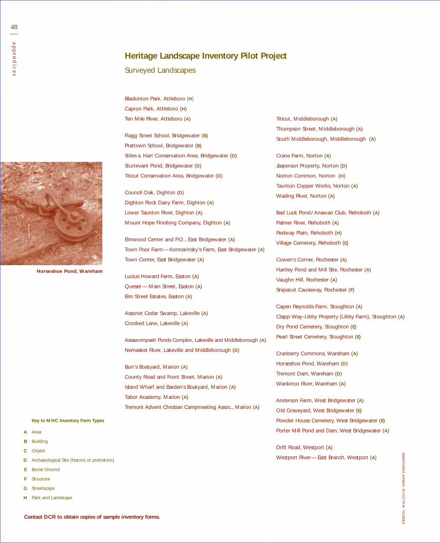
48
appen
dic
es
Blackinton Park, Attleboro (H)
Capron Park, Attleboro (H)
Ten Mile River, Attleboro (A)
Flagg Street School, Bridgewater (B)
Prattown School, Bridgewater (B)
Stiles & Hart Conservation Area, Bridgewater (D)
Sturtevant Pond, Bridgewater (D)
Titicut Conservation Area, Bridgewater (D)
Council Oak, Dighton (D)
Dighton Rock Dairy Farm, Dighton (A)
Lower Taunton River, Dighton (A)
Mount Hope Finishing Company, Dighton (A)
Elmwood Center and P.O., East Bridgewater (A)
Town Poor Farm—Kormarinsky’s Farm, East Bridgewater (A)
Town Center, East Bridgewater (A)
Lucius Howard Farm, Easton (A)
Queset — Main Street, Easton (A)
Elm Street Estates, Easton (A)
Assonet Cedar Swamp, Lakeville (A)
Crooked Lane, Lakeville (A)
Assawompsett Ponds Complex, Lakeville and Middleborough (A)
Nemasket River, Lakeville and Middleborough (D)
Burr’s Boatyard, Marion (A)
County Road and Front Street, Marion (A)
Island Wharf and Barden’s Boatyard, Marion (A)
Tabor Academy, Marion (A)
Tremont Advent Christian Campmeeting Assoc., Marion (A)
Heritage Landscape Inventory Pilot Project
Surveyed Landscapes
Titicut, Middleborough (A)
Thompson Street, Middleborough (A)
South Middleborough, Middleborough (A)
Crane Farm, Norton (A)
Jasperson Property, Norton (D)
Norton Common, Norton (H)
Taunton Copper Works, Norton (A)
Wading River, Norton (A)
Bad Luck Pond/Anawan Club, Rehoboth (A)
Palmer River, Rehoboth (A)
Redway Plain, Rehoboth (H)
Village Cemetery, Rehoboth (E)
Cowen’s Corner, Rochester (A)
Hartley Pond and Mill Site, Rochester (A)
Vaughn Hill, Rochester (A)
Snipatuit Causeway, Rochester (F)
Capen Reynolds Farm, Stoughton (A)
Clapp-Way-Libby Property (Libby Farm), Stoughton (A)
Dry Pond Cemetery, Stoughton (E)
Pearl Street Cemetery, Stoughton (E)
Cranberry Commons, Wareham (A)
Horseshoe Pond, Wareham (D)
Tremont Dam, Wareham (D)
Wankinco River, Wareham (A)
Anderson Farm, West Bridgewater (A)
Old Graveyard, West Bridgewater (E)
Powder House Cemetery, West Bridgewater (E)
Porter Mill Pond and Dam, West Bridgewater (A)
Drift Road, Westport (A)
Westport River— East Branch, Westport (A)
Key to MHC Inventory Form Types
Area
Building
Object
Archaeological Site (historic or prehistoric)
Burial Ground
Structure
Streetscape
Park and Landscape
Contact DCR to obtain copies of sample inventory forms.
A
B
C
D
E
F
G
H
DE
SIG
N:
MA
LC
OL
MG
RE
AR
DE
SIG
NE
RS
Horseshoe Pond, Wareham

Acknowledgements
This guide benefited from the support of many agencies, staff, organizations, and individuals. The time,energy, and insight of all those involved have contributed to the process of developing this document, and are appreciated. Special gratitude is due to The Trustees of Reservations and PRESERVATION
Mass (formerly Historic Massachusetts, Inc.) for their extensive time working with the legislature to recognize the importance of preserving heritage landscapes throughout the Commonwealth.
Statewide Advisory Committee
Debbie Cary • Director, Broad Meadow Brook Wildlife Sanctuary, Massachusetts Audubon Society (1997–present)
Margaret Dyson • Former President, Historic Massachusetts, Inc. (1999–2001)
Corliss Engle • Horticulturist (2001–present)
Julius Gy. Fabos • Department of Landscape Architecture, University of Massachusetts (1997–2000)
Elsa Fitzgerald • Former Assistant Director, Massachusetts Historical Commission (1998–present)
Betsy Shure Gross • Executive Director, Office of Public and Private Partnerships, EOEA (1997–present)
James Igoe • President, PRESERVATION Mass (2002–present)
Robin Karson • Director, Library of American Landscape History (2001–present)
Edith Makra • Urban Forestry Program Coordinator, Department of Environmental Management (2000–2002)
John Martin • Department of Landscape Architecture, University of Massachusetts (1997–2001)
Judith McDonough • Former State Historic Preservation Officer, Massachusetts Historical Commission (1997–2001)
Lauren G. Meier • Historical Landscape Architect, Olmsted Center for Landscape Preservation (1997–2003)
Nora Mitchell • Director, Olmsted Center for Landscape Preservation (1997–1999)
Keith Morgan • Professor of Art History, Boston University (2001–2002)
Eric O’Brien • Director, Massachusetts Park and Recreation Association (1997–2001)
Leslie Reed-Evans • Director, Williamstown Rural Lands Foundation (1997–1999)
Phillip Rodbell • Director of Urban Forestry, DEM (1997–2000)
Clarissa Rowe • Chair of the Board, Historic Massachusetts, Inc. (now PRESERVATION Mass) (2000–2001)
Jennifer Jillson Soper • Division of Conservation Services, EOEA (1998–2001)
Michael Steinitz • Director, Preservation Planning Division, Massachusetts Historical Commission (2001–present)
Liz Vizza • Boston Society of Landscape Architects (1997–2000)
Wesley T. Ward • The Trustees of Reservations (1997–2000)
Massachusetts Historical Commission
Cara Metz • State Historic Preservation Officer
Michael Steinitz • Director, Preservation Planning Division
Leonard Loparto • Archaeologist /Preservation Planner
Executive Office of Environmental AffairsMassachusetts Watershed Initiative 1993–2003
Karl Honkonen, Director of Watershed Initiative
David Janik, Buzzards Bay Watershed Team Leader
Andrea Langhauser, Narragansett Bay/Mt. Hope Watershed Team Leader
Patrick Rogers, Taunton River Watershed Team Leader
Pilot Project Participating Communities
Local project coordinators, municipal staff, volunteers, and property owners within each of the following participating communities:
Attleboro, Bridgewater, Dighton, East Bridgewater, Easton, Lakeville, Marion, Middleborough, Norton, Rehoboth, Rochester, Stoughton, Wareham, West Bridgewater, Westport

C O M M O N W E A LT H O F M A S S A C H U S E T T S
Executive Office of Environmental Affairs
Department of Conservation and Recreation
251 Causeway Street, Boston, MA 02114617.626.1250 WWW. MASS . GOV / DCR