Embed Size (px)
Citation preview
MAPPING
Where in the world is…
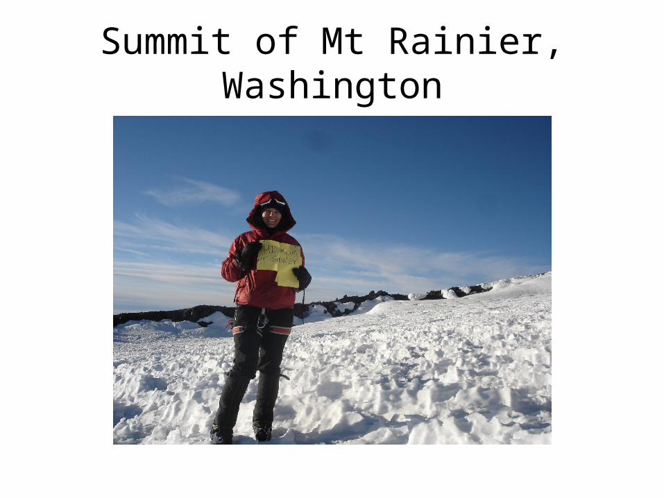
Summit of Mt Rainier, Washington
To Review…
1. The Major divisions of Earth Science
Geology
Oceanography
Meteorology
Astronomy
2. Earth’s Spheres
Hydrosphere
Atmosphere
Geosphere
Biosphere
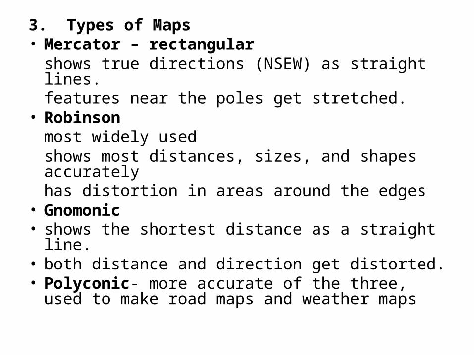
3. Types of Maps• Mercator – rectangular
shows true directions (NSEW) as straight lines. features near the poles get stretched.
• Robinson most widely usedshows most distances, sizes, and shapes accuratelyhas distortion in areas around the edges
• Gnomonic• shows the shortest distance as a straight line. • both distance and direction get distorted. • Polyconic- more accurate of the three, used to
make road maps and weather maps
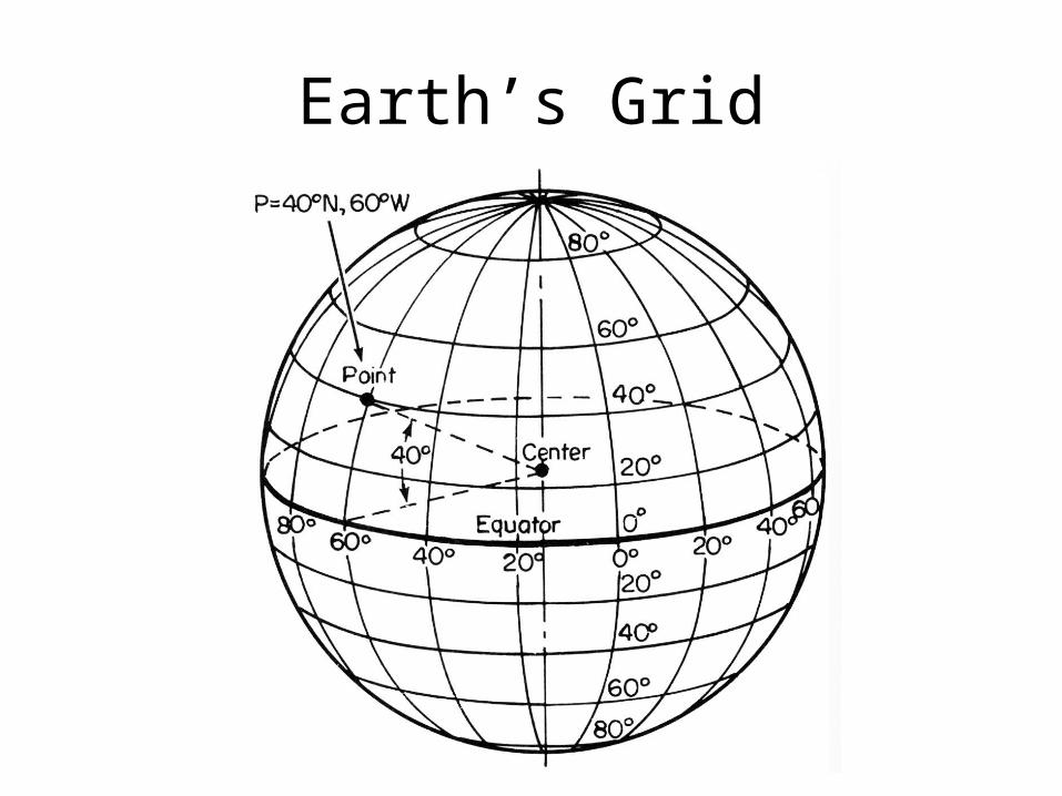
Earth’s Grid
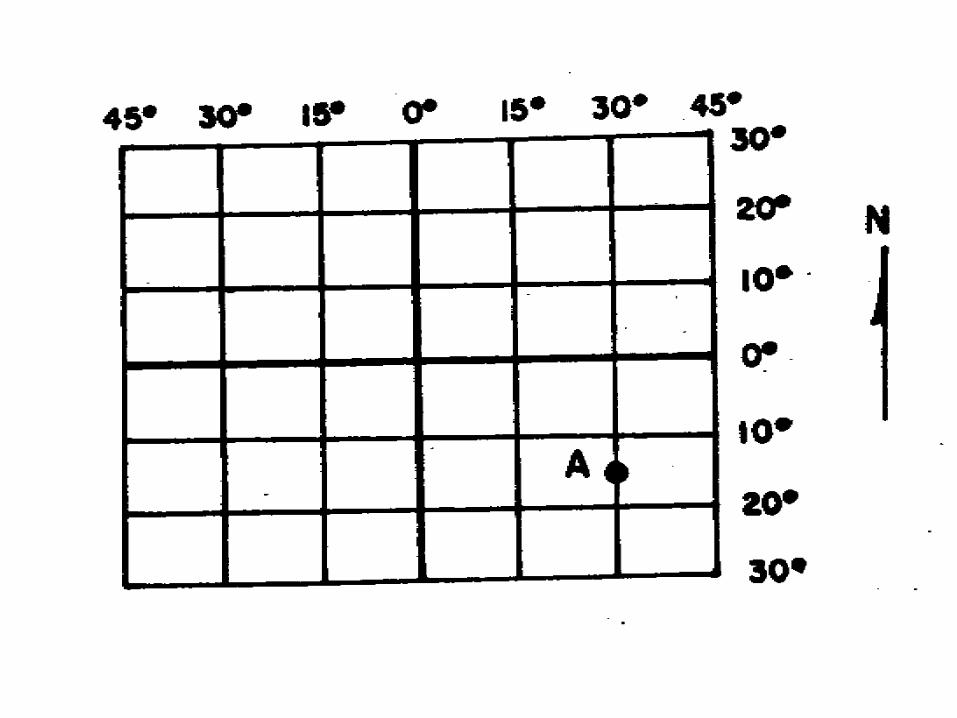
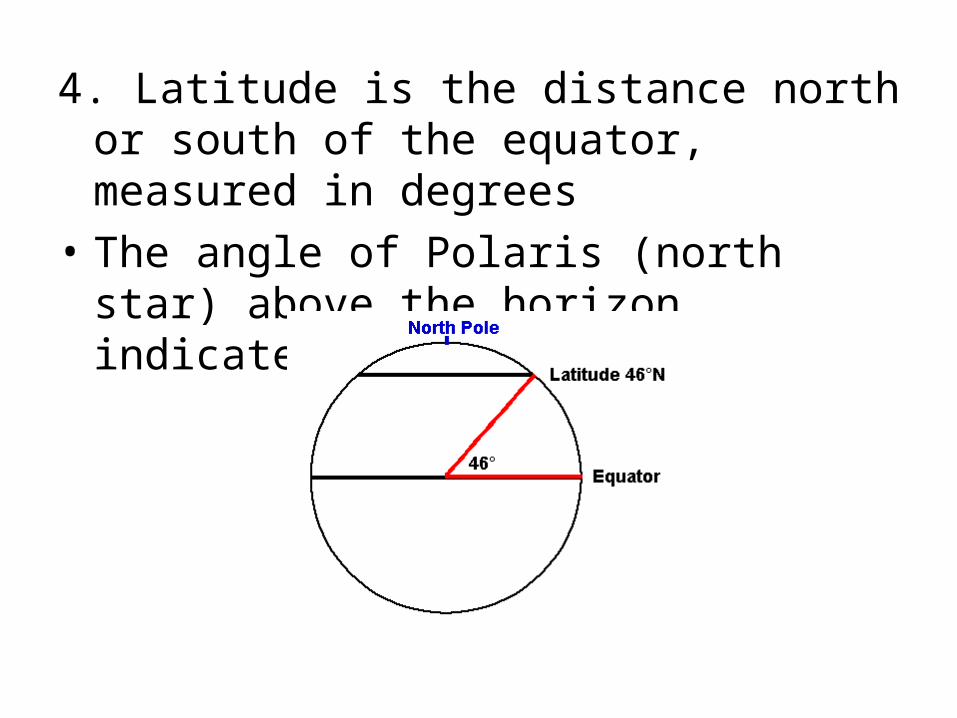
4. Latitude is the distance north or south of the equator, measured in degrees
• The angle of Polaris (north star) above the horizon indicates latitude
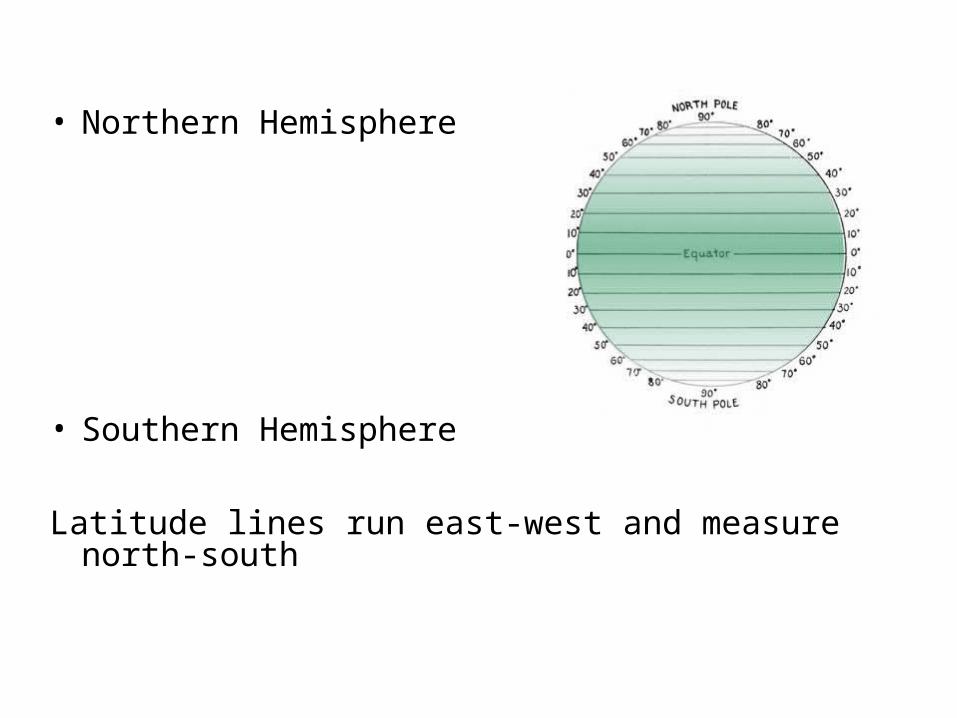
• Northern Hemisphere
• Southern Hemisphere
Latitude lines run east-west and measure north-south
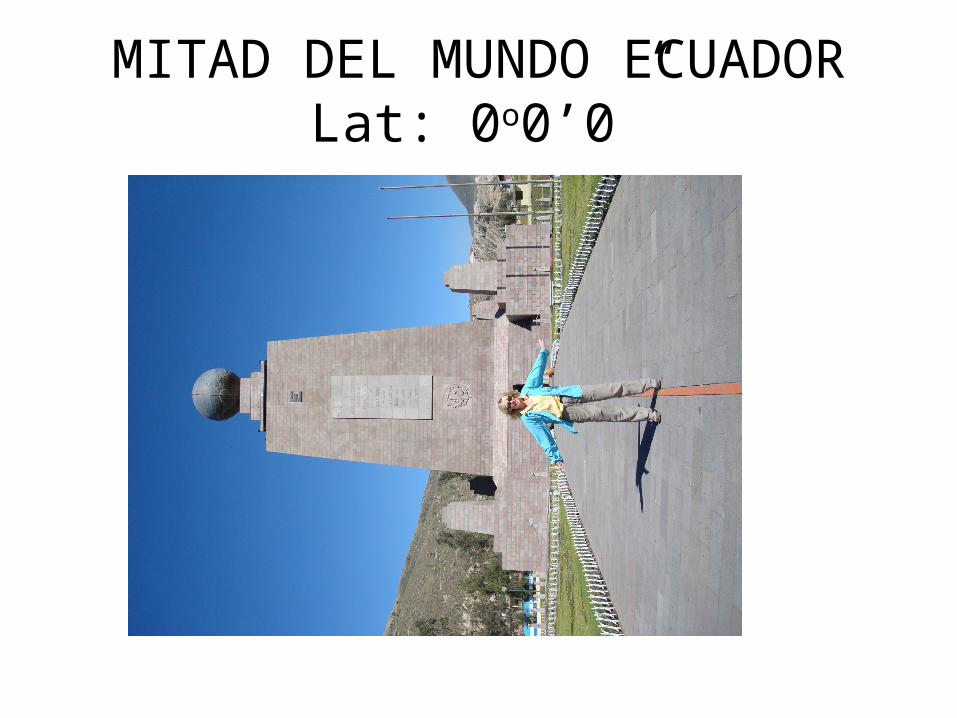
MITAD DEL MUNDO ECUADORLat: 0o0’0”
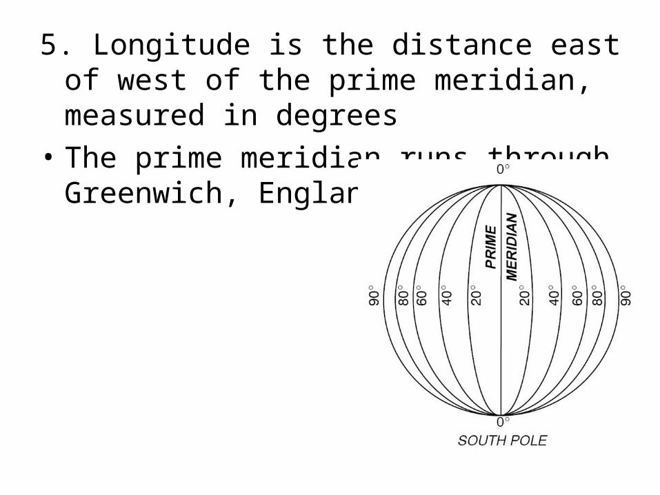
5. Longitude is the distance east of west of the prime meridian, measured in degrees
• The prime meridian runs through Greenwich, England
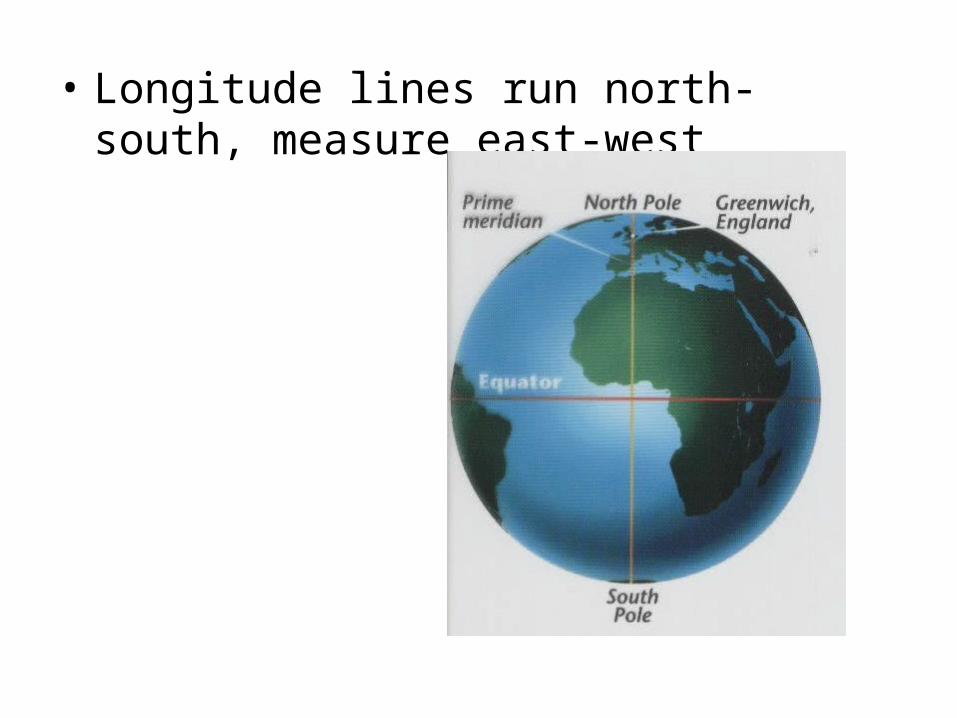
• Longitude lines run north-south, measure east-west
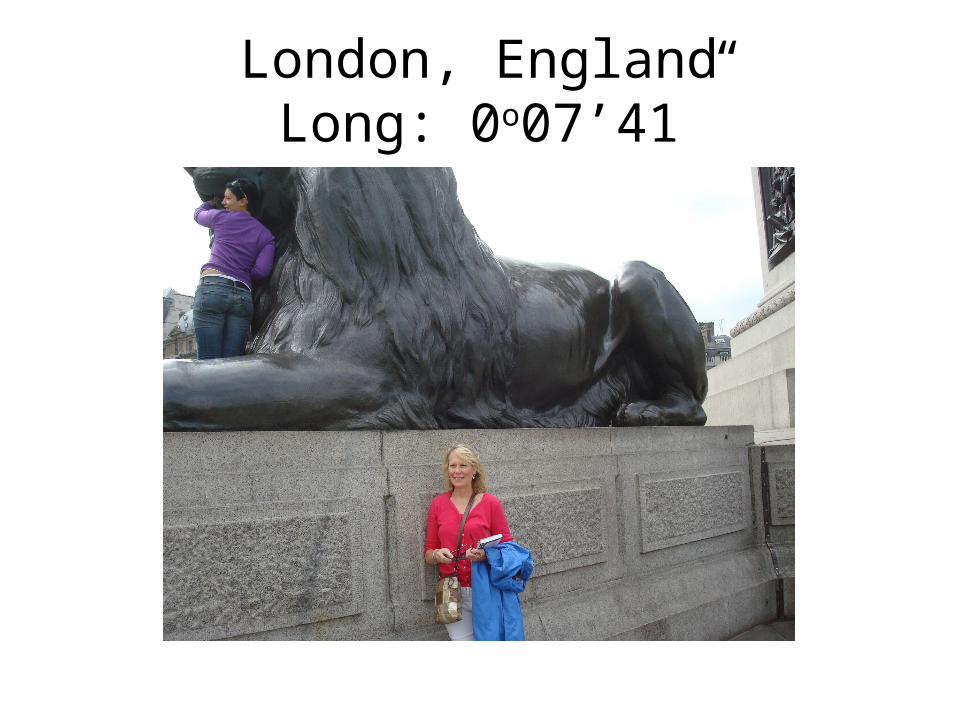
London, England Long: 0o07’41”
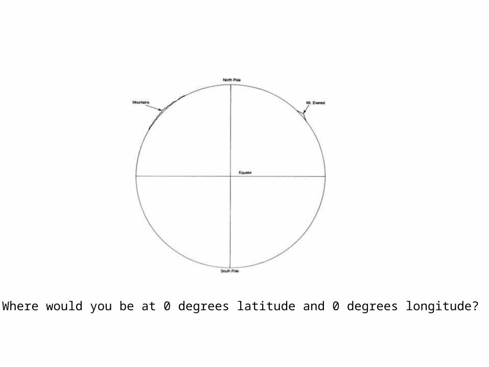
Where would you be at 0 degrees latitude and 0 degrees longitude?
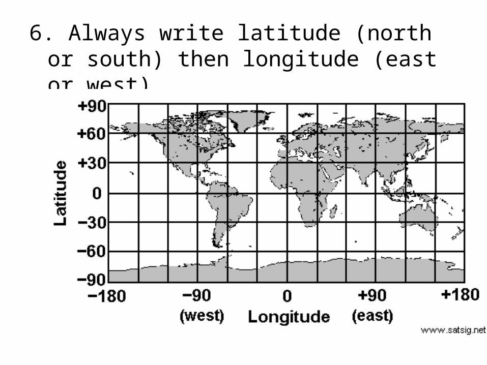
6. Always write latitude (north or south) then longitude (east or west)
7. Other types of mapping provides the ability to more precisely analyze Earth’s physical properties
• Weather satellites
• Landsat satellites
• GPS
• VLBI
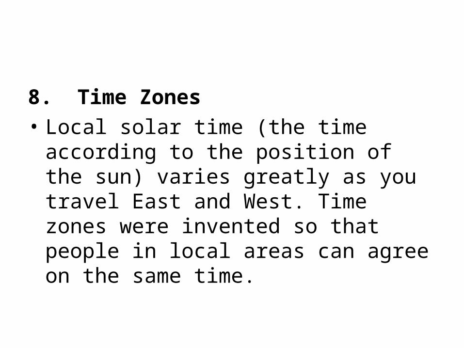
8. Time Zones
• Local solar time (the time according to the position of the sun) varies greatly as you travel East and West. Time zones were invented so that people in local areas can agree on the same time.
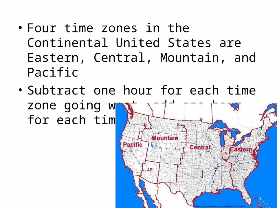
• Four time zones in the Continental United States are Eastern, Central, Mountain, and Pacific
• Subtract one hour for each time zone going west, add one hour for each time zone going east
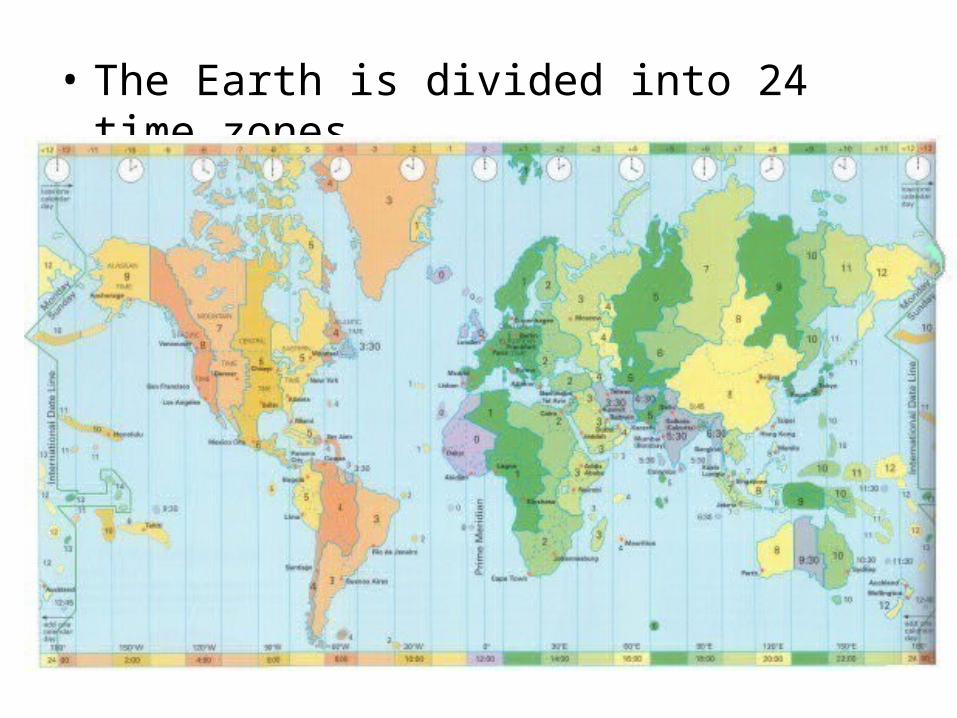
• The Earth is divided into 24 time zones
9. The Earth's structure is layered.
• Each layer is called a “sphere” since it wraps around the ball of Earth.
• The lithosphere is the "rock layer" of the Earth. • The hydrosphere is the "water layer" of the
Earth. • The atmosphere is the "air layer" of the Earth. • The atmosphere and hydrosphere are so thin
compared to the entire size of the Earth that, if drawn as seen from space, the ink would be thicker than each of the two layers would be if drawn to scale.
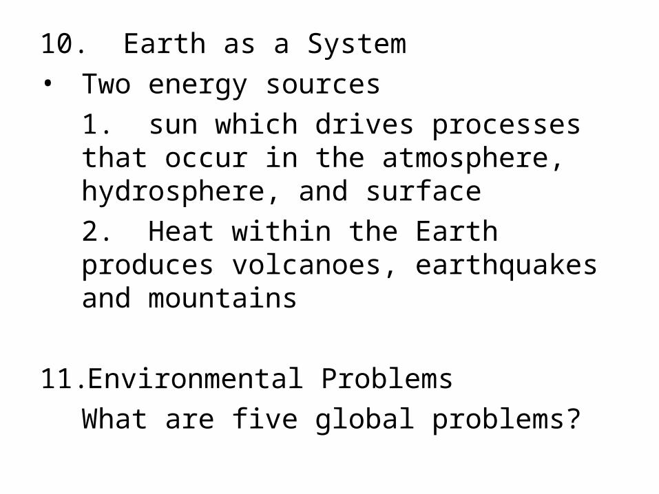
10. Earth as a System
• Two energy sources
1. sun which drives processes that occur in the atmosphere, hydrosphere, and surface
2. Heat within the Earth produces volcanoes, earthquakes and mountains
11.Environmental Problems
What are five global problems?