Embed Size (px)
Citation preview
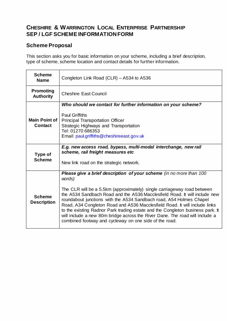
CHESHIRE & WARRINGTON LOCAL ENTERPRISE PARTNERSHIP SEP / LGF SCHEME INFORMATION FORM
Scheme Proposal This section asks you for basic information on your scheme, including a brief description,
type of scheme, scheme location and contact details for further information.
Scheme
Name
Congleton Link Road (CLR) – A534 to A536
Promoting
Authority
Cheshire East Council
Main Point of
Contact
Who should we contact for further information on your scheme?
Paul Griffiths Principal Transportation Officer
Strategic Highways and Transportation Tel: 01270 686353 Email: [email protected]
Type of
Scheme
E.g. new access road, bypass, multi-modal interchange, new rail scheme, rail freight measures etc
New link road on the strategic network.
Scheme
Description
Please give a brief description of your scheme (in no more than 100
words)
The CLR will be a 5.5km (approximately) single carriageway road between the A534 Sandbach Road and the A536 Macclesfield Road. It will include new roundabout junctions with the A534 Sandbach road, A54 Holmes Chapel
Road, A34 Congleton Road and A536 Macclesfield Road. It will include links to the existing Radnor Park trading estate and the Congleton business park. It
will include a new 80m bridge across the River Dane. The road will include a combined footway and cycleway on one side of the road.
Geographical Area
Please provide a short description of area covered by the Scheme (in no more than 100 words)
The Preferred Route Alignment for the scheme will be confirmed in April 2014. The area of interest for the CLR runs to the north of Congleton linking the
A534 Sandbach Road to the west with the A536 Macclesfield Road to the north.
The CLR opens up land to the north and west of Congleton for housing and employment development and provides improved access to the existing
Radnor Park industrial estate and Congleton business park.
The scheme will cross farm land and requires the River Dane to be crossed (a key constraint on the existing network as there are currently only two road crossings of the river in the town). The CLR may also pass close to ancient
woodland and numerous ponds.
OS Grid Reference: SJ 865920 63010 Postcode: CW12
Please append a map showing the location (and route) of the proposed scheme, existing transport infrastructure and other points of particular interest to the bid e.g. development sites, areas of existing employment,
constraints etc.
Attached as supporting evidence.
Scheme
Summary
Please select what the Scheme is trying to achieve. Please select all categories that apply.
Improve access to a development site that has the potential to create
housing
The CLR is a crucial piece of infrastructure required to support the
employment and housing aspirations included within the Council’s Local Plan Strategy. The scheme will facilitate the development of the following strategic development sites.
Back Lane and Radnor Park –located to the North West of Congleton with
the potential for 500 new homes,10 hectares of employment land adjacent to Radnor Park Trading Estate and up to 10 hectares of land for a leisure hub adjacent to Back Lane Village Green;
Congleton Business Park Extension – located on the North Western edge of Congleton with the potential for 450 new homes and 10 hectares of land
for commercial and employment uses adjacent to Congleton Business Park;
Giantswood Lane to Manchester Road – located to the North of
Congleton, there is a Strategic Location with the potential for 550 new homes and an additional Local Plan Strategy site to the south of
Giantswood Lane for 150 new homes; and
Manchester Road to Macclesfield Road – located to the North of
Congleton with the potential for 550 new homes.
Improve access to a development site that has the potential to create
jobs
The strategic development sites identified above also contain provision for commercial and retail development which have the potential to create jobs. As identified each site is wholly dependent on the delivery of the CLR. Further
details are as follows:
Back Lane and Radnor Park – potential for an extension to Radnor Park Trading Estate with 10 hectares for employment uses, retail to meet local
needs, 10 hectares of leisure uses, a new primary school and other community uses;
Congleton Business Park Extension – potential for a 10 hectare extension to Congleton Business Park for employment, as well as land for
commercial uses and retail to meet local needs;
Giantswood Lane to Manchester Road –provision of retail to meet local needs.
Manchester Road to Macclesfield Road – potential for the provision for some small scale local retail, approximately 200sqm – 300sqm and other
community uses.

Improve access to urban employment centres
The CLR will have significant benefits for one of the Borough’s largest employment centres. Congleton with a population of over 26,000 is the third largest urban area within the Borough. The CLR will reduce delays on the
both the local and strategic network providing significant benefits for local residents, business users and commuters. The removal of traffic congestion
and associated environmental impacts within Congleton will support inward investment opportunities as well as the economic and social prosperity of the area.
The CLR will also support the unlocking of sub regionally important
development sites at M6 Junction 17 and South Macclesfield (the Borough’s second largest urban area).
Improve access to Enterprise Zones
N / A – Congleton is not a designated Enterprise Zone.
Maintain accessibility by addressing the condition of
structures
N / A – The scheme does not involve the maintenance of existing structures.
Ease congestion / bottlenecks
Congleton is situated on the River Dane in east Cheshire. Four highways, the A34, A54 A536 and A534 all converge within the town in order to cross the
river. Thus, the roads through the town centre carry both local traffic and traffic passing through the town in order to travel to destinations further afield
such as Macclesfield and the M6. As identified in the Cheshire East LTP 2011 – 2026 there is significant
congestion (particularly at peak periods) in Congleton. Traffic Master data from 2010 identifies significant delays at several junctions including the A34 /
A534 / A54 (Waggon and Horses) roundabout, A34 / West Street roundabout and A54 / A34 Rood Hill traffic signals.
Figure 1 below illustrates the relative level of delay at junctions in the AM peak based on output from Traffic Master data.
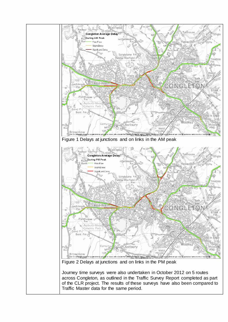
Figure 1 Delays at junctions and on links in the AM peak
Figure 2 Delays at junctions and on links in the PM peak
Journey time surveys were also undertaken in October 2012 on 5 routes
across Congleton, as outlined in the Traffic Survey Report completed as part of the CLR project. The results of these surveys have also been compared to Traffic Master data for the same period.
End to end times are longer in the peaks compared to the inter-peak period.
The greatest difference between the peak / inter peak times is for route 3 northbound where the average AM peak time is nearly 19 minutes whereas the inter peak average time is around 10.5 minutes. This route runs from the
A534 west of Congleton to Eaton on the A536 to the north. Route 1 (that runs along the A54 through the town) varies by between 4 and 5 minutes by
direction, between the peak and inter peak times. Similar differences are noted on route 2 which runs from the A34 south of Congleton to the A527 near Biddulph via Mill Lane / West Street.
This suggests that there is congestion along these routes in the peak periods.
The greatest level of congestion is experienced at the following junctions: A34 / A54 Rood Hill traffic signals, A54 / A534 / A34 Waggon and Horses gyratory, and the A34 / West Street roundabout. There is also congestion around the
signals and roundabout on Mountbatten Way close to the town centre.
Other(s), Please specify – N / A
Strategic Case This section should set out the rationale for making the investment and evidence on the
strategic fit of the Scheme.
Current Transport-
Related Challenges Addressed by
Scheme
What are the current problems to be addressed by your
Scheme? (describe any economic, environmental, social problems or opportunities which will be addressed by the scheme). Please provide a clear link to how the
intervention will overcome the identified problems and why this is the right intervention from a strategic
perspective. (limit: 1 side of A4)
Congleton is situated on the River Dane in Cheshire. Four highways, the A34, A54, A536 and A534 all converge within
the town in order to cross the river. Thus, the roads through the town centre carry both local traffic and traffic passing through the town in order to travel to destinations further afield
such as Macclesfield and the M6. High car ownership levels and heavy out commuting, lead to problems with congestion
throughout the day, but especially during the AM and PM peak periods.
As identified in the Cheshire East LTP 2011 – 2026 there is significant congestion (particularly at peak times) in Congleton.
Traffic Master data from 2010 identifies significant delays at several junctions including the A34 / A534 / A54 (Waggon and Horses) roundabout, A34 / West Street roundabout and A54 /
A34 Rood Hill traffic signals.
CEC has identified three AQMA’s within Congleton, where the required nitrogen dioxide standard is breached. These are on the A34 West Road, the A34/A54 Rood Hill and the A34 Lower
Heath, all of which were declared on the 1st May 2005. These
are all traffic related.
The A54 Rood Hill and A34 Rood Hill to Lower Heath is a “Designated Important Area for Road Noise” as part of
Environmental Work Directive. It requires CEC highways to produce a noise action plan to assess the options to reduce
noise. Motorised traffic also causes severance around the town centre in particular for pedestrians and cyclists.
There is anecdotal evidence that businesses are choosing not to expand existing operations in the town/immediate area due
to the level of congestion experienced. This is supported by the attached document entitled, “The key to unlocking Cheshire East: Securing jobs and a future for the local
economy (DRAFT)”, Link2 Prosperity, May 2013.
The CLR will address all these issues by removing through traffic and thus reducing traffic volumes on the A34, A54 and A536.
What is the consequence of this scheme not happening? Without the Link Road the impact of the housing allocations on
the local highway network will have to be mitigated with local highway improvements on existing roads. These alternatives will increase local severance, reduce air quality and offer no
opportunity to enhance pedestrian and cycle facilities. In terms of congestion relief the alternatives offer a much reduced level
of improvement and do little to improve strategic links. The local highway improvements have been subjected to
some preliminary testing using the SATURN traffic model. These have established that if capacity can be increased by
localised widening at existing junctions, the additional traffic from developments can be accommodated. As noted previously the level of congestion reduction for existing traffic
is expected to be minimal.
Future Transport-
Related Challenges Addressed by
Scheme
Are there any problems you have identified that will occur in the future that your Scheme is intended to address?
(e.g. congestion, road safety, access to services and opportunities etc.). (limit: 1 side of A4)
Without any intervention, the previous list of problems will
continue to be experienced although the duration and numbers of people affected is expected to grow disproportionately. Key problems that would be exacerbated are:
Congestion would be expected to spread beyond the peak;
Journey times across the network and delays at the key junctions identified above would deteriorate further;
The deterioration of network conditions would impact on
the economic and social prosperity of the area;
Community severance and general conditions for non-
motorised users would continue to worsen;
Conditions at the AQMA’s identified above would continue
to worsen; and
The strategic housing and employment sites identified
above would not be deliverable without alternative infrastructure provision, impacting on the ability of the Council to deliver the jobs led growth aspirations identified
within the emerging Local Plan.
Geographic Areas
Affected by Scheme
Please provide information on the geographical areas that will benefit from your Scheme. You should indicate those
areas that will directly benefit, areas that will indirectly benefit and those areas that will be impacted adversely.
BENEFITS: Direct Impacts will focus on the A34 corridor
through Congleton between the Lower Heath Gyratory
(A34/A536 junction) and the Waggon and Horses roundabout (A54 / A534 / A34), where traffic flow will decrease and congestion is relieved. The A54 Holmes Chapel road and
A534 Sandbach Road (within the urban area) will also be relieved.
The town centre will benefit indirectly from reduced traffic levels, as traffic currently “rat running” on Mill street / West
Street can use the more appropriate route via A54 Rood Hill and A34 Clayton By-pass.
Holmes Chapel close to Junction 18 of the M6 will benefit from reductions in traffic on the A54 and A535, as traffic to / from
the Macclesfield area to/from the M6 (south) transfers to route via the CLR to access the M6 Motorway at Junction 17. The SATURN traffic model forecasts traffic to be around 35% lower
with the scheme in 2017 on the A535 than it would otherwise have been. In 2032 the flow on the A54 between Holmes
Chapel and M6 Junction 18 is forecast to be around 10% lower with the scheme.
It should be noted that based on the 2010 English Indices of Multiple Deprivation, there is one area of Deprivation within
Congleton (Bromley Farm) and two areas within South Macclesfield (South Park and Weston) that will benefit from the introduction of the scheme.
DISBENEFITS: A small number of existing properties on
Chelford Road on the western edge of Congleton may experience an increase in noise due to the new road. Mitigation measures are likely to be possible to reduce or
eliminate this impact.
Contingency
Planning
If LGF funding is not available for your Scheme, do you
have a contingency plan for this Scheme?
The Council is fully committed to the delivery of the CLR. Due to the scale of the CLR and the current financial constraints associated with securing funding for Local Authority Major
Schemes the Council is committed to the development of a financial plan that seeks to maximise the potential for private
sector contributions as well as other local and central Government funding sources from outside of the SEP process. In the event that funding for the CLR isn’t available, lower
costs measures on the existing A34 corridor will be developed as noted previously, to facilitate the developments identified in
the Local Plan Strategy. These measures would not deliver the transformational benefits of the Link Road, provide no future transport capacity, and attract lower developer
contributions – whilst still costing in the region of £10M.
The Contingency Plan for the scheme is that it would have to be included in the scheme of critical infrastructure delivered from future developer contributions. This will be through
receipts gathered under the Community Infrastructure Levy (CIL) regulations.
However, the current timescale for the adoption of the Community Infrastructure Levy is mid 2015 at the earliest.
There is considerable competition for this funding not least from other highway improvement schemes but also from other
required infrastructure such as school expansion programme and open space provision.
At this stage it is difficult to assess the priority of schemes that will receive funding through CIL. Furthermore, even if this scheme were to be a priority funded scheme, progress would
have to wait until sufficient development had taken place to match the necessary shortfall in funding.
If LGF funding is not secured, then alternative mitigation and/or alternative funding sources would have to be examined.
If the scheme was wholly dependent on capturing CIL receipts, it would delay the delivery of the scheme by up to 10 to 15
years. Most notably the strategic housing and employment sites identified would be less easy to deliver impacting on the ability of the Council to deliver the growth aspirations identified
within the Local Plan Strategy.
As part of the development and appraisal of alternative options for the CLR, analysis has revealed that with the exception of the promoted scheme, the broad range of options considered
would fail to address the current and future transport problems and support the delivery of the strategic objectives for the
Congleton area, namely:
To support the economic, physical and social regeneration
of Congleton by creating and securing jobs;
To relieve existing town centre traffic congestion/ HGVs,
remove traffic from less desirable roads and facilitate town centre regeneration;
To open up new development sites and improve access to Radnor Park Industrial Estate and Congleton Business Park;
To improve strategic transport linkages across the Borough facilitating wider economic and transport benefits;
To reduce community severance along key town centre corridors; and
To reduce traffic related pollutants within the towns
declared Air Quality Management Areas.
Please describe what alternative options have been considered and why these have been rejected.
In accordance with best practice for the development of transport strategies, a broad range of potential transport
interventions (28) were identified and appraised against their potential contribution to the delivery of the Council endorsed objectives (see above) as well as the transport related
problems for the Congleton area. This has been reported in a Stage 1 Scheme Assessment Report (B1832001/OD004
December 2013) based on the Department for Transport’s Design Manual for Roads and Bridges guidance on Scheme Assessment Reporting.
In addition each intervention was subjected to an EAST (Early
Appraisal Sifting Tool) assessment. This approach enabled a consistent and transparent means for the identification of a preferred transport solution for the Congleton area which
accords with the Treasury’s best practice five case model and guidance for the development of Local Authority Major
Schemes. Potential interventions included multi modal schemes, on line
highway improvements and off line (Link Road) options, that can be summarised as follows: Multi-modal Options
Bus services/facilities improvement
Park and Ride facilities in the town
Additional financial support for existing services
Rail service/facilities improvement
Promotion of existing facilities through marketing
Improved pedestrian and cyclist facilities
Public realm improvements
Car share schemes
Travel planning (businesses and schools)
Online Improvements through Congleton
Tidal flow on A34
Localised junction improvements
Network management measures (MOVA, SCOOT)
Strategic signing strategy
Traffic management strategy
Parking strategy
HGV ban
Rationalised junction strategy
Off line highway options
Link road connecting A534 Sandbach Road to A536 Macclesfield Road
‘Partial’ Link Road connecting A534 Sandbach Road to Viking Way
‘Partial’ Link Road connecting Viking Way to A536 Macclesfield Road
Link to the south of Congleton
Link to the east of Congleton
The process concluded that a highway based solution is the preferred transport intervention and this was endorsed by
Cabinet in May 2013. It was acknowledged that lower cost options would be complementary to the CLR scheme promoted within this submission but would not be successful in
removing the volume of traffic from Congleton required to alleviate the existing / future problems and meet the agreed
objectives for the Congleton area (referenced above). As noted previously a composite on-line lower cost option has
been tested using the SATURN traffic model. The outputs from this have been used to assess the economic impact of this
option, based on some preliminary designs and associated costs estimates. It should be noted that the level of congestion relief is much less for this option.
Fit with overall
Strategy
Please provide a description for how your proposal fits with the overall LEP strategy.
The scheme supports the High Growth City strategic priority,
specifically policies: T2: Connectivity enhancement between Crewe, M6 and mid-
Cheshire towns and T3: Access improvement to unlock priority employment and
housing sites across the LEP area towns to unlock High Growth City I1: Promoting Cheshire and Warrington as ‘open for business
B1: Supporting Business Growth and Excellence in Cheshire and Warrington
Reduce congestion and improve the efficiency if the network to support economic growth and regeneration
The CLR will remove through traffic currently travelling between A34(N)/A536(N) and A54(W)/A534(W). This will
relieve congestion at three key junctions in Congleton:
A34/A54/A534 Waggon and Horses roundabout,
A34 West Road/West Street/A34 Clayton Bypass
roundabout,
A34 Clayton Bypass/A34 Rood Hill/A54 Rood Hill traffic signals.
It will open up land to the north of Congleton for new housing
development/industrial use and improve access to existing Radnor Park industrial estate and Congleton Business Park, with a new direct access to/from the A54(W) and A534 (see
appended Development Strategy supporting information).
Holmes Chapel close to Junction 18 of the M6 will benefit from reductions in traffic on the A54 and A535, as traffic to / from the Macclesfield area to/from the M6 (south) transfers to route
via the CLR to access the M6 Motorway at Junction 17.
Reduce the impact of traffic on the environment, reduce carbon emissions and take steps to adapt the transport network to the effects of climate change;
The scheme will result in reduced congestion and delay on key
parts of the network. Significant levels of traffic will reassign from the town centre and sensitive receptors as identified below.
CEC has identified 3 AQMA’s within Congleton, where the
required nitrogen dioxide standard is breached. These are on the A34 West Road, the A34/A54, Rood Hill, Congleton,
and the A34 Lower Heath, all of which were declared on the 1st May 2005. These are all traffic related.
The A54 Rood Hill and A34 Rood Hill to Lower Heath is a
“Designated Important Area for Road Noise” as part of Environmental Work Directive. It requires CEC Highways to
produce a noise action plan to assess the options to reduce noise. Motorised traffic also causes severance around the town centre in particular for pedestrians and cyclists.
Maintain large transport structures;
N / A – the CLR will not support the maintenance of any large
transport structures.
Contribute to safe and secure transport and promote types of transport that are beneficial to health;
The reduction in queues associated with the scheme and the transfer of traffic to a highway built to modern standards will
reduce the risk of accidents. From analysis of the accident records (2007 - 2011) on the web site
http://crashmap.co.uk/Search, this reveals that there were the following accidents within the immediate vicinity of the scheme (between Child Lane / A34 Newcastle Road Junction and
Smithy Lane / A34 Congleton Road / School Lane Junction).
3 Fatal.
11 Serious; and
34 Slight. The removal of significant levels of traffic from the Congleton
area will also improve the safety for non-motorised users and promote travel by healthier modes.
In terms of security the scheme will be designed to modern standards and include appropriate provision of non-motorised
user facilities to meet current demands in the area, including a combined footway and cycleway on one side of the road.
Improve accessibility to jobs and key services,
particularly for disadvantaged communities or groups.
As identified the introduction of the CLR will have significant
benefits for one of the Borough’s largest employment centres. Congleton with a population of over 26,000 is the third largest
urban area within the Borough. The CLR will reduce delays on both the local and strategic network providing significant benefits for local residents, business users and commuters.
The Removal of traffic congestion and associated environmental impacts within Congleton will support inward
investment opportunities, improve access to key services as well as the economic and social prosperity of the area. The CLR will also support the unlocking of sub regionally important
development sites at M6 Junction 17 and South Macclesfield.
It should be noted that based on the 2010 English Indices of Multiple Deprivation, there is one area of deprivation within Congleton (Bromley Farm) and two areas of deprivation within
South Macclesfield (South Park and Weston) that will benefit from the introduction of the scheme.
New Housing
If this scheme facilitates the delivery of new houses, please state the number of houses expected, their
location and over what timescale.
The scheme will facilitate the development of the following
strategic development sites over the local plan period (2014 to 2030).
Back Lane and Radnor Park – located to the North West of Congleton with the potential for 500 new homes;
Congleton Business Park Extension – located on the North Western edge of Congleton with the potential for 450 new
homes adjacent to Congleton Business Park;
Giantswood Lane to Manchester Road – located to the
North of Congleton, this is a Strategic Location with the potential for 550 new homes and an additional Local Plan Strategy site to the south of Giantswood Lane for 150 new
homes; and
Manchester Road to Macclesfield Road – located to the
North of Congleton with the potential for 550 new homes..
TOTAL DIRECT - 2200
Are these houses in addition to those included within the
Local Plan? The housing identified above is all identified in the emerging
Local Plan. The new Local Plan for Cheshire East is not yet adopted, but has been approved by Full Council and will be
submitted for inspection in Spring 2014. It is expected to be adopted later in 2014.
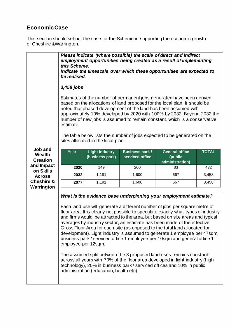
Economic Case
This section should set out the case for the Scheme in supporting the economic growth of Cheshire &Warrington.
Job and Wealth
Creation and Impact
on Skills Across
Cheshire &
Warrington
Please indicate (where possible) the scale of direct and indirect employment opportunities being created as a result of implementing
this Scheme. Indicate the timescale over which these opportunities are expected to be realised.
3,458 jobs Estimates of the number of permanent jobs generated have been derived based on the allocations of land proposed for the local plan. It should be
noted that phased development of the land has been assumed with approximately 10% developed by 2020 with 100% by 2032. Beyond 2032 the
number of new jobs is assumed to remain constant, which is a conservative estimate.
The table below lists the number of jobs expected to be generated on the sites allocated in the local plan.
Year Light industry
(business park)
Business park /
serviced office
General office
(public
administration)
TOTAL
2020 149 200 83 432
2032 1,191 1,600 667 3,458
2077 1,191 1,600 667 3,458
What is the evidence base underpinning your employment estimate?
Each land use will generate a different number of jobs per square metre of floor area. It is clearly not possible to speculate exactly what types of industry and firms would be attracted to the area, but based on site areas and typical
averages by industry sector, an estimate has been made of the effective Gross Floor Area for each site (as opposed to the total land allocated for
development). Light industry is assumed to generate 1 employee per 47sqm, business park / serviced office 1 employee per 10sqm and general office 1 employee per 12sqm.
The assumed split between the 3 proposed land uses remains constant across all years with 70% of the floor area developed in light industry (high
technology), 20% in business park / serviced offices and 10% in public administration (education, health etc).
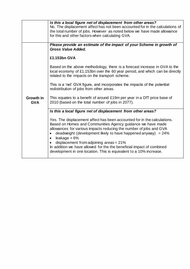
Is this a local figure net of displacement from other areas? No. The displacement affect has not been accounted for in the calculations of
the total number of jobs. However as noted below we have made allowance for this and other factors when calculating GVA.
Growth in
GVA
Please provide an estimate of the impact of your Scheme in growth of
Gross Value Added.
£1.153bn GVA
Based on the above methodology, there is a forecast increase in GVA to the
local economy of £1.153bn over the 60 year period, and which can be directly related to the impacts on the transport scheme.
This is a ‘net’ GVA figure, and incorporates the impacts of the potential redistribution of jobs from other areas.
This equates to a benefit of around £19m per year in a DfT price base of
2010 (based on the total number of jobs in 2077).
Is this a local figure net of displacement from other areas?
Yes. The displacement affect has been accounted for in the calculations. Based on Homes and Communities Agency guidance we have made
allowances for various impacts reducing the number of jobs and GVA
deadweight (development likely to have happened anyway) = 24%
leakage = 6%
displacement from adjoining areas = 21% In addition we have allowed for the the beneficial impact of combined
development in one location. This is equivalent to a 10% increase.
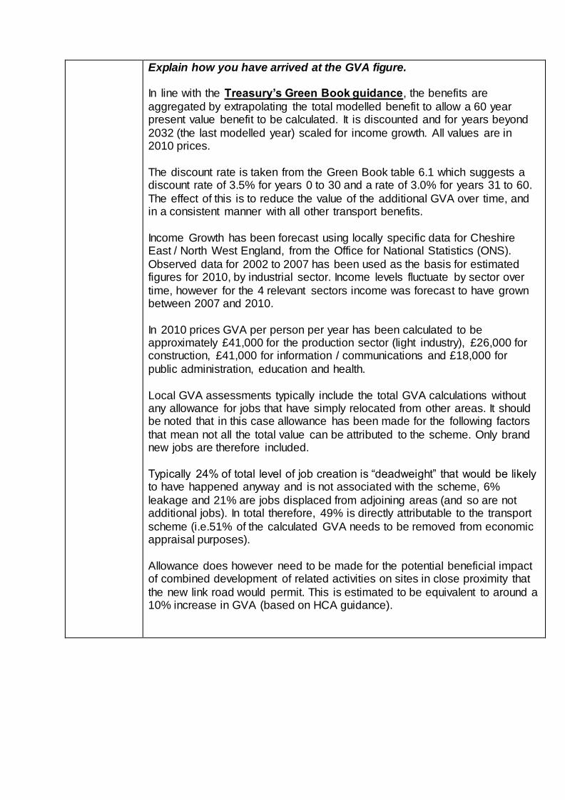
Explain how you have arrived at the GVA figure.
In line with the Treasury’s Green Book guidance, the benefits are
aggregated by extrapolating the total modelled benefit to allow a 60 year present value benefit to be calculated. It is discounted and for years beyond
2032 (the last modelled year) scaled for income growth. All values are in 2010 prices.
The discount rate is taken from the Green Book table 6.1 which suggests a discount rate of 3.5% for years 0 to 30 and a rate of 3.0% for years 31 to 60.
The effect of this is to reduce the value of the additional GVA over time, and in a consistent manner with all other transport benefits.
Income Growth has been forecast using locally specific data for Cheshire East / North West England, from the Office for National Statistics (ONS).
Observed data for 2002 to 2007 has been used as the basis for estimated figures for 2010, by industrial sector. Income levels fluctuate by sector over
time, however for the 4 relevant sectors income was forecast to have grown between 2007 and 2010.
In 2010 prices GVA per person per year has been calculated to be approximately £41,000 for the production sector (light industry), £26,000 for construction, £41,000 for information / communications and £18,000 for
public administration, education and health.
Local GVA assessments typically include the total GVA calculations without any allowance for jobs that have simply relocated from other areas. It should be noted that in this case allowance has been made for the following factors
that mean not all the total value can be attributed to the scheme. Only brand new jobs are therefore included.
Typically 24% of total level of job creation is “deadweight” that would be likely to have happened anyway and is not associated with the scheme, 6%
leakage and 21% are jobs displaced from adjoining areas (and so are not additional jobs). In total therefore, 49% is directly attributable to the transport
scheme (i.e.51% of the calculated GVA needs to be removed from economic appraisal purposes).
Allowance does however need to be made for the potential beneficial impact of combined development of related activities on sites in close proximity that
the new link road would permit. This is estimated to be equivalent to around a 10% increase in GVA (based on HCA guidance).
Productivity Benefits to
Business
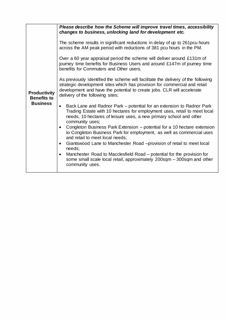
Please describe how the Scheme will improve travel times, accessibility changes to business, unlocking land for development etc.
The scheme results in significant reductions in delay of up to 261pcu hours across the AM peak period with reductions of 381 pcu hours in the PM.
Over a 60 year appraisal period the scheme will deliver around £131m of
journey time benefits for Business Users and around £147m of journey time benefits for Commuters and Other users.
As previously identified the scheme will facilitate the delivery of the following strategic development sites which has provision for commercial and retail
development and have the potential to create jobs. CLR will accelerate delivery of the following sites:
Back Lane and Radnor Park – potential for an extension to Radnor Park Trading Estate with 10 hectares for employment uses, retail to meet local
needs, 10 hectares of leisure uses, a new primary school and other community uses;
Congleton Business Park Extension – potential for a 10 hectare extension
to Congleton Business Park for employment, as well as commercial uses and retail to meet local needs;
Giantswood Lane to Manchester Road –provision of retail to meet local needs;
Manchester Road to Macclesfield Road – potential for the provision for some small scale local retail, approximately 200sqm – 300sqm and other community uses.
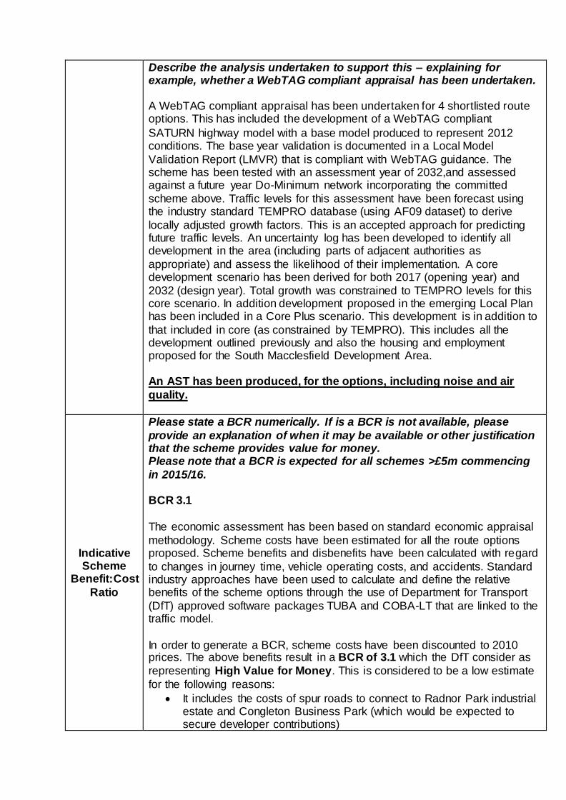
Describe the analysis undertaken to support this – explaining for example, whether a WebTAG compliant appraisal has been undertaken. A WebTAG compliant appraisal has been undertaken for 4 shortlisted route options. This has included the development of a WebTAG compliant
SATURN highway model with a base model produced to represent 2012 conditions. The base year validation is documented in a Local Model
Validation Report (LMVR) that is compliant with WebTAG guidance. The scheme has been tested with an assessment year of 2032,and assessed against a future year Do-Minimum network incorporating the committed
scheme above. Traffic levels for this assessment have been forecast using the industry standard TEMPRO database (using AF09 dataset) to derive
locally adjusted growth factors. This is an accepted approach for predicting future traffic levels. An uncertainty log has been developed to identify all development in the area (including parts of adjacent authorities as
appropriate) and assess the likelihood of their implementation. A core development scenario has been derived for both 2017 (opening year) and
2032 (design year). Total growth was constrained to TEMPRO levels for this core scenario. In addition development proposed in the emerging Local Plan has been included in a Core Plus scenario. This development is in addition to
that included in core (as constrained by TEMPRO). This includes all the development outlined previously and also the housing and employment proposed for the South Macclesfield Development Area. An AST has been produced, for the options, including noise and air
quality.
Indicative Scheme
Benefit:Cost
Ratio
Please state a BCR numerically. If is a BCR is not available, please
provide an explanation of when it may be available or other justification that the scheme provides value for money. Please note that a BCR is expected for all schemes >£5m commencing
in 2015/16.
BCR 3.1
The economic assessment has been based on standard economic appraisal
methodology. Scheme costs have been estimated for all the route options proposed. Scheme benefits and disbenefits have been calculated with regard
to changes in journey time, vehicle operating costs, and accidents. Standard industry approaches have been used to calculate and define the relative benefits of the scheme options through the use of Department for Transport
(DfT) approved software packages TUBA and COBA-LT that are linked to the traffic model.
In order to generate a BCR, scheme costs have been discounted to 2010 prices. The above benefits result in a BCR of 3.1 which the DfT consider as
representing High Value for Money. This is considered to be a low estimate
for the following reasons:
It includes the costs of spur roads to connect to Radnor Park industrial estate and Congleton Business Park (which would be expected to secure developer contributions)
Scheme cost estimates include allowance for risk and optimism bias (at the higher value of 44%)
Preliminary compensation cost estimates are robust. The calculation of this BCR is documented in the Economic Assessment
Report (Monetised Costs and Benefits)(B1832001/OD016 February 2014).
It should be noted that environmental impacts on carbon, air quality and noise have been quantified and are included in the calculation of the quoted BCR.
Given the nature of the scheme we have not attempted to include for any maintenance benefits associated with the scheme, as these are expected to
be minimal. As noted above the scheme BCR would be expected to significantly increase
once it has progressed through statutory processes and the level of Optimism Bias uplift is adjusted accordingly.
An Appraisal Summary Table (AST) is appended to this Information Form.
Financial Case This section is asking you to set out the financial case for your Scheme.
Scheme Costs
Before putting forward a Scheme proposal for potential
funding, Scheme promoters should ensure they understand the financial implications of developing the Scheme (including
any implications for future resource spend and ongoing costs relating to maintaining and operating the asset), and the need to secure and underwrite any necessary funding outside the
LGF contribution
Cheshire East Council fully understands the financial implications of developing the scheme and has secured any necessary funding outside of the LTB’s contribution.
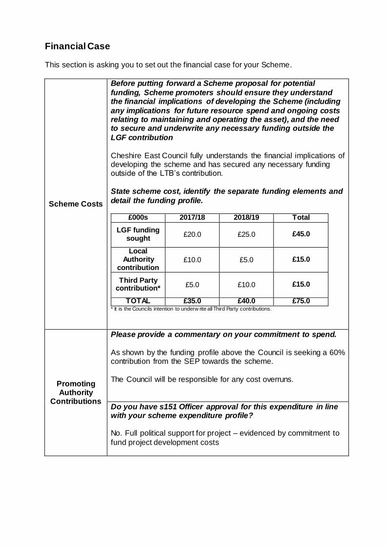
State scheme cost, identify the separate funding elements and
detail the funding profile.
£000s 2017/18 2018/19 Total
LGF funding sought
£20.0 £25.0
£45.0
Local Authority
contribution £10.0 £5.0
£15.0
Third Party contribution* £5.0 £10.0
£15.0
TOTAL £35.0 £40.0 £75.0
* It is the Councils intention to underw rite all Third Party contributions.
Promoting Authority
Contributions
Please provide a commentary on your commitment to spend.
As shown by the funding profile above the Council is seeking a 60% contribution from the SEP towards the scheme.
The Council will be responsible for any cost overruns.
Do you have s151 Officer approval for this expenditure in line with your scheme expenditure profile? No. Full political support for project – evidenced by commitment to
fund project development costs
Third Party
Contributions
Please provide details on any third party contributions for your Scheme. This should include evidence to show how any third
party contributions are being secured (e.g. S106 agreement) the level of commitment and when they will become available.
The Council is actively developing a robust financial plan to support the delivery of the scheme. Potential third party contributions
towards the scheme have been identified from the following sources:
Section 106: the Council intend to include a Section 106 policy for the aforementioned strategic housing sites within the
emerging Local Plan. Based on average house prices for the Congleton area and assuming a 30% affordable home allowance, viability assessments have revealed that over the
Plan period the sites have the potential to contribute between £10 and £15 million towards the CLR.
Borough Wide CIL receipts: as part of the emerging Local Plan the Council is in the process of developing a Borough wide CIL strategy. Based on average house prices across the Borough
and assuming a 30% affordable home allowance, investigations have revealed that over the Plan period potential CIL receipts
are significant. In addition to the above the Council will also seek to support the
delivery of the CLR through the following Government funding sources:
New Homes Bonus: over the Local Plan period the CLR will
support the delivery of over 2,000 homes with a significant proportion being affordable homes. The Council is investigating the use of this annual Government funding source and
associated affordable home enhancements to support the delivery of the CLR.
Applications for funding through future rounds of Regional Growth and Growing Places Fund: As well a robust ‘transport case’, the Council considers that the CLR has a strong fit with
the Government’s agenda to support economic growth and facilitate the delivery of key housing and employment sites. The
Council will therefore continue to be proactive in securing additional Government funding for the CLR.
Due to the importance of the CLR to the Borough’s strategic highway network and its requirement to support the delivery of
strategic housing and commercial sites the Council is also investigating the potential use of capital receipts to support the delivery of the scheme.
Work is on-going to develop the financial plan for the scheme in
time to support the Local Plan inspection process scheduled for

later in 2014. The financial plan for the scheme will be a ‘live’ document that is updated at key milestones in the scheme
programme to reflect any changes in potential funding sources. It is considered that as the LTB application is for funding in the ‘medium term’ that the scheme programme allows for sufficient time to
enable a robust financial plan to be in place to support the CPO process and provide delivery assurance to the LTB.
Is this commitment legally binding / secure? Not yet legally binding, as the development sites identified are in the emerging Local Plan which has not yet been adopted.
Affordability
and Financial Risk
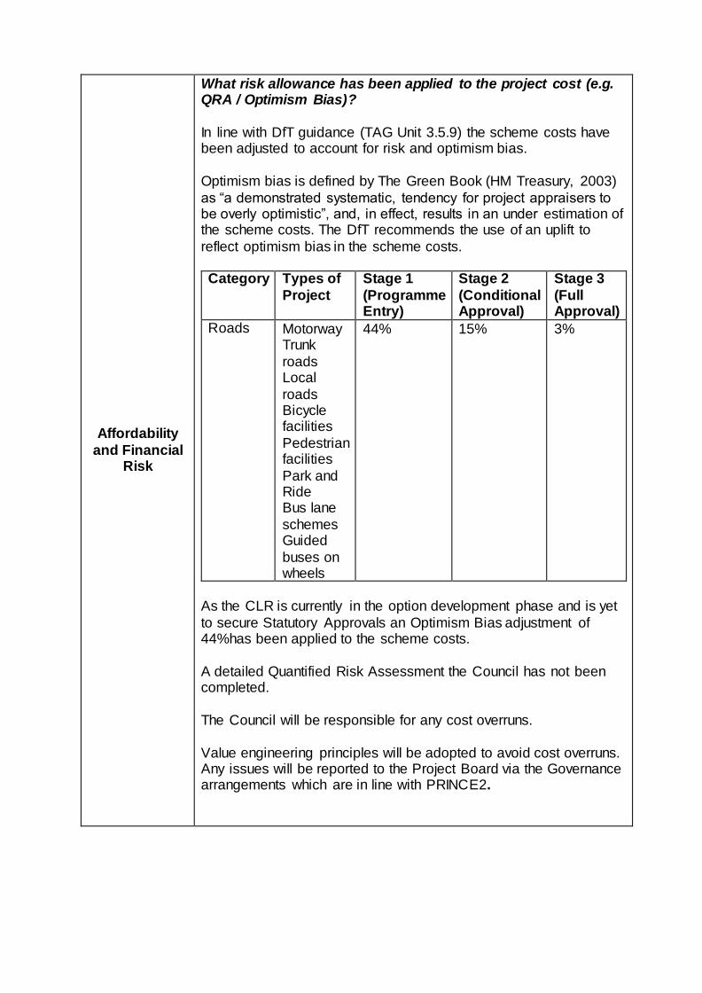
What risk allowance has been applied to the project cost (e.g. QRA / Optimism Bias)?
In line with DfT guidance (TAG Unit 3.5.9) the scheme costs have been adjusted to account for risk and optimism bias.
Optimism bias is defined by The Green Book (HM Treasury, 2003)
as “a demonstrated systematic, tendency for project appraisers to be overly optimistic”, and, in effect, results in an under estimation of the scheme costs. The DfT recommends the use of an uplift to
reflect optimism bias in the scheme costs. Category Types of
Project
Stage 1
(Programme Entry)
Stage 2
(Conditional Approval)
Stage 3
(Full Approval)
Roads Motorway Trunk
roads Local
roads Bicycle facilities
Pedestrian facilities
Park and Ride Bus lane
schemes Guided
buses on wheels
44% 15% 3%
As the CLR is currently in the option development phase and is yet
to secure Statutory Approvals an Optimism Bias adjustment of 44%has been applied to the scheme costs.
A detailed Quantified Risk Assessment the Council has not been completed.
The Council will be responsible for any cost overruns.
Value engineering principles will be adopted to avoid cost overruns. Any issues will be reported to the Project Board via the Governance arrangements which are in line with PRINCE2.
Legacy
Benefits
Please provide information on any legacy benefits (if any) of your Scheme.
The scheme will reduce the maintenance costs associated with the local road network.
Management Case - Delivery This section is asking you to demonstrate how you intend to assess whether your Scheme is deliverable in the next spending round or at some future date.
Current Scheme
Status
Please state scheme status e.g. Is the scheme at the
conceptual stage? Has a business case been developed?
Is it a committed scheme or has it been given legacy provisional approval? Has a bid for funding been submitted/ was it successful?
The CLR is currently in the option development phase and the
Preferred Route Announcement is targeted for May 2014 in line with the Local Plan process.
An outline business case for the scheme is under development along with a WebTAG complaint traffic model. Funding to
complete the business case and to progress the scheme to Preferred Route Announcement has been committed by the Council.
The following is a list of items/tasks/programme milestones that the Congleton Project has achieved to date:
Initial Investigation & Scoping - review of problems, opportunities, constraints and production of an
Interventions Report
Development of a set of scheme objectives
Improvement Strategy identification followed by Early
Assessment and Sifting Exercise (EAST report produced)
Data gathering including
Noise & Air Quality desk study
Geotechnical Desk Study
Traffic data collection and traffic model development (including LMVR and TFR)
Ecological Phase 1 Habitat Survey
Landownership survey
Landscape survey
for production of a Stage 1 Scheme Assessment Report
Options Cost Estimate development
Economic Appraisal
Environmental Impact Assessment (& Report)
Stage 2 Scheme Assessment Report
Public Consultation exercise (& Report)
Commitment to Fund Scheme development
Please state what level of commitment there is to develop the Scheme to a Business Case and what funding is
required for scheme development/ Business Case preparation?
The Council is fully committed to progress the scheme. The scheme has been prioritised following an initial sifting exercise
of the ‘long list’ of schemes included within the Capital Plan. Schemes have been prioritised based on the following criteria:
Strategic Fit with LTB Objectives;
Likely Value for Money (Transport Benefits);
Deliverability by 2019; and
Third party Contributions.
The subsequent list of priority schemes has been agreed with the Council’s Senior Members.
As identified above the CLR is currently in the option
development phase and the Preferred Route Announcement is targeted for May 2014 in line with the Local Plan process.
An outline business case for the scheme is under development following on from the WebTAG complaint traffic model.
Funding to complete the business case and to progress the scheme to Preferred Route Announcement has been committed by the Council (Cabinet Approval, November 2012).
As identified the above SEP funding for the scheme is being
requested for the medium term. This is to support the development of a robust financial plan to secure the additional funding required to facilitate the delivery of the scheme. Prior
to securing the level of Third Party contributions required to meet the funding gap it is the Council’s intention to underwrite
them. A Cabinet Report has been produced which will be presented
to the April 2014 Cabinet which seeks funding for the next stage of work. To date in the region of £1m of Council funds
have been spent on scheme development which demonstrates considerable commitment to the scheme.
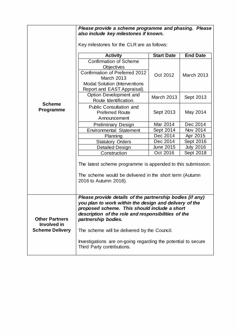
Scheme
Programme
Please provide a scheme programme and phasing. Please also include key milestones if known.
Key milestones for the CLR are as follows:
Activity Start Date End Date
Confirmation of Scheme
Objectives
Oct 2012 March 2013 Confirmation of Preferred 2012
March 2013
Modal Solution (Interventions Report and EAST Appraisal).
Option Development and
Route Identification. March 2013 Sept 2013
Public Consultation and Preferred Route
Announcement
Sept 2013 May 2014
Preliminary Design Mar 2014 Dec 2014
Environmental Statement Sept 2014 Nov 2014
Planning Dec 2014 Apr 2015
Statutory Orders Dec 2014 Sept 2016
Detailed Design June 2015 July 2016
Construction Oct 2016 Sept 2018
The latest scheme programme is appended to this submission.
The scheme would be delivered in the short term (Autumn
2016 to Autumn 2018).
Other Partners Involved in
Scheme Delivery
Please provide details of the partnership bodies (if any)
you plan to work within the design and delivery of the proposed scheme. This should include a short
description of the role and responsibilities of the partnership bodies.
The scheme will be delivered by the Council.
Investigations are on-going regarding the potential to secure Third Party contributions.
Scheme
Acceptability
Does the scheme have clear political support?
Letters of support have been received from the following organisations:
Link 2 Prosperity
East Cheshire Chamber of Commerce, who canvassed all
their members and also led a delegation to Parliament tomeet the Congleton MP and Minister for Planning
MP support from both Macclesfield and Congleton
referenced in Hansards
Congleton Town Council
Congleton Town Partnership
Congleton High School and Eaton Bank Academy
Congleton Business Association (retail)
A copy of the above letters of support are included within the appended document, “The key to unlocking Cheshire East: Securing jobs & a future for the local economy”, DRAFT, May
2013.
A Business specific consultation undertaken as part of the Cheshire East Local Plan, identified poor East West links transport links and access to the Motorway as a problem. In
Congleton, a collection of 48 local businesses, including multi-national companies such as Siemens and Senior Aerospace
have formed a lobby group ‘Link 2 Prosperity’ to support proposals for a new Link Road around Congleton to address poor transport links that are harming the local economy. In the
recent Congleton route option consultation exercise 231 individual businesses responded in total, all in support of the
new link. 99.6% of the business community cited the reason for support as ‘economic benefits’.
Does the scheme have public support?
Yes, the scheme does have public support.
A public consultation exercise was undertaken between 13th
January 2014 and 28th February 2014. This included a manned exhibition over 3 days at Congleton Town Hall,
displays at Council offices, a consultation leaflet (distributed to local residents within 500m of the scheme and stakeholders) and information on the Council website. We have also met with
Local Parish Councils and individual land owners.
Nearly 1300 completed questionnaires were received. Preliminary indications suggest that there is support for all 4
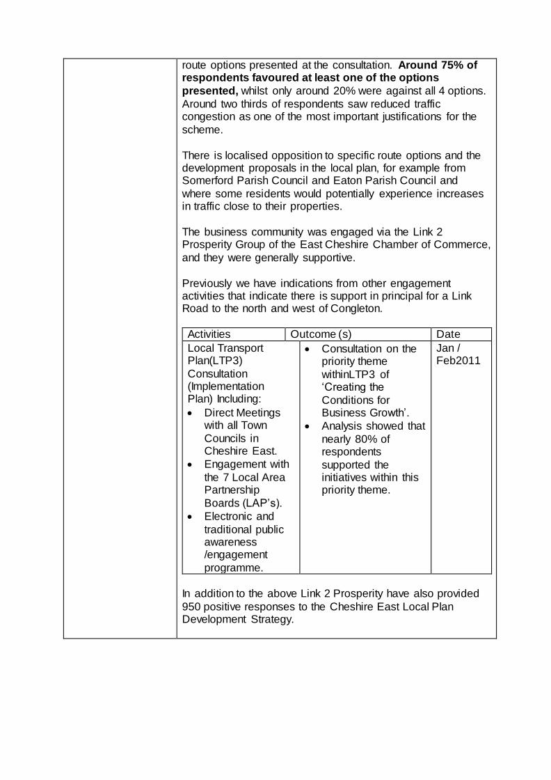
route options presented at the consultation. Around 75% of respondents favoured at least one of the options
presented, whilst only around 20% were against all 4 options.
Around two thirds of respondents saw reduced traffic congestion as one of the most important justifications for the
scheme.
There is localised opposition to specific route options and the development proposals in the local plan, for example from Somerford Parish Council and Eaton Parish Council and
where some residents would potentially experience increases in traffic close to their properties.
The business community was engaged via the Link 2 Prosperity Group of the East Cheshire Chamber of Commerce,
and they were generally supportive.
Previously we have indications from other engagement activities that indicate there is support in principal for a Link Road to the north and west of Congleton.
Activities Outcome (s) Date
Local Transport Plan(LTP3)
Consultation (Implementation Plan) Including:
Direct Meetings with all Town
Councils in Cheshire East.
Engagement with
the 7 Local Area Partnership
Boards (LAP’s).
Electronic and
traditional public awareness /engagement
programme.
Consultation on the priority theme
withinLTP3 of ‘Creating the
Conditions for Business Growth’.
Analysis showed that
nearly 80% of respondents
supported the initiatives within this priority theme.
Jan / Feb2011
In addition to the above Link 2 Prosperity have also provided
950 positive responses to the Cheshire East Local Plan Development Strategy.
Statutory Processes
Does the scheme have Planning Approval? If not what
needs to be done before a planning application can be submitted and what is the timeline for submitting a planning application?
No, the scheme does not have planning approval yet. The
current scheme programme envisages a planning application submission in late 2014. Once the preferred route has been announced in early Summer 2014, work will begin to produce
an Outline Business Case which will provide evidence for the planning application. Supporting work will include a detailed
Environmental Impact Assessment as well as an updated Economic Assessment Report.
Is there a likelihood of a public inquiry? If not please
explain why you expect this to be the case.
Yes, A Public Inquiry is likely and has been allowed for in the project plan / programme
Land
Do you need to acquire land to implement this scheme? If so, please explain where you are with this process and
when you expect to be able to acquire the land. Yes – allowance for CPO in programme
Contact has been made with all relevant land owners in order
to gain access to land for the required environmental surveys. Informal preliminary discussions have been undertaken with some land owners. In particular those locations which are
common to all the proposed options. Once a preferred route has been identified detailed Ground Investigation surveys will
be undertaken. At that stage formal engagement with the affected land owners will commence. At this stage it is not clear how much land will be the subject of compulsory
acquisition.
Construction
Procurement
How do you intend to procure the construction of the scheme and what is your timeline for this?
The preferred form of procurement has yet to be decided – Target cost / ECI assumed in programme
General Risk to Scheme Delivery
Please describe any other risks (and risk mitigation) associated with your Scheme.
The Risk Register for the scheme is included within the
Supporting Information appended to this submission. Progress regarding project risks is communicated to the Project Board in
line with the Governance arrangements (see below). A commentary on the key projects risk is provided below:
Planning – The scheme crosses mainly semi-rural
agricultural land in open countryside to the north of Congleton. Progress on the CLR development must be made in close liaison with landowner / developer interests
and CEC planning policy to avoid conflict of interests. The CLR will be progressed via the Local Plan and will
therefore be subject to examination at various stages by an independent planning inspector. The scheme itself will then be subject to statutory planning approval processes.To the
west, the route will pass close to residential properties on Chelford Road, from where objections can be expected.
The project programme anticipates that a Public Inquiry will be held.
Stakeholder Support – The CLR is sully supported by
elected members. CEC cabinet and elected members are continuously updated on progress and MPs briefed to avoid
surprises. The Town Council and Chamber of Commerce also support the Link Road.
Land Acquisition – The CLR will cross mainly agricultural
land. However, timing of the road needs to be carefully related to the development of the Strategic Planning Policy
and Site Allocations to avoid the purchase of land at ‘development’ prices.
Legislative – It is anticipated that Roads Orders and Compulsory Purchase Orders will be required to secure the scheme. No powers have been awarded, and draft Orders
have not yet been prepared.
Procurement –The preferred form of procurement
(traditional design/ D&B/ ECI) has yet to be decided.
Risks Management – CEC is working with its consultants to
manage risks, by: comprehensive environmental assessment working in liaison with national and local agencies; detailed traffic data collection and modelling built
on existing proven models; estimation of land purchase and compensation costs; development and appraisal of route
alternatives in accordance with best practice; and identification of funding streams and development of a robust business case.
How will any identified risks be managed between Scheme
deliver partners?
The Council operates Executive style governance with
responsibility devolved to Executive members. The governance arrangements and what decisions are taken by
Executive members are determined by a system of key decisions as per the Council’s Constitution.
The Executive Monitoring Board (EMB) will provide the necessary authority to allow the scheme to progress at a
number of key stages in the project lifecycle, with the relevant Executive members sitting on the cabinet approval. Members of the scheme’s Project Board hold senior executive functions
within Cheshire East Council (CEC). The Project Board is responsible for setting the strategic direction of the project in
line with the end-user requirements and authority provided by the EMB. The specific remit of the Project Board members is to assist the Senior Responsible Owner (SRO) in decision
making and on-going progress of the project. The SRO, Kevin Melling (Head of Highways and Transport)
will chair the Project Board and provide the LAEAC with regular updates and assurances post Project Board meetings.
The Core Management Team will be responsible to the Project Board and specifically the Project Director (Andrew Ross –
Strategic Highways and Infrastructure Manager) for the consideration and resolution of detailed project issues.
The Core Management Team will consist of members capable of making decisions of a technical and, where appropriate,
strategic nature. The Core Management Team will be led by Paul Griffiths CEC Principal Transportation Officer.
The Project Delivery Team will be responsible to the Core Management Team and specifically the Project Director for the
delivery of the scheme in all respects. The Project Delivery Team will be led by the Project Manager.
A summary of the key roles and responsibilities is provided in the table below:
Senior Responsible Owner: Kevin Melling –
Head of Highways and Transport
Kevin is responsible for ensuring that the project / programme
meetings its objectives, delivers the projected benefits, maintains
its business focus and is well managed with clear authority, context and control of risk.
Senior User and Project
Director: Andrew Ross –
Strategic Highways and
Infrastructure Manager
Andrew is responsible for the
specification of the needs of all those who will use the final
product, for user liaison with the
project team and for monitoring
to ensure the solution will meet those needs within the
constraints of the business case in terms of quality, functionality and ease of use.
Senior Supplier: Dave
Riley – Director of Operations (Jacobs)
Dave represents the interests of
the team designing, developing, procuring and implementing the
scheme. He is accountable for the quality of products delivered by the supply chain and has the
authority to commit or acquire the necessary supplier
resources. Project Sponsor: Paul
Griffiths – Principal
Transport Officer
Paul will provide the interface between the project ownership
and delivery on the client side. He is the single point of contact with the project team for the day
to day management of the scheme.
Evidence and Supporting Information
Evidence
Supporting Information
Please list here all technical reports documenting the evidence base for the Scheme and the Scheme’s performance
The following information is available to support this
submission:
Geographical Location Plan
Appraisal Summary Table
Local Model Validation Report (OD007 November 2013)
Scheme Programme
Letter of support and Link 2 Prosperity supporting
document
Economic Assessment Report (OD016 February 2014) -
Economic Methodology and supporting calculations including GVA Methodology and supporting calculations
Development Strategy supporting information
Please include any additional facts which may assist in
the assessment of this Scheme against strategic fit, value for money and deliverability. N / A
Completed scheme information sheets should be sent by email to Nasar Malik at: [email protected]