Embed Size (px)
Citation preview
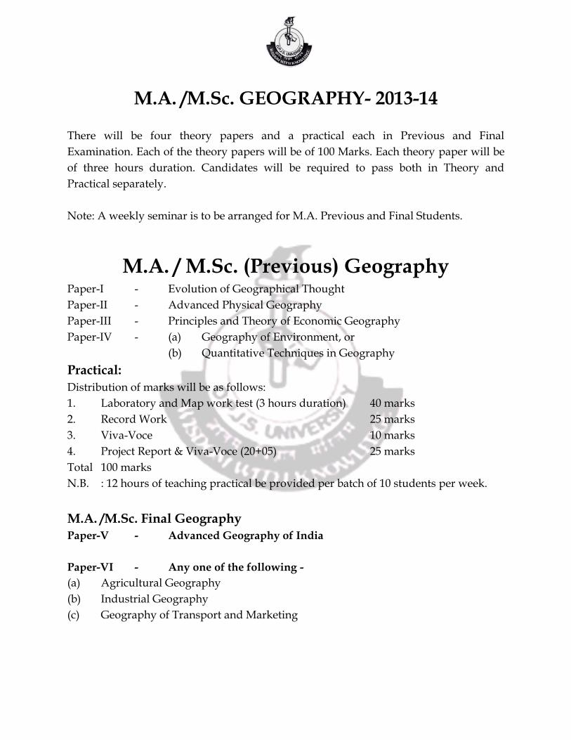
M.A. /M.Sc. GEOGRAPHY- 2013-14
There will be four theory papers and a practical each in Previous and Final
Examination. Each of the theory papers will be of 100 Marks. Each theory paper will be
of three hours duration. Candidates will be required to pass both in Theory and
Practical separately.
Note: A weekly seminar is to be arranged for M.A. Previous and Final Students.
M.A. / M.Sc. (Previous) Geography Paper-I - Evolution of Geographical Thought
Paper-II - Advanced Physical Geography
Paper-III - Principles and Theory of Economic Geography
Paper-IV - (a) Geography of Environment, or
(b) Quantitative Techniques in Geography
Practical:
Distribution of marks will be as follows:
1. Laboratory and Map work test (3 hours duration) 40 marks
2. Record Work 25 marks
3. Viva-Voce 10 marks
4. Project Report & Viva-Voce (20+05) 25 marks
Total 100 marks
N.B. : 12 hours of teaching practical be provided per batch of 10 students per week.
M.A. /M.Sc. Final Geography
Paper-V - Advanced Geography of India
Paper-VI - Any one of the following -
(a) Agricultural Geography
(b) Industrial Geography
(c) Geography of Transport and Marketing
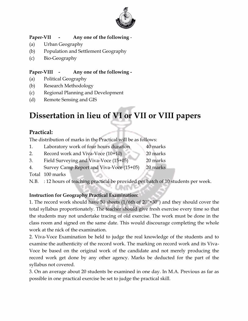
Paper-VII - Any one of the following -
(a) Urban Geography
(b) Population and Settlement Geography
(c) Bio-Geography
Paper-VIII - Any one of the following -
(a) Political Geography
(b) Research Methodology
(c) Regional Planning and Development
(d) Remote Sensing and GIS
Dissertation in lieu of VI or VII or VIII papers
Practical:
The distribution of marks in the Practical will be as follows:
1. Laboratory work of four hours duration 40 marks
2. Record work and Viva-Voce (10+10) 20 marks
3. Field Surveying and Viva-Voce (15+05) 20 marks
4. Survey Camp Report and Viva-Voce (15+05) 20 marks
Total 100 marks
N.B. : 12 hours of teaching practical be provided per batch of 10 students per week.
Instruction for Geography Practical Examination:
1. The record work should have 50 sheets (1/6th of 20''×30'') and they should cover the
total syllabus proportionately. The teacher should give fresh exercise every time so that
the students may not undertake tracing of old exercise. The work must be done in the
class room and signed on the same date. This would discourage completing the whole
work at the nick of the examination.
2. Viva-Voce Examination be held to judge the real knowledge of the students and to
examine the authenticity of the record work. The marking on record work and its Viva-
Voce be based on the original work of the candidate and not merely producing the
record work get done by any other agency. Marks be deducted for the part of the
syllabus not covered.
3. On an average about 20 students be examined in one day. In M.A. Previous as far as
possible in one practical exercise be set to judge the practical skill.
4. The External Examiners, be provided syllabus and detailed instructions at the time of
obtaining his consent. For M.A./M.Sc. Final a minimum of two days be fixed to conduct
the examination.
Note: A copy of the instructions is sent to the examiners for their information.
M.A. / M.Sc. (Prev.)-2014
Paper - I Evolution of Geographical Thought
UNIT - I
Definitions, scope, nature and purpose of Geography (including concepts) and its
relation with other social sciences. Post War trends, Inter-disciplinary Trends,
Recent trends in Geography. Development of Geography in India.
UNIT - II
Pre-Scientific Geographical ideas in Ancient and Medieval times : Indian influences.
Geography of the Vedic Age and Geography of the Purana’s (First four chapters of
Geography of Purana’s by S.M. Ali).
UNIT - III
Contribution by Greek, Roman and Arab Geographers (Al-Baruni and Ibn-I Batuta) The
Emergence of scientific Geography in the 18th and 19th centuries.
UNIT - IV
Founders of modern Geography-Humboldt, Ritter, Leaders of the first generation after
Ratzel, Richthofen, Hettner, Contribution of Vidal-de-la-Blache and Brunhes.
UNIT - V
Dichotomies in Geography : Physical and Human Geography, Determinism and
Possibilism, Regional and Systematic Geography, Qualitative and Quantitative
Geography. Theoretical and Applied Geography, Analytical and Synthetical
Geography, Positivism, Functionalism, Idealism and Realism in Geography.
Books Recommended:
1. Minshull, Roger : The Changing Nature of Geography.
2. Hartshorne, Richard : Perspectives on the Nature of Geography. The Association of
American Geographers, Hutchinson University Library, London.
3. Dikshit, R.D.: Geographical Thought A Contextual History of Ideas, Prentice Hall of
India Pvt.Ltd.
4. Wooldridge & East: The Spirit and Purpose of Geography, Hutchinson University
Library, London.
5. Dikshit, R.D.: The Arts Science of Geography, Integrated Readings. Prentice Hall of
India, New Delhi, 1994.
6. Saxena, D.P. : Regional Geography of Vedic India, Granthan Rambag, Kanpur.
7. Harvey & Holly : Themes in Geographic Thought, Rawat Publications, Jaipur.
8. Husain, Majid : Evolution of Geographical Thought, Rawat Publications, Jaipur.
9. Haggett, P. - Geography : A Modern Synthesis, Harper International Ed.
Paper - II Advanced Physical Geography
UNIT - I
Geomorphology: Fundamental concepts. Factors controlling landform development;
Endogenetic and Exogenetic forces; Denudation process:Weathering and Erosion.
Geosynclines, Mountain Building, Continental Drift and Plate Tectonics
UNIT - II
Concept of Geomorphic Cycle; Landforms associated with fluvial, glacial, arid, coastal
and Karst topography. Slope-forms and processes; Environmental and Applied
Geomorphology.
UNIT - III
Climatology : Composition and Structure of the Atmosphere; Insolation; Heat budget of
the earth; Distribution of temperature; Atmospheric pressure and general circulation of
winds; Monsoons and jet streams.
UNIT - IV
Stability and instability of the atmosphere; Air-masses; Fronts; Temperate and Tropical
cyclones; Types and distribution of precipitation; Classification of world climates:
Kopen’s and Thornthwaite’s schemes; Hydrological Cycle; Climate change and Global
warming.
UNIT - V
Oceanography : Origin of ocean basins; Ocean Bottom relief of Indian, Atlantic and
Pacific Oceans; Ocean deposits; Coral reefs; Temperature and Salinity of the Oceans;
Density of sea water; Tides and ocean currents; Sea - level changes; Ocean’s Mineral
wealth.
Books Recommended:
1. Ahmad, E.: Coastal Geomorphology of India, New Delhi.
2. Wooldridge & Morgan : An Introduction to Geomorphology, Longmans, Green and
Co., London.
3. Steers, J.A. : Unstable Earth, Methuen & Co., London.
4. Strahler, A.N. : Earth Sciences, Harper and Row Publishers, New York.
5. Strahler, A.N.: Modern Physical Geography, John Willey and Sons Inc. New York.
6. Dayal, P. : A Text Book of Geomorphology.
7. Kale, V.S. & Gupta, A. : Elements of Geomorphology.
8. Khan, M.Z.A.& Gangwale Sonal : Global Climate change, Rawat Publications,
Jaipur, 2011
9. Singh, S. : Geomorphology, Prayag Publication, Allahabad, 1998.
10. Thornbury, A.K. : Gemorphology, Prentice Hall, New York.
11. Lobeck, A.K. : Gemorphology, McGraw Hill Book Co., New York.
12. King & Embleton : Glacial and Pre Glacial Geomorphology, Amold.
13. Cotton, C.A. : Geomorphology, John Willey & Sons, New York.
14. Jeffreys, H. : The Earth-Its Origin, History and Physical Constitution.
15. Sharma, H.S. (Ed.) : Perceptives in Geomorphology, Concept Publishers, New Delhi
Paper - III Principles and Theory of Economic Geography
UNIT - I
Nature, Scope and Methods of Economic Geography, Concept of Economy, Simple
model of economy, Impact of modern economy on environment. Spatial structure of
economy.
UNIT - II
Types of Agriculture - Subsistence agriculture, Tropical plantation, Mediterranean
agriculture, Mixed farming, Stock raising and its products. Energy Resources of the
world - Coal, Petroleum, Hydroelectricity and Atomic power. Energy Crisis, Non-
conventional Sources of Energy.
UNIT - III
Locational analysis and spatial distribution of Iron and Steel, Cotton textile, Chemical,
Paper and pulp industries. Development of marketing systems in the world and WTO.
UNIT - IV
Location and interaction in a simplified economic landscape. Spatial variation in
transport cost. Spatial variation in production cost. Demand scale and agglomeration.
UNIT - V
Decision making process - a behavioural approach. Concept of economic region-
formation and types. Economic regions of India.
Books Recommended:
1. Lloyd & Dicken : Location in Space : Theoretical Approach to Economic Geography.
2. Mc-Cart & Lindeberg : A Preface to Economic Geography.
3. Smith, D.E. : Industrial Location - An Economic Geographical Analysis.
4. Hodder & Lee : Economic Geography.
5. Berry Conkling & Ray : The Geography of Economic Systems, Prentice Hall.
6. Smith, J.C. & Philip, M.O. : Industrial and Commercial Geography, Henry Halt.
7. Bengston, N.A. & Royen M.V. : Fundamentals of Economic Geography, Prentice
Hall, New York.
8. Alexander, J.W. : Economic Geography, Prentice Hall, New York.
9. Guha & Chatterjee : A New Approach to Economic Geography.
10. Renner, T.H. & Other : World Economic Geography.
11. Robinson, H. : Economic Geography, M.Sc. Donald, London.
Paper - IV (a) Geography of Environment
UNIT - I
Concept of environment and ecology, Nature and scope of the Geography of
environment. Concept of ecology and eco-system-definition and elements, energy flow
in eco-system.
UNIT - II
Productivity in eco-system. Eco-cycles. Types of eco-system. Man-environment
relationships, perception of environment and its quality. Degradation of
Environment, Development vis-a-vis ecological crisis. Global Environmental Issues:
Climatic Change - Ozone depletion, Green House Effect and Global Warming,
Desertification, Biodiversity.
UNIT - III
Environmental Pollution - Water, Air, Noise, Soil and Radio-activity, causes, impact and
measures of control with Indian examples. Population, Resources and Ecological crisis.
UNIT - IV
Environment and quality of life. Environmental Management-Approaches,
Management of forest, soil, wildlife, energy and mineral resources, Disasters & their
management. Environmental Impact Assessment. Conservation of natural resources.
UNIT - V
Sustainable development. Environmental policies and programmes (international and
national). Environmental problems, planning and legislation in India.
Books Recommended :
1. Batel, B. (Ed.) - Management of Environment, Wiby Eastern Ltd., New Delhi, 1980.
2. Desh Bandhu (Ed.) - Environmental Management, Indian Environment Society, New
Delhi.
3. Singh & Singh (Ed.) - Geography of Environment Concept, New Delhi.
4. Saxena, H.M. - Environmental Geography, Rawat Pub., Jaipur, 2005.
5. Savinder Singh - Geography of Environment, Allahabad.
6. Murdock, W. (Ed.)- Environment Resources, Pollution and Society, Sin over
Association Inc.
7. Gupta & Gurjar - Sustainable Development, Rawat Pub., Jaipur.
8. Khan, M.Z.A.& Gangwale Sonal : Global Climate change, Rawat Publications,
Jaipur, 2011
9. Strahler, A.N. - Geography and Man’s Environment, John, Willey.
10. Khan, M.Z.A. & S.K. Agarwal - Environmental Geography, APH Publishing House,
New Delhi, 2004.
11. Centre for Science - The State of Indian Environment : A Citizen’s Report 1982,
Environment 1985, New Delhi.
Paper – IV (b) Quantitative Techniques in Geography
UNIT - I
Statistical data, various types of average, measures of dispersion and their calculation.
Normal Frequency distribution curve and its uses. Binomial and Poison Distribution,
Frequency Distributions.
UNIT - II
Measures of spatial distribution point and line distribution. Nearest Neighbour Index
and spatial randomness. Characteristics of samples. Methods of Sampling.
UNIT - III
Statistical significance, Diagrams, Standard error of difference, Students test and
Senedor’s variance Ratio Test. Models as Quantitative techniques - Simulation Model,
The Gravity Model.
UNIT - IV
Measurement of Connectivity and accessibility. Product moment correlation
coefficient. Spearman’s rank correlation coefficient. Kendal’s correlation Coefficient.
UNIT - V
The correlation matrix. Regression line and confidence limits. The Chi-square Test and
its uses. Fluctuations and trends. Logarithmic graph.
Books Recommended:
1. Bunge, W. - Theoretical Geography and Studies in Geography, Ser. C. General and
Mathematical Geography No.1 Department of Geography, University of Lund,
C.W.K. Gleerup ; Lund, 1973
2. Cole, J.P. & King, C.A.M. - Quantitative Geography, Willey, 1968.
3. Dalton, R. & Other - Correlation Techniques in Geography, George Philip & Sons
Ltd., London, 1972.
4. Dalton, R. & Others - Sampling Techniques in Geography, George Philip & Sons Ltd.
London, 1975.
5. Duncan, O.D. - Statistical Geography - Problems in Analysing Areal Data, 1961.
6. Elhance, D.N. - Fundamentals of Statistics, Kitab Mahal, Allahabad, 1962.
7. Fesguon, R. - Linear Regression in Geography, CATMOG 15, Geo Abstracts,
University of East Angila, Norwhich, U.K., 1978.
8. Kellerman, A. - Centrographic Measures in Geography, CATMOG, 32, Ge Abstracts,
University of East Angile, 1981.
9. Gregory, S. - Statistical Methods and the Geographer, Longman, London, 1978.
10. King, L.J. - Statistical Analysis in Geography, Prentice Hall, 1960.
11. Monkhouse, F.J. & Wiklinson, H.R. - Maps and Diagrams, B.I. Publication, Bombay.
Practical Distribution of marks will be as follows -
1. Laboratory and Map work test (4 hrs. duration) 40 marks
2. Record Work 25 marks
3. Viva - voce 10 marks
4. Project Report and viva - voce (20+5) 25 marks
Note: 12 hrs. of teaching practical be provided per batch of 10 students per week.
Laboratory and Map work -
1. The Art and Science of Cartography, History of Maps, Materials, techniques and
Preparation of Maps.
2. Enlargement, Reduction and finding Area of Maps. Use of Planimeter.
3. Interpretation of Weather Maps and Weather Forecast.
4. Map Projection.
Projection and their classification -
Construction and characteristics of projections (Mathematical constructions)
1. Conical Projections:
(a) Equal Area with one Standard Parallel (Lambert’s Projection)
(b) Equal Area with two Standard Parallel (Albert’s Projection)
(c) Bonne’s
(d) Polyconic
(e) International
2. Cylindrical Projections :
(a) Cylindrical Equal Area
(b) Mercator’s
(c) Gall’s stereographic
3. Zenithal Projection’s
(a) Gnomonic 1. Polar Case 2. Eq-case
(b) Stereographic 1. Polar Case 2. Eq-case
(c) Orthographic 1. Polar Case 2. Eq-case
(d) Equal Area 1. Polar Case 2. Eq-case
(e) Equidistant 1. Polar Case 2. Eq-case
4. Conventional Projections :
(a) Sinusoidal
(b) Mollweide
(c) Interrupted Molleweide and Godde’s
(d) Interrupt Sanson Flamsteed (Homelosine)
Choice of Projections: Projections used for maps produced in India.
Geographical Maps/Diagrams:
Computation of data, preparation of frequency tables, representation of histograms and
Ogives. Finding Skewness, computation of Mean. Median and Mode. Deviations:
Standard Deviation and Mean Deviation. Correlation. Theoretical Basis of Nearest
Neighbour Analysis-Practical exercise on nearest Neighbour Analysis. Network
Analysis. Locational Analysis of urban centers. Coefficient of Variation. All these are
computed from the Statistical Data, preferably based on District or Tehsil unit areas and
the following types of maps and diagrams be prepared.
One exercise on each of the following and their interpretations-Isopleths,
choropleth, chorochromatic, Isochrones and Population Potential Surface maps.
Population Pyramid, Sten-de-Geers and Stilgen-Baurs-Method.
Three dimensional diagrams of economic and social data, Block Pile, Sphere, Pyramid,
Graphs, Polygraph, Semilog and log-graphs, Trilinear chart, Circular graph,
Climatograph, Hythergraph, Taylor’s/Foster’s Climograph, annual water deficiency
and water surplus graph.
Project Report: Attendance in camps compulsory. Report should be prepared for a topic
related to any regional problem. A group of eight students be constituted for each
problem and a report should be prepared in typed form within 20 to 25 pages with the
help of maps and diagrams.
Books Recommended:
1. Robinson, A.H. etal - Elements of Geography, John Willey and Sons, U.S.A. 1995.
2. Sarkar, A.K. - Practical Geography - A Systematic Approach, Oriental Longman,
Calcutta, 1997.
3. Khan, Z.A. - Text Book of Practical Geography, Concept, New Delhi, 1998.
4. Monkhouse, E.J. & Wilkinson, H.R. - Maps and Diagrams, Methuen, London, 1994.
5. Singh, R.L. - Elements of Practical Geography, Kalyani Pub., New Delhi.
6. Steer, J.A. - Map Projections; University of London Press, London.
7. Lawrence, G.R.P. - Cartographic Methods, London, 1971.
8. Dickinson, G.C. - Statistical Mapping of Statistics, London.
M.A. / M.Sc. (Final) - 2014
Paper V- Advanced Geography of India
Unit - I
Physiographic and drainage systems. Soils, Vegetation, Origin and Mechanism of
Indian Monsoon. Schemes of Natural Physiographic and climate classifications.
Identification of drought and flood prone areas.
Unit -II
Tribal areas and their problems, Population growth, distribution, density, Sex Ratio and
literacy, Population problems and policies. Urbanisation in India.
Unit -III
Resources conservation and utilization of land, mineral, water, biotic and marine
resources. Agricultural land use pattern, Green revolution and its impact on Indian
Agriculture. Agriculture infrastructure - Irrigation, Fertilizers and Seeds, Dry zone
Agriculture. Agro-Climatic Regions of India.
Unit -IV
Industry - factors of Localization, classification and detailed study of the following-Iron
and steel, Cement, Fertilizer, paper and Pulp and Sugar industries. Study of the
network of Road, railways, Airways and Water ways. Regional disparities in
development in India.
Unit -V
Geographical study of Rajasthan under the following heads: Relief, Climate,
Vegetation, Soils, Agricultural development, Irrigation, Mineral and Power resources,
Industrial development, Detailed study of the following regions -
1. Marusthali 2. Aravali 3. Eastern Plain 4. Hadoti Plateau
1. Krishna, M.S. : Geology of India and Burma,Law Journal Office, Madras.
2. Kumar, L.S.S. & : Agriculture in India, Vol. 1 & II, Asia Publishing Others
House,
Bombay
3. Indian Year Book, Latest Edition: Publication Division, Delhi. Irrigation Atlas of
India. Irrigation Atlas of India.
4. Chatterji, S.B . : Climatology of India, Calcutta University, Calcutta
5. Sharma, T.R. : Location of Industries of India, Hindi Kitab, Bombay
6. Gazetteers of India : Publication Division, New Delhi
7. S.P. Roy Choudhary : Land and Soil, National Book Trust, New Delhi
8. Sinha : A Treaties on Industrial Minerals.
Paper VI (a) - Agricultural Geography
Unit -I
Agriculture - Concept, origin, dispersal and Development of agriculture through the
ages in important agricultural areas of the world. Development of Agricultural
Geography with special reference to India. Factors affecting Agriculture: Physical -
relief, climate, soil, water, storage etc. Social - land ownership, land tenure and size of
holdings. Economic - Input of human and animal power, irrigation and fertilizers,
Mechanization etc Others - Financial management, Market system, Transport, Trade etc.
Unit -II
Water - Water resources, quality of water for irrigation, water quality criteria, various
methods of irrigation and their comparative advantages. Soil and water balance. Types
of Agriculture - Shifting cultivation, Plantation agriculture, Mediterranean type,
Collective and state farming, Extensive and Intensive agriculture, Dry farming etc.
and their characteristics.
Unit -III
Agricultural land use: Concept, history, principles, objectives, policies and planning of
land use surveys. Land classification: need and basis of land classification - British
pattern, American pattern, Indian pattern.
Land use data: Sources, types, mapping and problems.
Unit -IV
Models in agricultural land use: concept, need and principles. Von Thunen's
Agricultural Location theory. Preparation and planning of detailed performa for land
use surveys. Measurements of the levels of agricultural development : Concept and
methodology - Agricultural regionalization -Concept, methods of delimitation
(Including statistical methods). Agricultural Regions of the World (Whittlsey).
Unit -V
Crop ranking, Crop combination regions - meaning and methodology (Detailed study
of Kendal's, Weaver's, Doe’s and Prof. S.M. Rafi Ullah's method). Cropping intensity,
Crop diversification - methods and deductions. Agricultural efficiency -concept,
methods of measurement. Nutrition and balance sheet. Crop-land use and deficiency
diseases.
Books Recommended:
1. I.C.A.R. - Soil and Water Conservation Research (1956-71)
2. I.C.A.R. - Soil Conservation in India.
3. Sachchidananda- Social Dimensions of Agricultural Development, National
Publishing House, Delhi
4. Noor Mohammed- New Dimensions in Agriculture, Concept, New Delhi, 1991
5. Stamp, L.D. - Land of Britain - Its use and Misuse.
6. Kostowicki - World Types of Agriculture, Polish Academy, Warsow
7. Shafi,M. - Land Use in Eastern U.P., Aligarh University Press.
8. Misra,V.C., Ayyar, N.P. Kumar -Applied Geography, Ali Memorial Number,
University Press, Agra
Paper VI (b) - Industrial Geography
Unit - I
Location factors in manufacturing, concept of optimum location. The Least Cost School
and the Transport Cost School. The Market Areas School. The Marginal Location
School. The Behavioral School.
Unit - II
The Reduction of weight of Materials. The Copper Industry. The Aluminum industry.
The Pulp and paper industry. The Cement Industry. New Trends in Industrial
Geography. Testing Location Theory, Empirical Studies. Significance of Enterprise and
Firm.
Unit - III
Important Industrial regions of the World : select one each of U.S.A. and Federation of
Independent states - Japan, Britain and West Europe. Important Industrial Regions of
India. The Changing character of geographical concentration and impact of
technological change, changing character of Industrial regions. Formation of Industrial
Regions.
Unit - IV
Study of the following regions.
1. The Hooghlyside Industrial Regions. 2. The Damodar Valley Industrial Region
3. The Ruhr Basin Industrial Region 4. The Great Lakes Industrial Region.
Unit-V
Influence of power and Geographical Inertia in Manufacturing Industries.
The Textile Industry. Multi-locational Industries-Iron and Steel, Aluminium, Oil
Refining. Market Oriented Industries-Furniture, Textile Machinery. Footloose
Industries-Automobile, Commercial Ship Building, Raw Material oriented Industries.
The Locational importance of reduction in materials.
Books Recommended :
1. Llyod and Dicken : Location in Space : A Theoretical Approach to Economic
Geography.
2. M.C. Cart & Limberg Hodder & Lec : Economic Geography
3. Smith, D.E. Cox & K.P. Man : Industrial Location, A Economic Geographic Analysis,
Location and Behaviour - An Introduction to Human Geography.
4. Riley, R.C. - Industrial Geography, Chalto & Windus, London, 1973
5. Alexander, J.W.- Economic Geography, Prentice Hall, New Delhi.
6. Boesh - A Geography of World Economy.
7. Estall, R.C. & Buchanan, R.O. - Industrial Activity & Economic Geography,
Hutchinson Co.,London.
Paper VI(c) - Geography of Transport and Marketing
Unit - I
Nature and Scope of Transport Geography, Transport as controller of economic
activity, Models of transport development. Net work Analysis, measurement of
accessibility and Connectivity.
Unit -II
Nature and Scope of Marketing Geography, Growth of Market centres in various parts
of the world including India.
Unit - III
Types of markets, Regulated markets, Periodic Markets - Nature, Distribution,
Commodity structure and social importance.
Unit - IV
Market Morphology, Market Sphere of influence, Agricultural Marketing,
Unit - V
Behavioral Pattern of market place participants, Cartographic representation of
Transport and marketing data.
Books Recommended :
1. Berry, B.J.L. : Geography of Market Centres & Retail Distribution, Prentice Hall,
1967.
2. Chorley, R.J. & Haggett, P.(ed.): Network Analysis in Geography, Arnold, 1969
3. Garnier, B.J. & Delobez, A. : Geography of Marketing, Longman, London, 1995.
4. Hurst, E. : Transport Geography - Comments & Reading, McGraw Hill, 1974
5. Scott, P.: Geography and Retailing, Hutchinson, London
6. Saxena, H.M. : Marketing Geography, Rawat Pub., Jaipur, 2005
7. Robinson, H. & Burnford, C.G. : Geography of Transport, London, 1978
8. White, H.P. & Senior, M.L. : Transport Geography, Longman, London, 1983
Paper VII (a) - Urban Geography
Unit -I
Aims and scope of Urban Geography. Factors affecting the growth of towns during
Neolithic period, Greek and Roman period, Dark Ages, Medieval period, Renaissance
period, Industrial Revolution and Modern times. Chief characteristics of the towns of
each period.
Unit-II
Trends of urbanization in the world. Urbanization in India since 1901 and its problems.
Definitions of Urban centres. Chief characteristics of modern town, City Conurbation,
Metropolis and Megalopolis.
Unit-III
Spatial pattern and distribution of urban centres. Classification of cities. Urban Rank -
Size relationship. The Basic and Non-Basic concept of urban economic functions and its
application.
Unit- IV
Urban Morphology, Unplanned and planned growth of town : Urban plans,
Morphology of Indian cities, Market Morphology. Functional structure of towns-C.B.D.,
Residential areas, manufacturing areas and other functional areas. Models of urban
structure. Central Place Theory.
Unit- V
Centrifugal and centripetal forces in Urban Geography, Development of suburbs, Rural-
urban fringe, Satellite town, ring towns, Sphere of urban influence (Umland) and its
delimitation. Principles of Town Planning -Preparation of a Master Plan with example
of a Rajasthan town. Principles of regional Planning.
Books Recommended:
1. Taylor, G : Urban Geography, Methuen & Co., London
2. Geddes : Study in City - Development
3. Singh, R.L. : Banaras : A Study in Urban Geography, Students Friends,
Allahabad
4. A.E. Smailes : The Geography of Towns, Huchinson University Library,
London
5. Dickinson, R.E. : City Region and Regionalism, Routeledge and Kegon Paul,
London
6. Harold M. Mayer : Readings in Urban Geography, Central Book Depot.,
Allahabad
7. V.L.S. Prakash Rao : Towns of Mysore State, Statistical Publishing House,
Calcutta
8. Shah Manzoor Alam : Hyderabad and Secundrabad Twin City : Studies in urban
Geography, Allied Publishers, Delhi
Paper VII (b) - Geography of Population and Settlement
Unit - I
Definition and scope of Population Geography. Theory and Biological Population
Geography -
Malthusian, Neo- malthusian and Optimum Population. Theory and Biological
Population Census with special reference to the Indian Census. Growth, Density and
Distribution of Population in the world with special reference to India.
Unit - II
Age and Sex Composition, Economic and religious Composition of Population with
special reference to India, Rural and Urban Population and Urbanization, Internal and
International Migration, Behavioral Migration Studies. The Population Policy of Govt.
of India.
Unit - III
Definition, Scope and Development of Settlement Geography. Theories of Settlement
Geography. Causes of Origin of Settlement Types.
Unit - IV
Site and situation of Rural and Urban settlements, Settlement pattern, Size and spacing
of Rural and Urban settlements, Morphological characteristics of Rural and Urban
settlements with special reference to India Sector.
Unit - V
Concentric zone and multiple Nuclie Models of Urban growth. Problems of Urban
housing and emergence of status.
Books Recommended :
1. Clarks : Population Geography
2. Jones : A Population Geography
3. Trewartha : A Geography of Population
4. Woods : Population Analysis in Geography
5. Woods : Theoritical Population in Geography
6. Beaujen Garnier : Geography of Population
7. Zelinsky : A Prologue to Population Geography
8. Wilson : Population Geography
9. Chandra : Population Geography
10. Hudson, E.S. : Geography of Settlement

Paper VII(c) - Bio- Geography
Unit - I
Meaning and scope of Bio- Geography, History of Zoo- Geography and Plant
Geography, Ecology, Habitat, Habitat and Climatic factors, Plant response to
environment.
Unit - II
Barriers to distribution and means of dispersal of plants. Types of Plant and plant
Communities in general. Factors controlling forest distribution. Characteristics and
distribution of Equatorial and temperate forests and grasslands.
Unit - III
Climate change and their effect on the plant cover, condition of existence for animals.
Barriers to distribution and means of dispersal of animals. Types of Isolation, effect of
geographic Isolation. Distribution of animals.
Unit - IV
Zoo Geographical regions. Aquatic environment and life, marine and fresh water
Fauna. Vegetation and floral regions of India, economic importance.
Unit - V
Conservation of wild life and forests, Soil erosion and conservation. Pollution and its
effect on wild life and vegetation. National Parks and Sanctuaries of India. Biodiversity
and its conservation.
Books Recommended :
1. Newbegin : Plant and Animal Geography
2. Cline : Foundation of Plant Geography
3. G. Ponald : The Geography of Flowering Plants.
4. Darlington : Zoo- Geography
5. Schimper : Plant Geography
6. S. L. Hora : Fundamental Conception of Zoo- Geography, N.G.S.I. Banaras
7. S. L. Hora : Terrestrial Fishes and the Significance of their Distribution in
Geographical Studies, N.G.S.I. Banaras
8. H.S. Mathur : Bio- Geography
Paper VIII (a) - Political Geography
Unit - I
Definition, Scope and Development of Political Geography :
1. Definition and scope of political geography : its relation with other social
sciences.
2. Geopolitics and German School of Thought
3. Development of Political Geography. Concepts of Mackinder, Spykman,,
Meining,Hoosan, De Seversky, World's Geostrategic regions.
5. Geopolitics and confilict zones of the world.
Unit - II
Methodology:
1. The functional approach and Unified Field Theory in Political Geography.
2. The Elements of the state: Territory, Population, Organisation and power.
3. The Heart of the State: Core Areas.
4. The focus: Capital City.
Unit - III
Frontiers, Boundaries: Concepts and Classification:
1. Frontiers, Boundaries and Buffer Zones.
2. Classification of Boundaries, changing concept.
3. The concept of Territorial Sea and Maritime Boundaries.
4. Landlocked States: Problems of access.
Unit - IV
Growth of Nations and Disintegration of Empires:
1. Unitary and Federal States.
2. The Dying Colonialism and Resurgent Nationalism.
3. Supernationalism: from State to Blocks
Strategy of International Politics :
1. Study of Federation of Independent states and U.S.A. as Power.
2. Emergence of Third World Block.
3. Politico-geographical study of India.
Unit - V
Extending Dimensions of Political Geography:
1. The Politics and transportation
2. The geography of foreign aid and economic development.
3. The politico-geographical implications of space research.
4. Electoral Geography - Importance, Concepts, Electoral studies of elections and
Gerrymandering.
Books recommended:
1. Alexander, L.M. : World Political Patterns. John Murray and Co., London.
2. Boggs, S.W. : International Boundaries, Columbia.
3. Bowman, I. : The New World Problems in Political Geography, World Co.
Younkers, On Hudson.
4. East, W.G. & Moodies, A.E.: The Changing World, George G. Harrap & Co., London.
5. East, W.G. & Spate, O.H.K. :The Changing Map of Asia, Methuen & Co., London
6. Frigreiv. J. : Geography & World Power, University of London Press,
London
7.
8. Fawcer, C.B. : Frontiers - Study in Political Geography, Oxford University
Press, Oxford.
9. Fizgiddeon, R.H. : Global Politics, University of California Press,
Parkaley.
10. Horradin, J.F. : An outline of Political Geography, Affred A. Knob, New
York
Paper VIII (b) - Research Methodology
Unit-I
Problems of Geographical Research, Identification of Problems of regional and
systematic Geography. Nature and source of data to be used, Hypothesis, Models.
Unit- II
Preparation of Research project and report writing, Carotgraphic representation of
agricultural, transport, marketing and industrial data.
Selected techniques of spatial analysis, Methods of measurement of concentration and
dispersion of economic activities.
Unit - III
Nearest neighbour analysis with examples, Regional interaction analysis, Gravity
potential, Methods of delimiting regions - Resource Regions, Economic, Industrial,
Agricultural and Planning regions.
Unit- IV
Regional population analysis - Population projection, Population Migration Projection,
Network analysis with examples. Delimiting urban and market spheres of influence.
Unit-V
Techniques of Map analysis. Basics of Remote Sensing and G.I.S.. Morphometric
analysis - drainage, scope analysis, Integrated area development planning.
Paper VIII(c) - Regional Planning and Development
Unit - I
Regional concept in Geography, Conceptual and theoretical framework, merits and
limitations for application to regional planning and development; changing concept of
the region from an inter-disciplinary view-point.
Unit- II
Concept of space, area and locational attributes. Approaches to delineation of different
types of regions and their utility in planning. Planning process - sectoral, temporal and
spatial dimensions;
Unit-III
Indicators of development and disparities - case study of India. Regional development
strategies - concentration v/s dispersal, case studies for plans of developed and
developing countries.
Unit- IV
Short- term and long term planning in a national context. Regional plans of India
Regional development in India - problems and prospects..
Unit- V
Concept of Multi-level planning : Decentralised planning; Peoples participation in the
planning process; Panchayati Raj system. Role and relationship of Panchayati Raj
institutions (Village Panchaayat, Panchayat Samiti and Zila Parishad) and
administrative structure (Village, Block and District).
Books Recommended :
1. Abler, R. et.al : Spatial Organisation : The Geograper's View of the World,
Prentice Hall, Englewood Cliffs, N.J., 1971
2. Bhat, L.S. : Regional Planning in India, Statistical Publishing Society,Calcutta,
1973
3. Bhat, L.S. : Micro-Level Planning : A Case Study of Karnal Area, Haryana, K.B.
Publications, New Delhi, 1976
4. Chorley, R.J. & Hagget, P.: Models in Geography, Methuen, London, 1967
5. Christaller, W. : Central Places in Southern Germany, Translated by C.W. Baskin,
Prentice Hall, Englewood Cliffs, New jersey, 1966
6. Friedmann, J. & Alonso, W.: Regional Development Policy - A Case Study of
Venezuela,
Paper VIII (d) - Remote Sensing and GIS
Unit- I
Historical development of Remote sensing as a technology - Relevance of remote
sensing in Geography- Concepts and basics. Energy source, energy and radiation
principles, energy interactions in the atmosphere and earth surface features. Remote
sensing systems : platforms and sensors.
Unit- II
Air Photos and Photogrammetry : Elements of Photographic system : type, scales and
ground coverage, resolution, radiometric characteristics, films, filters, aerial
cameras, geometric fundamentals of photogrammetry, elements of vertical
photographs, relief displacement, image parallax, strereoscopic, orthophotos. Airphoto
interpretation : shape, size, pattern, tone, texture, shadows, site, advantage and
limitation and remote sensing and its comparison with map, aerial photographs and
satellite imagery.
Unit- III
Satellite Remote Sensing : History and development of various types of satellite and
space programme with special reference to Indian Space Research programme. Types of
imagery, techniques of visual interpretation, ground verification, transfer of interpreted
thematic information of base maps.
Unit- IV
Digital image processing : rectification and resolution, Image enhancement, Contrast
manipulation, Classification - supervised and unsupervised, Post classification analysis.
Unit- V
Application: Air photo and image interpretations and mapping, forest and wild life,
mines and Geology. Land use and land cover, Soil, land evaluation, weather studies,
water resources; Urban studies and hazard management and environmental
management. GIS - Introduction, definition and scope, its application in various fields
and planning. GPS.
Book Recommendation
1. Pratt, W.K. : Digital Image Progessing, Willey, New York, 1978
2. Rao, D.P. (eds.) : Remote Sensing for Earth Resources, Association of
Exploration, Geophysicist, Hyderabad, 1998
3. Thomas,M. Lillesand & Ralph W. Kefer : Remote Sensing and Image Interpretation,
John Willey & Sons, New York, 1994
4. Wolf Paul, K. : Element of Photogrammetry, McGraw Hill Book. Co.
5. Chouhan, T.S. & K.N. Joshi : Applied R.S. and Photo Interpretation,Vigyan
Prakashan, Jodhpur.
6. Gautam, N.C. : SPGU - Technology of Geography, N.R.S.A. Hyderabad
7. Singh, S. : Remote Sensing Technology, Scientific Publication, Jodhpur
8. Rao, D.P. (eds.) : Remote Sensing for Earth Resources, Association of
Exploration Geophysists, Hyderabad. 1998
Dissertation on Geographical Problem (In lieu of paper VI or
VII or VIII)
N.B. : The candidates offering this paper will be required to submit dissertation as per
University conditions. It will be examined by a board of two examiners. Three copies of
dissertation must be submitted to the University. Out of which one copy will be
returned to the Department/ College and one of the Supervisor. The dissertation should
exclusively be based on field work and statistical analysis as far as possible and be
prepared under the guidance of a postgraduate teacher of five years standing. The
volume of the dissertation should not exceed 100 pages.
Practicals
Surveying and laboratory Work (Total 10 hrs per batch of 10 candidates spread over
two days).
1. Laboratory work (4 hrs duration)40 Marks
2. Record work & viva-voce (15+5) 2 hrs20 Marks
3. Field surveying & viva voce (15+5) 4 hrs20 Marks
4. Survey camp & viva - voce (15+5)20 Marks
Total 100 Marks
N.B. 12 hrs of teaching practical be provided per batch of 10 students per week. The Art
of surveying, History of surveying, scope, utility and problems. Classification of
Surveying.
Methods and techniques of representation of relief :
(a) Methods and techniques of depicting relief.
(b) Profile, gradients and calculation of slopes.
(c) Contours and intervisibility.
(d) Block diagrams, field sketching, serial profile, hypsographic curves, altimetric
frequency graphs.
Interpretation of Topographical Maps: A brief history of topographical Maps of the
world with special reference to India and the interpretation. Detailed study of
toposheets. Air photo Interpretation and exercise on the determination of height of
plan, parallax, number of runs and number of photographs, knowledge of stereoscopic
vision, mosaic, types of cameras, emulsions and stereoscopes, Interpretation and
identification of cultural and physical fefatures on serial photography. Importance of
Remote Sensing and GIS in Geographical Studies.
Field Surveying and Camp Work:
Theodolite: its part and their functions, use of theodolite, theodolite traverse and
traverse computation, independent coordinates.
Use and application of plane table and clinometers in small area survey, traverse,
Resectioning: Two and Three -point problems, practical contouring by Clinometers.
Levelling: Terms, types and principles of levelling, Classification of levelling, Profiles
and other levelling. Use of Dumpy level, practical countouring, Cross sectioning, use
and application of Abney level.
Survey Camp - A topographical survey of settlement will be done by organising a camp
atleast for a week duration and maps, reports of the camp will be prepared, students
will stay at camp. The report shall be prepared separately and independently.
Books Recommended :
1. Kanetkar, T.P. & Kukarni, S.V.- Surveying and levelling, Vol., A.V. Gria Prakash, Puna
2. Deshpande, T.S.- A Text Book of Surveying and Levelling, United Book Corporation, Puna
3. James Glending - Principle and Use of Surveying, Blackie and Sons Ltd., Glasgo 4. B.C. Punamia - Surveying and Field Work, Vol.1, Standard Books Depot, Delhi 5. Breed, C.B. & Honmer, G.L. - The Principal of Surveying, Vol I and II 6. Davis, R.E. & Foot, F.S.- New York Surveying, Theory and Practice, John Willey
& Sons Inc. 7. T.R. Tracy- Surveying, Theory and Practice, McGraw Hill Book Co., New York 8. Thrifall, H.S.A.- Text Book of Surveying and Levelling, Chart Grafin, London 9. Williamson- Surveying and Field Work, Constable 10. Roorkee - Engineering College - Manual of Surveying 11. N.C. Gautam - Urban Land use Studies through Airphoto Interpretation
Techniques, Pink Publishing House, Mathura