Embed Size (px)
Citation preview

Lower Yonge Precinct PlanApril 2016

ii
Prepared By
Waterfront Toronto: Rebecca Carbin, Tara Connor, Meg Davis, Trevor Gardner, Chris Glaisek, Renee Gomes, Meghan Hogan, Dave Madeira, Anna Palamarchuk, Lisa Prime, Amanda Santo, Mira Shenker, Tristan Simpson, Rei Tasaka
City of Toronto: Barb Carou, Jeff Dea, Noreen Dunphy, Sean Harvey, Lauralynn Johnston, Caroline Kim, Kyle Knoeck, Eddy Lam, Kevin Lee, Gregg Lintern, Willie Macrae, Allison Meistrich, Andrea Old, John O’Reilly, Sherry Pedersen, Jane Perdue, Jennifer Tharp, Anson Yeun
In Collaboration With:Archaeological Services Inc.ArupCicada Design Inc.Golder AssociatesMMM Group LimitedPerkins + WillSwerhun Facilitation
Waterfront Toronto, City of Toronto and the Consulting Team acknowledge the contribution of the following to the project:
StakeholdersThe Residences of the World Trade Centre (10 Queens Quay & 10 Yonge Street) - Angela Griffith and Richard WhitelawBuild Toronto/Tridel (10 York Street/ 120 Harbour Street) - Don Logie, John MacIntyre, Steve Daniels, Gabriella Sicheri
Oxford Properties (10/20 Bay Street & 85 Harbour Street) - Dion DiFebo, Beverly Tay, Mark CotePinnacle Condos (12/16 Yonge Street, 33 Bay Street, 16/18 Harbour Street) - Grace Wang, Cameron Duff, Andy Seto, Karina Perdomo 18 Yonge Street - Noeleen Barron, Wayne Howell (Del Property Management Inc.)Ports Toronto/Oxford Properties (60 Harbour Street/30 Bay Street) - Bill Jackman, Mark CoteMenkes (90 Harbour Street) - Alan Menkes, Jude Tersigni, Jennifer McKinlayPier 27 (Cityzen) - Kristine JanzenCycle Toronto (formerly Toronto Cyclist Union) - Clay McFayden, Alison Stewart, Antony Hilliard Daniels Waterfront Condos - Neil Pattison, David AirdFinancial District BIA - Grant Humes, Evan M. WeinbergGlen Murray’s Office - Matt EdwardsGooderham Worts Neighbourhood Association - Julie BeddoesOffice of Councillor Joe Cressy (Ward 20); formerly Councillor Ramkhalawansingh - Brent GilliardOffice of Councillor Pam McConnell (Ward 28) - Tom DavidsonOntario Motor Coach Association - Dave CarrollRedpath Sugar - Andrew Judge, George CarterSt. Lawrence Market BIA - Al SmithSt. Lawrence Neighbourhood Association - Lorrie Naylor, David S. CrawfordThe Riviera (228/230 Queens Quay) - Vesna Saltagic
Toronto Centre for Active Transportation - Thomas SmahelToronto Entertainment District BIA - Janice Solomon, Dana DuncansonToronto Island Community Association - Pam Mazza, Anna Prodanou, Baye HunterTransit Advocate - Steve MunroWater Club Condos (208/218 Queens Quay, 8 York Street) - Daniel Bonea The Waterfront BIA - Kevin Currie, Carol JollyWest Don Lands Committee - Larry WebbWestin Harbour Castle - Tim ReardonYMCA - Leigh CoffeyYork Quay Neighbourhood Association - Ulla Colgrass, Braz Menezes
LandownersPinnacle InternationalLCBO/Infrastructure OntarioChoice Properties REITToronto Port Lands Company
Note: All graphics contained herein are for illustrative purposes only.

iii
TABL
E OF
CONT
ENTS
1.0 Introduction 1
2.0 Area Context 72.1 The Area Today 82.2 Evolution of the Area 92.3 Land Ownership 132.4 Existing and Planned Context 13 2.4.1 Land Use and Development 152.5 Heritage and Archaeology 11
3.0 Precinct Plan Vision and Principles 173.1 Vision 193.2 Objectives 193.3 Five Guiding Principles 20
4.0 Public Realm 234.1 Streets and Blocks 274.2 Street Types 28 4.2.1 The “Main Streets” 30 4.2.2 Promenade Streets 35 4.2.3 Neighbourhood Streets 384.3 Streetscape Design 394.4 Transit 414.5 Cycling Network 444.6 Parks and Open Space 47 4.6.1 Open Space Network 49 4.6.2 Lower Yonge Park 51 4.6.3 Mid-Block Connections 52 4.6.4 Privately Owned Publicly-Accessible Spaces (POPS) 53 4.6.5 The PATH 56
5.0 Development 595.1 Land Use 60 5.1.1 Mixes of Uses 60 5.1.2 Housing 645.2 Built Form 66 5.2.1 Base Buildings 68 5.2.2 Tall Buildings 78 5.2.3 Base Buildings - Heritage 785.3 Parking and Loading 84
6.0 Community Services and Facilities 876.1 School 906.2 Childcare 916.3 Community Recreation Centres 916.4 Library Facilities 916.5 Emergency Services 926.6 Human Services 92
7.0 Sustainability 937.1 Buildings 957.2 Energy 997.3 Resiliency and Adaptation to Climate Change 1027.4 Mobility 1047.5 Biodiversity 1057.6 Wise Use of Resources 106 7.6.1 Water 106 7.6.2 Waste 107 7.6.3 Materials 108 7.6.4 Human Health and Well-being 109
8.0 Innovation and Economy 111
9.0 Public Art 113 9.1 Public Art Context 115 9.2 Method and Approach 118 9.3 Site Selection 118 9.4 The Public Art Plan 120
10.0 Phasing and Implementation 123 10.1 Implementation Tools 124
10.2 Phasing/Funding 127

iv

1
Introduction1.0

2Figure 1.1 Aerial Photo of the Lower Yonge Study Area (2006)
Lower Yonge Precinct Plan

3
1.0 IntroductionThe Lower Yonge Precinct Plan (the “Precinct Plan”) provides a vision and framework for comprehensive development of this central waterfront area. This Precinct is expected to accommodate significant height and density which makes it imperative to provide a framework to ensure that new development is appropriately planned and sensitive to the Precinct’s prominent location on the waterfront. The public realm must be generous and well designed, and there needs
Introduction
to be an appropriate mix of uses, services and amenities for future residents and workers.
The Precinct Plan is the blueprint for a functional, complete community that supports a high density by providing a sustainable mix of uses, and a fine-grained network of varied and distinct public spaces. These spaces are aimed at drawing people into and around the Precinct and connecting it with surrounding
neighbourhoods and to Lake Ontario. With a mix of residential, institutional, civic, office and retail uses, the Precinct will provide homes, workplaces, and local services and facilities for thousands of Torontonians, balancing residential and commercial development to create an active mixed-use community. Lower Yonge will meet the high standard for comprehensive planning and development set by previous waterfront precinct planning initiatives.
Rendering
Figure 1.2 Artistic Rendering of the Toronto Skyline

4
The Central Waterfront Secondary Plan (“CWSP”) identifies “Precinct Implementation Strategies” (Precinct Plans) as a tool for comprehensive planning and as a prerequisite for the transformation of Regeneration Areas in the waterfront. Through incorporating the elements and strategies of precinct planning, as outlined in the CWSP, this Precinct Plan establishes objectives for the Lower Yonge area’s built form and public realm, the overall urban design vision, and how the precinct will relate to adjacent neighbourhoods and districts.
The CWSP identifies the foot of Yonge Street as an ‘Inner Harbour Special Place’ which is to be designed with developments that will contribute to the special nature of this area. With this as a guiding principle, the precinct has been comprehensively planned to turn these lands into a gateway to Toronto’s Waterfront and into a vibrant, connected, landmark community.
The Precinct Plan was developed in two phases. Phase One addressed the larger structural elements of the precinct plan. It focused on a new streets and blocks plan, local and regional transportation network changes, land use and compatibility, built form and massing, and public realm considerations. The first phase culminated in the receipt and endorsement, in part, by City Council in August 2014, of three reports:
1. The Lower Yonge Transportation Master Plan (“TMP”) Environmental Assessment (“EA”) Report, prepared by Arup, dated August 2014;
2. The Lower Yonge Urban Design Report: Principles and Recommendations, prepared by Perkins and Will, dated August 2014;
3. The Lower Yonge Precinct Plan – Proposals Report (“Proposals Report”), dated August 5, 2014.
The City Staff report contained a set of draft Planning and Policy Directions for this Precinct Plan.
The recommendations contained within the TMP were further endorsed by City Council in March 2015 and accepted by the Ministry of Environment and Climate Change shortly thereafter. These three reports established the foundations on which the precinct planning process was based and set the stage for the second phase.
Phase Two focused on refinements to the earlier Phase One work, particularly with respect to built form and massing, public realm, compatibility with existing uses and transportation infrastructure.
Additional work has been conducted on community services and facilities, affordable housing, active transportation measures and implementation mechanisms.
A Municipal Class Environmental Assessment (MCEA) has been initiated to move forward phases 3 and 4 the TMP EA, building on the recommendations made in phase 1 and 2 of the TMP EA. As part of the MCEA, an Environmental Study Report is required to fulfill the applicable Environmental Assessment (EA) requirements under Schedule C of the Municipal Class EA process.
Figure 1.3 Artistic Rendering of the Lower Yonge Precinct
Lower Yonge Precinct Plan

5
Introduction
Also required are the complete functional designs for:
1. Preferred alternative design concepts that will be identified from the completion of Phase 3 of the MCEA for the Precinct; and
2. Transportation infrastructure changes identified in the already completed TMP.
Overall, the MCEA will focus on refinements to the TMP EA, as well as introduce a public realm concept, local servicing options, costing and phasing recommendations for the ultimate design.
It is anticipated that the MCEA will completed by the end of 2016.
The Precinct Plan is built upon the Phase One and Two work, which included extensive consultation with community members, landowners and other stakeholders.
Figure 1.4 Flow Chart of Phases

6
Lower Yonge Precinct Plan
Implementation
The Plan is intended to be read in conjunction with, and be implemented through, the CWSP, the Lower Yonge Official Plan Amendment (“OPA”), and the City Planning staff report dated April 22, 2016.
The Precinct Plan provides background to the OPA, as well as detailed planning directions and recommendations on the area’s public realm, infrastructure, development and implementation and phasing plans. As such, the Precinct Plan, the staff report, and the OPA provide the foundation and context against which all future development applications in the Lower Yonge Precinct will be evaluated.
The Precinct Plan should be interpreted as a guiding document. It provides a framework within which to achieve the vision set out for Lower Yonge. Specific performance standards such as building setbacks and parking standards will be set out in site-specific zoning by-laws for the development of each property. Environmental Assessments (EAs) for the development of public infrastructure will further prescribe final street and block configurations and public realm concepts.
The Precinct Plan is organized into ten main sections:
1.02.03.04.05.06.07.08.09.0
10.0
Introduction
Area Context
Precinct Plan Vision and Principles
Public Realm
Development
Community Services and Facilities
Sustainability
Innovation and Economy
Public Art
Phasing and Implementation

Area Context7
Area Context2.1 The Area Today 2.2 Evolution of the Area 2.3 Land Ownership 2.4 Existing and Planned Context 2.5 Heritage and Archaeology
2.0
Lower Yonge Precinct Plan8
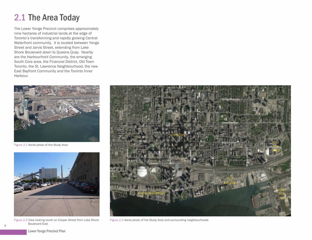
2.1 The Area TodayThe Lower Yonge Precinct comprises approximately nine hectares of industrial lands at the edge of Toronto’s transforming and rapidly growing Central Waterfront community. It is located between Yonge Street and Jarvis Street, extending from Lake Shore Boulevard down to Queens Quay. Nearby are the Harbourfront Community, the emerging South Core area, the Financial District, Old Town Toronto, the St. Lawrence Neighbourhood, the new East Bayfront Community and the Toronto Inner Harbour.
Figure 2.3 Aerial photo of the Study Area and surrounding neighbourhoods
Figure 2.1 Aerial photo of the Study Area
Figure 2.2 View looking south on Cooper Street from Lake Shore Boulevard East

Area Context9
2.2 Evolution of the AreaArchaeological Services Inc. prepared an Archaeological Conservation and Management Strategy in October 2008 that investigates the history and evolution of the Central Waterfront, including the precinct and surrounding area, that formed part of the land-reclamation operations in the nineteenth and twentieth centuries. Summarized below is a detailed depiction of the evolution of the area.
Early developments extended the shoreline wharves between Simcoe and Church Streets to the New Windmill Line. This was followed by extensive campaigns of filling to the Harbour Head Line. Construction of the Harbour Head Line began in 1916 at the foot of Bathurst and had reached the foot of Yonge Street by 1923. The shorewalls, slips and docks associated with this section of the Head Line were made of timber cribbing capped with concrete. The areas behind were filled using hydraulic dredges working in the harbour. Using this material for the fill behind the Head Line also deepened the harbour.
Filling of the Central Waterfront between Yonge Street and Jarvis was completed in the mid- to late-1920s. This work also involved construction of a timber retaining wall, known as the Pierhead or Bulkhead Line, between the New Windmill Line and the Harbour Head Line (along the future alignment of Queens Quay), stretching from Yonge to Berkeley. The final campaign of filling took place between the 1930s and the 1950s, extending to the Harbour Head Line to achieve the modern configuration of the central waterfront.
Following the basic proposal outlined in the 1912 Harbour Commission Plan, the areas developed in the twentieth century were occupied by a mix of industrial uses. Proceeding from west to east, north of the Pierhead Line, developments on the lands formed in the 1920s included the emergence of a largely industrial precinct at the foot of Bathurst Street; the reconfiguration and expansion of the Canadian National Railway’s Spadina Yard; the continued use of the Canadian Pacific Railway’s John Street Yard; and the construction of as many as 17 commercial and civic wharves between Simcoe and Jarvis streets.

Lower Yonge Precinct Plan10
Two short-lived developments of note in the central and eastern sections of the precinct were the Air Harbour at the foot of Freeland Street (1929-1939) and the Royal Canadian Air Force’s Equipment Depot No. 1 (1940-1946), which encompassed the grounds between Yonge, Sherbourne, Fleet (Lake Shore Boulevard) and Queens Quay.
The newly created land south of the railway corridor remained largely vacant until the late 1940s when large industrial buildings were built, taking advantage of the industrial transportation opportunities afforded by the waterfront to the south and railway corridor to the north.
Figure 2.4 View looking southeast along Queens Quay East from Royal York Hotel (1929) ) (image Credit: Archeaological Services Inc.)
The Liquor Control Board of Ontario (“LCBO”) office, warehouse and retail store at 55 Lake Shore Boulevard East were built in 1954.
Redpath Sugar, located immediately south of the Precinct, started crafting sugar as the Canada Sugar Refining Company in 1854 in Montreal, Quebec. It was the first of its kind in Canada, using sugar cane imported from the British West Indies. In 1930, Redpath Sugar merged with Canada Sugar Refining Company Limited of Chatham, Ontario. The Redpath Sugar Refinery was built in its current location on the waterfront in the mid 1950s, at the time of the completion of the Saint Lawrence Seaway.
The Gardiner Expressway north of Lower Yonge was completed in 1964 above Lake Shore Boulevard. The expressway was built as a continuous elevated structure to avoid conflicts with the roads and railway corridors that serviced the industrial waterfront.
The waterfront’s industrial past is visible today in the form of industrial-sized development blocks, wide and prominent roads and expressways, and a railway corridor. These physical conditions, along with the lack of public realm, contribute to the prevailing perception of the Lower Yonge Precinct as an area devoted to industry.

Area Context11
NOTE:Due to the scale of the compilations and overlays, the locationand configuration of any specific feature within a specific propertycannot be considered exact.
ARCHAEOLOGICALSERVICESINC.
ASI F
ile 0
7SP-
41BA
SE M
AP:
City
of T
oron
to 2
005
WATERFRONT TORONTO ARCHAEOLOGICAL CONSERVATION AND MANAGEMENT PLAN:CENTRAL WATERFRONT PRECINCT INVENTORYSCALE
0 500m
WEST
BATH
UR
ST
LAKE SHORE BLVD.
ST. QUEENS
QUAYWEST
WEST
PETE
RST
.SL
IP
REE
SST
.SL
IP
SIM
CO
EST
.SL
IP
SPAD
INAS
LIP
LAKE SHORE BOULEVARD WEST
LOW
ER S
PAD
INA
AVEN
UE
REE
SST
.
YOR
KST
.SL
IP
QUAY
YON
GE
ST.
SLIP
YON
GE
BAY
ST.
YOR
K WEST
HARBOUR STREET
ST.
SQUARE
FRONT
STREETWEST
SPAD
INA
REE
SST
.
HEENANPL.
FRONT STREET WEST
PIPER STREET
STATION STREET
FREDERICK
G.
GARDINER
EXPRESSWAY
UNION STATION
CUSTOMS HOUSE
STR
EET
FREE
LAN
DST
REE
T
CO
OPE
RST
REE
T
QUEENS
QUAY
LOW
ERJA
RVI
SST
.
LAKE
JAR
VIS
STR
EET
SLIP
TORONTO TERMINALS
RAILWAY VIADUCT
THE
ESPLANADE
WILTON
ST.
SCO
TT
MAR
KET
FAR
QU
HAR
S
SCOTT LANE
LOW
ERJA
RVI
S
HEN
RYLA
NE
FREDERICK
NIAGARA ST.
HOUSEY ST.
G GARDINER EXPRESSWAY
ANG
US
PLAC
E DR
APER
ST
.
LITT
LENO
RWAY
CRE
S.
TUTUBLVD.
BATH
UR
ST
TORONTO BAY
QUEENS
BLUE JAYS
WAY
BREMNERBOULEVARD BREMNER
BOULEVARD
VAN de WATER
WH
ARF
CO
UR
T
CR
ES.
4
553
11
33
10
650
679
24
22
10
29
27
25
34
2
4
6
8
10
12
680
682
684
686
688
690
22242628303234 192123
25
27
43
600
20
22A
34A
3638404269
2 659
659R
LITTLE NORWAY PARK
28
8183 7987 85 6971 6367 65 6173 5759 55
25
27
51
60 52
53
38
34
TORONTO ISLANDS
25
450
433
4A
4B
499
28
20
441
537
524
580
500
462
579
466
450
470
1
1
628
601
585
10
539
558
560
530
532542
556
440
444
50051
0
433499
498
558
550
556 542
540
560
5
600
530
500 48
0
2010
545
11
525
15
13
535
1
5
627
627A
455
46147
9
439
10
458
452
480
46047
0
464
466
46847
2
474
47648
2
2A
360
540
MUSIC GARDEN
PARK WATERFRONT TORONTO
TOR
ON
TOISLANDS
TORONTO SHORELINE
TOR
ON
TO SH
OR
ELINE
TOR
ON
TOISLANDS
TORONTO ISLANDSTORONTO ISLANDS
1
TOR
ON
TOISLANDS
1
TOR
ON
TOISLANDS
TORONTO ISLANDS
1
TOR
ON
TOISLANDS
TORONTO ISLANDS
1
75.7
76.2
76.3
75.9
76.1
74.7
75.6
75.7
TOR
ON
TOISLANDS
75.6
75.7
75.5
75.4
75.7
75.5
75.7
75.6
76.1
75.7
75.3
76.1
75.7
75.5
75.4
TORONTO ISLANDS
1
75.7
76.2
76.3
75.9
76.1
74.7
75.6
75.7
TOR
ON
TOISLANDS
75.6
75.7
75.5
75.4
75.7
75.5
75.7
75.6
76.1
75.7
75.3
76.1
75.7
75.5
75.4
TORONTO ISLANDS
1
2
74
5
9
3
11
15
3335373941
43
45
4953
77
21A
2224262830
3234363840424446
25
35
5545
1
16
3537
56
58
66
70
151
140
5
7
1718
DAVID CROMBIE PARK
10
1
85
2
115
95
105
4A
4
98
25
85
7921B
11131517192123
49
47
31
50
32A
4820
53 55 57 59 61 63 65 67
94
118
110
8
131
18
125
75
54
1
27
6
12
120
118
110
200
48 72
161
32
22
10
30
1
15
95
1
15
7
95
143
177
810
130
1
55
33
43
53
102
128
125
2
2525R
TORONTO SHORELINE
20
174
164
( 1 4
4 )
47
45
43
55
1
156R
156 10
0
10
123
149
20023
0270
250
352
360
368 34
0
332 32
0
330 31
0
25
39
2
49
20
SIMCOE PARK
156 10
0
10
141
139
171
33
21
8
10
12
2583
4749
45
2288
6
4
2288
6
4
15
19
18
53
45
123
36
149
151
7
7B7A
16
16A
16B
30
51
192520
90
1
1
1A
120
10
21
23R
41
4333
5565
99
8977
101109
97 93105
111
89
226A 224B226B
224A
222B222A
226A 224B226B
224A222A222B
20320
7A211
207
ISLAND FERRY
PLANTERS QUEEN'S QUAY
UNION STATION PARKETTE
HARBOUR SQUARE
POET LAUREATE
TORONTO SHORELINE
300
400
47
45
43
306
450
12
10
32
30 20
2220
24
28
26
30
18
25
16
810
64.5
1412
27
524
18
580
500
19
25
23
27
29
17
19
462
1 1
5
13
7
15
3
1
9
51
558
560
530
532
554
552 54
2
556
440
444
49
578
510
31
24
20
18
1416
6
108
27 2523 21
540
546
2
13
1412
11
4
1086
17 151939 293743 33
4145
20
61
1
50
40
27R
11
9
1
85
60
1 1
5
10
30
174
164
( 1 4
4 )
225
238
145
239
100
208
200
218
8
18
20
130
300
400
306
242
238
21R
239
245
21
281
339
410
25
415
375
354
4
65
255
305
299
301
280
222
20023
0270
250
352
360
368 34
0
332 32
0
330 31
0
452
171
225
277 25
5
325 31
5
371A
369
367
365 363
361 35
7
355
16
14
12
381
373
371B
1
300
89R81
83
23
28
10
26
35
335
9
28
351
11
3032 3
5
350
311315
2288
6
4
2288
6
4
230230
250
248
250A
258
256
254
25226
0266
264
262
5
270
7
3
35039
0
370
249
25127
5
PARK SOUTHERN LINEAR
PARK NORTHERN LINEAR
ROUNDHOUSE PARK
PARK REES STREET
OLYMPIC GARDENS
PARK WATERFRONT TORONTO
PARK WATERFRONT TORONTO
PARK WATERFRONT TORONTOTORONTO WATERFRONT PARK
HARBOUR SQUARE
PETER STREET BASIN PARK
CRAWFORD PARKISABELA VALANCY
BOBBIE ROSENFELDT
PARK (Private)
TORONTO SHORELINE
LEGENDPrecinct BoundaryCW-1 circa 1893-1925 Yonge Street WharfCW-2 circa 1893-1925 City WharfCW-3 circa 1893-1925 Toronto Electric Light Co. WharfCW-4 circa 1903-1923 Toronto Canoe Club WharfCW-5 circa 1903-1923 Argonaut Rowing Club WharfCW-6 circa 1903-1923 Unidentified WharfCW-7 circa 1903-1923 Harbour Square WharfCW-8 circa 1893-1925 Toronto Ferry Terminal WharfCW-9 circa 1914-1945 Dominion Shipbuilding CompanyCW-10 circa 1923 Concrete ShorewallCW-11 1929-1939 Air HarbourCW-12 circa 1925 Bulkhead/Pierhead Line and Contemporary ShoreCW-13 RCAF Equipment Depot No. 1CW-14 Modern ShoreCW-15 Toronto Water Supplycirca 1893-1903 Waterfront Developmentcirca 1910-1931 Waterfront Development
T
55
TR
3
12
130
ET
EL
1
CW-13
CW-13
CW-13
424446
40
46844
57
JJ
ALA
RYYYA YY
NE33
35373941
43
5
93
7
2211AAA
DAVAA ID CR
25
21B
2123
7
31
NR
YN
E
43
45
4953
7
D R
19
47
22242628
13200
2830
7
J
MAR
KET2
TONWW
TEO
LR AYA
3
TORONTO SHORELINE
AYASSWA
3030
60
B
AK SH
BBBOOOBBIER SENFELD
P Private)
NE
AA
ARD
1111
5
BOBO
V
OUBO
APA
AN d
0
26
LAKALLLA
SIMC
OE IC
E SU
PPSI
MCOE
ICE
SUP
33
PSI
MCOE
ICE
SUPPP
SI
BOUR SQUAREQUAREHARBOURRBHARBOUR UARERBOURRBOUR
CONCRETE WALLCOONCRETE WALLCONCRETE WALL
CW-1
CW-8
CW-3
CW-7CW-4, 5, 6 CW-12
CW-11
CW-14
35
CW-1
5
4A
8811
33
71B
nk RailwayRaiRnkn Rai wayRRRTrunTGrand TTTrunn R
Credit Valley RailwayditCre
20
ET
222
UNI
EEETT
OO
AYA
ON
Y
NTO SLSS
T
W
S
KETT
V OMB
88EN KEKEKEKE
LOW
E
15151719
PLY
CO.
YC
PY
11551177Y
6677667
3537
SCO T
6
L
O
L
QU
AR
STAT7
117711
7A
ION
149
111444999
151
STRTTTT EET
211122
TT
WA
ROOR
LWA
ROORROOR
WAWAAILRA
T
AILL
TOT
RA
5555
NN ONTO RERR
WWWWW
IAD
LSLSS
DUCT
T NN
E LAKAKLLALAAKE KKK
BIE
S
MA
MAR
KET
ARKE
T
WE
LOW
EJAAJAA
RV
ARAR
99 79 . 57595 6 6 6
500
0
24680
A
246
0246
46880
500
59 61 63 655 6 6 6
PAARKKKAR
791113 7
THE
SCO
TT
N
PARKETTE
61
N ST
ATIONN 41
139
CUSTOMS HOUSE
1
Union StationUnion StationUnion StationUnion StationUUUU
Union StationUnion StationUnionUnioUnionUnion StationStationtitiStationStation
70
12
3
27
6
12
SCO
HAR
S 1155
110
FFA74
RQ
94
1
140
WA
PROROS
PAARKR (K Pr
331111315
CW-2
CW-9
CW-10
2A
1053
0
500
627
627A
TU
33234
43
36384042
QUEE
85
PAARK WAATERFRA RONT TO
339
HAAAARBOU
1091
1111
TT LAUREA
1
25
21
23R
ISLAND FERRRRRRRRYYRRR
111
CW-1
0
CW-9
Figure 2.5 Shoreline Progrssion Map (image Credit: Archeaological Services Inc.)

Lower Yonge Precinct Plan12
Figure 2.6 Lower Yonge Precinct - Existing Ownership

Area Context13
2.3 Land OwnershipThe Lower Yonge Precinct currently comprises three large, undivided parcels, totaling nine hectares in area. Current uses and ownership are as follows:
i. 1-7 Yonge Street (Pinnacle International): 25-storey office building, with a five-storey base building to the north and east, and a large surface parking lot to the north.
ii. 55-95 Lake Shore Boulevard East and 2 Cooper Street: The LCBO through Infrastructure Ontario (“IO”) is the current owner. LCBO head offices, the LCBO warehouse, an LCBO retail outlet and a large surface parking lot on the east side of Cooper Street. These lands are currently in the process of being disposed of to a private development consortium.
iii. 10 Lower Jarvis Street (Choice Properties REIT): Loblaws grocery store with ancillary retail and an above-grade parking structure.
iv. 15 Freeland Street and 15 Cooper Street: Toronto Port Lands Company rail spurs.
2.4 Existing and Planned Context2.4.1 Land Use and DevelopmentThe Lower Yonge Precinct is located southeast of the South Core and Financial District, south of the Old Town and St. Lawrence Neighbourhoods and to the west of East Bayfront and North Keating Precincts. Some of the surrounding existing and planned land uses include:
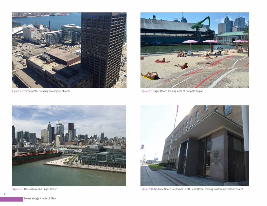
East: East of Lower Jarvis Street is the East Bayfront Precinct, which includes Sugar Beach, Sherbourne Common, the Corus Quay building, George Brown College’s Waterfront Campus building and Aqualina/Aquavista (under construction), Monde and Lighthouse Tower developments (under construction).
South: On the south side of Queens Quay East, the Pier 27 development at 25 Queens Quay East abuts the Yonge Street Slip. This seven-building residential development with civic and retail spaces on the ground floor is comprised of primarily mid-rise buildings with one 35-storey tower at the northwest corner of the site. Abutting Pier 27 to the east is the Redpath Sugar Refinery at 95 Queens Quay East.
West: Immediately west of the precinct is the ‘World Trade Centre’ development, with 26 and 37-storey towers at 10 Queens Quay West and 10 Yonge Street, respectively, and Harbourfront Centre further to the west. To the northwest is the mixed-use ‘Pinnacle Centre’ development at 33 Bay Street, 18 Harbour Street, and 12 and 16 Yonge Street with heights ranging from 30 to 54 storeys.
North: To the north are the elevated Gardiner Expressway, Lake Shore Boulevard below, and the CN rail corridor.
Lower Yonge Precinct Plan14
Figure 2.7 Toronto Star Building, looking south east Figure 2.9 Sugar Beach looking west at Redpath Sugar
Figure 2.8 Corus Quay and Sugar Beach Figure 2.10 55 Lake Shore Boulevard LCBO Head Office, looking east from Freeland Street

Area Context15
2.5 Heritage and ArchaeologyThe Lower Yonge Precinct has been identified as an area with a rich source of archaeological information regarding the city’s historical relationship to Lake Ontario and its industrial past.
The conservation of heritage and archaeological resources will play a vital role in creating a special and distinctive waterfront. The Provincial Policy Statement (2014), the City’s Official Plan and the CWSP all intend for heritage buildings and features to be conserved, archaeological resources to be protected, and lost heritage to be commemorated. Properties of cultural heritage value are listed on the City’s Inventory of Heritage Properties. Heritage Preservation staff have reviewed properties in the Precinct to identify archaeological features worthy of investigation or commemoration.
There is one listed property within the Lower Yonge Precinct at 55 Lake Shore Boulevard East. This is the site of the LCBO head office and warehouse buildings, each identified as heritage resources. The LCBO buildings are the last remaining structures in the Precinct from the mid-twentieth century industrial era. Designed by the prominent Toronto architectural firm Mathers and Haldenby, the modernist buildings exhibit high quality detailing and finishes.
The Precinct Plan envisions conservation of the entire LCBO head office building and the majority of the warehouse. Any alterations to these two connected buildings will be premised upon a zoning amendment application that conserves and interprets the buildings in a meaningful way, in the context of the Lower Yonge Precinct Plan. Modifications are, however, necessary in order to accommodate the proposed easterly extension
of Harbour Street and the siting of towers on the block. The Precinct will benefit from the retention of these older structures, as they will add historic interest and distinction to the area.
The conservation of these buildings, to the greatest extent possible, provides a valuable opportunity to imbue this new neighbourhood with a uniqueness often best achieved through the retention of older structures. Their height and massing will provide a contextual reference point for new development. The warehouse loading area may enhance and extend the public realm as a mid-block pedestrian connection.
With respect to archaeological resources, Heritage Preservation Services staff reviewed properties within the Precinct looking for potential below-grade features that may be affected by a soil disturbance. Features identified as worthy of commemoration include:
• Structures associated with the Royal Canadian Air Force Equipment Depot No. 1 (1940- 1946) which were scattered throughout the study area; and
• The 1925 Bulkhead/Pierhead line, the temporary extent of lake fill operations along the south edge of the Lower Yonge Precinct.
The head of the Toronto Electric Light Co. Wharf (1893 – 1925), potentially located at 55 Lake Shore Boulevard East, may require further archaeological investigation. The large wharf was expanded between 1903 and 1910 and featured up to two structures. Substantial portions of the foundation may survive; therefore, any deep soil disturbance activity would be subject to a program of archaeological monitoring to photograph and fully document any remains.
Figure 2.11 Rail Corridor looking east from Yonge Street

Lower Yonge Precinct Plan16
Figure 2.12 Yonge Slip looking north, 1926 (Image Credit: Toronto Archives)

Precinct Plan Vision and Principles17
Precinct Plan Vision and Principles3.1 Vision 3.2 Objectives3.3 Five Guiding Principles
3.0

Lower Yonge Precinct Plan18
Figure 3.1 Artistic Rendering of Lower Yonge Precinct seen from Toronto Islands

Precinct Plan Vision and Principles19
3.1 VisionThe Lower Yonge Precinct is envisioned as a transition from the high-density, office-based Financial Core to the west to the mixed-use neighbourhoods being developed in the East Bayfront and Keating Channel precincts to the east. Its built form and land use patterns must be carefully considered to create the character, vibrancy, comfort and quality of life that will attract both residents and businesses and make that transition as seamlessly and coherently as possible.
The uniquely central location of the Lower Yonge Precinct makes its revitalization critical not only to the success of the waterfront, but to the growth of the City of Toronto as a whole. Complete communities rely on a successful public realm, transportation access, and a mix of uses and housing options in order to thrive.
The Lower Yonge Precinct will be a vibrant, mixed-use, complete community that derives its character from its waterfront context and the large central park at its heart. A home and workplace for people of all incomes, as well as a destination to visit, Lower Yonge will be a green, sustainable neighbourhood with streets and sidewalks that are inviting to both pedestrians and cyclists. The area will be characterized by mid-rise base buildings framing the public realm at a human scale, and broadly spaced towers ensuring sunlight, good wind conditions and ample views of the sky are realized on all streets and in the park.
3.2 ObjectivesThe Lower Yonge Precinct has the following objectives:
1. Create a unique place of beauty and exemplary design that extends the existing and planned public realm network across the Central Waterfront and strengthens the relationship between the Lower Yonge Precinct, Lake Ontario and surrounding neighbourhoods.
2. Establish a fine-grained network of public streets and pedestrian connections to improve connectivity both within and surrounding the Precinct.
3. Organize the Precinct around a large, central park that provides outdoor recreational opportunities for residents, employees and visitors.
4. Promote opportunities for active transportation and recreation.
5. Establish a complete, mixed-use community that is active both day and night, with an appropriate land use mix that includes affordable housing opportunities, employment uses, community services and facilities, and open space.
6. Provide a built form and massing in good proportion that includes consistent, prominent base buildings punctuated by broadly spaced towers that provide adequate sky view from the public realm, and maintain sunlight and comfortable wind conditions for pedestrians on adjacent streets, parks and open spaces.
7. Ensure land uses and built form are compatible with and do not negatively impact surrounding land uses and neighbourhoods.
8. Create a community that is a model for sustainability across Toronto, Ontario and Canada with a focus on energy, efficiency, resiliency and green infrastructure.

Lower Yonge Precinct Plan20
3.3 Five Guiding PrinciplesFive principles have guided the development of the Precinct Plan from the very beginning to ensure that the vision is achieved:
Ease of movement (multiple, connected circulation paths)
Accessible public places (high quality, safe and vibrant outdoor destinations)
Pedestrian comfort (sidewalks and public places that are physically comfortable)
Diversity of uses (a live-work-play-shop- environment)
Good urban form (context at a human scale)
1
2
3
4
5
1
Figure 3.2 Connected Streets
Figure 3.3 Increased Porosity
Figure 3.4 Pedestrian-scaled Blocks
Figure 3.5 Waterfront Access
These principles and related goals are explained in greater detail below.
Ease of Movement
Short block dimensions, frequent intersections and a variety of engaging pedestrian and cycling routes should form a neighbourhood pattern of streets and blocks that encourages walking and biking. A network of interconnected routes and multiple connections between the precinct and surrounding areas must be developed to enhance ease of movement, facilitating links to multiple public destinations including open spaces, transit and the waterfront. Bicycle use among riders of all ages and capabilities should be encouraged through separated or standard bike lanes. Wide sidewalks and pedestrian safety strategies, such as reduced curb-to-curb dimensions, should be implemented to make walking safe and comfortable.
Goals: → Getting to, from and through the precinct will
be easy, locally and regionally; → Active transportation will be an integral part of
precinct life; → Connections to downtown and the waterfront
will be enhanced; and → Comfortable and attractive pedestrian and
bike networks will be provided.

Precinct Plan Vision and Principles21
Accessible Public Places
Public spaces that are accessible, comfortable and flexible in their use should be created to offer residents a variety of services, amenities and cultural venues with easy access to public transit. Restaurants, cafes, public art and cultural venues should face onto open public places to contribute to a fulfilling, sustainable urban lifestyle that promotes physical and psychological health.
Goals: → Public and publicly accessible open space will
increase the livability of the precinct; → People will feel safe and linger in the precinct’s
public places; and → A variety of opens spaces will be available.
Pedestrian Comfort
Buildings and public open spaces should be designed to maximize pedestrian comfort in all seasons. Streets, parks and open spaces should be sunny places protected from unpleasant wind conditions. Spaces between buildings should be comfortable, interesting and attractive to contribute to a vibrant, urban neighbourhood that is pleasant, walkable and provides varied experiences.
Goals: → The public realm will be made up of sunny
places for people to sit, gather and enjoy the outdoors;
→ Outdoor public places will be protected from strong winds so they will be active all year round; and
→ Streets, paths and parks will make a comfortable precinct-wide network of open spaces.
Figure 3.7 Convenient Location
Figure 3.8 Outdoor Recreation
2
Figure 3.6 Network of Open Space
3
Figure 3.10 Buffer Against Winter Winds
Figure 3.9 Sunny Parkland and Public Realm
Diversity of Uses
The precinct should include a variety of uses, adding vibrancy and animation to the area both day and night. It should also provide workers and residents the option of commuting and fulfilling their daily needs without the use of a car. With services and amenities located within a comfortable walking distance, people will be able to walk their children to daycare on their way to the train in the morning and stop at the market to pick up groceries on their way home from work.
Goals: → A variety of services and amenities will be
located within a convenient walking distance; → A diversity of uses will extend the day/night life
and vibrancy of the precinct; and → Office and commercial uses will be distributed
throughout the precinct.
4
Figure 3.11 Diverse Uses
Figure 3.12 Active Ground Floor + Small Shops

Lower Yonge Precinct Plan22
Good Urban Form
Buildings in the Lower Yonge Precinct should be appropriately scaled at ground level to create well-defined street and park edges at a human scale, and be organized to preserve views of the waterfront. Base buildings should convey a sense of activity and liveliness, and taller buildings should be located where they will not overwhelm adjacent open spaces. Residential towers should be slender and commercial towers should not be too broad, so as to ensure sunlight on adjacent streets and views of the sky throughout the precinct. Buildings with historic significance should be preserved and sensitively incorporated into new developments to add to the character and variety of the built fabric.
Goals: → Building forms will create interest and comfort
within streets and parks, allowing sunlight to reach streets and lessening wind impacts;
→ Heritage buildings and sites will be respected; → View corridors towards Lake Ontario will be
protected; and → Ample sky views will be preserved.
5
Figure 3.13 View Corridors Protected
Figure 3.14 Variety of Building Types
Figure 3.15 Sunny Parkland and Public Realm - Tall Buildings to the North
Public Realm23
Public Realm4.1 Streets and Blocks 4.2 Street Types 4.3 Streetscape Design 4.4 Transit 4.5 Cycling Network 4.6 Parks and Open Space
4.0

Lower Yonge Precinct Plan24
Figure 4.1 Looking west from Rees Street on Queens Quay West

Public Realm25
4.0 Public RealmA beautiful, lively and spacious public realm is vital to creating a healthy and successful community, especially in high-density areas. Outdoor spaces where local residents, employees and visitors can congregate, shop and move through the neighbourhood give the streets life and foster a sense of community. A well-planned public realm also results in other benefits to communities. The location and spacing of trees can slow traffic, thereby creating a safer environment. Ample public space enables retail, cafes and restaurants to spill out into the sidewalks, helping to animate these areas.
The Lower Yonge Public Realm Plan is built upon the principles and policies developed for the CWSP and other waterfront revitalization initiatives. The CWSP emphasizes the significance of the public realm by identifying it as one of its four core principles. The CWSP notes that “building a network of spectacular waterfront parks and public spaces” is key to transforming the Central Waterfront into a place with the appropriate amenities for visitors, workers and residents.
The Central Waterfront has a vibrant public realm west of Bay Street with active public destinations, including well-loved parks, plazas, beaches, playful decks, boardwalks, footbridges, a bike path and the waterfront promenade along Queens Quay West (See Figure 4.1).
Investments in the public realm east of Yonge Street have begun, laying the groundwork for a public realm of equal richness and vibrancy. The public realm recommendations of this report build upon that existing network of parks (See Figure 4.2) and public spaces and connect to them both visually and physically.
The Precinct will allocate a significant amount of space to an enhanced public realm, including high-quality parks and public spaces, courtyards, mid-block connections, covered walkways and landscaped streets. It is intended that these spaces will integrate key public amenities and community facilities within and surrounding the Precinct.
Figure 4.2 Corktown Common in West Donlands, looking north west

Lower Yonge Precinct Plan26
Figure 4.3 Proposed Streets and Blocks Plan

Public Realm27
4.1 Streets and BlocksA comprehensive network of public streets and pedestrian laneways will ensure the community is well connected and offer multiple convenient routes to, from, and through the precinct. Surrounding the precinct, the Gardiner Expressway/Lake Shore corridor, Lower Jarvis Street and Queens Quay East are each in the process of undergoing independent transformations. To the north, the Gardiner Expressway/Lake Shore corridor is currently being studied as part of the Gardiner Expressway/Lake Shore Boulevard East Reconfiguration EA. To the east, Lower Jarvis Street will be realigned in accordance with the East Bayfront Municipal Class EA. To the south, Queens Quay East is planned to be revitalized as per the East Bayfront Transit EA with two-way vehicular traffic, a dedicated transit line and a grade-separated multi-use trail.
Key recommendations for the street network have been carried forward from the Urban Design Report:
• A fine-grained, walkable public street network should be established to extend a typically scaled city street pattern through the precinct. The finer street grid will maximize pedestrian permeability and contribute to good light conditions in the public realm and within adjacent development as per the Proposed Street and Block Plan (Fig.4.3).
• Streets should be designed to be multi-modal and promote active transportation.
• Streets from adjacent neighbourhoods should be extended through the precinct to achieve maximum integration with the surrounding city fabric and connections to surrounding waterfront communities and the downtown.
The Lower Yonge Precinct street network described in this report was developed in coordination with the Lower Yonge TMP EA. It is being refined as part of the Lower Yonge MCEA.
To improve the pedestrian environment and to enhance street connections, primary and local streets within the Precinct will be Complete Streets designed for all ages, abilities, and modes of travel. On Complete Streets, safe and comfortable access for pedestrians, cyclists, transit users and people with limited mobility is not an afterthought, but an integral planning feature. They should also be sustainable, safe and planned comprehensively to ensure their long-term viability. The street network in the Lower Yonge Precinct has been planned with a coordinated approach to allocating transit and cycling routes while ensuring sufficient public realm for pedestrians and an adequate portion of road space for motor vehicles.
The street network divides the precinct into eight large development blocks, similar in size and scale with the typical grid pattern found throughout the downtown. This results in a more fine-grained network, encouraging people to move fluidly throughout the community. As described in section 4.6.3, the blocks will be further refined with strategically located mid-block linkages to create ample pedestrian permeability and promote walking rather than vehicular trips. The resulting block plan establishes a pedestrian-friendly, multi-modal street network that balances local and regional needs. Changes to the street network will facilitate the reconnection of the city to its waterfront, improve connectivity across the waterfront among emerging neighbourhoods, and establish appropriately sized blocks to support new mixed-use development.
The following key moves will contribute to ease of movement in and around the precinct:
• Extension of Harbour Street as a pedestrian and bicycle-friendly, “main” street from Yonge Street to Lower Jarvis Street;
• Creation of a local “New Street” between Cooper Street and Lower Jarvis Street;
• Insertion of north-south and east-west pedestrian mid-block connections;
• Elimination of the “S” curve and regularization of the Yonge Street/Harbour Street and Yonge Street/Lake Shore Boulevard intersections;
• Removal of the Bay Street on-ramp to the eastbound Gardiner Expressway;
• Shortening of the Gardiner Expressway eastbound Lower Jarvis Street off-ramp to land at Yonge Street;
• Conversion of Harbour Street between York Street and Yonge Street into a two way street;
• Extension of Cooper Street across Lake Shore Boulevard, under the Gardiner Expressway and through the rail corridor embankment to connect with Church Street to the north; and
• Potential “straightening” of Yonge Street and Cooper Street, south of Harbour Street.

Lower Yonge Precinct Plan28
4.2 Street TypesThe Lower Yonge Precinct street types are categorized as follows:
1. Primary “Main Street”: Queens Quay East
2. Local “Main Street”: Harbour Street
3. Promenade Streets: Yonge Street, Cooper Street, Lower Jarvis Street
4. Neighbourhood Streets: Freeland Street, New Street

Public Realm29
Figure 4.4 Street Hierarchy Plan

Lower Yonge Precinct Plan30
4.2.1 The “Main Streets”
Queens Quay East
Queens Quay East will be the primary main street for the Lower Yonge Precinct. Queens Quay connects all of the emerging communities on the waterfront from Bathurst Quay to the Port Lands. It runs parallel to the lakefront and forms the southern boundary of the Lower Yonge Precinct. As the main street of the Central Waterfront, Queens Quay West from Bay Street to Bathurst Street is now a Complete Street with wide sidewalks, new street furniture and granite pavers, dedicated streetcar lanes, a continuation of the Martin Goodman Trail, and two lanes of vehicular traffic along the north side of the street. These components combine to create a safe environment for people of all abilities to travel via all modes of transportation. The Queens Quay Revitalization initiative began in 2006 with plans to transform Queens Quay into a world-class boulevard. The western half has been completed and was opened in the summer 2015. The eastern half, from Bay Street to Parliament Street, is approved but awaiting funding commitments.
Queens Quay has played a critical role in reinforcing a consistent, harmonized streetscape design across the waterfront. Queens Quay East should have a public realm character consistent with elsewhere in the Central Waterfront. With a right-of-way width of 38 metres, Queens Quay East will provide ample space for transit, cyclists and pedestrians. A grand promenade designed with the waterfront’s signature granite maple leaf mosaic will run adjacent to a cycling facility flanked by a double row of trees. Services and access from Queens Quay will be limited in order to achieve a continuous active public realm. Figure 4.5 Queens Quay West and Martin Goodman Trail, looking east from York Street

Public Realm31
Figure 4.6 Queens Quay Waterfront Connections

Lower Yonge Precinct Plan32
Figure 4.7 Artistic Rendering of Harbour Street looking east from Yonge Street

Public Realm33
Harbour Street
Harbour Street’s central location within the Lower Yonge Precinct will make it the east-west, central neighbourhood street around which the precinct is structured. It will become the ‘local main street’.
West of Yonge Street, Harbour Street is currently an auto-oriented corridor that primarily serves regional through traffic from the Gardiner Expressway to northbound Bay and Yonge Streets. The completed EA for the relocation of the Gardiner Expressway York-Bay-Yonge off-ramp to Lower Simcoe Street will dramatically change the character of Harbour Street. The associated reduction of ramp infrastructure creates space for a two-way traffic street, serving both regional and local needs.
Harbour Street should have a consistent public realm design from Lower Simcoe Street to Lower Jarvis Street, with a right-of-way width of 27 metres from Yonge Street to Lower Jarvis Street. The alignment of Harbour Street east of Yonge Street should align with the midpoint of Lower Jarvis Street between Queens Quay East and Lake Shore Boulevard East to enhance visual and physical connectivity within the precinct and with the neighbourhood to the east. The sidewalk on the north side of Harbour Street should be wider with enlarged frontage and furnishing zones to take advantage of the sunshine available on the north side of the street and to encourage active street life. Sidewalks on Harbour Street should not be interrupted with parking access and service driveways. Vehicle access to development blocks should be located on Freeland Street and New Street. Harbour Street will also have dedicated cycling lanes.
Figure 4.8 Harbour Street Cross Section

Lower Yonge Precinct Plan34
Figure 4.9 Artistic Rendering of Yonge Street from Proposed Harbour Street, looking south east

Public Realm35
4.2.2 Promenade StreetsPromenade Streets are Yonge Street, Cooper Street and Lower Jarvis Street. These north-south streets will potentially allow for an enhanced pedestrian environment with an extended boulevard width of 10 metres from curb to the building face. This widened walkway will accommodate high volumes of pedestrian traffic but may also provide space for a double row of trees, street furniture such as benches and bike rings, and spill-out areas for restaurants and shops. Promenade streets also facilitate strong connections through the precinct to achieve maximum integration with the downtown while providing views south to Queens Quay East and Lake Ontario.
Yonge Street
Yonge Street will become the western Promenade Street of the precinct. With the shortening of the Gardiner Expressway off-ramp, the intersection at Lake Shore Boulevard will be regularized. While four vehicular lanes with bike facilities on each side will be provided on Yonge Street between Harbour Street and Lake Shore Boulevard, northbound vehicular lanes will potentially be minimized between Queens Quay East and Harbour Street in order to accommodate a wider sidewalk along the east side (at the foot of the former Toronto Star Building).
Yonge Street should have a consistent right-of-way width of 30 metres that will allow a bike facility between Queens Quay East and Lake Shore Boulevard and the extended sidewalk width. (Figure 4.10)
Figure 4.10 Yonge Street Cross Section (illustrative)

Lower Yonge Precinct Plan36
Figure 4.11 Artistic Rendering of Cooper Street, looking north from Queens Quay East

Public Realm37
Cooper Street
Cooper Street will be the central Promenade Street of the precinct and will eventually provide a much-needed connection north to the St Lawrence Neighbourhood by connecting to Church Street. The southern half of Cooper Street, between Harbour Street and Queens Quay East, should be straightened so that the street alignment is consistent between Lake Shore Boulevard and Queens Quay East and aligns with the future Church Street extension.
Cooper Street will have a consistent right-of-way width of 20 metres that could accommodate separated bike lanes, with an extended sidewalk width.
Lower Jarvis Street
Lower Jarvis Street will be the eastern Promenade Street of the precinct, with the potential extension of the 10-metre boulevard on the west side, providing enhanced access to Queens Quay East and Sugar Beach.
The preferred alternative in the TMP includes operational improvements to the existing Lower Jarvis intersection at Lake Shore East Boulevard through the expansion of Lake Shore Boulevard East from two lanes to three between Yonge Street and Jarvis Street. The additional lane will occupy the footprint of the shortened Gardiner off-ramp to Jarvis Street. A new intersection between Lake Shore East Boulevard and Queens Quay East along Lower Jarvis Street will be introduced with the extension of the two-way Harbour Street. Pedestrian improvements are also anticipated for the Lake Shore Boulevard/Lower Jarvis Street intersection.
Lower Jarvis Street will have a consistent right-of-way width of 26 metres, which could accommodate separated bike lanes and the proposed promenade. Figure 4.13 Lower Jarvis Street Cross Section (illustrative)
Figure 4.12 Cooper Street Cross Section (illustrative)

Lower Yonge Precinct Plan38
4.2.3 Neighbourhood StreetsFreeland Street and New Street are the Neighbourhood Streets within the precinct. Neighbourhood Streets enhance local access by providing alternative pedestrian, cycling and vehicular routes, and vehicular access points for new development. The only recommended vehicular access points for residents, employees, visitors and commercial users are on Freeland and New Streets.
Freeland Street and New Street
Freeland and New Streets will be important north-south local streets. They will break down the precinct into urban-scaled blocks. They will provide the primary access points for parking and loading facilities and views south to Queens Quay East and Lake Ontario beyond.
Freeland Street and New Streets will have a consistent right-of-way width of 20 metres.
Figure 4.14 Freeland and New Street Cross Section (illustrative)

Public Realm39
and require long pedestrian crossing distances. Narrow sidewalk widths discourage pedestrian activity. The existing Harbour Street functions as a through street with limited accommodation for pedestrians or cyclists. With the exceptions of Yonge Street and Queens Quay, none of the streets have bike facilities.
Streets should be designed with distinct sidewalk zones that facilitate accessible, unobstructed pedestrian travel, while allowing space for adjacent uses that might include sidewalk cafes, bike parking, art installations, and public amenities
Figure 4.15 Merchant’s Wharf in East Bayfront looking west towards Sherbourne Common
4.3 Streetscape DesignDue to its proximity to Union Station, Air Canada Centre, Toronto Islands Ferry Terminal, Sony Center for the Performing Arts, St. Lawrence Market, Harbourfront and the waterfront itself, this precinct will be alive with pedestrian activity. However, in many instances, the existing routes connecting these facilities and attractions do not enhance the walking experience. They include narrow sidewalks, difficult connections across sweeping turning lanes, and physical barriers.
The existing auto-oriented public realm and streetscape design facilitate higher vehicle speeds
including tree plantings and street furniture. Figure 4.15 shows an example of streetscape design in East Bayfront.
Streetscapes in the Lower Yonge Precinct will be designed with the following sidewalk zones: Funiture Zone, Throughway Zone and Frontage Zone.

Lower Yonge Precinct Plan40
Figure 4.16 St. George Street between College Street and Bloor Street (Image Credit: Brown and Storey Inc.)
Figure 4.17 Market Street between Front Street and The Esplanade (Image Credit: DTAH)
Furnishing Zone
The Furnishing Zone of the sidewalk is used for street trees, landscaping, transit stops, street lights, and street furniture. This zone acts as a buffer between the active pedestrian clearway and street traffic, and provides a space where streetscape elements can be organized in a comprehensive and orderly manner. Traffic and parking poles, fire hydrants, and utility boxes should also be located in this zone.
Throughway Zone
The Throughway Zone of the sidewalk is exclusively for accessible pedestrian travel along the street and should be clear of all obstacles, including vertical obstructions and changes in grade such as driveway aprons. This is also called the pedestrian clearway.
Frontage Zone
The Frontage Zone extends from the face of buildings to the property line and is a transition zone between the public sidewalk and the semi-public or private space within buildings. Ground floor uses adjacent to this zone may occupy this area with outdoor displays, café or restaurant seating and plantings, with appropriate permits. Architectural elements, such as awnings, canopies and marquees, may also occupy this zone. Frontage Zones could include both public and private property, but should all be publicly accessible.
Public Realm41
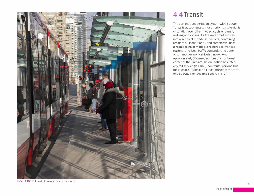
4.4 TransitThe current transportation system within Lower Yonge is auto-oriented, mostly prioritizing vehicular circulation over other modes, such as transit, walking and cycling. As the waterfront evolves into a series of mixed-use districts, containing residential, institutional, and commercial uses, a rebalancing of modes is required to manage regional and local traffic demands, and better accommodate non-vehicular movement. Approximately 300 metres from the northwest corner of the Precinct, Union Station has inter-city rail service (VIA Rail), commuter rail and bus facilities (GO Transit) and local transit in the form of a subway line, bus and light rail (TTC).
Figure 4.18 TTC Transit Stop along Queens Quay West

Lower Yonge Precinct Plan42
East Bayfront LRT
The future East Bayfront LRT is planned to run along Queens Quay East at the southern edge of the study area. This LRT line will extend from North Keating in the east, along Queens Quay before heading north to Union Station along Bay Street. This LRT, together with the new pedestrian-friendly streets, will greatly expand the transit accessibility of the precinct. Further changes to the existing local and regional transit service would be considered as residential and commercial development proceeds.
Figure 4.19 Queens Quay West, looking west near York Street

Public Realm43
transit map
Figure 4.20 Existing / Proposed Transit

Lower Yonge Precinct Plan44
4.5 Cycling NetworkQueens Quay East, Yonge Street and the Harbour Street extension are designed as Complete Streets and are proposed to accommodate separated cycling facilities.
Separated bike lanes proposed along Yonge Street will connect Queens Quay East (and the Martin Goodman Trail) to Front Street East and enhance connectivity north into the downtown core. They will also provide access to the approved off-road trail along the north side of Lake Shore Boulevard from Cherry Street to Bay Street. The bike facility on the Harbour Street extension east of Yonge Street to Lower Jarvis Street will connect to the existing/proposed cycle track that runs along the south side of Harbour Street and south side of Lake Shore Boulevard, west of Yonge Street. It will also connect to the proposed separated bike lanes on Yonge Street and Lower Jarvis Street. Bike lanes on Lower Jarvis Street will provide an important link between Queens Quay East, Harbour Street and Lake Shore Boulevard East.
The proposed Cooper Street tunnel will provide a cycling connection between Cooper Street and Church Street. This integrated cycling network has been designed to facilitate connections and provide viable cycling options for residents, employees and visitors to the area. (Fig.4.22)
Figure 4.21 Martin Goodman Trail on Queens Quay West, looking east from Lower SImcoe Street

Public Realm45
Figure 4.22 Cycling Connections Plan

Lower Yonge Precinct Plan46
Figure 4.23 Regent Park (Image Credit: Daniels)

Public Realm47
4.6 Parks and Open SpacePublic parkland and open spaces make Toronto a healthy and livable city. Investing in parkland and planning for robust open space networks are an integral part of city building. Downtown and Central Waterfront contain the largest percentage of new residential development in all of the city’s growth areas. With the increased residential population, the need for parkland also increases. Commercial development has further fueled the demand for parkland. Park users have also specified the need for parkland facilities that cater specifically to children and dogs (FIg.4.24).
The Lower Yonge Precinct has a projected future residential population of approximately 13,000 people, who will generate demands for parkland and recreational amenities, with additional demand from the approximately 15,000 employees projected for the Precinct. Parks in the broader waterfront area, outside of Lower Yonge, serve either a destination or specialized function or serve their own respective communities.
Figure 4.24 Underpass Dog Park, Boston

Lower Yonge Precinct Plan48
Figure 4.25 Open Space Network

Public Realm49
Figure 4.26 Parliament Street Parkette
4.6.1 Open Space NetworkThe Open Space Network map (Fig. 4.25) illustrates the rhythm of the large open spaces and parks established along Queens Quay East. It also highlights the Lower Yonge Precinct’s connections to surrounding parks and open spaces in relation to key north-south streets within the downtown area. Underutilized, publicly-owned spaces in the vicinity of the Precinct (i.e., under the Gardiner Expressway) will be evaluated for use as landscaped spaces for dog runs or other recreational facilities.
Yonge Street and Jarvis Street are major north-south streets that connect key landmarks of the downtown to the waterfront. Church Street
is proposed to be another key connection with a tunnel to Cooper Street. The new Bay Park Centre at Bay Street and Front Street (45 and 141 Bay Street) proposes a new open space over the railway, which establishes a north-south connection along Bay Street south from Union Station down to Queens Quay East and the lake. The Esplanade, Queens Quay East and the future Harbour Street extension establish major east-west ‘green’ corridors within the waterfront, and major open spaces, such as Sherbourne Common, Sugar Beach, and the proposed Foot of Yonge Park and the Ferry Terminal Park, connect along these corridors.

Lower Yonge Precinct Plan50
Figure 4.27 Artistic Rendering of Lower Yonge Park looking north west from Queens Quay East at Cooper Street
Public Realm51
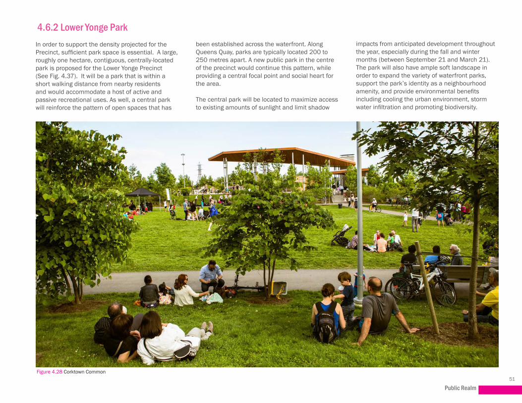
4.6.2 Lower Yonge ParkIn order to support the density projected for the Precinct, sufficient park space is essential. A large, roughly one hectare, contiguous, centrally-located park is proposed for the Lower Yonge Precinct (See Fig. 4.37). It will be a park that is within a short walking distance from nearby residents and would accommodate a host of active and passive recreational uses. As well, a central park will reinforce the pattern of open spaces that has
been established across the waterfront. Along Queens Quay, parks are typically located 200 to 250 metres apart. A new public park in the centre of the precinct would continue this pattern, while providing a central focal point and social heart for the area.
The central park will be located to maximize access to existing amounts of sunlight and limit shadow
impacts from anticipated development throughout the year, especially during the fall and winter months (between September 21 and March 21). The park will also have ample soft landscape in order to expand the variety of waterfront parks, support the park’s identity as a neighbourhood amenity, and provide environmental benefits including cooling the urban environment, storm water infiltration and promoting biodiversity.
Figure 4.28 Corktown Common

Lower Yonge Precinct Plan52
4.6.3 Mid-Block ConnectionsThe Precinct Plan has been designed to enable a series of mid-block connections to ensure ease of movement through the precinct and to surrounding neighbourhoods.
The Public Realm Plan (Fig. 4.37) creates a finer-grain network to connect people to places through the building sites and to enhance pedestrian permeability. It aims to encourage walking within and around the precinct while discouraging the use of automobiles for short trips. Mid-block connections provide alternate and interesting routes for pedestrians, reinforcing the north-south and east-west connections.
North and south of Harbour Street, east-west mid-block linkages are planned between building sites or through the use of interior atrium spaces. An east-west mid-block link runs between Lake Shore Boulevard and Harbour Street, providing a continuous connection from Yonge Street to Lower Jarvis Street and beyond. Similarly, between Harbour Street and Queens Quay East, an east-west mid-block connection will run through building sites, giving local residents and employees easy access to the proposed Lower Yonge Park and to Lower Jarvis Street, which connects to Queens Quay East, Sugar Beach and the water’s edge. Additionally, north-south mid-block connections are planned to facilitate ease of movement from Lake Shore Boulevard to Harbour Street and from Harbour Street to Queens Quay East.
Heritage Mews
A Heritage Mews will be located to the south of the existing LCBO office building, running east-west. This will provide a vehicular access point to the block, but will also create a mid-block pedestrian and cycling connection.
Figure 4.29 Mid-block Connection, West Donlands (Image Credit: Scott Torrance)
Figure 4.30 55 Lake Shore Boulevard LCBO Head Office, looking east from Freeland Street

Public Realm53
4.6.4 Privately Owned Publicly-Accessible Spaces (POPS)Privately owned, publicly accessible spaces (“POPS”) are a key part of the city’s public realm network and provide open space in much needed locations. Like other parts of the public realm, POPS should be used to reinforce the structure of the city. For instance, they might mark an important intersection, provide context for a heritage building, or provide a mid-block connection that reveals an important view. POPS can take the form of courtyards, plazas, gardens, mid-block pedestrian connections or atriums. Provided and maintained by private developers, they supplement and complement public parks, but do not replace them.
The City’s Urban Design Guidelines for POPS (2014) help to ensure that these spaces are attractive, comfortable, safe, and an asset to the public realm.
Based on the City of Toronto’s POPS guidelines, which were approved by Council to use in draft form, POPS will be designed to be:
• Located at the same grade as the public right-of-way (with the exception of the PATH);
• Safe environments for users with consideration for Crime Prevention Through Environmental Design (CPTED) principles;
• Environments that are comfortable with users throughout the year:
• Suitable for sitting and standing, based on wind conditions;
• Oriented to achieve maximum access to sunlight;
• Illuminated appropriately at night;
• Equipped with an appropriate number, location and type of seating spaces;
Figure 4.33 Mid-block Connection, Toronto Figure 4.34 Mid-block connection with public art, 300 Front Street, Toronto (Image Credit: Urban Toronto)

Lower Yonge Precinct Plan54
Figure 4.36 Bay Adelaide Centre, entrance courtyard with glass skylight paving, Toronto (Image Credit: The Architectural Glass Group)
• A balance of hard and soft landscape (to soften the appearance of the urban environment, and provide environmental benefits including cooling the urban environment, stormwater infiltration and promoting biodiversity);
• Pedestrian priority areas (access by motorized vehicles will be restricted, utilization as drop-off areas, and access to on-site parking and loading will be prohibited);
• A minimum of 10 metres wide as outdoor mid-block connections; and
• Surrounded with active uses including food services, stores and restroom facilities, when provided as interior spaces.

Public Realm55
Figure 4.37 Public Realm Plan

Lower Yonge Precinct Plan56
4.6.5 The PATHThe PATH system facilitates pedestrian linkages to public transit, accommodating business-day commuters, tourists and residents en route to a variety of destinations in a safe and weather-protected environment. The PATH has historically been located underground north of Lake Shore Boulevard. With the recent development of Harbour Plaza (90 Harbour Street and 1 York Street) and Waterpark Place Phase 3 (85 Harbour Street and 88 Queens Quay West) south of Lake Shore, the PATH has now been connected above grade from Union Station south to Queens Quay.
Figure 4.39 A new pedestrian bridge over Simcoe Street connecting the South Core to the Skywalk (Image Credit: Vik Pahwa)Figure 4.38 PATH along Roy Thomson Hall courtyard(Image Credit: TT n Sheldy)
While the City of Toronto PATH Master Plan Study (2012) recommends connecting the Lower Yonge Precinct to the PATH network, PATH connections within the precinct are recommended to be limited to at-grade or below-grade connections. Above-grade bridge connections within the precinct are proposed to be limited to a connection over Lake Shore Boulevard.

Public Realm57
Figure 4.40 PATH Plan
Lower Yonge Precinct Plan58
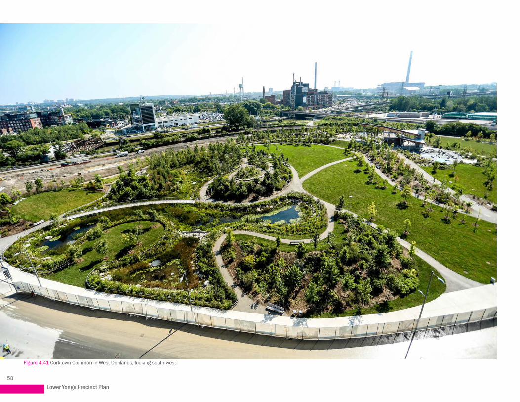
Figure 4.41 Corktown Common in West Donlands, looking south west

59
Development5.1 Land Use 5.2 Built Form 5.3 Parking and Loading
5.0

Lower Yonge Precinct Plan60
5.1 LAND USE5.1.1 Mix of UsesEnsuring an appropriate balance of residential and non-residential uses is an integral part of creating a vibrant and complete community. The Lower Yonge Precinct targets a mix of uses that is 25% to 40% non-residential uses and 60% to 75% residential uses based on the directions of this plan for built land use. The community will represent a diverse mix of uses that will be characterized by high-density residential with commercial, recreational and cultural uses. Highly urban in nature, different mixes of uses and a pedestrian-friendly public realm will create a vibrant, urban hub and meeting places for both local residents and visitors. Active street frontages and improved sidewalks that connect to a wide range of uses and open spaces will encourage recreation, interaction and a sense of community within the Precinct. It is also an appropriate location for new employment uses, given its location within the Downtown and Central Waterfront, and proximity to Union Station and the planned East Bayfront LRT.
The Lower Yonge Precinct Plan will support development of appropriate employment (i.e. non-retail) uses, and will require a portion of total development to be employment related. Nearby areas are planned or developed with 25%to 40% of floor area dedicated to employment uses. These are starting points to assess an appropriate proportion of employment and to consider tools to secure its development alongside residential uses.
A sufficient percentage of non-residential uses, including office and retail, ensures that there are people in the community at all hours of the day. Accompanying development proposals, a phasing plan will be required to demonstrate that the non-residential component will be delivered with the residential component.
Figure 5.1 Artistic Rendering looking southeast from Yonge Street and proposed Harbour Street

Development61
5.1.1.1 Location of Non-Residential Uses
This plan identifies lands along Yonge Street and south of Harbour Street as the ideal locations for office development. Proximity to higher order transit at Union Station and the planned LRT along Queens Quay East factored into this decision. Building on strategies to the east, land use compatibility with the Redpath Sugar facility was another determining factor. Commercial uses fronting on Queens Quay East will help to buffer the more sensitive residential uses north of Harbour Street (See Figure 5.3).
5.1.1.2 Location of Retail Uses
Retail should be concentrated along Harbour Street, and adjacent to higher order streets including Yonge Street, Cooper Street, Lower Jarvis Street and Queens Quay East, which are important connections to and across the waterfront.
5.1.1.3 Location of Cultural, Civic and Tourist Attractions
Cultural, civic and tourist attractions are also important to communities of this scale. They act as a catalyst, drawing people and interest to the community and fostering economic growth and resiliency.
According to the CWSP, the foot of Yonge Street should be treated as a special place on the waterfront, the place where Yonge Street meets the lake. It is to be designed to include major public amenities of high quality, distinctive cultural buildings, appropriate tourist facilities and a range
of public uses and other development that will contribute to the special nature of this area.
5.1.1.4 Compatibility with Surrounding Uses
As part of the East Bayfront planning, the Ministry of the Environment and Climate Change (MOECC) acknowledged the need for a better relationship between existing industrial uses and urban renewal and revitalization. As such, it established new guidelines for urban areas where sensitive land uses are located in proximity to existing industrial facilities.
Sugar refinery and processing factory Redpath Sugar (formerly Tate & Lyle) has been in operation on Toronto’s waterfront since 1955. It is situated on a 10-acre site and is on the City of Toronto’s listing of heritage buildings. Redpath Sugar imports bulk raw cane sugar from Central and South America by ship through the St. Lawrence Seaway. It employs close to 300 people, operates 24 hours a day, has the capacity to operate seven days a week, and produces approximately 2,000 tons of sugar per day. Roughly 100 trucks enter and exit the site each day and 25-30 ships import raw materials to the factory between April and mid-December. Raw sugar is also stored in the Port Lands at Marine Terminal 51 west of Cherry Street, and at another facility in Belleville.
Figure 5.2 Redpath Sugar (Image Credit: Redpath Sugar)

Lower Yonge Precinct Plan62
Figure 5.3 Land Use Map

Development63
As part of the precinct planning exercise, a noise, odour and air quality assessment was conducted on behalf of the City to ensure compatibility between Redpath’s operations and the proposed mixed-use community in Lower Yonge. The study confirmed initial findings that the proposed location of non-residential uses south of Harbour Street will act as a buffer between Redpath and the residential uses proposed north of Harbour Street (Fig. 5.3). The non-sensitive uses within the buffer zone must be constructed prior to the development of sensitive buildings and the design of those buildings must take advantage of the specific heights, dimensions and locations that maximize their potential benefits when used as part of the buffer zone.
Air quality modelling indicated that there is potential for development within the Precinct that would cause Redpath to fall out of compliance with the MOECC’s guidelines. However, it is anticipated that these impacts could be mitigated, either through at-source or at-receptor mitigation. A mitigation framework (agreed upon by the City, Redpath and other key stakeholders) should be established at the outset of any development before any detailed designs are investigated.
The study further confirmed that developments will be required to submit additional site-specific noise, odour and air quality studies in accordance with MOECC regulations and guidelines in support of future planning applications in order to identify the requisite mitigation measures to be implemented within the new developments.
Figure 5.5 View of Financial District, Redpath Sugar and Sugar Beach, looking northwest from the Inner Harbour
Figure 5.4 View of Sugar Beach looking towards Redpath Sugar and Lake Ontario
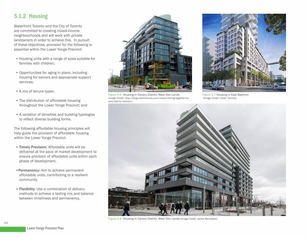
Lower Yonge Precinct Plan64
5.1.2 HousingWaterfront Toronto and the City of Toronto are committed to creating mixed-income neighbourhoods and will work with private landowners in order to achieve this. In pursuit of these objectives, provision for the following is essential within the Lower Yonge Precinct:
• Housing units with a range of sizes suitable for families with children;
• Opportunities for aging in place, including housing for seniors and appropriate support services;
• A mix of tenure types;
• The distribution of affordable housing throughout the Lower Yonge Precinct; and
• A variation of densities and building typologies to reflect diverse building forms.
The following affordable housing principles will help guide the provision of affordable housing within the Lower Yonge Precinct.
• Timely Provision: Affordable units will be delivered at the pace of market development to ensure provision of affordable units within each phase of development.
•Permanency: Aim to achieve permanent affordable units, contributing to a resilient community.
• Flexibility: Use a combination of delivery methods to achieve a lasting mix and balance between timeliness and permanency.
Figure 5.6 Housing in Canary District, West Don Lands (Image Credit: http://blog.newinhomes.com/news/coming-together-ca-nary-district-toronto/)
Figure 5.7 Housing in East Bayfront (Image Credit: Urban Toronto)
Figure 5.8 Housing in Canary District, West Don Lands (Image Credit: James Bombales)