Embed Size (px)
Citation preview
US Army Corps of Engineers
BUILDING STRONG®
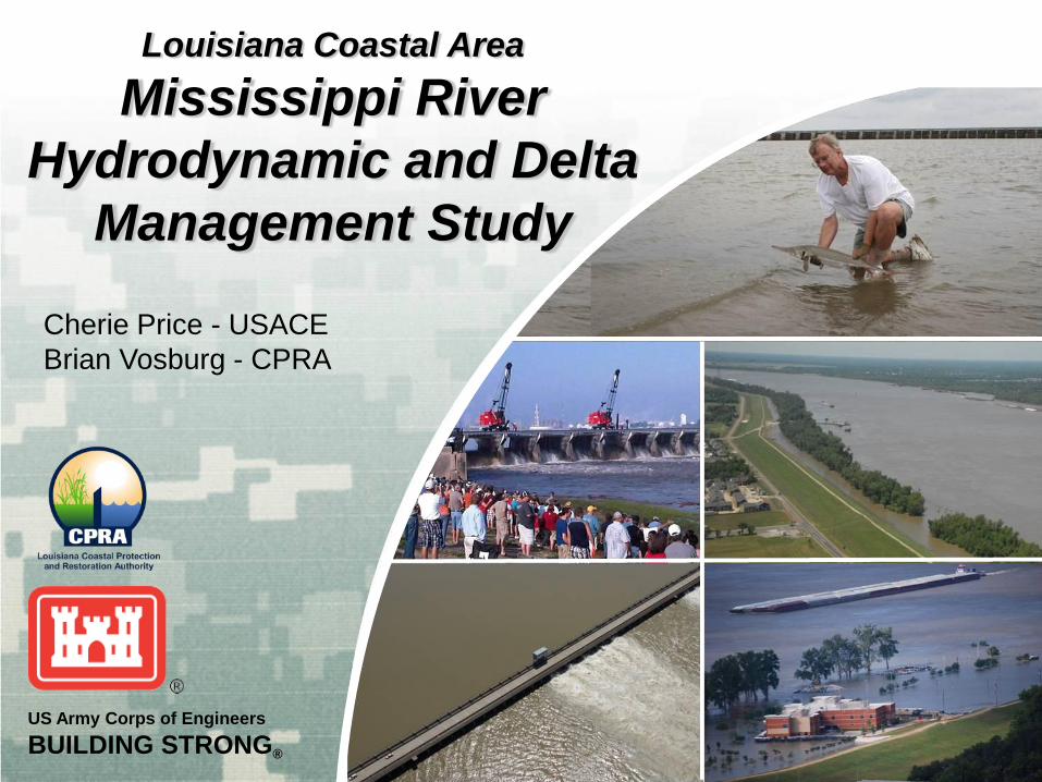
Louisiana Coastal Area
Mississippi River
Hydrodynamic and Delta
Management Study
Cherie Price - USACE
Brian Vosburg - CPRA
BUILDING STRONG®
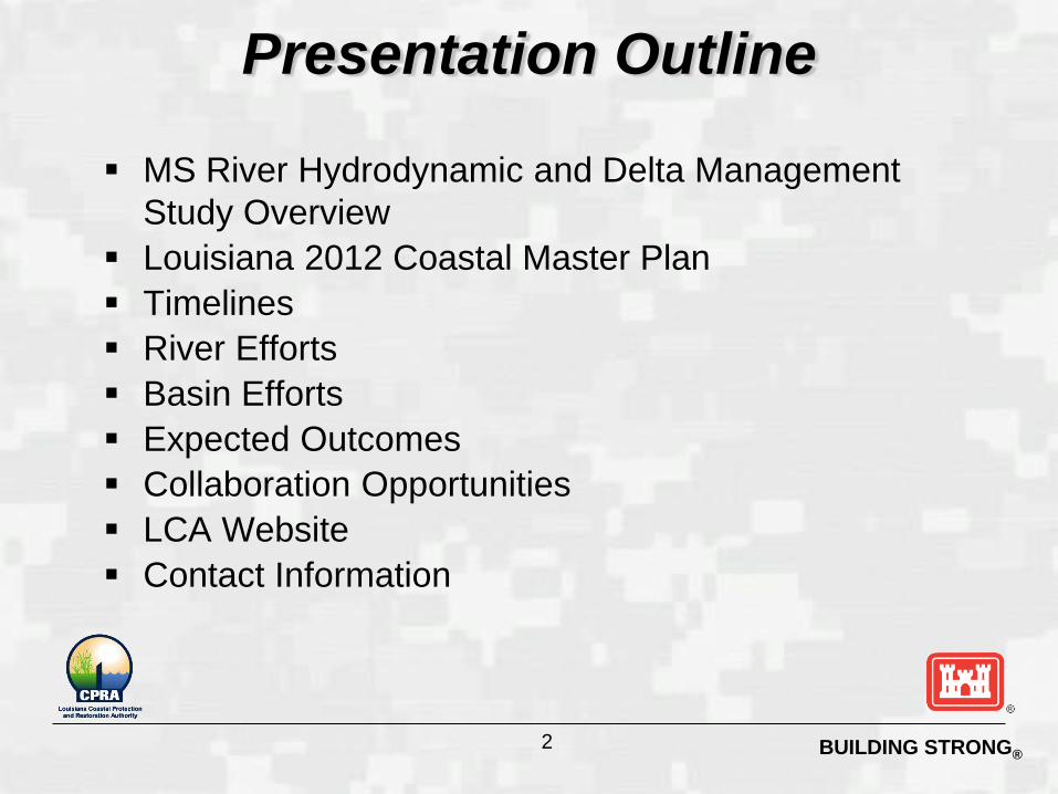
Presentation Outline
MS River Hydrodynamic and Delta Management
Study Overview
Louisiana 2012 Coastal Master Plan
Timelines
River Efforts
Basin Efforts
Expected Outcomes
Collaboration Opportunities
LCA Website
Contact Information
2

BUILDING STRONG®
MRHDM combines the first two large-scale, long-term
studies
► “Mississippi River Hydrodynamic Study”
► “Mississippi River Delta Management Study”
► Assessment of fundamental changes to coast and
river management
► Investigation of significant potential for achieving
restoration and management objectives
Cost-Share Agreement signed August 24, 2011
► 5 years
► $25.3 M study effort
Study Overview
3
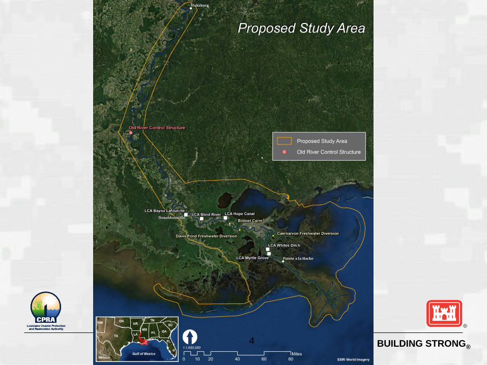
BUILDING STRONG® 4
BUILDING STRONG®
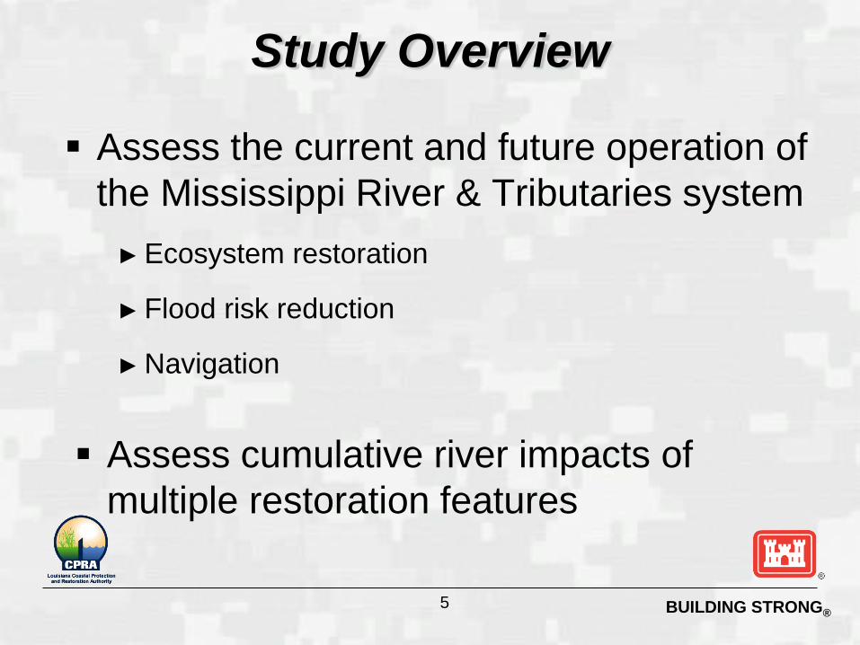
Assess the current and future operation of
the Mississippi River & Tributaries system
► Ecosystem restoration
► Flood risk reduction
► Navigation
Assess cumulative river impacts of
multiple restoration features
Study Overview
5
BUILDING STRONG®
Move this
after the
second
Study
Overview
slide
6
BUILDING STRONG®
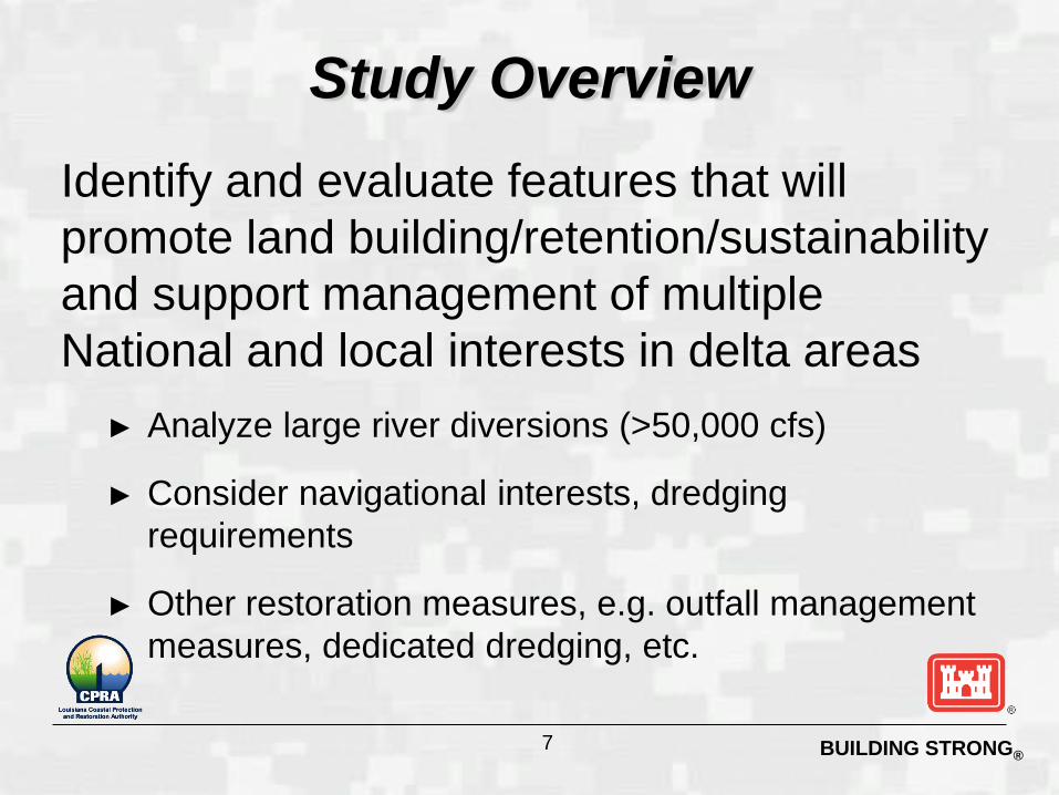
Identify and evaluate features that will
promote land building/retention/sustainability
and support management of multiple
National and local interests in delta areas
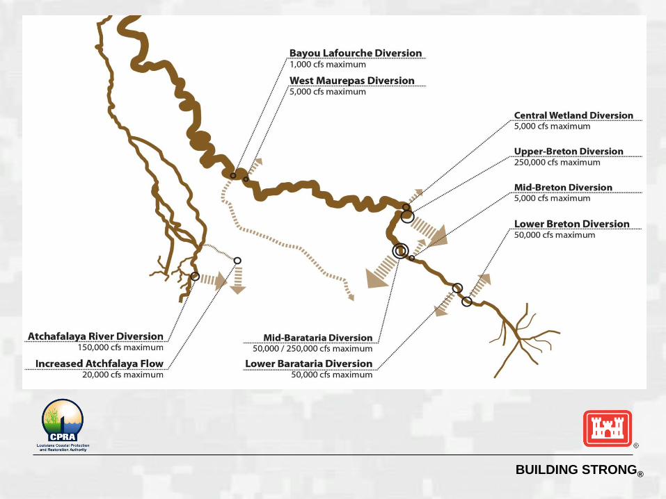
► Analyze large river diversions (>50,000 cfs)
► Consider navigational interests, dredging
requirements
► Other restoration measures, e.g. outfall management
measures, dedicated dredging, etc.
Study Overview
7
BUILDING STRONG®
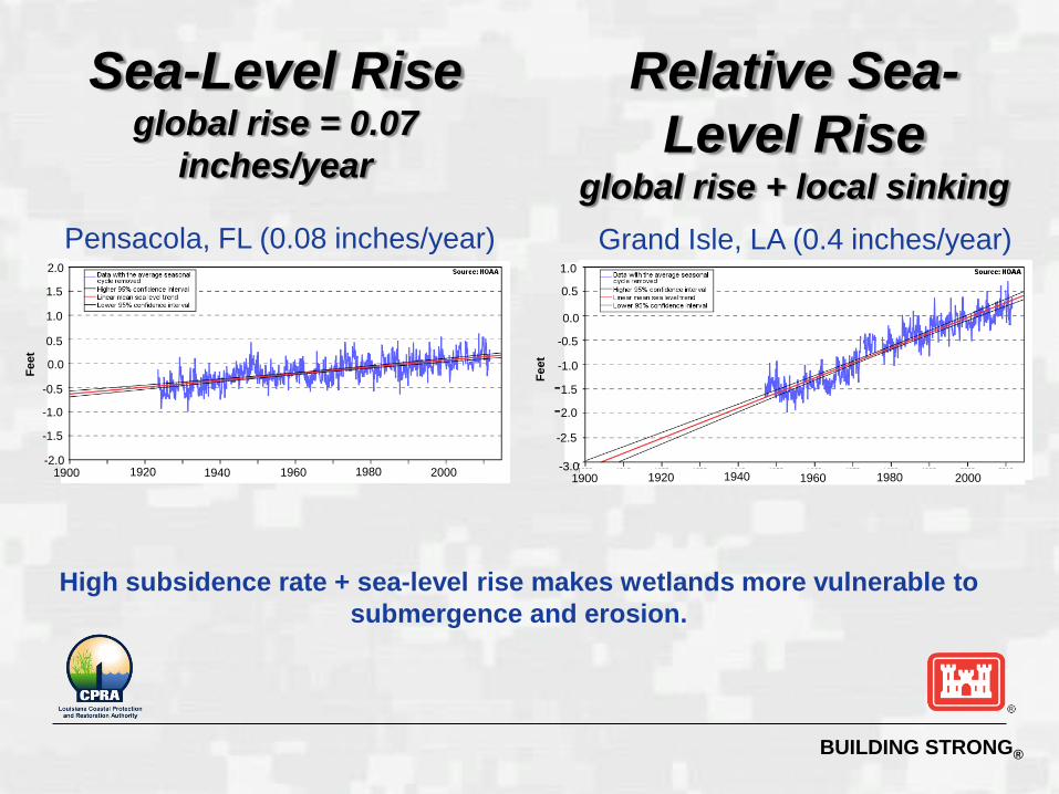
-2.0
-1.5
-1.0
-0.5
0.0
0.5
1.5
1.0
1900 1920 1940 1960 1980 2000
Fe
et
Pensacola, FL (0.08 inches/year)
Sea-Level Rise global rise = 0.07
inches/year
2.0
-2.5
-2.0
-1.5
-1.0
-0.5
0.0
0.5
1.0
-3.0
Fe
et
1900 1920 1940 1960 1980 2000
Grand Isle, LA (0.4 inches/year)
Relative Sea-
Level Rise global rise + local sinking
High subsidence rate + sea-level rise makes wetlands more vulnerable to
submergence and erosion.
BUILDING STRONG®
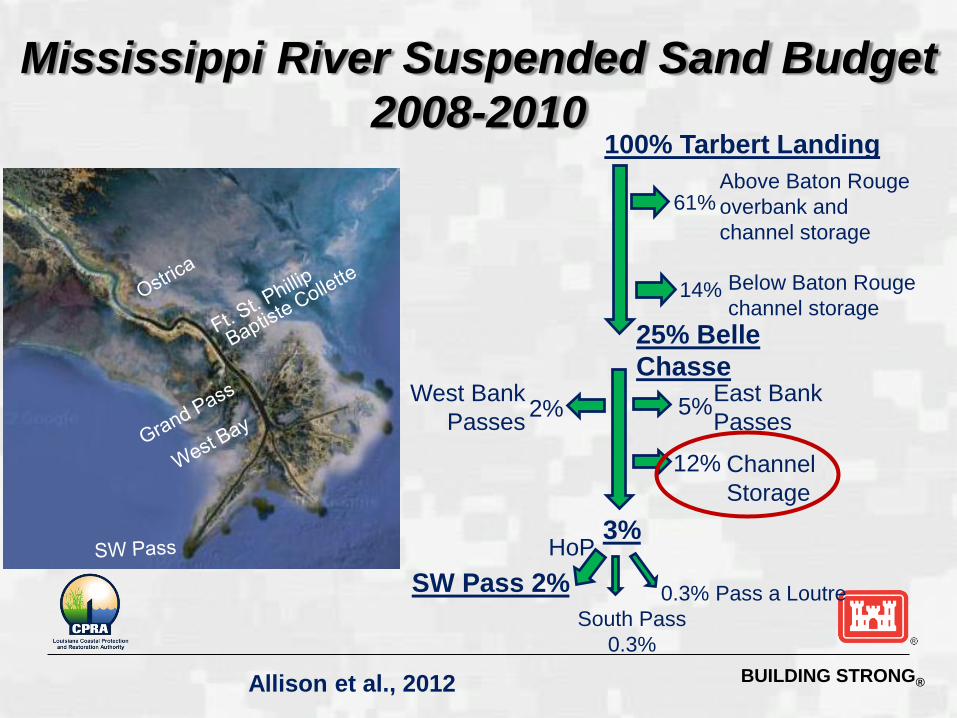
Mississippi River Suspended Sand Budget
2008-2010
Allison et al., 2012
100% Tarbert Landing Above Baton Rouge
overbank and
channel storage
25% Belle
Chasse
3%
0.3% Pass a Loutre
South Pass
0.3%
SW Pass 2%
61%
5% 2% East Bank
Passes
12% Channel
Storage
West Bank
Passes
14% Below Baton Rouge
channel storage
HoP
BUILDING STRONG® 10
BUILDING STRONG®
Nonstructural
Measures
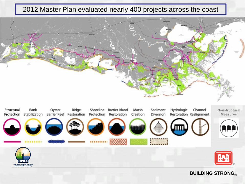
2012 Master Plan evaluated nearly 400 projects across the coast
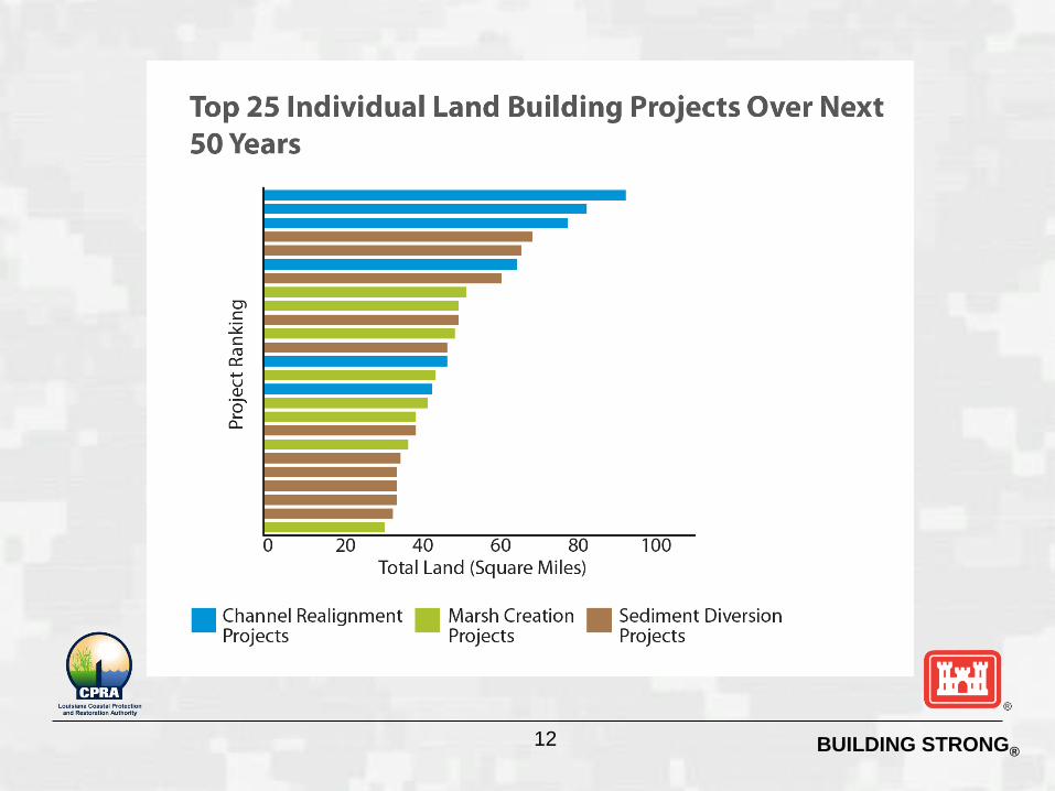
BUILDING STRONG® 12
BUILDING STRONG®
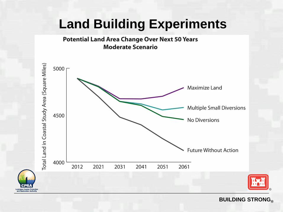
Land Building Experiments
BUILDING STRONG®
BUILDING STRONG®
Timelines
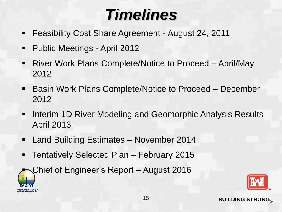
Feasibility Cost Share Agreement - August 24, 2011
Public Meetings - April 2012
River Work Plans Complete/Notice to Proceed – April/May
2012
Basin Work Plans Complete/Notice to Proceed – December
2012
Interim 1D River Modeling and Geomorphic Analysis Results –
April 2013
Land Building Estimates – November 2014
Tentatively Selected Plan – February 2015
Chief of Engineer’s Report – August 2016
15
BUILDING STRONG®
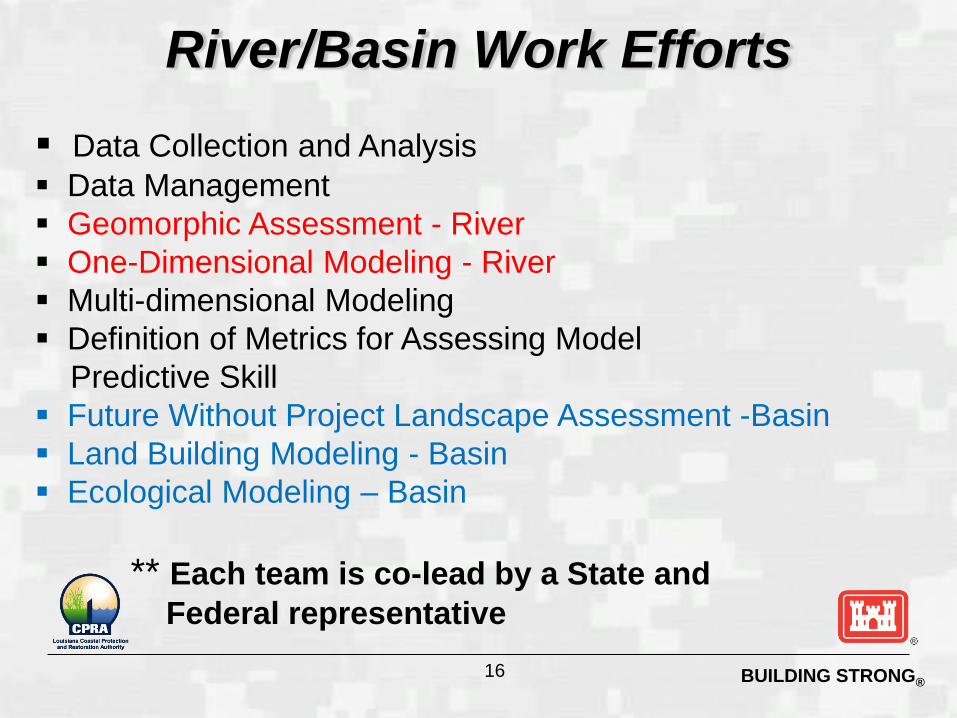
River/Basin Work Efforts
Data Collection and Analysis
Data Management
Geomorphic Assessment - River
One-Dimensional Modeling - River
Multi-dimensional Modeling
Definition of Metrics for Assessing Model
Predictive Skill
Future Without Project Landscape Assessment -Basin
Land Building Modeling - Basin
Ecological Modeling – Basin
** Each team is co-lead by a State and
Federal representative
16

BUILDING STRONG®
Move this
after the
second
Study
Overview
slide
17
BUILDING STRONG®
River Work Efforts
18
BUILDING STRONG®
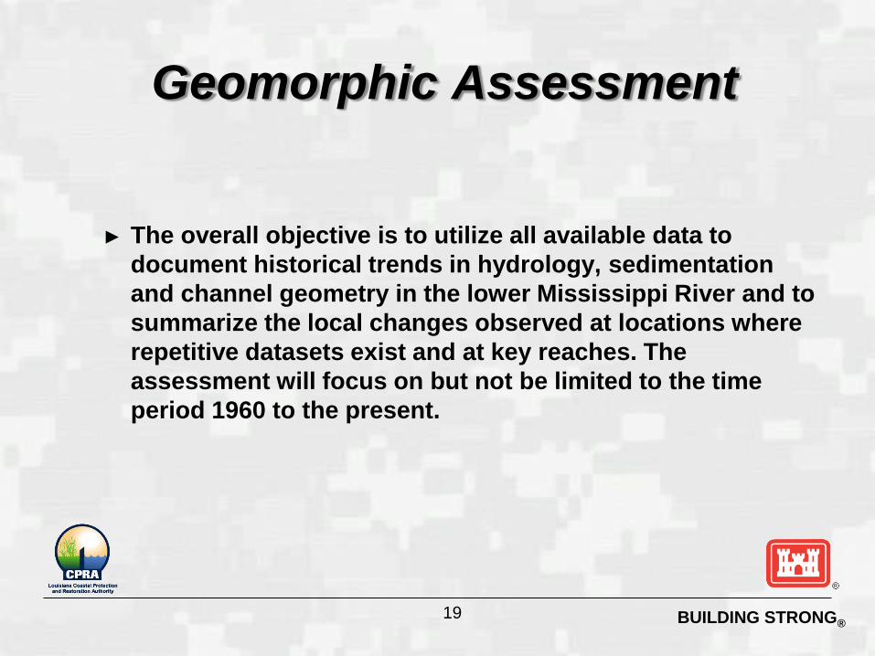
Geomorphic Assessment
► The overall objective is to utilize all available data to
document historical trends in hydrology, sedimentation
and channel geometry in the lower Mississippi River and to
summarize the local changes observed at locations where
repetitive datasets exist and at key reaches. The
assessment will focus on but not be limited to the time
period 1960 to the present.
19
BUILDING STRONG®
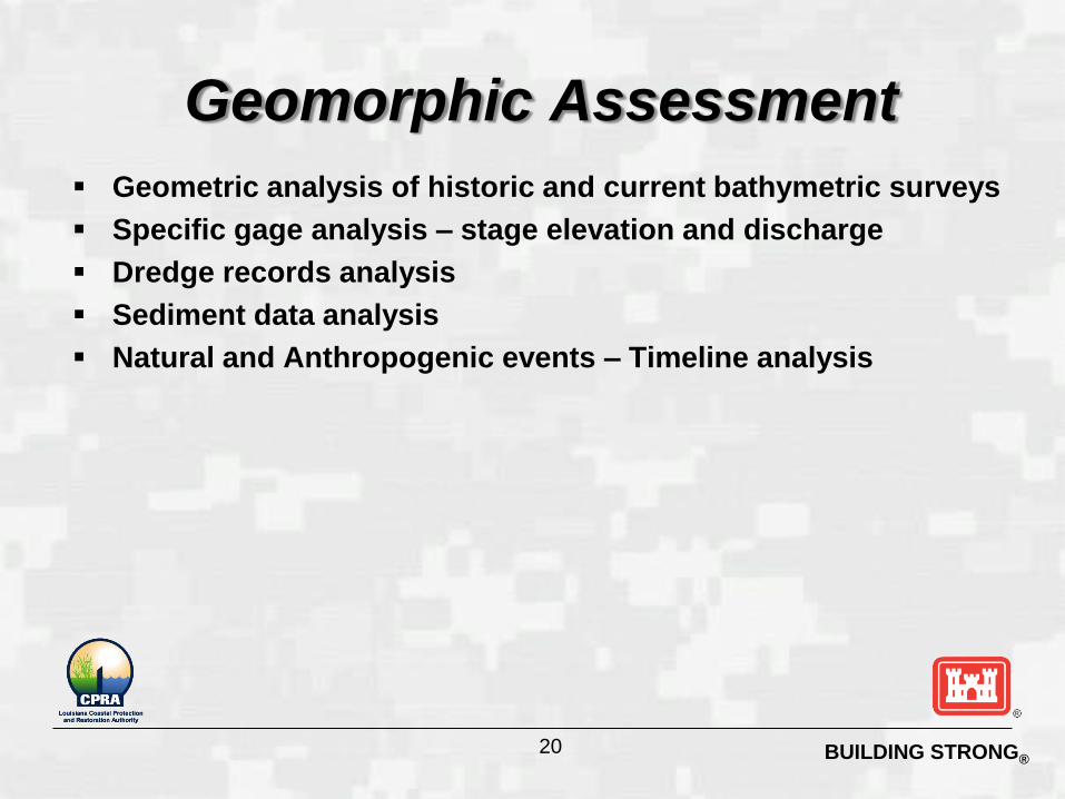
Geomorphic Assessment
Geometric analysis of historic and current bathymetric surveys
Specific gage analysis – stage elevation and discharge
Dredge records analysis
Sediment data analysis
Natural and Anthropogenic events – Timeline analysis
20
BUILDING STRONG®
Data Collection and Analysis
► The overall objective is to utilize existing data and
to collect and analyze new data to enhance the
understanding of hydrodynamic and sediment
processes in the lower MS River in order to
support numerical modeling efforts
21
BUILDING STRONG®
Data Collection and Analysis
Longitudinal, boat based studies of hydrodynamics, suspended
sediment and bed load flux at high and low water discharge
events
Reach scale, site specific, boat based studies of hydrodynamics,
suspended sediment and bed load flux over a range of water
discharges
Boat based studies of salt-wedge dynamics in the estuarine
reach during low water discharge periods
Stationary platform data collection of key parameters including
stage elevation, turbidity, salinity and water discharge
22
BUILDING STRONG®
One-Dimensional Modeling
► Overall objective is to develop a broadly accepted
1D modeling system that will be able to address
the long term (decadal) effects of management
decisions on the hydrodynamics and sediment
transport dynamics in the lower Mississippi River
from Vicksburg to the Gulf of Mexico
23
BUILDING STRONG®
One-Dimensional Modeling
►Task 1: Initial HEC-6T Demonstration and
Application Expansion of Model Domain
Update Geo-referenced Cross-section Databases
Model Validation
Scenario Testing
►Task 2: HEC-RAS Model Development Model Development
Model Validation
Scenario Testing
24
BUILDING STRONG®
Multi-dimensional Modeling
► Overall objective is to setup and apply a suite of
multi-dimensional modeling tools to develop an
understanding of, and accurately simulate the
hydrodynamic, salinity, temperature and sediment
dynamics along critical reaches of the Lower
Mississippi River, over shorter time scales than
the one-dimensional models.
25
BUILDING STRONG®
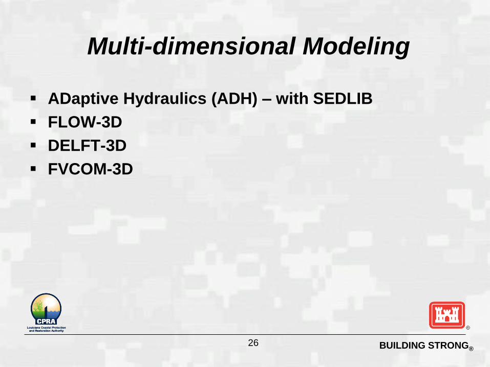
Multi-dimensional Modeling
ADaptive Hydraulics (ADH) – with SEDLIB
FLOW-3D
DELFT-3D
FVCOM-3D
26
BUILDING STRONG®
Basin Work Efforts
27
BUILDING STRONG®
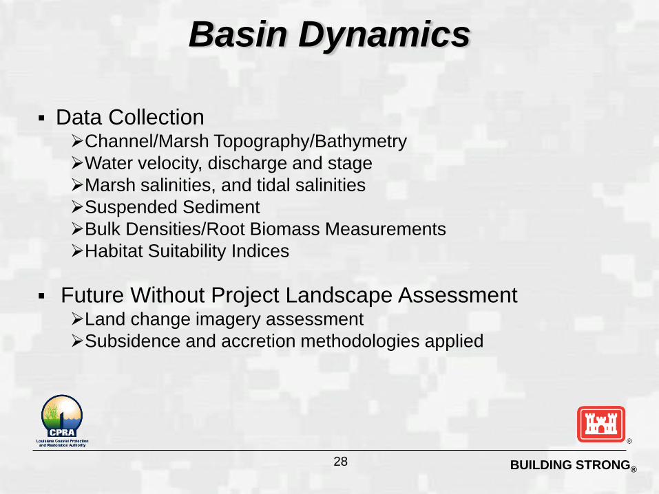
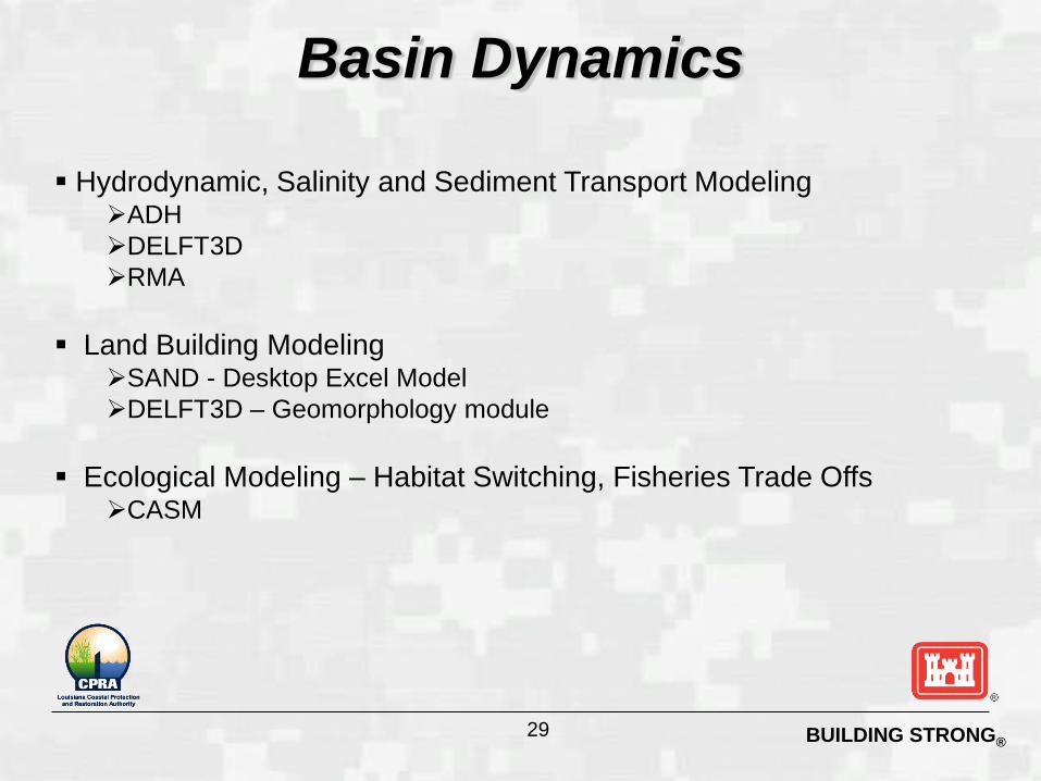
Basin Dynamics
Data Collection
Channel/Marsh Topography/Bathymetry
Water velocity, discharge and stage
Marsh salinities, and tidal salinities
Suspended Sediment
Bulk Densities/Root Biomass Measurements
Habitat Suitability Indices
Future Without Project Landscape Assessment Land change imagery assessment
Subsidence and accretion methodologies applied
28
BUILDING STRONG®
Basin Dynamics
Hydrodynamic, Salinity and Sediment Transport Modeling ADH
DELFT3D
RMA
Land Building Modeling SAND - Desktop Excel Model
DELFT3D – Geomorphology module
Ecological Modeling – Habitat Switching, Fisheries Trade Offs CASM
29
BUILDING STRONG®
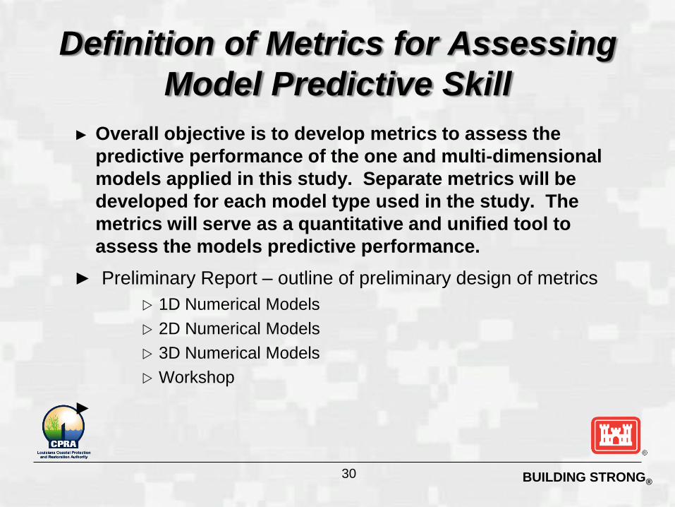
Definition of Metrics for Assessing
Model Predictive Skill
► Overall objective is to develop metrics to assess the
predictive performance of the one and multi-dimensional
models applied in this study. Separate metrics will be
developed for each model type used in the study. The
metrics will serve as a quantitative and unified tool to
assess the models predictive performance.
► Preliminary Report – outline of preliminary design of metrics
1D Numerical Models
2D Numerical Models
3D Numerical Models
Workshop
►
30
BUILDING STRONG®
Data Management
► All data products generated by the project will be
maintained on existing State and Federal systems
and archived for future use by Federal, State and
outside Technical entities.
► Relevant data will be identified and integrated into
data visualization products such as web maps,
web charts, and/or 2D-3D visual representations.
These products will be made available through
State and Federal data portals.
31
BUILDING STRONG®
Quantities of existing and future river water and sediment
available to support sustainable restoration while maintaining
navigation and flood risk reduction.
Programmatic modeling and tools to support the development
and evolution of a decision making framework for the river and
surrounding basins.
Forecast long-term sustainability of existing river related systems
Analysis of river management options and tradeoffs to various
areas of Federal and local interest
System wide plan to target sustainable net positive elevation
change in targeted receiving basins.
Expected Outcomes
32
BUILDING STRONG®
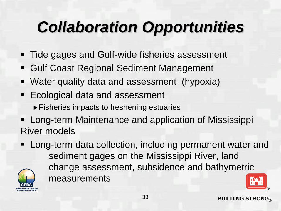
Tide gages and Gulf-wide fisheries assessment
Gulf Coast Regional Sediment Management
Water quality data and assessment (hypoxia)
Ecological data and assessment
►Fisheries impacts to freshening estuaries
Long-term Maintenance and application of Mississippi
River models
Long-term data collection, including permanent water and
sediment gages on the Mississippi River, land
change assessment, subsidence and bathymetric
measurements
Collaboration Opportunities
33
BUILDING STRONG®
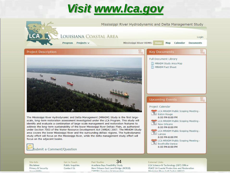
Visit www.lca.gov
34
BUILDING STRONG®
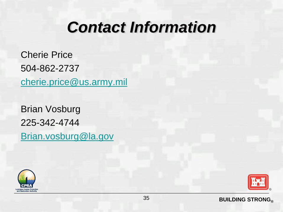
Cherie Price
504-862-2737
Brian Vosburg
225-342-4744
Contact Information
35
BUILDING STRONG®
Questions?
36