Embed Size (px)
Citation preview
Flood Risk Review Report – UoM 24 Aughinish CHP and Sub-station IRR V0_B 1
Location: Aughinish CHP and ESB Sub Station Co. Limerick
Unique ID: 240366 (from PFRA database)
Initial OPW Designation APSR AFRR IRR
Co-ordinates Easting: 129250 Northing: 153000
River / Catchment / Sub-catchment River Shannon / Shannon
Type of Flooding / Flood Risk (identify all that apply)
Fluvial non-tidal Fluvial tidal Coastal
Stage 1: Desktop Review
1.1 Flood History (include review of Floodmaps.ie)
River Flow Path
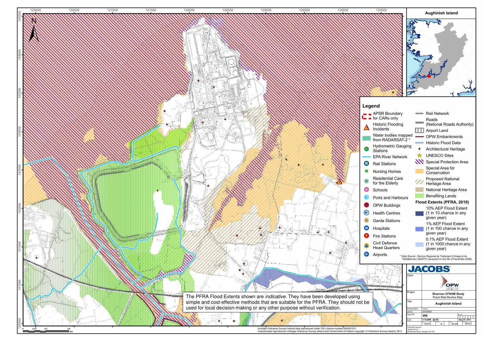
Aughinish CHP and ESB Sub Station are situated on Aughinish Island in the Shannon Estuary and at the mouth of the Robertstown river and Poulaweala Creek.
At this location the Shannon Estuary is several km wide, fully influenced by the tide rather than fluvial flows, and is therefore noted as being vulnerable to “coastal” flooding rather than “fluvial tidal” flooding.
Flood event records
No flood records are listed in floodmaps.ie
1.2 Relevant information on flooding issues from OPW and LA staff
PFRA database comments (in italics): OPW comments ESB Sub station, coastal, IRR Risk Review, using ICPSS data when available - and possible minor works - Inform ESB - Not an APSR Original comment related to MORGANS NORTH LA comments No comments. Meeting / discussion summary comments: OPW comments No comments LA comments No comments
Flood Risk Review Report – UoM 24 Aughinish CHP and Sub-station IRR V0_B 2
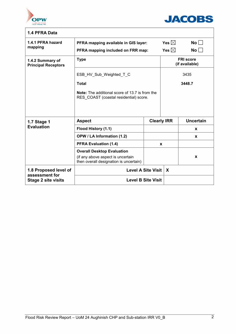
1.4 PFRA Data
1.4.1 PFRA hazard mapping
PFRA mapping available in GIS layer: Yes No
PFRA mapping included on FRR map: Yes No
Type FRI score (if available)
1.4.2 Summary of Principal Receptors
ESB_HV_Sub_Weighted_T_C Total Note: The additional score of 13.7 is from the RES_COAST (coastal residential) score.
3435
3448.7
Aspect Clearly IRR Uncertain
Flood History (1.1) x
OPW / LA Information (1.2) x
PFRA Evaluation (1.4) x
1.7 Stage 1 Evaluation
Overall Desktop Evaluation
(if any above aspect is uncertain then overall designation is uncertain)
x
Level A Site Visit X 1.8 Proposed level of assessment for Stage 2 site visits Level B Site Visit
Flood Risk Review Report – UoM 24 Aughinish CHP and Sub-station IRR V0_B 3
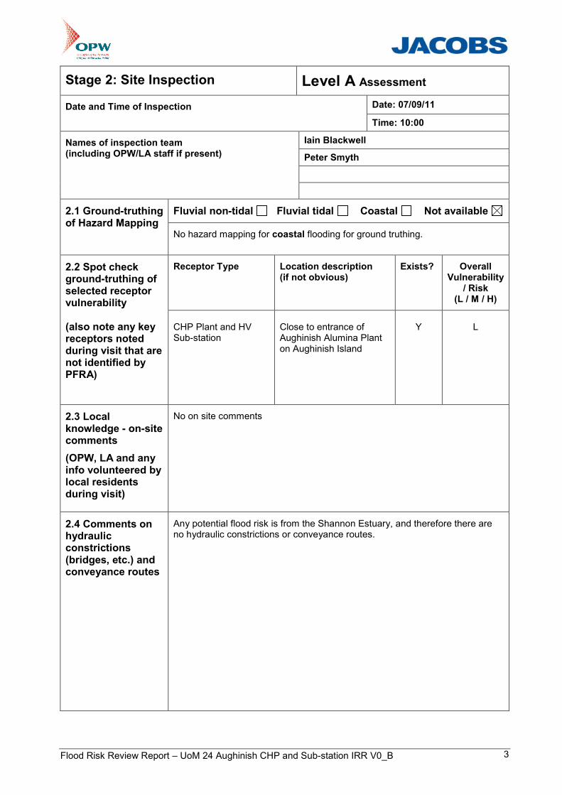
Stage 2: Site Inspection Level A Assessment
Date: 07/09/11 Date and Time of Inspection
Time: 10:00
Iain Blackwell
Peter Smyth
Names of inspection team (including OPW/LA staff if present)
Fluvial non-tidal Fluvial tidal Coastal Not available 2.1 Ground-truthing of Hazard Mapping
No hazard mapping for coastal flooding for ground truthing.
Receptor Type Location description (if not obvious)
Exists? Overall Vulnerability
/ Risk (L / M / H)
2.2 Spot check ground-truthing of selected receptor vulnerability (also note any key receptors noted during visit that are not identified by PFRA)
CHP Plant and HV Sub-station
Close to entrance of Aughinish Alumina Plant on Aughinish Island
Y
L
2.3 Local knowledge - on-site comments
(OPW, LA and any info volunteered by local residents during visit)
No on site comments
2.4 Comments on hydraulic constrictions (bridges, etc.) and conveyance routes
Any potential flood risk is from the Shannon Estuary, and therefore there are no hydraulic constrictions or conveyance routes.

Flood Risk Review Report – UoM 24 Aughinish CHP and Sub-station IRR V0_B 4
2.5 SVRS Assessment Matrix
Weightings: A - x1 - reasonable expectation of flooding B - x2 - high expectation of flooding or flooding is tidal (any risk) C - x5 - risk to life
Approx. Number 1 to 4 5 to 20 >20
Weighting A B C A B C A B C
Property (domestic)
10 100 200
Property (small retail or business)
20 200 400
Property (large retail or business)
50 500 1000
Road or Rail Infrastructure
30 300 600
Critical Infrastructure (local) [hospital, school, police/fire/ambulance station, substation, WTW/WWTW, gov bldg, other (specify)]
50 500 1000
Critical Infrastructure (national importance)
250 1000 2000
Cultural Heritage Site
20 200 400
Environmental Designated Site
20 200 400
Hazardous Substances Site
50 500 1000
Total SVRS 0
2.6 Defence Assets
Formal and Informal Flood Defence Assets
(include effective and ineffective assets to inform asset survey and potential mitigation measures)
Open Channel Watercourses
Man-made river channel Flood relief channel Canal
Mill leat Drainage channels / back drains
Bridges and Culvert crossings
Single Arch bridge Multi-Arch bridge
Single Span bridge Multi-Span bridge
Box culvert(s) Pipe culvert(s) Arch Culvert(s)
Culverted Watercourses (culvert length is greater than just a crossing)
Box culvert(s) Pipe culvert(s) Arch Culvert(s) Irregular Culvert(s)
Walls and Embankments
Embankment(s) Raised wall(s) Retaining wall(s)
Control Structures – weirs, gates, dams
Fixed crest weir Adjustable weir Dam / Barrage
Sluice gates Lock gates Radial gates
Storage
On-line storage (natural) On-line storage (artificial) Off-line storage
Flood Risk Review Report – UoM 24 Aughinish CHP and Sub-station IRR V0_B 5
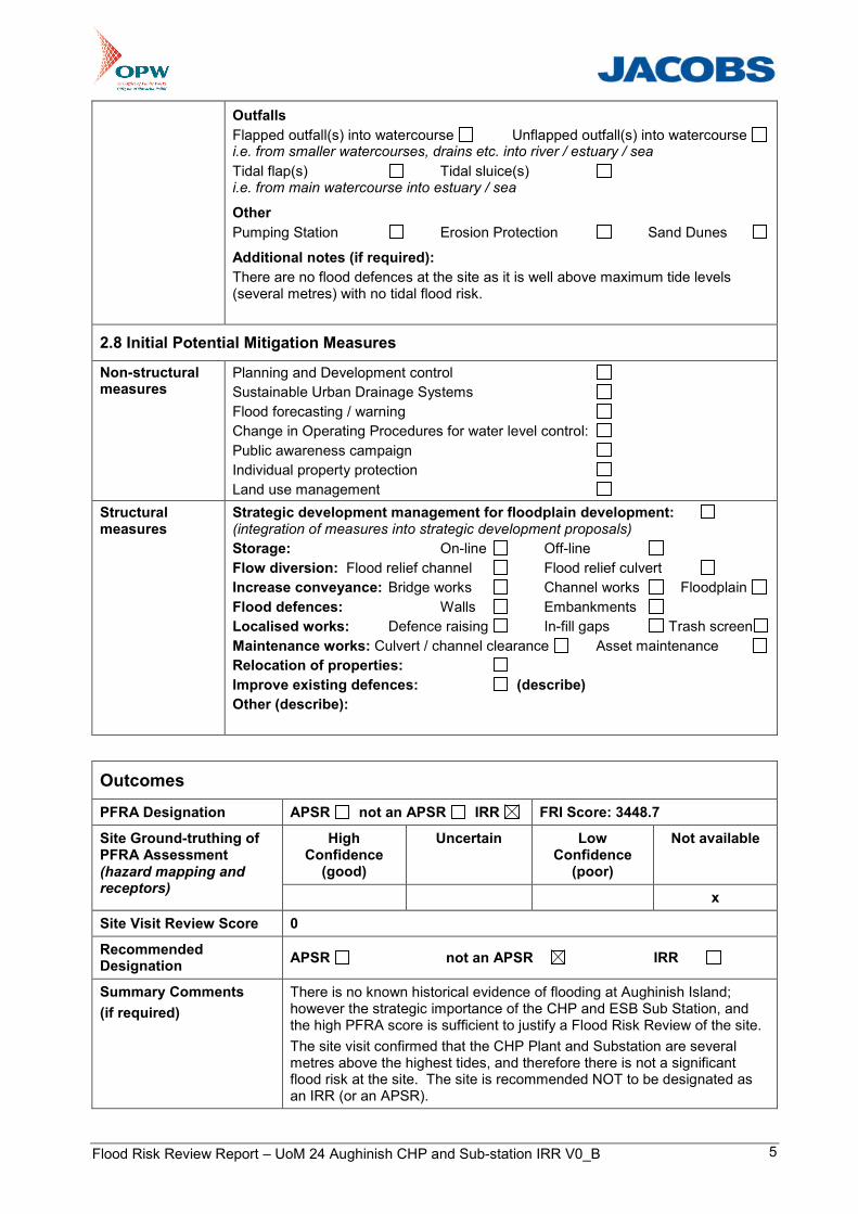
Outfalls
Flapped outfall(s) into watercourse Unflapped outfall(s) into watercourse i.e. from smaller watercourses, drains etc. into river / estuary / sea
Tidal flap(s) Tidal sluice(s) i.e. from main watercourse into estuary / sea
Other
Pumping Station Erosion Protection Sand Dunes
Additional notes (if required):
There are no flood defences at the site as it is well above maximum tide levels (several metres) with no tidal flood risk.
2.8 Initial Potential Mitigation Measures
Non-structural measures
Planning and Development control
Sustainable Urban Drainage Systems
Flood forecasting / warning
Change in Operating Procedures for water level control:
Public awareness campaign
Individual property protection
Land use management
Structural measures
Strategic development management for floodplain development: (integration of measures into strategic development proposals)
Storage: On-line Off-line
Flow diversion: Flood relief channel Flood relief culvert
Increase conveyance: Bridge works Channel works Floodplain
Flood defences: Walls Embankments
Localised works: Defence raising In-fill gaps Trash screen
Maintenance works: Culvert / channel clearance Asset maintenance
Relocation of properties:
Improve existing defences: (describe)
Other (describe):
Outcomes
PFRA Designation APSR not an APSR IRR FRI Score: 3448.7
High Confidence
(good)
Uncertain Low Confidence
(poor)
Not available Site Ground-truthing of PFRA Assessment (hazard mapping and receptors)
x
Site Visit Review Score 0
Recommended Designation
APSR not an APSR IRR
Summary Comments
(if required)
There is no known historical evidence of flooding at Aughinish Island; however the strategic importance of the CHP and ESB Sub Station, and the high PFRA score is sufficient to justify a Flood Risk Review of the site.
The site visit confirmed that the CHP Plant and Substation are several metres above the highest tides, and therefore there is not a significant flood risk at the site. The site is recommended NOT to be designated as an IRR (or an APSR).
Flood Risk Review Report – UoM 24 Aughinish CHP and Sub-station IRR V0_B 6
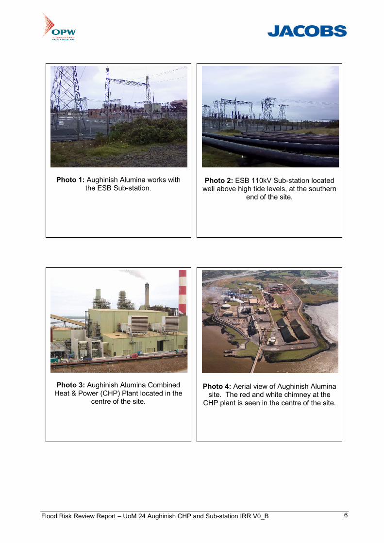
Photo 1: Aughinish Alumina works with
the ESB Sub-station.
Photo 2: ESB 110kV Sub-station located well above high tide levels, at the southern
end of the site.
Photo 3: Aughinish Alumina Combined Heat & Power (CHP) Plant located in the
centre of the site.
Photo 4: Aerial view of Aughinish Alumina site. The red and white chimney at the
CHP plant is seen in the centre of the site.
!!H
!!H
!!H
!!H
!!H
!!H
!!H
!!H
!!H
!!H
!!H
!!H
!!H
!!H
!!H
!!H
!!H
!!H
!!H
!!H
!!H
!!H
!!H
!!H
!!H
!!H
!!H
!!H
!!H
!!H
!!H
!!H
!!H!!H
!!H
!!H
!!H
!!H
!!H
!!H
!!H
!!H
!!H
!!H
!!H
!!H
!!H
!!H
!!H
!!H
!!H
!!H
!!H
!!H
!!H
!!H
!!H
!!H
!!H
!!H
!!H
!!H
!!H
!!H
!!H
!!H
!!H
!!H
!!H
!!H
!!H
!!H
!!H
!!H
!!H
!!H
!!H
!!H
!!H
!!H
!!H
!!H
!!H
!!H
!!H
!!H
!!H
!!H
!!H
!!H
!!H
!!H
!!H
!!H
!!H
!!H
!!H
!!H
!!H
!!H
!!H
!!H
!!H!!H
!!H
!!H
!!H
!!H
!!H
!!H
!!H
!!H
!!H
!!H
!!H
!!H
!!H
!!H
!!H
!!H
!!H
!!H
!!H
!!H
!!H
!!H
!!H
!!H
!!H
!!H
!!H
!!H
!!H
!!H
!!H
!!H
!!H
!!H
!!H
!!H
!!H
!!H
!!H
!!H
!!H
!!H
!!H
!!H
!!H
!!H
!!H
!!H
!!H
!!H
!!H
!!H
!!H
!!H
!!H
!!H
!!H
!!H
!!H
!!H
!!H
!!H
!!H
!!H
!!H
!!H
!!H
!!H
!!H
!!H
!!H
!!H
!!H
!!H
!!H
!!H
!!H
!!H
!!H
!!H
!!H
!!H
!!H
!!H
!!H
!!H
!!H
!!H
!!H!!H
!!H
!!H
!!H
!!H
!!H
!!H!!H
!!H
!!H
!!H
!!H
!!H
!!H
!!H
!!H
!!H
!!H
!!H
!!H
!!H
!!H
!!H
!!H
!!H
!!H
!!H
!!H
!!H
!!H
!!H
!!H
!!H
!!H
!!H
!!H
!!H
!!H
!!H
!!H
!!H
!!H
!!H
!!H
!!H
!!H
!!H
!!H
!!H
!!H
!!H
!!H
!!H
!!H
!!H
!!H
!!H
!!H
!!H
!!H
!!H
!!H
!!H
!!H
!!H
!!H
!!H
!!H
!!H
!!H
!!H
!!H !!H
!!H
!!H
!!H
!!H
!!H
!!H
!!H
!!H
!!H
!!H
!!H
!!H
!!H
!!H
!!H
!!H
!!H
!!H
!!H
!!H
!!H
!!H
!!H
!!H
!!H
!!H
!!H
!!H
!!H
!!H
!!H
!!H
!!H
!!H
!!H
!!H
!!H
!!H
!!H
!!H
!!H
!!H
!!H
!!H
!!H
!!H
!!H
!!H
!!H
!!H
!!H
!!H
!!H
!!H
!!H
!!H
!!H
!!H
!!H
!!H
!!H
!!H
!!H
!!H
!!H
!!H
!!H
!!H
!!H
!!H
!!H
!!H
!!H
!!H
!!H
!!H
!!H
!!H
!!H
!!H
!!H
!!H
!!H
!!H
!!H
!!H
!!H
!!H
!!H
!!H
!!H
!!H
!!H
!!H
!!H
!!H
!!H
!!H
!!H
!!H
!!H
!!H
!!H
!!H
!!H
!!H
!!H
!!H
!!H
!!H
!!H
!!H
!!H
!!H
!!H
!!H
!!H
!!H
!!H
!!H
!!H
!!H
!!H
!!H
!!H
!!H
!!H
!!H
!!H
!!H
!!H
!!H
!!H
!!H
!!H
!!H!!H
!!H
!!H
!!H
!!H
!!H
!!H
!!H
!!H
!!H
!!H
!!H
!!H
!!H
!!H
!!H
!!H
!!H
!!H
!!H
!!H
!!H
!!H
!!H
!!H
!!H
!!H
!!H
!!H
!!H
!!H
!!H
!!H
!!H
!!H
!!H
!!H
!!H
!!H
!!H
!!H
!!H
!!H
!!H
!!H
!!H
!!H
!!H
!!H
!!H
!!H
!!H
!!H
!!H
!!H
!!H
!!H
!!H
!!H
!!H
!!H
!!H
!!H
!!H
!!H
!!H
!!H
!!H
!!H
!!H
!!H
!!H
!!H
!!H
!!H
!!H
!!H
!!H
!!H
!!H
!!H
!!H
!!H
!!H
!!H
!!H
!!H
!!H
!!H
!!H
!!H!!H
!!H
!!H
!!H
!!H
!!H
!!H
!!H
!!H
!!H
!!H
!!H
!!H
!!H
!!H
!!H
!!H
!!H
!!H
!!H
!!H
!!H
!!H
!!H
!!H
!!H
!!H
!!H
!!H
!!H
!!H
!!H
!!H
!!H
!!H
!!H
!!H
!!H
!!H
!!H
!!H
!!H
!!H
!!H
!!H
!!H
!!H
!!H
!!H
!!H
!!H
!!H
!!H
!!H
!!H
!!H
!!H
!!H
!!H
!!H !!H
!!H!!H
!!H
!!H
!!H
!!H
!!H
!!H!!H
!!H
!!H
!!H
!!H
!!H
!!H
!!H
!!H
!!H
!!H
!!H
126000 126500 127000 127500 128000 128500 129000 129500 130000 130500
1505
0015
1000
1515
0015
2000
1525
0015
3000
1535
0015
4000
1545
00
Revision
FINAL
@ A3Drawn
Sep 07, 2011
32103000
Shannon CFRAM Study
Client
Project
Title
Drawing StatusJob No.Figure No.
Scale
Copyright reservedJacobs UK Ltd95 Bothwell Street, Glasgow, G2 7HX
Includes Ordnance Survey Ireland data reproduced under OSi Licence number EN0021011. Unauthorised reproduction infringes Ordnance Survey Ireland and Government of Ireland copyright, © Ordnance Survey Ireland, 2011.
1:15,000
0 0.3 0.60.15Km
±
IRR
Flood Risk Review Map
LegendAPSR Boundary for CARs only
@@! Historic Flooding IncidentsWater bodies mapped from RADARSAT-2 *
!!HHydrometric Gauging StationsEPA River Network
!!R Rail Stations!!N Nursing Homes
!!N Residential Care for the Elderly
!!E Schools!!] Ports and Harbours!!O OPW Buildings!!H Health Centres!!G Garda Stations!!H Hospitals!!F Fire Stations
!!#Civil Defence Head Quarters
!!o Airports
Rail NetworkRoads (National Roads Authority)Airport LandOPW EmbankmentsHistoric Flood Data
G Architectural Heritage_̂ UNESCO Sites
Special Protection AreaSpecial Area for ConservationProposed National Heritage AreaNational Heritage AreaBenefiting Lands
Flood Extents (PFRA, 2010)10% AEP Flood Extent (1 in 10 chance in any given year)1% AEP Flood Extent (1 in 100 chance in any given year)0.1% AEP Flood Extent (1 in 1000 chance in any given year)
AD/SF IB/PSChecked Approved
JCReview
KK/JM
Aughinish Island
Aughinish Island
* Data Source - Service Régional de Traitement d’Image et de Télédétection (SERTIT) (acquired on the 5th of December 2009).
The PFRA Flood Extents shown are indicative. They have been developed using simple and cost-effective methods that are suitable for the PFRA. They should not be used for local decision-making or any other purpose without verification.