Embed Size (px)
Citation preview
LizardTech Geospatial ProductsApril, 2010
2
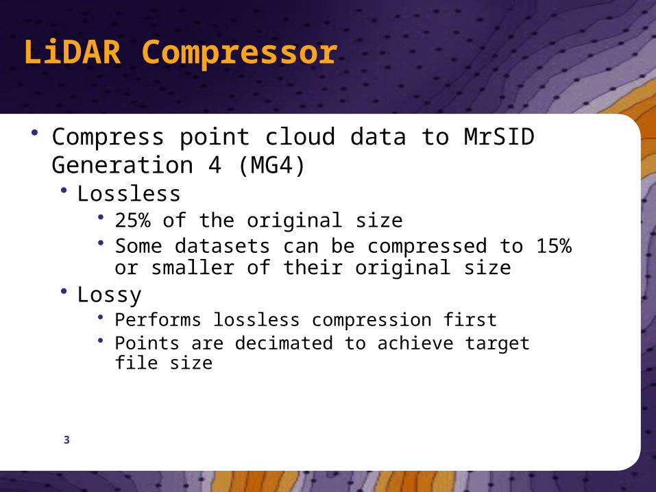
LiDAR Compressor
• Compress point cloud data to MrSID Generation 4 (MG4)• Lossless
• 25% of the original size • Some datasets can be compressed to 15% or
smaller of their original size• Lossy
• Performs lossless compression first• Points are decimated to achieve target file size
3
4
LiDAR Compressor benefits
• Rapid viewing• Easily manage your entire point cloud• MrSID Generation 4 LiDAR files are supported in:
• ESRI ArcGIS 3D Analyst• Merrick MARS® 6.0• Global Mapper 11.0• LizardTech GeoViewer
• More to come soon!
• Easy to use• Minimal training required
5
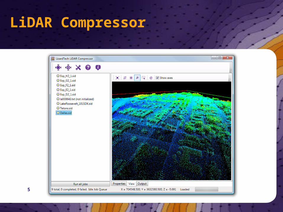
LiDAR Compressor

6
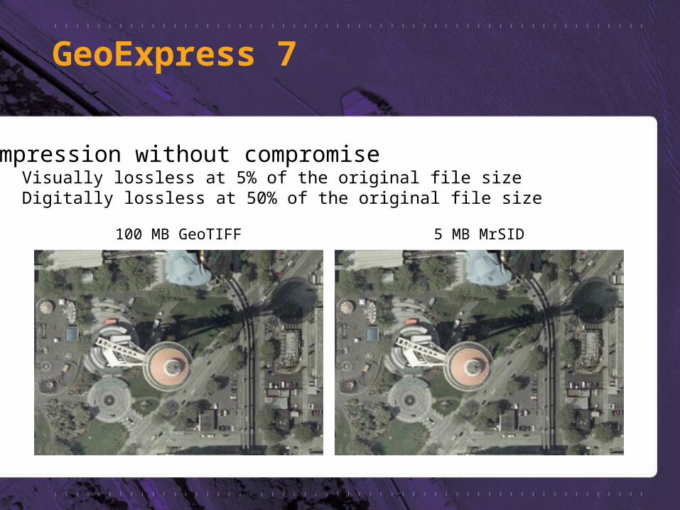
GeoExpress 7
100 MB GeoTIFF 5 MB MrSID
Compression without compromise • Visually lossless at 5% of the original file size• Digitally lossless at 50% of the original file size
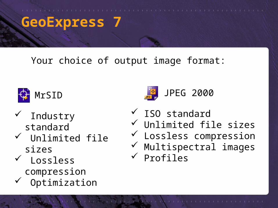
ISO standard Unlimited file sizes Lossless compression Multispectral images Profiles
Your choice of output image format:
MrSID
Industry standard Unlimited file sizes Lossless compression Optimization
GeoExpress 7
JPEG 2000
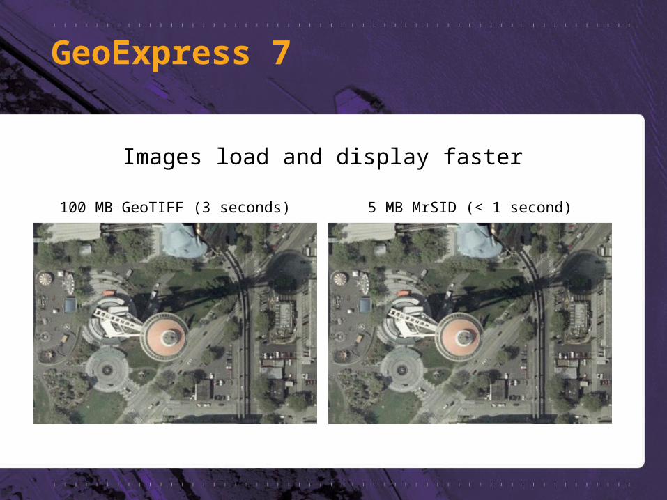
100 MB GeoTIFF (3 seconds) 5 MB MrSID (< 1 second)
Images load and display faster
GeoExpress 7
Supported in almost every major GIS application
ESRI ERDAS Bentley Autodesk Intergraph MapInfo Google Earth
and many, many others …
GeoExpress 7
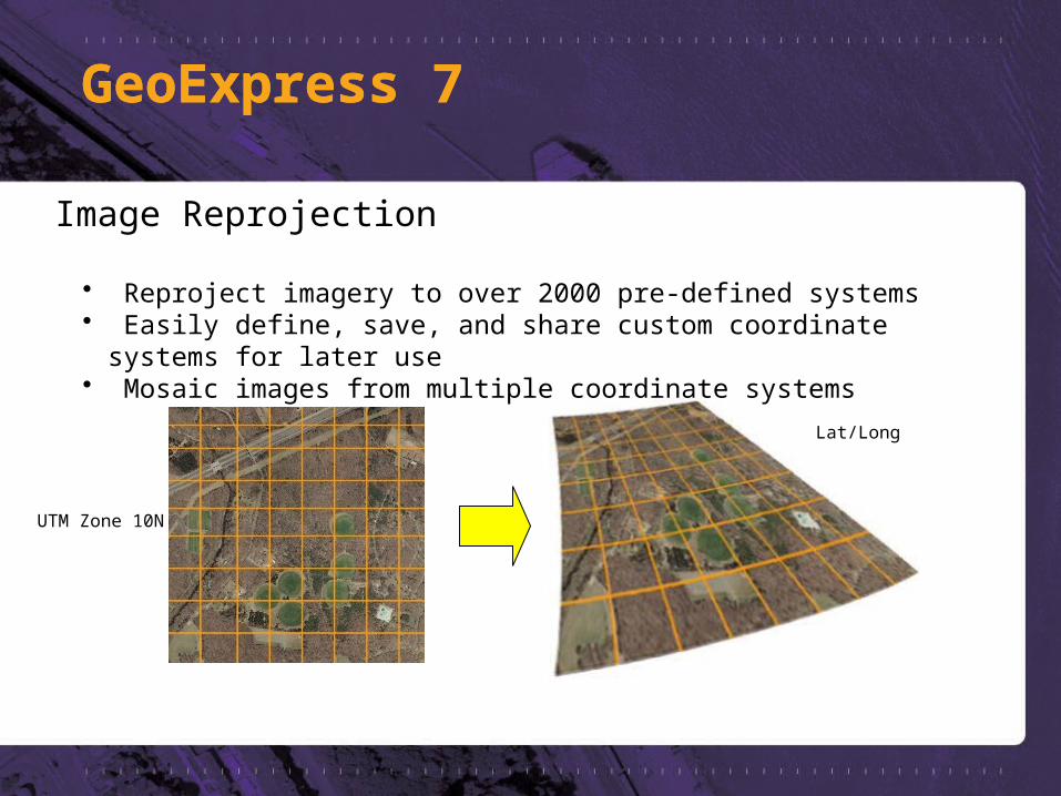
UTM Zone 10N
Lat/Long
Image Reprojection
• Reproject imagery to over 2000 pre-defined systems• Easily define, save, and share custom coordinate systems for later use• Mosaic images from multiple coordinate systems
GeoExpress 7GeoExpress 7
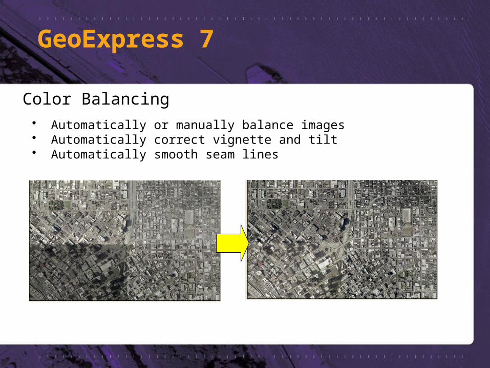
Color Balancing• Automatically or manually balance images• Automatically correct vignette and tilt• Automatically smooth seam lines
GeoExpress 7GeoExpress 7
GeoExpress 7
• “Despeckling” tools in GeoExpress 7• Compress “collar” areas of imagery losslessly• Retain color values• No speckling
• Apply to old datasets to clean up edges
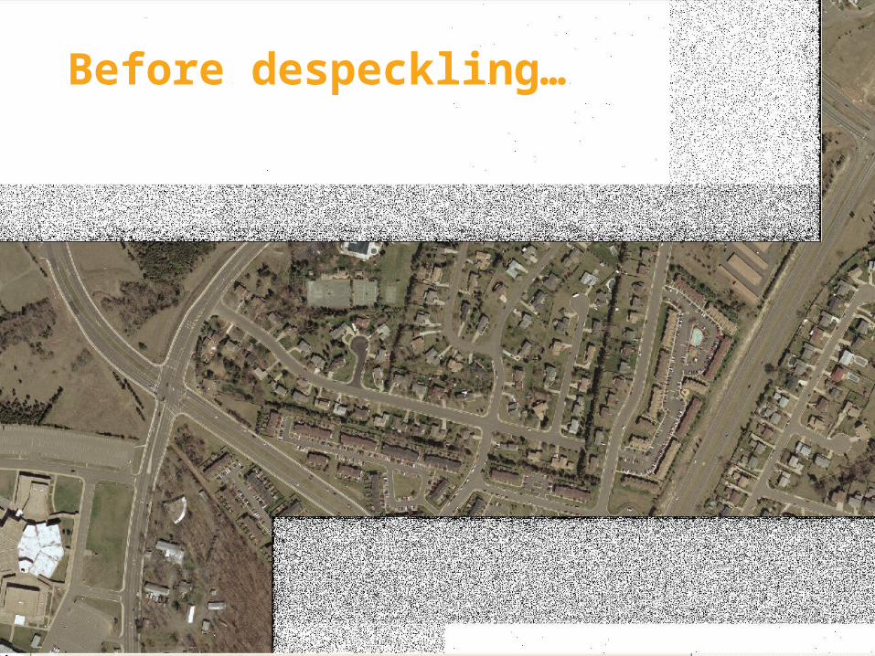
Before despeckling…
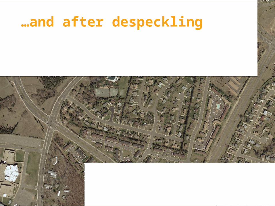
…and after despeckling
• Rapidly deliver large datasets of raster imagery to any device – ever over low bandwidth connections
• Satisfy more image requests faster
• Increase the speed of delivery without any additional investment in hardware or bandwidth
• Easy to set up and easy to administer
Express Server

• Works with existing image servers • View your maps up to 25 times faster than with ArcGIS
Server or ArcGIS Image Server alone
• Serves imagery to most GIS applications • Work with remote datasets hundreds of gigabytes in size
right on your desktop
• WMS Support delivers imagery to any WMS client
Express Server
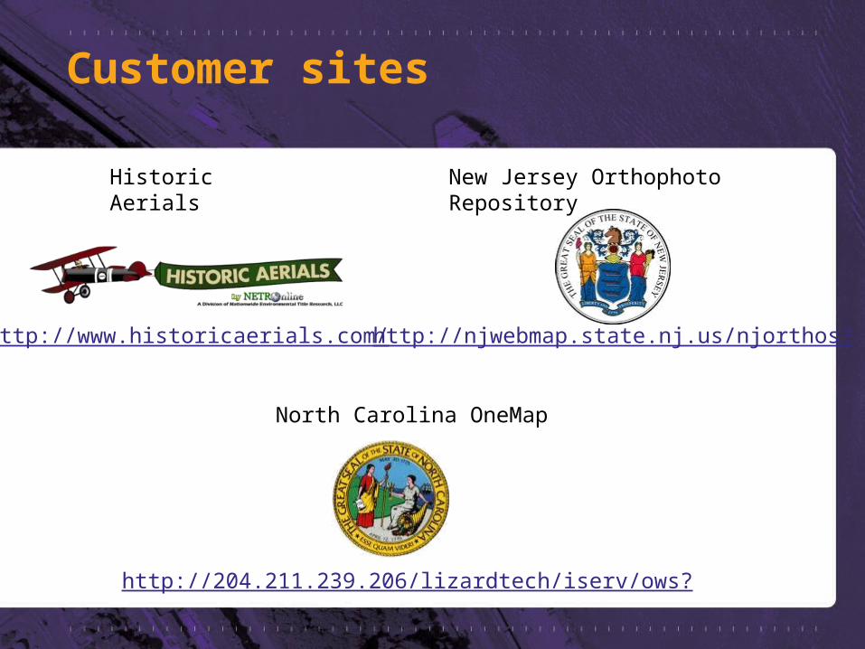
http://www.historicaerials.com/
http://204.211.239.206/lizardtech/iserv/ows?
http://njwebmap.state.nj.us/njorthos?
Customer sites
North Carolina OneMap
Historic Aerials New Jersey Orthophoto Repository
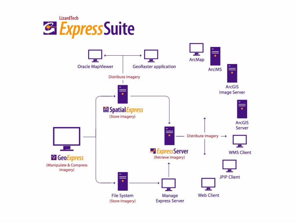
Spatial Express
• Store MrSID and JPEG 2000 imagery in Oracle Spatial
• Save storage space• Use just 5% of the normal space required for
storage• Easily viewable
• View imagery in nearly any application via WMS using LizardTech Express Server
• Viewable in packages built with Oracle GeoRaster
19
20
21


![MrSID: A Modern Geospatial Image Format · 123 123 123, you might instead be able to code it using a sort of shorthand notation like 123[5] in which you store the value only once](https://img.pdfslide.us/doc/110x75/6006e43f52131e0e9952fecd/mrsid-a-modern-geospatial-image-123-123-123-you-might-instead-be-able-to-code.jpg)