Embed Size (px)
Citation preview
New Port Richey 2030 Comprehensive Plan
Livable City Element
Livable City Element March 21, 2016

New Port Richey 2030 Comprehensive Plan
Livable City Element
[This page intentionally left blank.]
Livable City Element
March 21, 2016
New Port Richey 2030 Comprehensive Plan
Page LIV-i
Table of Contents I. Purpose ....................................................................................................................... LIV-1
II. Background ................................................................................................................. LIV-2 Urban Fabric ....................................................................................................................................LIV-2 Community Vision ...........................................................................................................................LIV-3
III. Components of Livable City Design .......................................................................... LIV-3 City Level Design ............................................................................................................................LIV-4 Neighborhood Level Design ......................................................................................................... LIV-11 Street Level Design ...................................................................................................................... LIV-12 Site Level Design ......................................................................................................................... LIV-15
IV. Plan to Address Needs ............................................................................................. LIV-17
V. Goals, Objectives and Policies ................................................................................ LIV-19 Introduction ................................................................................................................................... LIV-19 Implementation ............................................................................................................................. LIV-19
Goal 1: City Level Design ........................................................................................................... LIV-19
1.1 Traditional Neighborhood Design ....................................................................... LIV-19 1.2 Mixed Use .......................................................................................................... LIV-21 1.3 CPTED ............................................................................................................... LIV-22 1.4 Sustainability ...................................................................................................... LIV-23 1.5 Open Space ....................................................................................................... LIV-24 1.6 Creative Space ................................................................................................... LIV-26 1.7 Outdoor Gathering Space .................................................................................. LIV-27 1.8 Public Infrastructure ........................................................................................... LIV-28 1.9 Schools ............................................................................................................... LIV-29 1.10 Streets and Alleys Network ................................................................................ LIV-30 1.11 Greenways and Trails Network .......................................................................... LIV-31 1.12 Public Library ...................................................................................................... LIV-32
Goal 2: Neighborhood Level Design ........................................................................................... LIV-33
2.1 Neighborhoods ................................................................................................... LIV-33 2.2 Centers ............................................................................................................... LIV-35 2.3 Employment Districts.......................................................................................... LIV-37 2.4 Corridors ............................................................................................................. LIV-38 2.5 Compatibility ....................................................................................................... LIV-40
Goal 3: Street Level Design ........................................................................................................ LIV-43
3.1 Pedestrian Network ............................................................................................ LIV-43 3.2 Pedestrian Crossings ......................................................................................... LIV-45 3.4 Accessibility ........................................................................................................ LIV-46 3.5 Bicycle Network .................................................................................................. LIV-47 3.6 Transit Network .................................................................................................. LIV-49 3.7 Transit Amenities ................................................................................................ LIV-50 3.8 Street Planning ................................................................................................... LIV-51 3.9 Safety and Traffic Calming ................................................................................. LIV-52 3.10 Streetscape ........................................................................................................ LIV-53
Goal 4: Site Level Design ........................................................................................................... LIV-55
Livable City Element
March 21, 2016
New Port Richey 2030 Comprehensive Plan
Page LIV-ii
4.1 Development Pattern.......................................................................................... LIV-55 4.2 Building Setbacks ............................................................................................... LIV-57 4.3 Parking ............................................................................................................... LIV-58 4.4 Site Access and Circulation ............................................................................... LIV-59 4.5 Building Façade .................................................................................................. LIV-60 4.6 Signs................................................................................................................... LIV-62
Appendix Community Vision (Major Issues and Visioning Workshop) .......................... Livable City Element Appendix Neighborhood Compatibility-Related Regulations ......................................... Livable City Element Appendix Definitions .................................................................................................... Livable City Element Appendix
List of Tables Table LIV-1 Proposed Gateway Locations .................................................................................... LIV-12

Livable City Element
March 21, 2016
New Port Richey 2030 Comprehensive Plan
Page LIV-1
I. Purpose
The purpose of the Livable City Element is to articulate the community’s general urban design preferences with respect to public and private property and to establish goals, objectives and policies to guide land developers and City decision makers in the development of sustainable neighborhoods and quality places. The element addresses citywide urban design issues involving sites, buildings, civic space, public ways, cultural resources, and infrastructure. The Livable City Element represents an optional element per §163.3177(7)(f), FS. Livable refers to the environmental and social quality of an area as perceived by the people who live, work or visit there. Factors of livability includes safety and health (traffic safety, personal security and public health), local environmental conditions (cleanliness and noise, air and water quality), quality of social interaction (neighborliness, respect for other community members, community identity and pride), opportunities for recreation and leisure, aesthetics (beauty in the built and natural environments), and unique cultural and ecological resources (historic structures, creative communities and wildlife habitat). Communities are a web of interactions among the environment, the economy and society. The concept of sustainability involves an integrated view of the community within its various contexts (neighborhood, region, world, etc.) to create and sustain healthy environments, healthy economies, and social equity. The Livable City Element is intended to enhance community livability, sustainability and quality of life through acknowledgement of the following livable community and smart growth principles: Development Pattern
The pattern and design of the community should be made to enhance the lifestyles and needs of its residents. Plan policies, land development regulations and decision making should reinforce good design.
Integrated Community
Planning should result in complete and integrated communities containing housing, shops, work places, schools, a library, parks and civic space essential to the daily life of the residents. The community should have a center focus that combines commercial, civic, cultural and recreational uses.
Community Building
Community involves the various ways a collection of people with some shared elements interact within a setting. At the City and neighborhood levels, community building is supported by physical settings that provide opportunities for social interaction.
Context Sensitivity
New development, redevelopment and public facilities projects should relate to the context of the neighborhood it will be joining. Compatibility issues are usually not as much use-related as they are design-related. When livable design principles are employed, different uses can fit together better to benefit the entire area.
Livable City Element
March 21, 2016
New Port Richey 2030 Comprehensive Plan
Page LIV-2
Reduced Auto Dependence
Development patterns that balance alternative modes of travel can produce communities in which life can be lead without total reliance on the automobile. Neighborhoods should be designed so that housing, jobs, daily needs and other activities are within easy walking distance of each other. As many activities as possible should be located within walking distance of transit stops. Streets, pedestrian paths and bike paths should contribute to a system of fully-connected and interesting routes to all destinations. Street design should encourage pedestrian and bicycle use by being small-scale and spatially defined by buildings, trees and lighting; and by discouraging high speed traffic.
Usable Open Space and Public Space
The community should contain an ample supply of specialized open space in the form of squares, greens and parks whose frequent use is encouraged through placement and design. Public spaces should be designed to encourage the attention and presence of people.
Balanced Mix of Housing and Jobs
A community should contain a diversity of housing types to enable citizens from a wide range of economic levels and age groups to live within its boundaries. Businesses within the community should provide a range of job types for residents.
Resource Conservation
Wherever possible, the natural terrain, drainage and vegetation of the community should be preserved with superior examples contained within parks, greenbelts or greenways. Community design should help conserve resources and minimize waste. Communities should provide for the efficient use of water through the use of natural drainage, drought tolerant landscaping and recycling. Street orientation, building placement and the use of shade should contribute to the energy efficiency of the community.
Protect and Enhance Neighborhood Identity
Plans and design standards for individual neighborhoods or districts can help protect and enhance what is unique and valued. Addressing needs and providing some predictability of the future can reinforce neighborhood identity and sense of pride and ownership.
The Livable City Element is also supported by goals, objectives and policies of the Future Land Use, Transportation and Recreation and Open Space elements. Revisions to the New Port Richey Land Development Code will be necessary for meaningful implementation of this element.
II. Background
Urban Fabric A frequent sentiment expressed by the New Port Richey community is fondness for its small town character. This character is likely a reflection of the traditional neighborhood development (TND) form that is representative of many City neighborhoods and the village scale of its downtown. The grid network of small-scale streets provides a high level of connectivity between neighborhoods and community places. It is common to see children walking or riding bicycles to school, the library, or neighborhood stores. Walkable and relatively compact neighborhoods,
Livable City Element
March 21, 2016
New Port Richey 2030 Comprehensive Plan
Page LIV-3
especially near Downtown, are conducive to a strong sense of community. Downtown is a community focal point offering activities for all segments of the population. Local traditions of community life are kept alive through the support of the City and a wide range of community organizations. Festivals and events are inclusive and accessible by all members of the community. In older portions of the City, the grid of blocks, small rectangular parcels, and narrow streets and alleyways establishes a fine-grained development pattern that is generally pleasant for the pedestrian. The pattern is reinforced by streets lined with trees, residential buildings set back behind front gardens, and buildings typically one- to two-stories in height. In the newer parts of the City, typically those areas built after 1950, street patterns and building placement are oriented to the automobile. In the newer commercial areas, buildings are usually set behind parking lots located along the street. Parking lot landscaping and buffering is minimal. Community Vision In 2005 at the outset of the Comprehensive Plan update, the City held a Major Issues and Visioning workshop to identify the community’s major issues and vision for future physical environment. During the workshop, the community expressed the need for improved aesthetics within commercial corridors and residential areas. Urban design and appearance-related preferences included street beautification, landscaped parking areas, gateways, public art, architectural and site design standards and effective code enforcement. The workshop participants also indicated needs for greater variety in transportation options. The community asked that there be more mobility options in the City so that people could walk, bicycle or use transit in lieu of driving to every destination. The local vision also included safer streets and adequate and context-sensitive downtown parking. The workshop also revealed the community’s high regard for the municipal library, which serves as major Downtown destination for all segments of the permanent, seasonal and visitor populations.
III. Components of Livable City Design
The physical elements that create community are defined by the functions and relationships of its different parts. The City has neighborhoods, commercial centers and employment districts where the activities of daily life take place. An understanding of the linkages and connections between these places, and within the region, is critical to integrated land use and transportation planning that is also supportive of community. The components of livable city design are organized in this section under the four categories listed below. These categories range from broad spectrum elements under city level design to the fine-grained design treatments in site level design.
City Level Design Neighborhood Level Design
Street Level Design Site Level Design

Livable City Element
March 21, 2016
New Port Richey 2030 Comprehensive Plan
Page LIV-4
City Level Design Architecture of Engagement Physical design constitutes an independent variable that influences social structure. Elements such as front porches, civic spaces and well-designed streets encourage neighbors to come together and form a community. This supports the recent position of social science that social connectedness and civic engagement contribute to the health, vitality, and stability of a community.1 Before a person engages any community, he or she needs to make human contact. Architecture of engagement structures space in a way that maximizes social interaction so that individuals can build the trust that underlies the social order. These spaces lead to the formation of social capital, which in turn benefits communities by providing linkages between the individual and society that are essential to economic and social life. While there are limits to what can be accomplished by applying physical remedies alone to long-standing social and economic problems, economic vitality, community stability, and environmental health cannot be sustained without a coherent and supportive physical framework.2 City Scale Scale is the relationship of various parts of the environment to each other, to people and to the limits of perception. It is what establishes some neighborhoods or streets as pedestrian-oriented and others as automobile-oriented. For example, Downtown is representative of a pedestrian-orientation, while the US 19 corridor has an automobile-orientation. Livable community design principles promote pedestrian-orientation (or human-scale) in land use and transportation decisions that affect the physical environment. City Structure The City structure is comprised of neighborhoods, centers and employment districts. These areas are interconnected by streets, public transit corridors, sidewalks and footpaths. Highways and limited regional public transit enable workers to commute to major employment centers outside the City. Neighborhoods should be within walking distance of neighborhood centers, parks, schools and other community facilities. The neighborhood environ-ment should be walkable and bikeable and have safe and convenient connections to transit and other neighborhoods. Infill development and redevelopment activity envisioned for City neighborhoods is mostly small-scale, representing subtle increases in density and building design that is compatible with neighborhood character.
1 Langdon, Phillip. 1997. Can Design Make Community? Responsive Community.
2 Charter, Congress for the New Urbanism, 1996.
“…a well-designed city is walkable. It’s a place where your destinations are close enough to walk to and where you feel safe enough to walk. And it’s a place that is interesting enough socially to make you feel that walking is perhaps something more than just getting from point A to point B.”
Peter Calthorpe, Author The Next American Metropolis
Livable City Element
March 21, 2016
New Port Richey 2030 Comprehensive Plan
Page LIV-5
Larger-scale developments should be directed to designated Centers. Centers are mixed use nodes that are appropriately sited along designated public transit corridors to serve the region, several neighborhoods, or a single neighborhood. As such, centers differ in form, intensity, and function. In all cases, they serve as a focus for community life and may include public facilities like schools and civic buildings. Centers are distributed throughout the City and are within walking or bicycling distance of virtually all City residents. Neighborhood Centers
Neighborhood centers are small retail centers with a primary trade area limited to the immediate surrounding area. These centers include a variety of neighborhood-scale retail shops and offices oriented toward the everyday needs of surrounding residents. Carefully sited and designed “mom and pop” retail stores can enhance quality of life in neighborhoods by providing convenience and opportunities for social engagement. Streets provide walking and biking connections from adjacent neighborhoods. Residents can walk to buy a carton of milk, avoiding a car trip and meeting neighbors along the way. Neighborhood centers also create public gathering spaces, which help build a sense of community.
Multi-Neighborhood Centers
Multi-neighborhood centers are retail shopping centers or districts that serve more than one neighborhood with a diverse mix of uses including retail, service, office, and residential. One- and two-story buildings with storefront windows, entries, and outdoor seating areas create a pedestrian-friendly atmosphere. Plazas and parks provide public gathering spaces around which retail uses are clustered. Transit service links these centers to other City and County centers.
Regional Centers
It is possible for automobile-oriented environments to be transformed to more livable places through application of livable community design principles in conjunction with private major redevelopment projects and public infrastructure projects. Linear patterns of highway commercial development could be reconfigured at key locations to regional centers, activity centers of city and regional significance. A mix of shopping, offices and some housing within two- and three-story buildings with ground floor shops would have trip reduction benefits and add units and variety to the local housing stock. Trees, benches, outdoor seating areas, sidewalks, plazas, and other amenities would make side streets pedestrian-friendly. Transit service is highly accessible and frequent on US 19, a prime target for revitalization and redevelopment.
Employment Districts in the City include the areas surrounding North Bay Hospital and Community Hospital. These relatively large areas of the City are dominated by job-generating land uses and some retail and service uses. Livable community design employed within employment districts can generate a stronger sense of community to those who work or live here and strengthen connections between these areas and the rest of the City. Improved bicycle and pedestrian circulation, transit service and housing opportunities for employees could reduce parking demand in these areas. Infill and redevelopment along Public Transit Corridors should be designed in accordance with transit-oriented development (TOD) principles. Components of TOD include walkable

Livable City Element
March 21, 2016
New Port Richey 2030 Comprehensive Plan
Page LIV-6
design with pedestrian as the highest priority; transit station as the prominent feature of the center; a mix of uses in close proximity including office, residential, retail, and civic uses; higher density, high-quality development within 10-minute walking radius surrounding center transit station; collector support transit systems (e.g., trolley); accessible by bicycles; reduced and managed parking inside 10-minute walk circle around the center transit station. Center Focus Communities should have an appropriately-scaled and economically healthy center focus. At the city level, a wide range of commercial, residential, cultural, civic and recreational uses should be located in a Multif-Neighborhood or Regional Center, like Downtown. At the neighborhood level, Neighborhood Centers should contain local businesses that serve the daily needs of nearby residents. Street and Alleyway Network Street design for conventional suburban development is characterized by a hierarchical, tree-like pattern that proceeds from cul-de-sacs and local streets to collectors to wide arterials. The organization of the network collects and channels trips to higher capacity facilities. The use of streets in residential areas for through-traffic is minimized by limiting access by constructing few perimeter intersections, reducing interconnections between streets, and by using curving streets and cul-de-sacs. Where this layout is employed, automobiles are the most convenient choice for all trips, short and long. The street layout forces longer, less direct auto travel when street connections are missing. This hierarchical street layout reflects the guiding principle that streets on which residences front should serve the least traffic possible. At best, only vehicles traveling to or from the homes on a given street would ever appear on that street. There would be little or no through-traffic, hence the prevalence of cul-de-sacs. Traffic from residential streets is quickly channeled through the street hierarchy to collectors and then to arterials. Only arterials provide direct connectivity between land uses and other neighborhoods. Under this scenario, congestion on arterials is common. Traditional neighborhood development calls for an interconnected (grid) network of streets and sidewalks to disperse vehicular trips and to make human powered modes of travel (such as walking and biking) practical, safe, and attractive for short trips. This type of street network is representative of the City’s downtown neighborhoods which exhibit many aspects of TND. The TND street pattern can also have a hierarchy, with some roadways designed to carry greater traffic volumes. However, a basic assumption is that neighborhood streets that serve local residential trips can also safely serve other neighborhood trips and some through-traffic. For example, a street with 40 homes would need to carry about 20 vehicle trips during the peak hour. The effective capacity of this street could easily be 200 vehicles per hour without a significant effect on safety or environmental quality. By limiting the access to the street as in a suburban street layout, 90 percent of its effective capacity is wasted. Nearby arterials must make up the difference. By eliminating dead ends and designing all streets to be interconnected, neighborhoods provide multiple route choices for trips. By using narrow streets and by constructing more of them, more

Livable City Element
March 21, 2016
New Port Richey 2030 Comprehensive Plan
Page LIV-7
(yet smaller) intersections are created. In concept, therefore, overall network capacity is increased, traffic is dispersed, and congestion is reduced in communities with this type of street layout. Alleys are important components of a livable community due to increased opportunities for traffic circulation and safety and redevelopment options. Alleys afford design flexibility by allowing narrow lots with fewer driveways on local streets. Fewer driveways also mean more affordable, smaller home sites and more space for on-street parking, especially if homeowners use the alleys for vehicular access, parking, and utilitarian activities. Alleys provide space for underground or unattractive overhead utilities while freeing streets for trees and other plantings. Alleys also can be used for trash storage and collection and emergency vehicle access. Alleys eliminate residential driveways and the need for backing up onto the street, which would otherwise occur and is inherently unsafe. Greenways and Trails One of the greatest challenges in city revitalization is attracting people back from the suburbs. Greenways and trails are valued for their ability to connect people with places and enhance the beauty of neighborhoods and centers. These facilities contribute to community livability, improve the economy through tourism and civic improvement, preserve and restore open space and provide opportunities for physical activity to improve fitness and mental health. Greenways are corridors of protected open space managed for conservation and recreation purposes. Greenways often follow natural land or water features, and link nature reserves, parks, cultural features and historic sites with each other and with populated areas. Greenways can be publicly or privately owned, and some are the result of public/private partnerships. Some greenways include trails, while others do not. Trails are corridors used for walking, bicycling and other forms of recreation and transportation. Trails connect residential areas with retail areas, neighborhoods with schools, and homes with work. Trails provide safe and pleasant environments for people to commute either to work or to public transit. They also encourage people to enjoy the outdoors. If planned properly, they can provide an alternate route for commuting, reducing air pollution and traffic congestion. Public Space In addition to a network of streets, civic structures and open public spaces establish a well-defined civic realm. Civic buildings and public activities need appropriate, visible public settings in the form of parks and squares bounded by streets. In the best traditional neighborhoods, continuity exists between parks and public spaces and the network of streets serving the neighborhoods. These public spaces function as landmarks and anchors for the community and become an integral part of its identity and image. Public spaces should be the focus of building orientation and neighborhood activity. New Port Richey is home to various public facilities including schools, parks, government buildings and parking lots. These facilities could serve as centers for public life in neighborhoods that do not have a nearby commercial center. This role could be encouraged by physical changes that create informal gathering places, bicycle and pedestrian access, lighting for night time use, and in some cases, small-scale retail services such as cafes. For instance, a school parking lot is

Livable City Element
March 21, 2016
New Port Richey 2030 Comprehensive Plan
Page LIV-8
transformed into a public gathering place when it is used for a Saturday morning farmer's market. Scenic Vistas and Viewsheds While scenery is important to the overall quality of communities, scenic vistas and viewsheds are often destroyed during rapid change, both in the natural and built environments. Identification and protection of these assets is an important component of smart growth and scenic stewardship. Scenic areas endow communities with substantial benefits, such as higher property values and increased tourism revenue. Protecting scenic vistas and viewsheds from the effects of haphazard development allows a community to preserve its unique charm, build civic pride, and attract positive growth to the area. Water bodies and natural landscapes are picturesque and serene and make a community unique and memorable. New Port Richey is fortunate to have the natural beauty of the Pithlachascotee River as scenic backdrop to Downtown and parks throughout the City. Efforts should be made to protect scenic viewsheds of this significant aesthetic resource. Cultural Environment Historical Resources Historic places tell a community where it came from -- what previous generations achieved, what they believed, what they hoped to be. Historic structures usually exhibit rich architectural traditions that are seldom replicated in contemporary structures. The style and variety of historic buildings make them aesthetic assets and focal points in a community and often the foundation for design themes in architectural standards and guidelines. Public Art Public art can enrich any environment in the City. New Port Richey has begun to create public spaces with works of art, ranging from sculpture at civic locations to building murals in the Downtown. While the City has no public art requirement, there is an interest in exploring ways to integrate art into development projects. The City recently adopted an ordinance that encourages contributions to public art. Creative Sector Cities are placing a renewed interest in the economic and community development benefits that the presence of a multi-tiered, creative community provides. The benefits of the creative sector range from sources of tax revenue and employment to neighborhood revitalization to cultural tourism. The space needs of the City’s cultural assets should be considered—in particular, the non-profit and for-profit, small to mid-sized creative enterprises and individuals that revitalize neighborhoods, generate taxes and provide jobs, and inspire our quality of life. Proximity to others in the creative community promotes innovation, collaboration and creative social networks, which generates thriving enterprises and a cohesive cultural community. For example, the municipal library serves as a vehicle for cultural tourism and economic development through its digital connections, community partnerships, public programs and proximity to the Downtown activity center.
Livable City Element
March 21, 2016
New Port Richey 2030 Comprehensive Plan
Page LIV-9
Utility Structures Vertical and Aerial Structures Utility structures are often visually unattractive. Screening and buffering should be used to obstruct ground-level views of unattractive utility structures. Special treatments (e.g., murals or architecture), applied to large utility structures (e.g., water tower) can convey historical or cultural aspects of the community and transform a negative or neutral feature into an element of community pride. The use of underground utilities is a significant way of reducing visual clutter in the streetscape, while decreasing the vulnerability of aerial equipment to severe weather. Stormwater Facilities Development-related stormwater ponds often create gaps in the urban fabric and thereby clash with the function and aesthetics of neighborhoods and centers. Regional stormwater retention systems support compact development, pedestrian-orientation, community aesthetics and water quality objectives by eliminating the requirement for stormwater ponds serving individual developments. Rather, the stormwater impacts from individual developments can be integrated into larger municipal stormwater facilities funded with a payment in lieu of program. In addition to improved water quality treatment afforded through proper maintenance by the City, these water features can be designed as an urban amenity (e.g., water feature) and provide incentive for redevelopment of parcels with site constraints. Street Lighting Street lighting and outdoor lighting of public space can provide excess illumination creating glare and undesirable illumination of surrounding properties and the night sky. Well-designed outdoor lighting predominantly illuminates the intended object or area, uses the lowest foot-candle to serve the purpose, and renders good color that enhances vision. Maintenance Cleanliness and orderliness are important in an urban setting due to the compactness of buildings and public spaces, number of users and modes of travel. Swept sidewalks and trails, debris-free curbs, landscape beds and parking lots, and clean storefront windows are more noticeable when traveling by foot or bicycle. The City has a maintenance program for streets, sidewalks, parks, public parking lots and other features of the public realm. In the private realm, the general upkeep of residential and commercial properties can greatly influence community appearance and the. To address code violations, the City has increased code enforcement staff and implemented a proactive versus complaint-based approach to identifying code violations. A City ordinance requires that rental housing be registered with the City to facilitate notice and resolution of code compliance issues. Additionally, the Greater New Port Richey Main Street organization promotes Downtown business owners to maintain storefronts and display areas, as prescribed by the Florida Main Street Program.
Livable City Element
March 21, 2016
New Port Richey 2030 Comprehensive Plan
Page LIV-10
Crime Prevention through Environmental Design The Crime Prevention through Environmental Design (CPTED) theory is that the proper design and effective use of the built environment can lead to a reduction in opportunities for crime and improvement in quality of life. CPTED was originally developed to reduce crime in public housing projects, but it is a concept that is also applicable to all areas of a community. The principles of CPTED can be used to effectively secure one building or an entire city. Crime Prevention through Environmental Design (CPTED) Principles:
Defensible Space Defensible space is the term used to describe an area that has been made a "zone of defense" by the design characteristics that create it. Under the defensible space guidelines, all areas are designated as either public, semi-private or private. This designation defines the acceptable use of each zone and determines who has a right to occupy it under certain circumstances.
Territoriality
Territoriality involves an individual's perception of, and relationship with, the environment. A strong sense of territoriality encourages an individual to take control of his or her environment and defend it against attack. A sense of territoriality is fostered by architecture that allows easy identification of certain areas as the exclusive domain of a particular individual or group. This feeling is enhanced when the area involved is one the individual can relate to with a sense of pride and ownership. It is not enough for a person simply to be able to defend his environment; he must also want to defend it. “Want" results from territorial feelings of pride and ownership.
Surveillance
Surveillance is the principal weapon in the protection of a defensible space. Criminals are least likely to act when there is a high risk of their actions being witnessed. Environments in which legitimate occupants can exercise a high degree of visual control increase the likelihood of criminal acts being observed and reported. Types of surveillance include informal or natural surveillance (direct result of architectural design) and formal surveillance (e.g., electronic monitoring).
Lighting
Good lighting is one of the most effective crime deterrents. When used properly, light discourages criminal activity, enhances natural surveillance opportunities, and reduces fear. As used in CPTED, lighting also plays a part in creating a feeling of territoriality. Lighting can influence an individual's feelings about his environment from an aesthetic as well as a safety standpoint. A bright, cheerful environment is much more pleasing than one that appears dark and lifeless.
Livable City Element
March 21, 2016
New Port Richey 2030 Comprehensive Plan
Page LIV-11
Landscaping Landscaping design plays a significant role in CPTED. As a symbolic barrier, landscaping can mark the transition between zones. Features such as decorative fencing, flower beds, ground cover, and varied patterns in cement work can clearly show separation between zones. If more substantial barriers are needed, shrubbery such as evergreen hedges can be used to create more formidable obstacles. Another function of landscaping in crime prevention is aesthetics. Again, an attractive environment generates a sense of pride and ownership.
Physical Security
The proper application of security hardware and the elimination of security weaknesses from a structural standpoint can have a significant impact on future crime problems. As an element of CPTED, physical security planning is not intended to create an impenetrable fortress. The goal is merely to make penetration more difficult and time-consuming. Degree of difficulty and length of delay are key factors in reducing the probability that crime will occur.
Neighborhood Level Design Neighborhood Identity Having a distinctive identity will help neighborhoods create a quality of life that is attractive for business retention and future residents and private investment. Planning efforts should help to create and preserve each neighborhood's sense of uniqueness, attractiveness, history, and cultural and social diversity, and include public gathering places and a strong local sense of place. Compatible Development The neighborhood is the smallest organizing unit of the city structure. As identified in Map LIV-1, there are 19 neighborhoods in the City, each with its own distinct character and contribution to the overall community. Each neighborhood is a living reminder of the architectural styles, building materials, scale, and street patterns that were typical at the time of its development. Neighborhood integrity can be conserved or enhanced if the construction of new homes, additions, and remodeling responds to the prevailing scale, form, and materials. With a sparse inventory of vacant, developable land in the City, vacant parcels within and on the periphery of established residential areas will be the focus of future development and redevelopment activity. Population growth and a changing regional demographic is creating demand for larger housing than was called for when the local housing market catered to retiree households and seasonal residents. It is anticipated that the private sector will respond to current housing needs and preferences within the context of escalating real estate costs by providing larger single-family units, townhouses, multi-family developments and mixed use developments with a residential component. With guidance, the physical and functional aspects of new development can reinvigorate neighborhoods by enhancing appearance, safety, efficiency, and cohesiveness. Design issues in City neighborhoods include compatible renovation of homes and redevelopment of home sites and making streets more pedestrian-friendly through site and
Livable City Element
March 21, 2016
New Port Richey 2030 Comprehensive Plan
Page LIV-12
building design. In the past, multi-plex housing developments introduced into single-family neighborhoods did not emulate the development character of the neighborhood. Often, these tri-plex and quadra-plex buildings were designed with entrances facing the interior of the development rather than the street and parking lots in front yard areas. As change occurs, the balancing of new development with neighborhood character is essential. Modernization of the aging housing stock, addition of higher density residential development and mixed use development, and neighborhood serving commercial developments must be designed in a manner that recognizes and respects the unique features and characteristics of neighborhoods, thereby ensuring continued enjoyment of the City’s small town character and unique quality of life. Gateways Community identity is strengthened when the entrances to the City and its neighborhoods are clear and memorable. Gateways convey a sense of arrival and place and may include some combination of special landscaping, quality signage, public art or architecture, and traffic control (e.g., traffic circles). Gateways can terminate a vista by creating an end point on the street where the eye stops and registers a memorable vision. Examples of terminal vistas include bell towers, stately trees, civic buildings (library, museums), monuments, church steeples, public art or other objects of cultural or historical significance. Gateways can also contribute to traffic calming. The City recognizes the importance of gateways at major entrances to the City and distinctive signage at key entry points in neighborhoods. The Redevelopment Plan proposes the locations listed in Table LIV-1 for future gateways. Neighborhood plans also identify locations for gateway treatments.
Table LIV-1 Proposed Gateway Locations
City of New Port Richey
Madison St and Cecelia Ave
Grand Blvd and Cecelia Ave
Main St and Harrison St or Rowan Rd
Grand Blvd and Broadway Ave
Rowan Rd and Bandura Rd
US 19 Medians (Marine Pkwy to River)
Source: New Port Richey Redevelopment Plan, 2001.
Public Squares and Greens Public squares and greens are small-scale parks that can provide a range of things to do, are easy to get to and connected to the surrounding community, are safe, clean, and attractive and provide places for people to interact socially. These public places are easily accommodated on vacant lots typical within urban neighborhoods. Street Level Design As a public space, the street is one of the most important design elements that the City can control. Often, the character of the street is even more important than the buildings in forming the image of a particular neighborhood. The City’s reputation is enhanced by the pleasing
Livable City Element
March 21, 2016
New Port Richey 2030 Comprehensive Plan
Page LIV-13
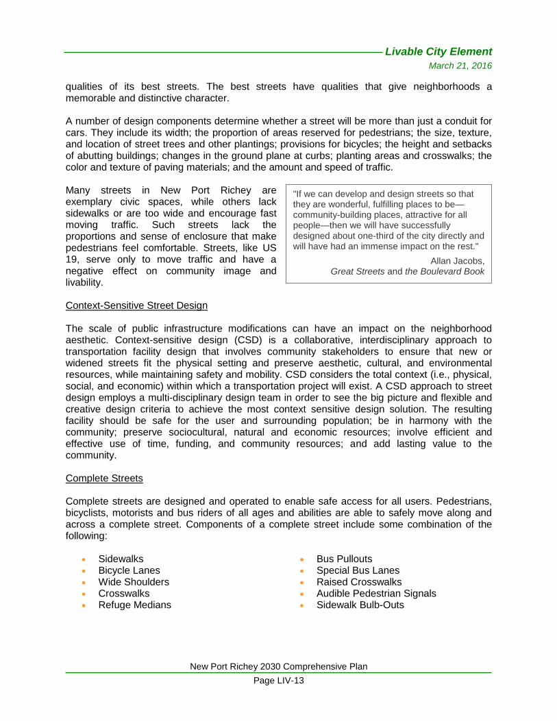
qualities of its best streets. The best streets have qualities that give neighborhoods a memorable and distinctive character. A number of design components determine whether a street will be more than just a conduit for cars. They include its width; the proportion of areas reserved for pedestrians; the size, texture, and location of street trees and other plantings; provisions for bicycles; the height and setbacks of abutting buildings; changes in the ground plane at curbs; planting areas and crosswalks; the color and texture of paving materials; and the amount and speed of traffic. Many streets in New Port Richey are exemplary civic spaces, while others lack sidewalks or are too wide and encourage fast moving traffic. Such streets lack the proportions and sense of enclosure that make pedestrians feel comfortable. Streets, like US 19, serve only to move traffic and have a negative effect on community image and livability. Context-Sensitive Street Design The scale of public infrastructure modifications can have an impact on the neighborhood aesthetic. Context-sensitive design (CSD) is a collaborative, interdisciplinary approach to transportation facility design that involves community stakeholders to ensure that new or widened streets fit the physical setting and preserve aesthetic, cultural, and environmental resources, while maintaining safety and mobility. CSD considers the total context (i.e., physical, social, and economic) within which a transportation project will exist. A CSD approach to street design employs a multi-disciplinary design team in order to see the big picture and flexible and creative design criteria to achieve the most context sensitive design solution. The resulting facility should be safe for the user and surrounding population; be in harmony with the community; preserve sociocultural, natural and economic resources; involve efficient and effective use of time, funding, and community resources; and add lasting value to the community. Complete Streets Complete streets are designed and operated to enable safe access for all users. Pedestrians, bicyclists, motorists and bus riders of all ages and abilities are able to safely move along and across a complete street. Components of a complete street include some combination of the following:
Sidewalks Bicycle Lanes Wide Shoulders Crosswalks Refuge Medians
Bus Pullouts Special Bus Lanes Raised Crosswalks Audible Pedestrian Signals Sidewalk Bulb-Outs
"If we can develop and design streets so that they are wonderful, fulfilling places to be—community-building places, attractive for all people—then we will have successfully designed about one-third of the city directly and will have had an immense impact on the rest."
Allan Jacobs, Great Streets and the Boulevard Book

Livable City Element
March 21, 2016
New Port Richey 2030 Comprehensive Plan
Page LIV-14
Transit Amenities While Pasco County is the sole provider of fixed route transit, the City can assist in providing transit access and amenities to enhance the transit user experience within New Port Richey. For instance, the City’s streetscape projects addressing transit corridors (i.e., Main Street, Grand Boulevard, and Madison Street) should evaluate the appropriate placement of transit stops and shelters based on adjacent land uses. Through provision of certain features, the likelihood that people will use public transit increases. Pedestrian-friendly design features are inherently also transit-friendly, since all transit trips include a walking segment. The shift to a multi-modal transportation system designed to reduce auto dependency will require comprehensive planning and financial resources toward the creation of an environment that encourages walking, biking, and the use of transit. For example, to provide further intermodal connectivity, Pasco County Public Transit (PCPT) has implemented a Bikes on Buses program. The PCPT Transit Infrastructure Guidelines Manual,3 providing standards and guidelines for the design and siting of bus stops and other transit-supportive infrastructure elements, is resource for streetscape design. Some of the criteria are standard in nature for application to specific bus stop types, while other design guidelines enable more flexibility to allow particular infrastructure elements to adapt to the surrounding character and environment of the area being served. Street Trees Street right-of-way represents approximately 17 percent of the total land area in the City, making the visual impact of these areas is significant. Street trees are one of the most effective ways to improve street aesthetics. Regularly spaced street trees provide coherence and help make the street memorable. This is especially important where nearby buildings are not a consistent scale and style. Regular spacing of trees that are similar in form and texture provides order and coherence and gives scale to the street. Tree canopy provides shade for pedestrian and creates a sense of enclosure and comfort. Trees of a single species, planted at regular intervals (25 to 30 feet apart) can reduce the apparent width of streets and intersections and define the street as a continuous space. Currently, the City is planning for four streetscape projects including segments of Grand Boulevard, Main Street, Madison Street, and Nebraska Avenue (Railroad Square). Additionally, the CRA Residential Program addresses residential streetscaping, including street resurfacing/reconstruction, curb construction or replacement, sidewalk repairs, street trees, traffic calming, street lighting and other repairs as requested by the neighborhood residents. Streetscape improvements also have been identified in conjunction with the eight neighborhood plans that have been completed to date. The New Port Richey Redevelopment Plan identified the following streetscaping/highway beautification projects for future implementation:
3 Source: www.pascocountyfl.net/pubser/comser/PublicTrans/InfrastG.pdf.
Livable City Element
March 21, 2016
New Port Richey 2030 Comprehensive Plan
Page LIV-15
US Highway 19 (State project): Median landscaping
Gulf Drive (US 19 to Grand Blvd): Reconstruction including turning lanes, curbs, sidewalks, lighting and traffic calming features
Massachusetts Ave (Grand Blvd to Davis St) (County project):
Reconstruction including turning lanes, curbs, sidewalks, lighting, drainage and traffic calming features.
Nebraska Avenue/Main St (Congress St to Rowan Rd) (County project):
Reconstruction including turning lanes, curbs, sidewalks, lighting and traffic calming features
Street Lighting Street lighting is often responsible for light trespass on neighboring properties and the creation of glare in the atmosphere. Poorly-designed outdoor lighting results in light pollution (wasted energy), reducing the natural dark sky experience for urban dwellers and impacting some terrestrial and marine wildlife. Well-designed outdoor lighting illuminates the intended object or area, uses the lowest foot-candle to serve the purpose, and renders good color that enhances vision. Suburban-scale neighborhoods typically employ large, efficient luminaries on high, widely spaced poles to illuminate the nighttime street for safer vehicle operation and for pedestrian and neighborhood security (Also see Crime Prevention through Environmental Design above). In traditional neighborhoods (urban-scale), street lighting essentially serves the same purposes as in suburban neighborhoods. However, the intensity of illumination and location of light poles are more pedestrian-scale. Smaller, less intense luminaries are often less obtrusive to adjacent properties and shielding reduces glare and glow, preserving views of the dark sky. Site Level Design Site design that is in concert with community design preferences can contribute to the desired visual identity of a community, as well as the functional aspects of the site. Building placement near the sidewalk contributes to the “outdoor room” effect, where people are more apt to walk and congregate. Parking areas can visually dominate views from the street and interfere with the outdoor room effect, as well as pedestrian accessibility. Functional open space such as plazas, green spaces and focal elements that are appropriate for public gatherings, outdoor dining, etc. are components of quality site design. Landscaping within parking lots and along the perimeter of the site and building foundation helps new development blend with existing uses and softens the visual effect of hardscapes. Parking Design Parking lots occupy large amounts of surface area in the City. The negative physical impacts of parking lots on the surrounding area can be minimized locating parking behind buildings or in parking structures wherever possible. Parking lots should be designed to include trees and landscaping and be pleasant for pedestrians to encourage walking between destinations after arrival. Parking lots should be designed to be multi-purpose, such as functional open space for seasonal events, rather than just repositories for cars. Consider including public art in parking lots and parking structures.
Livable City Element
March 21, 2016
New Port Richey 2030 Comprehensive Plan
Page LIV-16
Alternatives to surface parking lots should be encouraged to minimize the amount of land that must be devoted to parking. This is especially critical in Downtown, where preserving the compact, pedestrian environment is paramount. Parking requirements should be evaluated against actual parking needs for specific uses. Design criteria should be based on a parking standard somewhere between average and peak conditions. Parking requirements that allow creative solutions such as valet parking, landscaped parking reserves, satellite parking, and others that minimize the use of open land for parking should be considered. Development that creatively integrates parking into the project by providing for shared use of parking areas needs to be encouraged. Street design that incorporates on-street parking provides parking while contributing to the pedestrian environment through traffic calming and creating a barrier between pedestrians and moving cars. Building Design New buildings contribute to the overall design character of the neighborhood and, therefore, should respect the architectural styles, bulk, setbacks, color, scale, character and development pattern of the surrounding neighborhood. Architectural design can affect the curb appeal of buildings, reduce the overall bulk and appearance of large buildings, and reflect the preferred design character of the community. Building entries, windows, and human-scale design features help to enliven streets and other public spaces, making them safer and more interesting. Regulation, voluntary guidelines or combination of the two could be employed to promote buildings that exhibit certain desirable characteristics such as architectural style, color, and scale. Design guidance should be drawn from the local context and vernacular traditions. Signs The Land Development Code identifies the importance of sign regulation in reducing visual clutter in areas Citywide, while enhancing safety and promoting economic viability. The adopted sign regulations require attention to community aesthetics and property values though limitations on type, location, quantity, and size of signs. The City adopted sign regulations specifically for Downtown and the Downtown Residential Overlay District (DROD). There is the perception by some members of the community that the DROD sign regulations are too restrictive relative to sign area. Much of the City’s heavy commercial corridors are cluttered with signs. This is especially true of the US 19 corridor, which received the lowest rating of all of the images presented in a visual preference survey conducted at the Major Issues and Visioning Workshop. This indicates that the existing sign ordinance standards or compliance timeframes are not proving to be effective in promoting the community’s aesthetic values. More attractively-designed freestanding signs should be encouraged or made part of the Sign Code, including the requirement of landscape bases. Outdoor Lighting The minimization of light intensity and trespass from light sources (including illuminated signs) can reduce glare, which has an impact on the community’s nighttime appearance. Outdoor lighting on private property must abide by lighting standards in the Land Development Code. Many communities have amended their lighting standards to address glare, light trespass and
Livable City Element
March 21, 2016
New Port Richey 2030 Comprehensive Plan
Page LIV-17
energy efficiency of outdoor lighting for commercial and some residential uses. In pedestrian-oriented centers and districts, decorative light poles and lamps can illuminate the site and pedestrian ways while enhancing the site and neighborhood aesthetics. Civic Space and Open Space Plazas, squares, and public greens create visual relief and respite from sometimes chaotic, albeit interesting, urban living. The aesthetic influence of civic space in the urban setting is undeniable since a typical objective of these places is to add beauty to the built environment. Also, an appropriate balance between physical development and open space (green space) is desirable in an urban setting. Open spaces create an appealing backdrop to the built environment and help define urban form. These spaces can be sited on remnant parcels throughout the community to bring an element of surprise and interest to people who happen across them when walking to a destination.
IV. Plan to Address Needs
To protect the natural environment and increase quality of life, neighborhoods, communities and regions should have compact, multi-dimensional land use patterns that ensure a mix of uses, minimize the impact of cars, and promote walking, bicycling, and transit access to employment, education, recreation, entertainment, shopping, and services. Economic development and transportation investments should reinforce these land use patterns, and the ability to move people and goods by non-automobile alternatives wherever possible. Additionally, quality design plays an important part in the well-being of a community. In many ways, urban design issues transcend other elements of community development since community appearance conveys image, and image influences where people choose to live, work, and shop. The look, feel and function of places throughout the City will be critical to the achievement of redevelopment and economic development strategies. Therefore, it is in the City’s interest to foster quality design and other aspects of community livability through policies, standards, and programs that promote a positive and distinct City image. Urban design standards and guidelines should recognize the attributes and traits that are important to both the City as a whole as well as unique character and/or themes prevalent in City neighborhoods. The LDC currently contains requirements for site design. However, these requirements should be evaluated to ensure that their application does not prohibit the desired development pattern (e.g., pedestrian-oriented, mixed use and transit-oriented development). The physical transformation of the public and private realms is not achieved overnight but, rather, gradually develops over years. As such, steadfast pursuit of community appearance objectives is required by City decision-makers to avoid the “overnight” impacts of a poorly designed building, parking lot, or street on years of effort and expense spent toward creating something better.

Livable City Element
March 21, 2016
New Port Richey 2030 Comprehensive Plan
Page LIV-18
[This page intentionally left blank.]