Embed Size (px)
Citation preview

Lewis River - Vancouver Lake Water Trail Plan
October 2012
Report and Recommendations
Lewis River - Vancouver Lake Water Trail Plan October 2012
Acknowledgements Vancouver-Clark Parks and Recreation Staff
Partnering Agency Staff
StakeholdersGail AlexanderEric D. AndersonJon BabcockKaty BrooksBrian CalkinsRob CarpenterBill DygertChuck FrayerBrent GreningChris HathawayLehman HolderMike HouckCarolyn JohnsonPatrick LeeCheri MartinDale MillerJeff MizeDavid MorganRon OnslowJim PresserAnita RobertsWilliam RobisonChris RobisonEric RosewallAlan StewartSteven WallToni Wiseand others...
Michael LindeDan Miller
Laura Hudson, Interim DirectorJean Akers, park planner
Lewis River - Vancouver Lake Water Trail Plan
Lewis River - Vancouver Lake Water Trail PlanOctober 2012
Table of Contents
Executive Summary.......................................
Frequently Asked Questions.........................
Scope and Purpose.......................................
River Inventory, Maps and Conditions........
Economic and Program Opportunities.......
Recommendations.....................................
1
3
7
13
31
35
Lewis River - Vancouver Lake Water Trail Plan

Lewis River - Vancouver Lake Water Trail Plan Executive Summary1
Executive Summary
The Vancouver-Clark Parks and Recreation Department (VCPRD) in collaboration with the National Park Service: Rivers, Trails, and Conservation Assistance Program led a community-wide water trail planning process to identify the opportunities to improve the existing recreational paddling resource along portions of targeted waterways in western Clark County. The water trail planning effort extends for over 32 miles from stretches of the North Fork Lewis River in Woodland, along portions of the East Fork Lewis River in La Center and flows into the Columbia River, continuing along the entire stretch of Lake River, encompassing the Bachelor Island Slough and into Vancouver Lake.
While the project planning began in the summer of 2010 with a grant application to the National Park Service RTCA for technical assistance, recognition of the need to plan these recreation resources was clearly identified in the 2006 Clark County Regional Trail & Bikeway Systems Plan.
Federal, state and local agencies, non-profit organizations, local water-related businesses, property owners and interested individuals participated in the assessment of existing waterway conditions and access sites, provided recommendations for enhanced user experiences and public safety and advocated for more methods to provide water trail use information.
As the planning effort was culminating with its recommendations, the first annual “Big Paddle” event was celebrated on June 2, 2012 with numerous dignitaries, stakeholders and paddling enthusiasts exploring a portion of Lake River from the Port of Ridgefield to its confluence with the Columbia River. The paddle was successful enough to trigger enthusiasm for continuation as an annual event.
As a result of the enthusiasm and support for advancing the water trail as a recreational resource, two grants were awarded to fund the design and publication of a water trail paddling guide.
The 2006 Clark County Regional Trail and Bikeways System Plan identifies several water trails for paddling in the County.
Lewis River - Vancouver Lake Water Trail Plan
Lewis River - Vancouver Lake Water Trail PlanExecutive Summary 2
Clear and consistent signs can provide better access to the waterways.
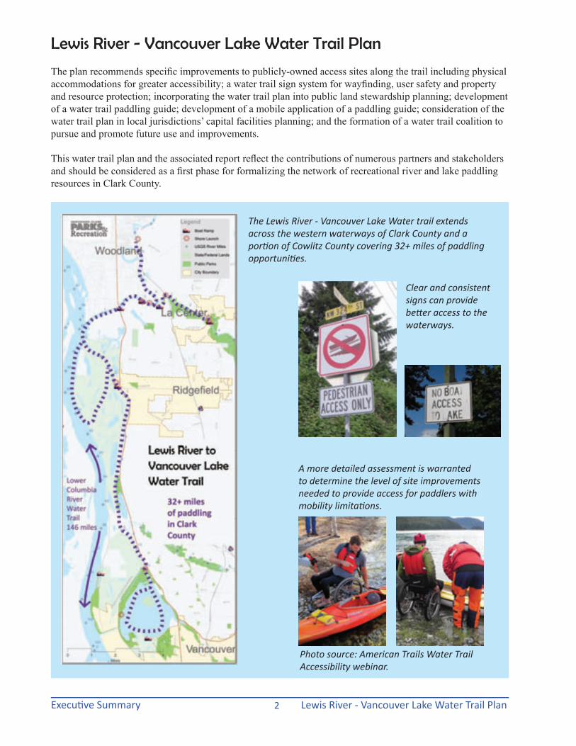
The plan recommends specific improvements to publicly-owned access sites along the trail including physical accommodations for greater accessibility; a water trail sign system for wayfinding, user safety and property and resource protection; incorporating the water trail plan into public land stewardship planning; development of a water trail paddling guide; development of a mobile application of a paddling guide; consideration of the water trail plan in local jurisdictions’ capital facilities planning; and the formation of a water trail coalition to pursue and promote future use and improvements.
This water trail plan and the associated report reflect the contributions of numerous partners and stakeholders and should be considered as a first phase for formalizing the network of recreational river and lake paddling resources in Clark County.
A more detailed assessment is warranted to determine the level of site improvements needed to provide access for paddlers with mobility limitations.
Photo source: American Trails Water Trail Accessibility webinar.
The Lewis River - Vancouver Lake Water trail extends across the western waterways of Clark County and a portion of Cowlitz County covering 32+ miles of paddling opportunities.
Lewis River - Vancouver Lake Water Trail Plan

Lewis River - Vancouver Lake Water Trail Plan Frequently Asked Questions3
Frequently Asked Questions
What is a water trail?A water trail is a designated stretch of navigable waterway that can be composed of river, creek, lake, reservoir, canal, tidal estuary and ocean or any combination of water routes for a recreational experience. Water trails help to identify the appropriate routes along existing stretches of river and shorelines that allow for access to recreational, scenic and cultural resources. Water trails are primarily designed for small water craft such as canoes, kayaks, rafts, and drift boats. Water trails are an increasingly popular form of recreation that utilizes existing water resources with a relatively small amount of site improvements such as launch sites, signs, parking, restrooms, and other amenities to enhance the user experience.
Clark County Water TrailsThe Lower Columbia River Water Trail is a designated 146-mile water trail on the Lower Columbia River that extends from the Bonneville Dam to the Pacific Ocean. The Lower Columbia River defines the southern and western boundaries of Clark County. The Lower Columbia River is also
of a tidal channel connecting Vancouver Lake to the Columbia River just south of its confluence with the Lewis River. The Regional Trail and Bikeway System Plan identifies the following additional water trails for which future planning efforts may address expanded recreational access and amenity improvements for waterways within the county:
• The North Fork of the Lewis River from Woodland upstream, including Yale Lake and Lake Merwin reservoirs. This waterway defines the primary northern boundary of the County.
• The East Fork of the Lewis River from La Center to Lucia Falls Regional Park. Thiswaterway transects the County from east to west with its headwaters in the Gifford Pinchot National Forest in Skamania County.
• The Lacamas Lake Water Trail, mostly in the City of Camas, which already experiences significant recreational use.
part of the Lewis and Clark National Historic Trail.
The Vancouver Lake-Lake River trail and segments of the North Fork and East Fork Lewis River water trails are identified in the Clark County Regional Trail and Bikeway System Plan and are addressed in this water trail plan. Lake River consists
The 2006 Clark County Regional Trail and Bikeways System Plan identifies several water trails for paddling in the County.
Lewis River - Vancouver Lake Water Trail Plan

Lewis River - Vancouver Lake Water Trail PlanFrequently Asked Questions 4
Why is a water trail needed?The water trail is not creating a new path and the extensive waterways of Clark County already exist as recreational resources. A water trail provides an opportunity to connect people to water-related activities for a safe and enhanced experience. The water trail can identify what lands and amenities are public or private and where appropriate facilities are for disposing of trash and human waste. The creation of a formalized trail can help protect natural resources, private property, identify public access points, promote boater safety, increase knowledge of water conditions and wayfinding along the waterways. The expanded awareness of the water trail as a recreational resource can also boost local economic activity through boat and equipment sales and rentals, food and support services and provide another physical activity that promotes personal health.
What is the purpose of the water trail plan?The plan will formally designate the location of the trail, identify needs for additional amenities, access points and other improvements, and address potential conflicts or safety concerns in order to facilitate a better recreational experience for the community. It will also allow the organizations and agencies involved in the plan to apply for grants to help make the identified improvements, and help public agencies budget for future projects related to the water trail.
Who is developing the plan?The plan is being developed by water trail users, land managers, local jurisdictions and other stakeholders under the guidance of the Vancouver-Clark Parks and Recreation Department, and with technical assistance from the National Park Service’s Rivers, Trails, and Community Assistance Program.
What happens after the plan is completed?Concurrent with the development of the water trail plan, a user map or guide is being created that would be made available on the Lower Columbia Estuary Partnership website (www.estuarypartnership.org), along with information about the Lower Columbia River Water Trail and other tributary trails to the Lower Columbia River. A printed version of the map or guide is also planned for release by the end of 2012. Recommendations from the plan can help guide local jurisdictions and private investment to plan for targeted site and physical improvements to water access, expanded support services and programmed activities along the water trail.
Who will implement, manage and maintain the water trail after it has been designated?The recommendations included in the plan would be made on a voluntary basis only as funding and other resources allow. Implementation could be accomplished by a variety of stakeholders, including local jurisdictions, private businesses, water trail user groups and others. From adding simple “wayfinding” mile markers to improving accessibility at launch sites, the water trail plan recommendations may be implemented as time, labor and funding is available.
Why doesn’t the trail go further up the North or East Forks of the Lewis River?This initial water trail planning effort is intended to enhance water-related recreational opportunities for paddlers of all abilities. As a result, only the flat water areas of the linked waterways are included in the plan. In future water trail planning, more extensive reaches of the river should be evaluated for potential improvements as well as both recreation and conservation recommendations.
Where can I launch my water craft?Existing public boat ramps or shore launch sites are located in a number of places along waterways
Clear and consistent signs can provide better access to the waterways.
Lewis River - Vancouver Lake Water Trail Plan Frequently Asked Questions5
in Clark County. This water trail extends along the North Fork of the Lewis River from the informal shore launch beside the bridge crossing at Hayes Road (Woodland) and the East Fork Lewis River from launch sites at the City of La Center Bridge to the south end of Vancouver Lake where an unpaved boat launch allows access from the Washington State Fish and Wildlife lands at the end of La Frambois Road (Vancouver).
Vancouver Lake can be influenced by strong winds and is linked to the tidal influences of the Columbia River. All paddlers should check water and weather conditions prior to planning an outing and should always carry personal flotation devices for every person on the water. In the drier summer months, low water conditions in the lake can occasionally lead to blue-green algae blooms, resulting in unsafe swimming conditions. The city and county post warnings on the Web and at the lake and send information to local media when this occurs. Lake paddlers should be aware of water quality conditions prior to enjoying the recreational opportunities.
How many miles can I paddle?This water trail covers a total of over 32 river miles. Points of access are dispersed at intervals along each river reach and at Vancouver Lake, which allows for trips of varying lengths. Before setting out on the water, paddlers should check the tidal charts since tides influence the direction of current on Lake River, affecting the paddling speed and amount of effort needed to travel between launch sites, if a one-way trip is planned.
Where can I rent a canoe or kayak?Ridgefield Kayak in Ridgefield, WA has kayak rentals available from their docks for ready access to Lake River. Boats can also be rented from other vendors in the Portland-Vancouver region and transported by car or truck to another launch site. Check www.ridgefieldkayak.com for more information.
Are there guides for trips?Ridgefield Kayak provides scheduled interpretive and special subject guided paddling excursions, in addition to the kayak rentals. The Sierra Club and other similar environmental groups also plan outings along the water trail, particularly near the Ridgefield National Wildlife Refuge where bird watching is a strong attraction.
Is there camping available along the trail?Paradise Point State Park has campsites as well as a convenient launch site along the shores of the East Fork of the Lewis River. Pekin Ferry Inland Navigation Company also operates a private boat ramp and campsite, plus RV sites, along the Lewis River just below where the East and North Forks converge.
What is a “blue trail” or “blueway”?A “blue trail” is another name for a water trail. The term “blueway” has come into greater use with the initiation of the America’s Great Outdoor’s planning that defines a “blueway” more broadly to include the lands necessary to protect the water trail and its water-based resources as well as the programs and efforts to support those resources.
User Safety The waterways in and around Clark County provide a variety of recreational opportunities including paddling, fishing, floating, boating, swimming, and fishing. An important purpose of the water trail plan identifies potential public safety concerns and personal safety risks to prevent accidents and avoid personal injury and property damage. In the State of Washington, boating licenses are required for operators 12 years and older operating a power-driven vessel with an engine that is 15 horsepower or more. While paddlers are excluded from this requirement the safety training available through the boating license process is very valuable for all
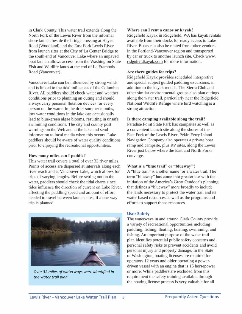
Over 32 miles of waterways were identified in the water trail plan.
Lewis River - Vancouver Lake Water Trail PlanFrequently Asked Questions 6
recreational watercraft users to avoid accidents and limit risks.
Most accidents occur when paddlers over estimate their boating skills and underestimate the potential dangers on the water.
Basic Paddling Safety Tips:
Weather: Check the weather forecast before you embark on your paddling adventure. Conditions can change rapidly and there are long stretches on waterways without access to safe pull-offs or emergency rescue service. Cell phone coverage along the 32+ miles of water trail is not consistent or reliable and should never be the primary assurance for safety or rescue. If you see weather conditions changing: sudden temperature drops, increasing and volatile winds or darkening clouds, get off the water as soon as feasible.
Tidal Conditions: The Columbia River has strong tidal influences all the way to the Bonneville Dam. Tides can alter the current of Lake River and have significant influence on paddling conditions. Paddlers should refer to tidal charts as part of their pre-departure trip planning. Some website resources include:http://tidespy.com http://water.weather.gov/ahps2/hydrograph.php?wfo=pqr&gage=shno3http://water.weather.gov/ahps2/hydrograph.php?wfo=PQR&gage=LRWW1&view=1,0,1,0,0,0,1,0http://water.weather.gov/ahps2/hydrograph.php?wfo=pqr&gage=vapw1&hydro_type=0
Pre-departure: Plan for your trip by knowing how much time your paddle will likely take and ensure that you have enough drinking water, sun screen, snacks, rain gear, lifejacket, whistle, and other supplies to ensure that your journey is both safe and enjoyable. Travel with at least one other paddler and tell someone else about your trip itinerary, including your anticipated completion time. For recommendations on how best to prepare a Float Plan, see http://www.floatplancentral.org/ .
Lifejacket & whistle: Each paddler should be wearing a well-fitting personal floatation vest equipped with
an accessible whistle. The majority of drowning victims associated with boat accidents were not wearing their life jackets. Paddlers aged 12 and under are required to wear a personal flotation device. Don’t become another statistic.
Learn to Swim: If you don’t already know how to swim, take a course at your local community center, American Red Cross, or YMCA. Basic swimming skills will allow for a more enjoyable paddling experience and help avoid tragic accidents.
Gear & clothing: Be familiar with your boat, its gear, and the appropriate types, fabrics and layers of clothing to protect each paddler in variable weather conditions. Wearing protective footwear and a wind/water-resistant layer is recommended.
Put-in/Take-out sites: For many paddlers, the most vulnerable time is getting in or out of their kayak or canoe. Examine the launch and landing areas carefully to note the water depths, uneven surface conditions, currents and potential hazards. Never leave your boat unsecured while empty and in the water.
For more information on Washington’s boating education and safety, visit Adventures in Boating Washington: http://www.boat-ed.com/wa/handbook/ or contact the Washington State Parks and Recreation Commission at (360) 902-8844.
Lewis River - Vancouver Lake Water Trail Plan Scope and Purpose7
Scope and Purpose
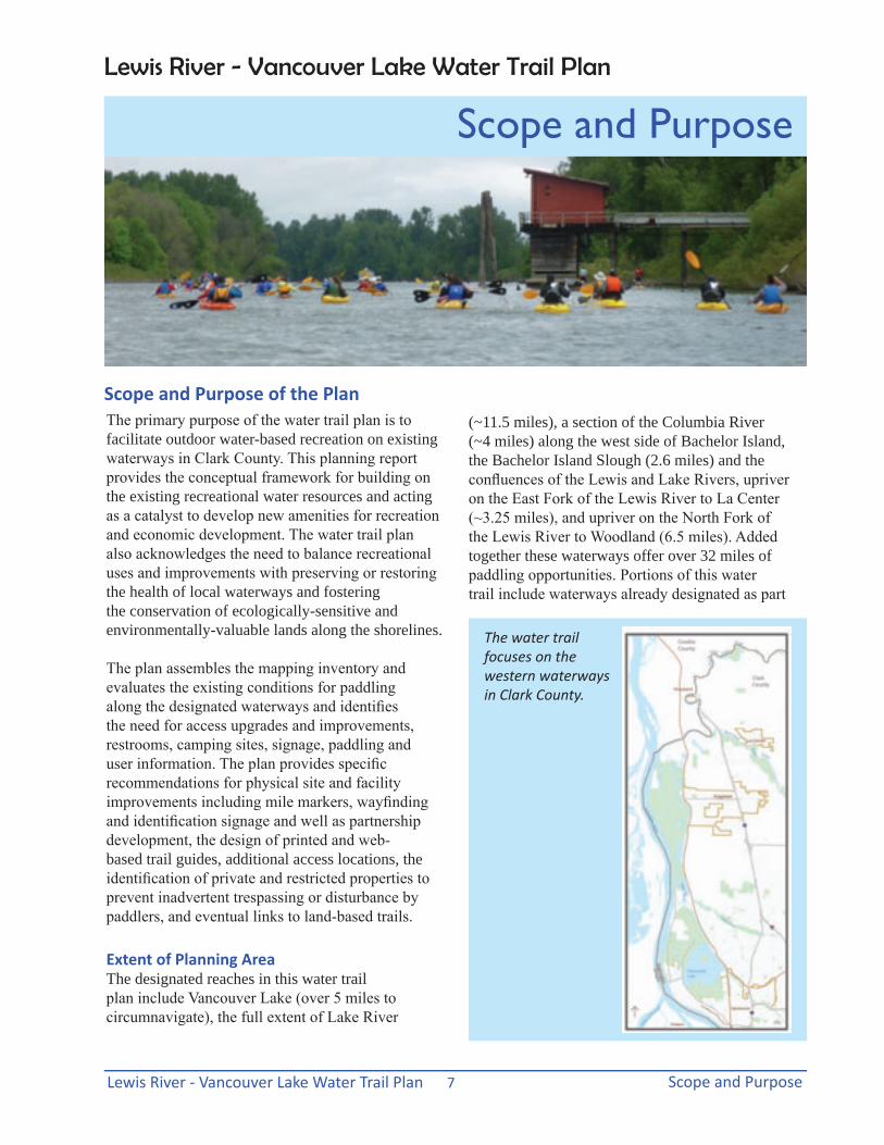
Scope and Purpose of the Plan(~11.5 miles), a section of the Columbia River (~4 miles) along the west side of Bachelor Island, the Bachelor Island Slough (2.6 miles) and the confluences of the Lewis and Lake Rivers, upriver on the East Fork of the Lewis River to La Center (~3.25 miles), and upriver on the North Fork of the Lewis River to Woodland (6.5 miles). Added together these waterways offer over 32 miles of paddling opportunities. Portions of this water trail include waterways already designated as part
The primary purpose of the water trail plan is to facilitate outdoor water-based recreation on existing waterways in Clark County. This planning report provides the conceptual framework for building on the existing recreational water resources and acting as a catalyst to develop new amenities for recreation and economic development. The water trail plan also acknowledges the need to balance recreational uses and improvements with preserving or restoring the health of local waterways and fostering the conservation of ecologically-sensitive and environmentally-valuable lands along the shorelines.
The plan assembles the mapping inventory and evaluates the existing conditions for paddling along the designated waterways and identifies the need for access upgrades and improvements, restrooms, camping sites, signage, paddling and user information. The plan provides specific recommendations for physical site and facility improvements including mile markers, wayfinding and identification signage and well as partnership development, the design of printed and web-based trail guides, additional access locations, the identification of private and restricted properties to prevent inadvertent trespassing or disturbance by paddlers, and eventual links to land-based trails.
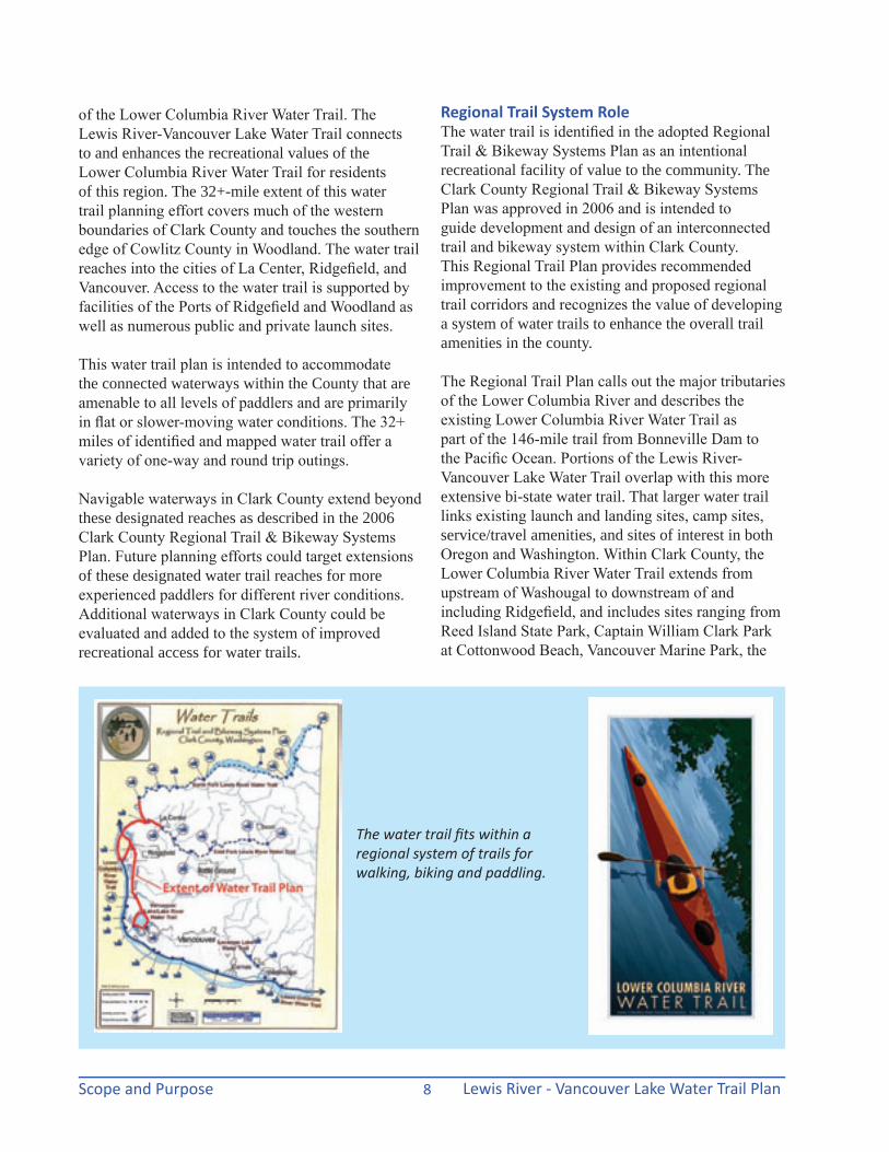
Extent of Planning AreaThe designated reaches in this water trail plan include Vancouver Lake (over 5 miles to circumnavigate), the full extent of Lake River
The water trail focuses on the western waterways in Clark County.
Lewis River - Vancouver Lake Water Trail Plan
Lewis River - Vancouver Lake Water Trail PlanScope and Purpose 8
of the Lower Columbia River Water Trail. The Lewis River-Vancouver Lake Water Trail connects to and enhances the recreational values of the Lower Columbia River Water Trail for residents of this region. The 32+-mile extent of this water trail planning effort covers much of the western boundaries of Clark County and touches the southern edge of Cowlitz County in Woodland. The water trail reaches into the cities of La Center, Ridgefield, and Vancouver. Access to the water trail is supported by facilities of the Ports of Ridgefield and Woodland as well as numerous public and private launch sites.
This water trail plan is intended to accommodate the connected waterways within the County that are amenable to all levels of paddlers and are primarily in flat or slower-moving water conditions. The 32+ miles of identified and mapped water trail offer a variety of one-way and round trip outings.
Navigable waterways in Clark County extend beyond these designated reaches as described in the 2006 Clark County Regional Trail & Bikeway Systems Plan. Future planning efforts could target extensions of these designated water trail reaches for more experienced paddlers for different river conditions. Additional waterways in Clark County could be evaluated and added to the system of improved recreational access for water trails.
Regional Trail System RoleThe water trail is identified in the adopted Regional Trail & Bikeway Systems Plan as an intentional recreational facility of value to the community. The Clark County Regional Trail & Bikeway Systems Plan was approved in 2006 and is intended to guide development and design of an interconnected trail and bikeway system within Clark County. This Regional Trail Plan provides recommended improvement to the existing and proposed regional trail corridors and recognizes the value of developing a system of water trails to enhance the overall trail amenities in the county.
The Regional Trail Plan calls out the major tributaries of the Lower Columbia River and describes the existing Lower Columbia River Water Trail as part of the 146-mile trail from Bonneville Dam to the Pacific Ocean. Portions of the Lewis River-Vancouver Lake Water Trail overlap with this more extensive bi-state water trail. That larger water trail links existing launch and landing sites, camp sites, service/travel amenities, and sites of interest in both Oregon and Washington. Within Clark County, the Lower Columbia River Water Trail extends from upstream of Washougal to downstream of and including Ridgefield, and includes sites ranging from Reed Island State Park, Captain William Clark Park at Cottonwood Beach, Vancouver Marine Park, the
The water trail fits within a regional system of trails for walking, biking and paddling.
Lewis River - Vancouver Lake Water Trail Plan Scope and Purpose9
Fort Vancouver Beach, Frenchman’s Bar Park, and the Ridgefield National Wildlife Refuge. The Lower Columbia River Water Trail is coordinated by the Lower Columbia Estuary Partnership and is guided by the Partnership’s Lower Columbia River Water Trail Committee. An interactive trail web site is available at www.columbiawatertrail.org.
The major tributaries of the Lower Columbia River that flow through Clark County and are navigable for small watercraft are identified as water trails in the Clark County Regional Trail & Bikeway Systems Plan. Those designated water trails include North Fork Lewis River Water Trail, East Fork Lewis River Water Trail, Vancouver Lake/Lake River Water Trail, and Lacamas Lake Water Trail. The named water trails are not meant to be all-inclusive or exclusive of other potential segments of navigable waterways within the county. Rather, the plan recognizes that the rivers are the trail and users have an extensive range of trip options from a few hours to multi-day journeys.
Planning ProcessThe water trail plan was initiated in the fall of 2010 as a result of the technical assistance grant from the National Park Service’s Rivers, Trails, and Community Assistance Program. Vancouver-Clark Parks and Recreation Department tag-teamed with
the National Park Service (NPS) to manage the planning process with numerous stakeholders adding their contributions and value to the information, inventory, assets and public needs and demands for this recreational resource.
The initial inventory and mapping assessment was completed in December 2011. The primary stakeholder group reviewed the mapping and inventory of public water access locations, public land ownerships and purposes, in-reach waterway mapping, river atlas map information, and suggested potential future access locations and site improvements along the 32+ miles of designated river and lake resources.
The stakeholders identified the need for existing and future recreational paddlers to have greater access to information about the water-based resources through on-line, mobile app, and printed maps and guides. A sub-committee of interested stakeholders was formed to explore the options and opportunities to provide this information in a range of technologies. The Intertwine Alliance, a partnership of public/private entities promoting nature in the Portland-Vancouver metropolitan area, was engaged to identify the water trail on its website and created a You-Tube video clip of a paddler’s adventure to expand the outreach and awareness of this outdoor recreation resource.
A grant application was submitted to the Parks Foundation to provide financial backing for the graphic design and layout and subsequent printing of a paddling guide. The grant was awarded in the spring of 2012, co-sponsored by the Parks Foundation and the Tidewater Barge, Inc. A graphic design consultant was hired for guide design and layout through the Parks Foundation. The Tidewater grant funded the first printing of the guide.
Waterways were mapped with an inventory of existing access and paddling conditions and reviewed carefully by stakeholders.
That guide will be distributed throughout the county and bi-state metropolitan region to promote recreational use, tourism and economic development relating to water-based recreation. Anticipated distribution should coincide with the final plan report in the fall of 2012.
Lewis River - Vancouver Lake Water Trail PlanScope and Purpose 10
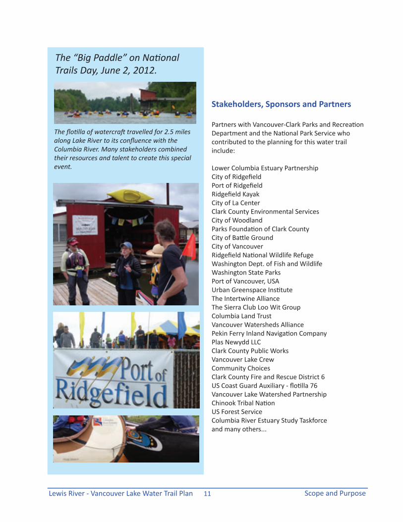
The need for public outreach to bring more exposure to the water trail planning process and introduce more people to their water resources stimulated the development of an event termed the “Big Paddle”, planned as a celebration of National Trails Day, June 2, 2012. Big canoes were provided by the Lower Columbia Estuary Partnership and the Chinook INdian Nation and numerous single and double kayaks were provided courtesy of Ridgefield Kayaks to get invited dignitaries, elected officials and interested stakeholders out on the water. Partnering organizations were invited to participate in the event and the paddling outing.
The local cable service, CVTV, provided a film crew and local newspapers were invited to paddle as well. CVTV produced a 5-minute segment on the water trail plan that released in early July. Go to http://www.youtube.com/watch?v=E8ayw7BRMkc&list=PL65955F85046D1D90&index=35&feature=plpp_video
The draft water trail planning report was reviewed by the stakeholder group and the Vancouver-Clark Parks and Recreation Advisory Commission before being presented to local city councils and the Clark County Board of Commissioners. The final plan, ready in the fall of 2012, accommodated those numerous reviews and provides recommendations for formalizing this network of waterways and enhancing the recreational resources.
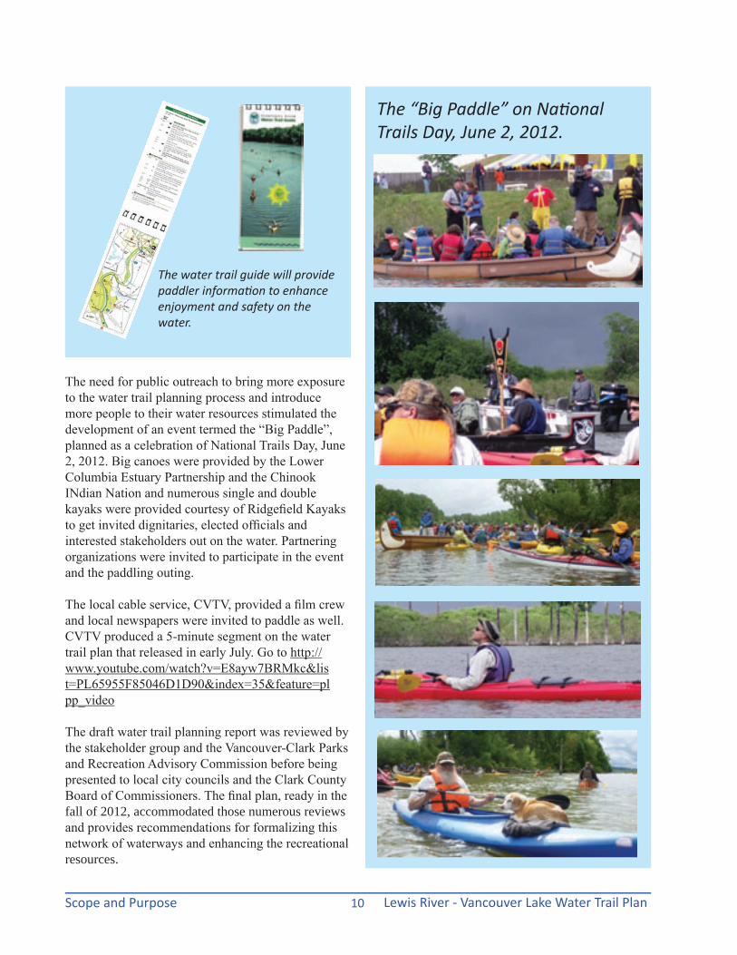
The water trail guide will provide paddler information to enhance enjoyment and safety on the water.
The “Big Paddle” on National Trails Day, June 2, 2012.
Lewis River - Vancouver Lake Water Trail Plan Scope and Purpose11
Stakeholders, Sponsors and Partners
The “Big Paddle” on National Trails Day, June 2, 2012.
The flotilla of watercraft travelled for 2.5 miles along Lake River to its confluence with the Columbia River. Many stakeholders combined their resources and talent to create this special event.
Partners with Vancouver-Clark Parks and Recreation Department and the National Park Service who contributed to the planning for this water trail include:
Lower Columbia Estuary Partnership City of Ridgefield Port of Ridgefield Ridgefield Kayak City of La Center Clark County Environmental Services City of Woodland Parks Foundation of Clark County City of Battle Ground City of VancouverRidgefield National Wildlife Refuge Washington Dept. of Fish and Wildlife Washington State Parks Port of Vancouver, USA Urban Greenspace Institute The Intertwine Alliance The Sierra Club Loo Wit Group Columbia Land TrustVancouver Watersheds Alliance Pekin Ferry Inland Navigation CompanyPlas Newydd LLC Clark County Public Works Vancouver Lake Crew Community Choices Clark County Fire and Rescue District 6 US Coast Guard Auxiliary - flotilla 76 Vancouver Lake Watershed Partnership Chinook Tribal Nation US Forest Service Columbia River Estuary Study Taskforceand many others...

Lewis River - Vancouver Lake Water Trail PlanScope and Purpose 12
this page is intentionally blank
Lewis River - Vancouver Lake Water Trail Plan River Inventory, Maps and Conditions13
River Inventory, Maps and Conditions
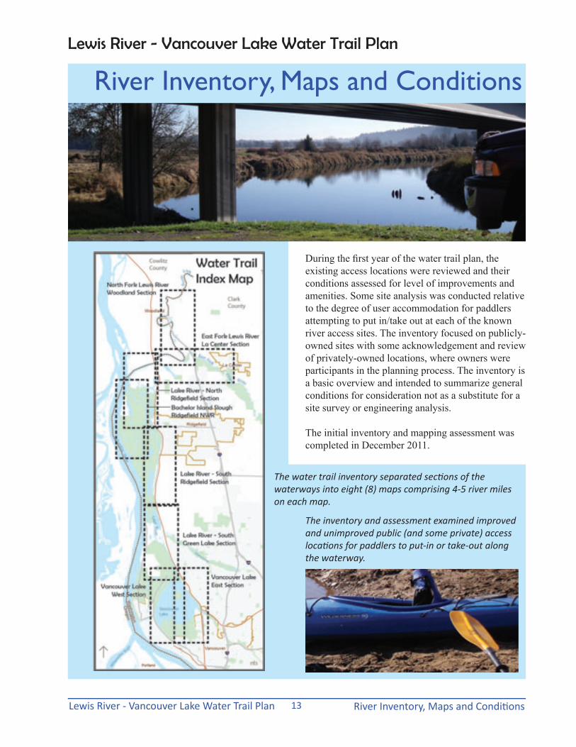
The water trail inventory separated sections of the waterways into eight (8) maps comprising 4-5 river miles on each map.
During the first year of the water trail plan, the existing access locations were reviewed and their conditions assessed for level of improvements and amenities. Some site analysis was conducted relative to the degree of user accommodation for paddlers attempting to put in/take out at each of the known river access sites. The inventory focused on publicly-owned sites with some acknowledgement and review of privately-owned locations, where owners were participants in the planning process. The inventory is a basic overview and intended to summarize general conditions for consideration not as a substitute for a site survey or engineering analysis.
The initial inventory and mapping assessment was completed in December 2011.
The inventory and assessment examined improved and unimproved public (and some private) access locations for paddlers to put-in or take-out along the waterway.
Lewis River - Vancouver Lake Water Trail Plan

Lewis River - Vancouver Lake Water Trail PlanRiver Inventory, Maps and Conditions 14
Water Access Site Inventory Hayes Road Bridge Shore Launch: A graveled pull-off and informal parking area exists within the right-of-way of Hayes Road in Woodland that could accommodate up to 12 spaces. There are no restroom facilities, required fees, or signage identifying this as an access site for put in/pull out along the North Fork of the Lewis River. The slope to the water’s edge is steep and eroded with a variable surface that would change at different river levels.
Martin WDFW Boat Ramp: This public boat ramp operated by the Washington Department of Fish and Wildlife, provides a paved ramp, parking for approximately 50 spaces, a vault toilet, a sign kiosk, and requires a daily parking permit fee ($10) or a Discover Pass ($30 annually).
CD Hale Road Shore Launch: This one-lane public road right-of-way ends directly into the shoreline of the East Fork of the Lewis River. The site is not visible from adjacent neighbors and somewhat camouflaged from the River at different river levels. The gravel road ends in a widened section that allows for turnaround space and limited, undesignated parking. No restrooms or other improvements and rough surfaces from gravel area to water’s edge limit the accessibility of this site. A sign on the street intersection with 325th Street identifies the water access as “pedestrian only”.
Pollock Road Shore Launch: On the south shore of the East Fork of the Lewis River, the public right-of-way of Pollock Road extends along the river edge to allow a gravel surfaced launch site. No official parking or restroom facilities are available. Road shoulders uphill from the river’s edge can be used for parking on this dead-end road. The existing sign for water access is not visible from the road. No signs from the connecting roads provide identification of this shoreline access site. The site is fairly visible from traffic along the higher elevation of La Center Road.
The Martin WDFW boat ramp and its large gravel parking area access the Lewis River.
Across the North Fork from Woodland, Hayes Road shore launch is upstream of the bridge.
CD Hale Road ends with a gravel parking and turnaround area along the East Fork.
Pollock Road ends at the water’s edge, facing the La Center Bottoms natural area.
Lewis River - Vancouver Lake Water Trail Plan River Inventory, Maps and Conditions15
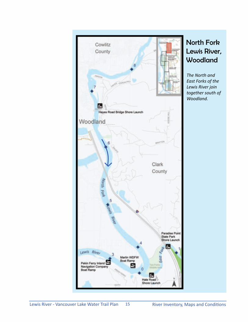
The North and East Forks of the Lewis River join together south of Woodland.
North Fork Lewis River, Woodland

Lewis River - Vancouver Lake Water Trail PlanRiver Inventory, Maps and Conditions 16
La Center Shore Launch: Located from a gravel lane that runs beneath the La Center Road bridge, this public shore access allows for about four (4) gravel parking spaces. A restroom is located uphill in the paved parking areas for the La Center Bottoms Open Space. Signage for the shore launch is not visible from the road.
Paradise Point State Park Shore Launch: As part of the State Park’s amenities, the area beneath the I-5 Bridge provides a broad shoreline area that easily accommodates the launching of canoes or kayaks. Surfaces range from gravel to hard-packed earth and conditions vary with changing river levels. Paradise Point State Park requires a daily parking permit fee ($10) or the use of a Discover Pass ($30 annually).
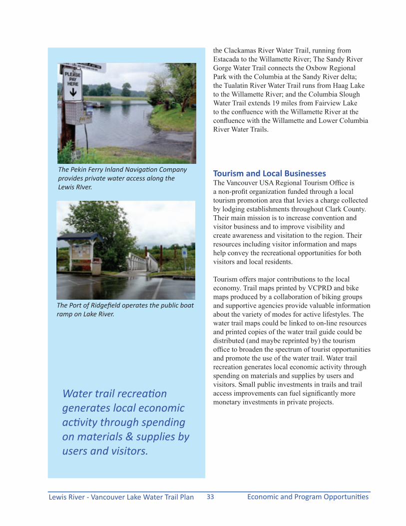
Pekin Ferry Inland Navigation Company, Inc.: This private boat ramp facility on the Lewis River offers other services, including camping, accessible portable toilet, and beach swimming. The boat ramp is paved, with no launch fee. Parking fees are $5/day or $125/year for an annual pass. Signage for the launch facility is visible from the road. Check out www.pekinferry.com for more information.
La Center shore launch is located just downstream from the La Center Bridge.
Paradise Point State Park has expansive shore areas for launching and disembarking.
The boat ramp at Pekin Ferry offers access to the Lewis River.
Water Access Site Inventory
Lewis River - Vancouver Lake Water Trail Plan River Inventory, Maps and Conditions17
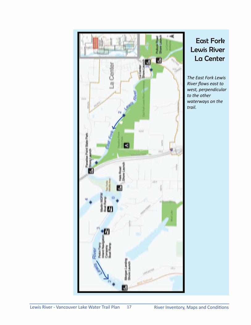
East Fork Lewis River
La Center
The East Fork Lewis River flows east to west, perpendicular to the other waterways on the trail.
Lewis River - Vancouver Lake Water Trail PlanRiver Inventory, Maps and Conditions 18
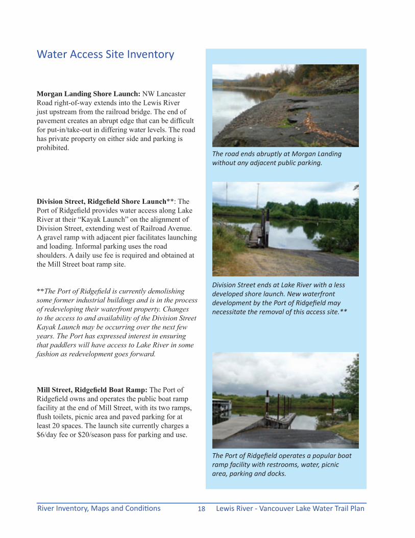
Morgan Landing Shore Launch: NW Lancaster Road right-of-way extends into the Lewis River just upstream from the railroad bridge. The end of pavement creates an abrupt edge that can be difficult for put-in/take-out in differing water levels. The road has private property on either side and parking is prohibited.
Division Street, Ridgefield Shore Launch**: The Port of Ridgefield provides water access along Lake River at their “Kayak Launch” on the alignment of Division Street, extending west of Railroad Avenue. A gravel ramp with adjacent pier facilitates launching and loading. Informal parking uses the road shoulders. A daily use fee is required and obtained at the Mill Street boat ramp site.
**The Port of Ridgefield is currently demolishing some former industrial buildings and is in the process of redeveloping their waterfront property. Changes to the access to and availability of the Division Street Kayak Launch may be occurring over the next few years. The Port has expressed interest in ensuring that paddlers will have access to Lake River in some fashion as redevelopment goes forward.
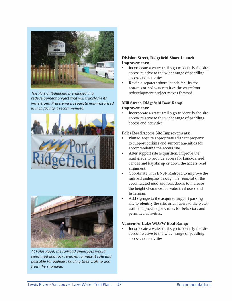
Mill Street, Ridgefield Boat Ramp: The Port of Ridgefield owns and operates the public boat ramp facility at the end of Mill Street, with its two ramps, flush toilets, picnic area and paved parking for at least 20 spaces. The launch site currently charges a $6/day fee or $20/season pass for parking and use.
Water Access Site Inventory
The road ends abruptly at Morgan Landing without any adjacent public parking.
Division Street ends at Lake River with a less developed shore launch. New waterfront development by the Port of Ridgefield may necessitate the removal of this access site.**
The Port of Ridgefield operates a popular boat ramp facility with restrooms, water, picnic area, parking and docks.

Lewis River - Vancouver Lake Water Trail Plan River Inventory, Maps and Conditions19
The confluences of the Lewis and Lake Rivers with the Columbia River are affected by tides and heavy seasonal boat traffic.
Confluences: Lewis River Lake River
Lewis River - Vancouver Lake Water Trail PlanRiver Inventory, Maps and Conditions 20
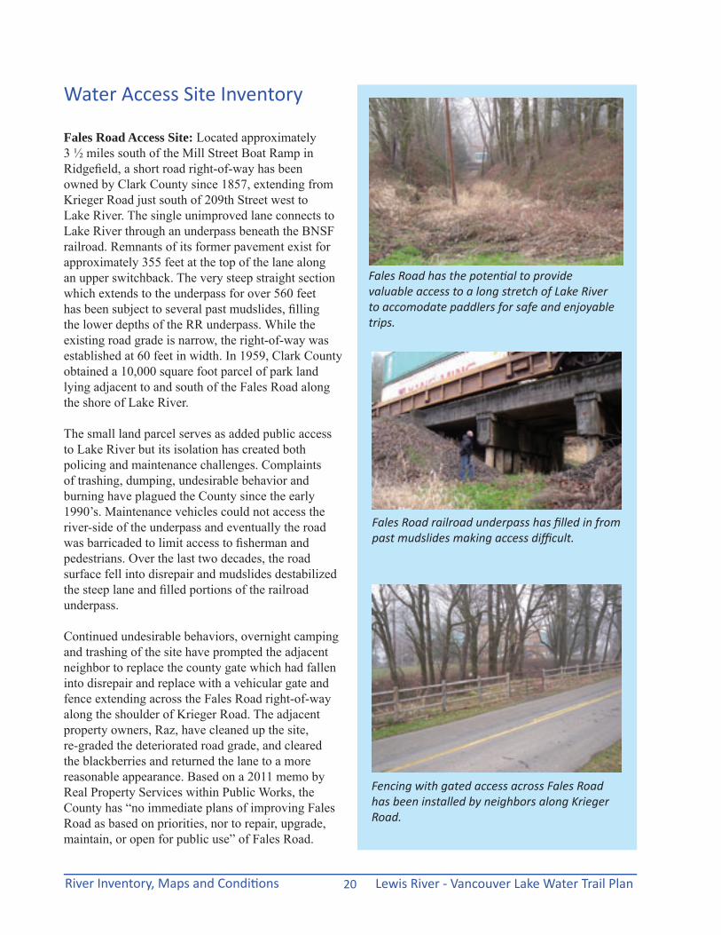
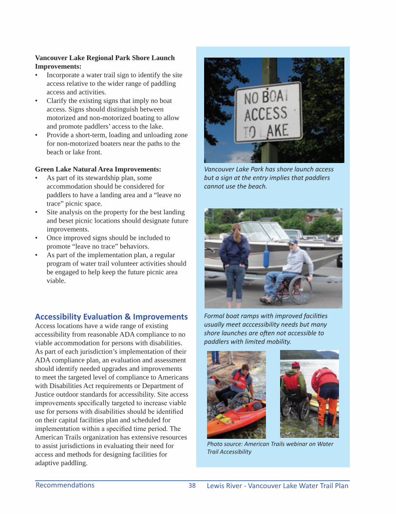
Fales Road Access Site: Located approximately 3 ½ miles south of the Mill Street Boat Ramp in Ridgefield, a short road right-of-way has been owned by Clark County since 1857, extending from Krieger Road just south of 209th Street west to Lake River. The single unimproved lane connects to Lake River through an underpass beneath the BNSF railroad. Remnants of its former pavement exist for approximately 355 feet at the top of the lane along an upper switchback. The very steep straight section which extends to the underpass for over 560 feet has been subject to several past mudslides, filling the lower depths of the RR underpass. While the existing road grade is narrow, the right-of-way was established at 60 feet in width. In 1959, Clark County obtained a 10,000 square foot parcel of park land lying adjacent to and south of the Fales Road along the shore of Lake River.
The small land parcel serves as added public access to Lake River but its isolation has created both policing and maintenance challenges. Complaints of trashing, dumping, undesirable behavior and burning have plagued the County since the early 1990’s. Maintenance vehicles could not access the river-side of the underpass and eventually the road was barricaded to limit access to fisherman and pedestrians. Over the last two decades, the road surface fell into disrepair and mudslides destabilized the steep lane and filled portions of the railroad underpass.
Continued undesirable behaviors, overnight camping and trashing of the site have prompted the adjacent neighbor to replace the county gate which had fallen into disrepair and replace with a vehicular gate and fence extending across the Fales Road right-of-way along the shoulder of Krieger Road. The adjacent property owners, Raz, have cleaned up the site, re-graded the deteriorated road grade, and cleared the blackberries and returned the lane to a more reasonable appearance. Based on a 2011 memo by Real Property Services within Public Works, the County has “no immediate plans of improving Fales Road as based on priorities, nor to repair, upgrade, maintain, or open for public use” of Fales Road.
Fales Road has the potential to provide valuable access to a long stretch of Lake River to accomodate paddlers for safe and enjoyable trips.
Water Access Site Inventory
Fales Road railroad underpass has filled in from past mudslides making access difficult.
Fencing with gated access across Fales Road has been installed by neighbors along Krieger Road.
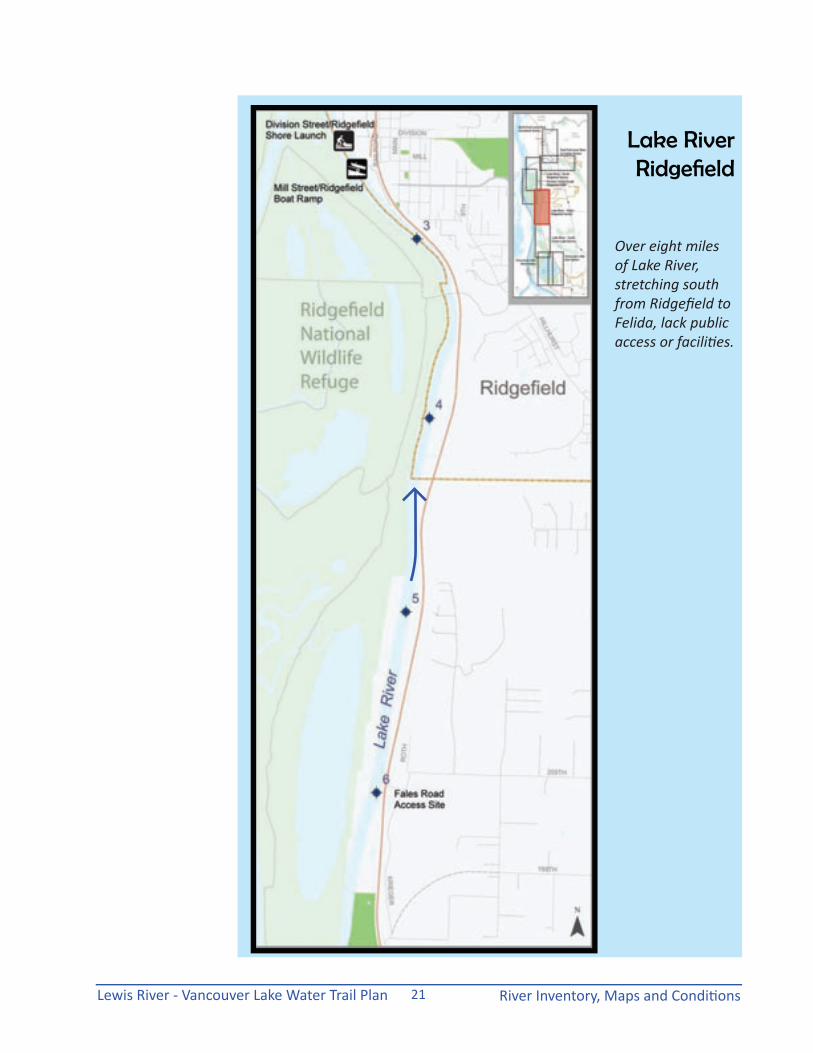
Lewis River - Vancouver Lake Water Trail Plan River Inventory, Maps and Conditions21
Lake River Ridgefield
Over eight miles of Lake River, stretching south from Ridgefield to Felida, lack public access or facilities.

Lewis River - Vancouver Lake Water Trail PlanRiver Inventory, Maps and Conditions 22
The water trail provides sustainable recreation compatible with many species of wildlife that can be viewed while paddling.
While the Fales Road right-of-way does not currently support public access to the River, its location halfway between the Ridgefield boat ramp and the Felida boat ramp provides a strategic (potential) emergency access location along an isolated 8+ mile section of Lake River. Washington laws protect this public access to a navigable waterway from being vacated by the County. However, with the current fenced condition and no support services such as off-street parking and/or actual road improvements for reasonable trail access, this site will provide little active value to the water trail and its recreational use.
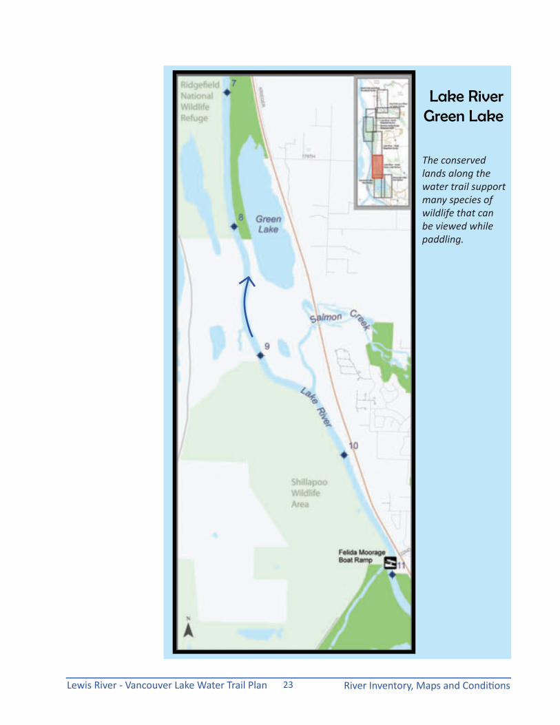
Green Lake: Although not an existing access site, these county-owned conservation lands contain over 1.5 miles of shoreline along Lake River between Fales Road and Felida Moorage. The conservation lands, acquired in 1991, encompass over 220 acres, wedged between the railroad and along the river, across the rail lines from Krieger Road. No public access currently exists.
Felida Moorage Boat Ramp: At the end of NW 122nd Street, this private facility along Lake River just north of Vancouver Lake offers a paved boat ramp with a $3 launch fee per boat. A gravel parking area supports approximately 30 vehicles with parking rates at 50 cents/vehicle.
Water Access Site Inventory
The Felida boat ramp accesses the southern segment of Lake River near the northern portion of Vancouver Lake.
Green Lake county property would be a convenient distance for turning around on a paddle from Felida.
Lewis River - Vancouver Lake Water Trail Plan River Inventory, Maps and Conditions23
Lake River Green Lake
The conserved lands along the water trail support many species of wildlife that can be viewed while paddling.

Lewis River - Vancouver Lake Water Trail PlanRiver Inventory, Maps and Conditions 24
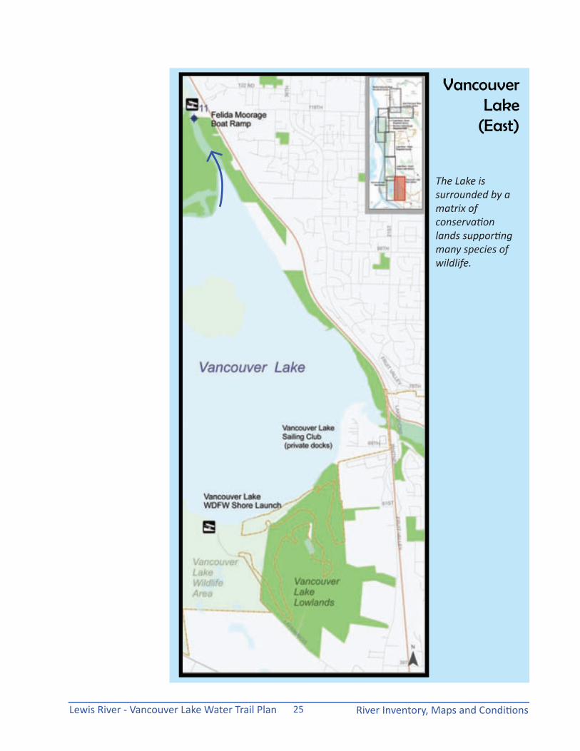
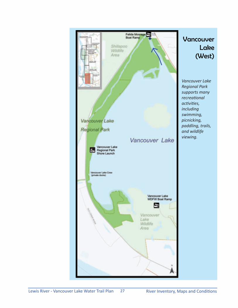
Vancouver Lake WDFW Shore Launch: At the southern end of Vancouver Lake, the end of La Frambois Road leads through the Washington Department of Fish and Wildlife’s Shillapoo Wildlife Area to the shallow waters of the Lake. A paved parking area with a pit toilet provides access to the game lands and parking for up to 40 vehicles with trailers. A gravel lane leads to the lake with a large gravel turnaround near approximate shoreline. A Discovery Pass ($30/year) or fishing/hunting license is required for parking and launch access. Conditions at the shore launch vary considerably with different lake levels.
Vancouver Lake Regional Park Shore Launch: This regional public park, owned by Clark County, provides a sandy beach swimming area amenable to shore launches for paddlers wanting to explore Vancouver Lake or enter Lake River from the south. A parking fee is required for vehicles: $3/day for cars; $6/car/truck with trailer; $8/bus; or a $40/annual pass. No launch fees are charged. Restrooms and showers are open and available in the summer season. The park has paved parking, picnic tables, picnic shelters, play areas and improved trails. No sign identifies the site as a potential shore launch site for access to Vancouver Lake. Some confusion with existing signage indicating “no boat access” (intended for motorized boats) may hamper public use of the beachfront water access. Non-motorized boat launching hand-carried from vehicles remaining in the parking areas is permissible.
Water Access Site Inventory
The WDFW shore launch at the southern end of Vancouver Lake is subject to flooding during seasonal high water.
The beach at Vancouver Lake Park allows for shore launching for hand-carried boats from the parking lot. The Park also provides restrooms, picnic tables, shelters, trails and open play fields.
Lewis River - Vancouver Lake Water Trail Plan River Inventory, Maps and Conditions25
Vancouver Lake
(East)
The Lake is surrounded by a matrix of conservation lands supporting many species of wildlife.

Lewis River - Vancouver Lake Water Trail PlanRiver Inventory, Maps and Conditions 26
River Reach MapsThe detailed inventory and assessment of public-owned access sites and river reaches was conducted by VCPRD staff and water trail stakeholders. The maps were reviewed by participating landowners and public agency representatives to refine and enhance the river mapping information. The eight (8) river reach maps were used as the basis for the printed trail guide and provide scaled depictions of the waterways with marked mileage, navigational information and access site locations.
Private Property, Wildlife Refuge and Other Adjacent Land UsesAn important goal for a formalized water trail is to direct appropriate use of public access sites and waterways to avoid impacts to sensitive natural resource areas and protect private lands from unwanted trespassing. Traveling down the rivers today, the paddler may have great difficulty understanding which properties along the waterways are public and which are private. The waterways within the scope of this planning effort flow through federal, state and local conservation lands that have been established for a variety of designations.
The Ridgefield National Wildlife Refuge was established in the mid-1960’s to provide wintering habitat for a subspecies of Canada geese called duskies and manages habitat for swans, cranes and herons. The Refuge also provides valuable habitat for other waterfowl species, song and predatory birds, mammals, and other terrestrial as well as aquatic wildlife. In seasons of high water, the Refuge has been subject to undesired trespassing by paddlers who may be unaware of their unintentional disruption to wildlife breeding and the integrity of refuge habitat.
Washington State agencies also own and manage public land along the water trail. Paradise Point State Park, Two Forks Wildlife Area, and Shilapoo Wildlife Area have each been established with different intent and levels of allowable public access or use. As a state park, Paradise Point focuses on providing a recreational resource with camping facilities, boating access to the East Fork of the Lewis River, picnicking, trails and a new disc golf course.
Types of AccessThe water trail maps distinguish between paved boat ramps and less-improved shore launch sites. Shore launch sites have highly variable conditions in surfacing, distance to vehicle load/unload and parking areas, variable slopes and roughness affecting the degree of access and convenience for paddlers.
The majority of the water trail consists of navigable rivers and, thus, is available for both public recreation boating and fishing use. Public boat ramps are heavily used by fisherman during seasonal salmon runs and heavily used by recreational motor boats in the hotter parts of the summer. To avoid congestion at boat ramps, paddlers are encouraged to launch from the shore since their watercraft is more versatile and requires only basic put-in/take-out facilities. Paddlers along the water trail have more opportunities for physical access to the waterways since kayaks and canoes can be launched and landed successfully without paved boat ramps.
Existing shoreline locations along the water trail that provide paddlers put in and take out opportunities have a wide range of accessibility and accommodations for persons with varying levels of mobility. More developed boat ramp and launch facilities may have accessible ramping, ADA-compliant restrooms and other universal access characteristics. The more remote or unimproved shore launches will be difficult to manage and not likely to meet any accessibility needs. The water access site inventory identified existing handicapped facilities, where obvious, but did not conduct an evaluation of ADA compliance levels or needs.
Shoreline access varies significantly.
Lewis River - Vancouver Lake Water Trail Plan River Inventory, Maps and Conditions27
Vancouver Lake
(West)
Vancouver Lake Regional Park supports many recreational activities, including swimming, picnicking, paddling, trails, and wildlife viewing.
Lewis River - Vancouver Lake Water Trail PlanRiver Inventory, Maps and Conditions 28
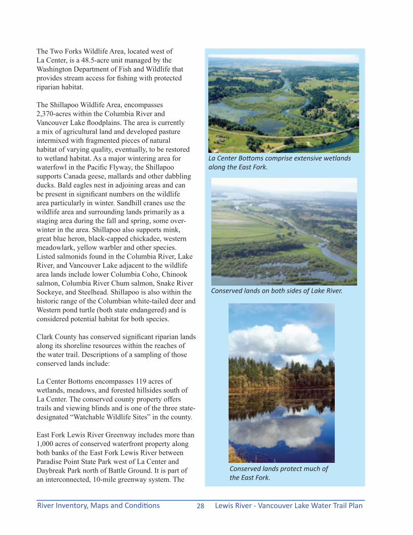
The Two Forks Wildlife Area, located west of La Center, is a 48.5-acre unit managed by the Washington Department of Fish and Wildlife that provides stream access for fishing with protected riparian habitat.
The Shillapoo Wildlife Area, encompasses 2,370-acres within the Columbia River and Vancouver Lake floodplains. The area is currently a mix of agricultural land and developed pasture intermixed with fragmented pieces of natural habitat of varying quality, eventually, to be restored to wetland habitat. As a major wintering area for waterfowl in the Pacific Flyway, the Shillapoo supports Canada geese, mallards and other dabbling ducks. Bald eagles nest in adjoining areas and can be present in significant numbers on the wildlife area particularly in winter. Sandhill cranes use the wildlife area and surrounding lands primarily as a staging area during the fall and spring, some over-winter in the area. Shillapoo also supports mink, great blue heron, black-capped chickadee, western meadowlark, yellow warbler and other species. Listed salmonids found in the Columbia River, Lake River, and Vancouver Lake adjacent to the wildlife area lands include lower Columbia Coho, Chinook salmon, Columbia River Chum salmon, Snake River Sockeye, and Steelhead. Shillapoo is also within the historic range of the Columbian white-tailed deer and Western pond turtle (both state endangered) and is considered potential habitat for both species.
Clark County has conserved significant riparian lands along its shoreline resources within the reaches of the water trail. Descriptions of a sampling of those conserved lands include:
La Center Bottoms encompasses 119 acres of wetlands, meadows, and forested hillsides south of La Center. The conserved county property offers trails and viewing blinds and is one of the three state-designated “Watchable Wildlife Sites” in the county.
East Fork Lewis River Greenway includes more than 1,000 acres of conserved waterfront property along both banks of the East Fork Lewis River between Paradise Point State Park west of La Center and Daybreak Park north of Battle Ground. It is part of an interconnected, 10-mile greenway system. The
La Center Bottoms comprise extensive wetlands along the East Fork.
Conserved lands on both sides of Lake River.
Conserved lands protect much of the East Fork.
Lewis River - Vancouver Lake Water Trail Plan River Inventory, Maps and Conditions29
greenway is state-designated priority habitat for large concentrations of migratory waterfowl, wintering bald eagles, and features high-quality riparian habitat. Most of the greenway is open to the public, but is not developed. Two regional parks: Lewisville and Daybreak Parks provide watercraft launch access further upstream from the extent of the current water trail plan.
Vancouver Lake Lowlands includes 692 acres of shoreline, wetlands, forested hillsides, meadows and farm and pasture land on Vancouver Lake, Lake River and lower Salmon Creek. The conserved lands are used heavily by geese and ducks, sandhill cranes, great blue heron, bald eagles, red-tailed hawks, beaver, deer and many other fish and wildlife species.
All of these conserved lands serve to provide wildlife habitat and protect water quality and in some cases can also support access to the waterways for recreational use. However, many sites function as refuges where public access can create an adverse impact on wildlife protection. Paddlers need to know the level of allowable access to be respectful of these sites and their functions.
Paddlers and other boaters often do not know where to properly dispose of garbage and human waste. One of the goals of the water trail targets the clear delineation between appropriate public access sites and private lands along the water edges through the use of signs, mapping guides, boundary and mileage markers.
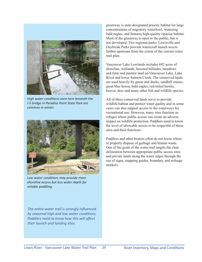
The entire water trail is strongly influenced by seasonal high and low water conditions. Paddlers need to know how this will affect their launch and landing sites.
High water conditions seen here beneath the I-5 bridge in Paradise Point State Park are common in winter.
Low water conditions may provide more shoreline access but less water depth for reliable paddling.

Lewis River - Vancouver Lake Water Trail PlanRiver Inventory, Maps and Conditions 30
this page is intentionally blank
Lewis River - Vancouver Lake Water Trail Plan Economic and Program Opportunities31
Economic and Program Opportunities
Benefits of the Water Trail
Measuring ValueTrails across the country benefit from some quantitative measure of trail use. By counting the users along a trail at intervals during the year and extrapolating the data, trail planners and stakeholders can articulate the value to the community based on amount of use. This data conveys a powerful message to elected officials, local government and state and federal granting agencies.
Public/Private Partnerships Representatives from public, private and non-profit recreational and educational organizations provided input and recommendations to the plan to allow for the enhancement of their business or services. For example, Paradise Point State Park may consider the expansion of their camping amenities to provide boat-in only camp sites in a section of the state park land. Pekin Inland Navigation Company are considering expanding their camping and boat launch facilities to engage in interpretive paddling and kayak rentals. Ridgefield Kayaks, already very active in the guided paddling outings and kayak rentals, supported all aspects of the water trail planning effort and proposed new alliances with partners and events.
Water trail development can help support local businesses, promote tourism, and diversify economic activity of the communities along the trail in Clark and Cowlitz Counties. The recreational resource is already flowing through the community. Enhancing access will increase its use and the opportunities for people to get out, paddle and enjoy.
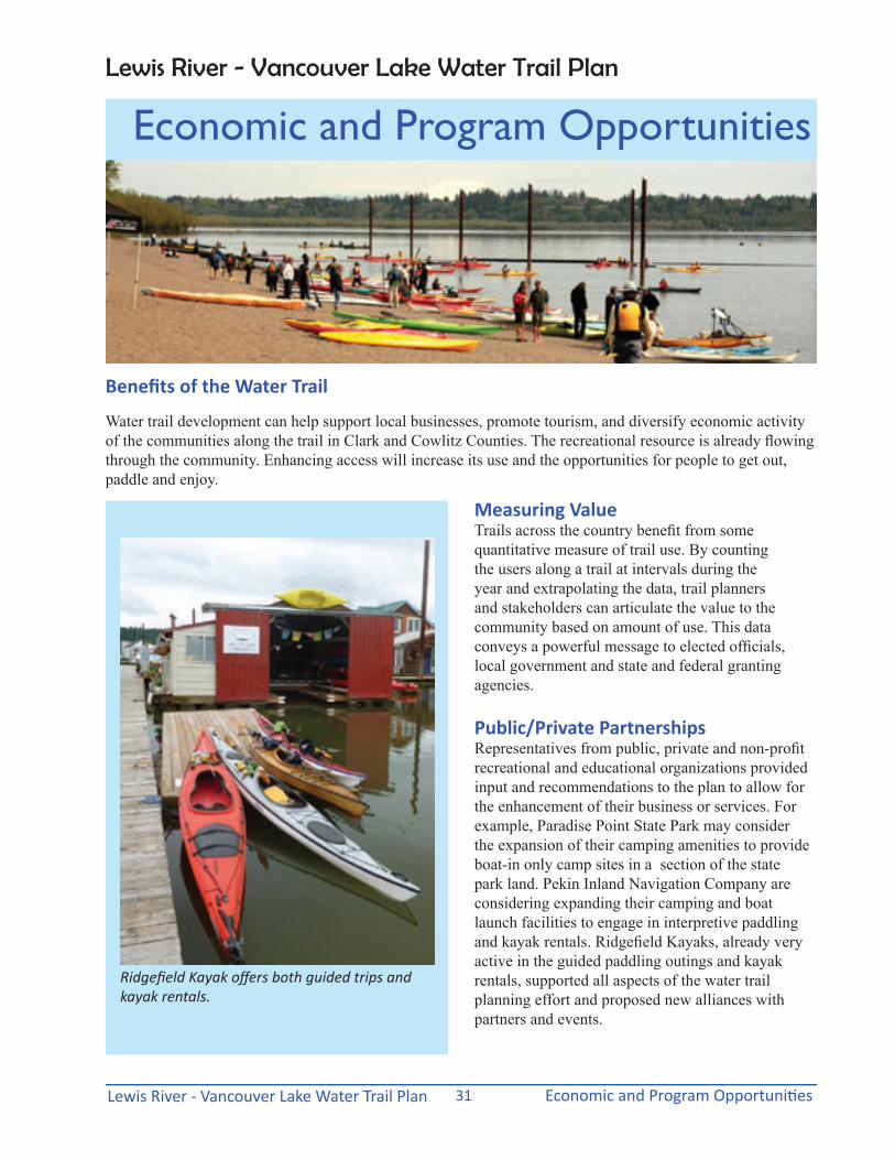
Ridgefield Kayak offers both guided trips and kayak rentals.
Lewis River - Vancouver Lake Water Trail Plan

Lewis River - Vancouver Lake Water Trail PlanEconomic and Program Opportunities 32
“Big Paddle”The “Big Paddle”, an event coinciding with National Trails Day, was planned to raise awareness of the water trail planning effort. The June 2nd paddling outing involved a flotilla of three (3) big canoes and dozens of kayaks that left the Port of Ridgefield and paddled down Lake River to its confluence with the Columbia River. Several historic and cultural experts shared locally relevant information about the immediate area during the Paddle. The event was a collaboration of many water trail stakeholders, local governments, and environmental organizations. The Big Paddle was successful enough that City and Port of Ridgefield, along with other partners, are considering conducting this as an annual event.
Expansion of Existing ActivitiesThe Lewis River – Vancouver Lake Water Trail is an existing but underutilized recreational resource in Clark County and portions of Cowlitz County. For local paddlers and visitors, the water trail plan recommendations will promote the cohesive development of signage, water trail designation and identification, readily available mapping resources, improved site access and heightened awareness of available waterways. The planning process and implementation of recommendations will expand the existing uses on the water providing benefits for more local recreation, health and economic activities in the community. The water trail will also connect users to the Lower Columbia River and its tributaries in Clark County and its rich historic, cultural and natural resources.
Intertwine and Regional PerspectiveThe water trail is also part of a larger system of parks, trails and natural spaces that connect people to nature in the Portland-Vancouver metropolitan region. The Intertwine Alliance is a collaborative partnership of local and regional agencies, non-profits, health providers, outdoor recreation businesses, groups and individuals working to foster and enhance the “Intertwine”. The Intertwine is loosely defined as the parks, trails and natural areas in the urban and suburban communities that have value through connecting residents to nature and help people live active, healthy lives. This network of urban nature includes the many waterways and, thus, water trails that flow through the Portland-Vancouver region.
In its efforts to increase access to nature, the Intertwine Alliance supports a website that informs users about opportunities to get outside and play. Trail descriptions, including this water trail, are being added to their website regularly, providing another resource for residents’ recreational planning. This water trail expects to have its information on the Intertwine website in several formats to engage more paddling access to the waterways.
This Lewis River-Vancouver Lake Water Trail is attached and tributary to the Lower Columbia River Water Trail that extends for 146 miles from the Bonneville Dam to the ocean. Other water trails in the Portland-Vancouver metropolitan region include the Willamette River Water Trail, flowing for 106 miles from Buena Vista to the Columbia River;
The Intertwine Alliance is working to promote the region’s system of parks, trails and natural spaces, including water trails.
Lewis River - Vancouver Lake Water Trail Plan Economic and Program Opportunities33
the Clackamas River Water Trail, running from Estacada to the Willamette River; The Sandy River Gorge Water Trail connects the Oxbow Regional Park with the Columbia at the Sandy River delta; the Tualatin River Water Trail runs from Haag Lake to the Willamette River; and the Columbia Slough Water Trail extends 19 miles from Fairview Lake to the confluence with the Willamette River at the confluence with the Willamette and Lower Columbia River Water Trails.
Tourism and Local BusinessesThe Vancouver USA Regional Tourism Office is a non-profit organization funded through a local tourism promotion area that levies a charge collected by lodging establishments throughout Clark County. Their main mission is to increase convention and visitor business and to improve visibility and create awareness and visitation to the region. Their resources including visitor information and maps help convey the recreational opportunities for both visitors and local residents.
Tourism offers major contributions to the local economy. Trail maps printed by VCPRD and bike maps produced by a collaboration of biking groups and supportive agencies provide valuable information about the variety of modes for active lifestyles. The water trail maps could be linked to on-line resources and printed copies of the water trail guide could be distributed (and maybe reprinted by) the tourism office to broaden the spectrum of tourist opportunities and promote the use of the water trail. Water trail recreation generates local economic activity through spending on materials and supplies by users and visitors. Small public investments in trails and trail access improvements can fuel significantly more monetary investments in private projects.
The Pekin Ferry Inland Navigation Company provides private water access along the Lewis RIver.
The Port of Ridgefield operates the public boat ramp on Lake River.
Water trail recreation generates local economic activity through spending on materials & supplies by users and visitors.

Lewis River - Vancouver Lake Water Trail PlanEconomic and Program Opportunities 34
America’s Great Outdoors report recommends establishing a national system of blueway trails.
Adopting a healthy lifestyle can begin at an early age. The water trail adds to the choices for outdoor recreation and physical activity.
America’s Great Outdoors: “Blueways” The America’s Great Outdoors report by the Department of the Interior includes a recommendation on establishing a National Recreational Blueway Trails Initiative. In February 2012, Secretary of the Interior Ken Salazar signed an order that establishes national water trails as a class of national trails under the National Trails System Act of 1968. The Department of the Interior stated that the goal is to “help facilitate outdoor recreation on waterways in and around urban areas, and provide national recognition and resources to existing, local water trails.” This “blueways” initiative is providing focus on waterways for their recreational, economic, and ecological importance. According to the Department, water trails can become catalysts for restoring the health of local waterways throughout the community. The Lower Columbia River Water Trail (LCRWT) is currently pursuing this national water trail designation. With this designation, signage, technical assistance and resources may be provided to build on and promote the development of the water trail. Once the LCRWT receives designation the Lewis River-Vancouver Lake could theoretically pursue the national designation as well or consider ways to promote the local water trail as a natural extension of the national water trail.
Public Health and Physical ActivityThe water trail offers opportunities for outdoor exercise, improving both physical and mental health. Over 32 miles of paddling distances can be added to the 66+ miles of walking/biking trails that are already available within the urban area of Vancouver along with numerous other trail opportunities throughout the County. Beyond encouraging physical activity, the water trail promotes public health by connecting people to nature, relieving stress through a more restorative environment, and providing a recreational choice that encourages families and groups to interact in an enjoyable pastime.

Lewis River - Vancouver Lake Water Trail Plan Recommendations35
Access Site Improvements
Site improvements in this water trail report focus primarily on publicly-owned access sites. Public sites have the responsibility for meeting reasonable accessibility requirements; require future planning to be identified on capital facilities/improvement plans; and to be budgeted in the typically biennial budget cycles. Private site improvements are pursued at the discretion of the private property owner or facility operator and could be considered in the context of adding value to their enterprise rather than warranted as a general public improvement. For most private site improvements the advantage of adding signs for the water trail should be obvious to capture the value of more users having access to a larger system of water-based recreation. The addition of water trail signs along public right-of-way at strategic locations for directing users to private launch access sites could be coordinated between the private enterprise and the public jurisdiction governing the right-of-way.
Throughout the inventory and assessment of the existing facilities along the targeted sections of the water trail, conditions were described that warranted some level of site improvements or enhancements.
Finding the water trail will require a coordinated system of directional signs.
RecommendationsLewis River - Vancouver Lake Water Trail Plan

Lewis River - Vancouver Lake Water Trail PlanRecommendations 36
Hayes Road Bridge Shore Launch Improvements: • Formalize the parking arrangement with
improved grading, gravel surfacing and wheel stops.
• Create more gradual stabilized trail as shore launch connecting parking to variable river levels.
• Add signs from public roadway identifying the site as public access to the river and part of the water trail system.
Martin WDFW Boat Ramp Improvements:• Incorporate a water trail sign to identify the
access to a wider range of paddling access and activities.
• Dedicate space on the sign kiosk for a water trail map with guide/website information.
Paradise Point State Park Shore Launch Improvements:• Launch site should be evaluated for compliance
with outdoor ADA guidelines to ensure public accessibility.
• Incorporate a water trail sign to identify the access to a wider range of paddling access and activities.
• Dedicate space on the sign kiosk for a water trail map with guide/website information.
• Additional camping facilities could accommodate a new “boat-in only” facility for paddlers if an area is available. If developed, a shoreline access site would need to be added along the East Fork of the Lewis River.
Pollock Road Shore Launch Improvements:• Evaluate the site for any opportunities to improve
access provision. Site analyses that examine topography and the extent of the flood plain could reveal some potential for creating a more amenable access site.
• Add signs from public roadway (La Center Road and Timmen Road) identifying the site as public access to the river and part of the water trail system.
La Center Shore Launch Improvements:• Add signs from public roadway identifying the
site as public access to the river and part of the water trail system.
• Increase physical access along shoreline by upgrading informal gravel slopes to meet ADA outdoor accessibility guidelines.
• Add water trail map to existing La Center Bottoms sign kiosk or create additional sign for water trail information in upper paved parking area.
CD Hale Road Shore Launch Improvements: • Formalize the parking arrangement with
improved grading, gravel surfacing and wheel stops.
• Create more gradual stabilized trail as shore launch connecting parking to variable river levels.
• Add signs from public roadway identifying the site as part of the water trail system.
• Incorporate a water trail sign to identify the site access relative to the wider range of paddling access and activities.
Variable water levels and uneven surfaces can radically alter the launching and landing conditions at access sites.
Lewis River - Vancouver Lake Water Trail Plan Recommendations37
Division Street, Ridgefield Shore Launch Improvements:• Incorporate a water trail sign to identify the site
access relative to the wider range of paddling access and activities.
• Retain a separate shore launch facility for non-motorized watercraft as the waterfront redevelopment project moves forward.
Mill Street, Ridgefield Boat Ramp Improvements:• Incorporate a water trail sign to identify the site
access relative to the wider range of paddling access and activities.
Fales Road Access Site Improvements: • Plan to acquire appropriate adjacent property
to support parking and support amenities for accommodating the access site.
• After support site acquisition, improve the road grade to provide access for hand-carried canoes and kayaks up or down the access road alignment.
• Coordinate with BNSF Railroad to improve the railroad underpass through the removal of the accumulated mud and rock debris to increase the height clearance for water trail users and fisherman.
• Add signage to the acquired support parking site to identify the site, orient users to the water trail, and provide park rules for behaviors and permitted activities.
Vancouver Lake WDFW Boat Ramp: • Incorporate a water trail sign to identify the site
access relative to the wider range of paddling access and activities.
The Port of Ridgefield is engaged in a redevelopment project that will transform its waterfront. Preserving a separate non-motorized launch facility is recommended.
At Fales Road, the railroad underpass would need mud and rock removal to make it safe and passable for paddlers hauling their craft to and from the shoreline.
Lewis River - Vancouver Lake Water Trail PlanRecommendations 38
Vancouver Lake Park has shore launch access but a sign at the entry implies that paddlers cannot use the beach.
Formal boat ramps with improved facilities usually meet acccessibility needs but many shore launches are often not accessible to paddlers with limited mobility.
Vancouver Lake Regional Park Shore Launch Improvements:• Incorporate a water trail sign to identify the site
access relative to the wider range of paddling access and activities.
• Clarify the existing signs that imply no boat access. Signs should distinguish between motorized and non-motorized boating to allow and promote paddlers’ access to the lake.
• Provide a short-term, loading and unloading zone for non-motorized boaters near the paths to the beach or lake front.
Green Lake Natural Area Improvements:• As part of its stewardship plan, some
accommodation should be considered for paddlers to have a landing area and a “leave no trace” picnic space.
• Site analysis on the property for the best landing and beset picnic locations should designate future improvements.
• Once improved signs should be included to promote “leave no trace” behaviors.
• As part of the implementation plan, a regular program of water trail volunteer activities should be engaged to help keep the future picnic area viable.
Accessibility Evaluation & ImprovementsAccess locations have a wide range of existing accessibility from reasonable ADA compliance to no viable accommodation for persons with disabilities. As part of each jurisdiction’s implementation of their ADA compliance plan, an evaluation and assessment should identify needed upgrades and improvements to meet the targeted level of compliance to Americans with Disabilities Act requirements or Department of Justice outdoor standards for accessibility. Site access improvements specifically targeted to increase viable use for persons with disabilities should be identified on their capital facilities plan and scheduled for implementation within a specified time period. The American Trails organization has extensive resources to assist jurisdictions in evaluating their need for access and methods for designing facilities for adaptive paddling.
Photo source: American Trails webinar on Water Trail Accessibility
Lewis River - Vancouver Lake Water Trail Plan Recommendations39
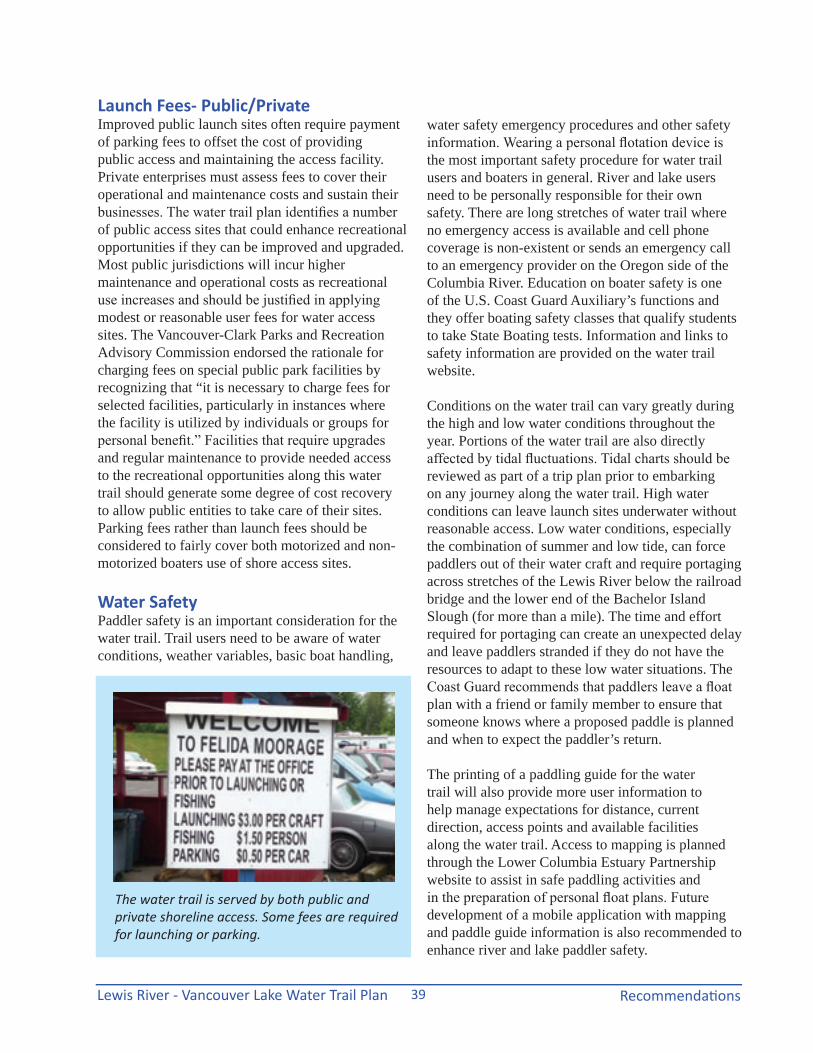
Launch Fees- Public/PrivateImproved public launch sites often require payment of parking fees to offset the cost of providing public access and maintaining the access facility. Private enterprises must assess fees to cover their operational and maintenance costs and sustain their businesses. The water trail plan identifies a number of public access sites that could enhance recreational opportunities if they can be improved and upgraded. Most public jurisdictions will incur higher maintenance and operational costs as recreational use increases and should be justified in applying modest or reasonable user fees for water access sites. The Vancouver-Clark Parks and Recreation Advisory Commission endorsed the rationale for charging fees on special public park facilities by recognizing that “it is necessary to charge fees for selected facilities, particularly in instances where the facility is utilized by individuals or groups for personal benefit.” Facilities that require upgrades and regular maintenance to provide needed access to the recreational opportunities along this water trail should generate some degree of cost recovery to allow public entities to take care of their sites. Parking fees rather than launch fees should be considered to fairly cover both motorized and non-motorized boaters use of shore access sites.
Water Safety Paddler safety is an important consideration for the water trail. Trail users need to be aware of water conditions, weather variables, basic boat handling,
water safety emergency procedures and other safety information. Wearing a personal flotation device is the most important safety procedure for water trail users and boaters in general. River and lake users need to be personally responsible for their own safety. There are long stretches of water trail where no emergency access is available and cell phone coverage is non-existent or sends an emergency call to an emergency provider on the Oregon side of the Columbia River. Education on boater safety is one of the U.S. Coast Guard Auxiliary’s functions and they offer boating safety classes that qualify students to take State Boating tests. Information and links to safety information are provided on the water trail website.
Conditions on the water trail can vary greatly during the high and low water conditions throughout the year. Portions of the water trail are also directly affected by tidal fluctuations. Tidal charts should be reviewed as part of a trip plan prior to embarking on any journey along the water trail. High water conditions can leave launch sites underwater without reasonable access. Low water conditions, especially the combination of summer and low tide, can force paddlers out of their water craft and require portaging across stretches of the Lewis River below the railroad bridge and the lower end of the Bachelor Island Slough (for more than a mile). The time and effort required for portaging can create an unexpected delay and leave paddlers stranded if they do not have the resources to adapt to these low water situations. The Coast Guard recommends that paddlers leave a float plan with a friend or family member to ensure that someone knows where a proposed paddle is planned and when to expect the paddler’s return.
The printing of a paddling guide for the water trail will also provide more user information to help manage expectations for distance, current direction, access points and available facilities along the water trail. Access to mapping is planned through the Lower Columbia Estuary Partnership website to assist in safe paddling activities and in the preparation of personal float plans. Future development of a mobile application with mapping and paddle guide information is also recommended to enhance river and lake paddler safety.
The water trail is served by both public and private shoreline access. Some fees are required for launching or parking.
Lewis River - Vancouver Lake Water Trail PlanRecommendations 40
Habitat ResourcesOne of the primary attractions for paddlers along this water trail is the enjoyment of witnessing wildlife so close to an urban area. Surveys of water trail users in other parts of the country indicate that engaging in wildlife viewing is a major attraction for recreational users and significantly affects their choice of where to go.
Clark County has engaged in land conservation along its waterways for many decades and has successfully conserved hundreds of acres of riparian forests to preserve both terrestrial and aquatic wildlife habitat. The value for preserving water quality along these rivers and streams is a critical public goal in addition to being essential to meeting the requirements of the Endangered Species Act and the Clean Water Act.
Clark County’s Conservation Futures funding has enabled the Legacy Lands program to leverage other public dollars to acquire and conserve 44 projects for over 4,400 acres across the county. Much of these efforts have been along the County’s waterways.
The State Shoreline Management Act requires the county to follow its adopted Shoreline Master Program that governs activities on and near lakes,
streams and rivers to ensure that adequate protection is established for the over 400 miles of rivers, streams and lake shores in Clark County. The water trail plan seeks to reinforce the need for access to the recreational resource of these waterways protecting the integrity of both water quality and habitat value.
Federal, state and local agencies as well as conservation organizations and private landowners own conserved lands along the waterways. Each property owner may have different mandated uses and intentions for their conservation lands. The water trail guide will help users understand that both public and private lands along the shoreline may not be accessible for paddlers’ use. Respect for land ownership and use can be fostered through coordinated signage and paddler guide notation.
Land StewardshipClark County Environmental Services is responsible for preparing stewardship plans for all county-owned conservation lands. Many of these conservation lands are located along the water trail. The need for maintaining or adding public access to the waterways should be a consideration in the development of each stewardship plan.
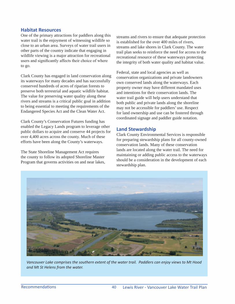
Vancouver Lake comprises the southern extent of the water trail. Paddlers can enjoy views to Mt Hood and Mt St Helens from the water.
Lewis River - Vancouver Lake Water Trail Plan Recommendations41
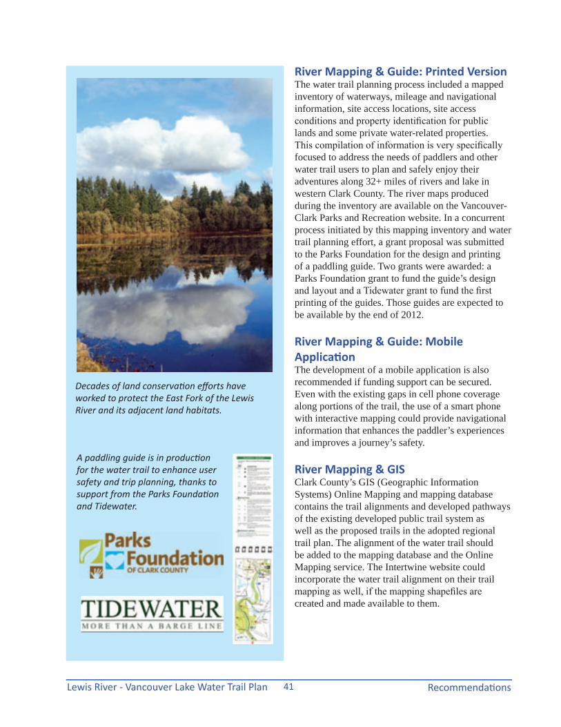
River Mapping & Guide: Printed VersionThe water trail planning process included a mapped inventory of waterways, mileage and navigational information, site access locations, site access conditions and property identification for public lands and some private water-related properties. This compilation of information is very specifically focused to address the needs of paddlers and other water trail users to plan and safely enjoy their adventures along 32+ miles of rivers and lake in western Clark County. The river maps produced during the inventory are available on the Vancouver-Clark Parks and Recreation website. In a concurrent process initiated by this mapping inventory and water trail planning effort, a grant proposal was submitted to the Parks Foundation for the design and printing of a paddling guide. Two grants were awarded: a Parks Foundation grant to fund the guide’s design and layout and a Tidewater grant to fund the first printing of the guides. Those guides are expected to be available by the end of 2012.
River Mapping & Guide: Mobile ApplicationThe development of a mobile application is also recommended if funding support can be secured. Even with the existing gaps in cell phone coverage along portions of the trail, the use of a smart phone with interactive mapping could provide navigational information that enhances the paddler’s experiences and improves a journey’s safety.
River Mapping & GISClark County’s GIS (Geographic Information Systems) Online Mapping and mapping database contains the trail alignments and developed pathways of the existing developed public trail system as well as the proposed trails in the adopted regional trail plan. The alignment of the water trail should be added to the mapping database and the Online Mapping service. The Intertwine website could incorporate the water trail alignment on their trail mapping as well, if the mapping shapefiles are created and made available to them.
Decades of land conservation efforts have worked to protect the East Fork of the Lewis River and its adjacent land habitats.
A paddling guide is in production for the water trail to enhance user safety and trip planning, thanks to support from the Parks Foundation and Tidewater.
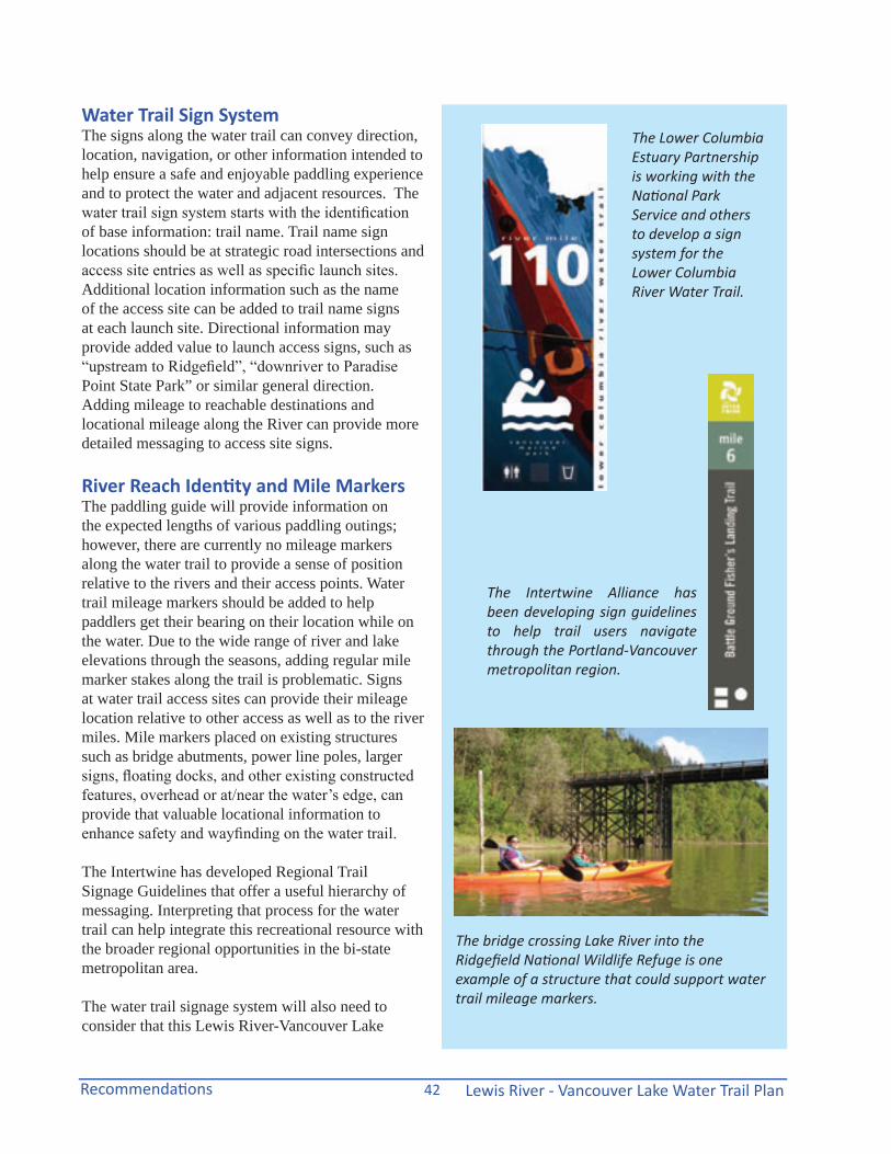
Lewis River - Vancouver Lake Water Trail PlanRecommendations 42
Water Trail Sign SystemThe signs along the water trail can convey direction, location, navigation, or other information intended to help ensure a safe and enjoyable paddling experience and to protect the water and adjacent resources. The water trail sign system starts with the identification of base information: trail name. Trail name sign locations should be at strategic road intersections and access site entries as well as specific launch sites. Additional location information such as the name of the access site can be added to trail name signs at each launch site. Directional information may provide added value to launch access signs, such as “upstream to Ridgefield”, “downriver to Paradise Point State Park” or similar general direction. Adding mileage to reachable destinations and locational mileage along the River can provide more detailed messaging to access site signs.
River Reach Identity and Mile MarkersThe paddling guide will provide information on the expected lengths of various paddling outings; however, there are currently no mileage markers along the water trail to provide a sense of position relative to the rivers and their access points. Water trail mileage markers should be added to help paddlers get their bearing on their location while on the water. Due to the wide range of river and lake elevations through the seasons, adding regular mile marker stakes along the trail is problematic. Signs at water trail access sites can provide their mileage location relative to other access as well as to the river miles. Mile markers placed on existing structures such as bridge abutments, power line poles, larger signs, floating docks, and other existing constructed features, overhead or at/near the water’s edge, can provide that valuable locational information to enhance safety and wayfinding on the water trail.
The Intertwine has developed Regional Trail Signage Guidelines that offer a useful hierarchy of messaging. Interpreting that process for the water trail can help integrate this recreational resource with the broader regional opportunities in the bi-state metropolitan area.
The water trail signage system will also need to consider that this Lewis River-Vancouver Lake
The bridge crossing Lake River into the Ridgefield National Wildlife Refuge is one example of a structure that could support water trail mileage markers.
The Lower Columbia Estuary Partnership is working with the National Park Service and others to develop a sign system for the Lower Columbia River Water Trail.
The Intertwine Alliance has been developing sign guidelines to help trail users navigate through the Portland-Vancouver metropolitan region.
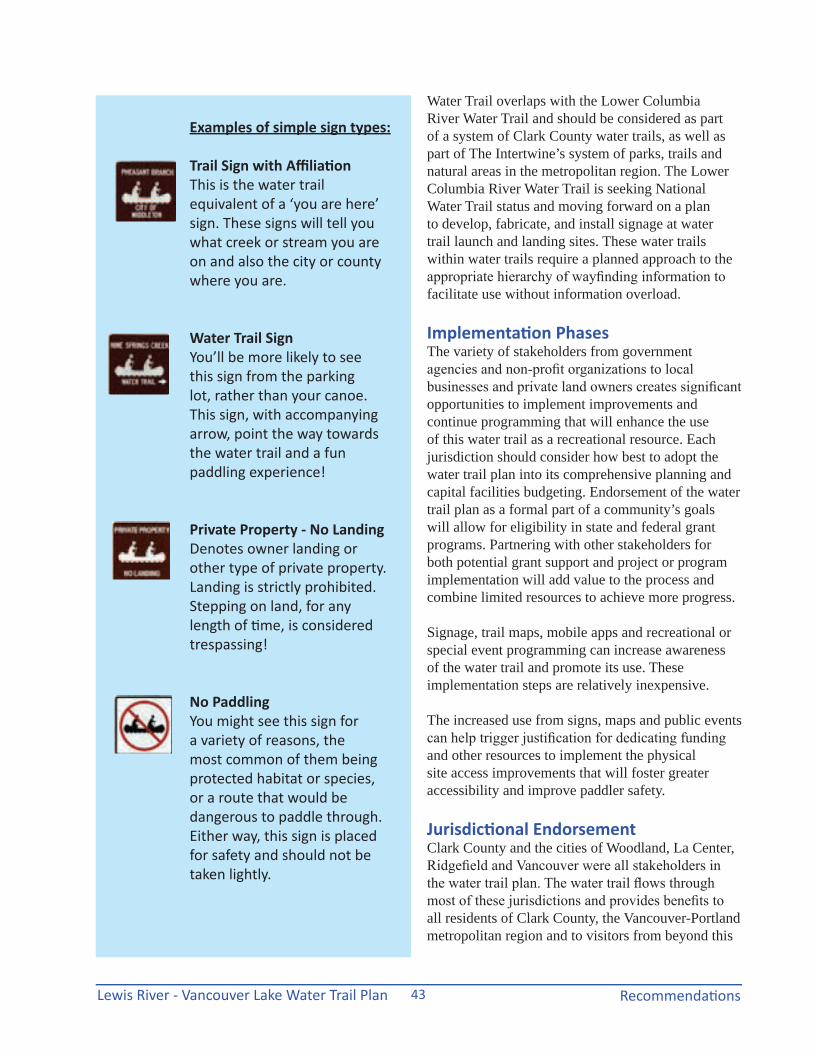
Lewis River - Vancouver Lake Water Trail Plan Recommendations43
Water Trail overlaps with the Lower Columbia River Water Trail and should be considered as part of a system of Clark County water trails, as well as part of The Intertwine’s system of parks, trails and natural areas in the metropolitan region. The Lower Columbia River Water Trail is seeking National Water Trail status and moving forward on a plan to develop, fabricate, and install signage at water trail launch and landing sites. These water trails within water trails require a planned approach to the appropriate hierarchy of wayfinding information to facilitate use without information overload.
Implementation Phases The variety of stakeholders from government agencies and non-profit organizations to local businesses and private land owners creates significant opportunities to implement improvements and continue programming that will enhance the use of this water trail as a recreational resource. Each jurisdiction should consider how best to adopt the water trail plan into its comprehensive planning and capital facilities budgeting. Endorsement of the water trail plan as a formal part of a community’s goals will allow for eligibility in state and federal grant programs. Partnering with other stakeholders for both potential grant support and project or program implementation will add value to the process and combine limited resources to achieve more progress.
Signage, trail maps, mobile apps and recreational or special event programming can increase awareness of the water trail and promote its use. These implementation steps are relatively inexpensive.
The increased use from signs, maps and public events can help trigger justification for dedicating funding and other resources to implement the physical site access improvements that will foster greater accessibility and improve paddler safety.
Jurisdictional EndorsementClark County and the cities of Woodland, La Center, Ridgefield and Vancouver were all stakeholders in the water trail plan. The water trail flows through most of these jurisdictions and provides benefits to all residents of Clark County, the Vancouver-Portland metropolitan region and to visitors from beyond this
Examples of simple sign types:
Trail Sign with AffiliationThis is the water trail equivalent of a ‘you are here’ sign. These signs will tell you what creek or stream you are on and also the city or county where you are.
Water Trail SignYou’ll be more likely to see this sign from the parking lot, rather than your canoe. This sign, with accompanying arrow, point the way towards the water trail and a fun paddling experience!
Private Property - No LandingDenotes owner landing or other type of private property. Landing is strictly prohibited. Stepping on land, for any length of time, is considered trespassing!
No PaddlingYou might see this sign for a variety of reasons, the most common of them being protected habitat or species, or a route that would be dangerous to paddle through. Either way, this sign is placed for safety and should not be taken lightly.
Lewis River - Vancouver Lake Water Trail PlanRecommendations 44
immediate area. To provide for the endorsement necessary to apply for grants and other public or private funding, the water trail plan should be adopted by all the governmental jurisdictions within its current scope, including Woodland, La Center, Ridgefield, Vancouver and Clark County.
Since many of the access site locations are under public ownership, any capital improvements must be planned and budgeted through the respective jurisdiction’s capital facility planning and budgetary process. Beyond endorsement of the water trail plan, each jurisdiction should examine how its capacity to fund improvements is reflected in their capital facilities plan and budget.
The Ports of Vancouver, Ridgefield and Woodland are important partners in the water trail plan through their participation and endorsement of safe, recreational water uses that promote local economies. The endorsement by the different port authorities of the water trail plan may come from supporting site access improvements, sponsoring paddling events, and providing technical assistance.
Water Trail CoalitionThe planning for the water trail crossed jurisdictional boundaries and involved a wide variety of public and private partners and stakeholders. No one entity could have successfully completed the plan without this coordinated collaboration. The Lower Columbia Estuary Partnership has agreed to provide website support for water trail mapping and coordination with their Lower Columbia River Water Trail planning efforts. Vancouver-Clark Parks and Recreation should continue in some planning and facilitation role, as directed by the County, to further implementation through seeking grant funding support and inter-jurisdictional collaboration.
The greatest strength of the planning process came from the numerous stakeholders representing local, state and federal agencies, private and business interests, and non-profit organizations. Their energy and enthusiasm for the water trail plan should continue to be fostered, perhaps in the form of an informal water trail coalition. At the very least, their support will be needed to endorse any grant
applications and to help plan future paddling events, such as the second annual “Big Paddle” being planned by Ridgefield.
The formation of a water trail coalition could consolidate the many public and private efforts that should continue on improving and expanding this water trail recreational resource. If an independent coalition does not follow this planning effort, perhaps, an existing environmentally-based non-profit organization could provide leadership to promote the water trail.
Roles and ResponsibilitiesVancouver-Clark Parks and Recreation Department (VCPRD) under the technical guidance of the National Park Service led the water trail planning process to facilitate the development of existing inventory, mapping and recommendations for improvements and promotion of use. Under an interlocal agreement, VCPRD provides administrative, design, planning and operational services to Clark County. Since the water trail is a recognized regional trail recommendation in the County’s adopted Regional Trail and Bikeway Systems Plan, VCPRD should continue, with the County’s endorsement, to facilitate planning and development of this water trail and other water trails in the County.
The Lower Columbia Estuary Partnership (LCEP) provided significant guidance and technical assistance during the water trail planning process. LCEP should continue to facilitate future efforts through hosting web-based information and maps on the water trail and coordinating the relationship of this county water trail with the Lower Columbia Water Trail and its efforts towards national water trail designation, signage system design development and site access improvements. LCEP may also be a willing partner in planning and participating in local paddle events similar to the “Big Paddle” held on June 2, 2012 in Ridgefield.
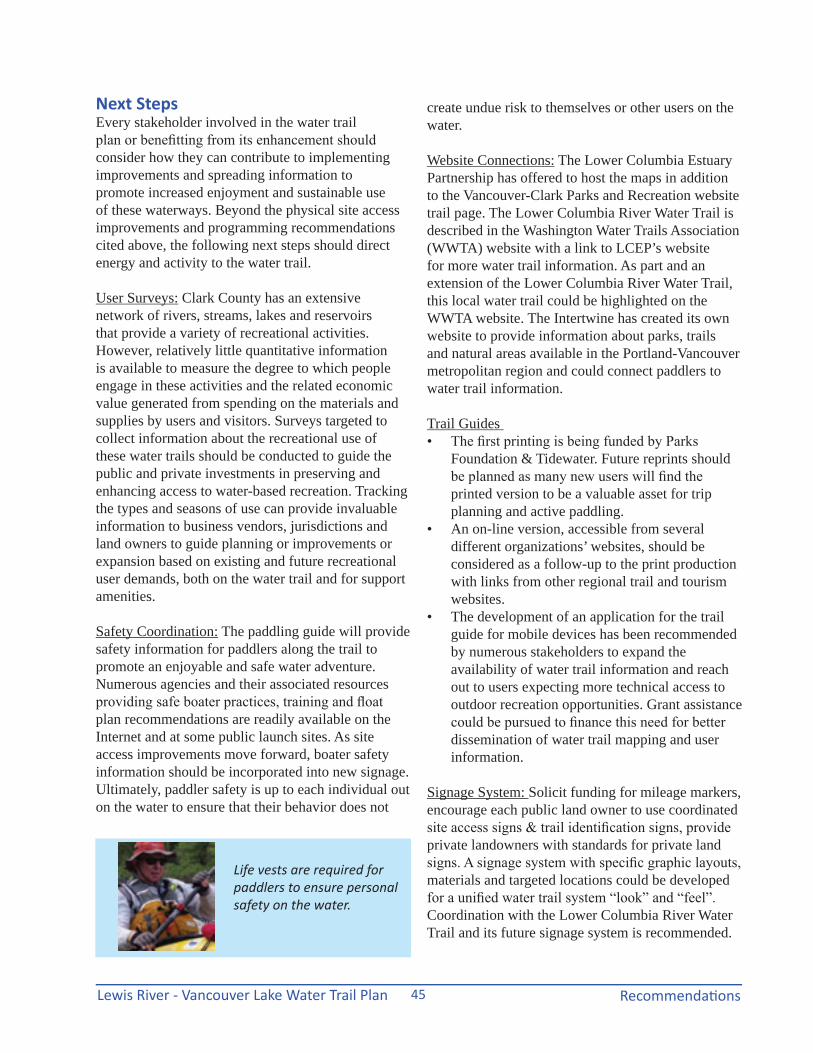
Lewis River - Vancouver Lake Water Trail Plan Recommendations45
Next StepsEvery stakeholder involved in the water trail plan or benefitting from its enhancement should consider how they can contribute to implementing improvements and spreading information to promote increased enjoyment and sustainable use of these waterways. Beyond the physical site access improvements and programming recommendations cited above, the following next steps should direct energy and activity to the water trail.
User Surveys: Clark County has an extensive network of rivers, streams, lakes and reservoirs that provide a variety of recreational activities. However, relatively little quantitative information is available to measure the degree to which people engage in these activities and the related economic value generated from spending on the materials and supplies by users and visitors. Surveys targeted to collect information about the recreational use of these water trails should be conducted to guide the public and private investments in preserving and enhancing access to water-based recreation. Tracking the types and seasons of use can provide invaluable information to business vendors, jurisdictions and land owners to guide planning or improvements or expansion based on existing and future recreational user demands, both on the water trail and for support amenities.
Safety Coordination: The paddling guide will provide safety information for paddlers along the trail to promote an enjoyable and safe water adventure. Numerous agencies and their associated resources providing safe boater practices, training and float plan recommendations are readily available on the Internet and at some public launch sites. As site access improvements move forward, boater safety information should be incorporated into new signage. Ultimately, paddler safety is up to each individual out on the water to ensure that their behavior does not
create undue risk to themselves or other users on the water.
Website Connections: The Lower Columbia Estuary Partnership has offered to host the maps in addition to the Vancouver-Clark Parks and Recreation website trail page. The Lower Columbia River Water Trail is described in the Washington Water Trails Association (WWTA) website with a link to LCEP’s website for more water trail information. As part and an extension of the Lower Columbia River Water Trail, this local water trail could be highlighted on the WWTA website. The Intertwine has created its own website to provide information about parks, trails and natural areas available in the Portland-Vancouver metropolitan region and could connect paddlers to water trail information.
Trail Guides • The first printing is being funded by Parks
Foundation & Tidewater. Future reprints should be planned as many new users will find the printed version to be a valuable asset for trip planning and active paddling.
• An on-line version, accessible from several different organizations’ websites, should be considered as a follow-up to the print production with links from other regional trail and tourism websites.
• The development of an application for the trail guide for mobile devices has been recommended by numerous stakeholders to expand the availability of water trail information and reach out to users expecting more technical access to outdoor recreation opportunities. Grant assistance could be pursued to finance this need for better dissemination of water trail mapping and user information.
Signage System: Solicit funding for mileage markers, encourage each public land owner to use coordinated site access signs & trail identification signs, provide private landowners with standards for private land signs. A signage system with specific graphic layouts, materials and targeted locations could be developed for a unified water trail system “look” and “feel”. Coordination with the Lower Columbia River Water Trail and its future signage system is recommended.
Life vests are required for paddlers to ensure personal safety on the water.

Lewis River - Vancouver Lake Water Trail PlanRecommendations 46
Kiosk posters: Coordinate water trail mapping for use at existing launch sites to help paddlers “navigate” their outing and connect with potential future paddlers. Develop “posters” with water trail maps that work for insertion into kiosks and on existing signs.
Americans with Disabilities (ADA) Assessment: A more detailed site launch analysis should evaluate the level of necessary improvements to enable persons with mobility limitations to be able to launch and disembark along the water trail at reasonable intervals. Some ramps and shore launches could be designated for full ADA-compliant improvements to provide more inclusive participation in the enjoyment of this recreational resource.
Launch Site Care & Upkeep: As recreational use increases due to access and information improvements, the need for increased maintenance will be triggered. While the water trail promotes a pack it in-pack it out, “leave no trace” user etiquette, the sites along the water trail and its access locations will incur the need for additional trash removal and repairs. The responsibility for maintenance at access locations falls to the property owners. Many federal, state and local governments have been cutting staff and reducing site maintenance due to continual budget reductions. The resulting gaps in the level of care may trigger the need for volunteer program clean-up activities.
Water Trail Volunteer Program: The need for increased maintenance may not coincide with increased funding support by the public jurisdictions with launch sites along the water trail. As many local governments are initiating volunteer programs to fill the gaps in care of their public parks, engaging a water trail volunteer program may add value to both users and landowners. If the need for a separate volunteer program is not justified, targeted clean-up activities should be added to other park, environmental and watershed volunteer programs.
Sunset and moonlight paddling can provide a unique perspective on the water trail. Safety lights on boats are recommended.
Different dock designs can help improve paddlers’ accessibility, where appropiate.
Photo source: American Trails webinar
Kiosks at access locations could include a water trail map to help paddlers plan their trips.