Embed Size (px)
Citation preview
1 | P a g e M a p p i n g a R e g i o n
Lesson Resource Kit: Mapping a Region
Grades 4 – 6
Overview of Archives Online Resources Designed to complement a teacher’s practice, PAMA’s resource kit links archival resources, activities and the Ontario curriculum. Each lesson focuses on a key feature of PAMA’s archival collection, the themes to explore and a suggested activity for your class to connect Peel history with curriculum and learning goals.
PAMA Goals
- Make connections, spark discussion and tackle questions related to history - Create a comfortable and fun experience for young learners - Build a public gallery and archival audience for the future - Provide students with the opportunity to look and talk about history - Showcase the PAMA collection and special exhibitions
Introduction to Mapping A Region Starting in the 1500s, French and English explorers, soldiers, government officials, surveyors, and settlers all played a role in creating maps of the “New World” lands in North America, including the area that would one day be home to Peel (Mississauga, Brampton, and Caledon). The earliest maps of the Peel area were created between 1806 and 1821 by land surveyors working for British government officials. These survey maps guided arriving settlers to their assigned land and assisted in laying out early roads. As settlements grew and prospered, additional maps were created to help people navigate the growing network of roads, bridges, and railways that criss-crossed the farms and villages in Peel. Thankfully, many of these maps survive in our archival holdings. Our rich Peel archival map collection includes the various early surveys as well as a range of maps from the 1820s to the 2000s that show the changing layout of villages, towns, and modern subdivisions (neighbourhoods), road and rail networks, and natural features such as land elevations, waterways, and trees. Such historical maps provide fascinating insights into the past, documenting the humble origins of modern cities and towns, the location of long-gone heritage structures and landforms, and changing surveying, drafting, and printing techniques.
2 | P a g e M a p p i n g a R e g i o n
Reference Documents Each resource page has a small copy of a map with some general points on its history, creation or use. For a full high-quality rendering of each map, click the map title and the image will open.
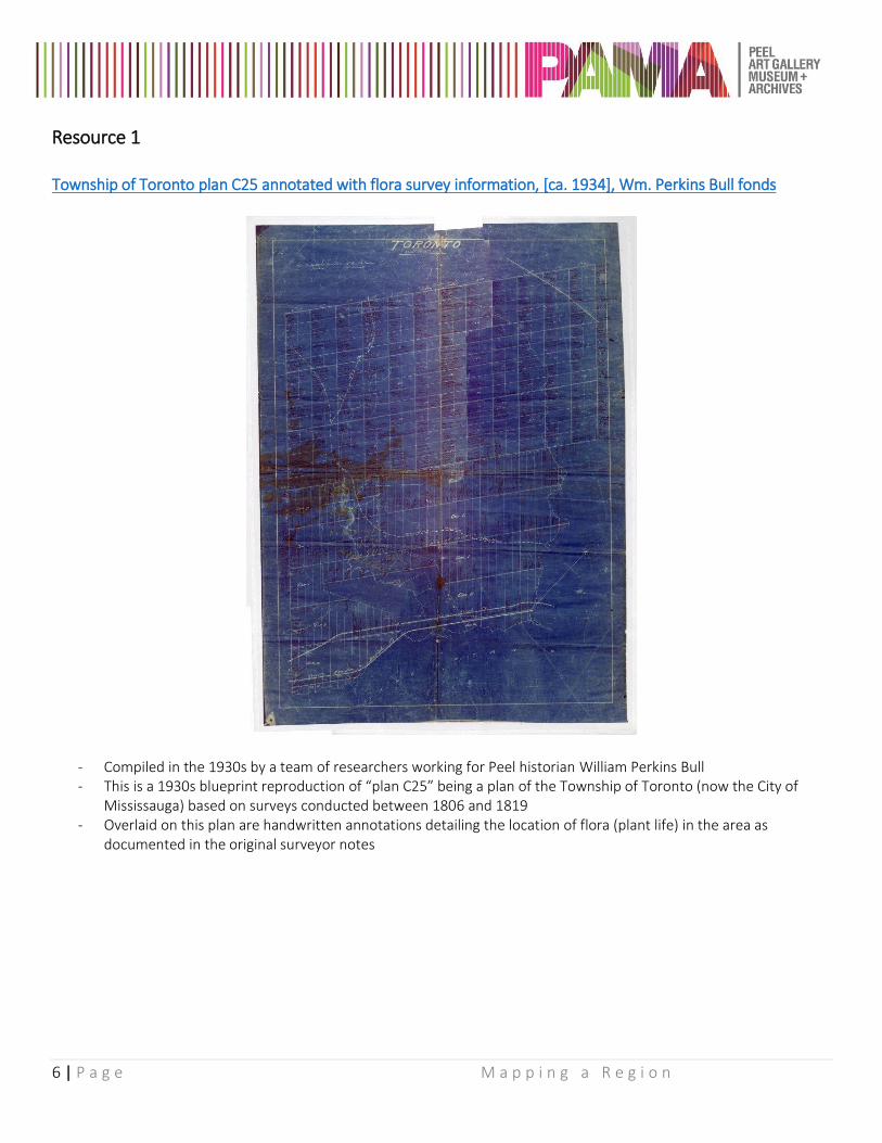
1. Township of Toronto plan C25 annotated with flora survey information, [ca. 1934], Wm. Perkins Bull fonds
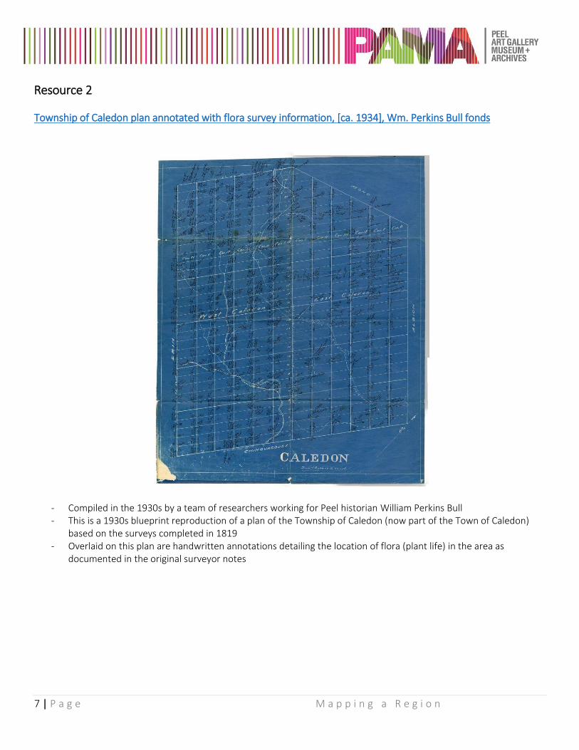
2. Township of Caledon plan annotated with flora survey information, [ca. 1934], Wm. Perkins Bull fonds
3. Plan of the Indian Reserve, River Credit, Canada, 1849, Region of Peel Archives map and plan collection
4. The County of Peel Map – specifically drawn and compiled for the Perkins Bull Historical Series by E.
Casson, [ca. 1933], Wm. Perkins Bull fonds
5. Map of Peel County, 1953, Russell Cooper fonds
6. Aerial photograph of Caledon East, 1967, County of Peel fonds
Themes
- Using primary sources - Elements of maps and extracting information from maps - Cardinal directions and reading a map - Settlement and community development
Inquiry Process Application Discussion points and connections between the resources provided and the Ontario Social Studies and History Curriculum for Grades 4 through 6 are in the following pages. For each grade, the connections are broken down as follows:
Reference Doc. Sources provided that best represent the topics discussed Formulate Questions Encourage students to explore the resources and ask questions – prompting
questions are available to assist Gather & Organize Collect and organize relevant data Interpret & Analyse Analyse and use different types of graphic organizers Evaluate & Conclude Synthesize information to make judgments Communicate Communicate judgments, decisions or plans of action
3 | P a g e M a p p i n g a R e g i o n
Grade 4: Flora & Human Activity
Reference Documents: Resources 1, 2 & 6 Formulate Questions
- Have students look at Resources 1, 2 and 6. Upon review, have students pose questions and share thoughts through group discussion on the resources.
Prompting Questions
- Resource 2 shows all the trees that grew in the area. Looking at Resource 6, did the area look like it had as many trees in 1967? Looking at a Google Map of Caledon today, are there more or less trees than in 1967?
- What impact has the growth in population of Peel had on the environment? - What should we be doing to balance continuing growth with environmental protection?
Gather & Organize
- Have students walk around their immediate area or a local park and document the changes the environment would have gone through for it to look like it does today.
- What natural resources have been protected despite the surrounding development? - Is there a balance between human needs and environment? Does one outweigh the other? If so, what
would need to happen for there to be a better balance? Interpret & Analyse
- Using the information gathered and Resource 4 as inspiration, have students create 3 different maps of the area they explored:
o A map that shows the natural resources (trees, elevation changes, water etc.). o A map that shows the human development (houses, roads, buildings). o A map of their idea for what a balanced environment meeting human needs for the area would
look like. Evaluate & Conclude
- What do your maps tell us about the interrelationship between human needs and the environment? - Moving forward as there continues to be human development, what can you do to protect the
environment? Communicate
- Have students share their thoughts and communicate their findings as a group. - What they could do to provoke change?
4 | P a g e M a p p i n g a R e g i o n
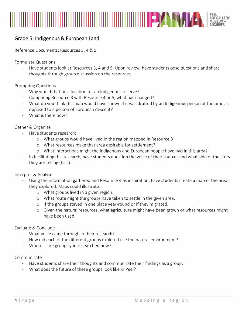
Grade 5: Indigenous & European Land
Reference Documents: Resources 3, 4 & 5 Formulate Questions
- Have students look at Resources 3, 4 and 5. Upon review, have students pose questions and share thoughts through group discussion on the resources.
Prompting Questions
- Why would that be a location for an Indigenous reserve? - Comparing Resource 3 with Resource 4 or 5, what has changed? - What do you think this map would have shown if it was drafted by an Indigenous person at the time as
opposed to a person of European descent? - What is there now?
Gather & Organize
- Have students research: o What groups would have lived in the region mapped in Resource 3 o What resources make that area desirable for settlement? o What interactions might the Indigenous and European people have had in this area?
- In facilitating this research, have students question the voice of their sources and what side of the story they are telling (bias).
Interpret & Analyse
- Using the information gathered and Resource 4 as inspiration, have students create a map of the area they explored. Maps could illustrate:
o What groups lived in a given region. o What route might the groups have taken to settle in the given area. o If the groups stayed in one place year-round or if they migrated. o Given the natural resources, what agriculture might have been grown or what resources might
have been used. Evaluate & Conclude
- What voice came through in their research? - How did each of the different groups explored use the natural environment? - Where is are groups you researched now?
Communicate
- Have students share their thoughts and communicate their findings as a group. - What does the future of these groups look like in Peel?
5 | P a g e M a p p i n g a R e g i o n
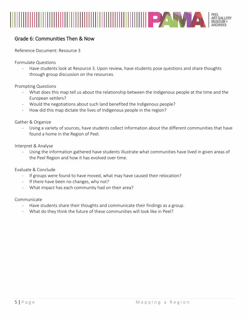
Grade 6: Communities Then & Now
Reference Document: Resource 3 Formulate Questions
- Have students look at Resource 3. Upon review, have students pose questions and share thoughts through group discussion on the resources.
Prompting Questions
- What does this map tell us about the relationship between the Indigenous people at the time and the European settlers?
- Would the negotiations about such land benefited the Indigenous people? - How did this map dictate the lives of Indigenous people in the region?
Gather & Organize
- Using a variety of sources, have students collect information about the different communities that have found a home in the Region of Peel.
Interpret & Analyse
- Using the information gathered have students illustrate what communities have lived in given areas of the Peel Region and how it has evolved over time.
Evaluate & Conclude
- If groups were found to have moved, what may have caused their relocation? - If there have been no changes, why not? - What impact has each community had on their area?
Communicate
- Have students share their thoughts and communicate their findings as a group. - What do they think the future of these communities will look like in Peel?
6 | P a g e M a p p i n g a R e g i o n
Resource 1 Township of Toronto plan C25 annotated with flora survey information, [ca. 1934], Wm. Perkins Bull fonds
- Compiled in the 1930s by a team of researchers working for Peel historian William Perkins Bull - This is a 1930s blueprint reproduction of “plan C25” being a plan of the Township of Toronto (now the City of
Mississauga) based on surveys conducted between 1806 and 1819 - Overlaid on this plan are handwritten annotations detailing the location of flora (plant life) in the area as
documented in the original surveyor notes
7 | P a g e M a p p i n g a R e g i o n
Resource 2
Township of Caledon plan annotated with flora survey information, [ca. 1934], Wm. Perkins Bull fonds
- Compiled in the 1930s by a team of researchers working for Peel historian William Perkins Bull - This is a 1930s blueprint reproduction of a plan of the Township of Caledon (now part of the Town of Caledon)
based on the surveys completed in 1819 - Overlaid on this plan are handwritten annotations detailing the location of flora (plant life) in the area as
documented in the original surveyor notes
8 | P a g e M a p p i n g a R e g i o n
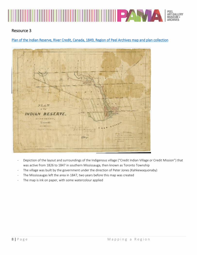
Resource 3
Plan of the Indian Reserve, River Credit, Canada, 1849, Region of Peel Archives map and plan collection
- Depiction of the layout and surroundings of the Indigenous village (“Credit Indian Village or Credit Mission”) that
was active from 1826 to 1847 in southern Mississauga, then known as Toronto Township
- The village was built by the government under the direction of Peter Jones (Kahkewaquonaby)
- The Mississaugas left the area in 1847, two years before this map was created
- The map is ink on paper, with some watercolour applied
9 | P a g e M a p p i n g a R e g i o n
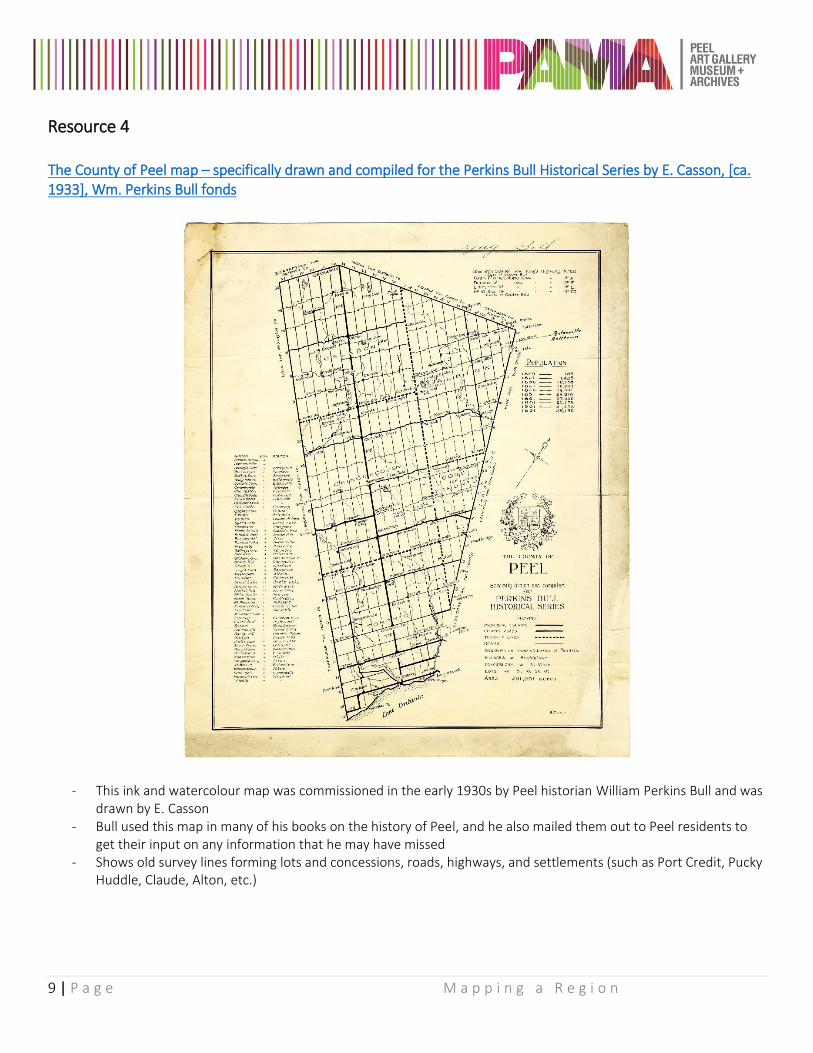
Resource 4 The County of Peel map – specifically drawn and compiled for the Perkins Bull Historical Series by E. Casson, [ca. 1933], Wm. Perkins Bull fonds
- This ink and watercolour map was commissioned in the early 1930s by Peel historian William Perkins Bull and was drawn by E. Casson
- Bull used this map in many of his books on the history of Peel, and he also mailed them out to Peel residents to get their input on any information that he may have missed
- Shows old survey lines forming lots and concessions, roads, highways, and settlements (such as Port Credit, Pucky Huddle, Claude, Alton, etc.)
10 | P a g e M a p p i n g a R e g i o n
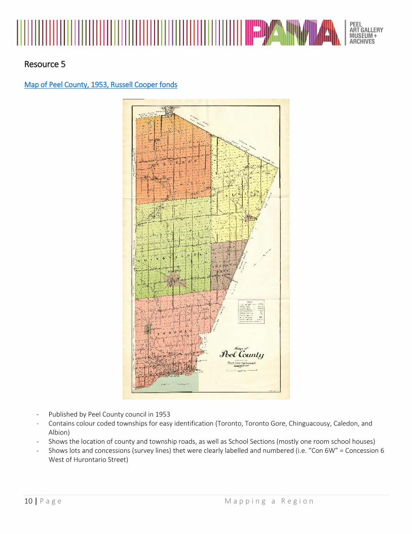
Resource 5 Map of Peel County, 1953, Russell Cooper fonds
- Published by Peel County council in 1953 - Contains colour coded townships for easy identification (Toronto, Toronto Gore, Chinguacousy, Caledon, and
Albion) - Shows the location of county and township roads, as well as School Sections (mostly one room school houses) - Shows lots and concessions (survey lines) thet were clearly labelled and numbered (i.e. “Con 6W” = Concession 6
West of Hurontario Street)
11 | P a g e M a p p i n g a R e g i o n
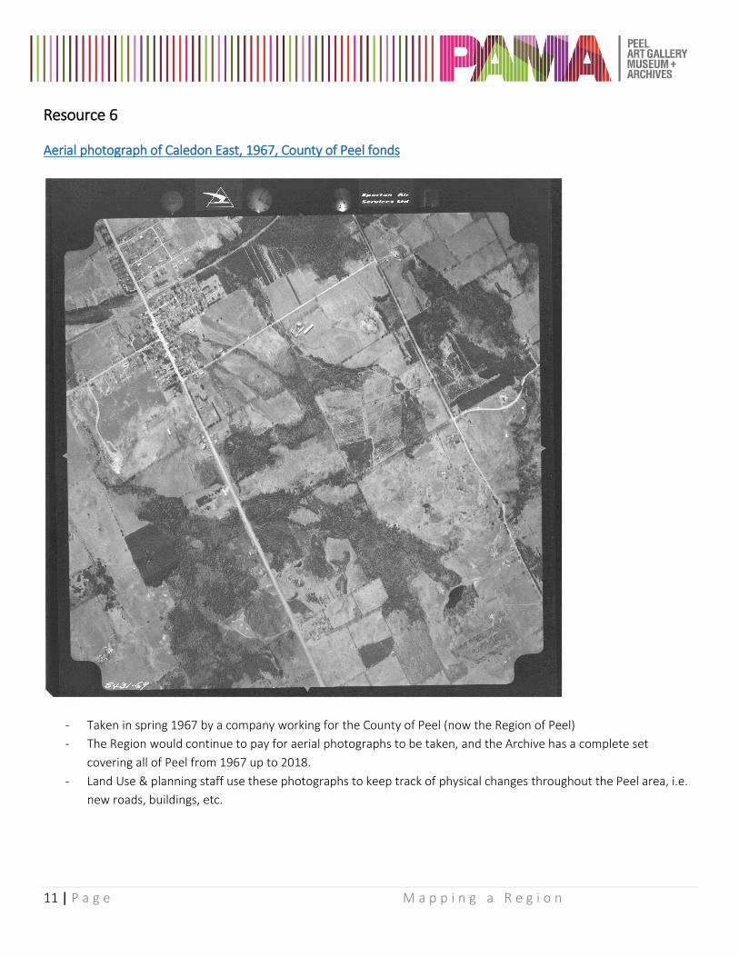
Resource 6
Aerial photograph of Caledon East, 1967, County of Peel fonds
- Taken in spring 1967 by a company working for the County of Peel (now the Region of Peel)
- The Region would continue to pay for aerial photographs to be taken, and the Archive has a complete set
covering all of Peel from 1967 up to 2018.
- Land Use & planning staff use these photographs to keep track of physical changes throughout the Peel area, i.e.
new roads, buildings, etc.
12 | P a g e M a p p i n g a R e g i o n
Share Your Stories If you have had the opportunity to use this resource with your class for your own lesson development or if you have an idea for a Resource Kit that you would use, we would love to hear from you!
Email: [email protected] Twitter: @visitPAMA Instagram: visitPAMA
For More Information If you have any questions about the information provided in this kit, or wish to find out more about any of the resources included, please contact PAMA Archives:
Phone: 905-791-4055 Email: [email protected]
The Archives features a variety of resources such as:
- Photographs - Maps - Architectural Plans - Newspapers - Posters - Letters - Journals - Business Records - Government Records
These resources can be used to research:
- Local government - Heritage Properties - The History of Peel Communities - History of a Peel School - History of a Peel Organization - Family History - Special Events in Peel