Embed Size (px)
DESCRIPTION
penting
Citation preview

Layers of the Earth

• The core is composed of mostly iron and nickel and remains very hot, even after 4.5 billion years of cooling. The core is divided into two layers: a solid inner core and a liquid outer core. The middle layer of the Earth, the mantle, is made of minerals rich in the elements iron, magnesium, silicon, and oxygen. The crust is rich in the elements oxygen and silicon with lesser amounts of aluminum, iron, magnesium, calcium, potassium, and sodium.
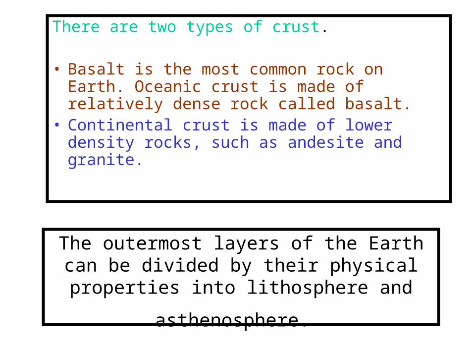
The outermost layers of the Earth can be divided by their physical properties into
lithosphere and asthenosphere.
There are two types of crust.
• Basalt is the most common rock on Earth. Oceanic crust is made of relatively dense rock called basalt.
• Continental crust is made of lower density rocks, such as andesite and granite.

Lithosphere
• •The lithosphere (from the
Greek, lithos, stone) is the rigid outermost layer made of crust and uppermost mantle.
• The lithosphere is the "plate" of the plate tectonic theory.

asthenosphere
• The asthenosphere (from the Greek, asthenos, devoid of force) is part of the mantle that flows, a characteristic called plastic behavior. It might seem strange that a solid material can flow.

•A good example of a solid that flows, or of plastic behavior, is the movement of toothpaste in a tube.
•The flow of the asthenosphere is part of mantle convection, which plays an important role in moving lithospheric plates.


PENGAPUNGAN BENUA
• Continental drift was originally proposed by Alfred Wegener, a German meteorologist, in 1912.
• Wegener used the fit of the continents, the distribution of fossils, a similar sequence of rocks at numerous locations, ancient climates, and the apparent wandering of the Earth's polar regions to support his idea. Wegener used his observations

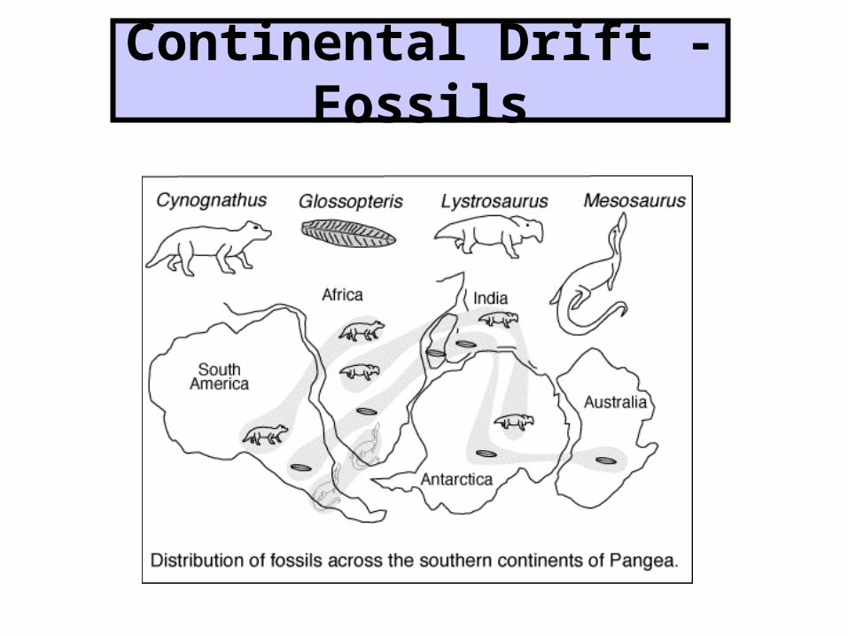
Continental Drift - Fossils

• Fossils of the same species were found on several different continents.
• Wegener proposed that the species dispersed when the continents were connected and later carried to their present positions as the continents drifted.
• For example, Glossopteris, a fern, was found on the continents of South America, Africa, India, and Australia.
• If the continents are reassembled into Pangaea, the distribution of Glossopteris can be accounted for over a much smaller contiguous geographic area.
• The distribution of other species can also be accounted for by initially spreading across Pangaea, followed by the breakup of the supercontinent, and movement of the continents to their present positions.

Continental Drift - Rock Sequences

• Rock sequences in South America, Africa, India, Antarctica, and Australia show remarkable similarities. Wegener showed that the same three layers occur at each of these localities.
• The bottom (oldest) layer is called tillite and is thought to be a glacial deposit. The middle layer is composed of sandstone, shale, and coal beds. Glossopteris fossils are in the bottom and middle layers.
• The top (youngest) layer is lava flows. The same three layers are in the same order in areas now separated by great distances.
• Wegener proposed that the rock layers were made when all the continents were part of Pangaea. Thus, they formed in a smaller contiguous area that was later broken and drifted apart.
Continental Drift - Glaciation
•Glaciation in South America, Africa, India, and Australia is best explained if these continents were once connected. Glaciers covered all or part of each of these continents during the same time period in the geologic past.


• • If the continents were in their
present position, a major glaciation event that covered nearly all of the continents and extended north of the equator would be required. Geologists have found no evidence of glacial action in the northern hemisphere during this time period. In fact, during this time period, the climate in North America was warm.

Continental Drift - Rock Sequences

• Rock sequences in South America, Africa, India, Antarctica, and Australia show remarkable similarities. Wegener showed that the same three layers occur at each of these localities. The bottom (oldest) layer is called tillite and is thought to be a glacial deposit. The middle layer is composed of sandstone, shale, and coal beds. Glossopteris fossils are in the bottom and middle layers. The top (youngest) layer is lava flows.
• The same three layers are in the same order in areas now separated by great distances. Wegener proposed that the rock layers were made when all the continents were part of Pangaea. Thus, they formed in a smaller contiguous area that was later broken and drifted apart.

Continental Drift - Glaciation
•Glaciation in South America, Africa, India, and Australia is best explained if these continents were once connected. Glaciers covered all or part of each of these continents during the same time period in the geologic past.


• If the continents were in their present position, a major glaciation event that covered nearly all of the continents and extended north of the equator would be required. Geologists have found no evidence of glacial action in the northern hemisphere during this time period. In fact, during this time period, the climate in North America was warm.


• Wegener proposed that the continents were adjacent to each other during the glacial event. Therefore, glaciers spread over a much smaller area in the southern hemisphere and probably did not influence the climate of the northern hemisphere.


• Wegener used the distribution of specific rock types to determine the distribution of climate zones in the geologic past.
• For example, glacial till and striations (scratches on the rock), sand dunes, and coral reefs, indicate polar, desert, and tropical climates, respectively. The present climate zones are shown in the above figure. Note how the distribution of reefs, deserts, and glacial ice constrain the position of the rotational pole of the Earth.


Using the distribution of rock types, Wegener reconstructed the distribution of
climates zones at specific times in the geologic past. He found that, unlike the
present distribution, in which zones parallel the equator, the past zones occupied very different positions.
This implies that the rotational pole was in very different locations relative to today. Wegener proposed an alternative interpretation. He believed that the climate zones remained stationary and the continents drifted to different locations. The drift of the continents caused the apparent movement of the climate zones.


Wegener used the distribution of climate zones to determine the location of the poles at different
times in the geologic past. He found that the rotational pole appears to
gradually change location, arriving at its present position only in the very
recent geologic past. • The apparent movement in the pole
position over time is called polar wandering. Wegener offered an alternative explanation. He suggested that the poles remained stationary and that the continents changed their positions relative to the poles.