Embed Size (px)
Citation preview
The Earth
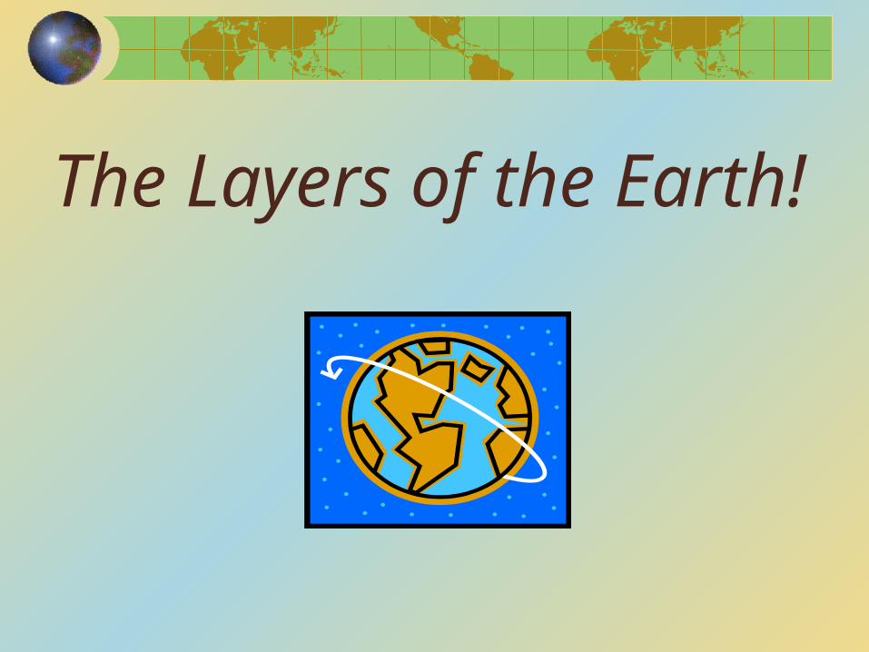
The Layers of the Earth!
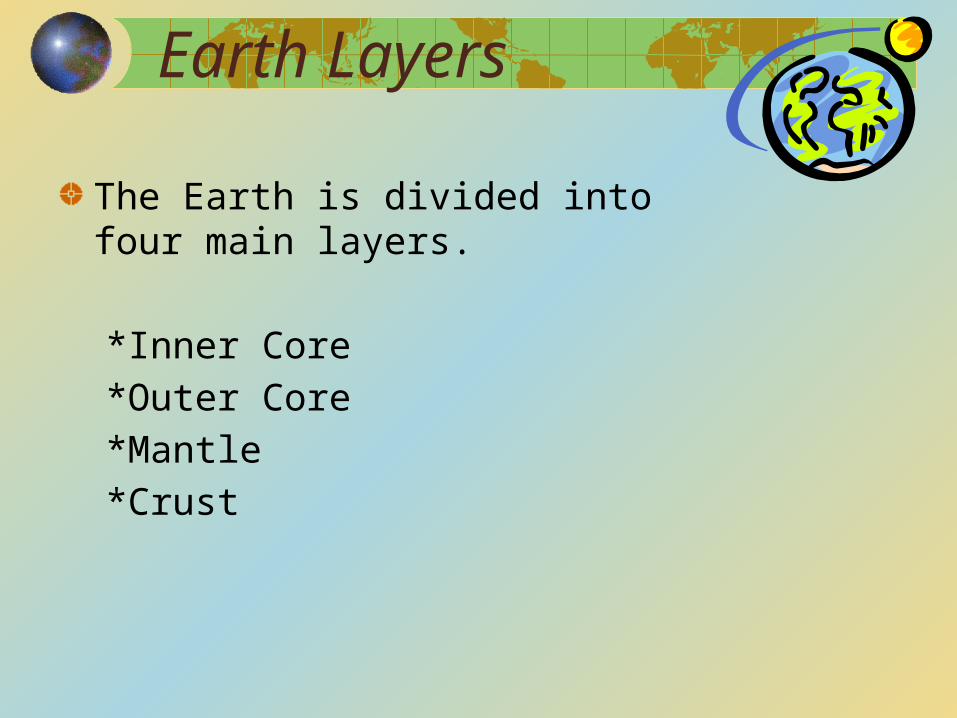
Earth Layers
The Earth is divided into four main layers.
*Inner Core*Outer Core*Mantle *Crust
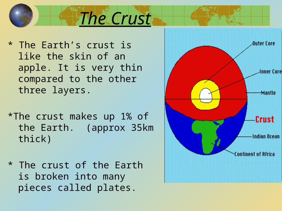
The Crust* The Earth’s crust is like the
skin of an apple. It is very thin compared to the other three layers.
*The crust makes up 1% of the Earth. (approx 35km thick)
* The crust of the Earth is broken into many pieces called plates.
The Mantle
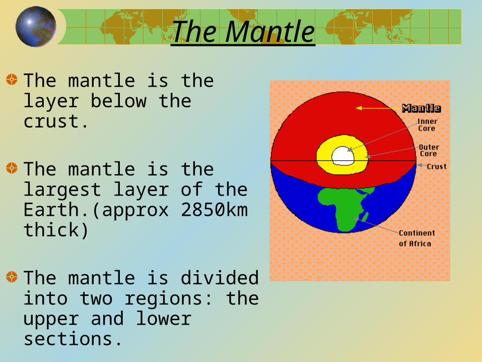
The mantle is the layer below the crust.
The mantle is the largest layer of the Earth.(approx 2850km thick)
The mantle is divided into two regions: the upper and lower sections.
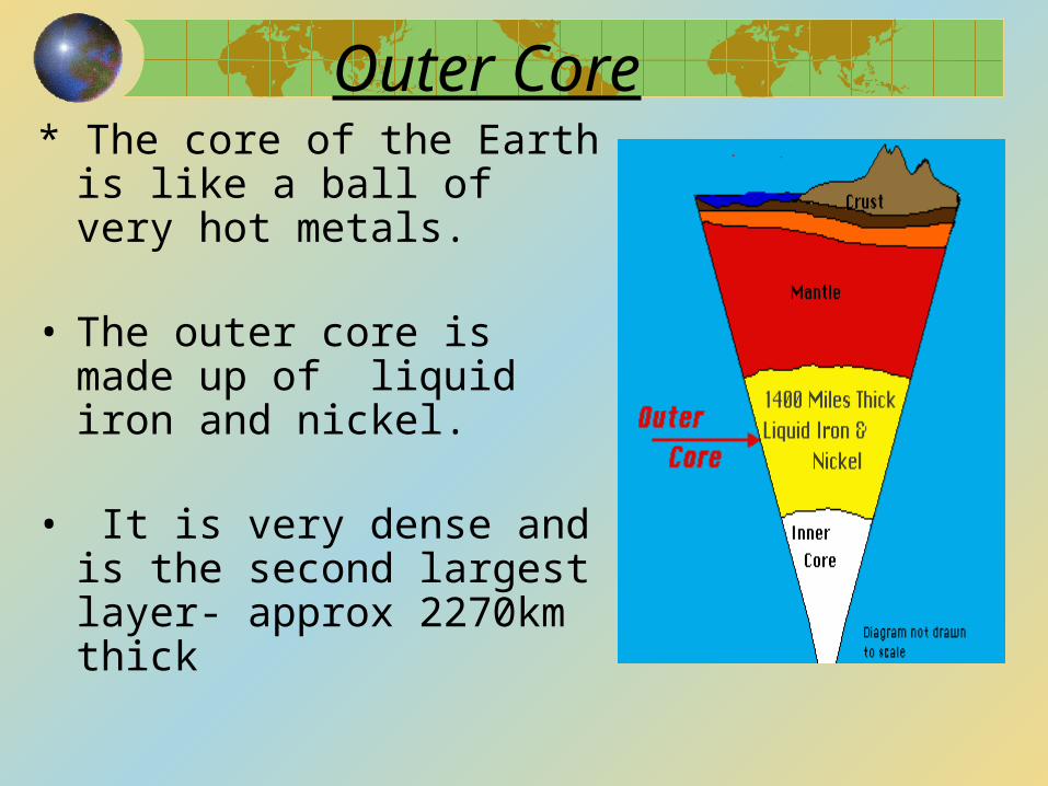
Outer Core* The core of the Earth is
like a ball of very hot metals.
• The outer core is made up of liquid iron and nickel.
• It is very dense and is the second largest layer- approx 2270km thick
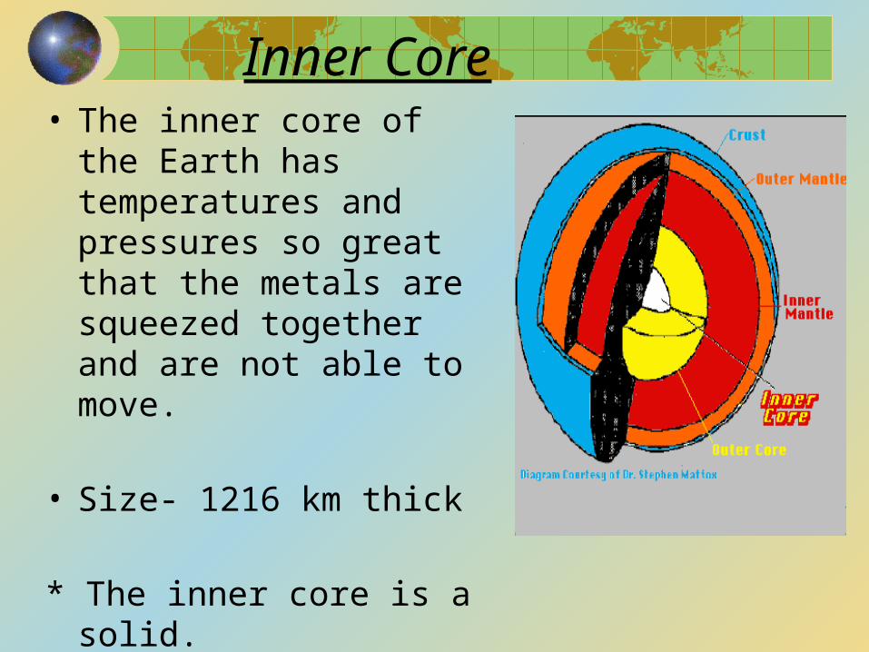
Inner Core• The inner core of the
Earth has temperatures and pressures so great that the metals are squeezed together and are not able to move.
• Size- 1216 km thick
* The inner core is a solid.
CONTINENTAL DRIFT
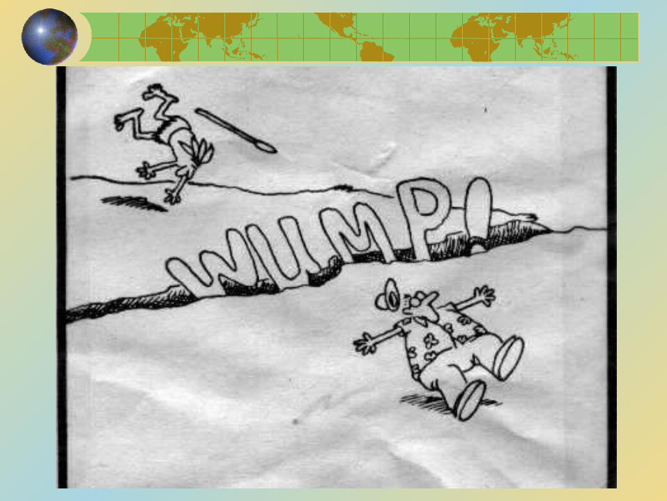
There are many theories about how the earth has come to take the shape that it is now.
Theory #1- Continental Drift
Alfred Wergener- about 100 years ago noticed a pattern and believed that the continents had once been joined.
He had 4 main pieces of evidence to support his Continental Drift Theory
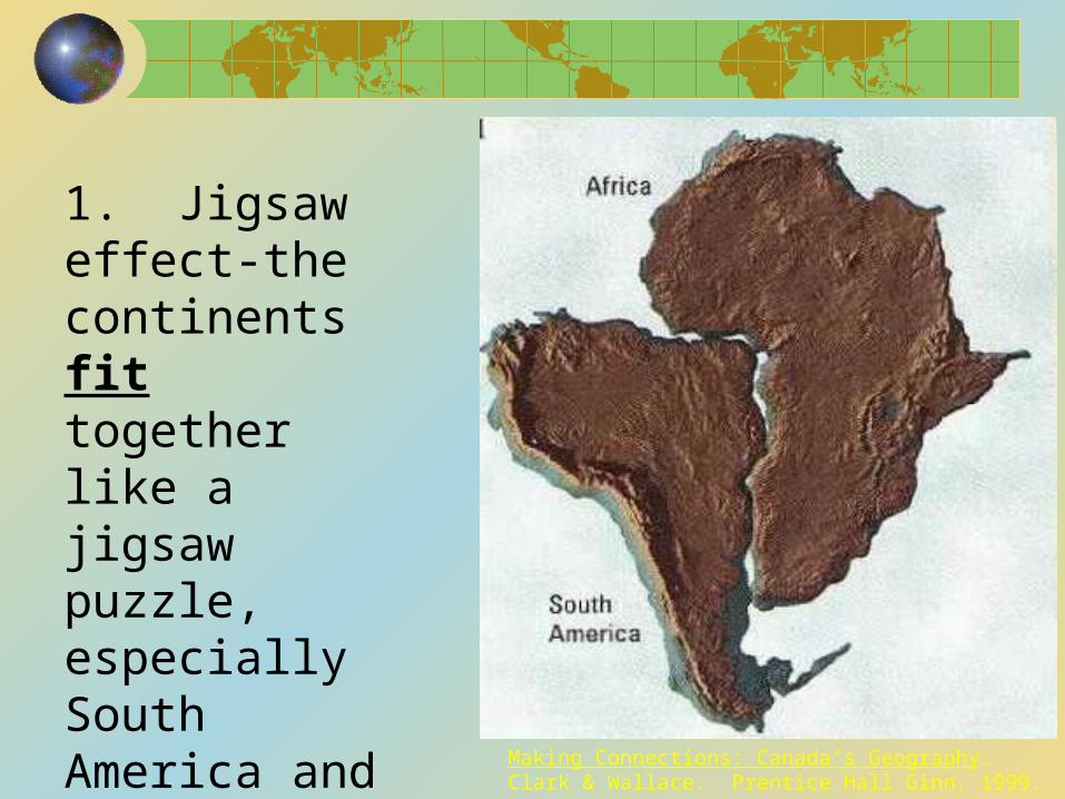
1. Jigsaw effect-the continents fit together like a jigsaw puzzle, especially South America and Africa
Making Connections: Canada’s Geography. Clark & Wallace. Prentice Hall Ginn, 1999.
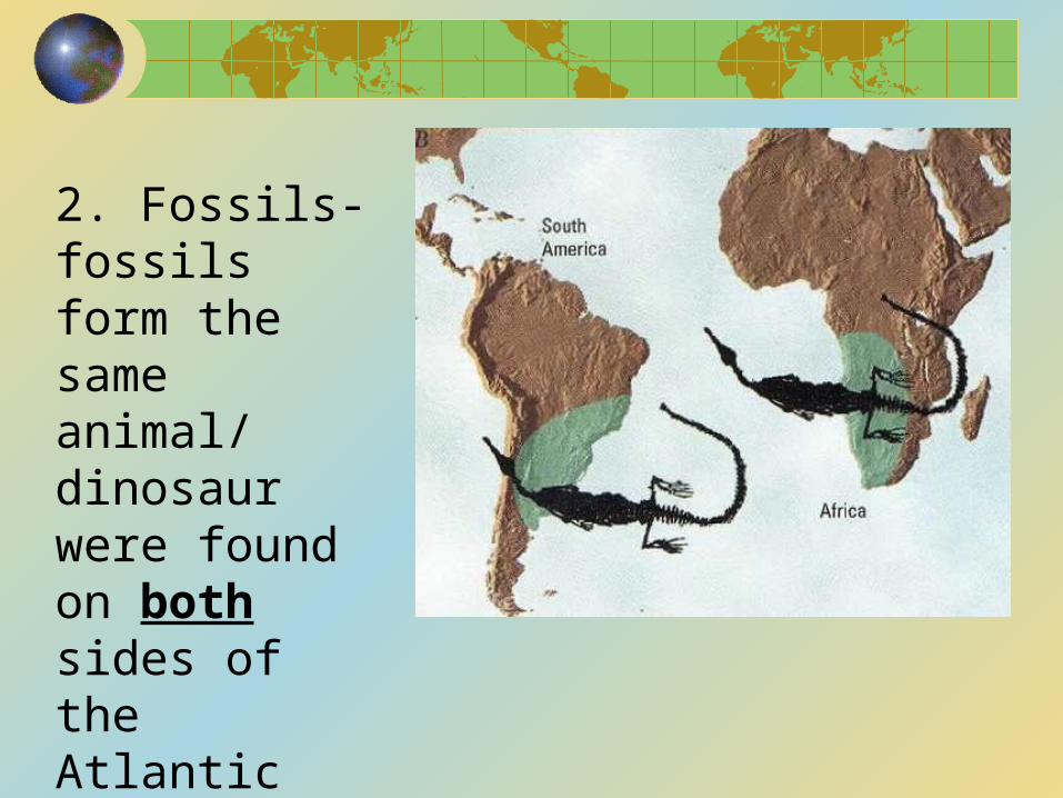
2. Fossils- fossils form the same animal/ dinosaur were found on both sides of the Atlantic Ocean
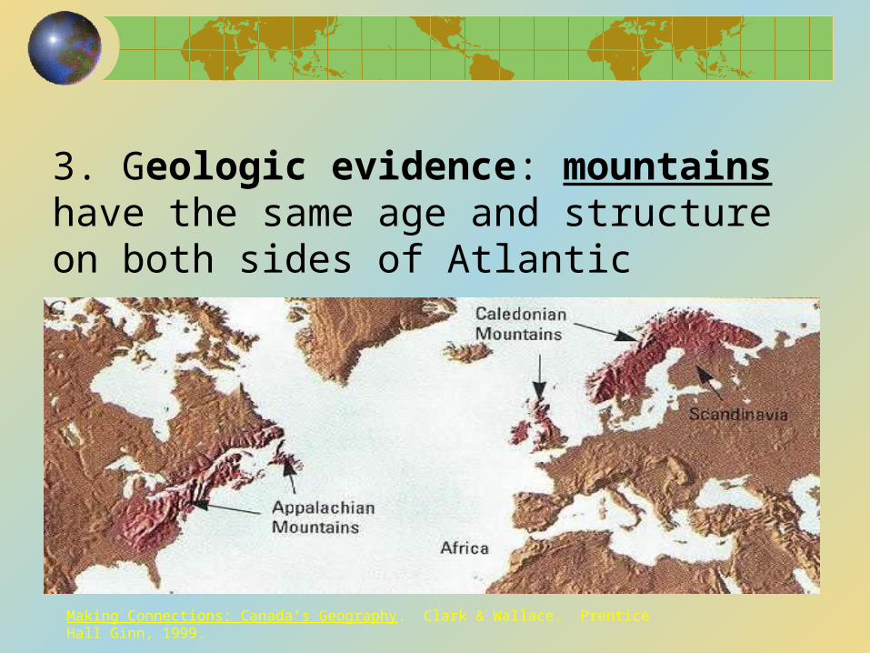
3. Geologic evidence: mountains have the same age and structure on both sides of Atlantic
Making Connections: Canada’s Geography. Clark & Wallace. Prentice Hall Ginn, 1999.
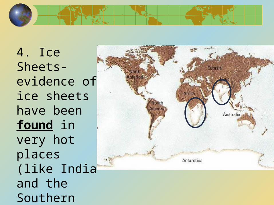
4. Ice Sheets- evidence of ice sheets have been found in very hot places (like India and the Southern part of Africa)
PLATE TECTONICS
In the early 1960’s the theory of Plate Tectonics emerged.
So what was the difference? Wegener could not explain how the plates moved and Plate Tectonics did
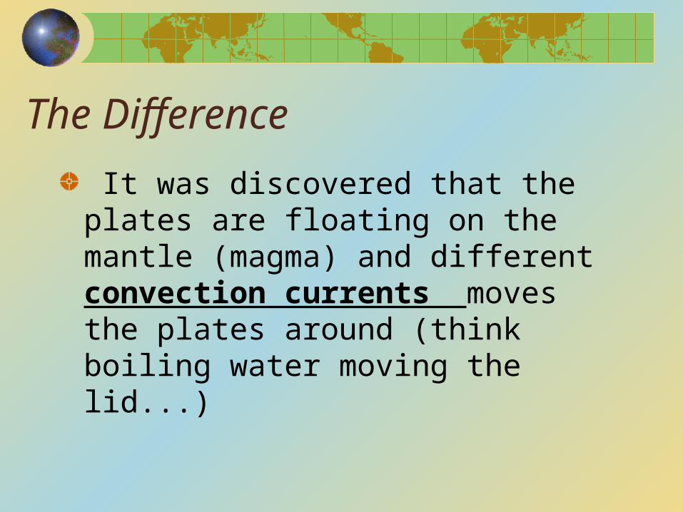
The Difference
It was discovered that the plates are floating on the mantle (magma) and different convection currents moves the plates around (think boiling water moving the lid...)
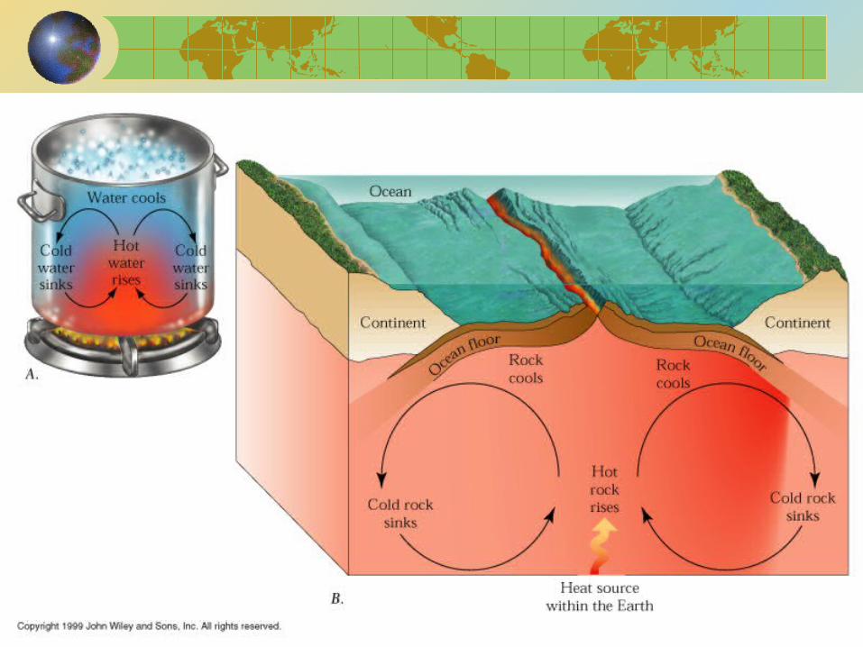
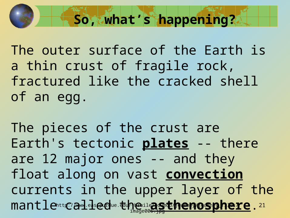
So, what’s happening?
The outer surface of the Earth is a thin crust of fragile rock, fractured like the cracked shell of an egg.
The pieces of the crust are Earth's tectonic plates -- there are 12 major ones -- and they float along on vast convection currents in the upper layer of the mantle called the asthenosphere.
http://www.eas.purdue.edu/~braile/edumod/journey/journey_files/image006.jpg 21
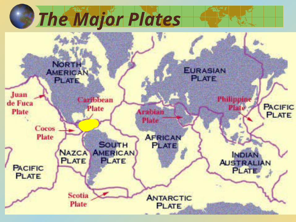
The Major Plates
Remember, there are two types of crust:
Oceanic crust, which extends all over the earth and is broken into the 12 large and many smaller plates; and,
Continental crust, which “rides around” on top of the oceanic crustal plates
23
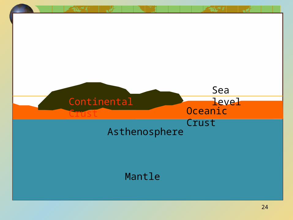
Mantle
Asthenosphere
Oceanic CrustContinental Crust
Sea level
24
Types of Plate Movement
There are three basic plate movements or boundaries.
1. Divergent:
•where the plates move apart
•new magma wells up to the surface forming new crust (a ridge)
•the Mid-Atlantic ridge is a prime example.
26
http://www.geo.lsa.umich.edu/~crlb/COURSES/117/Lec19/div.jpeg 27
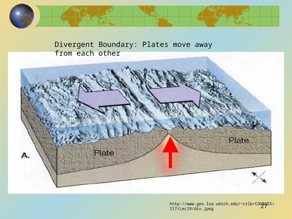
Divergent Boundary: Plates move away from each other
2. Convergent:
•two plates come together
•one plate subducts (goes under) the other plate, creating a subduction zone
•the crust at the leading edge of the subducting plate melts back into the mantle
•the Pacific Rim of Fire is a good example of this
•3 different types of convergent boundaries (ask your teacher if you need to know them)
28
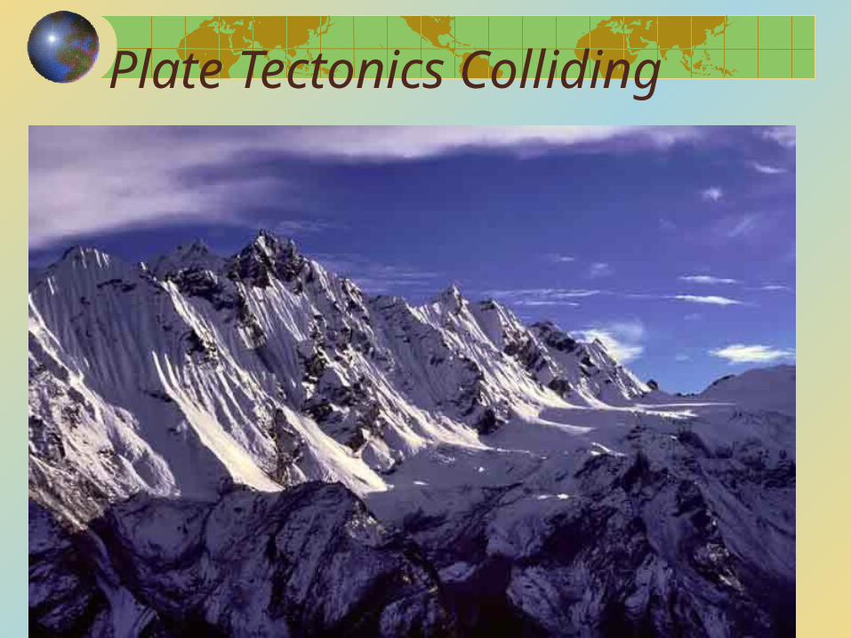
Plate Tectonics Colliding
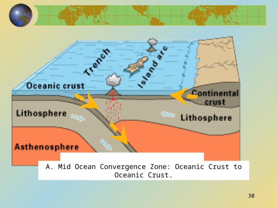
A. Mid Ocean Convergence Zone: Oceanic Crust to Oceanic Crust.
30
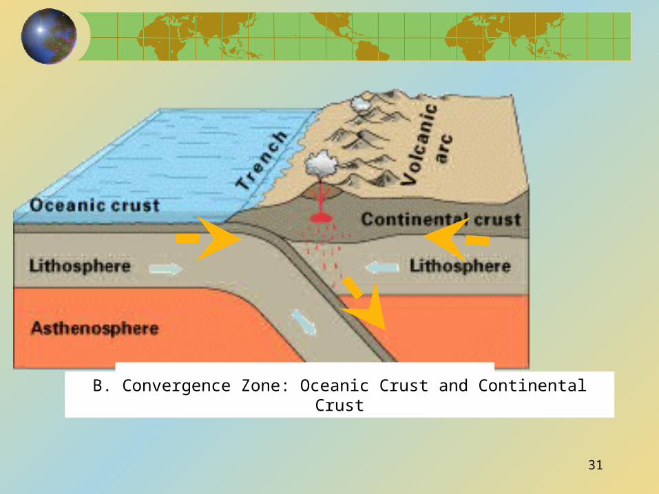
B. Convergence Zone: Oceanic Crust and Continental Crust
31
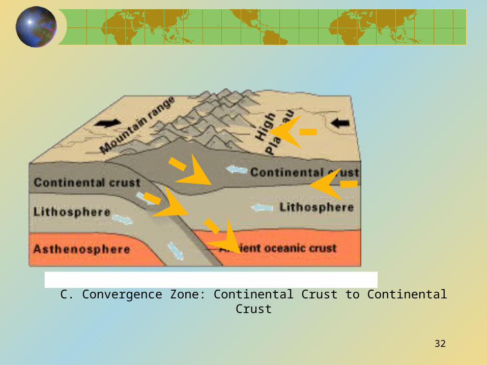
C. Convergence Zone: Continental Crust to Continental Crust
32
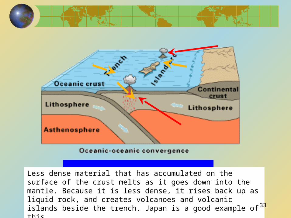
Less dense material that has accumulated on the surface of the crust melts as it goes down into the mantle. Because it is less dense, it rises back up as liquid rock, and creates volcanoes and volcanic islands beside the trench. Japan is a good example of this. 33
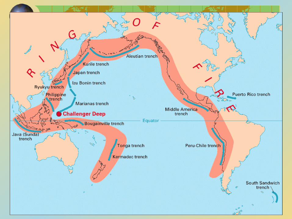
The Pacific Ring of Fire
Mt St Helen’s
34
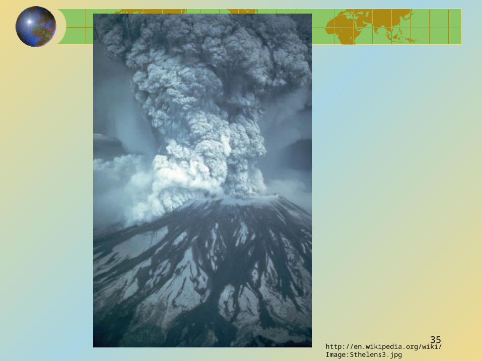
http://en.wikipedia.org/wiki/Image:Sthelens3.jpg
35
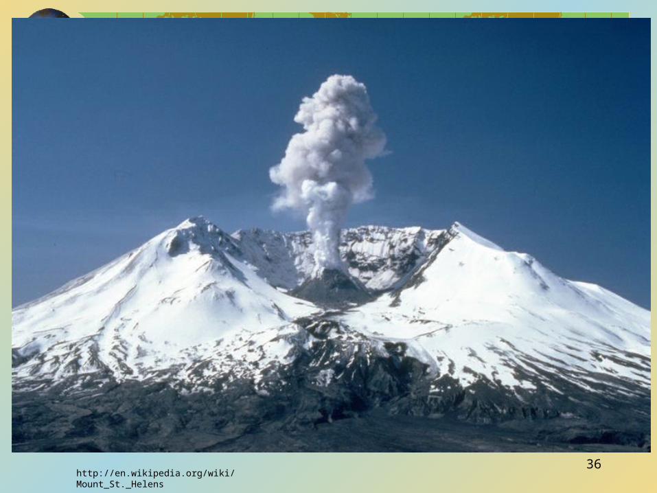
http://en.wikipedia.org/wiki/Mount_St._Helens
36

3. Transform Boundaries:
•two plates slide past each other
•this can create tremendous friction, which may be eventually released in the form of violent earthquakes
•Example : the San Andreas Fault is a transform boundary
http://observe.arc.nasa.gov/nasa/earth/tectonics/graphics/Image43.jpg
37
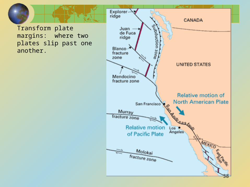
Transform plate margins: where two plates slip past one another.
38
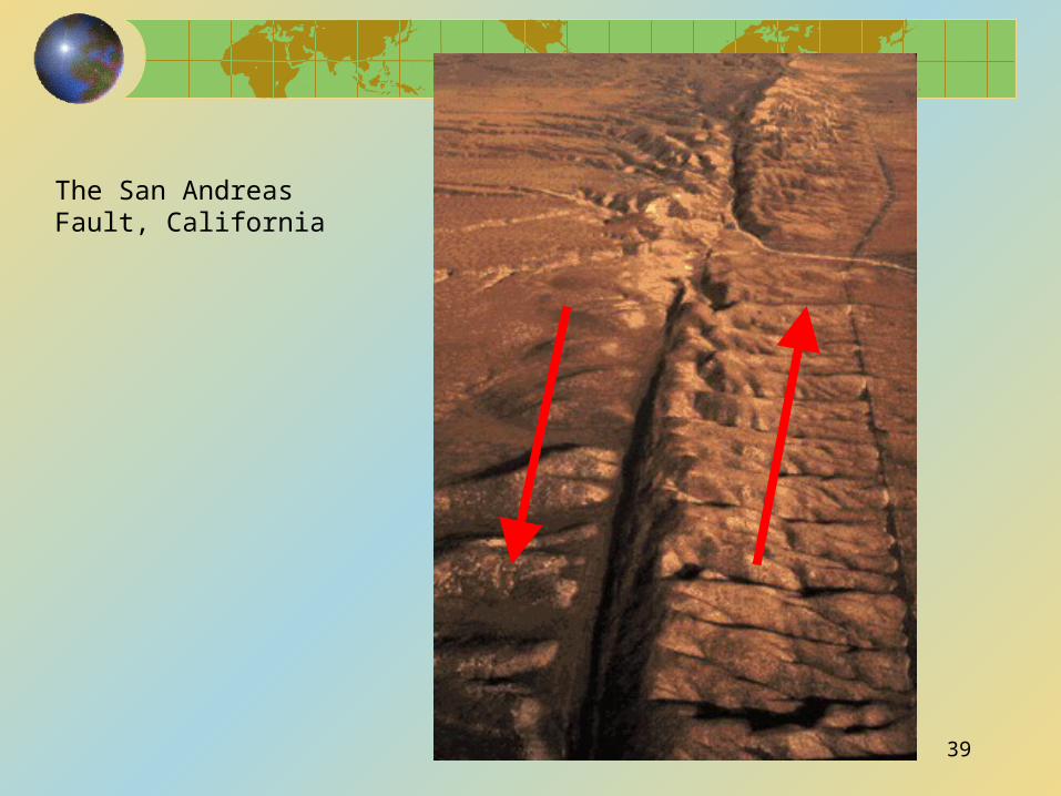
The San Andreas Fault, California
39
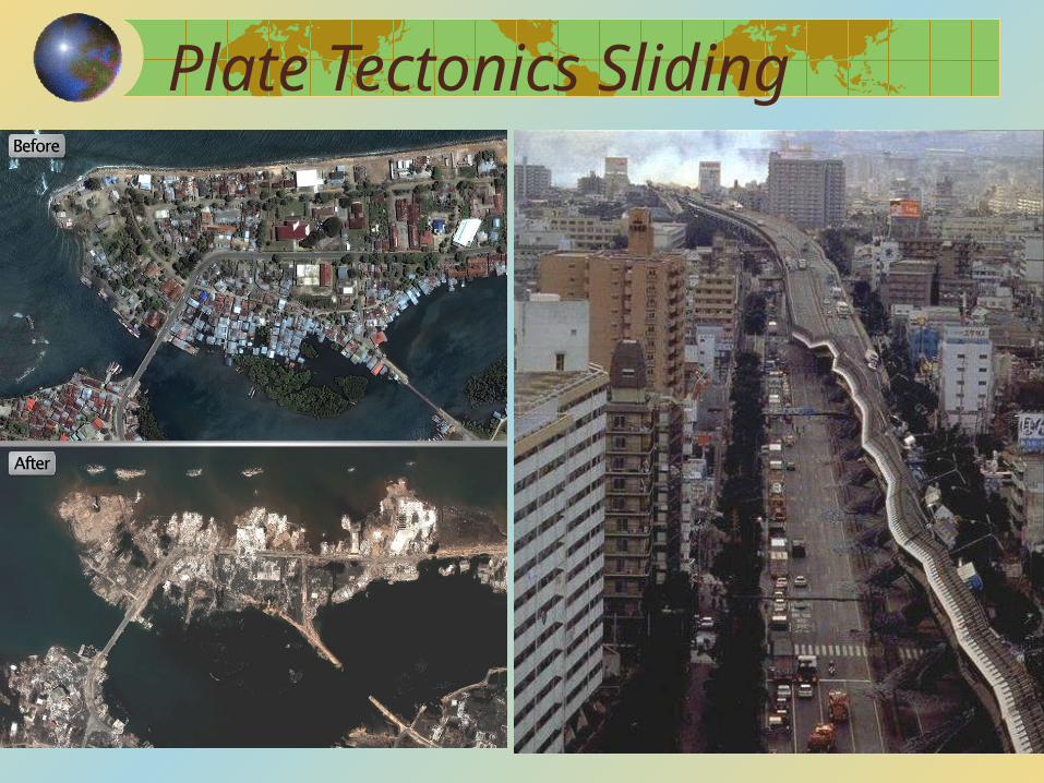
Plate Tectonics Sliding
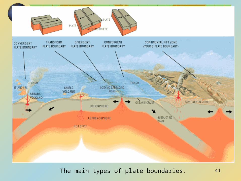
The main types of plate boundaries. 41
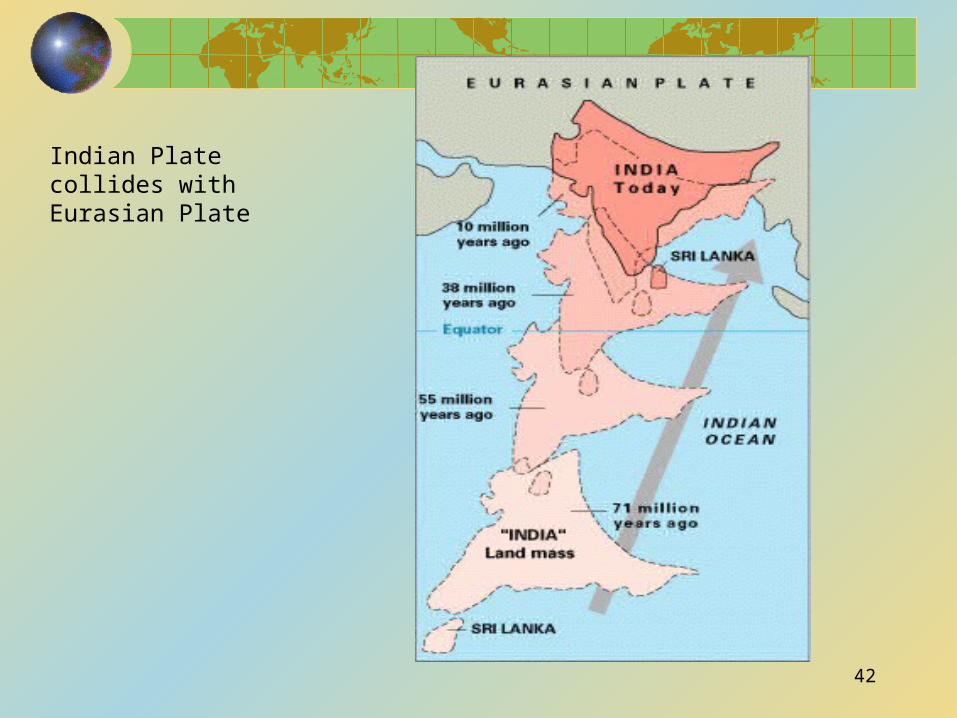
Indian Plate collides with Eurasian Plate
42
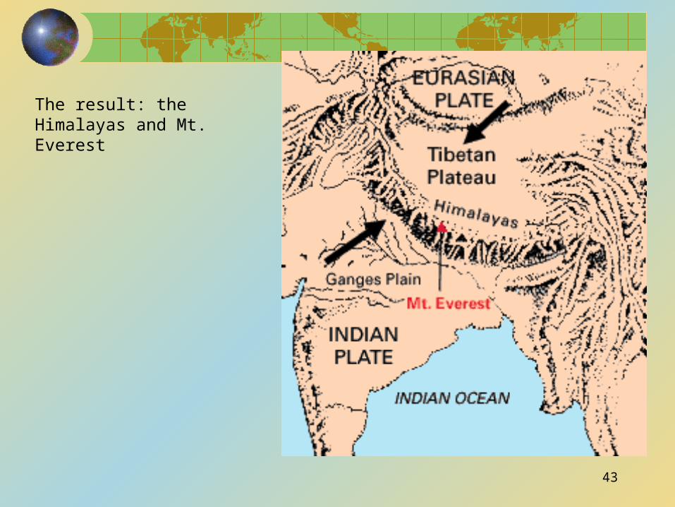
The result: the Himalayas and Mt. Everest
43
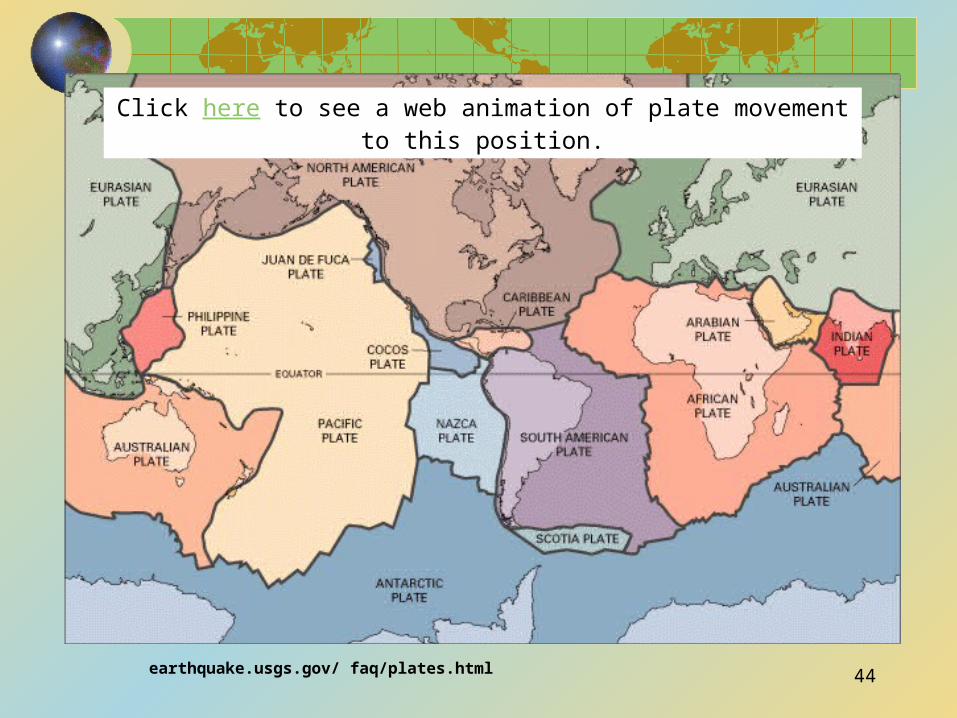
earthquake.usgs.gov/ faq/plates.html
Click here to see a web animation of plate movement to this position.
44
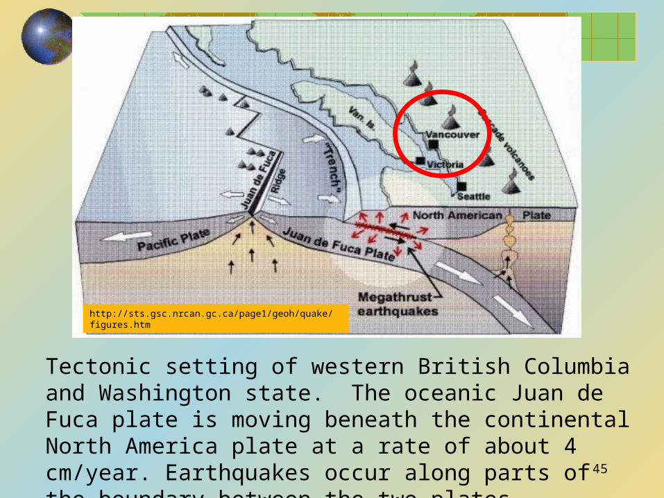
http://sts.gsc.nrcan.gc.ca/page1/geoh/quake/figures.htm
Tectonic setting of western British Columbia and Washington state. The oceanic Juan de Fuca plate is moving beneath the continental North America plate at a rate of about 4 cm/year. Earthquakes occur along parts of the boundary between the two plates.45
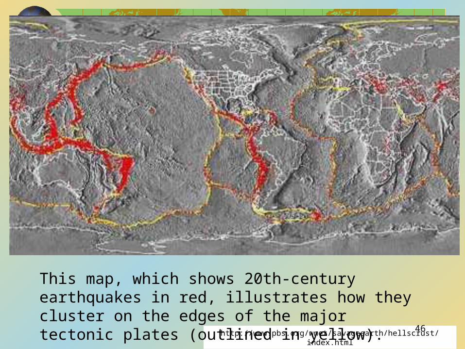
http://www.pbs.org/wnet/savageearth/hellscrust/index.html
This map, which shows 20th-century earthquakes in red, illustrates how they cluster on the edges of the major tectonic plates (outlined in yellow). 46