Embed Size (px)
Citation preview
Latitude and Longitude:Finding Locations on
Planet Earth.
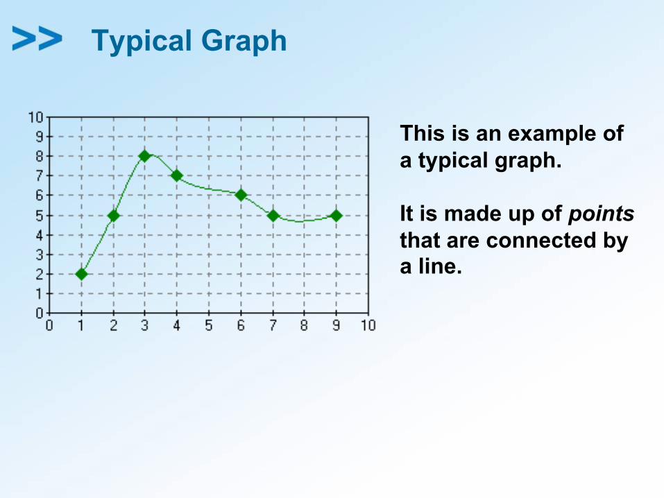
Typical Graph
This is an example ofa typical graph.
It is made up of pointsthat are connected bya line.
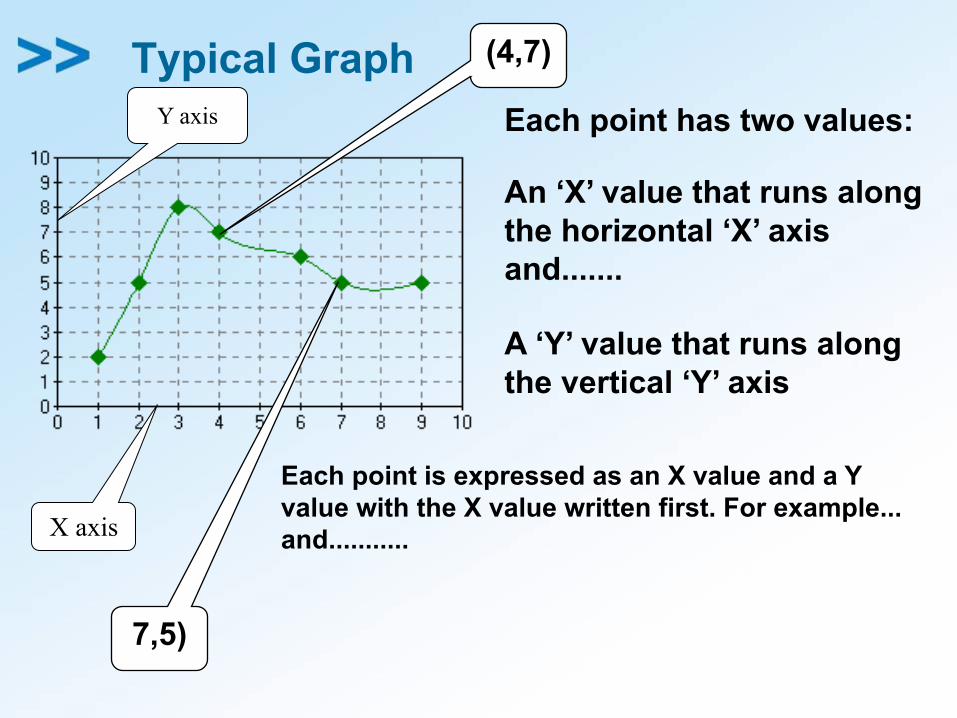
Typical GraphY axis
X axis
Each point has two values:
An ‘X’ value that runs alongthe horizontal ‘X’ axis and.......
A ‘Y’ value that runs alongthe vertical ‘Y’ axis
Each point is expressed as an X value and a Yvalue with the X value written first. For example...
(4,7)
and...........
7,5)
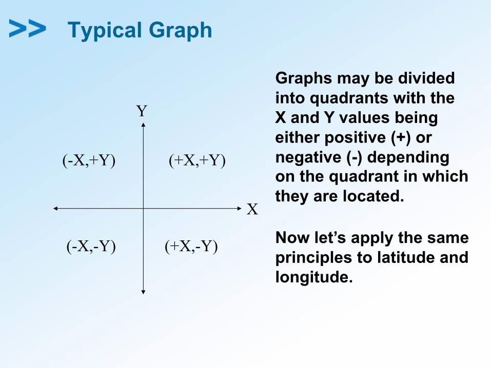
Typical Graph
X
Y
(-X,+Y)
(+X,-Y)
(+X,+Y)
(-X,-Y)
Graphs may be dividedinto quadrants with theX and Y values beingeither positive (+) ornegative (-) dependingon the quadrant in whichthey are located.
Now let’s apply the sameprinciples to latitude andlongitude.
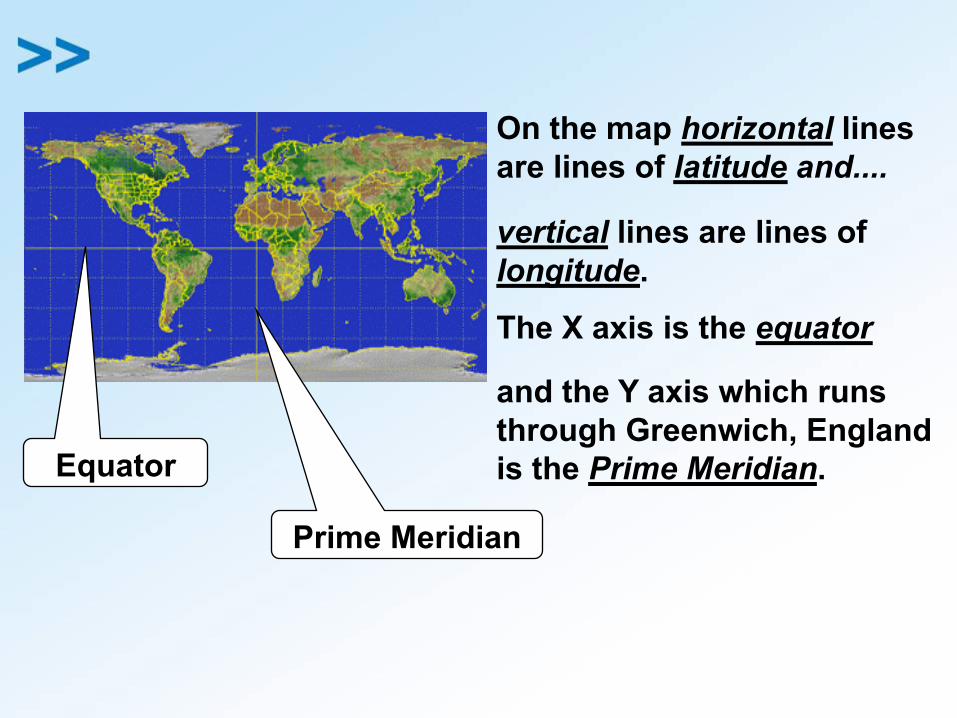
On the map horizontal linesare lines of latitude and....
vertical lines are lines oflongitude.
The X axis is the equator
and the Y axis which runsthrough Greenwich, Englandis the Prime Meridian.Equator
Prime Meridian
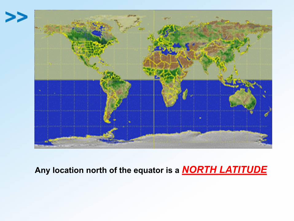
Any location north of the equator is a NORTH LATITUDE
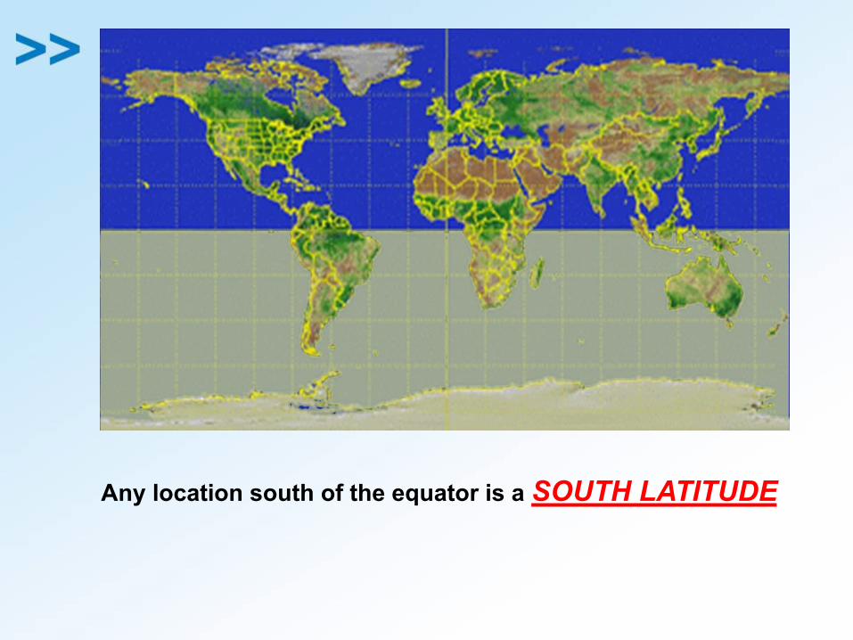
Any location south of the equator is a SOUTH LATITUDE
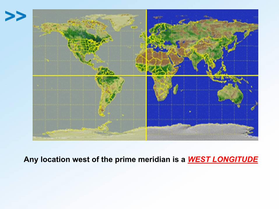
Any location west of the prime meridian is a WEST LONGITUDE
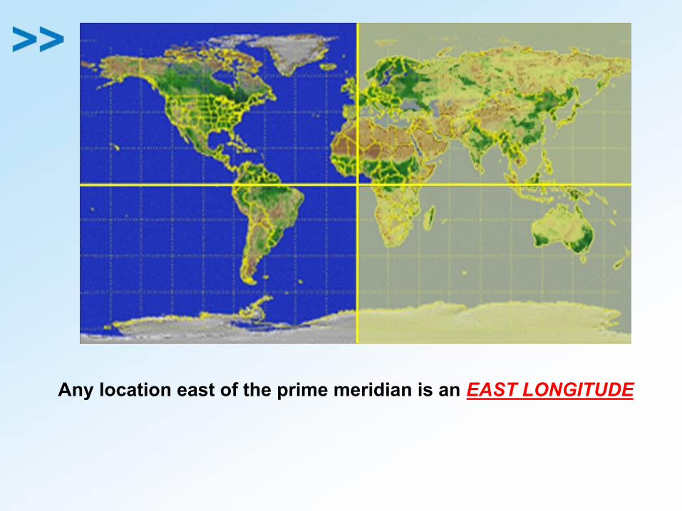
Any location east of the prime meridian is an EAST LONGITUDE
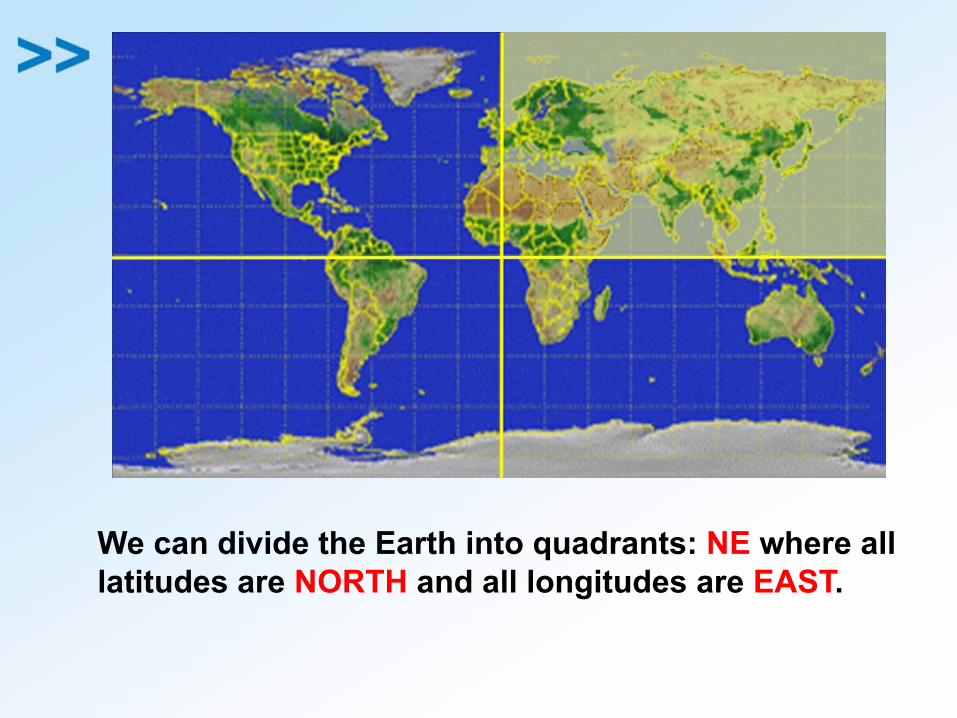
We can divide the Earth into quadrants: NE where alllatitudes are NORTH and all longitudes are EAST.
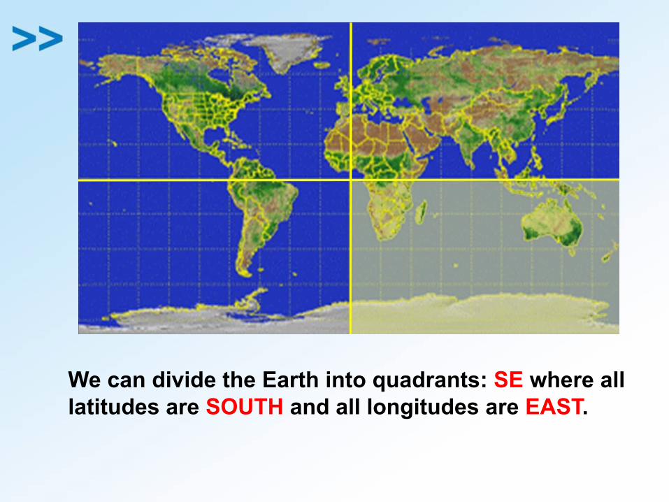
We can divide the Earth into quadrants: SE where alllatitudes are SOUTH and all longitudes are EAST.
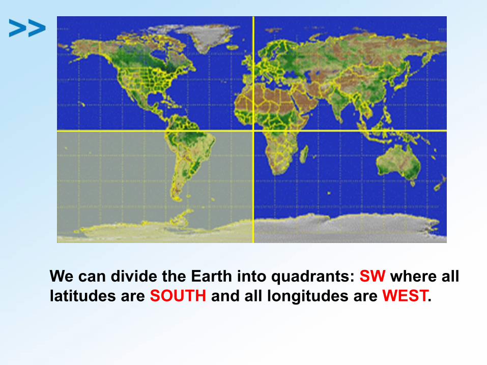
We can divide the Earth into quadrants: SW where alllatitudes are SOUTH and all longitudes are WEST.
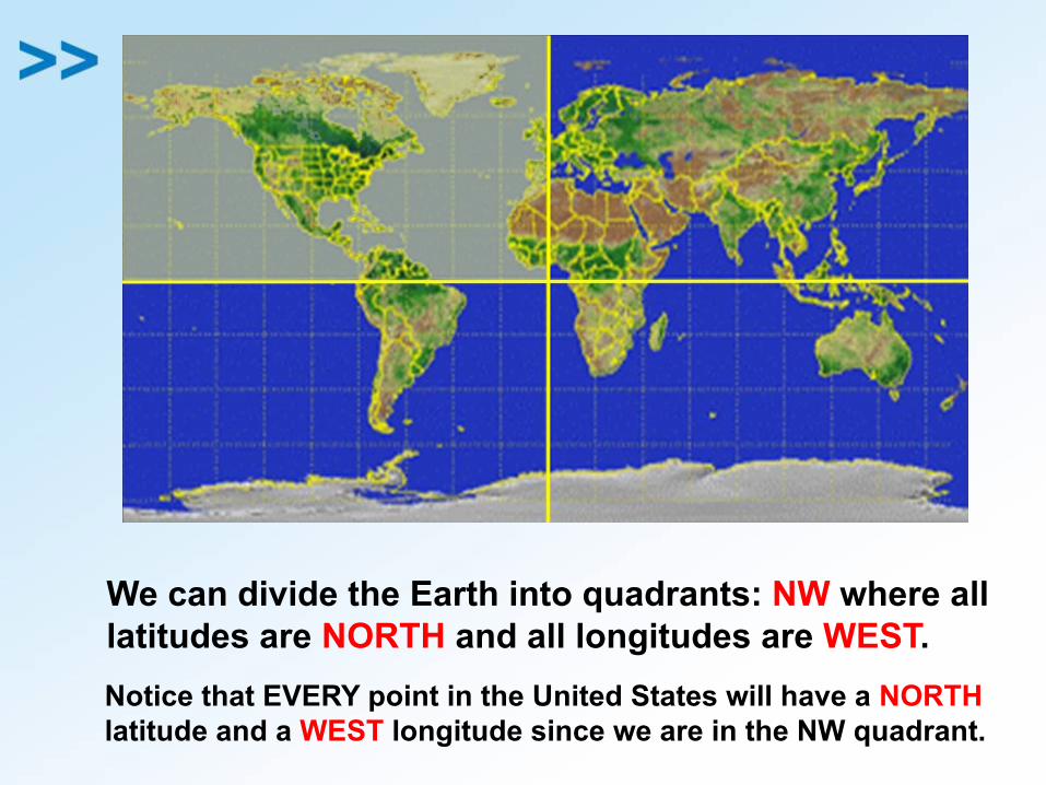
We can divide the Earth into quadrants: NW where alllatitudes are NORTH and all longitudes are WEST.Notice that EVERY point in the United States will have a NORTHlatitude and a WEST longitude since we are in the NW quadrant.
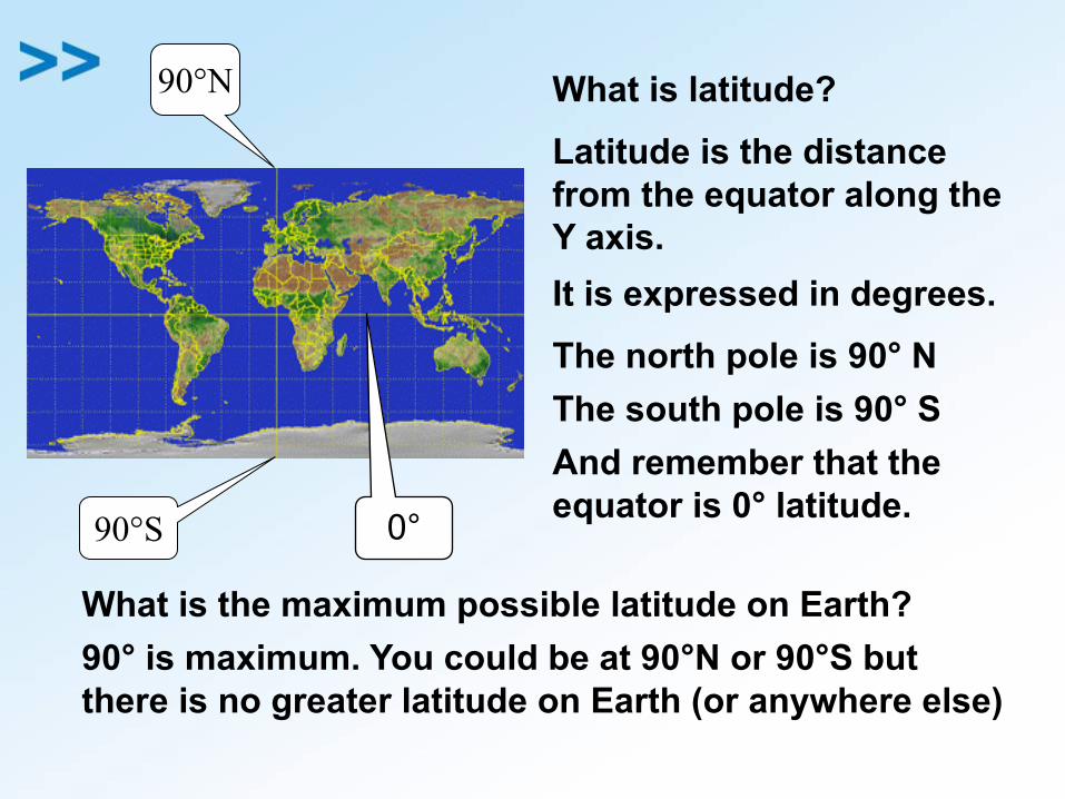
90°S
90°N What is latitude?Latitude is the distancefrom the equator along theY axis.It is expressed in degrees.The north pole is 90° NThe south pole is 90° SAnd remember that theequator is 0° latitude.
What is the maximum possible latitude on Earth? 90° is maximum. You could be at 90°N or 90°S butthere is no greater latitude on Earth (or anywhere else)
0°
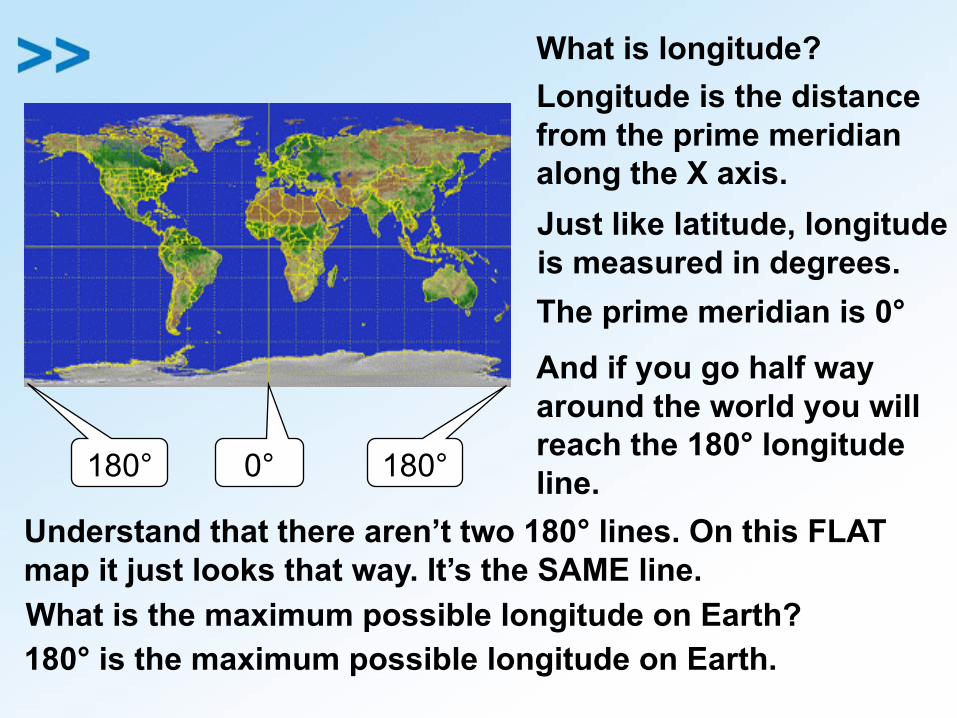
What is longitude?Longitude is the distancefrom the prime meridianalong the X axis.Just like latitude, longitudeis measured in degrees.The prime meridian is 0°
0°
And if you go half wayaround the world you willreach the 180° longitudeline.180° 180°
Understand that there aren’t two 180° lines. On this FLAT map it just looks that way. It’s the SAME line.What is the maximum possible longitude on Earth?180° is the maximum possible longitude on Earth.
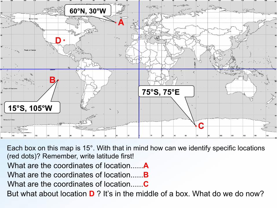
Each box on this map is 15°. With that in mind how can we identify specific locations(red dots)? Remember, write latitude first!What are the coordinates of location......A
60°N, 30°W
What are the coordinates of location......B
15°S, 105°W
What are the coordinates of location......C
75°S, 75°E
But what about location D ? It’s in the middle of a box. What do we do now?