Embed Size (px)
Citation preview
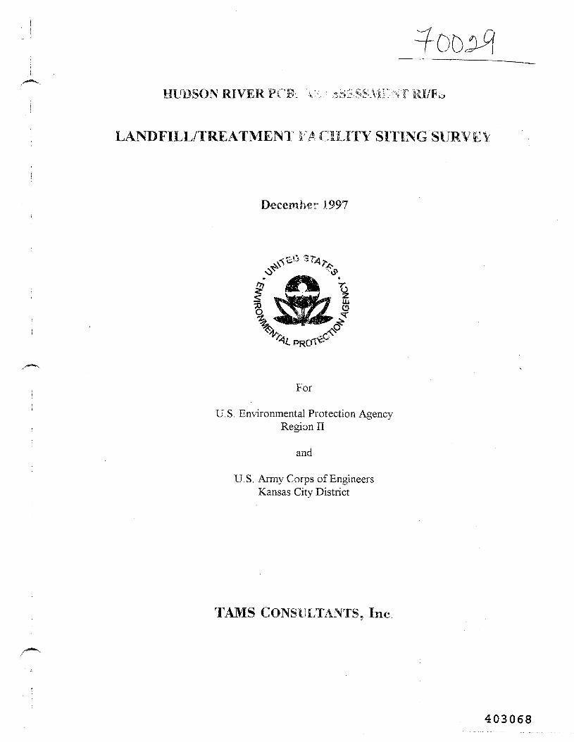
HUDSON RIVER PCB- \ !.>:,•< ;^ESSMENT RI/F*
LANDFILL/TREATMENT FACILITY SITING SURVEY
December 1.997
For
U.S. Environmental Protection AgencyRegion II
and
U.S. Army Corps of EngineersKansas City District
TAMS CONSULTANTS, Inc.
403068
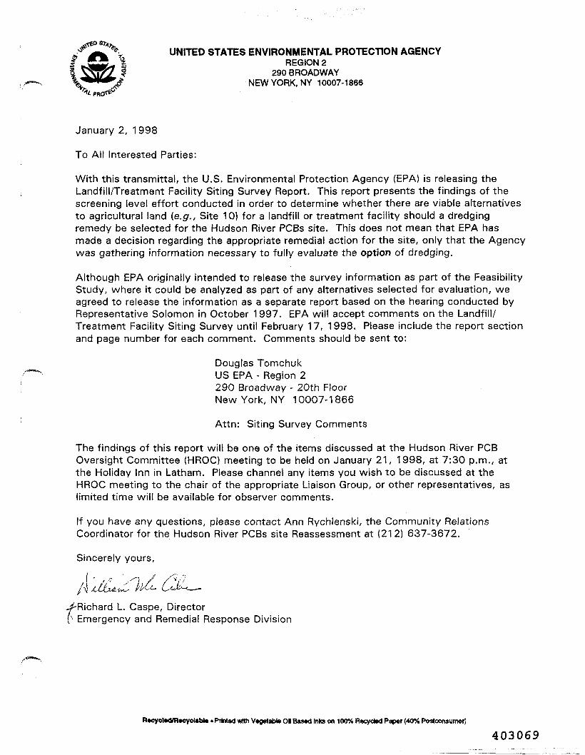
^ fc. \ UNFTED STATES ENVIRONMENTAL PROTECTION AGENCYREGION 2
290 BROADWAYNEW YORK, NY 10007-1866
January 2, 1998
To All Interested Parties:
With this transmittal, the U.S. Environmental Protection Agency (EPA) is releasing theLandfill/Treatment Facility Siting Survey Report. This report presents the findings of thescreening level effort conducted in order to determine whether there are viable alternativesto agricultural land (e.g., Site 10} for a landfill or treatment facility should a dredgingremedy be selected for the Hudson River PCBs site. This does not mean that EPA hasmade a decision regarding the appropriate remedial action for the site, only that the Agencywas gathering information necessary to fully evaluate the option of dredging.
Although EPA originally intended to release the survey information as part of the FeasibilityStudy, where it could be analyzed as part of any alternatives selected for evaluation, weagreed to release the information as a separate report based on the hearing conducted byRepresentative Solomon in October 1997. EPA will accept comments on the Landfill/Treatment Facility Siting Survey until February 17, 1998. Please include the report sectionand page number for each comment. Comments should be sent to:
Douglas TomchukUS EPA - Region 2290 Broadway - 20th FloorNew York, NY 10007-1866
Attn: Siting Survey Comments
The findings of this report wilt be one of the items discussed at the Hudson River PCBOversight Committee (HROC) meeting to be held on January 21, 1998, at 7:30 p.m., atthe Holiday Inn in Latharn. Please channel any items you wish to be discussed at theHROC meeting to the chair of the appropriate Liaison Group, or other representatives, aslimited time will be available for observer comments.
If you have any questions, please contact Ann Rychlenski, the Community RelationsCoordinator for the Hudson River PCBs site Reassessment at (212) 637-3672.
Sincerely yours,
./•Richard L. Caspe, Director0 Emergency and Remedial Response Division
R«cycl»d/R»cyctabU • Printed with Vegetable Ol Based Inks on 100% Recycled Paper (40% Postconsumer]
403069
HUDSON RIVER PCBs REASSESSMENT RI/FS
LANDFILL/TREATMENT FACILITY SITING SURVEY
December 1997
For
U.S. Environmental Protection AgencyRegion II
and
U.S. Army Corps of EngineersKansas City District
TAMS CONSULTANTS, Inc
403070
HUDSON RIVER PCBs REASSESSMENT RI/FS
LANDFILL/TREATMENT FACILITY SITING SURVEY
CONTENTS
1 . INTRODUCTION . . . . . . . . . . . . . . . . . . . . . . . . . . . . . . . . . . . . . . . . . . . . . . . . . . 1
2 . NYSDEC SITE SELECTION PROCESS . . . . . . . . . . . . . . . . . . . . . . . . . . . . . . . 32.1 NYSDEC Siting of Site 10 . . . . . . . . . . . . . . . . . . . . . . . . . . . . . . . . . . . . . . 32 .2 Siting Criteria . . . . . . . . . . . . . . . . . . . . . . . . . . . . . . . . . . . . . . . . . . . . . . . . 52.3 Characteristics of Site 10 . . . . . . . . . . . . . . . . . . . . . . . . . . . . . . . . . . . . . . . 102.4 NYSDEC Alternatives to Site 10 . . . . . . . . . . . . . . . . . . . . . . . . . . . . . . . . . 12
3 . SITE IDENTIFICATION . . . . . . . . . . . . . . . . . . . . . . . . . . . . . . . . . . . . . . . . . . . . 173 . 1 Baseline Information . . . . . . . . . . . . . . . . . . . . . . . . . . . . . . . . . . . . . . . . . . 1 73 .2 Site Identification Criteria . . . . . . . . . . . . . . . . . . . . . . . . . . . . . . . . . . . . . . 183 . 3 Site Designation . . . . . . . . . . . . . . . . . . . . . . . . . . . . . . . . . . . . . . . . . . . . . . 1 93 . 4 Field Reconnaissance . . . . . . . . . . . . . . . . . . . . . . . . . . . . . . . . . . . . . . . . . . 2 0
4 . SITE EVALUATION . . . . . . . . . . . . . . . . . . . . . . . . . . . . . . . . . . . . . . . . . . . . . . . 2 34 . 1 Step 1 Evaluation . . . . . . . . . . . . . . . . . . . . . . . . . . . . . . . . . . . . . . . . . . . . 2 3
4.1.1 Site Categorization . . . . . . . . . . . . . . . . . . . . . . . . . . . . . . . . . . . . . 2 3'4 .1.2 Candidate Site Screening . . . . . . . . . . . . . . . . . . . . . . . . . . . . . . . . . . 2 4
4 .2 Step 2 Evaluation . . . . . . . . . . . . . . . . . . . . . . . . . . . . . . . . . . . . . . . . . . . . 294.2.1 SiteTN-3 . . . . . . . . . . . . . . . . . . . . . . . . . . . . . . . . . . . . . . . . . . . . . 3 24.2.2 Sites TN-4A and TN-4B . . . . . . . . . . . . . . . . . . . . . . . . . . . . . . . . . 324.2.3 • Sites SC-3A and SC-3F . . . . . . . . . . . . . . . . . . . . . . . . . . . . . . . . . . . 334.2.4 Site SC-4 . . . . . . . . . . . . . . . . . . . . . . . . . . . . . . . . . . . . . . . . . . . . . 3 44.2.5 SiteFM-4 . . . . . . . . . . . . . . . . . . . . . . . . . . . . . . . . . . . . . . . . . . . . 3 44.2.6 SiteHF-1 . . . . . . . . . . . . . . . . . . . . . . . . . . . . . . . . . . . . . . . . . . . . . 3 54.2.7 Remnant Deposits . . . . . . . . . . . . . . . . . . . . . . . . . . . . . . . . . . . . . . 3 54.2.8 Site E (Partial) . . . . . . . . . . . . . . . . . . . . . . . . . . . . . . . . . . . . . . . . . 36
5. COMPARISON TO SITE 10 . . . . . . . . . . . . . . . . . . . . . . . . . . . . . . . . . . . . . . . . . . 38
REFERENCES . . . . . . . . . . . . . . . . . . . . . . . . . . . . . . . . . . . . . . . . . . . . . . . . . . . . . . . . . 4 6
TAMS CONSULTANTS, INC.
403071
HUDSON RIVER PCBs REASSESSMENT RI/FS
LANDFILL/TREATMENT FACILITY SITING SURVEY
CONTENTS (Continued)
TABLES
1 Evaluation of NYSDEC Alternative Disposal Sites and Site 10 . . . . . . . . . . . . . . . . 142 Category Summary of Candidate Containment/Treatment Sites . . . . . . . . . . . . . . . . 253 Evaluation of Candidate Containment/Treatment Sites . . . . . . . . . . . . . . . . . . . . . . . 274 Step 2 Evaluation of Candidate Sites . . . . . . . . . . . . . . . . . . . . . . . . . . . . . . . . . . . . 315 Site 10 Comparison . . . . . . . . . . . . . . . . ' . . . . . . . . . . . . . . . . . . , . . . . . . . . . . . . . . 40
PLATES
1 Alternative Containment/Treatment Sites and NYSDEC Sites . . . . . . . . . . . . . . . . . 112 Site 10 Comparison . . . . . . . . . . . . . . . . . . . . . . . . . . . . . . . . . . . . . . . . . . . . . . . . . 41
APPENDICES
A Municipal Contacts . . . . . . . . . . . . . . . . . . . . . . . . . . . . . . . . . . . . . . . . . . . . . . . . . 48B Select Photographs . . . . . . . . . . . . . . . . . . . . . . . . . . . . . . . . . . . . . . . . . . . . . . . . . 50
TAMS CONSULTANTS, INC.
403072
1. INTRODUCTION
This report presents the findings of a screening-level survey of sites where a landfill ortreatment facility could potentially be located should the United States Environmental Protection
Agency (USEPA) decide that it is necessary to dredge PCB-contaminated sediments from the Hudson
River. This survey was conducted by TAMS Consultants, Inc. (TAMS) as part of the Hudson River
PCBs Superfund Site Reassessment Remedial Investigation/Feasibility Study (RI/FS). TAMS' work
was performed under contract to the United States Army Corps of Engineers (USAGE) on behalf of
USEPA Region II. The purpose of the survey is to provide USEPA with input to facilitate scoping
of the final Feasibility Study for the project. Dredging and near-river treatment or disposal of dredge
spoils is one alternative remedy for consideration from an engineering standpoint with regard to the
Comprehensive Environmental Response Compensation and Liability Act (or CERCLA) and the
Superfund Amendment and Reauthorization Act (or SARA), which provide the context for the
Reassessment. In the Feasibility Study, USEPA may also consider utilizing remote landfill or
treatment facilities, outside of the area evaluated as part of this study.
With continuing public concern over the potential use of Site 10, selected earlier for this
purpose by the New York State Department of Environmental Conservation (NYSDEC), it has
become necessary to identify and evaluate the viability of other potential sites. In addition, it is
necessary to ascertain the existence of viable locations for installation of temporary facilities for
dewatering and/or treatment of dredge spoils and dewatering supernatant prior to disposal of dredge
spoils, elsewhere. The objectives of this survey are:
• To provide USEPA with an understanding of the previous siting efforts and siteevaluation criteria;
• To identify and compile areas potentially useable for treatment and/or long-termcontainment of PCB-contaminated dredge spoils from the Upper Hudson River;
TAMS CONSULTANTS. INC.
403073
To screen the potentially useable sites for engineering feasibility, for generalcompatibility with regulatory siting criteria, and in consideration of likely publicconcerns in order to generate a short list of candidate sites potentially warrantingfurther, in-depth evaluation in the FS phase of this Reassessment; and
To compare the candidate sites warranting further consideration to NYSDEC'spreferred site (Site 10) on the basis of New York State's siting considerations/criteria.
TAMS CONSULTANTS, INC.
403074
2. NYSDEC SITE SELECTION PROCESS
A summary of NYSDEC's siting efforts and the criteria used by NYSDEC in its site selection
and evaluation processes is provided below. Information on NYSDEC's top-ranked site, Site 10, as
well as information on NYSDEC alternatives to Site 10, is also included in this chapter. This
information is used in Chapter 5 as a basis for comparison for the newly-designated candidate
containment/treatment sites described in Chapter 4.
2.1 NYSDEC Siting of Site 10
In the late 1970s, NYSDEC began evaluation of sites in the Upper Hudson River valley for
containment of PCB-contaminated sediments from hot spots in the river. Prior to this period, New
York State Department of Transportation (NYSDOT) and NYSDEC removed significant volumes
of contaminated sediments from the Upper Hudson River for maintenance of the Hudson
River/Champlain Canal navigation channel. These dredge spoils were disposed at locations near the
river in Saratoga and Washington Counties. Disposal sites in Saratoga County included the Old and
New Moreau dredge-spoil areas and Special Area 13 in the Town of Moreau. Sites in Washington
County included the southern tip of Rogers Island, Site 518 near Lock 7, and Buoy 212 in the Town
of Fort Edward.
In 1981, NYSDEC selected Site 10 in the Town of Fort Edward for the containment of
contaminated river sediments. Forty sites were evaluated by NYSDEC prior to selection of Site 10
(USEPA, 1981). Site 10 was selected on the basis of size (approximately 250 acres total), clayey
subsoil, accessibility, and environmental and socioeconomic factors. Also, Site 10 was not within a
designated Agricultural District and was not in use as an active family farm at that time (Malcolm
Pirnie, 1978). Site 10 is located adjacent to the Thompson Island Pool portion of the Upper Hudson
River and is above the 100-year floodplain. Additional information on Site 10 can be found in
Section 2.3.
3 TAMS CONSULTANTS, INC.
403075
A Siting Board was convened to evaluate NYSDEC's request for use of Site 10. The Siting
Board gave its conditional approval to NYSDEC in 1982 (Sanders, 1989). In 1983, approvals for
Site 10 were revoked by the New York State Supreme Court on issues originally brought forth by
Washington County's Citizen Environmentalists Against Sludge Encapsulation (CEASE), including,
among others, a violation of local zoning laws at the location of the proposed site.
During this time, NYSDEC decided to evaluate alternative disposal sites in the event the on-
going legal challenge to Site 10 was not resolved. NYSDEC selected twelve alternative sites in
Rensselaer, Saratoga, and Washington Counties. Each of the sites, except one, was located by
NYSDEC in areas zoned for industrial or manufacturing use or in areas where no formal zoning or
land-use plans existed at that time. NYSDEC retained Malcolm Pirnie to evaluate and rank each of
the sites and develop conceptual designs and preliminary cost estimates for four of the top-ranked
alternatives to Site 10. Site 10 was included in the evaluation process and received the most
favorable score. Site G, located northeast of the Village of Fort Edward in the Town of Fort Edward,
Washington County, received the highest ranking among the twelve alternative sites (Malcolm Pirnie,
1985).
When the decision to "disallow" Site 10 was upheld by New York's Court of Appeals in 1985,
NYSDEC's Project Sponsor Group (PSG) prepared and submitted new permit applications for use
of Site G, based on the Malcolm Pirnie study. In 1987, coincident with hearings associated with the
Site G application, New York State's Environmental Conservation Law (ECL) was revised to
eliminate local zoning and land-use regulations in the siting of a hazardous waste disposal facility
(Sanders, 1989). By this time, the other issues in CEASE's legal challenge were also resolved. These
events eliminated the rationale for revoking approvals for Site 10.
In 1989, the Siting Board rejected use of Site G in part because of its smaller size relative to
Site 10. Also, Site 10 ranked more favorably than Site G when evaluated against the siting criteria.
The Siting Board voted in favor of NYSDEC's proposed dredging project and use of Site 10.
NYSDEC's Commissioner directed the PSG to conduct additional designs and reapply for use of Site
4 TAMS CONSULTANTS, INC.
403076
10 for containment of contaminated river sediments and channel sediments, as well as material to be
excavated from the remnant deposits and dredge-spoil sites.
Additional design for the expanded use of Site 10 was conducted in the early 1990s.
According to the former NYSDEC Hudson River PCB Project Manager (Dergosits, 1994, pers.
comm.), the proposed facility at Site 10 would consist of four containment cells with a nominal
capacity of 3.5 million cubic yards as well as a roughing and storage pond, a water treatment facility,
and associated buildings, roads, ditches and berms to be constructed over an area of approximately
145 acres. The design included dredging approximately 1.8 million cubic yards of sediments from
contaminated areas in the Upper Hudson River and 0.3 million cubic yards from canal maintenance
as well as excavating approximately 1.4 million cubic yards from Remnant Deposits 2, 3, 4, and 5 and
eight dredge-spoil areas (Dergosits, 1994, pers. comm.). No further action with this facility has been
taken by NYSDEC since these designs were completed.
2.2 Siting Criteria
New York State regulations for siting and constructing new hazardous waste facilities,
including treatment facilities and landfills, are contained in Title 6 (Department of Environmental
Conservation) of the Codes, Rules, and Regulations of New York (6 NYCRR) at Part 360 ("Solid
Waste Management Facilities") and Part 361 ("Siting of Industrial Hazardous Waste Facilities"). Part360 includes landfill construction requirements as well as permit application requirements. Specific
procedures and requirements for the siting of hazardous waste facilities are contained in Part 361.
Section 361.7 of 6 NYCRR Part 361 identifies fourteen siting considerations and their relative
importance by percentage to be used by a siting board in the review of an application for a new
industrial hazardous waste facility. The fourteen NYSDEC siting considerations and their assigned
numbers and relative importance by percentage are listed below:
TAMS CONSULTANTS, INC.
403077
NYSDEC Siting Considerations
1. Population density in the vicinity (0.5 mile) of the proposed site, 10%including residential and non-residential population
2. Population adjacent (0.5 mile) to anticipated transport route, 7%including residential and non-residential population
3. Risk of accident in transporting hazardous waste to the 10%proposed site, including mode of transport, length and accidentrate of transport route, structures within 0.5 mile of transportroute, transportation restrictions, and the nature and volume ofwaste being transported
4. Proximity to incompatible structures including residences, 3%airports, schools, hospitals, churches, commercial centers
5. Proximity to major utility lines 1%
6. Municipal effects including consistency with the intent of the 4%master land-use plan; consistency with local laws, ordinances,rules, and regulations; and public expense/revenue tradeoffs
7. Potential for surface water and groundwater contamination from 18%construction and operation of the proposed facility, includingproximity to floodplains, wetlands, recharge zones, and aquifers
8. Potential impacts on sources of water supply for human and 8%animal (livestock) consumption as well as agricultural,commercial, and industrial water supplies
9. Potential for fires and explosions at the site 11%
10. Impacts on air quality from operations at the site 12%
11. Proximity to areas of mineral exploitation 3%
12. Preservation of endangered, threatened, and indigenous species 6%
13. Conservation of historic and cultural resources 4%
14. Open space, recreational, and visual impacts 3%
TAMS CONSULTANTS, INC.
403078
In the past, NYSDEC did not consider Siting Considerations 9, 11, and 12 to be applicable to a
dredge-spoils landfill.
Specific criteria and procedures for applying the criteria to proposed sites, as well as a Siting
Evaluation Worksheet, are also provided in Section 361.7 of 6 NYCRR Part 361. Specific criteria
for each of the fourteen siting considerations are used to evaluate the sites. A Siting Board has the
authority to alter the weights of the criteria, based on applicability of individual criteria to specific
situations. Three distinct situations exist for each criterion, where the first situation is considered to
be the most favorable with respect to the siting criterion; the second consideration is less favorable;
and the third is least favorable. For example, NYSDEC Siting Consideration 7, potential for
contamination of surface water and groundwater, was allocated the largest single weight of 18
percent. Forty percent of the score for this specific siting consideration is based on hydrogeologic
characteristics consisting of three distinct situations, from most favorable to least favorable, including:
1. Natural soil conditions at the site are optimal; the soil characteristics would impedeany groundwater contamination;
2. Subsurface conditions at the site do not present any major problems with respect togroundwater contamination; however, site modifications may be required to furtherreduce the risk of groundwater contamination; and
3. Subsurface conditions at the site are not desirable; extensive site modifications wouldbe required to reduce the risk of groundwater contamination.
Should a proposed site meet condition 1 above, a value of 1 would be assigned; a value of 2 would
be assigned for condition 2; and a value of 3 for condition 3. The assigned value is then multiplied
by the criterion weight to determine the criterion score; the scores for each criterion for a specific
consideration are summed and the total is multiplied by the siting consideration weight. A score for
each siting consideration is determined in a similar manner and a total site score is obtained by
summation. Sites with the lowest total scores are considered most favorable with respect to the siting
criteria.
/•*"*->,
7 TAMS CONSULTANTS, INC.
403079
Part 360 identifies specific landfill construction requirements; these include, but are not limited
to, a minimum horizontal separation of 100 feet between deposited waste and the property line and
surface waterbodies; a minimum vertical separation of five feet between the base of the constructed
liner system and the seasonal high groundwater elevation and ten feet from the base of the liner
system to bedrock; a double-composite liner; and a leachate collection and removal system.
Requirements of the federal Toxic Substances Control Act (TSCA) for a PCB/chemical waste landfill,
contained in 40 CFR Part 761.75, are in general agreement with New York State's requirements.
Both state and federal regulations require a soil liner with a permeability less than 1 * 10"7 cm/sec and
a synthetic geomembrane liner which is chemically compatible with PCBs.
One of the differences between the state and federal requirements relates to depth to
groundwater. New York State's landfill construction requirements specify a minimum vertical
separation of five feet between the base of the constructed liner system and the seasonal high
groundwater table, whereas federal TSCA requires a separation of 50 feet. Potential sites located
in the lowland near-river areas, where depth to groundwater is typically within 50 feet of the ground
surface, would likely not satisfy this federal requirement. According to TSCA (40 CFR 761.60), all
dredged materials that contain PCBs at concentrations of 50 ppm or greater should be disposed in
an incinerator or a chemical waste landfill in compliance with 40 CFR 761.70 and 761.75,
respectively. Also, USEPA's Regional Administrator may approve an alternate disposal method.
In addition, the Regional Administrator may issue a waiver for that specific federal requirement.
The dredge spoils can be considered an industrial waste where historic industrial discharges
resulted in contamination (6 NYCRR Part 360.1). Siting considerations and criteria for industrial
hazardous waste facilities in New York State (6 NYCRR Part 361.7) were used by NYSDEC and
in this study to meet the goal of protecting public health and the environment. Near-river lowland
areas, where the federal requirement for depth to groundwater would likely not be met, were not
excluded from consideration by NYSDEC, nor by TAMS in this study.
TAMS CONSULTANTS, INC.
403080
As stated in Section 2.1, New York's Environmental Conservation Law was revised in 1987
to eliminate zoning and land-use considerations in the siting of a hazardous waste facility. According
to the Environmental Conservation Law Article 27, Title 11 (Siting Industrial Hazardous Waste
Facilities):
"Notwithstanding any other provision of law, no municipality may, except as expresslyauthorized by this article or the board, require any approval, consent, permit, certificate orother condition including conformity with local zoning or land use laws and ordinances,regarding the operation of a facility with respect to which a certificate hereunder has beengranted; provided, however, that such municipality has received notice of the filing of theapplication therefor. " (§27-1107, Powers of municipalities)
Thus, a municipality cannot reject a proposed facility because of non-conformity with local zoning
and land-use laws and ordinances unless authorized by the Siting Board. As per the current Facility
Siting Criteria under 6 NYCRR Part 361, the Siting Board can deny an application if residential areas
and contiguous populations will-be endangered, if construction or operation of the facility would be
contrary to local zoning or land-use regulations in force on the date of the application, or if the facility
is deemed not necessary or otherwise not in the public interest.
The Washington County Board of Supervisors recently adopted a resolution indicating its
opposition to Hudson River remedial measures that involve dredging and landfilling in the Town of
Fort Edward (Washington County, 1997). According to the resolution, a PCB dredge-spoils
landfilling project would inflict significant, long-term damage to the Town of Fort Edward, especially
affecting the agricultural industry, tourism development efforts, and the pastoral quality of life. Many
towns and villages throughout the Upper Hudson area as well as Saratoga County's Board of
Supervisors have adopted similar resolutions, asserting that a long-term containment facility or landfill
near the river would not be in the public interest.
JAMS CONSULTANTS, INC.
403081
2.3 Characteristics of Site 10
Information on the characteristics of Site 10 and NYSDEC's intended use of the site was
obtained from various sources, including Malcolm Pirnie (1978 and 1985) and USEPA (1981).
Site 10 is located about 2.5 miles south of the Village of Fort Edward and is within the Town
of Fort Edward, Washington County. As shown on Plate 1, the site is centrally located between
Lock 7 to the north and the Thompson Island Dam to the south, which is the Thompson Island Pool
reach of the Upper Hudson River where many of the NYSDEC-defmed hot spots exist. The western
limit of the site, adjacent to Route 4, is within 300 feet of the Hudson River and site elevations range
from about 10 to 60 feet above the elevation of the river. Thus, the site is outside the floodplain and
is in close proximity to the river, allowing for the use of hydraulic dredges and pipelines for pumping
dredge spoils directly from the river to the dewatering/containment areas. Dredge spoils would not
have to be trucked through local roadways. Also, much of the site has not been cultivated for some
time.
Numerous geotechnical and hydrogeologic field investigations have been conducted by
NYSDEC at Site 10. Soils at the site are predominantly comprised of the Kingsbury and Covington
soil series, both of which are deep, slowly permeable soils. Soil permeability at the site ranges from
less than 1x 10"7 cm/sec to about 2X10"7 cm/sec. Bedrock throughout most of the site is at a depth
of 40 to 50 feet below the ground surface. Subsurface conditions at this site were considered by
NYSDEC as suitable for a secure landfill. After screening forty sites and more-detailed investigations
at four of those sites, including Site 10, NYSDEC's contractor concluded that "Site 10 is favored due
to its proximity to the river (reduced transport distance), low elevation (permits use of either pipeline
or truck), present use (hay field), good site drainage, large size (two hundred plus acres), and natural
screening from nearby roads and houses" (Malcolm Pirnie, 1978). Also, the site was not located in
a designated Agricultural District and on-site slopes were generally less than three percent. However,
a May 1997 resolution by the Town Board of the Town of Fort Edward requested that the Site 10
parcels be returned to Agricultural District status (Town of Fort Edward, 1997). As of the date of
10 TAMS CONSULTANTS, INC.
403082
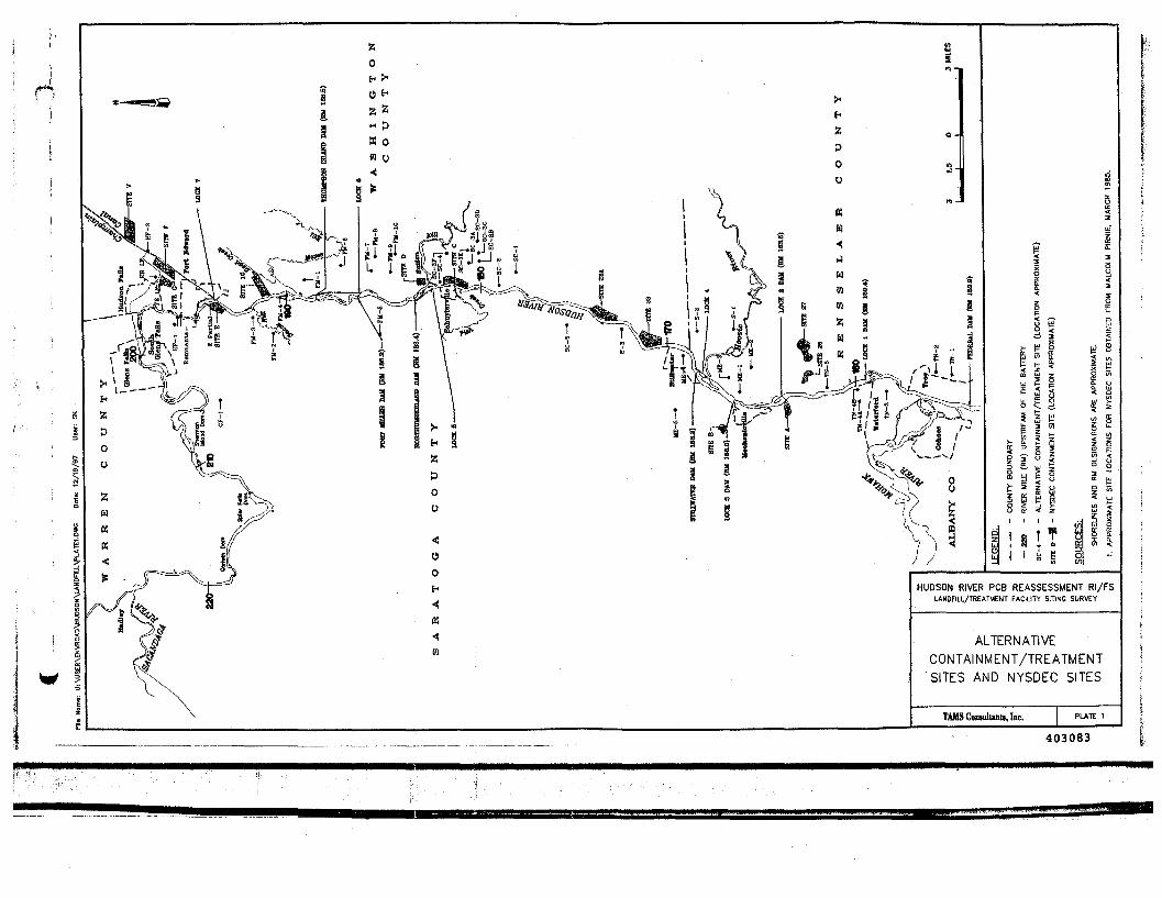
HUDSON RIVER PCB REASSESSMENT RI/FSLANDFILL/TREATMENT FACILITY SITING SURVEY
ALTERNATIVECONTAINMENT/TREATMENTSITES AND NYSDEC SITES
TAMS Coniulunu, Inc.
403083
this report, the Site 10 parcels are zoned for agricultural/residential use by the Town of Fort Edward
but have not been incorporated into the Agricultural District (Brooks, 1997, pers. comm.).
For the proposed containment cells at Site 10, NYSDEC would incorporate a double-
composite liner with a primary and secondary leachate collection system to prevent migration of
PCBs to groundwater. The double-composite liner would consist of a clay soil liner and a synthetic
liner, in accordance with state and federal requirements. As stated in Section 2.1, the most recent
NYSDEC plan for proposed Site 10 includes containment of approximately 2.1 million cubic yards
of contaminated sediments from the Upper Hudson River, as well as 1.4 million cubic yards of
material to be excavated from the remnant deposits and dredge-spoils sites, for a total nominal
capacity of 3.5 million cubic yards.
2.4 NYSDEC Alternatives to Site 10
In 1984, prior to the revision of the Environmental Conservation Law, NYSDEC decided to
evaluate alternative disposal sites should Site 10 be disallowed. NYSDEC selected twelve alternative
sites in Rensselaer, Saratoga, and Washington Counties. The locations of the sites were limited toa two-mile wide corridor along each side of the river from Waterford to Hudson Falls for a distance
of approximately 35 miles. Each of the sites, except one, was located by NYSDEC in an area zoned
for industrial or manufacturing use or in an area where no formal zoning or land-use plan existed at
that time. The one exception, Site B in the Town of Stillwater, Saratoga County, was located in a
predominantly residential district (Malcolm Pirnie, 1985). The locations of the twelve alternative
NYSDEC sites as well as Site 10 are shown on Plate 1.
NYSDEC retained Malcolm Pirnie to evaluate each of the sites and develop conceptual
designs and preliminary cost estimates for four of the top-ranked alternative sites. It was determined
that at least 75 acres of useable land would be required for containment of 700,000 cubic yards of
contaminated sediments from the hot spots in the Thompson Island Pool and an additional 350,000
cubic yards from hot spots downstream of the Thompson Island Dam (Malcolm Pirnie, 1985). To
12 TAMS CONSULTANTS, INC.
403084
effectively manage the sediment and water generated during dredging operations, the area would
include containment cells, a roughing and storage pond, a surge pond, and a water treatment plant.
Treated effluent would be discharged back to the Hudson River.
The NYSDEC sites were evaluated on numerous factors, including location, accessibility,
zoning, soils, drainage, and environmental sensitivity, among others. Information was obtained from
published reports, maps and interviews. Subsurface investigations and preliminary biological
assessments were also conducted. The sites were ranked according to the siting
considerations/criteria and evaluation procedures outlined in 6 NYCRR Part 361.7 (Facility Siting
Criteria for Siting of an Industrial Hazardous Waste Facility), which are summarized in Section 2.2.
Except for three siting considerations (9, 11, and 12) not considered to be applicable to a dredge-
spoils landfill, each of the siting considerations identified in Section 2.2 was considered in the ranking
process. Site 10 was included in the ranking for comparative purposes. Information on each of the
NYSDEC alternative sites as well as Site 10 and the final rankings for each site are provided in Table
1.
In this formal, quantitative ranking process, Site 10 received the most favorable (lowest) score
and was ranked first. Thus, none of the twelve alternative sites selected by NYSDEC and ranked byMalcolm Pirnie were deemed to be more suitable than Site 10. Site G, located northeast of the
Village of Fort Edward, received the highest ranking among the twelve alternative sites. Site G is
located in an area that was zoned for industrial use in the Town of Fort Edward. However, at that
time, a large portion of the site was used for agricultural purposes. In addition to the site's industrial
zoning, another advantage was that future development around the site was expected to be minimal
in that the area northwest of the site is the Fort Edward Landfill, which already contains PCBs, while
land to the east and south is within the flood zone of the Champlain Canal (Malcolm Pirnie, 1985).
Also, clay soils are present beneath a large portion of the site. The useable area for Site G
(approximately 83 acres) was determined to be significantly less than the useable area for Site 10
(approximately 170 acres). Also, since the site is located near Lock 8 on the Champlain Canal north
of the Hudson River, dredge spoils would have to be transported a greater distance when compared
13 TAMS CONSULTANTS, INC.
403085
Table 1Evaluation of NYSDEC Alternative Disposal Sites and Site 10
NYSDECRanking
1
2
3
4
5
6
7
8
9
10
11
12
13
Site
10
G
V
E
23
23A
F
27
C
26
A
D
B
County
Washington
Washington
Washington
Saratoga
Washington
Washington
Washington
Rensselaer
Washington
Rensselaer
Saratoga
Washington
Saratoga
usesQuadrangle
Fort Miller
Hudson Falls
Hudson Falls
Hudson Falls
Mechanicville andSchaghticoke
Schuylerville andSchaghticoke
Hudson Falls
Troy North
Schuylerville
Troy North
Mechanicville and TroyNorth
Schuylerville
Mechanicville
Considerations
Centrally located within TIP, outside floodplain, locally zoned residential-rural agricultural district, elevation about 30 ft aboveriver level, suitable for pumping spoils, 170 of 250 acres suitable after elimination of shallow bedrock areas, ideal soil
Zoned industrial but within agricultural district, near residential community (Ruggi and Fahlmann properties), adjacent to FortEdward landfill, dredge material through Lock 8, above floodplain, clays present, 83 of 1 28 acres usable
Near canal summit, north of Lock 8, industrial and residential district, partially cultivated, clay soils present, extensive wetlands,within floodplain, isolated from populated areas, far from Lock 7 along canal
Site includes New and Old Moreau Disposal areas and SA 13, cemetery, historic homestead, portions zoned industrial andresidential/agricultural, accessible from river at northern end of TIP, excavation of spoils into landfill, relocate Rt. 29
Entirely within floodplain, owned by Niagara Mohawk Power and was site of proposed power plant in 1 960s, not zoned butwithin agricultural district, excellent access from river, shallow groundwater, non-ideal soils, large area (31 0 acres)
Entirely within floodplain, not zoned but within agricultural district, excellent access from river, shallow groundwater, shallowbedrock, geology not suitable, near Saratoga National Park, large area (312 acres)
Zoned industrial, dredge material through Lock 8, shallow groundwater, extensive drainage ditches throughout site, portioncultivated but not within an agricultural district, in floodplain, large area (approx. 250 acres)
Poor accessibility from river, high elevation, far from TIP, land is within a designated agricultural district, no formal zoning orland-use plan in Town of Schaghticoke
No zoning restrictions, within floodplain and agricultural district, extensively cultivated, shallow groundwater, accessible fromriver, proximity to Schuylerville, bisected by Rt. 29, 105 of 184 acres usable
Poor accessibility from river, high elevation, far from TIP, only 55 acres of usable land, land is within a designated agriculturaldistrict, no formal zoning or land-use plan in Town of Schaghticoke
Manufacturing zoned, shallow groundwater and depth to bedrock, only 70 acres of usable land, proximity to Waterford's publicwater supply intake, far from Thompson Island Pool (TIP), rail line bisects site, in floodplain
Within populated hamlet of Clarks Mills in the Town of Greenwich, proposed as an industrial area, surrounded by agriculturaldistrict, relocation of many homes and roads would be necessary
Residential/rural zoned and portion within an agricultural district, high elevation would require trucking not pumping of spoils,high population density within one-half mile of site (Mechanicville), near water supply
Source: Malcolm Pirnie, 1985 TAMS Consultants, Inc.
to Site 10, which is located near the center of the Thompson Island Pool. The differences which were
quantified in the formal ranking process are described below.
Siting considerations and specific criteria for which Site G was considered less favorable than
Site 10, in order of decreasing point differential, include:
• Population within one-half mile of the site boundary (7-point differential);
• Population adjacent to transport route (7-point differential);
• Contamination of ground and surface waters, specifically, site runoff characteristicsas related to natural topography (3.6-point differential); and
• Risk of accident in transportation, including mode of transportation (longer bargingand pipeline distance for Site G) and transportation restrictions such as locks (2.5-point differential).
These four siting considerations accounted for a 20.1-point differential between Site 10 and Site G,
NYSDEC's preferred alternative.
Siting considerations and specific criteria for which Site G was considered more favorable
than Site 10, in order of decreasing point differential, include:
• Proximity to historical or cultural resources (4-point differential);
• Municipal effects, including consistency with intent of master land-use plan, and locallaws, ordinances, rules, and regulations (1.6-point differential); and
• Proximity to major utility lines (1-point differential).
These three siting considerations accounted for a 6.6-point differential. Scores for the remaining
siting considerations evaluated were identical for the two sites. The net differential between Site 10
and Site G was 13.5 points. The net differentials between Site 10 and each of the other NYSDEC
alternative sites were all greater than the Site 10/Site G differential. Among all sites, Site 10 received
the lowest (most favorable) scores for each of the siting considerations carrying the greatest weight,
15 TAMS CONSULTANTS, INC.
403087
including contamination of ground and surface waters, air quality, population density, and risk of
accident in transportation. Some of the alternative sites received lower (more favorable) scores than
Site 10 for siting considerations carrying less weight, including utility lines, municipal effects, and
conservation of historic and cultural resources.
16 TAMS CONSULTANTS, INC.
403088
3. SITE IDENTIFICATION
Subsequent to the review of NYSDEC's siting efforts and compilation of information
regarding NYSDEC's twelve alternative sites, TAMS conducted an independent screening of the
Upper Hudson study area for other potentially-viable locations for a dredge-spoils
containment/treatment facility. This chapter provides a summary of the information utilized to map
and evaluate the sites as well as the generic criteria used to identify the candidate sites.
The study area along the Upper Hudson River extends from the Federal Dam in the south to
Hudson Falls in the north, a distance of over 40 miles. This area includes portions of Rensselaer,
Saratoga and Washington Counties. Consistent with NYSDEC's siting efforts, a corridor two miles
from each side of the Upper Hudson River was used to identify sites for evaluation. Since this
corridor generated a significant number of sites for evaluation, it was considered unnecessary to
expand the corridor to more than two miles from the river.
3.1 Baseline Information
This section provides a summary of the information used to select the candidate
containment/treatment sites. Published maps and data were compiled to generate a base map for
locating the candidate sites. Information compiled included land use and zoning maps and reports,
topographic maps showing ground elevations, floodplain maps, and river survey maps indicatingriver-mile distances, as follows:
United States Geological Survey (USGS) topographic, quadrangle maps were usedas base maps. These maps show locations of major waterbodies, major roadways andrailways, and major developed areas. Ground surface elevations at a contour intervalof ten feet are also shown on the maps. Buildings/structures, including hospitals,churches, airports, cemeteries, industries, residences located predominantly outsideof the major developed areas, and river/canal locks and dams, are also included on themaps. The study area covers portions of ten USGS maps, including Troy North,
17 TAMS CONSULTANTS, INC.
403089
Tomhannock, Mechanicville, Schaghticoke, Quaker Springs, Schuylerville,Gansevoort, Fort Miller, Glens Falls, and Hudson Falls;
• Municipal offices in each of the three counties were contacted in early 1997 to obtainthe most recent data on land use and zoning. Additional information on land use,zoning and population was requested from each city, town and village within thestudy area. Population data received were total numbers for the individual towns orcounties and were not specific to the candidate sites. A list of those offices contactedis provided in Appendix A. The land-use/zoning areas, such as industrial/commercial,residential, and agricultural zones, were transferred to the USGS base maps;
• The 100-year floodplains of the Upper Hudson River and tributaries to the river werealso sketched on the USGS base maps. The locations of the floodplains wereobtained from the Federal Emergency Management Agency (FEMA) Flood InsuranceRate Maps (FIRMs) for the communities along the Upper Hudson River; and
• River-mile (RM) designations for the Upper Hudson River, referenced to the mouthof the Lower Hudson River at the Battery near Lower Manhattan (RM 0), were alsoadded to the USGS base maps. The river-mile designations were obtained from theHudson River Survey performed by Normandeau & Associates (1976-1977) and rivercross-section maps generated by TAMS.
The USGS base maps and supplemental information sketched on those maps were the
"working tools" of the survey.
3.2 Site Identification Criteria
Land areas were identified as candidate sites for inclusion in this preliminary survey on the
basis of six generic engineering and population criteria:
• Having a location within a corridor two miles in width from each bank of the UpperHudson River extending from Hudson Falls in the north to the Federal Dam at Troyin the south in Rensselaer, Saratoga and Washington Counties;
• Consisting of a contiguous area of 50 acres or more and having a shape with areasonable chance of supporting an engineered facility (e.g., avoiding areas withextreme length-to-width ratios, or those with too many "bulbs" separated by deepravines or hills). Whereas NYSDEC's minimum area for site selection was 75 acres(see Section 2.4), a 50-acre minimum was used in this study to include potentiallyviable smaller areas for either dredge-spoils dewatering/treatment without long-term
18 TAMS CONSULTANTS, INC.
403090
containment, or long-term containment of a smaller volume of dredge spoils whencompared to NYSDEC's estimated volume;
• Having an average slope of two percent or less (to avoid the need for multiple, small"terraces" in the final landfill configuration), unless configured in a bowl shapeproviding natural retention structures;
• Encompassing five or fewer residences or other structures within the site "boundary"as represented on the most recent USGS map;
• Encompassing no airports, churches, schools, or other public halls or portions ofrecognized parklands or preserves within the site "boundary" as represented on themost recent USGS maps; and
• Excluding permanent streams and major roads from the site "boundary."
In addition to sites identified using these criteria, areas listed in county land use, zoning, andmaster plan documents as industrially zoned or reserved for industrial use were added to the
compilation for consideration. These areas were outlined on the USGS base maps. Other areas, suchas the remnant deposits (excluding Remnant Deposit 1 which presently consists of small islands in
the center of the river near the General Electric Fort Edward Plant outfall), were added to thecompilation due to unique characteristics warranting consideration. Some of the existing landfill and
dredge-spoil sites already containing PCB-contaminated sediments or wastes were also included. Dueto the smaller size criterion than was used for the NYSDEC studies, it was also appropriate to
consider portions of previously-identified NYSDEC sites as individual entities for the purpose of this
survey, with the possibility that some of the less-desirable aspects indicated previously could beavoided or mitigated.
3.3 Site Designation
The USGS base maps were visually scanned to identify those parcels meeting the criteria
listed in Section 3.2. Parcels meeting the criteria were delineated on the maps and each candidate site
was assigned a unique designation. The designation was based on the name of the USGS quadrangle
and the numeric identifier, as follows:
1 9 TAMS CONSULTANTS, INC.
403091
Troy North, TN-#;
• Mechanicville, ME-#;
• Schaghticoke, S-#;
Schuylerville, SC-#;
Fort Miller, FM-#;
Hudson Falls, HF-#; and
• Glens Falls, GF-#.
The numeric identifier is sequential, based on the order in which a site was identified on the
individual USGS quadrangle. For example, Site FM-2 was the second site identified on the Fort
Miller USGS quadrangle. No sites were identified on the Tomhannock, Quaker Springs, or
Gansevoort USGS maps, as major portions of these three maps are outside the study area. The
NYSDEC sites, remnant-deposit sites, existing dredge-spoil sites and landfills were assigned the
previously-designated names and were also sketched on the USGS base maps.
3.4 Field Reconnaissance
To obtain information about the current condition of each of the newly-designated sites as
well as the former NYSDEC alternative sites, a field reconnaissance was performed over a three-day
period from May 20 to 22, 1997. Except for the remnant deposits, observations were made from
public roads or from other publicly-accessible areas. Attempts were made to visit many of the
NYSDEC-defined sites and former dredge-spoil disposal areas, as well as those candidate sites
identified in this study. A three-day field reconnaissance was originally envisioned, prior to
determining the number of potential candidate sites. The TAMS field team, consisting of two
professional engineers and a geologist, was able to visit each of the candidate sites and NYSDEC
sites in that time frame. One of the candidate sites (Site SC-1) and one of the NYSDEC sites (Site
26) were not accessible from public roads and were therefore not visited.
20 TAMS CONSULTANTS, INC.
403092
The field reconnaissance predominantly consisted of a windshield survey from roadways
adjacent to each of the candidate sites and NYSDEC sites. Visual observations were made at each
site and documented on field reconnaissance forms. Information documented includes: names of
nearby streets; type of terrain at the site; current land use at the site; surrounding land use; number
of residences at the site, schools, churches, or hospitals in the vicinity; types of roads near the site;
streams or waterbodies at and near the site; potential barge docking areas; potential pipeline routes
for near-river, lowland sites for pumping dredge spoils; potential overland transportation routes for
hauling dredge spoils by truck or rail; terrain along the overland transport routes; and residences
along the transport routes. Field investigations were not conducted at the sites. Photographs of the
candidate sites and surrounding areas were taken to document pertinent features, including current
land use. Representative photographs of some of the sites are included in Appendix B of this report.
21 TAMS CONSULTANTS, INC.
403093
PAGE INTENTIONALLY LEFT BLANK
22 TAMS CONSULTANTS, INC.
403094
4. SITE EVALUATION
. Based on the field reconnaissance and the compilation of published information documented
in Chapter 3, each of the newly-identified candidate sites was evaluated for basic engineering
feasibility and likely advantages or concerns. Each site was screened for further consideration in a
two-step process. Step 1 consisted of a categorization of each of the sites based on site elevation andzoning/land use. Also, an evaluation matrix was prepared in Step 1 as a screening tool. Many of the
sites were eliminated from further consideration at the end of Step 1. The Step 2 Evaluation included
an elimination of many of the remaining agricultural sites as well as a more-detailed analysis of the
remaining sites warranting further consideration at that stage. These remaining candidate sites were
then compared to NYSDEC's Site 10, based on the NYSDEC siting considerations previously
presented. The results of the comparisons to Site 10 are presented in Chapter 5.
4.1 Step 1 Evaluation
4.1.1 Site Categorization
Each candidate site was assigned to one of the following four categories: Lowland
Agricultural (LA), Upland Agricultural (UA), Lowland Industrial (LI), and Upland Industrial (UI)
based on two criteria. The first criterion is the surface elevation of the site in relation to the river in
view of engineering considerations with respect to transport of dredge spoils to the candidate site.
Land along the Upper Hudson River within the study corridor generally falls into one of three groups:
lowland areas adjacent to the river at elevations typically less than 50 ft above the elevation of the
river; steeply sloping land along the valley walls; and those areas beyond the steep slopes of the river
valley on the upland plateau. All sites were grouped as "L" for lowland or "IT.for upland, since
steeply sloping land was excluded in the initial site identification. For lowland sites, dredge spoils
would be pumped from the river to the disposal site, while rail or truck transport would be necessary
for upland sites.
23 TAMS CONSULTANTS, INC.
403095
The second criterion is based on land use or zoning of the parcel as taken from the maps
obtained from the various city, town and village governments. Those areas designated as industrial,
manufacturing or commercial were given the designation of "I". Those areas zoned as agricultural
were given the designation of "A". Residential areas were avoided in the initial site selection. For
those areas where formal land-use plans or zoning maps do not exist, determination of industrial or
agricultural use was based on visual observations during the field reconnaissance. It should be noted
that some sites within designated industrial zones or manufacturing districts are currently used for
agricultural purposes. Such sites were classified according to the designated zoning rather than the
current use. However, current use was noted during the field reconnaissance.
4.1.2 Candidate Site Screening
A total of 41 candidate sites were identified using the site identification criteria outlined in
Section 3.2. The location of the approximate center of each of these sites as well as the location ofNYSDEC's Site 10 and twelve alternative sites are shown on Plate 1. Of these 41 sites, two are
existing landfills (Kingsbury Landfill [KB LF] and Fort Edward Landfill [FE LF]), one utilizes
Remnant Deposits 2, 3, 4 and 5, and two are variants on NYSDEC sites (Site SC-4 overlaps with
portions of NYSDEC Site C and Site E [Partial] reconfigures NYSDEC Site E to avoid relocating
River Road and impacting the historic homestead and cemetery shown on the USGS map). A
breakdown of the sites by county and category is provided in Table 2. Fifteen industrial-designated
sites and 26 agricultural-designated sites were identified. Seven candidate sites are located in
Rensselaer County, fourteen in Saratoga County, and eighteen in Washington County. Two of the
41 sites span county lines: Site S-2 straddles the Rensselaer and Washington County lines and the
remnant deposits lie in both Saratoga and Washington Counties.
24 TAMS CONSULTANTS, INC.
403096
Table 2Category Summary of Candidate Containment/Treatment Sites
RensselaerCounty
SaratogaCounty
WashingtonCounty
Site S-2 (Rens.and Wash.Counties)
Agricultural
Upland
Lowland
2
2
3
5
11
2
1
REMN (Sar. andWash. Counties)
Industrial
Upland
Lowland
TOTALS
2
1
7
2
4
14
4
1
18 1
1
1
Note: Total of 41 potential alternative sites selected and evaluated, see Plate 1
An evaluation matrix, included as Table 3, was prepared to document information on each
of the 41 candidate sites. The matrix was used as a basis for comparisons among each of the sites
and as a tool for site elimination. Information included in the matrix was obtained from the USGS
base maps and the supplemental information added to those maps, as well as from observations made
during the field reconnaissance. The respective county and category of each of the candidate sites
are included in the matrix. Each of the remaining columns or groups of columns in the matrix
represent different aspects of NYSDEC's siting considerations for qualitative application, as follows:
*• Land Use/Zoning:Information on land use and zoning at the site and in the vicinity of the site wasobtained from the published maps and reports obtained from the county and localgovernment sources listed in Appendix A. For those areas where published land-use/zoning information does not exist, visual observations made during the fieldreconnaissance provided the basis for the entry in the matrix.
*• Floodplain:"No" - Site is entirely outside the FEMA published 100-year floodplain"Yes" - Most or all of the site is within the floodplain"Portion" - Only a portion of the site is within the floodplain
25 TAMS CONSULTANTS, INC.
403097
Elevation Above River (ft):The difference in elevation between the average ground surface elevation of thecandidate site and the average water surface elevation of the pool of the UpperHudson River/Champlain Canal adjacent to the site.
River-Mile Distance from Thompson Island Dam:The distance to the point in the river adjacent to the approximate center point of eachsite as measured along the river/canal axis from the Thompson Island Dam using thesystem of "River Miles" established for the project. The Thompson Island Dam,located at RM 188.5, is the downstream limit of the Thompson Island Pool (see Plate1). Distances in miles downstream (south) of the Thompson Island Dam are shownas negative, while those upstream (north) of the dam are indicated as positive.
Overland Pumping Distance (ft):The distance for overland pumping of dredge spoils was measured from the USGSbase maps for each of the candidate sites classified as lowland (LA or LI). The valuesrepresent the distance from a potential barge docking area in the river to the candidatesite. This consideration was generally not applicable to upland sites as pumping wasnot deemed feasible.
Major/County Roads:For each of the candidate sites classified as upland (UA or UI), names andclassifications of roadways in the vicinity of the site were obtained from USGS basemaps and local/county road maps. The trucking distance to all upland sites wasmeasured on the USGS maps by following a likely trucking route to the site alongexisting roads from a potential barge docking point on the river. The "distance tosite" column represents the distance along a road to be constructed from an existingroad to the site. This consideration was generally not applicable to lowland siteswhere material would likely be pumped directly to the dewatering/containment area.
Rail Lines:Determination of the feasibility of rail transport of dredge spoils to upland sites wasbased on locations of rail lines shown on the USGS maps. "Distance to offload"represents the length of spur to be constructed from a potential dewatering area nearthe river to an existing rail line. "Hauling distance" represents the distance along theexisting rail lines whereas "distance to site" represents the distance along a spur to beconstructed from the existing rail line to the site.
26 TAMS CONSULTANTS, INC.
403098
Table 3Evaluation of Additional Candidate Containment/Treatment Sites
Page 1 of 2
Site
TN-1
TN-2
TN-3
TN-4A
TN-48
TN-5
ME-1
ME-2ME-3
ME-4
ME-5
S-1
S-2S-3SC-ISC-2
SC-3A
SC-3B
SC-3C
SC-30
SC-3E
SC-3F
SC-4
SC-5
FM-1
FM-2
County
ensselaer
enssetaer
Saraloga
Saratoga
Saraloga
Rensselaar
R__
RenssaaarRensselaer
Saraloga
SiMoga
Rensselaer
WashingtonSaraloga
WashingtonWashington
Washington
Washington
Washington
Washington
Washiogio
Washington
Saratoga
Washingtor
Saratoga
Category
Ul
Ul
LI
LI
LI
LA
LI
LAUA
«
UA
UA
UALAUALA
UA
UA
UA
UA
Ul
Ul
LA
UA
UA
LA
Land Use
Site
Industrial
Industrial
Industrial
Low DensityResidential
tight Industrial/Manufacturing
ResidentialAgricultural
ManufacturingResidentialAgriculturalAgriculturalResidential/Agricultural'Commercial
AgriculturalResidentialAgricultural
ResidentialAgriculturalAgriculturalAgriculturalAgricultural
Agricultural
Agricultural
Agricultural
Agricultural
irxtuJlria!
IndustrialAgricultural/
Vacant
Agricultural
AgriculturalAgricultural &Residential
Vicinity
Schools andCemeteriesSchools andCemeteries
industrial
Lw DensityResidential/
Undeveloped,ctive/ Abandonee
AgriculturalCommercial,ResidentialResidentialAgricultural
Hamlet District.ResidentialAgriculturalResidentialAgriculturalAgriculturalResidential/
Commercial
AgncuKuralResidentialAgricultural
ResidentialAgriculturalAgriculturalAgriculturalAgricultural
Industrial/ PublicService/
Residential/Community
service
Agricultural
Agricultural
AgriculturalVacant/
CommercialRecreational/Residential;
VacantAgricultural/
Industrial
Agricultural
AgriculturalAgricultural &Residential
Floodplain
NO
NO
NO
NO
Portion
Portion
NO
vesNO
YES
NO
NO
NOYESNOYES
NO
NO
NO
NO
NO
NO
YES
NO
NO
NO
ElevationAbove River
<m
360
360
30
20
20
10
20
30210
<10
220
220
230<1020010
240
240
240
260
260
260
10
170
110
River MIUstance FromThompsonliland Otm
-33.8
-33.2
•303
•28.8
-28.S
-274
-22.9
-23.6-22.3
-18.9
-1QS
-22.6
-20.6-15.6-8.8-8.4
•7.9
-8.2
-a.4
-e,2
-7.9
-75
-6.6
-12.9
O S
24
OverlandPumpins
Dtiianc* (ft)
NA
NA
2900
1.500
600
600
600
NANA
550
NA
NA
NA500
NA250
NA
NA
NA
NA
NA
NA
200
NA
NA
NA
Nimesfs}
Rl. 142, fit. 40
Rt. 142, RL 40
NA
NA
NA
NA
NA
Linden Rd.Linden Rd
NA
aka Road. FlikeRoad
RL67
River Road.VerDecnRoad
NAPrivate Onve
NA
Rl. 29RLM. wyturAve, Fellows
Road
RL 29. WitburAvenue
Rt. 29, RL 40
R1.29
RL2S.WKidyH<lRoad
NA
River Road. R4, VWtouf ROMRt. 4. Patterson
Road
Clark Road
old Classification
eavyOuty. MediumDuty
eavy Duty. MediumDuty
NA
NA
NA
NA
NA
Light Dutytight Duty
NA
Medium Duly. LigniOut,
Heavy Duty
Medium Duly. LightDutyNA
UnimprovedNA
Heavy Duty
Primary Highway,Light Duty, Light Duty
Primary Highway.Light Duly
Primary Highway,Secondary Highway
mwKghw,
Primary Highway.Light Duty
Light Duty, PrimaryHighway, light DutyPrimary Highway.
Light Duty
TruckingDistance (ft)
17.400
13.900
NA
NA
NA
NA
NA
15.0004.800
NA
3.500 fl is LightDuty)
16.100
20.200NA
2.500NA
4.00013,400 (last
5.300 ft Is LightDuty)
12, 400 (last4.000 ft is Light
15.600
7.20012.000 (the fas3.000 n is Light
Duly)
NA
7.500 (first 700and last 4.000are Light Duty
5.000 (first 500is Light Duly)
7000
Site (ft)
0
0
NA
NA
NA
7.5001700
NA
500
200
200NAtooNA
0
0
0
£00
0
0
NA
0
0
200
Disltncetomoid* (ft)
NA
NA
NA
NA
NA
NA
NANA
.
NA
NA
NANANANA
NA
NA
NA
NA
NA
0
NA
NA
NA
300
Rill Lines
KtullngOtotance
TO
NA
NA
NA
NA
NA
NA
NA
NANA
«
NA
NA
NANANANA
NA
NA
NA
NA
NA
24700
NA
NA
NA
9,500
(stance TcSHe "(ft)
NA
NA
NA
NA
NA
NA
NANA
NA
NA
NA
NANANANA
NA
NA
NA
NA
NA
700(1)
NA
NA
NA
200
SB«
Minimal
MinimalMinimal
Residential.Heavy
industrial
Minimal
Moderate
Minimal
Minimal
MinimalMinimal
Minimal
Minimal
Minimal
MinimalLignt
MinimalMinimal
Minimal
Minimal
Haw
Ughl
Minimal
Minimal
Minimal
Minimal
Lignt
Minimal
Population
SurfaceTransport
Rout*.Trucking
Moderate
Moderate
NA
NA
NA
NA
MinimalMinimal
NA
Moderate
Moderate
LightNA
MinimalNA
Minimal
Minimal
Minimal
Moderate
Minimal
Minimal
NA
Minimal
Minimal
Minimal
SurfaceTransport
Route • RaitLine*
NA
NA
NA
NA
NA
NA
NA
NANA
NA
NA
NA
NANANANA
NA
NA
NA
NA
NA
Ligru
NA
NA
Minimal
Minimal
FurtherEvaluation
NO
NO
YES
YES
YES
NO
NO
NONO
NO
NO
NO
NONONO
YES
YES
YES
YES
NO
YES
YES
NO
YES
YES
Comment!
xchrted: Hauling distance, eievabon slope on SM
xcluded: HauUng distance, elevation, jlop,. pro*m,ty to LMiiingnurgii Reierww
Industrial area behind GE Stttcones Plant m Wuefloed
nduslnaf /agricultural area near GE Sihconei Rent in vVeierhxa
ndoslnal /agricultural araa near G£ SAconai Plant m Waterforc-
rtudeaAgnoAnLtavuin
Excluded: Reroute railroad track. *ueam crossing, proximty to golf course
Excluded: in floe-apian of Hoosic River, afficuli accessExcluded: Elevation, agricultural
:iduded: School and residences on penmettr at site, flooopiain
Excluded: Elevation, agricultural, population along trenipon route
Exctudad- etevabon. agricultural, long trucking '°uie
Excluded: Elevation. agncuHurai. no mator roMt (or truckingixduded: In flooopi&n. near Saratoga Parkixduded: Elavafcn. agricultural, requires budding • n** road
In fioodplain. agricuBural
Upland agricultural
SrnaH site • powwinai Krm space, couki oe used with vie SC-3C
Long, narrow site • po#«nuMs Unui space, could be used m contuncuon wtih W* SC-3B
LWandagncuHurai
Excluded. Active precast concrete plant
Adjacent to Fairgrounds
In floodolain overiaps with NYSOEC's S<te C
Excluded: Future land ut« (or Saratoga Niuonai C«m*iery tveteten* cerrnitnrf
Upland agncultural
Has railroad access
403099
Table 3Evaluation of Additional Candidate Containment/Treatment Sites
Page 2 of 2
Site
FMJ
FM-4
FM-5
FM-S
FM-7
FM-a
FM-9
FM-10
MF-1
REMN
£ (Partial)
FELF
KBLFGF-1
County
SaratogaSaratoga
Saratoga
Washington
Washington
Washington
Washington
Washington
Saratoga
WashingtonSaratoga
Saratoga
Washington
WasttngionSaratoga
Category
LA
LA
UA
UA
UA
UA
UA
UA
Ul
LI
U
Ul
UlUl
Site
Residential
Agricultural
Agricultural
Agricultural
Agncuiturai
Agricultural
Agricultural
Agricultural
Manufacturing
Open space
Manufacturing
Public Service
Public ServiceCommercial
Vicinity
Residential
Agricultural
Agricultural
Agricultural
Agricultural
Agricultural
Agricultural;Vacant/ Forestry
Agricultural
Urban Residential/Agricultural &Residential
2.4-Agricuttufal 3.iResidential.
Agricultural &Residential
Vacant/Residential
Vacant/CommercialCommercial
Floodplaln
YES
VES
NO
NO
NO
NO
NO
NO
NO
YES
YES
NO
NONO
ElevationAbove River
(1>
10
5
170
120
100
130
120
200
120
<10
10
130
7060
River MiteDlsunce From
ThompsonIsland Dam
33
1.4
-32
-1.6
•3.2
.3.2
-4.1
-t.4
8.8
6.8 average
S.4
8.2
6.66
OverlandPumping
Distance (R)
400
100
NA
NA
NA
NA
NA
NA
NA
7.000 R ava.300 (O»
Moreau). 1.000(New Moreau)
NA
S.OOONA
Nim«f()
NA
MA
RL32
RL4. East DuerRoad
Bald MountainRoad
Said MountainRoad
Rl 4. Rivefload. Thompson
Road
Rt 4. RiverRoad. Thompson
Road. ConretlRoad
Bluebird Road
NA
NARL 4. Burgoyna
Ave.
NA
R19I32
Road Classification
NA
NA
Secondary Highway
Primary Highway.Lignt Duly
Light Duly
Primary Highway.Light Duiy
Primary Highway.Light Duty. Light Duty
Primary Highway.Ught Duty. LightDuty. Light Duly
Medium Duty
NA
NAHeavy Duty Medium
Duty
NAHeavy Duty
TruckingDI*tin«|R)
NA
NA
12.800
6. 700 (tasl 6,700ft is Lignt Duty12.300 (last
4.300 ft is LightDuly)
14.300 ( (ail6.900 ft 11 Light
Duty)
8,400 (last S.100ft is Light Duty)
13.400 (mainlyLight Duty)
400
M
12.100
NA22.500
Disiinci toSilt (ft)
NA
NA
100
JOO
0
too
0
0
0
»0
Hf>800
mo«d- (M)
NA
NA
HA
NA
NA
0
NA
0
NANA
HiullngDUUn«e
(1)
NA
NA
NA
NA
NA
NA
NA
NA
14.700
NA
«NA
NA
NA
DUrtnc* ToS««"(fi|
NA
NA
NA
NA
NA
NA
NA
NA
500
NA
NA
NANA
Sitt
Mmmal
Minimal
Minimal
Mitwnai
tti_
Minimal
Minimal
Minimal
Modarau
Minimal
Minimal
Minimal
MinimalMinimal
SufficeTrantport
Route-TrucUnn
NA
NA
Moderate
Light
Light
Minimal
Lighi
NA
.Urtwn
NAMoowata
Surfic*Transport
Route - R*HUn*«
NANA
NA
NA
NA
NA
NA
Light
NA
NA
NA
NANA
FurtherEvaluation
YESYES
NO
NO
NO
NO
NO
NO
YES
YES
YES
NO
NONO
c ——— .
Small ate. could b* uua m conjunction wim FM-2Griffin Island. 1 10 2 nonwt on mind
xduded: 6!evawn, iruoung distance
iChxJed Agricultural, elevation, trucking rouw
wiuded: Small me. •tovwion. agrKuHur*
Excluded: Elevation, agricultural
Excluded: Elt«6on, agricultural
•xctudsd: Elevition, agncuturai
'a<celiixauae»iheh^araMorawkPo»«i Comply oo(ig**«»«<x)«p<<H™i»-j •»„!! »,.»•*
Uroque uling approach. uUiies If* willing remnant atpotii i»mj tii* oo« **»'v/ i.,*-,.*.*
Reconfigures the NYSDEC plan to avoid fliv* fto*) »na in* ivtitw« (•m«i*r,*v i»i»>4
Excluded: Si» area ii Mil man SO acrii
Excluded: Site area is leu than M acresrxch« :Popul«onde™iyBlongBl*r yLru«.ngiou« F«m*tt:Hd»*i :,.* >,t :..jn-f.
• Spur length from rivw to railroad to be constructed" Spur length (torn railroad to site lo Oe constructed1} Rail tine is approximately 120 ft below the average site elevation
Category. LA - Lowland AgriculturalLt - Lowland IndustrialUA - Upland AgriculturalUl - Upland Industrial
River Mile Distance calculated from Thompson I stand Dam (RM 188.5), negative value indicates soutn (downstream) ot Oam. positive value indicates north (upstream) ol Dam
Poputadon based on residerriial buHdmgs shown on USGS maps (vanous dales, 1966 lo 19BO).Minimal • Five or IMS houses indicated on USGS QuadrangleLight • Six to ten houses indicated on USGS QuadranglaModerate - Eleven lo Fifty nouses indicated on USGS Quaflf angleUman-Gf aaier than 50 houses mdicaled on USGS Quadrangle
For upland sites, only raH or trucking options ware evaluated., except the King&xiry Landfill (Site KB IF)-For lowland sites along the Hudson Rfvar. only hydraulic pumping was evaluated. Those lowland sites along tributaries of the Hudson River (Site M6-2. Hoostc River and FM-2. Snook Kill) would not oe amtniWt lo pumping (rom tot Mufl
403100
Population:A qualitative description (minimal, light, or moderate) of the population density at andnear the sites and along anticipated transport routes was made based on the numberof structures or residences shown on the most recent USGS maps. Industrialdevelopment in the site vicinity was also noted.
The 41 sites were then evaluated to determine which sites merited further consideration. Sites
eliminated from further consideration are designated by a "No" entry under the "Further Evaluation"
column of Table 3. Reasons for site elimination during the Step 1 Evaluation are included in the
"Comment" column. Upon completion of this Step 1 Evaluation, 17 sites remained for further
consideration. These sites included:
• Five lowland industrial sites (TN-3, TN-4A, TN-4B, Remnant Deposits 2 through 5,and E [Partial]);
• Two upland industrial sites (SC-3F and FfF-1);
Five lowland agricultural sites (SC-2, SC-4, FM-2, FM-3 and FM-4); and
Five upland agricultural sites (SC-3A, SC-3B, SC-3C, SC-3D and FM-1).
Sites were eliminated for various reasons, some of which include hauling distance and site
elevation (TN-1, TN-2, S-l, S-2), incompatible land uses or structures on and adjacent to the site (S-
3, SC-3E, SC-5, ME-4), population density along anticipated transport route (GF-1), and limited size
(FE LF, KB LF).
4.2 Step 2 Evaluation
At the onset of the Step 2 Evaluation, seven upland and lowland agricultural sites (SC-2, SC-
3B, SC-3C, SC-3D, FM-1, FM-2, and FM-3) were set aside and not considered further as there was
no obvious advantage over NYSDEC's Site 10. In the Step 2 Evaluation, additional information on
the remaining ten sites was obtained, including an approximation of the acreage of each site from the
USGS maps using a planimeter, determination of the predominant soil types from the county soil
29 . TAMS CONSULTANTS, INC.
403101
surveys, and a determination of the probable method of conveying dredge spoils from a barge on the
river to the site. This information is summarized in Table 4 as well as positive and negative
considerations associated with each of the sites.
Containment schemes consist of three components: sediment dewatering, treatment of the
contaminated water generated during dewatering, and landfilling. In the NYSDEC 1985 study, all
three scheme components were assumed to be conducted at one site. For Site 10 and four of the
NYSDEC top-ranked alternative sites (Sites G, V, E, and F), NYSDEC's conceptual designs
included hydraulic pumping of dredge spoils from a docking facility in the river or canal to a
combined dewatering/containment cell (Malcolm Pirnie, 1985). Overflow water would be collected,
treated, and discharged back to the river or canal. This method of managing the dredge spoils was
considered for the candidate lowland sites in this study.
For the upland sites in this study, a temporary dewatering facility would be constructed at a
lowland site along the river/canal and the dewatered spoils would be transported by truck or rail to
the candidate site for final containment. Dewatering the dredge spoils prior to transport would
decrease the risk factors in transporting high liquid-content material along public roadways and would
be less costly compared to overland hauling of saturated spoils. Two or more of the candidate sites
could be used for this method. However, the cost of this method would likely be greater than
containment at a single lowland site near the river.
A third method considered for management of the dredge spoils would utilize one of the
lowland candidate sites for dewatering and/or treatment, e.g., stabilization, prior to off-site transport
to a treatment facility or landfill located outside of the study area. For example, portions of the
remnant deposits, which are one of the candidate sites physically isolated from agricultural areas,
could be used for dewatering and/or treatment prior to final containment or treatment at a separate
location. Assessing the viability of different treatment methods and off-site facilities is part of the
Reassessment Feasibility Study.
30 TAMS CONSULTANTS, INC.
403102
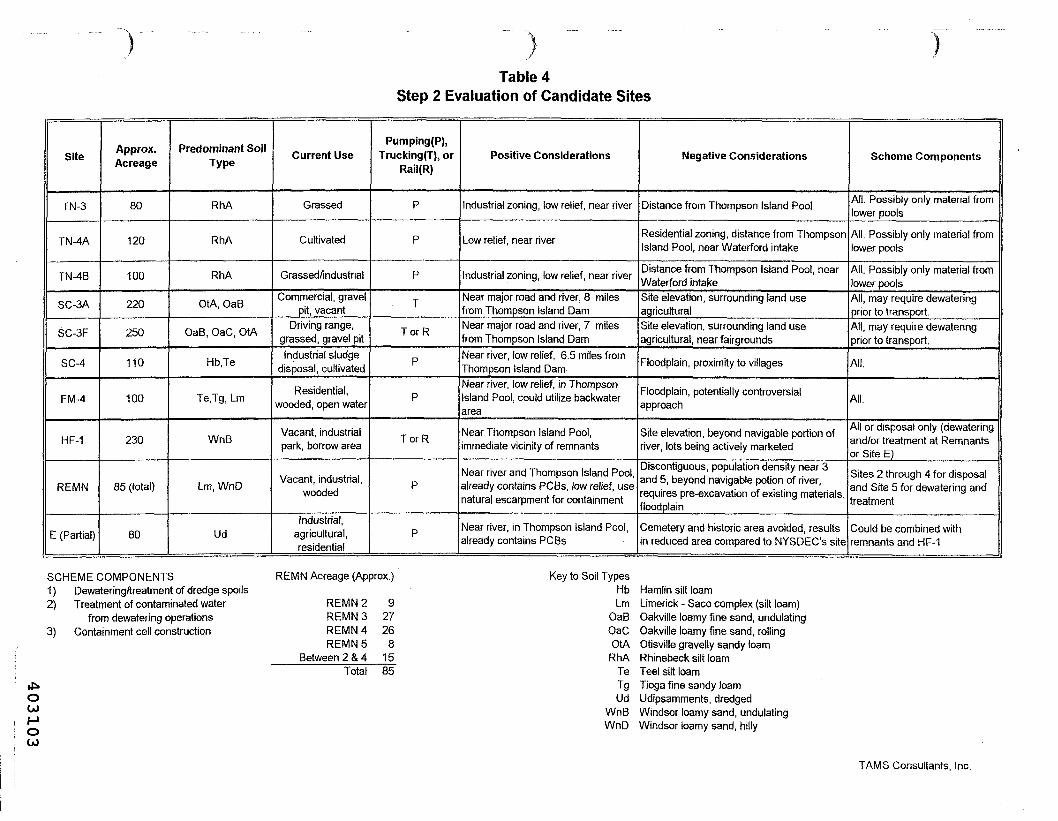
Table 4Step 2 Evaluation of Candidate Sites
Site
TN-3
TN-4A
TN-4B
SC-3A
SC-3F
SC-4
FM-4
HF-1
REMN
E (Partial)
Approx.Acreage
80
120
100
220
250
110
100
230
85 (total)
80
Predominant SoilType
RhA
RhA
RhA
OtA, OaB
OaB, OaC, OtA
Hb.Te
Te.Tg, Lm
WnB
Lm, WnD
Ud
Current Use
Grassed
Cultivated
Grassed/industrial
Commercial, gravelpit, vacant
Driving range,grassed, gravel pitIndustrial sludge
disposal, cultivated
Residential,wooded, open water
Vacant, industrialpark, borrow area
Vacant, industrial,wooded
Industrial,agricultural,residential
Pumping(P),Trucking(T), or
Rail(R)
P
P
P
T
TorR
P
P
TorR
P
P
Positive Considerations
Industrial zoning, low relief, near river
Low relief, near river
Industrial zoning, low relief, near river
Near major road and river, 8 milesfrom Thompson Island DamNear major road and river, 7 milesfrom Thompson Island DamNear river, low relief, 6.5 miles fromThompson Island DamNear river, low relief, in ThompsonIsland Pool, could utilize backwaterarea
Near Thompson Island Pool,mmediate vicinity of remnants
Near river and Thompson Island Pool,already contains PCBs, low relief, usenatural escarpment for containment
Slear river, in Thompson Island Pool,already contains PCBs
Negative Considerations
Distance from Thompson Island Pool
Residential zoning, distance from ThompsonIsland Pool, near Waterford intake
Distance from Thompson Island Pool, nearWaterford intakeSite elevation, surrounding land useagriculturalSite elevation, surrounding land useagricultural, near fairgrounds
Floodplain, proximity to villages
Floodplain, potentially controversialapproach
Site elevation, beyond navigable portion ofriver, lots being actively marketed
Discontiguous, population density near 3and 5, beyond navigable potion of river,requires pre-excavation of existing materials,floodplain
Cemetery and historic area avoided, resultsin reduced area compared to NYSDEC's site
Scheme Components
All. Possibly only material fromlower pools
All. Possibly only material fromlower pools
All. Possibly only material fromlower poolsAll, may require dewateringprior to transport.All, may require dewateringprior to transport.
All.
All.
All or disposal only (dewateringand/or treatment at Remnantsor Site E)
Sites 2 through 4 for disposaland Site 5 for dewatering andtreatment
Could be combined withremnants and HF-1
SCHEME COMPONENTS1) Dewatering/treatment of dredge spoils2) Treatment of contaminated water
from dewatering operations3) Containment cell construction
REMN Acreage (Approx.)
REMN2 9REMN 3 27REMN 4 26REMN5 8
Between 2 &4 15Total 85
OGOHOU>
Key to Soil TypesHb Hamlin silt loamLm Limerick - Saco complex (silt loam)
OaB Oakville loamy fine sand, undulatingOaC Oakville loamy fine sand, rollingOtA Otisville gravelly sandy loamRhA Rhinebeck silt loam
Te Teel silt loamTg Tioga fine sandy loamUd Udipsamments, dredged
WnB Windsor loamy sand, undulatingWnD Windsor loamy sand, hilly
TAMS Consultants, Inc.
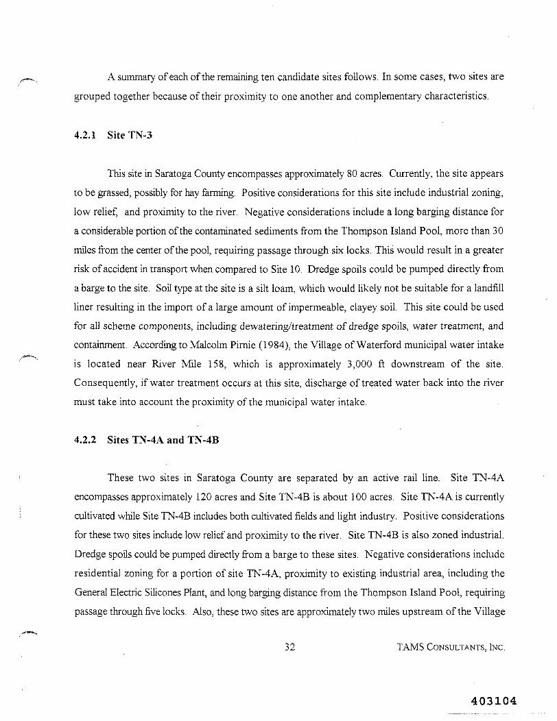
A summary of each of the remaining ten candidate sites follows. In some cases, two sites are
grouped together because of their proximity to one another and complementary characteristics.
4.2.1 SiteTN-3
This site in Saratoga County encompasses approximately 80 acres. Currently, the site appears
to be grassed, possibly for hay farming. Positive considerations for this site include industrial zoning,
low relief, and proximity to the river. Negative considerations include a long barging distance for
a considerable portion of the contaminated sediments from the Thompson Island Pool, more than 30
miles from the center of the pool, requiring passage through six locks. This would result in a greaterrisk of accident in transport when compared to Site 10. Dredge spoils could be pumped directly from
a barge to the site. Soil type at the site is a silt loam, which would likely not be suitable for a landfillliner resulting in the import of a large amount of impermeable, clayey soil. This site could be used
for all scheme components, including dewatering/treatment of dredge spoils, water treatment, andcontainment. According to Malcolm Pirnie (1984), the Village of Waterford municipal water intake
is located near River Mile 158, which is approximately 3,000 ft downstream of the site.
Consequently, if water treatment occurs at this site, discharge of treated water back into the river
must take into account the proximity of the municipal water intake.
4.2.2 Sites TN-4A and TN-4B
These two sites in Saratoga County are separated by an active rail line. Site TN-4A
encompasses approximately 120 acres and Site TN-4B is about 100 acres. Site TN-4A is currently
cultivated while Site TN-4B includes both cultivated fields and light industry. Positive considerations
for these two sites include low relief and proximity to the river. Site TN-4B is also zoned industrial.
Dredge spoils could be pumped directly from a barge to these sites. Negative considerations include
residential zoning for a portion of site TN-4A, proximity to existing industrial area, including the
General Electric Silicones Plant, and long barging distance from the Thompson Island Pool, requiring
passage through five locks. Also, these two sites are approximately two miles upstream of the Village
32 TAMS CONSULTANTS. INC.
403104
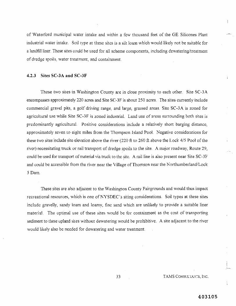
of Waterford municipal water intake and within a few thousand feet of the GE Silicones Plant
industrial water intake. Soil type at these sites is a silt loam which would likely not be suitable for
a landfill liner. These sites could be used for all scheme components, including dewatering/treatment
of dredge spoils, water treatment, and containment.
4.2.3 Sites SC-3A and SC-3F
These two sites in Washington County are in close proximity to each other. Site SC-3A
encompasses approximately 220 acres and Site SC-3F is about 250 acres. The sites currently include
commercial gravel pits, a golf driving range, and large, grassed areas. Site SC-3 A is zoned for
agricultural use while Site SC-3F is zoned industrial. Land use of areas surrounding both sites is
predominantly agricultural. Positive considerations include a relatively short barging distance,
approximately seven to eight miles from the Thompson Island Pool. Negative considerations for
these two sites include site elevation above the river (220 ft to 260 ft above the Lock 4/5 Pool of the
river) necessitating truck or rail transport of dredge spoils to the site. A major roadway, Route 29,
could be used for transport of material via truck to the site. A rail line is also present near Site SC-3F
and could be accessible from the river near the Village of Thomson near the Northumberland/Lock
5 Dam.
These sites are also adjacent to the Washington County Fairgrounds and would thus impact
recreational resources, which is one of NYSDEC's siting considerations. Soil types at these sites
include gravelly, sandy loam and loamy, fine sand which are unlikely to provide a suitable liner
material. The optimal use of these sites would be for containment as the cost of transporting
sediment to these upland sites without dewatering would be prohibitive. A site adjacent to the river
would likely also be needed for dewatering and water treatment.
33 TAMS CONSULTANTS, INC.
403105
4.2.4 Site SC-4
This site in Washington County overlaps with a portion of NYSDEC's Site C. One of the
negative aspects of Site C was the location of Route 29 and a local road, both of which exist within
the proposed site boundary as drawn by NYSDEC. Candidate Site SC-4 eliminated this problem by
moving the site boundaries to the north. This site encompasses approximately 110 acres. Currently,
the site includes cultivated areas and a sludge-disposal area for the Hollingsworth-Vose Mill. Land
areas in the vicinity of the site includes both agricultural and industrial uses. Positive considerations
for the site include proximity to the river, low relief, and a relatively short barging distance (about
seven miles) from the Thompson Island Pool. Dredge spoils could be pumped directly from a barge
to the site. Negative considerations include proximity to local villages, including Schuylerville and
Clarks Mills. Also, a large portion of the site is within the 100-year floodplain. Soil type at the site
is a silt loam, which would likely not be suitable for a landfill liner. This site could be used for all
scheme components, including dewatering/treatment of dredge spoils, water treatment, and
containment.
4.2.5 Site FM-4
This proposed site in Saratoga County includes Griffin Island and the backwater area between
Griffin Island and the west bank of the Hudson River up to River Road. The site encompasses
approximately 100 acres. The proposed scheme for this site would entail filling in the backwater area
to raise the ground surface up to the level of Griffin Island. Perimeter berms would be constructed
to prevent river flood waters from entering the proposed containment area. The site currently
includes a residence and wooded areas. The surrounding land use is predominantly agricultural.
Positive considerations for the site include its location within the Thompson Island Pool and its low
relief, enabling pumping of dredge spoils directly to the site. Negative considerations are that the site
is entirely within the 100-year floodplain and would require filling of open water and wetland areas.
Soil types on Griffin Island include silt loam and fine, sandy loam which would likely not be suitable
for a landfill liner. Also, the residence on site would likely have to be relocated. This site could be
3 4 TAMS CONSULTANTS , INC .
403106
used for all scheme components, including dewatering/treatment of dredge spoils, water treatment,
and containment.
4.2.6 SiteHF-1
This site in Saratoga County encompasses approximately 230 acres. Currently, most of the
site is situated in an area proposed as an industrial park. The Niagara Mohawk Power Corporation's
former borrow area, which was utilized by General Electric during the capping of the remnant
deposits, was located within the proposed boundaries of the site. The surrounding area includes
manufacturing and residential zones. Positive considerations for the site include proximity to the
Thompson Island Pool and the remnant deposits, where initial dewatering could occur. Dredge spoils
could be transported to the site via existing rail lines adjacent to the site or via upgraded access roads
from Remnant Deposits 2 and 4. Negative considerations include elevation at the site (approximately
120 ft above the river), the site is beyond the navigable portion of the Hudson River, and the lots at
the industrial park are being actively marketed. Soil type at the site is a loamy sand which would
likely not be suitable for landfill liner material. The optimal use of this site would be for final
containment or treatment of dewatered spoils as transporting sediment to the site prior to dewatering
would not be cost effective when compared with dewatering/containment at a nearby lowland site.
4.2.7 Remnant Deposits
This site includes Remnant Deposits 2 through 5 and the shoreline area between Remnant
Deposits 2 and 4. Remnant Deposits 2 and 4 are located on the west bank of the Upper Hudson
River in Saratoga County and Remnant Deposits 3 and 5 are located along the east bank in
Washington County. The combined acreage for these sites is approximately 85 acres. The sites are
currently vacant, grassed areas covering PCB-contaminated material. The surrounding land use
includes agricultural and industrial tracts (Site HP-1) adjacent to Remnant Deposits 2 and 4 and
residential and commercial uses adjacent to Remnant Deposits 3 and 5. Positive considerations for
the site include proximity to the river and the Thompson Island Pool. Relief at the site is low while
35 TAMS CONSULTANTS, INC.
403107
the existing slope along the river valley walls could be used for containment. Furthermore, these sites
already contain PCB-contaminated sediments but are currently unlined. One of the negative
considerations is that the sites are discontiguous and would require construction of separate cells for
containment. Also, the remnant deposits are beyond the navigable portion of the river. However,
dredge spoils could be pumped from the upstream end of the navigable portion of the river near
Rogers Island to Remnant Deposits 4 and 5. Another negative consideration is the population density
adjacent to Remnant Deposits 3 and 5.
The remnant deposits are areas of sediments with high PCS concentrations that surfaced after
the Fort Edward Dam was removed and the water level dropped. These areas were capped by
General Electric in 1990 and 1991, under a Consent Decree with USEPA, in order to prevent
exposure via direct contact and volatilization. The cap consisted of a leveling layer of clean sand
taken from the former Niagara Mohawk borrow area at Site HF-1, a material known as Claymax™
consisting of a highly absorbent clay enclosed between geotextile fabric, a sand subsoil layer, and then
a layer of clean topsoil. The areas were then seeded to establish a vegetative cover and maintained
to prevent tree growth. The shoreline was protected with rocks sized appropriately to withstand
flows from a 100-year flood. The elevation of the caps is above the 100-year floodplain. Soil boring
information collected prior to the capping of the remnant deposits indicates that a substantial portion
of the material is woodchips and does not have the structural properties necessary to support a
containment facility. The remnant deposits would be more suitable for a temporary dewatering or
treatment facility than a permanent containment area for new dredge spoils.
4.2.8 Site E (Partial)
In the NYSDEC 1985 study, negative considerations associated with Site E included the
required rerouting of River Road and the presence of the cemetery and historic homestead. Site E
(Partial) attempted to eliminate these negative aspects by reconfiguring the boundaries of the site to
avoid relocating River Road, the cemetery and the historic homestead. The current proposed site
encompasses approximately 80 acres, whereas NYSDEC's Site E is 128 acres. Current land use is
36 TAMS CONSULTANTS, INC.
403108
industrial and includes existing dredge spoil sites (Old and New Moreau Disposal Areas and
NYSDOT's Special Area 13). Adjacent land uses are agricultural and residential. Positive
considerations for this site include its location adjacent to the river and the Thompson Island Pool.
A portion of the site also contains PCB-contaminated dredge spoils. Negative considerations include
the presence of the historic homestead and cemetery adjacent to the reconfigured boundary. The Old
Moreau Landfill, which is not lined, would have to be excavated in order to construct a suitable liner.
The New Moreau Landfill would have to be investigated to determine if additional material could be
placed on top of this lined landfill without compromising the existing liner. Also, the reconfigured
site boundary is smaller than NYSDEC's Site E. Soil type at the site is listed in the Saratoga County
Soil Survey as dredged sediments which would not be suitable as a landfill liner. This site could be
used for all scheme components, including dewatering/treatment of dredge spoils, water treatment,
and containment.
37 TAMS CONSULTANTS, INC.
403109
5. COMPARISON TO SITE 10
As described in Section 2.4, NYSDEC evaluated twelve sites as alternatives to Site 10. These
sites, as well as Site 10, were evaluated and ranked by NYSDEC according to the requirements and
procedures of 6 NYCRR Part 361. Each of the fourteen siting considerations identified in Section
2.2 of this report was evaluated, except for three which were not considered by NYSDEC as
applicable to a dredge-spoils landfill. The siting considerations excluded from NYSDEC's ranking
include: potential for fire and explosions on site; areas of mineral exploitation; and preservation of
endangered, threatened, and indigenous species. Total scores were computed for each site based on
the procedures described earlier and the sites, including Site 10, were ranked from one to thirteen (see
Table 1). Site 10 was the top-ranked site among the thirteen evaluated by NYSDEC.
For evaluation of the newly-designated candidate sites, TAMS generally used the regulatory
criteria in a qualitative way rather than performing the numerical ranking as was done by NYSDEC.
The siting criteria were applied qualitatively as a tool to eliminate sites from further consideration and
guide scoping of the Feasibility Study, rather than as a site selection tool. This preliminary survey was
not intended to generate the detailed geologic, hydrogeologic, and demographic information that the
formal, quantitative ranking would require. Rather, general information was used to eliminate sites
from further consideration. Eight of the ten newly-designated sites remaining at the end of the Step
2 Evaluation were grouped into three combination of sites (TN-3, TN-4A, and TN-4B; SC-3A and
SC-3F; and HF-1, Remnants, and E Partial) based on proximity and site characteristics. Two sites
(Sites SC-4 and FM-4) were included as single entities for a total of five individual sites or
combination of sites potentially warranting further investigation, should USEPA decide to proceed
in that direction.
Each of the five sites or combination of sites was compared to Site 10 based on NYSDEC's
siting considerations and criteria. Scores for each of the final candidate sites were not computed on
the basis of the regulatory procedures. Rather, as shown in Table 5, each site or combination of sites
38 TAMS CONSULTANTS, INC.
403110
was qualitatively compared to Site 10. The three siting considerations (9, 11 and 12) not applied by
Malcolm Pirnie in the NYSDEC 1985 study because they were not considered applicable to a dredge-
spoils landfill were also not applied in this comparison. For each site, each of the remaining siting
considerations were evaluated based on the information compiled on the USGS maps and presented
in Tables 3 and 4. For each consideration, each site was determined to be either more favorable than
Site 10 ("+" entry in Table 5), less favorable than Site 10 ("-" entry), or roughly equivalent ("0"
entry). For each of the five sites, an overall comparison to Site 10 was made based on the entries in
Table 5 and the weights of each of the siting considerations. Although some sites were rated more
favorable than Site 10 for a specific siting consideration, the overall comparison for each site was
determined to be less favorable than Site 10. As was the case in the NYSDEC 1985 study, siting
considerations for which sites were rated more favorable than Site 10 carry less weight.
A summary of the comparisons for each of the five sites or combination of sites is provided
below (refer to Plate 2 for location).
TN-3, TN-4A, TN-4B Combination
These three sites were combined due to their close proximity to one another. The total
combined acreage for these sites is approximately 300 acres, with a major portion zoned for industrial
use. These sites could be used for all scheme components, including dewatering/treatment of dredge
spoils, water treatment, and containment. Containment/treatment at these sites could be limited to
dredge spoils from the lower pools, if the long barging distance is determined to be cost prohibitive
and dredging of contaminated sediments in the lower pools is determined to be necessary. A positive
aspect to this group of sites is the rather isolated location from agricultural and residential areas. As
this land is zoned industrial, the loss of current agricultural lands appears minimal. However, the area
in the site vicinity consists of industrial/commercial establishments, including the General Electric
Silicones Plant in Waterford.
39 TAMS CONSULTANTS, INC.
403111
Table 5Site 10 Comparison
NYSDEC Siting Consideration (1)
1 Population density2 Population adjacent to transport route3 Risk of accident in transportation4 Proximity to incompatible structures5 Utility lines6 Municipal effects7 Contamination of ground and surface waters8 Water supply sources9 Fire and explosions
10 Air quality1 1 Areas of mineral exploitation12 Preservation of endangered,
threatened, and indigenous species13 Conservation of historic and cultural resources14 Open space, recreational and visual impacts
Overall Comparison
Weight(%)(2)10710314188111236
43
Site (3)TN-3,
TN-4A,TN-4BComb.
M 11
"-"
M H
"0""0""+"
Tf M
"„"
NAii it
NANA
"0""0"
LessFavorable
SC-3A,SC-3FComb.
"0""0"".""0""0""0"11 ii
"0"NA"0"NANA
It M
"."
LessFavorable
SC-4
ii ii
tl M
"0""0""+""0"II ft
It ft
NAII M
NANA
"+"11 ti
LessFavorable
FM-4
"0""0""0""0""+""0"M M
M tl
NA"0"NANA
"0""."
LessFavorable
HF-1,REMN,
E (Partial)Comb.
M M
"-"
"-"
"0""0""+"II M
"0"NAil li
NANA
"0"M It
LessFavorable
Notes:(1) Siting Considerations listed in Section 2.2 of this report as per 6 NYCRR 361.7.(2) Individual siting consideration weight as per 6 NYCRR Part 361.7.(3) "+" The site was rated more favorable than Site 10 for this siting consideration.
"-" The site was rated less favorable than Site 10 for this siting consideration."0" The site was rated the same as Site 10 for this siting consideration.NA Not Applicable as per NYSDEC evaluation of sites (Malcolm Pirnie, 1985).
TAMS Consultants, Inc.
403112
HUDSON RIVER PCB REASSESSMENT RI/FSLANDFILL/TREATMENT FACILITY SITING SURVEY
TAMSCcmiiilUDU.lnc. PLATE 2
403113
As shown in Table 5, this combination of sites was determined to be less favorable than Site
10 for the following siting considerations: population density (residential and non-residential) on or
near the site and along the transport route; risk of accident in transportation because of the site's
distance from the Thompson Island Pool; potential for contamination of ground and surface waters
due to non-ideal natural soil conditions; proximity to Waterford water intake; and potential air quality
impacts to the nearby residential and industrial areas. The municipal effects siting consideration was
considered more favorable for this combination of sites because of the site's partially-industrial
zoning. However, this siting consideration carries a relatively small weight. From an overall
standpoint, this combination of sites was considered less favorable than Site 10.
SC-3A, SC-3F Combination
These two sites were combined due to their close proximity to one another. The total
combined acreage for these sites is approximately 470 acres, with a portion zoned for industrial use.
These sites could be used for containment and/or treatment of dredge spoils, however, dewatering
would likely have to occur at a separate location near the river because of the site's elevation and
distance from the river. A major road and rail line exist nearby to enable truck or rail transport from
the near-river dewatering area. •
As shown in Table 5, this combination of sites was determined to be less favorable than Site
10 for the following siting considerations: risk of accident in transport due to steep grades from the
river to the site; potential for contamination of ground and surface waters due to non-ideal soil
conditions; and impacts to recreational and cultural resources due to the site's proximity to the
Washington County Fairgrounds. From an overall standpoint, this combination of sites was also
considered less favorable than Site 10.
42 TAMS CONSULTANTS, INC.
403114
Site SC-4
As shown in Table 5, this near-river, lowland site was determined to be less favorable than
Site 10 for the following siting considerations: population density at or near the site and along the
transport route because of the site's proximity to the villages of Schuylerville and Clarks Mills;
potential for contamination of ground and surface waters due to non-ideal natural soil conditions,
shallow depth to groundwater, and location within the floodplain, water supply sources due to
potential impact of river floods through the site on river quality; potential air quality impacts to the
nearby residential areas; and open space/visual impacts. This site was considered more favorable than
Site 10 for two siting considerations carrying less weight, including utility lines and conservation of
historic and cultural resources. From an overall standpoint, this site was also considered less favorable
than Site 10.
Site FM-4
This site, Griffin Island, presented a unique siting approach in that the location is within the
Hudson River Superfund Site in the Thompson Island Pool. Similar approaches for a containment
facility have been used at other Superfund sites, e.g., Waukegan Harbor in Illinois, where near-shore
confined disposal areas in open water have been used for containment of contaminated dredge spoils.
As shown in Table 5, this lowland site was determined to be less favorable than Site 10 for the
following siting considerations: potential for contamination of ground and surface waters due to non-
ideal natural soil conditions, shallow depth to groundwater, and location within the floodplain and
wetland, open-water areas; water supply sources due to potential impact of river floods through the
site on river quality; and open space/visual impacts. This site was considered more favorable than Site
10 for the utility lines siting consideration. From an overall standpoint, this site was also considered
less favorable than Site 10.
43 TAMS CONSULTANTS. INC.
403115
HF-1, Remnant Deposits, Site E (Partial) Combination
These three sites were combined due to their proximity to one another and site characteristics.
It was envisioned that dewatering/treatment could be conducted at the remnant deposits and/or Site
E (Partial) with final containment or treatment at Site HF-1. Existing access roads link Remnant
Deposits 2 and 4 to Site HF-1. Site HF-1 is zoned industrial and is geographically isolated from
nearby residential areas. However, the planned use of this land is for the Town of Moreau Industrial
Park. Lots are presently for sale and are actively being marketed. Alternatively, containment could
be considered at Site E (Partial) and/or the remnant deposits. This would likely require the
excavation of existing PCB-contaminated soils and material for the construction of the containment
cells and liner.
As shown in Table 5, this combination of sites was determined to be less favorable than Site
10 for the following siting considerations: population density on or near the site and along the
transport route; risk of accident in transport of material to the Site HF-1 portion; potential for
contamination of ground and surface waters due to non-ideal natural soil conditions; potential air
quality impacts to the nearby residential and industrial areas in Fort Edward; and open space/visual
impacts. This combination of sites was considered more favorable than Site 10 for the municipal
effects siting consideration. The areas are not zoned for agricultural use and portions already contain
PCB-contaminated material. From an overall standpoint, this combination of sites was also considered
less favorable than Site 10.
44 TAMS CONSULTANTS, INC.
403116
PAGE INTENTIONALLY LEFT BLANK
45 TAMS CONSULTANTS, INC.
403117
REFERENCES
Brooks, R. 1997. Personal Communication to Michael L. Spera, TAMS Consultants, Inc., fromRobert Brooks, Washington County Department of Planning & Community Development, Director.December 15, 1997.
Dergosits, J. R. 1994. Personal Communication to Bruce Fidler, TAMS Consultants, Inc., from JohnR. Dergosits, NYSDEC, Hudson River PCB Project Manager. June 22, 1994.
Fort Edward, Town. 1997. Resolution No. 47: Returning Parcels in the Town of Fort Edward Backto Agricultural District. May 12, 1997.
Malcolm Pirnie. 1978. Phase I Engineering Report, Dredging PCB Contaminated Hot Spots, UpperHudson River, New York. For NYSDEC. December 1978.
Malcolm Pirnie. 1984. Draft Report: Study of Impacts of Hudson River Flow Regulation. ForHudson River - Black River District. May 1984.
Malcolm Pirnie. 1985. Hudson River PCB Reclamation/Demonstration Project, Evaluation ofAlternative PCB Sites/Disposal Technologies. For NYSDEC. March 1985.
NUS Corporation. 1984. Feasibility Study, Hudson River PCBs Site, New York. For USEPA.April 1984.
Sanders, J. E. 1989. The PCB Pollution Problem in the Upper Hudson River: From EnvironmentalDisaster to "Environmental Gridlock", Northeastern Environmental Science, Volume 8, Number 1.
TAMS/Cadmus/Gradient. 1997. Hudson River PCBs Reassessment RI/FS, Phase 2 Report, ReviewCopy, Further Site Characterization and Analysis, Volume 2C: Data Evaluation and InterpretationReport. TAMS Consultants, Inc., The Cadmus Group, Inc., and Gradient Corporation. For USEPA,Region II. February 1997.
United States Department of Agriculture, Natural Resources Conservation Service. May 1995. SoilSurvey of Saratoga County, New York - Interim Report.
United States Department of Agriculture, Soil Conservation Service. January 1988. Soil Survey ofRensselaer County, New York.
United States Department of Agriculture, Soil Conservation Service. September 1975. Soil Surveyof Washington County, New York.
46 TAMS CONSULTANTS, INC.
403118
USEPA. 1981. Draft Environmental Impact Statement for the Hudson River PCB DemonstrationReclamation Project. USEPA, Region II with US Army Corps of Engineers and NYSDEC. May1981.
Washington County Board of Supervisors. 1997. Resolution No. 164: Opposition to Hudson RiverPCB Landfill in Town of Fort Edward. May 16, 1997.
47 TAMS CONSULTANTS, INC.
403119
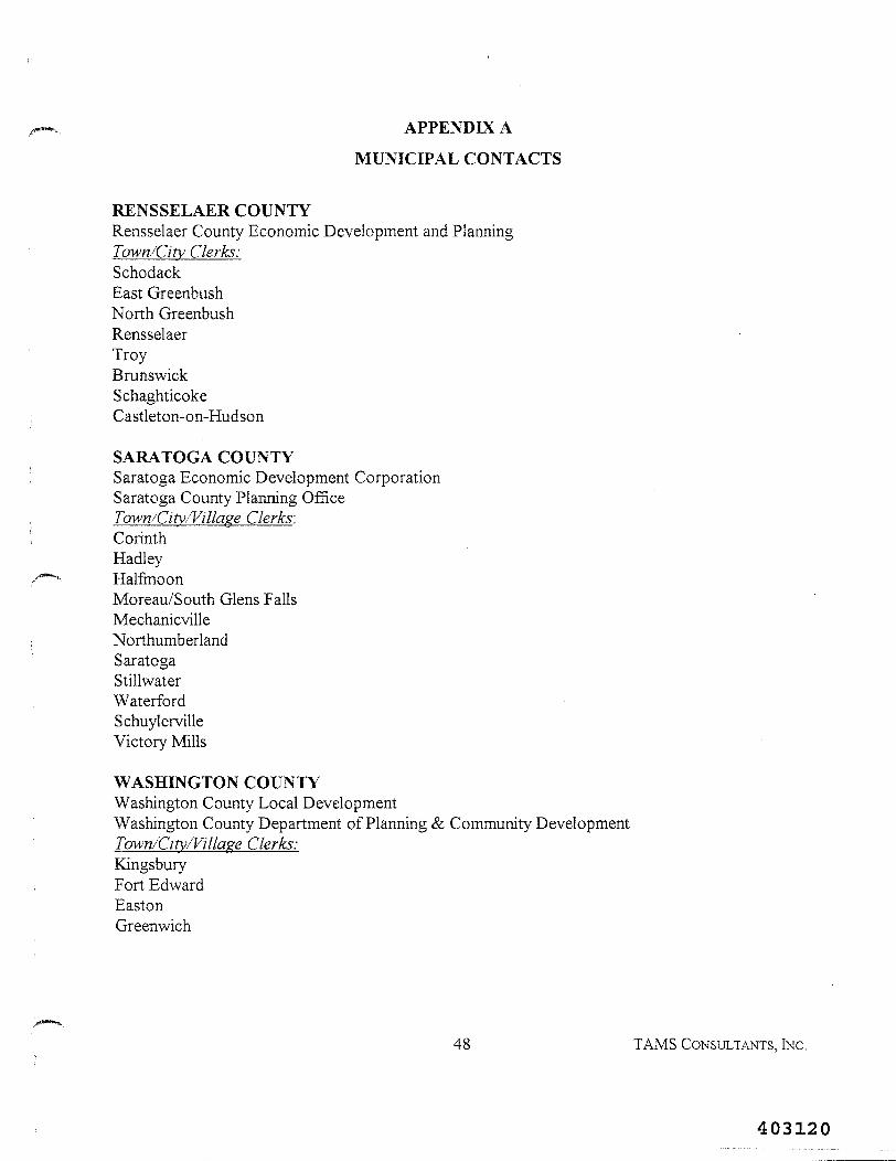
APPENDIX A
MUNICIPAL CONTACTS
RENSSELAER COUNTYRensselaer County Economic Development and PlanningTown/City Clerks:SchodackEast GreenbushNorth GreenbushRensselaerTroyBrunswickSchaghticokeCastleton-on-Hudson
SARATOGA COUNTYSaratoga Economic Development CorporationSaratoga County Planning OfficeTown/City/Village Clerks:CorinthHadleyHalfmoonMoreau/South Glens FallsMechanicvilleNorthumberlandSaratogaStillwaterWaterfordSchuylervilleVictory Mills
WASHINGTON COUNTYWashington County Local DevelopmentWashington County Department of Planning & Community DevelopmentTown/City/Village Clerks:KingsburyFort EdwardEastonGreenwich
48 TAMS CONSULTANTS, INC.
403120
PAGE INTENTIONALLY LEFT BLANK
49 TAMS CONSULTANTS, INC.
403121
APPENDIX B
SELECT PHOTOGRAPHS
50 TAMS CONSULTANTS, INC.
403122
PAGE INTENTIONALLY LEFT BLANK
51 TAMS CONSULTANTS, INC.
403123
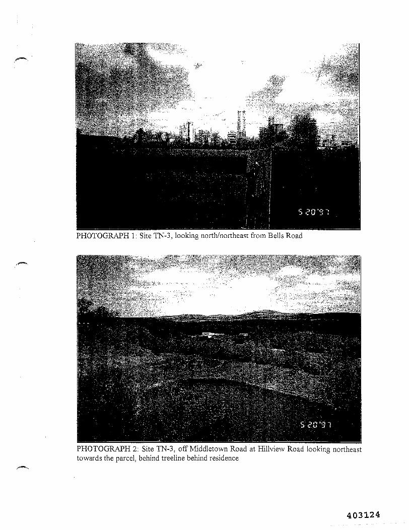
PHOTOGRAPH 1: Site TN-3, looking north/northeast from Bells Road
PHOTOGRAPH 2: Site TN-3, off Middletown Road at Hillview Road looking northeasttowards the parcel, behind treeline behind residence
403124
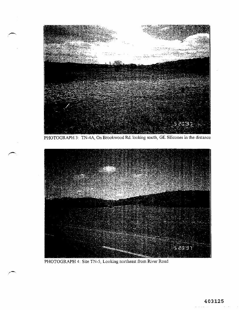
PHOTOGRAPH 3: TN-4A, On Brookwood Rd. looking south, GE Silicones in the distance
PHOTOGRAPH 4: Site TN-5, Looking northeast from River Road
403125
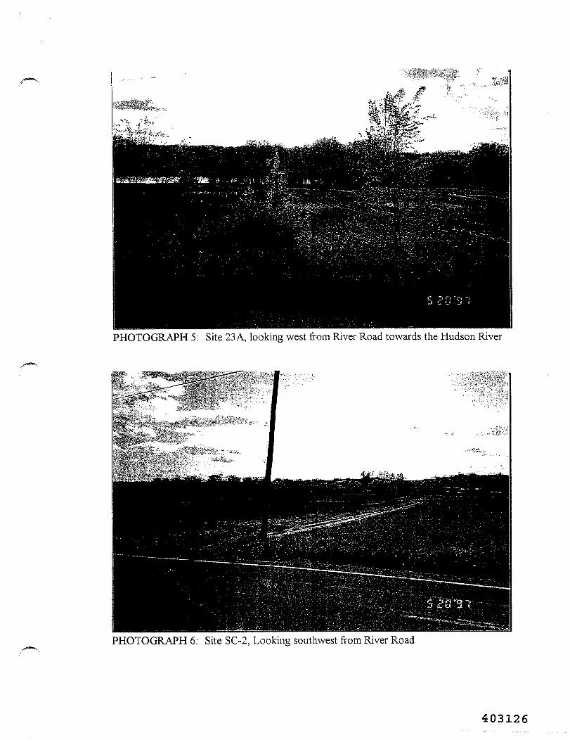
PHOTOGRAPH 5: Site 23 A, looking west from River Road towards the Hudson River
PHOTOGRAPH 6: Site SC-2, Looking southwest from River Road
403126
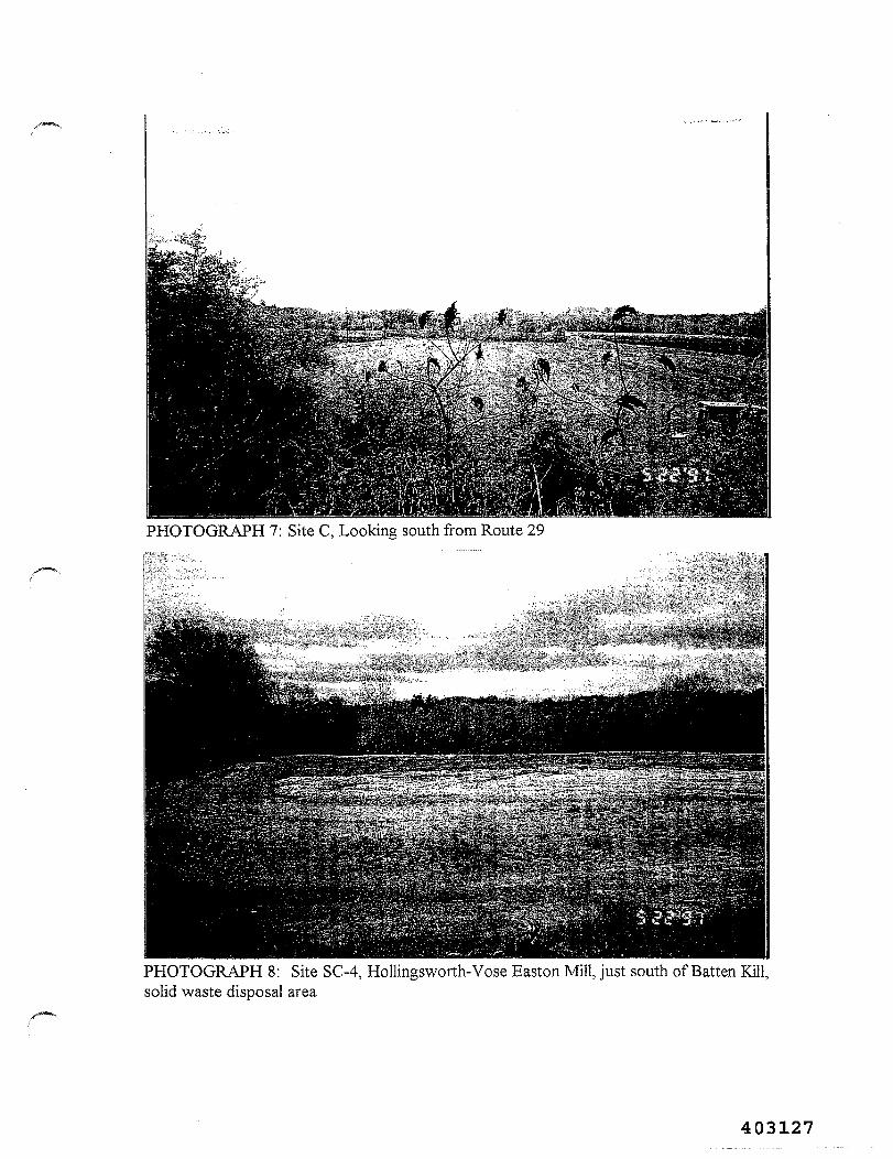
PHOTOGRAPH 7: Site C, Looking south from Route 29
PHOTOGRAPH 8: Site SC-4, Hollingsworth-Vose Easton Mill, just south of Batten Kill,solid waste disposal area
/••—N
403127
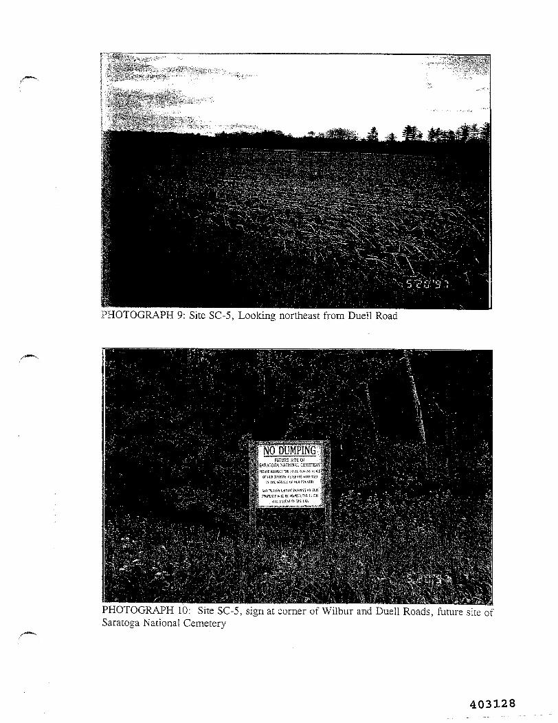
PHOTOGRAPH 9: Site SC-5, Looking northeast from Duell Road
PHOTOGRAPH 10: Site SC-5, sign at corner of Wilbur and Duell Roads, future site ofSaratoga National Cemetery
403128
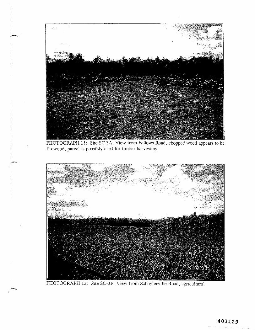
PHOTOGRAPH 11: Site SC-3A, View from Fellows Road, chopped wood appears to befirewood, parcel is possibly used for timber harvesting
PHOTOGRAPH 12: Site SC-3F, View from Schuylerville Road, agricultural
403129
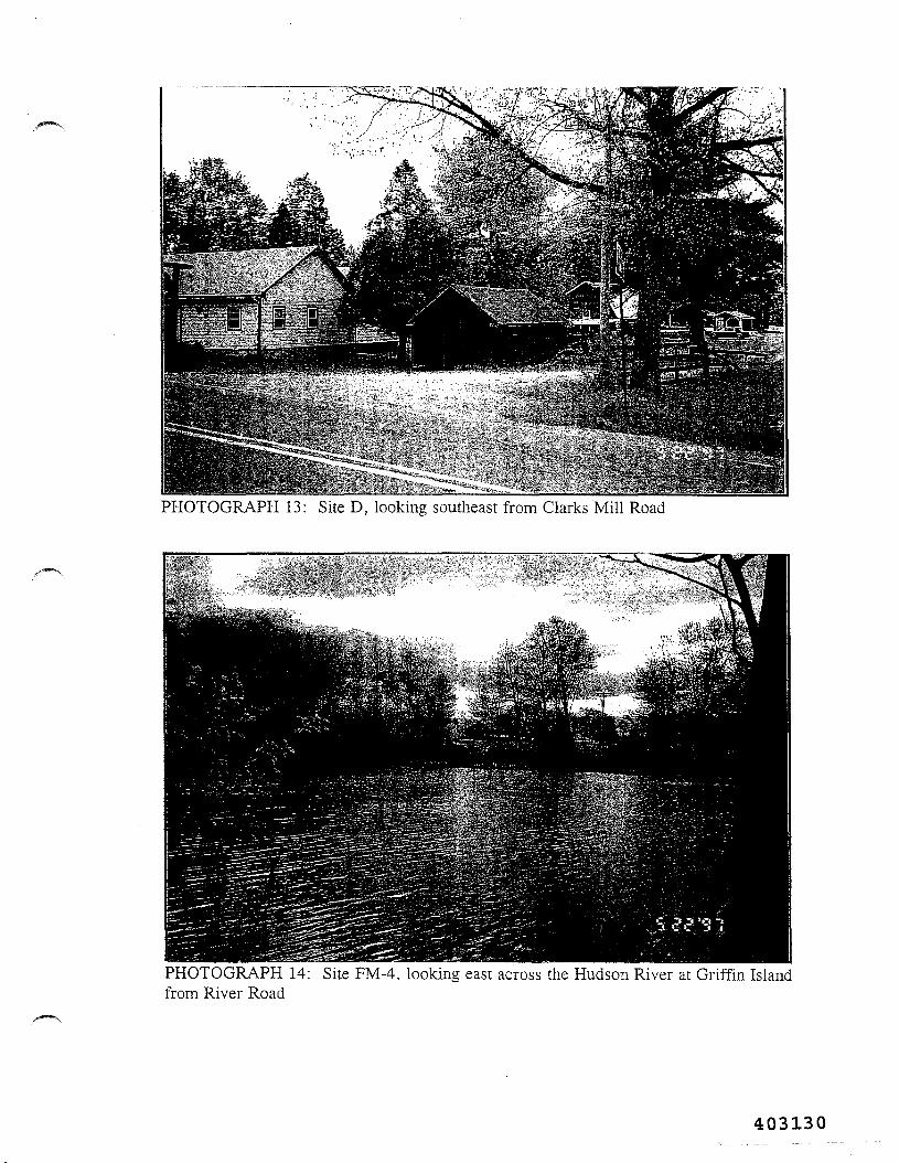
PHOTOGRAPH 13: Site D, looking southeast from Clarks Mill Road
PHOTOGRAPH 14: Site FM-4, looking east across the Hudson River at Griffin Islandfrom River Road
403130
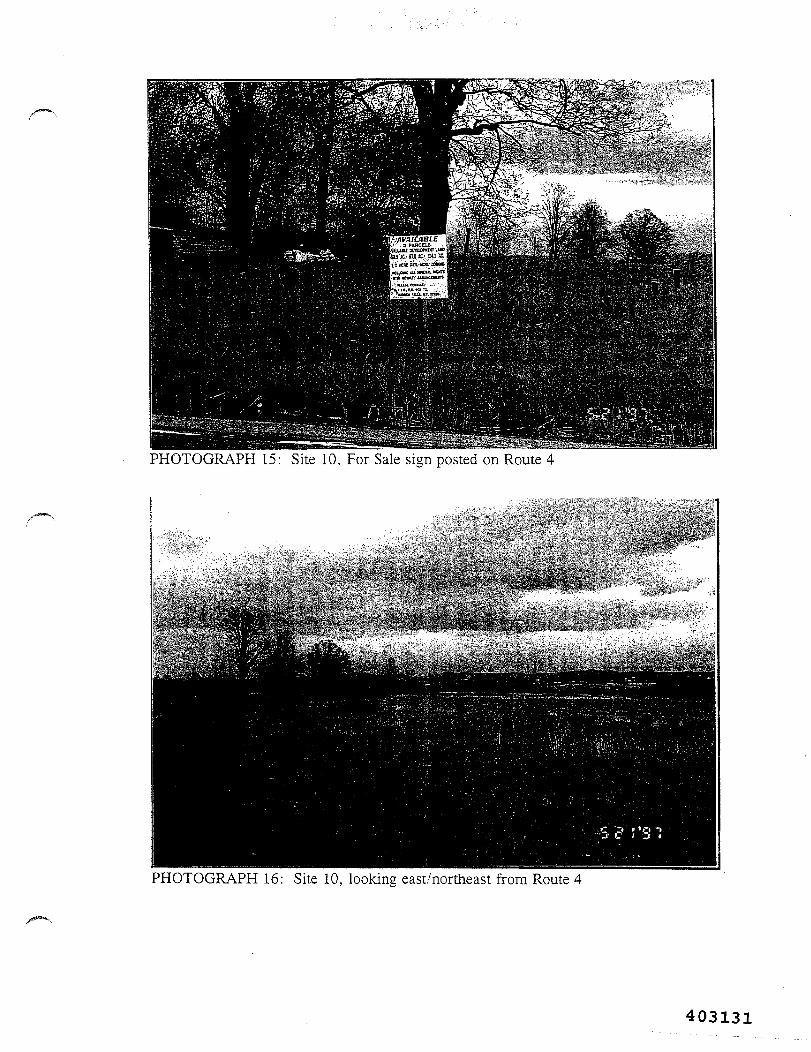
PHOTOGRAPH 15: Site 10, For Sale sign posted on Route 4
PHOTOGRAPH 16: Site 10, looking east/northeast from Route 4
403131
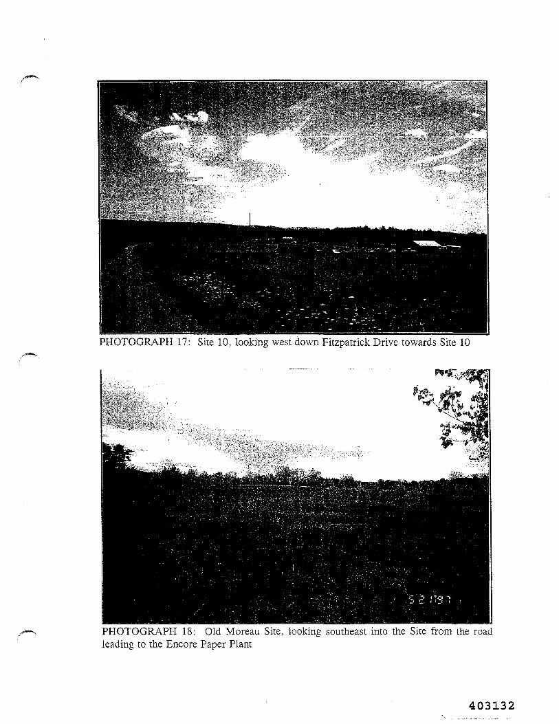
PHOTOGRAPH 17: Site 10, looking west down Fitzpatrick Drive towards Site 10
PHOTOGRAPH 18: Old Moreau Site, looking southeast into the Site from the roadleading to the Encore Paper Plant
403132
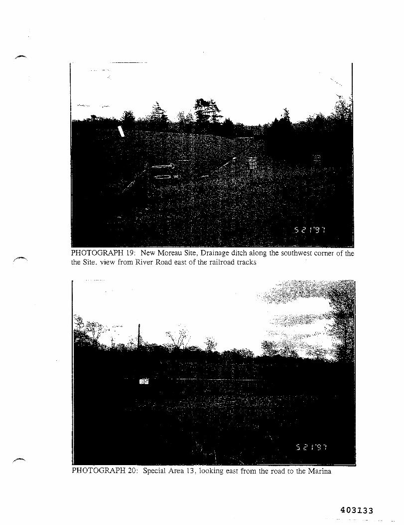
PHOTOGRAPH 19: New Moreau Site, Drainage ditch along the southwest corner of thethe Site, view from River Road east of the railroad tracks
PHOTOGRAPH 20: Special Area 13, looking east from the road to the Marina
403133
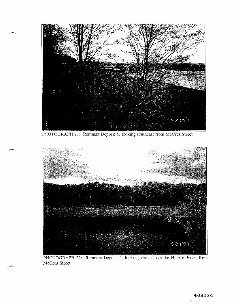
PHOTOGRAPH 21: Remnant Deposit 5, looking southeast from McCrea Street
PHOTOGRAPH 22: Remnant Deposit 4, looking west across the Hudson River fromMcCrea Street
403134
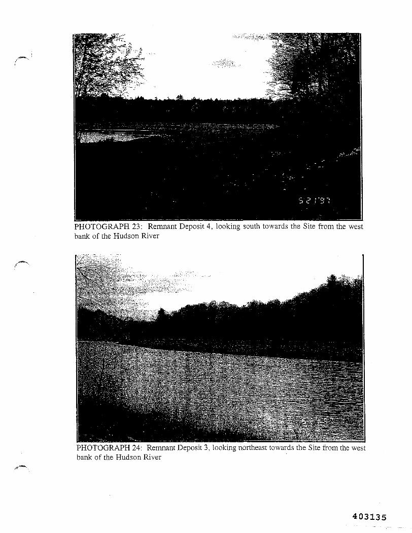
PHOTOGRAPH 23: Remnant Deposit 4, looking south towards the Site from the westbank of the Hudson River
PHOTOGRAPH 24: Remnant Deposit 3, looking northeast towards the Site from the westbank of the Hudson River
403135
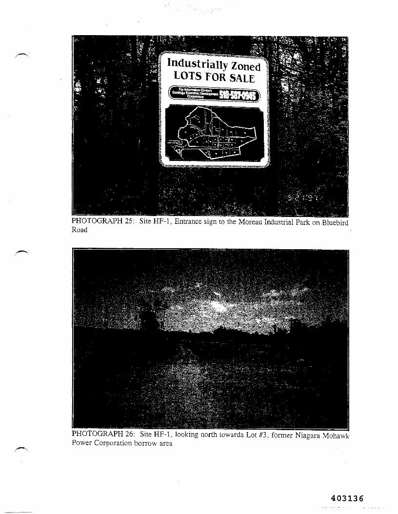
/"•***•>'
Industrially ZonedLOTS FOR SALE
PHOTOGRAPH 25: Site HF-1, Entrance sign to the Moreau Industrial Park on BluebirdRoad
PHOTOGRAPH 26: Site HF-1, looking north towards Lot #3, former Niagara MohawkPower Corporation borrow area
403136
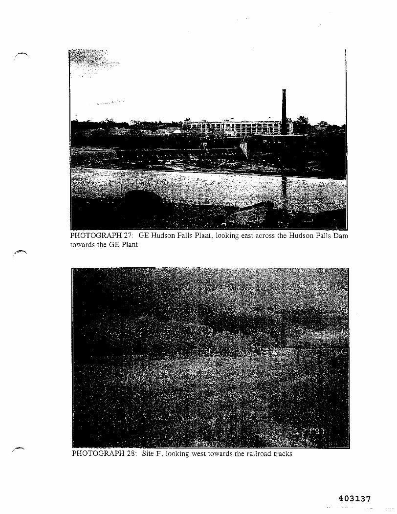
PHOTOGRAPH 27: GE Hudson Falls Plant, looking east across the Hudson Falls Damtowards the GE Plant
PHOTOGRAPH 28: Site F, looking west towards the railroad tracks
403137
PHOTOGRAPH 29: Site G, looking west towards the Site from the Old Champlain CanalHeritage Trail
PHOTOGRAPH 30: Fort Edward Municipal Landfill, looking east across the Site
403138
PHOTOGRAPH 31: Site GF-1, Behind Jeep dealership on Route 9, looking through thefence to the north/northeast along the former paved dragstrip
403139