Embed Size (px)
DESCRIPTION
http://www.inspectiewaterkeringen.nl/documents/inspectiewaterkeringen/downloads/kd12/KD2012_P04.pdf
Citation preview
29 March 2012
Rijkswaterstaat
Annual Levee Inspection Meetings
Jason Sheeley, U.S. Army Corps of Engineers
Geospatial Section Chief - Kansas City District
Mapping Chief – Modeling, Mapping and
Consequences Production Center
Levee Inspection Case Study
United States Army Corps of Engineers
Kansas City District
Overview
� Kansas City District Statistics
� National Perspective - U.S. Army Corps of Engineers (USACE) Levee Safety Program► Toolkit
• National Levee Database (NLD)
• Levee Inspection System (LIS)
� Kansas City District Case Studies► “Ground level” execution of the routine program
►2011 flood contingency operations
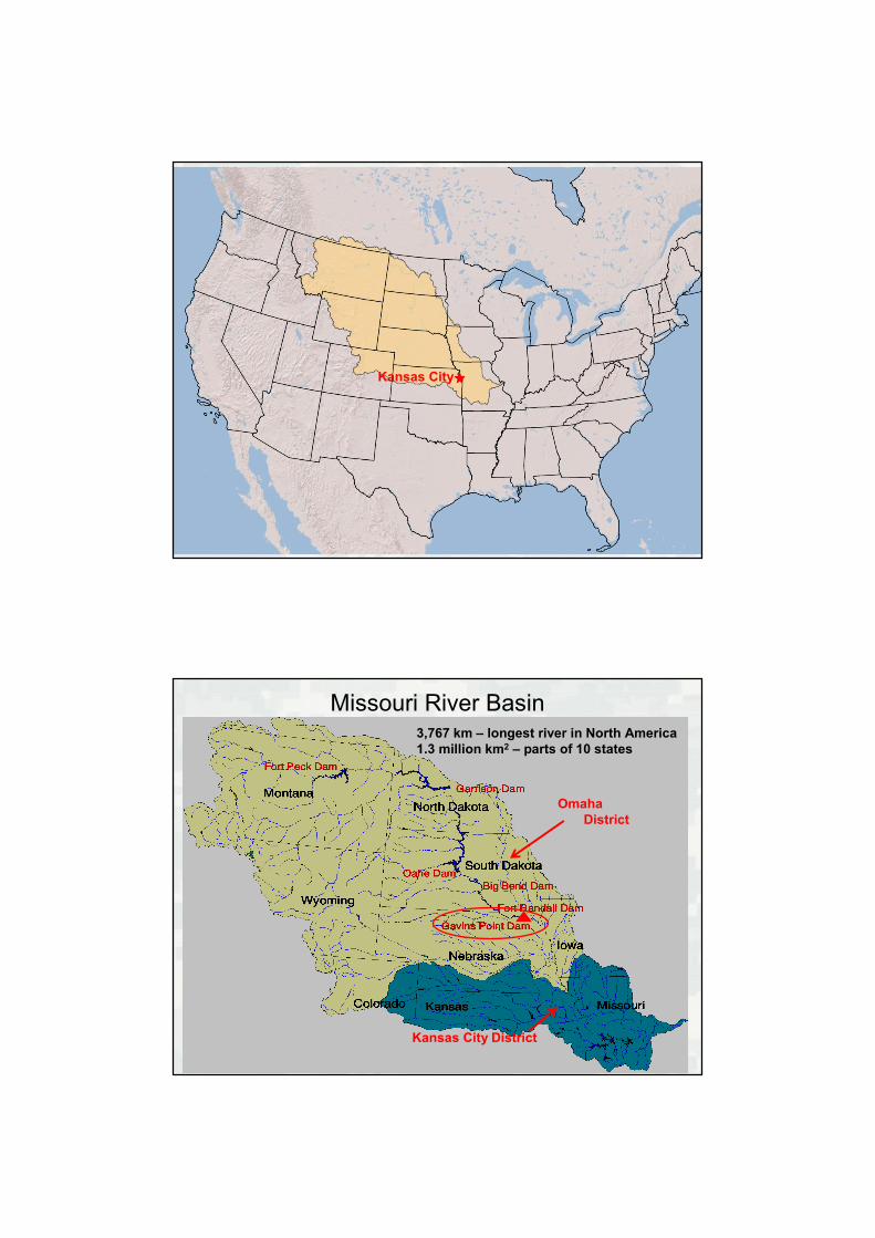
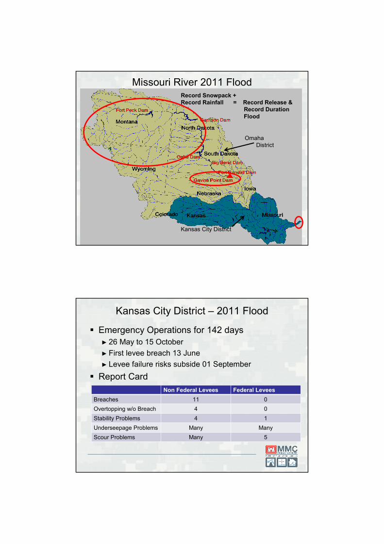
Kansas City
Omaha
District
Kansas City District
Missouri River Basin3,767 km – longest river in North America
1.3 million km2 – parts of 10 states
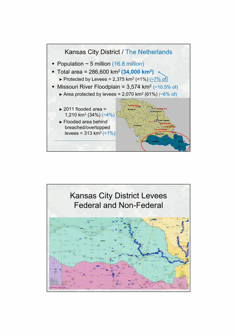
Kansas City District / The Netherlands
� Population ~ 5 million (16.8 million)
� Total area = 286,600 km2 (34,000 km2)
► Protected by Levees = 2,375 km2 (<1%) (~7% of)
� Missouri River Floodplain = 3,574 km2 (~10.5% of)
► Area protected by levees = 2,070 km2 (61%) (~6% of)
► 2011 flooded area =
1,210 km2 (34%) (~4%)
► Flooded area behind
breached/overtopped
levees = 313 km2 (<1%)
Kansas City District Levees
Federal and Non-Federal
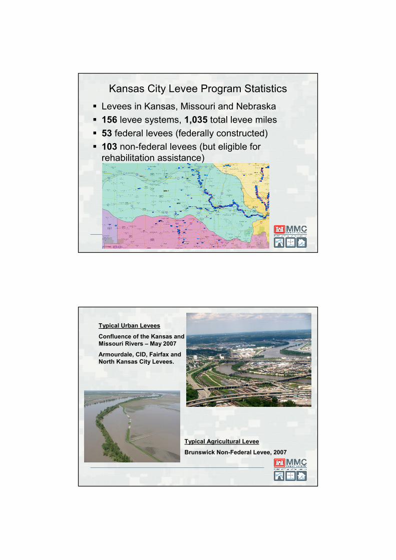
Kansas City Levee Program Statistics
� Levees in Kansas, Missouri and Nebraska
� 156 levee systems, 1,035 total levee miles
� 53 federal levees (federally constructed)
� 103 non-federal levees (but eligible for
rehabilitation assistance)
Typical Urban Levees
Confluence of the Kansas and
Missouri Rivers – May 2007
Armourdale, CID, Fairfax and
North Kansas City Levees.
Typical Agricultural Levee
Brunswick Non-Federal Levee, 2007

National Levee Database (NLD)
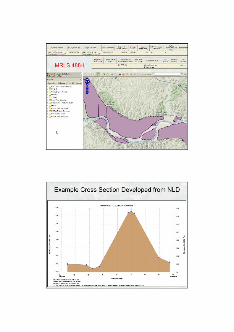
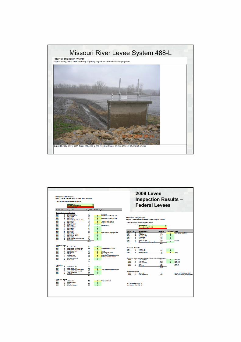
MRLS 488-L
Example Cross Section Developed from NLD
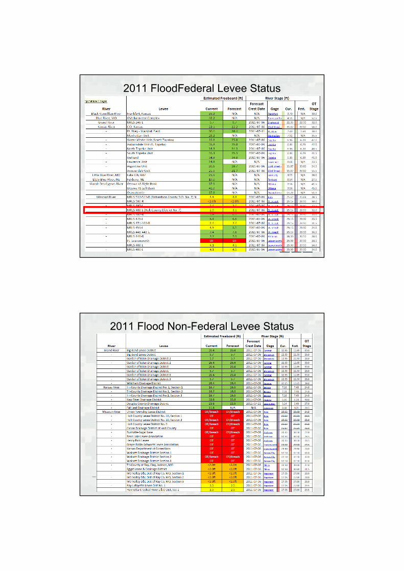
2011 FloodFederal Levee Status
2011 Flood Non-Federal Levee Status
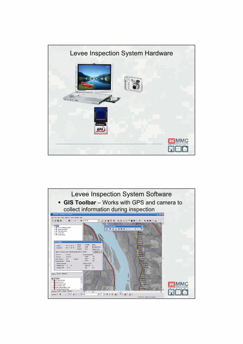
Levee Inspection System Hardware
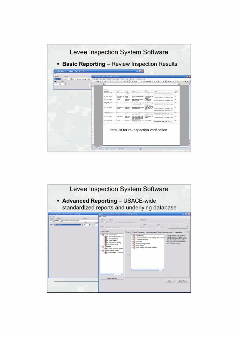
Levee Inspection System Software
� GIS Toolbar – Works with GPS and camera to
collect information during inspection
Levee Inspection System Software
� Basic Reporting – Review Inspection Results
Item list for re-inspection verification
Levee Inspection System Software
� Advanced Reporting – USACE-wide
standardized reports and underlying database
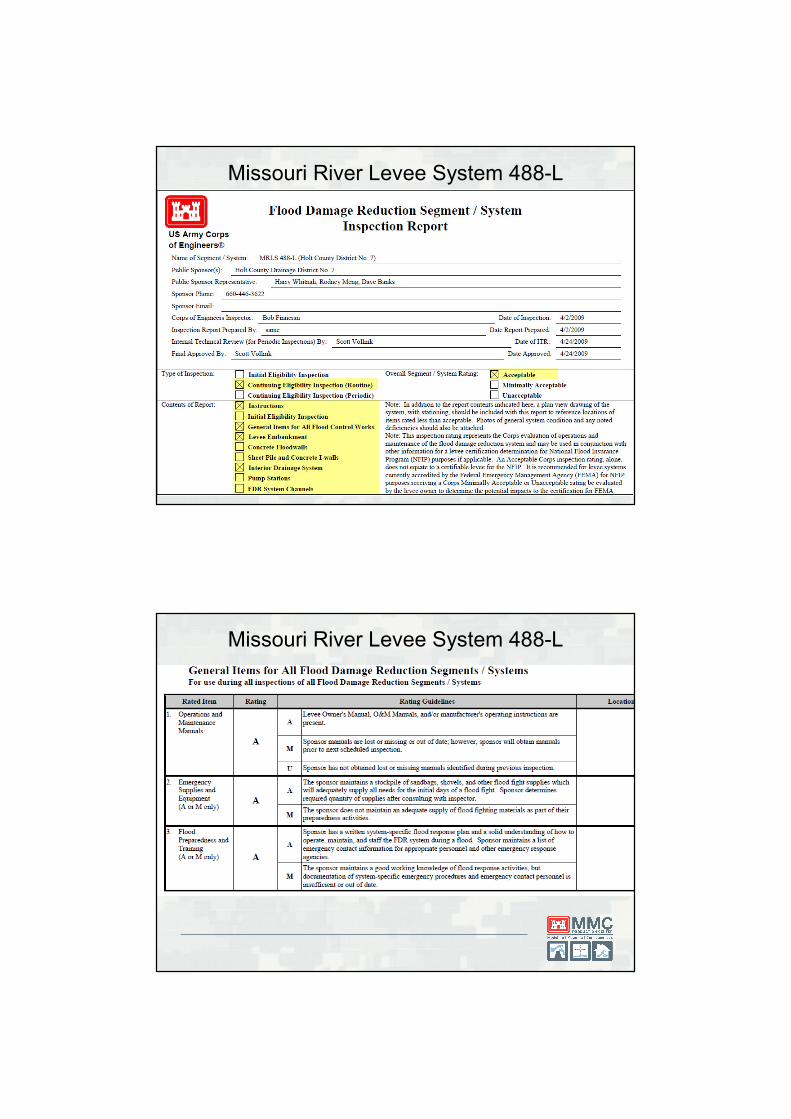
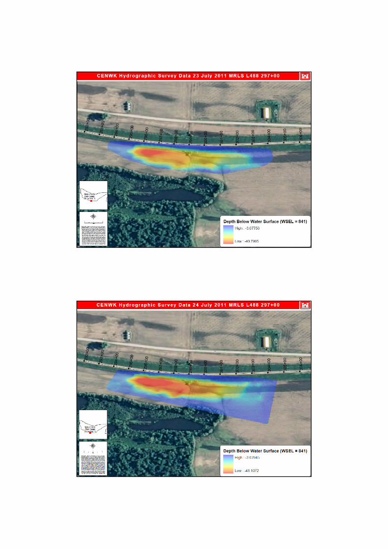
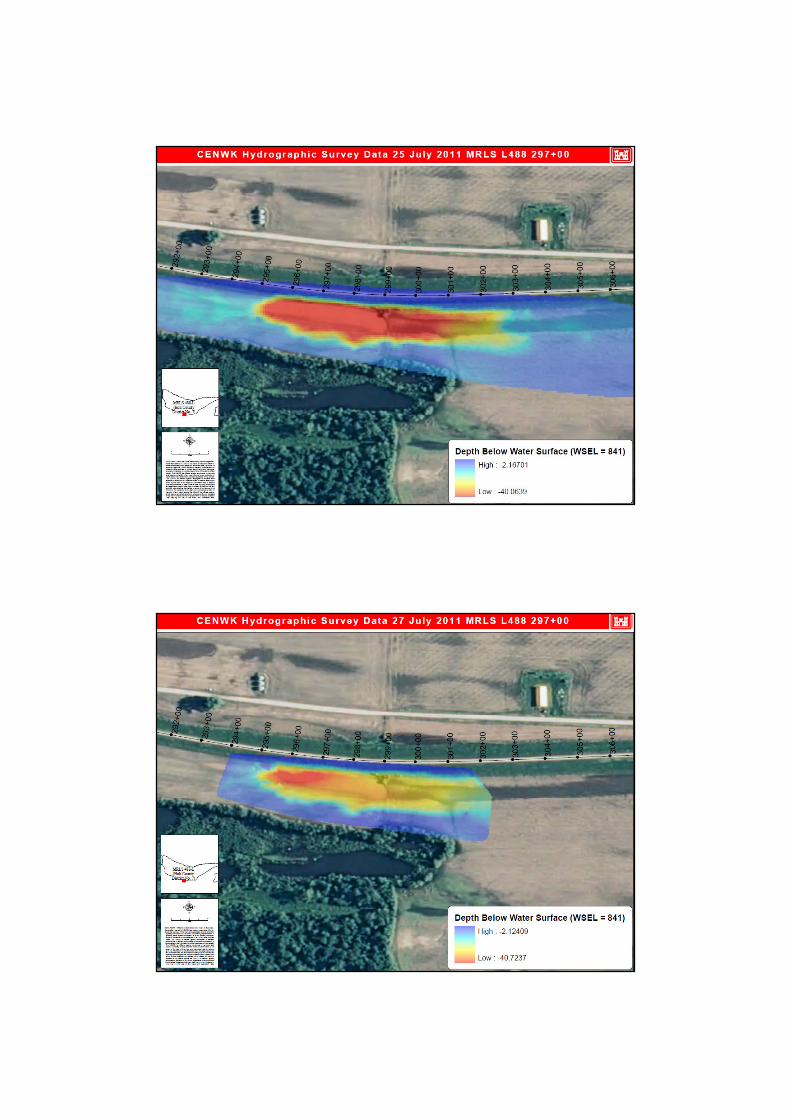
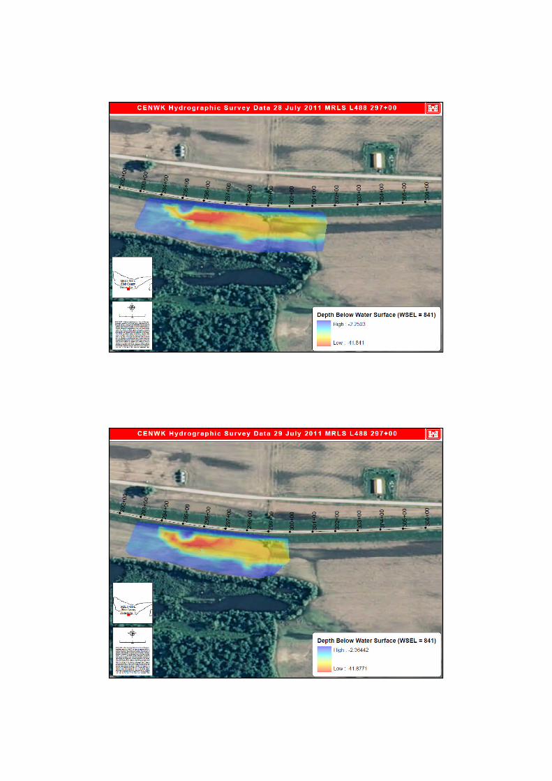
Missouri River Levee System 488-L
Missouri River Levee System 488-L
Missouri River Levee System 488-L
2009 Levee
Inspection Results –
Federal Levees
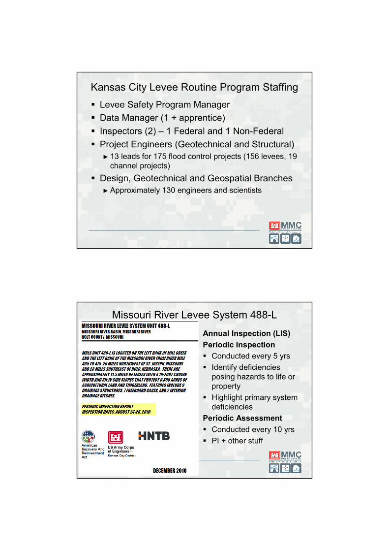
Kansas City Levee Routine Program Staffing
� Levee Safety Program Manager
� Data Manager (1 + apprentice)
� Inspectors (2) – 1 Federal and 1 Non-Federal
� Project Engineers (Geotechnical and Structural)
► 13 leads for 175 flood control projects (156 levees, 19
channel projects)
� Design, Geotechnical and Geospatial Branches
► Approximately 130 engineers and scientists
Missouri River Levee System 488-L
Annual Inspection (LIS)
Periodic Inspection
� Conducted every 5 yrs
� Identify deficiencies
posing hazards to life or
property
� Highlight primary system
deficiencies
Periodic Assessment
� Conducted every 10 yrs
� PI + other stuff
Omaha
District
Kansas City District
Missouri River 2011 FloodRecord Snowpack +
Record Rainfall = Record Release &
Record Duration
Flood
Kansas City District – 2011 Flood
� Emergency Operations for 142 days
► 26 May to 15 October
► First levee breach 13 June
► Levee failure risks subside 01 September
� Report Card
Non Federal Levees Federal Levees
Breaches 11 0
Overtopping w/o Breach 4 0
Stability Problems 4 1
Underseepage Problems Many Many
Scour Problems Many 5
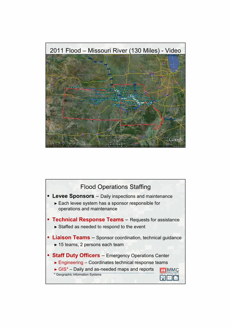
2011 Flood – Missouri River (130 Miles) - Video
Flood Operations Staffing
� Levee Sponsors – Daily inspections and maintenance
► Each levee system has a sponsor responsible for
operations and maintenance
� Technical Response Teams – Requests for assistance
► Staffed as needed to respond to the event
� Liaison Teams – Sponsor coordination, technical guidance
► 15 teams, 2 persons each team
� Staff Duty Officers – Emergency Operations Center
► Engineering – Coordinates technical response teams
► GIS* – Daily and as-needed maps and reports* Geographic Information Systems
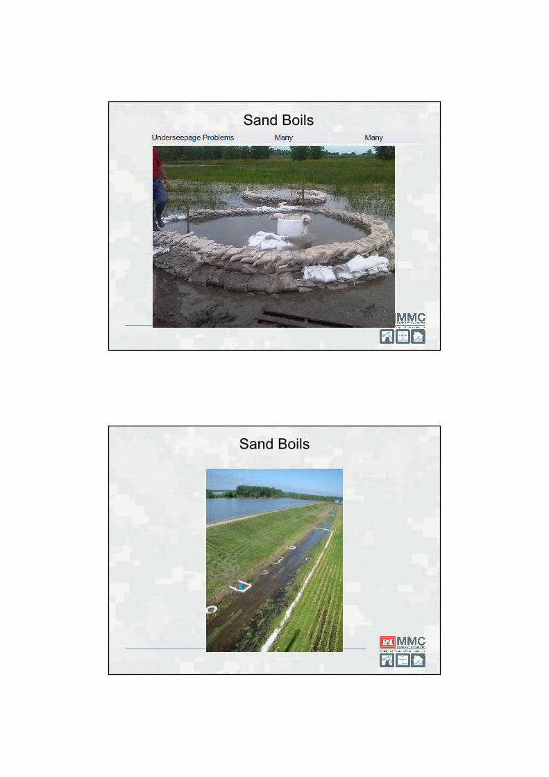
Sand Boils
Sand Boils
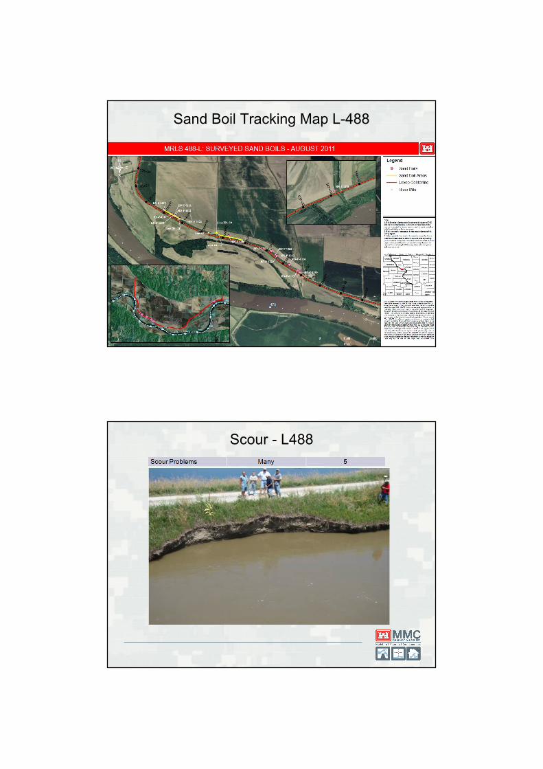
Sand Boil Tracking Map L-488
Scour - L488
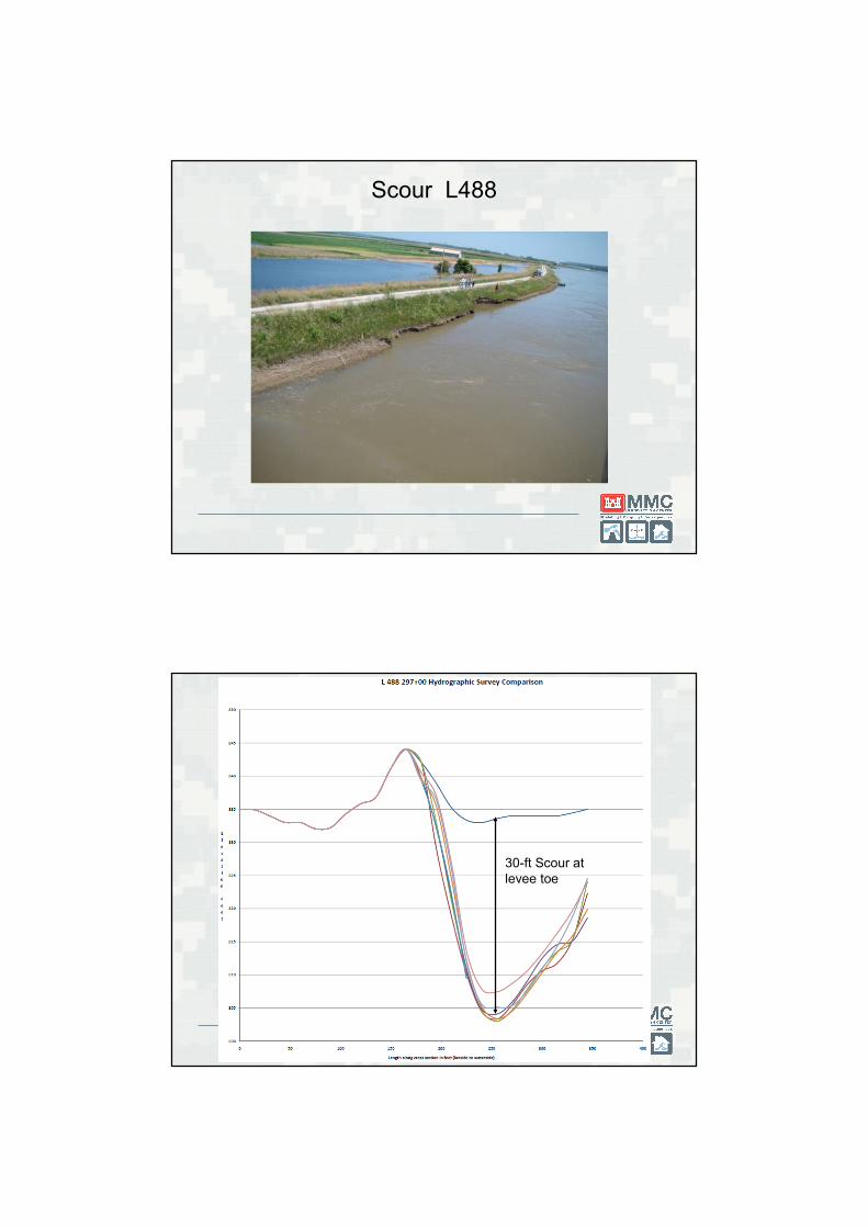
Scour L488
30-ft Scour at
levee toe
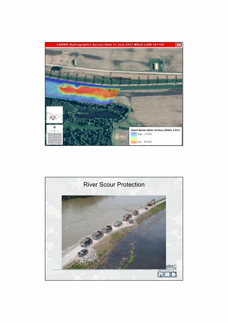
River Scour Protection
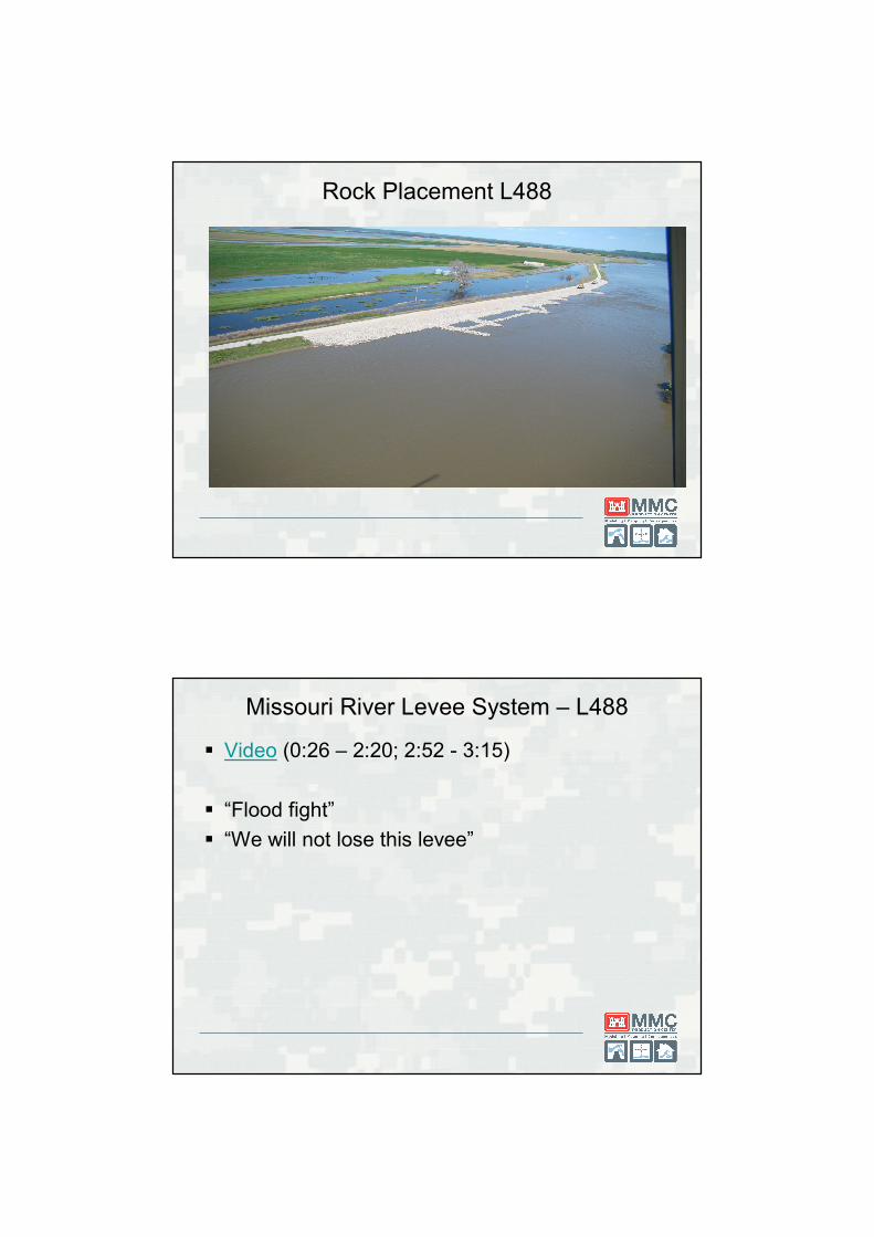
Rock Placement L488
Missouri River Levee System – L488
� Video (0:26 – 2:20; 2:52 - 3:15)
� “Flood fight”
� “We will not lose this levee”
3/29/2012 47
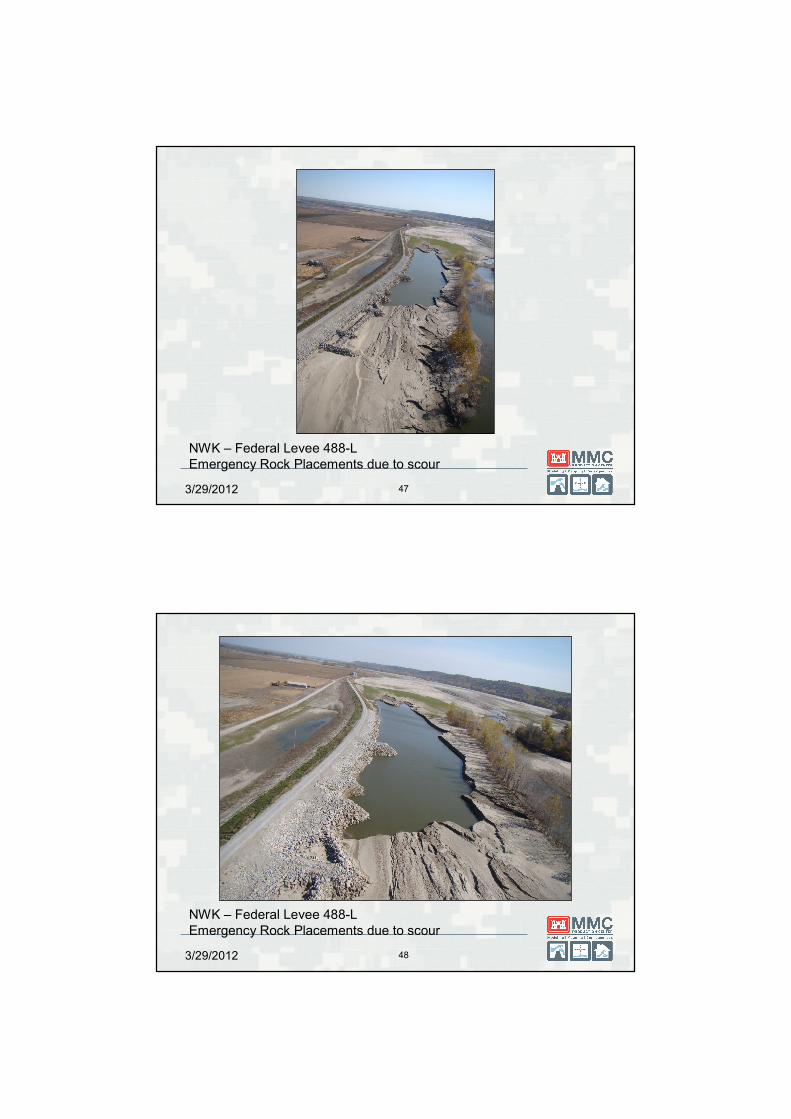
NWK – Federal Levee 488-L
Emergency Rock Placements due to scour
3/29/2012 48
NWK – Federal Levee 488-L
Emergency Rock Placements due to scour
Three Stage Levee Management Cycle
� Routine Program
► Annual inspection, periodic inspection/assessment
► Ensures levees perform as designed
► Coordination among USACE and levee sponsors
► Trained staff
� Emergency Operations
► Daily/recurring inspection process
► Sponsors/USACE work together
► Emergency mitigation activities as needed
� Post-Flood Rehabilitation
► Repairs prior to next flood season
3/29/2012 50
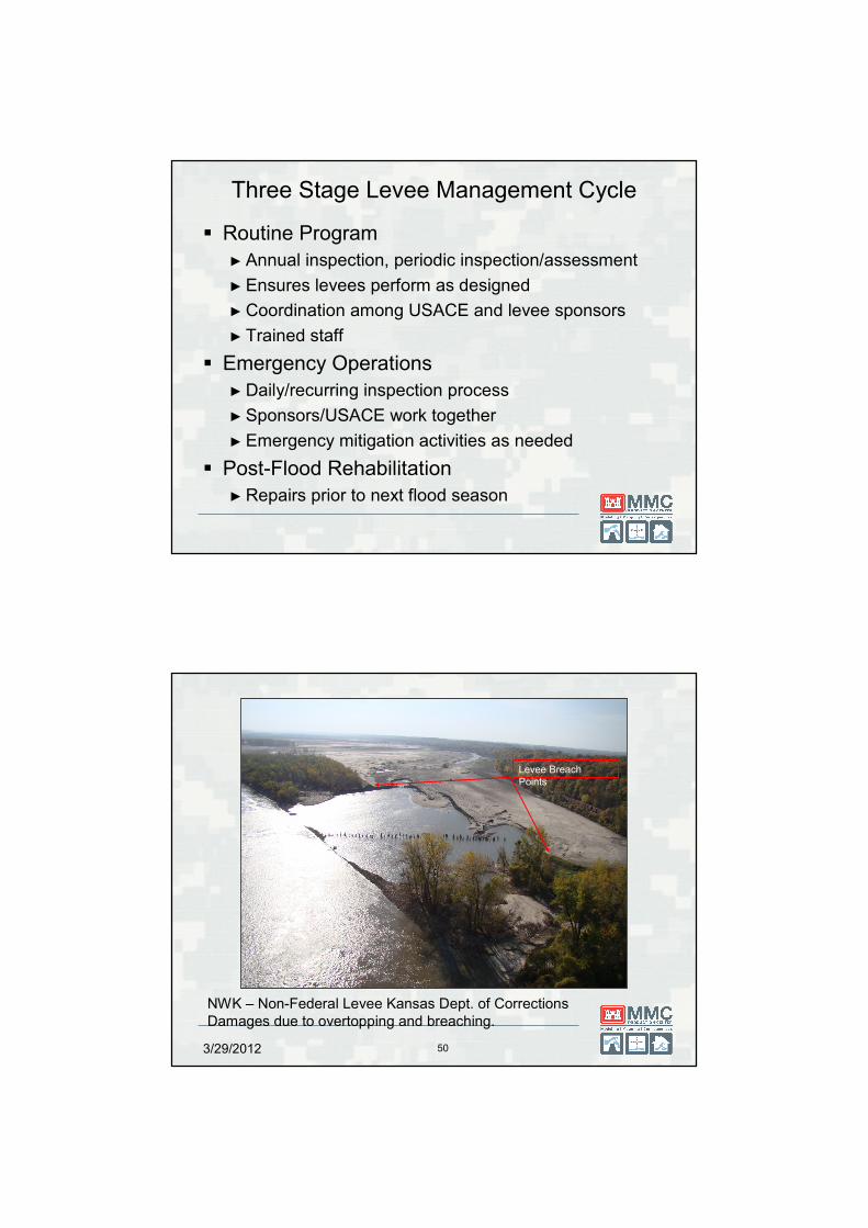
NWK – Non-Federal Levee Kansas Dept. of Corrections
Damages due to overtopping and breaching.
Levee Breach
Points
3/29/2012 51
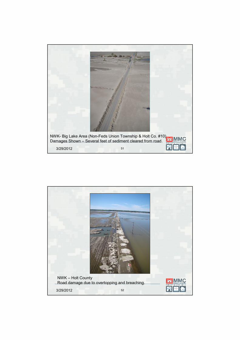
NWK- Big Lake Area (Non-Feds Union Township & Holt Co. #10)
Damages Shown – Several feet of sediment cleared from road.
3/29/2012 52
NWK – Holt County
Road damage due to overtopping and breaching.
3/29/2012 53
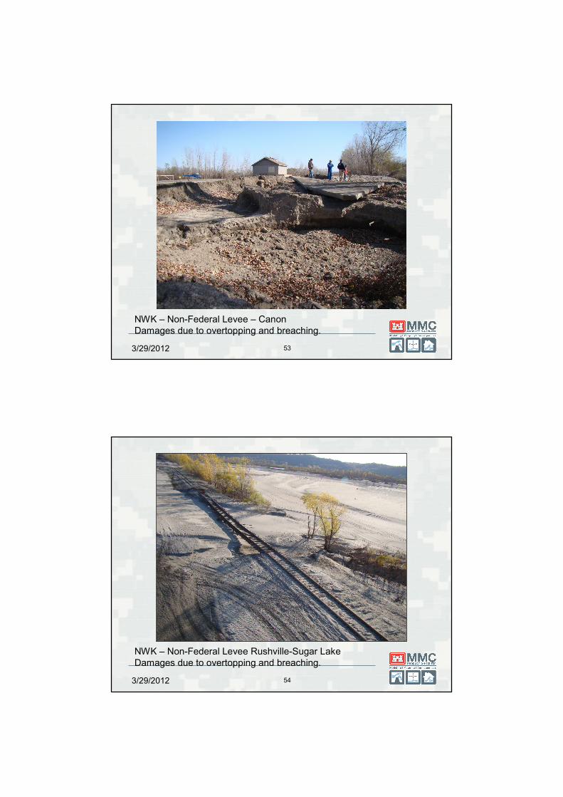
NWK – Non-Federal Levee – Canon
Damages due to overtopping and breaching.
3/29/2012 54
NWK – Non-Federal Levee Rushville-Sugar Lake
Damages due to overtopping and breaching.
3/29/2012 55
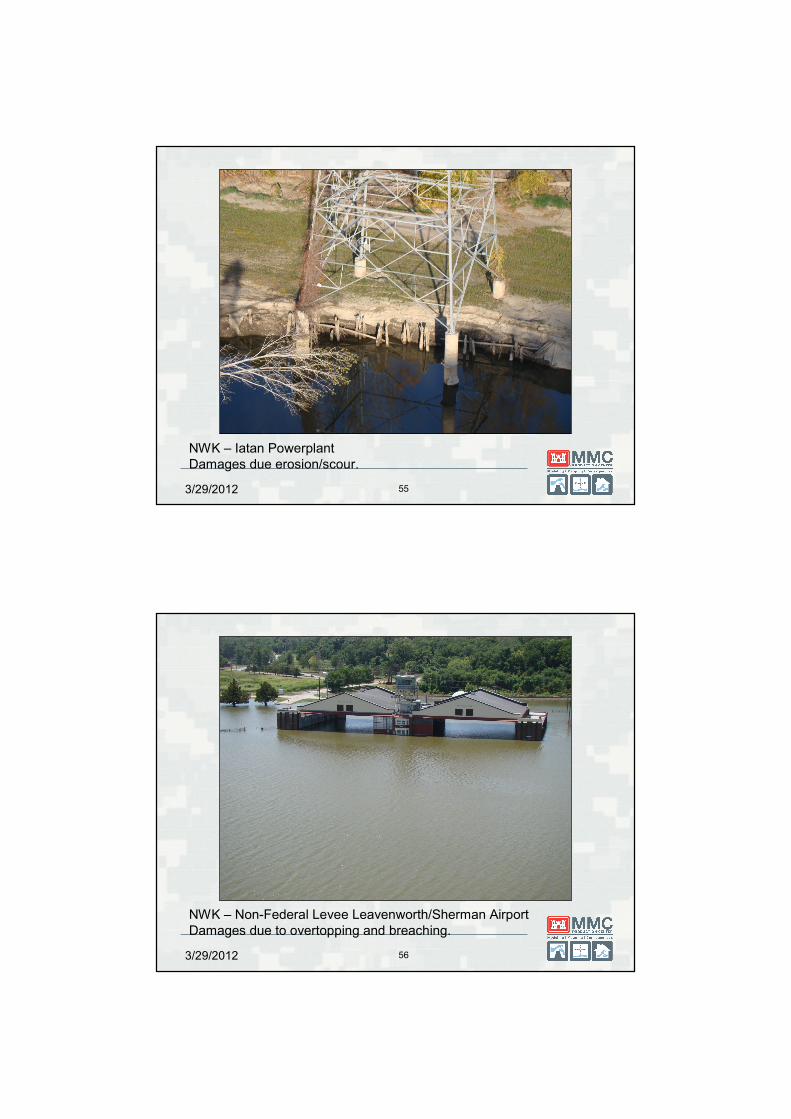
NWK – Iatan Powerplant
Damages due erosion/scour.
3/29/2012 56
NWK – Non-Federal Levee Leavenworth/Sherman Airport
Damages due to overtopping and breaching.
3/29/2012 57
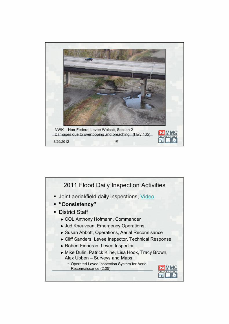
NWK – Non-Federal Levee Wolcott, Section 2
Damages due to overtopping and breaching. (Hwy 435)
2011 Flood Daily Inspection Activities
� Joint aerial/field daily inspections, Video
� “Consistency”
� District Staff
► COL Anthony Hofmann, Commander
► Jud Kneuvean, Emergency Operations
► Susan Abbott, Operations, Aerial Reconnisance
► Cliff Sanders, Levee Inspector, Technical Response
► Robert Finneran, Levee Inspector
► Mike Dulin, Patrick Kline, Lisa Hook, Tracy Brown,
Alex Ubben – Surveys and Maps
• Operated Levee Inspection System for Aerial
Reconnaissance (2:05)
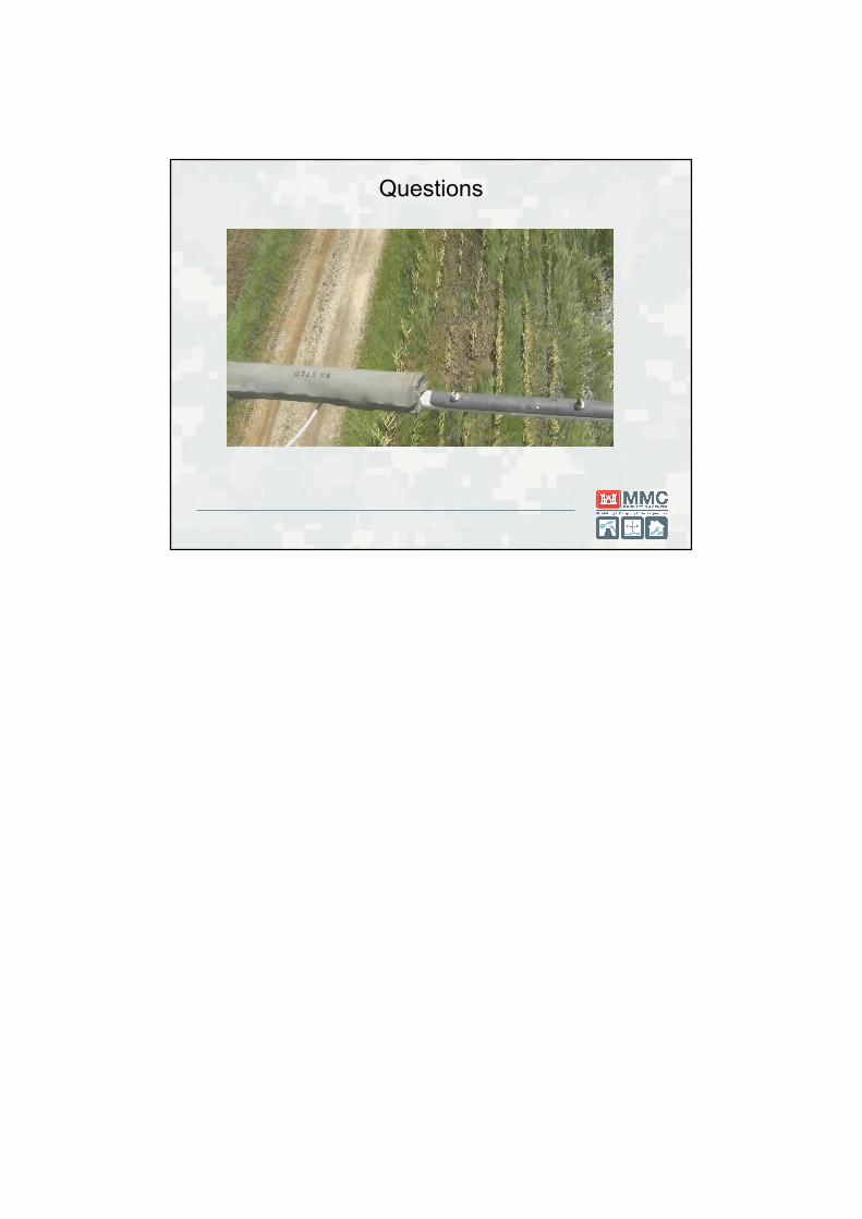
Questions


