Embed Size (px)
Citation preview
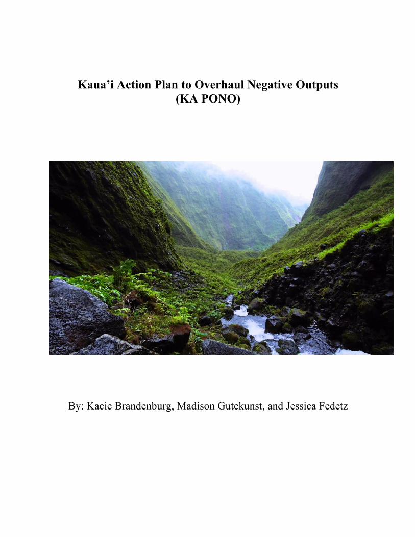
Kaua’i Action Plan to Overhaul Negative Outputs (KA PONO)
By: Kacie Brandenburg, Madison Gutekunst, and Jessica Fedetz
2
Table of Contents
1. Mission Statement………………………………………………………………………………3
2. History/Background…………………………………………………………………………….3
3. Policies and Mandates in Place…………………………………………………………………4
5. Problem 1: High Nitrogen and Phosphorus Levels….…………………………………………6
6. Goals……………………………………………………………………………………………6
7. Problem 2: Excessive Turbidity………………………………………………………………...7
8. Goals……………………………………………………………………………………………7
9. Problem 3: Bacteria and Fecal Contamination……….......…………………………………….7
10. Goals…………………………………………………………………………………………..7
11. KA PONO Summary of Goals..……………………………………………………………….9
12. References……………………………………………………………………………………10
3
Mission Statement: KA PONO’s mission is to attain EPA fishable and swimmable status for all waters on the Island of Kaua’i by reducing turbidity, total nitrogen and total phosphorus and maintaining a safe and clean environment for recreation. Historical Background: Before Hawai’i was proclaimed the fiftieth state of the United States in 1959, it was a monarchy (Lawrence, 1959). Kaua’i's first settlers are believed to be polynesians like the Marquesans, then Tahitians. Kaua’i is the only island King Kamehameha did not conquer in his quest to unite all of the Hawaiian islands, but in 1810, King Kaumualii, the King of Kaua’i, became the governor after making a peaceful resolution to unite all islands with Kamehameha. All monarchs before and after Kaumualii and Kamehameha ran their political and economic systems based on watersheds (EPAT, 1999). Each king named chiefs to rule these watershed-based political and economic districts; each chief was in charge of all of the flora, fauna, and people within that district. Districts of land, called ahupua’a, were delegated to chiefs and konohiki. An ahupua’a functioned as an integrated land and water system, as each watershed started at the highest peak of the highest mountain then extended to the coast and surrounding coral reefs (Levy 1975). Decisions surrounding land use, political, and economic problems took all other sectors into account, as all resources were considered with equal importance. Although chiefs ruled over the districts, they did not believe than anybody owned the land or any of its resources. The chiefs collectively “recognized that wise resource management and land use that avoided erosion and water pollution meant greater wealth for the political unit” (Sustainable Resources Group Intn’l, Inc, 2012). Vandana Shiva’s book, Water Wars: Privatization, Pollution, and Profit, explained that native Hawaiians gave water a mythical property and referred to it was wai ola, or “the water of life” (Shiva, 2002). Due to the emphasis on water as a precious resource, chiefs cared greatly for the land and resources given by the land. Westerners began to arrive in the 1700s, beginning with Captain Cook in 1778, which was the beginning of the end of polynesian land use management (Lawrence, 1959).The last monarch was Queen Liliuokalani, who was deposed by Americans in a bloodless revolution in 1898 (Lawrence, 1959). With the fall of the monarchy also came the fall of the watershed-based political and economic systems. Hawaii became a territory in 1903, then became a state in 1959 (Lawrence, 1959). Hawaii’s first governor was William Francis Quinn from Rochester, New York, and he served from 1957-1962 (National Governors Association, 2015). The first Hawaiian-born governor, George Ryoichi Ariyoshi, served from 1974-1986; David Ige is the current governor of Hawai’i and has been serving since 2014 (National, 2015). When Hawai’i became a state, land use and management changed. Native Hawaiians challenged the changes to their resource management, but the Supreme Court deemed “ancient Hawaiian water and land customs” to be “ineffective,” choosing “more definite terms of ownership, land rights, and resource management” over traditional management (Macfarlane, 2014). These
4
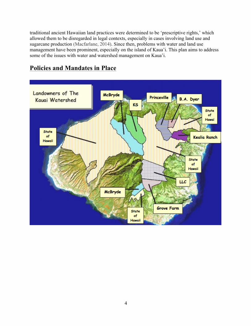
traditional ancient Hawaiian land practices were determined to be ‘prescriptive rights,’ which allowed them to be disregarded in legal contexts, especially in cases involving land use and sugarcane production (Macfarlane, 2014). Since then, problems with water and land use management have been prominent, especially on the island of Kaua’i. This plan aims to address some of the issues with water and watershed management on Kaua’i. Policies and Mandates in Place
5
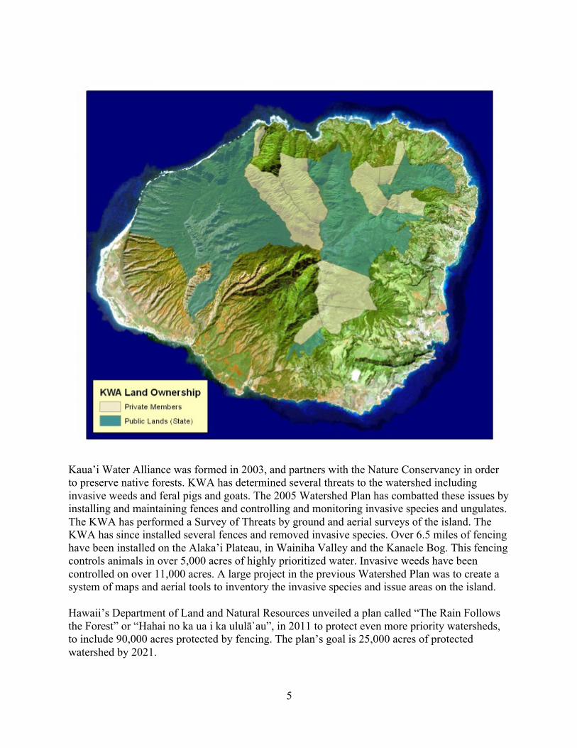
Kaua’i Water Alliance was formed in 2003, and partners with the Nature Conservancy in order to preserve native forests. KWA has determined several threats to the watershed including invasive weeds and feral pigs and goats. The 2005 Watershed Plan has combatted these issues by installing and maintaining fences and controlling and monitoring invasive species and ungulates. The KWA has performed a Survey of Threats by ground and aerial surveys of the island. The KWA has since installed several fences and removed invasive species. Over 6.5 miles of fencing have been installed on the Alaka’i Plateau, in Wainiha Valley and the Kanaele Bog. This fencing controls animals in over 5,000 acres of highly prioritized water. Invasive weeds have been controlled on over 11,000 acres. A large project in the previous Watershed Plan was to create a system of maps and aerial tools to inventory the invasive species and issue areas on the island. Hawaii’s Department of Land and Natural Resources unveiled a plan called “The Rain Follows the Forest” or “Hahai no ka ua i ka ululā`au”, in 2011 to protect even more priority watersheds, to include 90,000 acres protected by fencing. The plan’s goal is 25,000 acres of protected watershed by 2021.
6
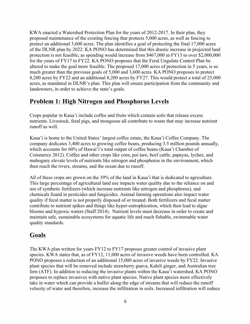
KWA enacted a Watershed Protection Plan for the years of 2012-2017. In their plan, they proposed maintenance of the existing fencing that protects 5,000 acres, as well as fencing to protect an additional 3,600 acres. The plan identifies a goal of protecting the final 17,000 acres of the DLNR plan by 2022. KA PONO has determined that this drastic increase in projected land protection is not feasible, as spending would increase from $467,000 in FY13 to over $2,000,000 for the years of FY17 to FY22. KA PONO proposes that the Feral Ungulate Control Plan be altered to make the goal more feasible. The proposed 17,000 acres of protection in 5 years, is so much greater than the previous goals of 5,000 and 3,600 acres. KA PONO proposes to protect 8,200 acres by FY22 and an additional 8,200 acres by FY27. This would protect a total of 25,000 acres, as mandated in DLNR’s plan. This plan will ensure participation from the community and landowners, in order to achieve the state’s goals. Problem 1: High Nitrogen and Phosphorus Levels Crops popular in Kaua’i include coffee and fruits which contain soils that release excess nutrients. Livestock, feral pigs, and mongoose all contribute to waste that may increase nutrient runoff as well. Kaua’i is home to the United States’ largest coffee estate, the Kaua’i Coffee Company. The company dedicates 3,400 acres to growing coffee beans, producing 3.5 million pounds annually, which accounts for 60% of Hawai’i’s total output of coffee beans (Kaua’i Chamber of Commerce 2012). Coffee and other crops like corn, poi taro, beef cattle, papayas, lychee, and mahogany elevate levels of nutrients like nitrogen and phosphorus in the environment, which then reach the rivers, streams, and the ocean due to runoff. All of these crops are grown on the 39% of the land in Kaua’i that is dedicated to agriculture. This large percentage of agricultural land use impacts water quality due to the reliance on and use of synthetic fertilizers (which increase nutrients like nitrogen and phosphorus), and chemicals found in pesticides and fungicides. Animal farming operations also impact water quality if fecal matter is not properly disposed of or treated. Both fertilizers and fecal matter contribute to nutrient spikes and things like hyper-eutrophication, which then lead to algae blooms and hypoxic waters (Staff 2014). Nutrient levels must decrease in order to create and maintain safe, sustainable ecosystems for aquatic life and reach fishable, swimmable water quality standards. Goals The KWA plan written for years FY12 to FY17 proposes greater control of invasive plant species. KWA states that, as of FY12, 11,000 acres of invasive weeds have been controlled. KA PONO proposes a reduction of an additional 15,000 acres of invasive weeds by FY22. Invasive plant species that will be removed include strawberry guava, Kahili ginger, and Australian tree fern (ATF). In addition to reducing the invasive plants within the Kaua’i watershed, KA PONO proposes to replace invasives with native plant species. Native plant species more effectively take in water which can provide a buffer along the edge of streams that will reduce the runoff velocity of water and therefore, increase the infiltration in soils. Increased infiltration will reduce
7
the amount of nitrogen and phosphorous entering nearby streams and rivers. KA PONO proposes that, in addition to removing invasives, 15,000 acres of native plants will be planted. Native plant species that will help to improve water quality include ‘āheahea, ‘akia, ‘akoko, and hala which can be seen below.
Problem 2: Excessive Turbidity Turbidity levels are determined by the cloudiness of water. Due to the mountainous topography of the island of Kaua’i, waterways are fast-flowing. Elevation reaches up to 1000 meters and towards the outskirts of the island, meet the water surface at elevation 0 meters. The Island of Kaua’i is 562 square miles and is home to a population of 67,091 residents. Over 39% of the island is used for agriculture including cattle, coffee, and other fruits. Over 4% of the island is urban land. The island has 90 miles of shoreline, high peaks, and deep canyons. The highest points of the island are Mount Kawaikini (5243 feet) and Mount Waialeale (5148 feet). Mount Waialeale is considered the wettest place on earth- receiving over 40 feet of rain annually. The Wailua River on Kaua’i is the longest river in the state at 20 miles long. This river moves 150 million gallons daily. Because of this heavy rainfall and mountainous land features, the island can be more sensitive to erosion and land development. These can lead to sediment in the water and high turbidity as well. Goals The goals that apply to reducing high nutrient content will also help to reduce the turbidity of the land because of the efficiency of native plants to stabilize soil and decrease erosion which would, in turn, decrease turbidity. Buffer zones will also reduce the amount of turbidity since this will reduce the speed at which waters will move, and therefore allow for less solids to be suspended in the water. Problem 3: Bacteria and Fecal Contamination Naturally occurring in the human and animal body, enterococcus bacteria contaminates water bodies. Kaua’i is known for having a strangely large population of feral chickens that cause fecal contamination. Chickens were imported into Kaua’i and does not ecologically benefit the island. Though the wild chickens eat venomous centipedes, they do not have a natural predator besides cats and
8
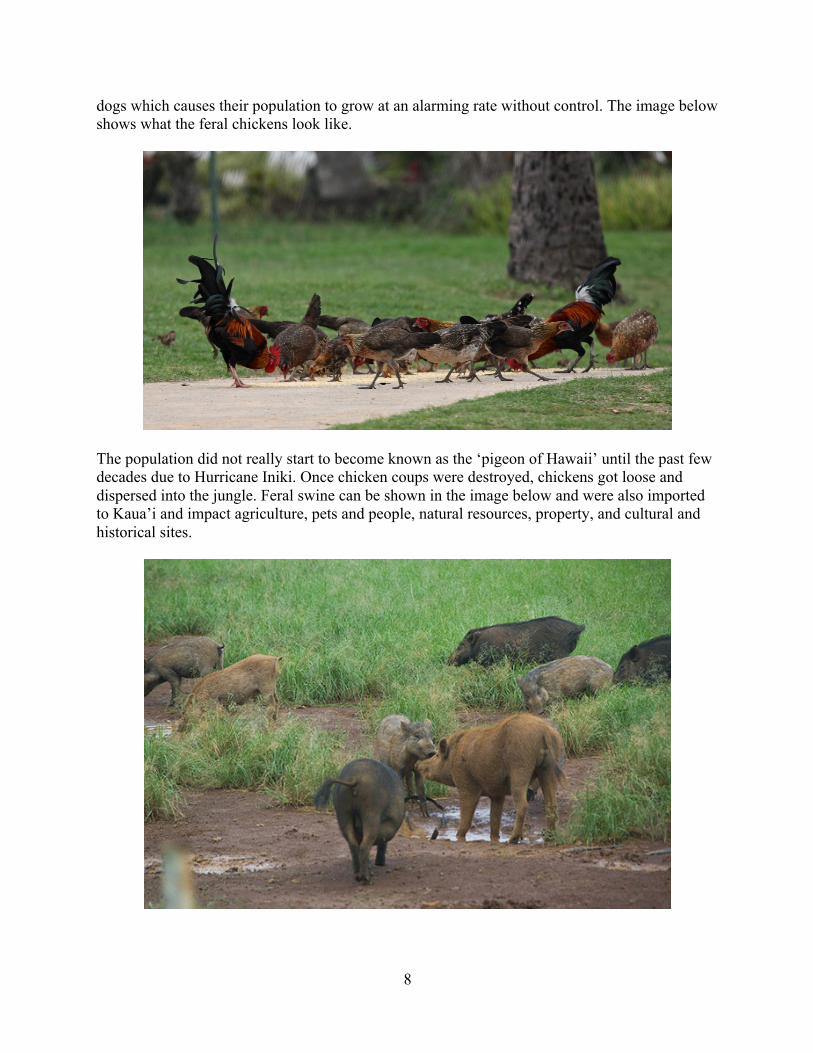
dogs which causes their population to grow at an alarming rate without control. The image below shows what the feral chickens look like.
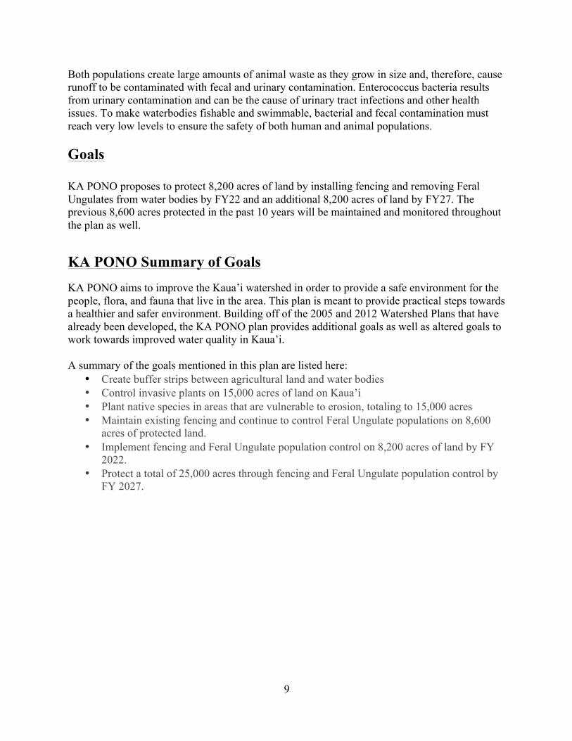
The population did not really start to become known as the ‘pigeon of Hawaii’ until the past few decades due to Hurricane Iniki. Once chicken coups were destroyed, chickens got loose and dispersed into the jungle. Feral swine can be shown in the image below and were also imported to Kaua’i and impact agriculture, pets and people, natural resources, property, and cultural and historical sites.
9
Both populations create large amounts of animal waste as they grow in size and, therefore, cause runoff to be contaminated with fecal and urinary contamination. Enterococcus bacteria results from urinary contamination and can be the cause of urinary tract infections and other health issues. To make waterbodies fishable and swimmable, bacterial and fecal contamination must reach very low levels to ensure the safety of both human and animal populations. Goals KA PONO proposes to protect 8,200 acres of land by installing fencing and removing Feral Ungulates from water bodies by FY22 and an additional 8,200 acres of land by FY27. The previous 8,600 acres protected in the past 10 years will be maintained and monitored throughout the plan as well.
KA PONO Summary of Goals
KA PONO aims to improve the Kaua’i watershed in order to provide a safe environment for the people, flora, and fauna that live in the area. This plan is meant to provide practical steps towards a healthier and safer environment. Building off of the 2005 and 2012 Watershed Plans that have already been developed, the KA PONO plan provides additional goals as well as altered goals to work towards improved water quality in Kaua’i. A summary of the goals mentioned in this plan are listed here:
• Create buffer strips between agricultural land and water bodies • Control invasive plants on 15,000 acres of land on Kaua’i • Plant native species in areas that are vulnerable to erosion, totaling to 15,000 acres • Maintain existing fencing and continue to control Feral Ungulate populations on 8,600
acres of protected land. • Implement fencing and Feral Ungulate population control on 8,200 acres of land by FY
2022. • Protect a total of 25,000 acres through fencing and Feral Ungulate population control by
FY 2027.

10
References 1. “Sustainable Development: The Role of Watershed Management.” EPAT: Sustainable Development: The Role of Watershed Management. N.p., 1999. Web. 04 Apr. 2017. https://epat.wisc.edu/.forest/.Sustainable-Development--The-Role-of-Wat1/.Document-divided-by-Chapter-with-Search-1/.Sustainable-Development--The-Role-of-Wat1.html 2. KWA “What We Do.” Hawaii Association of Watershed Partnerships. N.p., n.d. Web. 04 Apr. 2017. http://hawp.org/partnerships/Kaua’i-watershed/what-we-do/ 3. Kaua'i Watershed Alliance. "Kaua’i Watershed Management Plan: Overall Management Plan." (2005): n. pag. Web. 01 Apr. 2017. <http://hawp.org/wp-content/uploads/2012/03/KWA_management_plan.pdf>. 4. Kaua'i Watershed Alliance. "Kaua’i Watershed Management Plan: Overall Management Plan." (2012): n. pag. Web. 01 Apr. 2017. <http://hawp.org/wp-content/uploads/2012/03/KWA-Overall-Strategy-Mgmt-Plan-2012.pdf>. 5. "Watershed Management Plan for Hanalei Bay Watershed." Watershed Characterization 1 (2012): n. pag. Web. 02 Apr. 2017. http://dlnr.hawaii.gov/reefresponse/files/2014/04/HBWMP_Vol1_WatershedCharacterization_Oct2012.pdf 6. Lawrence, W. H. (1959, August 21). Hawaii Becomes the 50th State; New Flag Shown. Retrieved March 22, 2017, from http://www.nytimes.com/learning/general/onthisday/big/0821.html#article 7. National Governors Association. (2015). Hawaii : Past Governors Bios. Retrieved April 01, 2017, from https://www.nga.org/cms/home/governors/past-governors-bios/page_hawaii.html# 8. Macfarlane, I. (2014, May 14). A Historical Study of Native Hawaiian Water Management. Retrieved March 29, 2017, from http://scalar.usc.edu/works/water-sustainability-and-indigenous-knowledge/index 9. Shiva, V. (2002). Water wars: privatization, pollution, and profit. Berkeley, CA: North Atlantic Books. 10. Levy, Neil M. (1975). Native Hawaiian Land Rights, 63 Cal. L. Rev. 848. http://scholarship.law.berkeley.edu/californialawreview/vol63/iss4/2 11. “Native Plant.” Kilauea Point Natural History Association. N.p., n.d. Web. 04 Apr. 2017, from http://www.kilaueapoint.org/native/.