Embed Size (px)
Citation preview
Issue 6 The Silurian January 2020
1
Issue 6 The Silurian January 2020
2
Welcome to the sixth edition of the Silurian which contains an eclectic mix of articles, ranging from ideas into the origins of life to art installations inspired by geology. If you are feeling energetic follow Chris’s walk over the cliffs from Aberystwyth to Borth, or for the more sedentary inclined Colin’s geological road journey will add interest to the trip along the A44 into, or out of Wales.
Finally we all wish Bill Fitches all the best in his new life in Leeds.
Michele Becker
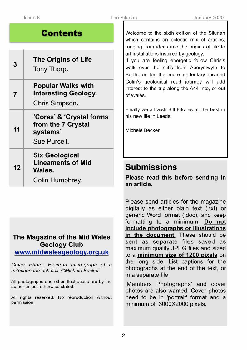
3The Origins of Life Tony Thorp.
7Popular Walks with Interesting Geology. Chris Simpson.
11
‘Cores’ & ‘Crystal forms from the 7 Crystal systems’ Sue Purcell.
12
Six Geological Lineaments of Mid Wales. Colin Humphrey.
The Magazine of the Mid Wales Geology Club
www.midwalesgeology.org.uk
Cover Photo: Electron micrograph of a mitochondria-rich cell. ©Michele Becker
All photographs and other illustrations are by the author unless otherwise stated.
All rights reserved. No reproduction without permission.
Submissions
Please read this before sending in an article.
Please send articles for the magazine digitally as either plain text (.txt) or generic Word format (.doc), and keep formatting to a minimum. Do not include photographs or illustrations in the document. These should be sent as separate files saved as maximum quality JPEG files and sized to a minimum size of 1200 pixels on the long side. List captions for the photographs at the end of the text, or in a separate file. 'Members Photographs' and cover photos are also wanted. Cover photos need to be in 'portrait' format and a minimum of 3000X2000 pixels.
Contents

Issue 6 The Silurian January 2020
Introduction
The two most fundamental questions which humans have grappled with since prehistory are to do with the origin of stuff and the origin of life. That we are no different in this age of the internet is evidenced by the literally hundreds of books, talks and videos brought up by a simple search. Discounting any of a theological nature, every variety of scientist has had his say, all influenced by their particular discipline. Some are prolific popular scientific authors with dozens of publications e.g. Paul Davies (physicist), Nick Lane, (biologist) and Adam Rutherford (geneticist), while others, equally or more credible, have an output more limited to the academic, like John Sutherland (chemist).
Pre-Darwin
In the early nineteenth century spontaneous generation was a widely held belief, being based on the common observation that stuff goes mouldy and being confirmed by many reported observations, often amusing to the modern intellect. It was even compounded with the new science of electricity by Andrew C r o s s e i n a m u c h p u b l i c i s e d "electrocrystallisation" experiment in which he passed an electric current through a volcanic rock and small insects were produced. They were named Acarus crossii in his honour. This
was described in a letter to the London Electrical Soc. dated 27th December 1837 (Read 20th Jan, 1838).
Andrew Crosse had some credibility as he was one of the first to develop large voltaic piles and was visited by Sir Humphry Davy (who visited Fyne Court in 1827) amongst others. The news was subsequently picked up by newspapers across the country and elsewhere in Europe. Some readers apparently gained the impression that Crosse had somehow "created" the insects, or at least claimed to have done so. He received angry letters in which he was accused of blasphemy and trying to take God's place as a creator.
Although sometimes credited with being the inspiration for Mary Shelley's "Frankenstein", this was not so because her publication antedated Crosse's experiment by 18 years.
It was only in the 1860s (i.e. contemporary with the publ icat ion of "Origin") that spontaneous generation was finally put to bed when Louis Pasteur carried out his famous experiments to prove that sterile broth remained sterile if not exposed to particles in the air.
Another widely held belief was that of "Vitalism", which held that life and organic stuff contained a "vital force" which inorganic materials did not. This held sway until disproved in 1828 by Friedrich Wohler, who showed that heating silver cyanate with ammonium chloride produced urea, without the aid of a living organism or of a kidney, either of man or dog.
Darwin
A l t h o u g h D a r w i n w a s contemporary with Mendel, the fact that Mendel 's work was not recognised until the turn of the century, meant that Darwin's views on evolution were analogue, although Mendel had shown that heredity was digital. In other words, Darwin would regard the product of crossing white and purple peas as likely to produce various shades of pink, Mendel showed that the progeny were purple or white accord ing to speci f ic ru les, determined by “heritable factors”. Although he did not name them, he had discovered genes.
3
The Origin(s) of Life
Fig. 1 From original paper. 14 - 26 show crossii emerging.

Issue 6 The Silurian January 2020The publication of Darwin's "On the Origin of Species" in 1859 made clear how all species could have originated from one single ancestor, but shed no light on the origin of that simple individual. Darwin himself, considering the existing culture of the time, was understandably reticent, but famously made comments about the "warm little pond" out of which something evolved. More relevantly, in a letter to Hooker, he wrote that ".... it is mere rubbish thinking, at present, of origin of life; one might as well think of the origin of matter."
Well, he was wrong there as physicists have pretty well solved the origin of matter, but the origin of life is proving to be a much harder nut to crack! Indeed, it was not possible to progress beyond the "warm little pond" concept until we understood more about what life was!
Warm Little Ponds
Darwin's speculations about warm ponds presaged the concept of a "Primordial soup" which dominated the search for origins for 100 years. The idea was that, if you took all the ingredients from an early inorganic earth and brewed them up with heat or electricity for long enough, something would emerge.
This culminated in the famous experiments conducted by Stanley Miller in 1953, under the supervision of Harold Urey. Mi l ler took the conceived components of a primitive atmosphere i.e. water, methane, hydrogen and ammonia and sparked them with a high voltage. Within a few days, the contents became a rich brown and analysis revealed the amino acid glycine, together with other biological amino acids, the building blocks of proteins. More recently, the original samples have been shown to contain all 20 biological amino acids plus another five.
Research has now shown that organic chemicals are everywhere, both on the planet and off. Our further understanding of origins depended on our probing the workings of the cell, and life.
Cells
There was little prospect of determining the o r ig in o f l i f e un t i l t he re was some understanding of what life was and this depended on the quality of available microscopes. Although Robert Hooke, with his compound microscope, had been the first to coin the word "cell" to describe the structure of sections of the bark of the cork tree in the 1660s, it was Antonie van Leeuwenhoek, with his single lens microscope who was the first to observe and describe various living infusoria, bacteria and other single celled organisms. He was a remarkable amateur scientist who developed a unique microscope with a tiny spherical lens of his own devising, produced by a technique which was only ful ly reproduced in 1957. He was somewhat
secretive about how he made his lenses, allowing people to assume that they were made by grinding. In fact, it is now established that his technique was to draw a thin thread of glass and to fuse the end to allow a clear spherical blob to form. He was thus able to produce them as he needed them and produced some 200 in toto!
Our knowledge of the nature of life progressed rapidly in the mid century. It became clear that
4
Fig. 2 Stanley Miller's apparatus. Wiki Commons.

Issue 6 The Silurian January 2020l i f e i s c e l l s . B e t t e r microscopes were becoming a v a i l a b l e a n d i n 1 8 3 2 Dumortier observed cells of algae lengthen and divide and in 1833 Robert Brown (well known for his discovery o f B r o w n i a n M o t i o n ) examined orchid cells and saw and named the cell nucleus. However it was Schwann and Schleiden in 1837 who put it together as "cell theory", but regarded the nucleus as the seed from which the cell developed. It was only in 1854 that Remak and Virchow realised that all cells derive from cells, by division.
The problem of the origin of life therefore becomes the problem of the origin of the first cell, or of something s impler. As th is is not o b s e r v a b l e , h a v i n g happened billions of years ago, it has to be deduced from studies of how a cell works.
Within the Cell - DNA
Improved microscopes revealed chromosomes within the nucleus, which became visible as the cell divided. Then, in the 1920s Thomas Hunt Morgan, in his "fly room" elucidated the functions of chromosomes and found that Mendel's "heritable factors", or genes, were positioned precisely along them. Both proteins and DNA were present in chromosomes, but it was not clear which held the genes until, in the 1940s Avery, MacLeod and McCarty showed that it was the DNA.
“What is Life?” The Book
In 1943 Erwin Schrodinger, the Nobel prizewinning physicist responsible for much in quantum theory and the "Schrodinger equation", delivered a seminal lecture in Dublin, published a year later as a small book entitled “What is Life”.
This book was seminal and influenced Francis Crick, James Watson and Maurice Wilkins, the discoverers of the structure of DNA. Schrodinger knew that heredity was concerned with chromosomes and that chromosomes
consisted of proteins and DNA. At that time DNA was regarded as “boring” and proteins were thought to be t h e m o r e i n t e r e s t i n g molecules. Some thought the hered i tab le fac to r was something to do with shapes or grooves in proteins, like a gramophone record.
Schrodinger recognised that the whole four dimensional pattern of an organism's development is determined by the structure of one cell, the fertilised egg. Moreover, not just by that, but by a small part of it, namely, the nucleus of that cell, and indeed, the chromosomes within that nucleus.
It is these chromosomes, or probably only an axial skeleton fibre of what we actually see under the m i c r o s c o p e a s t h e chromosome, that must
contain in some kind of code-script the entire pattern of the individual's future development and of its functioning in the mature state. Every complete set of chromosomes contains the full code; so there are, as a rule, two copies of the latter in the fertilised egg cell, which forms the earliest stage of the future individual.
In the 1930s, the controversial biologist, Darlington, had found the volume of a gene was equal to a cube of edge 300 Angstrom units. This equates to some 100 to 150 atomic distances. In other words, the gene must comprise only a few million atoms. Statistical mechanics dictates that any physical property of a sample of that size would be subject to a relative error of the order 0.1%. That is far too inaccurate to provide a mechanism for heredity, which requires mutations (errors) to occur, but to be minimal. Logically, therefore, the heritable factor had to be on a smaller scale and Schrodinger recognised this had to be in the form of a "code script" built in to a non-repeating polymer.
The fundamental question "What is life" is imponderable, but must include the fact that it is a non-equilibrium process. The second law of thermodynamics dictates that stuff runs
5
Fig. 3 van Leeuwenhoek's microscope. J. Rouwkema Wiki Commons CC BY SA 3.0

Issue 6 The Silurian January 2020down, or that Darwin's "warm little pond" will never generate life unless driven by energy. Life consumes food or energy to make our ordered bodies which would otherwise decay. Any plausible model of the origin of life requires a flow or source of energy provided by e.g. differences in temperature, pH, or chemistry.
DNA Based on the famous Photo 51, taken by the X ray crystallographer, Rosalind Franklin, and given to Crick by Wilkins, the double helix structure of DNA was established. This and the genetic code it carried led to a new approach to the search for plausible origins. In the first place the fact that DNA seems to be universal and that no living organism uses a different code shows that there was just one origin. Also, the objective was now clearly defined and chemists like John Sutherland could investigate logical synthetic paths towards nucleic acids, while others looked for synthetic pathways and catalysts which operated where there were temperature or environment differences which could drive the chemistry and evolution. There was also a search for molecules, simpler than DNA which were capable of evolving, the idea being that, once you get evolution, there are no limits.
One strand of research starts with separation. Without separation, there can be no evolution, so several workers start with self organising molecules like lipids and phospholipids which will, like soap, self organise. David Deamer and Bruce Damer have observed that dried phospholipids wetted on a microscope slide form layers and double walled vesicles. In the field, they investigated the scum line round hot puddles flanking volcanoes. They s u g g e s t a n e a r l y p r e b i o t i c evolutionary process driven by cyclic processes in which dissolved m o l e c u l e s c a n b e t r a p p e d , concentrated and polymerised in this environment. A sort of evolution can then take place as more robust vesicles recycle themselves. Once established, stable cells could d i s t r i b u t e a n d e v o l v e o t h e r properties. They found that double walled vesicles can develop which will maintain different concentrations of sodium and potassium ions inside and outside. Conceivably more robust ones could grow better and reproduce, initiating evolution.
DNA is horrendously complex, but within the cell RNA (essentially half a double helix) is used to carry the code and, as in ribosomes, can also catalyse reactions. The thought is that pre-DNA, a simpler "RNA World" could have evolved.
There has been some success in the synthesis of essential molecules for life like nucleic acids starting with reactive forms of carbon like CO, but Nick Lane favours CO2 as the most likely starting material as it was probably the most dominant carbon containing gas and is still the basis of photosynthesis which draws upon the e l e c t r o c h e m i c a l d i f f e r e n c e s i n i o n concentration across membranes. He notes that remarkably analogous conditions apply in alkaline hydrothermal vents, right down to the magnitude of the H+ gradient across thin
6
Fig. 4 Rosalind Franklin's Photo 51. Wiki Commons
Fig. 5 Lost City alkaline vent field . Wiki Commons.

Issue 6 The Silurian January 2020inorganic barriers. He suggests that this is the primordial pathway for CO2 reduction which is still that used by methanogens today.
Below these vents serpentinisation reactions convert olivine to serpentine, producing hydrogen and methane in a stream of warm alkaline water in which white calcium carbonates are precipitated. They are inhabited by primitive bacteria and archaea which form biofilms feeding on hydrogen and methane.
One life or many?
One upshot of origins research is determining whether we are alone or whether the universe is full of life, or lives. If plausible routes to life are many and easy, then we may have lots of neighbours, or vice-versa. It may be that another approach to that question may pay off. We have hardly scratched the surface of life on this planet and, in particular, millions of microbes have not been studied, let alone DNA sequenced. This is particularly true of many archaea which are difficult to culture. If life kicks off easily, there could be "foreign" non-DNA based microbes hiding on our planet, waiting to be discovered. On the other hand, although there are lots of habitable planets around, life may still be rare or even unique.
The Fermi paradox is still an open question. Our Earth is young and there are lots of habitable planets out there, but - Where is everybody? We still have no idea! SETI hasn't found them………yet! (for an answer to Tony’s question see below)
Tony Thorp
Walk One: The Coast Path from Aberystwyth to Borth.
This walk has some steep climbs; but should be within the capability of most regular walkers. It starts at the north end of Aberystwyth promenade and finishes in Borth. For the best views of the geological features described here, it is suggested that you check the tide tables beforehand, and aim to start from Aberystwyth 1-2 hours before low tide. The path is straightforward: up over Constitution Hill, past Clarach, Wallog and then over several hills and valleys before descending from Borth War Memorial into Borth itself. You can get the bus or the train in Borth to return to Aberystwyth. The rocks you walk over Most of the time, you will be walking over the Aberystwyth Grits: a series of sedimentary beds totalling several hundred metres in thickness which were laid down deep in the sea during the Silurian period, around 440 million years ago. The beds are a mixture of sandstones, and finer mudstones. Originally, the beds would have been horizontal. Movements of the Earth’s crust over the last 400 million years have, however, lifted these rocks from below sea level to above sea level; and have caused marked irregularities in the orientation of the beds. Earth movements compressing this area caused the horizontal beds to buckle and form a series of folds. Also, once the rocks were raised above sea level, they were subjected to erosion. What we look at today is the end result of earth movements and erosion, which can result in very complex arrangements of the rocks we walk over now.
7
“It is known that there are an infinite number of worlds, simply because there is an infinite amount of space for them to be in. However, not every one of them is inhabited. Therefore, there must be a finite number of inhabited worlds. Any finite number divided by infinity is as near to nothing as makes no odds, so the average population of all the planets in the Universe can be said to be zero. From this it follows that the population of the whole Universe is also zero, and that any people you may meet from time to time are merely the products of a deranged imagination.”
Douglas Adams From The Restaurant at the End of the Universe.
Popular Walks With Interesting Geology
Walking is a popular pastime. Many walks have something else of interest besides the walk itself, such as architecture or something of historical interest. This is the first of two articles highlighting interesting geology seen along popular walks. It is written for walkers with no previous knowledge of geology.

Issue 6 The Silurian January 2020On the left, we see the base of Constitution Hill at the start of the walk. There are successive layers of rock dipping gently towards the east. On the right, we see higher up the hill, the beds are dipping to the east, but with a much steeper gradient than down at sea level. Remember, 440 Million years ago, all these beds would have been parallel horizontal layers of rock. As you go along the walk, you can see that beds dipping gently to the east is the most common orientation within these cliffs; but there are many exceptions to this. Looking at the exposed rocks as you walk along the path, you can try to work out what has happened in terms of folding and erosion. Remember, the folding can be in three dimensions, and can be associated with rotation as well. The following diagram shows how regular flat beds end up as folded beds with great variation in orientation.
Row A shows the beds being laid down under the sea: regular and horizontal, but varying in thickness and composition. In Row B, movements of the earth’s crustal plates has resulted in uplift of the beds above sea level and lateral compression. This compression means that the beds end up in a series of folds, but the relative thickness and composition of the beds is maintained. As these rocks are now above the sea, they are exposed to erosion, which affects all the land surface of the earth to some degree. Over millions of years, the effect of rainfall, wind and frost results in loss of the surface exposed rock. The horizontal red line shows where erosion has reached today. All the rock above
the red line has been removed and ended up blown away by the wind or washed into rivers and the seas by rainfall. Row C shows the rocks as we see them today: a succession of rock layers varying in thickness, composition and orientation. The p redominan t o r i en ta t i on o f t he Aberystwyth Grits is shown in the next photographs: dipping towards the east with an angle of dip around 20° to 30° As you walk along the path, the cliffs catch your eye, and the orientation of the rock beds within them. But don’t forget to look left at the rocks exposed on the sea shore at low tide on your journey north. They often show very interesting appearances. These rocks are exposed at the southern end of the beach at Clarach. The following three pictures are close-up views going from west to east over this area.
Fig. 2 is the south-western aspect of this exposure. You can see that the beds are fairly regular, and they are all dipping gently to the west.
Fig. 3 shows the central section has a very complex appearance! At the top left of the
8
Fig. 2 Clarach tidal rocks, west.
Fig. 3 Clarach tidal rocks, centre.

Issue 6 The Silurian January 2020
picture, the beds are actually dipping south. In the central section, they are dipping west-south-west. On the right hand side of the photo, they are vertical. The left hand area in Fig. 4 is the same as the right hand area in Fig. 3, these beds are vertical. On the right hand side of Fig. 4 we are back to beds dipping gently to the east. Working out what happened millions of years ago to produce this complex appearance is what makes Geology so interesting! Continuing north from Clarach, the next low-lying part of the path is through Wallog. The main feature of geological interest at Wallog is the spit: Sarn Gynfelyn (Fig. 5). A spit is a depositional bar extending out to sea. It is thought that most of the rocks forming Sarn Gynfelyn were dropped there by melting ice at the end of the last Ice Age, about 15,000 years ago. The pattern of currents in the Irish Sea has maintained the bar since then.
Looking north towards Aberdyfi from the path south of Wallog, the spit is clearly visible extending out from the shingle beach into the sea. Maps of the sea floor show that the spit extends for seven miles into the sea. Even at high tide, the site of the spit can be seen by waves breaking over it.. After Wallog, there are several ups and downs in the path. When you get to the top of the second steep pull-up which includes about 50 wooden steps, stop at the top for a rest at a view point on the seaward side of the path. You look northward towards Aberdyfi with the
sand-dunes at Ynyslas on this side of the River Dyfi. You also see some incredible rocks in the foreground: Craig y Delyn (Harp Rock SN595877) (Figs 6 & 7). There are beds of rock steeply dipping to the west. The flat rock surface seen in the centre is the top face of one of these beds. This is clearly part of an anticline which would have turned over to dip to the east at some time in the past. Now, however, the top of the anticline has been eroded away, and we only see one limb of the fold. While you are at the viewpoint, you can see the rocks close up. Here are beds dipping to
9
Fig. 4 Clarach tidal rocks, east.
Fig. 5 Sarn Gynfelyn.
Fig. 6 Craig y Delyn (Harp Rock).
F i g . 8 C l ose-up o f t h e mudstone layers by the Harp R o c k viewpoint.
F i g . 7 C r a i g y D e l y n , close up to see the r o c k structure.

Issue 6 The Silurian January 2020the east which vary in thickness and composition. (Fig. 8 -There is a red ball point pen near the bottom of the picture to give you a scale.) If you have binoculars, you can look at the details of the beds elsewhere as well. Fig. 9 shows the cliff north of Wallog, the variation in thickness and colour of the rock beds is visible.
Once you reach the War Memorial near Borth, you are close to the end of the Walk. There are, however, two important geological features which can be best seen from this vantage point. The first is the sand dunes at Ynyslas (Fig. 10).
Sand dunes form along coasts when there is a source of sand, and the prevailing winds can blow sand off the beach to form hills behind the beach which are then stabilised by vegetation to form dunes. The dunes here at Ynyslas are well-stabilised and have been here for hundreds of years. (The houses at the top are in Aberdyfi, on the far side of the River Dyfi from the dunes.) The second feature is the Dyfi Valley (Fig. 11). The valley is markedly asymmetric. The River Dyfi lies at the northern edge of the valley, and there are high, steep-sided hills marking the northern edge of the valley. By contrast, south of the river is a large expanse of flat land with more gently rising hills further south. Borth is on the coast in the foreground. The large area of flat land behind includes Borth Bog which is part of the Dyfi National Nature
Reserve – the only UNESCO biosphere reserve in Wales. Fig. 12 below shows the River Dyfi more clearly with the steeply rising hills to the North. Why is the valley so asymmetrical? The
reason is that the valley is a buried valley. Solid rock is close to the surface north of the river; but over the large flat area south of the river, solid rock is anywhere between 50 to 100m beneath the surface. As sea level rose following the end of the last Ice Age 15,000 years ago, sediments were deposited within the valley to produce the landscape we now see.
Chris Simpson
10
Fig. 9 Mudstones north of Wallog.
Fig. 10 Ynyslas s a n d dunes.
Fig. 11 The Dyfi Valley.
Fig. 12 The River Dyfi
Unusual Rock Specimen
Anyolite from the Mundarara mine, Tanzania. A high-grade metamorphic rock named after anyole, the Maasai word for green. Photo Richard Becker.

Issue 6 The Silurian January 2020
Installation & Box Set Art inspired by the Lapworth Museum of Geology Birmingham University.
After a visit to the Lapworth museum I was inspired to create two art works: the Cores installation, which was featured in my autumn solo show called ‘Outside In’ at the Wyeside Arts Centre in Builth Wells, and the Box-Set, which was displayed in a cabinet as part of the “1+1= group” in the summer exhibition at the Courtyard in Hereford.
“Box Set in a Cabinet” - Crystal forms from the 7 Crystal systems
My starting point was seeing a diagram in the museum with a list of the forms of the s e v e n c r y s t a l s y s t e m s : c u b i c , t e t r a g o n a l , o r t h o r h o m b i c , monoclinic, triclinic, h e x a g o n a l a n d t r i g o n a l . I investigated each, a n d t h e n t o o k inspiration from one of the crystals of each form - galena, a p a t i t e , b a r y t e , corundum, zircon & chalcanthite.
Each open box is made of cardboard, with inserted paper c o n s t r u c t i o n s consisting of a graph
paper cut-out on w h i c h I i n k - j e t printed different flat colours appropriate t o t h e c h o s e n c r ys ta l s , be fo re selected areas were cut then mounted on metallic card. The f o r m u l a e w e r e drawn out in various ways on the base paper (54 x 115 cm) on which the boxes stood, with a piece of quartz placed at each corner.
To display the box-set in a cabinet was inspired by the recreated ‘spar box’ I saw at the museum. In Victorian times, miners in northern England collected beautiful minerals and displayed them in boxes, known as ‘spar boxes’. Some had street scenes or included stuffed animals; others were simpler. Mirrors made the insides of the boxes look bigger.
“Cores”
I h a v e always been fasc ina ted b y t h e physica l i ty of ice and earth cores. S c i e n t i s t s can tell a lot a b o u t t h e physical and c h e m i c a l properties of the rocks and sediments in earth cores, and which particles are in ice cores such as dust, ash, pollen, trace elements - our very own time capsules. I saw an earth core at the museum that inspired me to create this installation. The pieces vary in sizes, from the smallest at 24 x 6 cm, to the largest at 113 x 8 cm. They are made from cardboard tubes, covered with rice paper, PVA and acrylic paint, and suspended with metallic ribbons.
Sue Purcell
www.suepurcellart.com
The Lapworth Museum of Geology https://www.birmingham.ac.uk/facilities/lapworth-museum/index.aspx
11
‘Cores’ & ‘Crystal forms from the 7 Crystal systems’
Baryte Orthorhombic
Chalcanthite Triclinic

Issue 6 The Silurian January 2020
A r o a d j o u r n e y f r o m K i n g t o n t o Aberystwyth
Six great lineaments - bands of faulting, folding or thrusting, extending miles deep into the basement rocks, played a vital role in the geological history of Mid Wales. Each is crossed on the journey along the A44 from the English border near Kington, to Aberystwyth on Cardigan Bay. Axial traces of their fault bands persist for long distances – up to 140 miles in some cases, extending north of the district, sometimes to Cheshire, and curving south mostly into Pembrokeshire. They were the main controlling factors during the first two of four major events which shaped the region. • L o w e r P a l a e o z o i c
subsidence of the Welsh Bas in area (Fig.1) during a period of subduct ion and regional tension, led to a b a c k - a r c b a s i n forming an inland sea which covered most of W a l e s . N o r m a l subsidence across the lineaments totalled as much as five miles in t h e w e s t . T h e subsiding basin filled with soft mudstone and harder sandstone, varying upwards in the s e q u e n c e a s t h e d e p o s i t i o n a l environment changed, and laterally across the region, depending on the sediment flows.
• Upper Palaeozoic inversion of the Basin during a continental collision – the Acadian Orogeny - led to reactivation of some faults in the reverse direction, together with widespread and severe folding, producing uplift of of several miles in places and a 40% shortening of the region. The uplift was followed by erosion back to sea-level. Erosion of folds exposed hard and soft strata
side by side leading to marked changes in topography.
• Another uplift around 60 million years ago due to a mantle plume associated with opening of the Atlantic, was followed by erosion to an upland plateau dissected by drainage channels.
• Pleistocene (ice age) glacial erosion and then glaciofluvial incision of the upland plateau produced the present peneplain.
Each of six sections along the A44 crosses a lineament (see table below and Fig. 2). A seventh section, beginning at Rhayader, reroutes the A44 north along the A470 to Llangurig, where westward progress on the A44 can resume.
The Church Stret ton and Pontesford Lineaments lay on the the shallow marine shelf of the Welsh Basin, where there was little movement during the Basin subsidence phase but considerable lateral slip during the collision phase. The Tywi Lineament marks the edge of
the Basin shelf. From there the slope led down to the deeper basin, typically 400-600 metres deep. Sediment flowed onto the Basin shelf from a mountainous English Midland. Accumulating on the outer reaches of the shelf, it was periodically disturbed by earthquakes or great storms, and flowed as turbidites (turbulent flows of water and suspended sediment) f rom the east , downslope and out onto the floor of the deeper basin, reaching past Aberystwyth before the last of the suspended sediment settled.
12
Six Geological Lineaments of Mid Wales
Fig. 1 Welsh Basin in early Silurian period. The shelf began near Kington, with deeper water west of Rhayader.

Issue 6 The Silurian January 2020
By 405 Ma, subsidence had ceased, the basin had filled, and the rocks began to be compressed by a continental collision to the northwest. In addition a regional fold developed across three of the lineaments: up over the Tywi Anticline, down through the Central Wales Syncline, and up again over the Teifi Anticline.
Floodgates, on the English border, to Llanfihangel (14 km) Crosses the Church Stretton Lineament
The Lineament begins at the Welsh border, about 2½ km wide, curving 140 miles from Cheshire into south-west Wales. It is the outermost part of the Welsh Borderland Fault Zone, defining the eastern and southern edge of the Welsh Basin. Locally the oldest rocks in England and Wales are uplifted here at the Welsh border.
At Floodgates, 2 km before the border, there is a change from the red mudstone of the Pridoli epoch at the top of the Silurian period, to the underlying grey mudstone of the Ludlow epoch, formed from sediments laid down on the shelf of the Welsh Basin (Fig. 3). The first hills for some miles indicate a change in geology: Bradnor Hill to the right of the road, and Hergest Ridge to the left (south), are Upper Silurian, Ludlow epoch rocks, mudstone but with sandstone horizons which cap the hills. The A44 follows the line of a glacial meltwater channel cut through the Precambrian rock, erosion being assisted by pre-existing faults. Alluvium is found along the channel.
13
Lineament Lineament occurs between (road distance)
1. Church Stretton Fault: Floodgates and Llanfihangel (14 km)
2. Pontesford Fault: Llanfihangel and Crossgates (13 km)
3. Tywi Anticline and Fault Lineament: Crossgates and Rhayader (12 km)
( A470 Wye Valley between Rhayader and Llangurig (14 km))
4. Central Wales Syncline and Fault Lineament: Llangurig and Eisteddfa Gurig (14 km)
5. Teifi Anticline: Eisteddfa Gurig and Goginan (17 km)
6. Bronnant-Gladyfi Fault: Goginan and Aberystwyth (12 km)
Fig. 2 Six lineaments crossing Wales on the A44. They controlled formation of the Welsh Basin and its later uplift.
Fig. 3 A simple stratigraphy. Road is nearly all Silurian, very briefly c r o s s i n g O r d o v i c i a n a n d Precambrian.

Issue 6 The Silurian January 2020The Powys county sign marks the Welsh border and is also the start of the Church Stretton Fault. Stanner Rock to the right (north), and Hanter Hill to the left, are intrusive igneous rocks, of intermediate and mafic composition (dolerite and gabbro), dated at 702 Ma. The Stanner-Hanter complex has been interpreted as a small magma chamber that probably formed a feeder zone to an unpreserved volcanic complex (Fig. 4). At some point before the Acadian Orogeny, these Precambrian rocks were squeezed upwards during lateral-compressive movement on the Church Stretton Fault. Fault movement during the Acadian Orogeny was lateral (not vertical), with land to the west of the lineament sliding south-west relative to the land on the east. This strike-slip accounts for the relative absence of folding in these rocks.
Just beyond Stanner Rock the road rises and, still in the Precambrian inlier, Gore Quarry can be seen on the left, originally buried deep, and thus heated enough to be hardened by metamorphism. Nearby is Dolyhir Quarry, still Precambrian but this time sedimentary rock, into which the Stanner-Hanter igneous complex was intruded. The original sandy sediment was deposited on a river plain leading to a sea 200 Ma older than the ancient Welsh Basin itself.
After breasting the hill past Gore Quarry, and before driving down the other side of the hill of Precambrian sedimentary rock to Walton, there are distant views ahead and to the right, of the hills of Radnor Forest – a bleak upland rising to 660 metres and probably never extensively forested. This is more Silurian, Ludlow epoch rock, mudstone with erosion-resistant sandstone horizons, and is classic
central Wales peneplain. From Walton to New Radnor the road runs straight for 4 km over an area which was probably a glacial lake at the end of the Ice Age, draining the flows from the eastern side of Radnor Forest.
Llanfihangel to Crossgates (13 km) Crosses the The Pontesford Lineament.
The Pontesford Fault Lineament probably focused local Ordovician volcanism and later uplifted this harder rock to be level with the Silurian rock. Strike-slip movement on the lineament buffered the continental collision and thus avoided folding. The road runs on Devensian till of the last Ice Age, and on some alluvium, for most of the journey, weaving gently to avoid the hills, largely following glaciofluvial valleys. The bedrock is Upper Silurian, Ludlow and Wenlock epoch, 425-430 Ma. The Pontesford Lineament is reached at Llandegley and the band of faults and splays extends to Crossgates. Within the Lineament an inlier of older mainly igneous Ordovician rocks of Llanvirn epoch, 465 Ma, called the Builth Volcanics, has been uplifted and is exposed to the south close to the road.
2½ km past Llanfihangel a long road cutting on the right at Gwernargllwyd, exposes the Bailey Hill Formation of the Silurian Ludlow, formed from thinly bedded turbiditic fine sand and silt on a fossiliferous shallow marine shelf (Fig. 5). The dip is rarely more than 20º and is often nearly horizontal so that the same rock outcrops over large areas. The horizontal nature of the bedding is seen in a low quarried face to the right (north) of the road, the rock being aptly described as ‘striped flags’ (SO 160 595). Elsewhere the area is known for complex structures due to submarine landsliding after deposition but here the bedding is intact. Erosion of this near
14
Fig. 4 Igneous rocks on the Church Stretton lineament. Oldest rocks in England & Wales, faulted up on the Welsh border.
Fig. 5 Silurian rocks on the Pontesford lineament. Undeformed turbiditic ‘Striped Flags’ at Gwernargllwyd, past Llanfihangel

Issue 6 The Silurian January 2020horizontal bedding has made the hills noticeably symmetrical, smooth and rounded. The sandier beds act as caps with the hillsides tending to erode in a similar manner all round. Good examples are seen ahead between Llanfihangel and Llandegley.
The roadside cutting with the Striped Flags is followed by tight bends and then the elevated rocks of the Builth Volcanics are visible ahead in the distance (Fig. 6). They stretch 15 km south-east to Builth Wells, a combination of numerous dolerite intrusions, a variety of extensive tuffs (volcanic ash-fall rock), in places up to 80m thick, and the host Ordovician sandstone. Unlike the surrounding Silurian rocks the Ordovician inlier reveals north-east aligned ridges, having been folded before the Acadian Orogeny. Between Llanfihangel and Llandegley, looking west (left), the distant skyline shows a flat Silurian horizon ending suddenly at the Pontesford Lineament, and giving way to the knobbly horizon of the Ordovician Builth Volcanic Inlier.
After Llandegley, volcanic rock is exposed a few hundred metres to the left of the road for 2 km. A striking comparison between the knobbly Builth Volcanics just south of the A44, and the smooth often symmetrical domes of Silurian hills just north of the road, can be seen just before the Llandegley village sign (Fig. 7). Either of two long parking lay-bys on the left provide convenient stopping points. Volcanism occurred during the rifting of Avalonia from Gondwana. The volcanic ash is believed to have erupted from two volcanic vents, one north of Llandegley, and one near Howey, south of Llandrindod Wells. The tuff erodes in this conspicuously knobbly fashion. There would once have been volcanic rock north-west of the Builth Inlier but it has been moved some 25 miles north-east by strike-slip
movement on the Pontesford Lineament, to the Shelve area south-east of Welshpool.
Crossgates to Rhayader (12 km) Crosses the Tywi Lineament.
This is the third lineament on the journey, and the final component of the Welsh Borderland Fault Zone west of which there was considerable Basin subsidence (Fig. 8). The Lineament is the divide between the Basin deeper water and the slope and shelf; and between the relat ively unfossi l i ferous graptolitic deeper Basin and the fossiliferous shelly shelf facies; and between the severely folded and cleaved west and the undeformed east. It is also the first upfold in the regional fold system of western Mid Wales. The extent
15
Fig. 6 Builth volcanics on the Pontesford lineament. The Ordovician inlier seen from between Llanfihangel & Llandegley.
Fig. 7 Ordovician volcanics and Silurian sedimentary rocks. Volcanics south of the A44, and younger Silurian to north.
Fig. 8 Cross-section of the Tywi lineament. Huge basin subsidence on faults, and huge folding and reverse faulting on uplift.

Issue 6 The Silurian January 2020o f t h e d o w n - f a u l t i n g d u r i n g b a s i n sedimentation was much greater on this lineament than on the Church Stretton and Pontesford Faults, and the reverse faulting was also extensive: several kms of uplift across the faults between Gwystre and Gaufron. The Garth Fault, which runs through Gwystre, is the main divide between these different facies.
At Crossgates the road passes quickly from the fault band of the Pontesford Lineament to the fault band of the Tywi Lineament, the latter extending to Gaufron, 2 km before Rhayader. This lineament marks the eastern edge of the Welsh Basin shelf, beyond which was the slope and deeper water; and it buffered the collision effects of the Acadian Orogeny, preventing severe folding to the east. Uplift on the The Tywi Lineament is a combination of reverse faulting and up-folding. The up-faulted Ordovician Caradoc rock is older, harder, erosion resistant, and now elevated above the surrounding softer Silurian rock – mudstones of the uppermost Ordovician and Lower Silurian. There is also much minor folding between the individual faults.
At Nantmel the road crosses the core of the Tywi anticline, where older rock outcrops. A prominent vegetated ridge of hard Upper Ordovician Caradoc sandstone slopes down to the road on the right (north), flanked on either side by younger Ordovician Ashgill mudstone, softer and more easily eroded (Fig. 9). This particular Ordovician rock is free from sandstone units and is uniformly eroded, permitting the road to run relatively straight and level from just before Nantmel up to Gaufron. These flatter areas are also extensively mantled with glacial till. The road cuttings near Nantmel enable the road to maintain contour as it passes over the harder Ordovician rock in the core of the anticline.
Within the fault band the folded rocks are often steeply dipping. For the first time on the journey the rocks display a cleavage (see next sect ion) , tes t i fy ing to the increased metamorphism caused by continental collision. Approaching Rhayader the hills two miles to the front are the first sight of the Cambrian Mountains.
Rhayader to Llangurig (14 km) Does not cross a major lineament.
The A44 does not continue west at Rhayader because the river Wye lies ahead and terrain beyond is more contorted than hitherto. The route to Aberystwyth follows the A470 north along the east side of the Wye Valley to Llangurig, resuming its westerly course there. Locally there exists between the Tywi Anticline (on the last section) and the Central Wales Syncline (on the next section) a large second order fold combination: the Waun Marteg Syncline, and the Tylwch Anticline, the latter around 7 km across, producing a 2 km upfold and much distortion of local rock. The Rhayader-Llangurig road crosses this anticline obliquely, providing good roadside exposures to examine cleavage and folding. A glacier probably flowed north along this part of the Wye valley to Llangurig to join the large glacier flowing east from Plynlimon along, first the Wye and then the Severn Valley. Deglaciation at the end of the Devensian (ice age) produced a southwards meltwater flow which further incised the Wye Valley. This topography either side of the valley is the classic central Wales peneplain: an upland plateau deeply dissected by glaciofluvial drainage.
West of the Tywi Lineament, the rocks which formed in the subsiding Welsh Basin were once buried up to five miles deep, hot enough to reach 150ºC. Pressure created by continental collision and folding, aided by the burial temperature, caused clay minerals in the mudrock to recrystallise as mica, aligned as planes of weakness called cleavage. After exhumation by erosion this is revealed like a book of thick pages, different from bedding and jointing, and immediately noticeable in roadside cuttings after turning right in Rhayader (Fig. 10). The cleavage is uniformly
16
Fig. 9 Ordovician sandstone in the core of the Tywi lineament.
Fig. 10 Cleavage in rocks on leaving Rhayader. Lower Silurian Rhayader m u d s t o n e w i t h n e a r v e r t i c a l cleavage.
Issue 6 The Silurian January 2020steep, sometimes nearly vertical, and consistently faces roughly north-west, towards the pressure created by the Acadian phase of the continental collision. There was no cleavage east of the Tywi Lineament, but west of it all the mudstones show varying degrees of cleavage. Sandstone formations have little if any cleavage because they do not contain the necessary clay minerals. 1½ km after leaving Rhayader a conspicuous minor fold on the Tylwch Anticline is exposed in a roadside cutting on the right, with a layby opposite (SN 962 692) (Fig. 11). This is the widespread Rhayader Mudstone of the Lower
Silurian, pale grey with a slight greenish tint due to chlorite, a mineral produced by low grade metamorphism, and bioturbated so that many b e d d i n g p l a n e s a r e obliterated, giving it the appearance of massive (i.e thick) bedding. In places the exposed Rhayader Mudstone illustrates very clearly three different rock discontinuities: bedding, cleavage, and the jointing caused by removal of compressive stresses as the r o c k w a s e x h u m e d b y eros ion . Th is can be examined by stopping just inside the entrance to Gilfach nature reserve, or in the big layby opposite (Fig. 12).
Llangurig to Eisteddfa Gurig (14 km) Crosses the Central Wales Lineament.
The Central Wales Lineament, the fourth, begins around 1 km pas t L l angu r i g and extends 5 km to Pant Mawr,
with a bedrock downfold of 1¼ km. It is both a fault band, and a syncline between the Tywi Anticline to the east and the Teifi anticline to the west. Faults on the Central Wales Syncline were extremely important in Basin subsidence; and the syncline was important in the subsequent folding of western Mid Wales. This great fold system, and the extensive lower order folding within it, caused considerable NW-SE shortening of Wales during the Acadian Orogeny.
From Llangurig to Eisteddfa Gurig the road ascends the Cambrian Mountains along the northern side of a glaciofluvial valley. A fault band occurs within the syncline, not prominent at the A44 but extending prominently north into the Dylife Fault and south into the Claerwen Fault. It created accommodation space for a vast volume of sediment during the Basin subsidence phase, but was less important during the collision phase, though it acted as a control on the position of the downfold between two major anticlines.
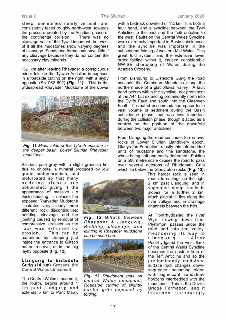
From Llangurig the road continues to run over rocks of Lower Silurian Llandovery epoch, Glanyrafon Formation, mostly thin interbedded units of mudstone and fine sandstone, the whole being soft and easily deformed. Folding on a 500 metre scale causes the road to pass over several outcrops of Rhuddnant Grits which lie below the Glanyrafon rocks (Fig. 13).
This harder rock is seen in roadside cuttings on the right 2 km past Llangurig, and in vegetated steep roadside slopes for a further 2 km. Much glacial till lies along the river valleys and in drainage channels between the hills.
At Pontrhydgaled the river Wye, f lowing down from Plynlimon, passes under the road and into the valley, m e a n d e r i n g i t s w a y t o L l a n g u r i g . A f t e r Pontrhydgaled the west flank of the Central Wales Syncline becomes the eastern limb of the Teifi Anticline and so the predominant ly mudstone surface rock changes down-sequence, becoming older, with significant sandstone horizons interbedded with the mudstone. This is the Devil’s Bridge Formation, and it b e c o m e s i n c r e a s i n g l y
17
Fig. 13 Rhuddnant grits on central Wales l ineament. Roadside cutting of slightly harder gr i ts exposed by folding.
Fig. 11 Minor folds of the Tylwch anticline in the deeper basin. Lower Silurian Rhayader mudstone.
Fig. 12 Gi l fach between R h a y a d e r & L l a n g u r i g . Bedd ing , c l eavage , and jointing in Rhayader mudstone can be seen here.

Issue 6 The Silurian January 2020prevalent as the road approaches its highest point, over 400 metres elevation. Across the top and soon after Eisteddfa Gurig, the rock again goes down-sequence as the Teifi Anticline exposes the lowest Silurian rocks once more roadside: the soft mudstones of the Cwmere Formation. Plynlimon, the highest point of the Cambrian Mountains at 752m, is 3 km north from Eisteddfa Gurig. From here the glaciers flowed off the Cambrians both east and west.
Eisteddfa Gurig to Goginan (17.5 km) Crosses the Teifi Anticline
The Lineament of the Teifi Anticline begins before Dyfryn Castell and extends 8 km by winding road to just after Ponterwyd. Axial faults along the Lineament played only a small part in the subsidence of the Basin but a discontinuity deep in the basement rock probably focused upfolding here during the collision phase, and the anticline exposes the harder, older Ordovician rock running along the Cambrian spine north and south from Plynlimon. After Eisteddfa Gurig the road descends the western flank of the Cambrians, following one of several glacial valleys heading westwards from Plynlimon towards Cardigan Bay. Initially the route lies on soft, often reddish coloured shale of the lowest Silurian, Cwmere Formation, a muddy sediment, deposited on the Basin floor under anoxic conditions, dark with organic matter and now split easily along numerous cleavage planes, seen roadside on the right 1½ km after Eisteddfa Gurig (Fig. 14).
Looking west, the valley floor is the same soft rock. But the overlying rock, seen in the hills is harder. This is Devil’s Bridge Formation, in which the mudstone is interbedded with sandstone (Fig. 15) and it becomes more prevalent as the route emerges from the anticline, and the surrounding rock changes up-sequence again. The near vertical folding of this alternating hard and soft rock causes differential erosion to a distinctive ‘ridge and saddle’ topography. Striking examples are seen ahead just after Ponterwyd (Fig. 16).
Approaching Ponterwyd the roadside low cutting on the r i g h t i s O r d o v i c i a n rock (Brynglas F o r m a t i o n ) e x p o s e d i n the core of the Teifi Anticline (Fig. 17). I t i s f i n e s a n d s t o n e , different to the
previous roadside Silurian mudstone, relatively free from cleavage, and lacking the mica flakes common in the mudstone. This is the first Ordovician rock near the road since that seen to the right of the road at Nantmel, on the Tywi Anticline, the first part of the great fold combination. Like the Nantmel outcrop the fold hinge here is not level but plunges (tilts downwards) to the south, disappearing under the younger Silurian, Devil’s Bridge Formation. From Ponterwyd the road passes out of the Teifi Anticline and hence up-sequence again so that both the road and the hills are Devil’s Bridge Formation. This can be examined at Bwlch Nantyrarian visitor centre, where there is roadside parking. As the road descends immediately after
18
Fig. 14 Teifi lineament, lowest Silurian shale, Cwmere format ion. Leaving Central Wales Syncline and crossing into Teifi Anticline (SN 792829).
Fig. 16 ‘Ridge & saddle skyline on the Teifi ant ic l ine. Emerging from Ponterwyd (SN745805).
Fig. 17 Ordovician rock in the core of the Teifi anticline. Approaching Ponterwyd, the t o p o f O r d o v i a n r o c k (SN757815).
Fig. 15 Valley & hills on the Teifi anticline. Valley of soft shale, hills of overlying Devil’s Bridge Formation (SN788829).

Issue 6 The Silurian January 2020Nantyrarian, the steep roadside cutting to the left displays some fine chevron folds, sharper than folds in the softer Rhayader Mudstones seen roadside on the section north of Rhayader.
Mine workings can be glimpsed from the road just past Dyffryn Castell and across the valley opposite Goginan. Over 200 disused mines exist in a 20 mile square intersected by the A44 as it crosses the Cambrians, including a concentration north and south of the road between Ponterwyd and Capel Bangor (Fig. 18). In the late 19th century over 3000 people worked in these lead mines of central Wales. Mines are located on ENE trending faults, activated during subduction of the Rheic Ocean, releasing trapped reservoirs of mineral-rich superheated brines. The formation of the Welsh Basin with its variety of lithologies, and deep burial of marine pore water saturated sediments, played an important part in creating the orefield.
Goginan to Aberystwyth (12 km) Crosses the Bronnant-Glandyfi Lineament
The Bronnant-Glandyfi Fault Lineament (Fig. 19) produced 2½ miles of downthrow on the west, creating a persistent channel along which sandstones flowed from the south of the Welsh Basin to Aberystwyth and beyond. Some of the Lower Silurian sediment from from the eastern side of the Basin would have flowed as far as present-day Cardigan Bay, but much thinned by distance. It was then deeply buried by rapid subsidence and heavy sediment flows from the south of the Basin. The Glandyfi Fault crosses the road just before Capel Bangor, with no surface expression because the road lies on alluvium
of the Rheidol valley, but the fault is proven to north and south. A second deep and persistent fault crosses the road just before the Lovesgrove Roundabout. This is the
Bronnant Fault, and a fault trace persists into Pembrokeshire. This narrow band of faults and splays is the Bronnant-Glandyfi Lineament, the sixth and final crossed on the journey.
From Capel Bangor the road completes its descent of the west f lank of the Cambrians and then crosses from the south side of the Melindwr Valley to the north side of the Rheidol Valley to finish the journey to the coast. The road emerges from the Teifi Anticline and the rock passes up-sequence as the Devil’s Bridge strata dips beneath the softer Borth Mudstone, which extends from Capel Bangor to the Lovesgrove Roundabout. A major change in geological structure and sedimentation pattern is crossed between Capel Bangor and Lovesgrove
roundabout
A mid Silurian uplift to the south of the Welsh Basin created a new sediment source, and the half graben formed by continuing subsidence on the Bronnant-Glandyfi Lineament established a channel wall constraining this sediment to flow north towards Aberystwyth, overlying the subsiding Borth Mudstone. This is the familiar Aberystwyth Grits, named in modern nomenclature the Trefechan and Mynydd Bach Formations of the Aberystwyth Grits Group, a medium to coarse-grained sandstone interbedded with mudstone, lying above the Borth Mudstone, and displayed at the north end of the promenade in Aberystwyth (Fig. 20).
19
Fig. 18 Central Wales orefield.
Fig. 19 Cross-section of the Bronnant-Glandyfi lineament. Aberystwyth Grits sourced from the south, younger Silurian sediments from the east.

Issue 6 The Silurian January 2020Close examination of the rock is possible beside the pavement at Castle rock (SN580 814) at the south end of the promenade. Flute casts (turbidite erosion scours) can be found indicating a current flow from south and SW (Fig. 21).
It also shows the difference between the sandstone and mudstone horizons, with cleavage in the mudstones and cross-bedding in the sandstones. The cross-bedding indicates an intermediate turbidite package, between coarser sediment already left behind and finer sediment which surged on towards Borth (Fig. 22). The Aberystwyth Grits Group is exposed on the coast nearly all the way south to Llangranog.
A Postscript about more recent eras
Since the mid Devonian the faults on these lineaments have been largely inactive. From the early Devonian to the early Jurassic period Mid Wales was emergent until, 200 million years ago, the ancient Caledonian mountains had been eroded back to sea level. With global sea-level then rising, Mid Wales became a shallow marine environment. West of Aberystwyth in Cardigan Bay some Jurassic rock remains but on land those deposits have since been eroded. Throughout the Cretaceous, although global sea-level was high, the Welsh Massif, including Mid Wales, probably remained emergent, one of few places in Western Europe which did so, slowly eroding back to low lying land. It was once thought that chalk covered most of Wales but on land there is no evidence of chalk, or even of the flint which accompanied the chalk. Practically all the present elevation of Mid Wales above sea-level dates from early in the Tertiary era. In two separate episodes between 60 to 50 Ma, Wales was uplifted again, probably by a mantle plume of hot magma (the Paleogene ‘hotspot’) centred to the north-west of Britain, producing a thermal uplift of 2 km at the centre and over 2000 km across. The hotspot was associated with the opening of the North Atlantic and it tilted much of Britain. The story since then has been of erosion, and especially of Ice Age scouring.
Extensive use has been made in this article of BGS maps and memoirs.
Colin Humphrey
20
Fig. 22 Bedding & cleavage at Castle Rock, Aberystwyth. Gently dipping sandstone interbedded with finely cleaved mudstone.
Fig. 21 Flute casts at Castle Rock - south end of the promenade. Elongated erosion scours on the underside of sandstone units.
Fig. 20 Aberystwyth grits seen from the promenade north end.