Embed Size (px)
Citation preview

introduction to the San Juan iSlandS
Scenic Byway 1
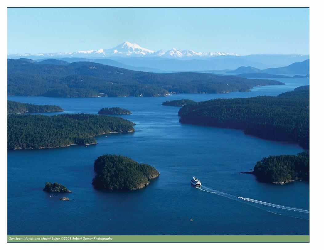
San Juan Islands and Mount Baker ©2008 Robert Demar Photography

corridor ManageMent Plan 1-1
i ntroduct ion to the San Juan i S landS Scen ic Byway
Voyage across the Salish Sea…to the San Juan Islands, a world-class destination and place like no other, known for majestic beauty, precious natural resources, and abundant recreation and wildlife watching opportunities. Accessible only by ferry, boat, or plane, the passage across the Salish Sea is part of the extraordinary experience of these islands. But the true experience of the San Juan Islands goes beyond these qualities to the unique cultural characteristics that have shaped life in the islands for generations and continue to shape it to this day.
Visitors to the San Juan Islands Scenic Byway can learn about many interesting historic events and past ways of life,
from the Coast Salish tribes who have always known these islands and waters as their homelands, to the “Pig War” era encampments of the United States and Great Britain (now cornerstone sites of San Juan Island National Historical Park), to later pioneer settlements. Today, visitors also can experience present-day lifestyles of the islands, including close-knit communities, bustling farms and ranches, picturesque villages and hamlets, barns and bungalows, marinas and ports, and artists’ studios and galleries.
Creating this plan to recognize and honor these unique qualities will enhance the experience of the San Juan Islands for islanders and visitors, alike. Plan
recommendations call for expanding multi-modal transportation options to enhance community livability, reduce environmental impacts, and improve visitor access. The plan also provides strategies to guide islanders and visitors in how to be good stewards, so the natural and cultural resources of the San Juans can be preserved for future generations.
When the vision for the San Juan Islands Scenic Byway is fully realized, people will experience the byway as a series of living landscapes and waterways. Opportunities for telling the many interesting stories of the byway will be realized through interpretation, education, promotion, and hands-on stewardship activities.
i ntroduct ion to the San Juan i S landS Scen ic Byway
San Juan iSlandS Scenic Byway1-2
Telling Our StoriesThrough various projects and programs, visitors will become inspired as they learn and understand how islanders:
• Live in this unique environment with a strong commitment to sustainability and stewardship.
• Protect natural resources such as endangered wildlife, marine life, and unique habitats.
• Preserve and restore cultural landscapes and historic buildings and sites.
• Grow, produce, and market local foods and products.
• Conserve energy and water.
• Promote and enhance visitors’ experiences in the islands by offering abundant recreation opportunities.
• Create and display diverse works of art and architecture throughout the islands.
• Protect scenic areas and viewsheds for future generations to enjoy.
Visitors will gain memorable and authentic experiences and an understanding of what life is like in the San Juan Islands and Pacific Northwest. Visitors will be able to take stewardship lessons forward to their own communities. Through the actions proposed in the corridor management plan, the true experience of the San Juan Islands will be enhanced and preserved for everyone—visitors and residents—and the unique quality of life in the islands will remain.
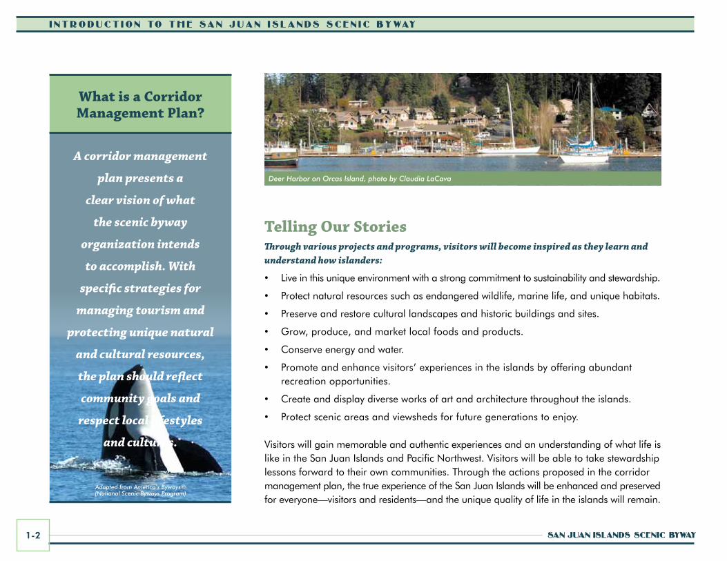
What is a Corridor Management Plan?
A corridor management
plan presents a
clear vision of what
the scenic byway
organization intends
to accomplish. With
specific strategies for
managing tourism and
protecting unique natural
and cultural resources,
the plan should reflect
community goals and
respect local lifestyles
and cultures.
Deer Harbor on Orcas Island, photo by Claudia LaCava
Adapted from America’s Byways®(National Scenic Byways Program)
corridor ManageMent Plan 1-3
i ntroduct ion to the San Juan i S landS Scen ic Byway
A scenic byway is a travelway and the
associated destinations along it that are
distinctive and recognized for their unique
scenic, natural, archaeological, historical,
cultural, and recreational qualities. A
byway evokes a sense of place and beckons
travelers to discover its hidden gems. A byway
engages visitors through interpretation and
education, while at the same time preserving
and enhancing the unique qualities that draw
these visitors. Byways may lead to spectacular
places, or they may be very scenic and pleasant
local routes. A scenic byway is typically a
corridor that has unique character and may be
designated at the state or federal level, or both.
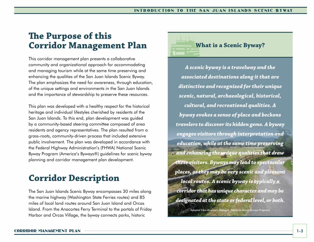
The Purpose of this Corridor Management PlanThis corridor management plan presents a collaborative community and organizational approach for accommodating and managing tourism while at the same time preserving and enhancing the qualities of the San Juan Islands Scenic Byway. The plan emphasizes the need for awareness, through education, of the unique settings and environments in the San Juan Islands and the importance of stewardship to preserve these resources.
This plan was developed with a healthy respect for the historical heritage and individual lifestyles cherished by residents of the San Juan Islands. To this end, plan development was guided by a community-based steering committee composed of area residents and agency representatives. The plan resulted from a grass-roots, community-driven process that included extensive public involvement. The plan was developed in accordance with the Federal Highway Administration’s (FHWA) National Scenic Byway Program (America’s Byways®) guidelines for scenic byway planning and corridor management plan development.
Corridor DescriptionThe San Juan Islands Scenic Byway encompasses 30 miles along the marine highway (Washington State Ferries routes) and 85 miles of local land routes around San Juan Island and Orcas Island. From the Anacortes Ferry Terminal to the portals of Friday Harbor and Orcas Village, the byway connects parks, historic
What is a Scenic Byway?
Adapted from America’s Byways® (National Scenic Byways Program)

0 2.25 9 13.5 184.5Miles
Vancouver
Bellingham
Everett
Seattle
Olympia
Tacoma
Bellevue
Victoria
Sidney
Bellingham
Anacortes
Everett
Seattle
Olympia
Tacoma
Bellevue
Victoria
Sidney
Vancouver
W A S H I N G T O N
C A N A D A
V A N C O U V E RI S L A N D
Anacortes
Burlington
Sea-Tac Int’l Airport
Burlington
Sea-Tac Int’l Airport
Mount VernonMount Vernon
Strait of Georgia
Salish Sea
PugetSound
Strait of Juan de Fuca
MOUNTAINSTO SOUND
GREENWAY
PACIFIC COASTSCENIC BYWAY
CHINOOK PASSSCENIC BYWAY
CASCADE LOOP/NORTH CASCADESSCENIC HIGHWAY
STRAIT OFJUAN DE FUCASCENIC BYWAY
HIDDEN COASTSCENIC BYWAY
CHUCKANUTDRIVE
CASCADE LOOP/STEVENS PASS
GREENWAY
MT. BAKERSCENIC BYWAY
CAPEFLATTERY
TRIBAL SCENICBYWAY
87
3
9
99
9
9
99
99
99
18
18
16
16
512
509
167
167 169
104
101
101
101
101
101
2
97
2
5
5
5
5
405
5
705
90
90
90
520
202
522
522
527
523
524
410
12
520
53620
20
20
MOUNTAINSTO SOUND
GREENWAY
PACIFIC COASTSCENIC BYWAY
CASCADE LOOP/STEVENS PASS
GREENWAY
STRAIT OFJUAN DE FUCASCENIC BYWAY
CAPEFLATTERY
TRIBAL SCENICBYWAY
HIDDEN COASTSCENIC BYWAY
CHINOOK PASSSCENIC BYWAY
MT. BAKERSCENIC BYWAY
CHUCKANUTDRIVE CASCADE LOOP/
NORTH CASCADESSCENIC HIGHWAY
SCENIC BYWAY
SAN JUANISLANDS
WHIDBEYSCENIC
ISLE WAY
WHIDBEYSCENIC
ISLE WAY
Figure 1.1 regiOnal COnTexT MaP
corridor ManageMent Plan 1-5
i ntroduct ion to the San Juan i S landS Scen ic Byway
sites, and other attractions, as well as various small communities. The ferry terminals at Lopez and Shaw islands also serve as portals to the byway, but the land portions of the route only extend onto San Juan and Orcas islands. The ferry terminal at Sidney on Vancouver Island, British Columbia, is also a portal to the byway for international travelers.
Through various land and water transportation options, diverse experiences await visitors, including sweeping vistas of water and sunsets, picturesque valleys, tree-lined country roads, farms and barns, artist enclaves, and charming villages and hamlets. The roadway system itself is as much a part of life in the islands as the historic communities it connects. For the purpose of the corridor management plan, the corridor includes areas visible from the byway routes, as well as recreational sites and destinations either directly accessible from the corridor or located within approximately two miles from the byway routes–in essence, nearly all publicly accessible areas of San Juan and Orcas islands. Refer to Figure 1.1 Regional Context Map and Figure 1.2 Scenic Byway Map.
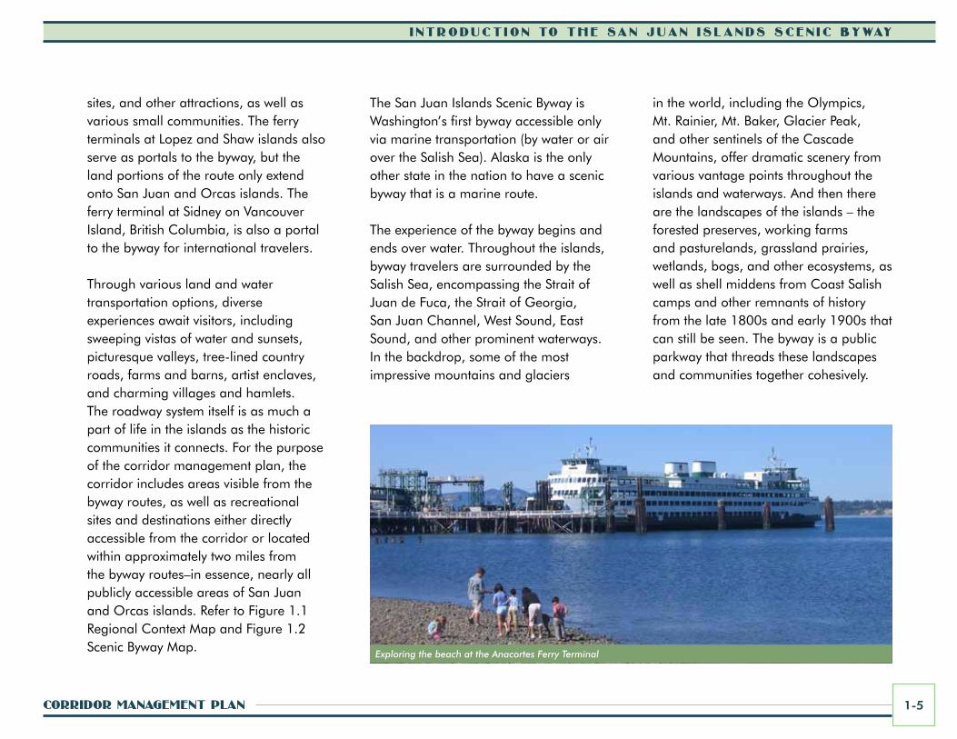
The San Juan Islands Scenic Byway is Washington’s first byway accessible only via marine transportation (by water or air over the Salish Sea). Alaska is the only other state in the nation to have a scenic byway that is a marine route.
The experience of the byway begins and ends over water. Throughout the islands, byway travelers are surrounded by the Salish Sea, encompassing the Strait of Juan de Fuca, the Strait of Georgia, San Juan Channel, West Sound, East Sound, and other prominent waterways. In the backdrop, some of the most impressive mountains and glaciers
Exploring the beach at the Anacortes Ferry Terminal
in the world, including the Olympics, Mt. Rainier, Mt. Baker, Glacier Peak, and other sentinels of the Cascade Mountains, offer dramatic scenery from various vantage points throughout the islands and waterways. And then there are the landscapes of the islands – the forested preserves, working farms and pasturelands, grassland prairies, wetlands, bogs, and other ecosystems, as well as shell middens from Coast Salish camps and other remnants of history from the late 1800s and early 1900s that can still be seen. The byway is a public parkway that threads these landscapes and communities together cohesively.

CANADA
UNITED STATES
CANADA
UNITED STATES
San JuanChannel
PresidentChannel
LummiBay
EastSound
WestSound
Gri�nBay
DoeBay
CowlitzBay
EchoBay
BurrowsBay
LopezSound
MudBay
LangleyBay
DeepwaterBay
SwiftsBay
ShoalBay
CascadeBay
FishingBay
MassacreBay
ShipBay
NorthBay
Wescott Bay
DavisBay
NorthBay
FalseBay
DeerHarbor
RocheHarbor
OpenBay
MackayeHarbor
ChannelHarney
S a l i s h S e a H
aro
St r a
i t
Haro Strait
Strait of Juan de Fuca
Salish Sea
ShawIsland
DecaturIsland
HenryIsland
BlakelyIsland
CypressIsland
LummiIsland
FidalgoIsland
WaldronIsland
SinclairIsland
Spieden Island
Stuart Island
ClarkIsland
SAN JUANISLAND
ORCASISLAND
LopezIslandVancouver
Island
JamesIsland
MoresbyIsland
SidneyIsland
ANACORTESFERRY
PORTAL
SIDNEYFERRYPORTAL
0 0.8 1.6 2.4 3.20.4Miles
Figure 1.2 SCeniC ByWay MaP
For Key Destinations and Special Places along the Byway, refer to the maps at the end of Section 4.
legenDByway Land Routes (Main Routes)Byway Marine RoutesFerry Route from Sidney B.C.Public Lands
corridor ManageMent Plan 1-7
i ntroduct ion to the San Juan i S landS Scen ic Byway
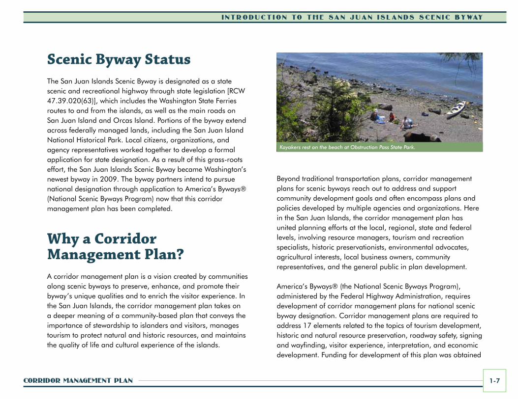
Scenic Byway StatusThe San Juan Islands Scenic Byway is designated as a state scenic and recreational highway through state legislation [RCW 47.39.020(63)], which includes the Washington State Ferries routes to and from the islands, as well as the main roads on San Juan Island and Orcas Island. Portions of the byway extend across federally managed lands, including the San Juan Island National Historical Park. Local citizens, organizations, and agency representatives worked together to develop a formal application for state designation. As a result of this grass-roots effort, the San Juan Islands Scenic Byway became Washington’s newest byway in 2009. The byway partners intend to pursue national designation through application to America’s Byways® (National Scenic Byways Program) now that this corridor management plan has been completed.
Why a Corridor Management Plan?A corridor management plan is a vision created by communities along scenic byways to preserve, enhance, and promote their byway’s unique qualities and to enrich the visitor experience. In the San Juan Islands, the corridor management plan takes on a deeper meaning of a community-based plan that conveys the importance of stewardship to islanders and visitors, manages tourism to protect natural and historic resources, and maintains the quality of life and cultural experience of the islands.
Beyond traditional transportation plans, corridor management plans for scenic byways reach out to address and support community development goals and often encompass plans and policies developed by multiple agencies and organizations. Here in the San Juan Islands, the corridor management plan has united planning efforts at the local, regional, state and federal levels, involving resource managers, tourism and recreation specialists, historic preservationists, environmental advocates, agricultural interests, local business owners, community representatives, and the general public in plan development.
America’s Byways® (the National Scenic Byways Program), administered by the Federal Highway Administration, requires development of corridor management plans for national scenic byway designation. Corridor management plans are required to address 17 elements related to the topics of tourism development, historic and natural resource preservation, roadway safety, signing and wayfinding, visitor experience, interpretation, and economic development. Funding for development of this plan was obtained
Kayakers rest on the beach at Obstruction Pass State Park.
i ntroduct ion to the San Juan i S landS Scen ic Byway
San Juan iSlandS Scenic Byway1-8
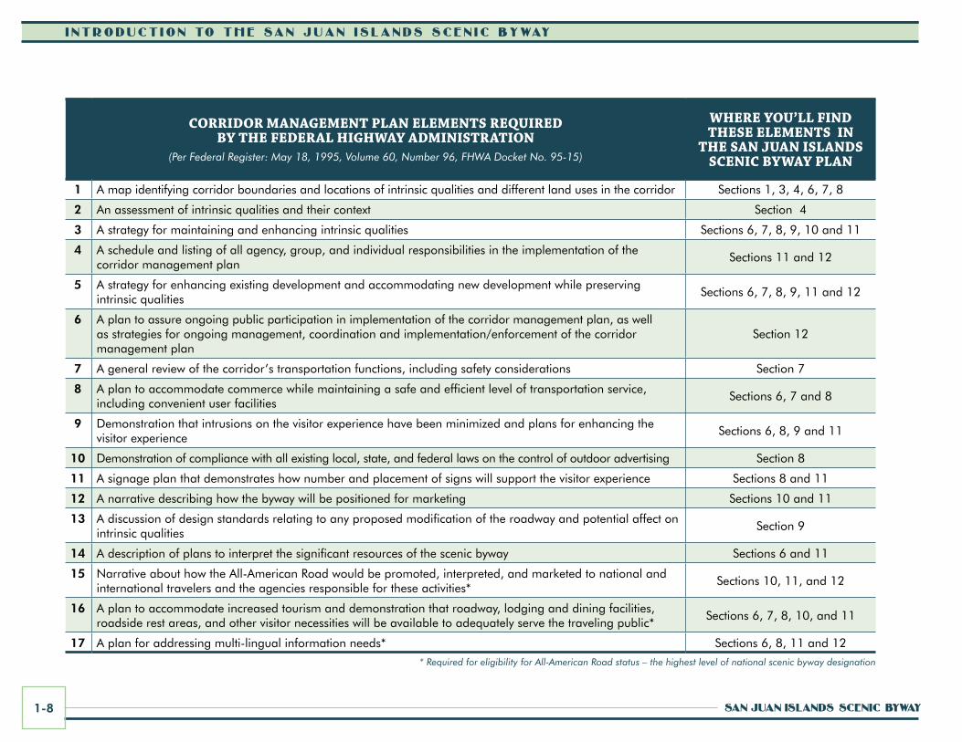
COrriDOr ManageMenT Plan eleMenTS requireD By The FeDeral highWay aDMiniSTraTiOn
(Per Federal Register: May 18, 1995, Volume 60, Number 96, FHWA Docket No. 95-15)
Where yOu’ll FinD TheSe eleMenTS in
The San Juan iSlanDS SCeniC ByWay Plan
1 A map identifying corridor boundaries and locations of intrinsic qualities and different land uses in the corridor Sections 1, 3, 4, 6, 7, 8
2 An assessment of intrinsic qualities and their context Section 4
3 A strategy for maintaining and enhancing intrinsic qualities Sections 6, 7, 8, 9, 10 and 11
4 A schedule and listing of all agency, group, and individual responsibilities in the implementation of the corridor management plan
Sections 11 and 12
5 A strategy for enhancing existing development and accommodating new development while preserving intrinsic qualities
Sections 6, 7, 8, 9, 11 and 12
6 A plan to assure ongoing public participation in implementation of the corridor management plan, as well as strategies for ongoing management, coordination and implementation/enforcement of the corridor management plan
Section 12
7 A general review of the corridor’s transportation functions, including safety considerations Section 7
8 A plan to accommodate commerce while maintaining a safe and efficient level of transportation service, including convenient user facilities
Sections 6, 7 and 8
9 Demonstration that intrusions on the visitor experience have been minimized and plans for enhancing the visitor experience
Sections 6, 8, 9 and 11
10 Demonstration of compliance with all existing local, state, and federal laws on the control of outdoor advertising Section 8
11 A signage plan that demonstrates how number and placement of signs will support the visitor experience Sections 8 and 11
12 A narrative describing how the byway will be positioned for marketing Sections 10 and 11
13 A discussion of design standards relating to any proposed modification of the roadway and potential affect on intrinsic qualities
Section 9
14 A description of plans to interpret the significant resources of the scenic byway Sections 6 and 11
15 Narrative about how the All-American Road would be promoted, interpreted, and marketed to national and international travelers and the agencies responsible for these activities*
Sections 10, 11, and 12
16 A plan to accommodate increased tourism and demonstration that roadway, lodging and dining facilities, roadside rest areas, and other visitor necessities will be available to adequately serve the traveling public*
Sections 6, 7, 8, 10, and 11
17 A plan for addressing multi-lingual information needs* Sections 6, 8, 11 and 12
* Required for eligibility for All-American Road status – the highest level of national scenic byway designation
corridor ManageMent Plan 1-9
i ntroduct ion to the San Juan i S landS Scen ic Byway
from the National Scenic Byways Program and local matching funds and resources. To learn more about the national program and other scenic byways and corridor management planning efforts throughout the country, visit: www.byways.org
Plan elementsThe corridor management plan provides a vision for the future of the San Juan Islands Scenic Byway and includes elements consistent with the Federal Highway Administration’s criteria for scenic byways. The specific elements that must be addressed for a byway to be considered for national designation are shown on page 1-8.
The plan includes the following sections:
1. Introduction to the San Juan Islands Scenic Byway
2. The Vision for the San Juan Islands Scenic Byway
3. Past and Present Conditions along the Scenic Byway
4. Assessment of the Byway’s Intrinsic Qualities
5. Understanding and Accommodating San Juan Island Scenic Byway Visitor Characteristics
6. Enhancing Visitor Experience through Interpretation and Improvements
7. Expanding Multi-modal Transportation Options for Visitors and Residents
8. Helping Visitors Find Their Way: Wayshowing and Signing Program
9. Scenic Byway Design Guidelines
10. Attracting Stewardship-minded Visitors: Marketing and Promotions Program
11. San Juan Islands Scenic Byway Action Plan
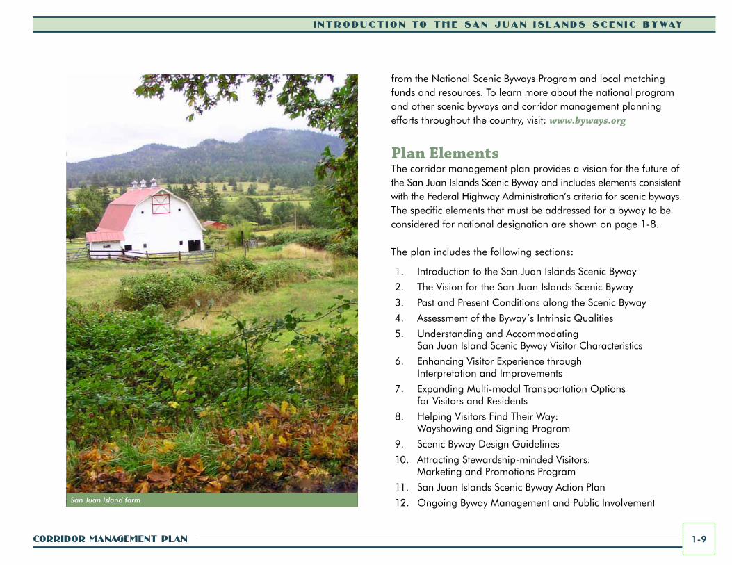
12. Ongoing Byway Management and Public Involvement San Juan Island farm
i ntroduct ion to the San Juan i S landS Scen ic Byway
San Juan iSlandS Scenic Byway1-10
Corridor Management Plan Purpose and usesThe Corridor Management Plan for the San Juan Islands Scenic Byway provides a critical opportunity to build awareness about the importance of community partnerships, environmental stewardship, and preservation of historic settings. The plan is a catalyst for the future, shaping the way residents and visitors relate to the lands and waters of the islands. This corridor management plan provides:
• A comprehensive description of existing conditions and intrinsic qualities – the description and assessment of these elements provide a basis for developing a unifying byway theme and brand and implementing interpretive programs that reflect the San Juan Islands’ rich natural and cultural heritage;
• A vision that draws together people from all communities of the San Juan Islands, helping to make the byway vision a reality;
• A set of goals and objectives that broadly address a diversity of interests throughout the islands – this is a community-based planning document;
• A tool that recommends strategies, projects, programs and actions that improve, enhance, and sustain the byway’s unique intrinsic qualities and the many enjoyable experiences it offers;
• A guide for addressing needs and solving existing problems within the context of the byway;
• A resource for the byway partnership to refer to and draw ideas and information from related to potential funding sources, coordination with stakeholders, public involvement, and project implementation processes and responsibilities; and
• A resource for local organizations and a reference for residents and visitors alike to learn about the San Juan Islands and the importance of stewardship in order to preserve and enhance this unique environment.
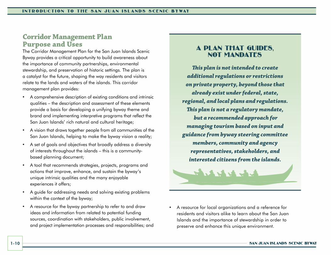
a Plan that guideS, not MandateS
This plan is not intended to create additional regulations or restrictions
on private property, beyond those that already exist under federal, state,
regional, and local plans and regulations. This plan is not a regulatory mandate,
but a recommended approach for managing tourism based on input and
guidance from byway steering committee members, community and agency
representatives, stakeholders, and interested citizens from the islands.

corridor ManageMent Plan 1-11
i ntroduct ion to the San Juan i S landS Scen ic Byway
Lime Kiln Point State Park (a.k.a. Whale Watch Park) is a great place to watch orcas from the shore.
Benefits of Scenic Byway PlanningPlanning for the San Juan Islands Scenic Byway and development and implementation of this corridor management plan will bring many benefits to the region and byway communities, including:
• Strengthened partnerships, cooperation, and communication across the islands by bringing diverse interest groups together;
• Coordinated planning and leveraging of resources across local, regional, state, and federal jurisdictions;
• Enhanced community livability, reduced environmental impacts, and improved visitor access through expanded multi-modal transportation options;
• Increased visitor and citizen awareness and understanding of community goals and stewardship needs and increased involvement in stewardship programs and activities;
• Funding and resources for projects through the National Scenic Byways Program, as well as other public, private, and non-profit grants and programs;
• Support for expanded transportation opportunities for byway travelers;
• Enhanced visitor experiences as a result of projects that engage and inspire through interpretation, recreation, education, and interactions with natural and cultural resource areas;
• A strengthened byway identity, as well as increased tourism promotion and related economic benefits;
• Strategic tourism management in a way that preserves and enhances resources and the quality of life of the islands; and
• Expanding the list of promoted tourism venues to include the full range of cultural tourism opportunities as a broader economic development strategy (i.e. agricultural, culinary, and heritage tourism).
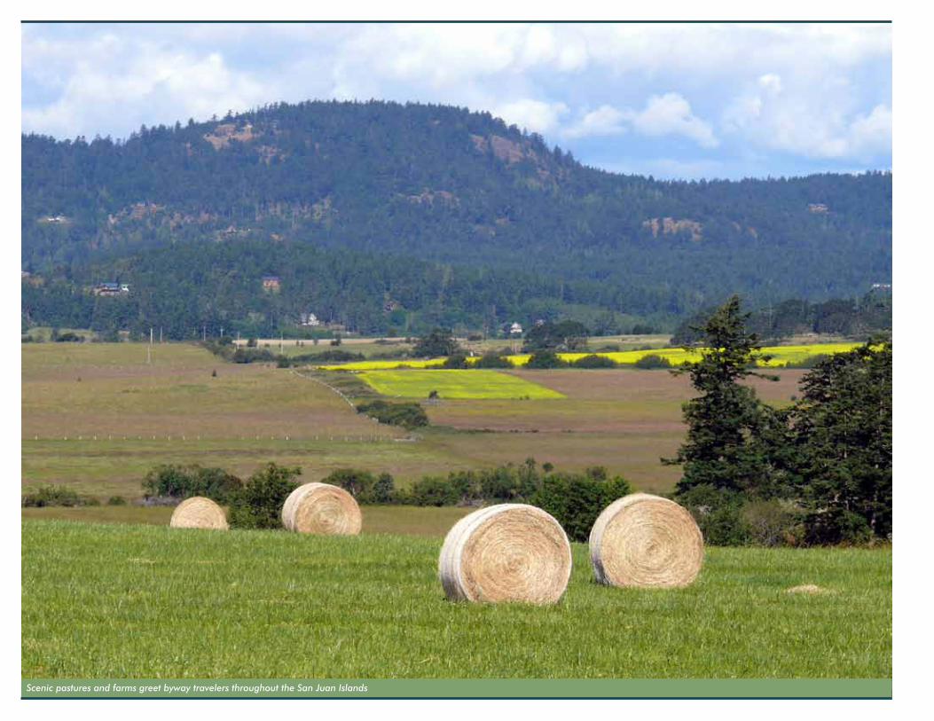
Scenic pastures and farms greet byway travelers throughout the San Juan Islands
corridor ManageMent Plan 1-13
i ntroduct ion to the San Juan i S landS Scen ic Byway
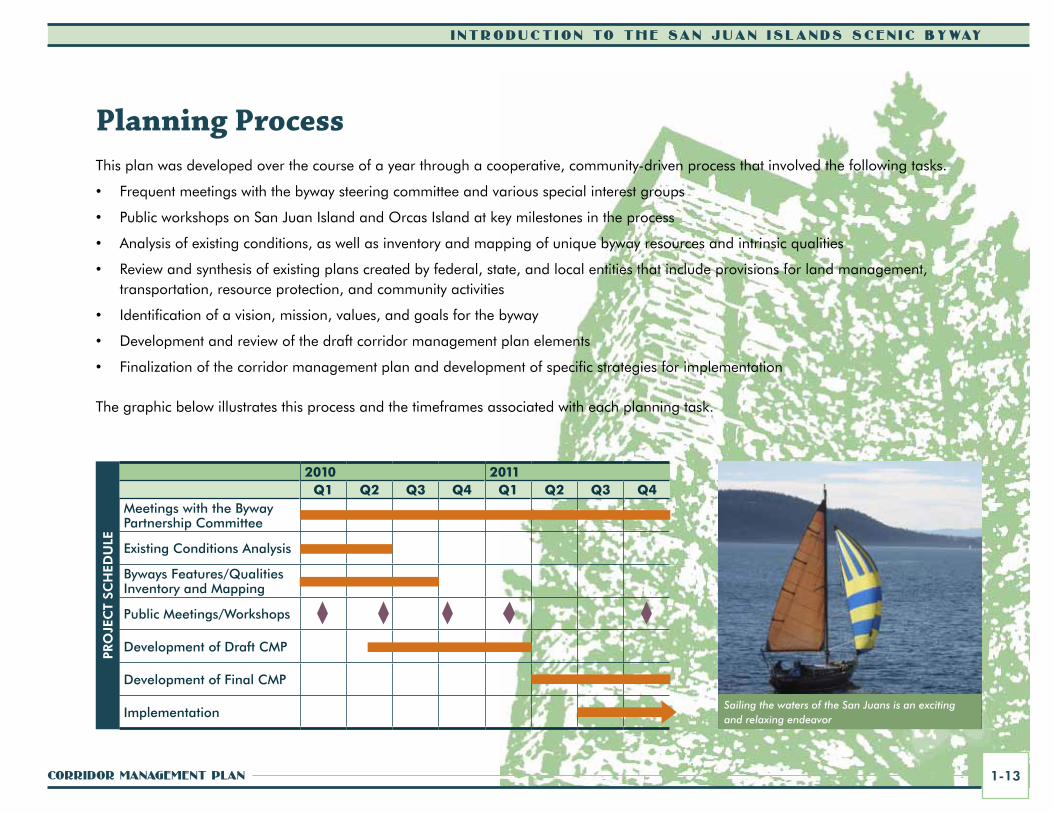
Planning ProcessThis plan was developed over the course of a year through a cooperative, community-driven process that involved the following tasks.
• Frequent meetings with the byway steering committee and various special interest groups
• Public workshops on San Juan Island and Orcas Island at key milestones in the process
• Analysis of existing conditions, as well as inventory and mapping of unique byway resources and intrinsic qualities
• Review and synthesis of existing plans created by federal, state, and local entities that include provisions for land management, transportation, resource protection, and community activities
• Identification of a vision, mission, values, and goals for the byway
• Development and review of the draft corridor management plan elements
• Finalization of the corridor management plan and development of specific strategies for implementation
The graphic below illustrates this process and the timeframes associated with each planning task.
Sailing the waters of the San Juans is an exciting and relaxing endeavor
PRO
JEC
T SC
HED
ULE
2010 2011Q1 Q2 Q3 Q4 Q1 Q2 Q3 Q4
Meetings with the Byway Partnership Committee
Existing Conditions Analysis
Byways Features/Qualities Inventory and Mapping
Public Meetings/Workshops
Development of Draft CMP
Development of Final CMP
Implementation
i ntroduct ion to the San Juan i S landS Scen ic Byway
San Juan iSlandS Scenic Byway1-14
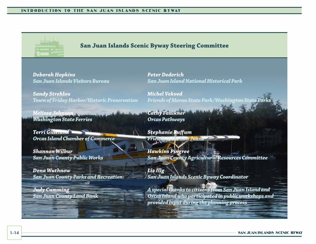
San Juan islands Scenic Byway Steering Committee
Peter DederichSan Juan Island National Historical Park
Michel VekvedFriends of Moran State Park/Washington State Parks
Cathy FaulknerOrcas Pathways
Stephanie BuffumFriends of the San Juans
Hawkins PingreeSan Juan County Agricultural Resources Committee
Liz IllgSan Juan Islands Scenic Byway Coordinator
A special thanks to citizens from San Juan Island and Orcas Island who participated in public workshops and provided input during the planning process
Deborah HopkinsSan Juan Islands Visitors Bureau
Sandy StrehlouTown of Friday Harbor/Historic Preservation
Melissa JohnsonWashington State Ferries
Terri GillelandOrcas Island Chamber of Commerce
Shannon WilburSan Juan County Public Works
Dona WuthnowSan Juan County Parks and Recreation
Judy CummingSan Juan County Land Bank

corridor ManageMent Plan 1-15
i ntroduct ion to the San Juan i S landS Scen ic Byway
involving Byway Communities, Stakeholders, and the Public in Plan DevelopmentInvolvement of byway communities, key stakeholders, and the public was critical to the development of this community-based corridor management plan. The various approaches used to engage and involve communities, stakeholders, and the public in the planning process are summarized below.
The Byway Partnership CommitteeThe San Juan Islands Scenic Byway Partnership Committee is made up of local citizens, agency representatives, and technical experts, who worked closely with the consultant team to prepare this plan in accordance with the Federal Highway Administration guidelines. The byway partnership committee met regularly to work on development of the plan and engage communities and the public in the planning process. The first step for the partnership committee was the creation of a vision, mission, values, and goals for the byway. Next, the committee compiled an inventory of sites that were representative of the six intrinsic qualities that characterize the byway: scenic, natural, archaeological, historic, cultural, and recreational. Concurrently to the intrinsic quality inventory and assessment, existing conditions along the corridor were analyzed. The committee then helped to develop the elements of the corridor management plan by contributing their ideas, thoughts, and suggestions for design guidelines, multi-modal transportation improvements, visitor experiences, interpretive programs, marketing and promotions, and signing and wayfinding. Once the ideas and strategies for each plan element were established,
the committee began developing an action plan of specific byway projects and programs to be implemented. Various stakeholder and community meetings and workshops were held during the planning process, and the byway steering committee members helped to organize and host these events to facilitate discussions.
Community and Public involvement activitiesA diversity of community and public involvement activities helped to engage people in development of the plan as highlighted below.
Byway Newsletters and QuestionnairesThe scenic byway coordinator distributed monthly electronic newsletter updates to byway interests throughout the planning process. Periodically these included links to questionnaires to gain information from the public to help guide plan development. Input. Comments received back through responses to the questionnaires and through email to the byway coordinator were referenced in development of the plan.
Project Information SheetA project information sheet was developed and distributed during the planning process. A copy is included in the Appendix to this plan.
WebsiteThe San Juan Islands Visitors Bureau website provides a specific area devoted to the scenic byway. Information about the byway, special announcements, and links were included and updated periodically. The website is planned to be an ongoing tool for building awareness about the byway and engaging the public. This website can be accessed via: www.visitsanjuans.com/scenicbyway
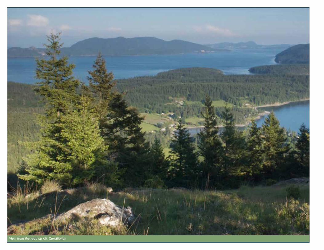
View from the road up Mt. Constitution
corridor ManageMent Plan 1-17
i ntroduct ion to the San Juan i S landS Scen ic Byway
A Call for InspirationA call for inspiration was sent out through email to groups and local newspapers and newsletters. The call requested the public to submit images, ideas, poetry, sketches, photos, descriptive words, quotes, or other elements representing the true essence of the San Juan Islands. The submittals were used as inspiration in the design of a logo and branding package for the scenic byway. The images and ideas also helped guide the development of byway themes. Many of these images and ideas are reprinted throughout this corridor management plan.
Public and Special Interest Group Workshops and MeetingsWorkshops and meetings with the public and special interest groups were held at key milestones in the planning process. For example, a public workshop series took place on San Juan and Orcas islands during the week of February 1, 2010 to introduce the process of developing the corridor management plan and gain input and insights from participants. Meetings were held in Friday Harbor on San Juan Island and Eastsound on Orcas Island. The purpose of the interactive workshop process was to:
• Build awareness of the corridor planning effort and clarify the purpose of the project;
• Confirm general goals and objectives for the planning process, as well as for the corridor;
• Report on the findings of the existing conditions analysis and intrinsic qualities inventory and gain additional input from the general public;
• Inform the public on the development of strategies to enhance and preserve the corridor’s intrinsic qualities, residents’ quality of life, and visitors’ experiences; and
• Engage the public in the planning process and build support for the project as a whole.
Various other community and special interest group meetings were held throughout the planning process including meetings with representatives from Deer Harbor, Orcas Village, Olga and east Orcas Island interests, Town of Friday Harbor, Washington State Ferries, Coast Salish tribes, and others. Each group was able to discuss their particular goals, concerns, and interests related to the byway.
Traveling Displays and ExhibitsDisplays and exhibits were developed for special events and festivals to provide information about the scenic byway and the planning process. For example, boards showing the corridor map were displayed at the county fair on San Juan Island in August 2010. People were given iconic stickers to place on the maps to designate special places and favorite activities along the byway, such as scenic viewpoints, picnicking areas, trails, bicycling routes, wildlife viewing, local farms, services, restrooms, and water access sites.
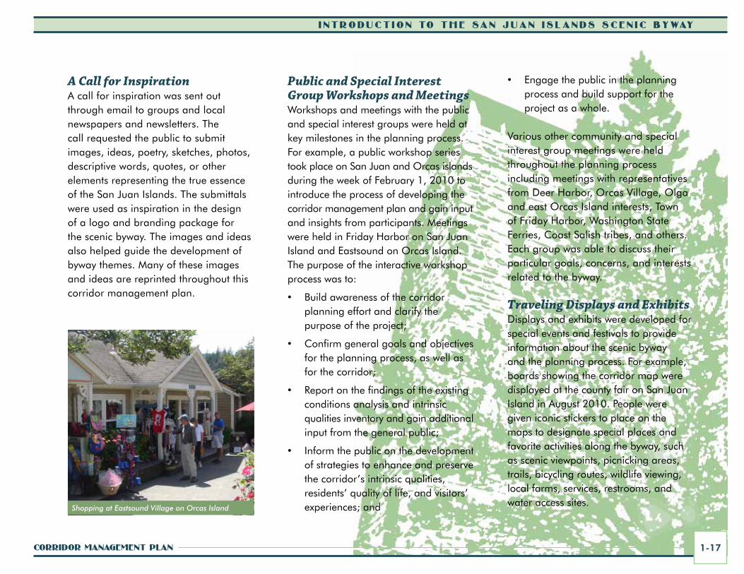
Shopping at Eastsound Village on Orcas Island
i ntroduct ion to the San Juan i S landS Scen ic Byway
San Juan iSlandS Scenic Byway1-18
Completing this Plan is Only the BeginningCompleting the corridor management plan for the San Juan Islands Scenic Byway is the first step toward ongoing management of the byway. This process will evolve over time, but it will be critical for the scenic byway partnership to stay engaged in implementing this plan and carrying the mission, vision, values, goals, and recommended programs and projects forward. Refer to Section 12 for guidance and recommendations for the scenic byway partnership in ongoing planning, management, and implementation efforts.
a Typical Visit to the San Juan islands Scenic BywayThe San Juan Islands Scenic Byway is divided into three distinct segments: the Salish Sea marine highway route between Anacortes and the San Juan Islands, often traveled by way of a Washington State ferry but also by private boat or by air; the land routes on San Juan Island; and the land routes on Orcas Island. Each of these unique segments are further described below.
Travelers in the summer are encouraged to visit the San Juan Islands without their cars and travel around the islands via a number of different modes such as by shuttle, bicycle, walking, and various types of rental vehicles.
Be sure to look for signs that welcome visitors to working studios and farms as you travel the byway.
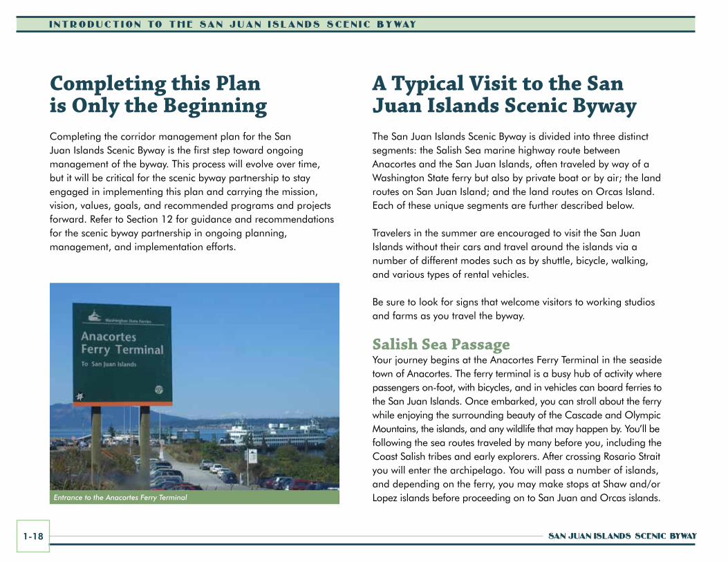
Salish Sea PassageYour journey begins at the Anacortes Ferry Terminal in the seaside town of Anacortes. The ferry terminal is a busy hub of activity where passengers on-foot, with bicycles, and in vehicles can board ferries to the San Juan Islands. Once embarked, you can stroll about the ferry while enjoying the surrounding beauty of the Cascade and Olympic Mountains, the islands, and any wildlife that may happen by. You’ll be following the sea routes traveled by many before you, including the Coast Salish tribes and early explorers. After crossing Rosario Strait you will enter the archipelago. You will pass a number of islands, and depending on the ferry, you may make stops at Shaw and/or Lopez islands before proceeding on to San Juan and Orcas islands.Entrance to the Anacortes Ferry Terminal

corridor ManageMent Plan 1-19
i ntroduct ion to the San Juan i S landS Scen ic Byway
Inside the Whale Museum on San Juan Island
San Juan islandYou'll disembark the ferry at the Town of Friday Harbor, a walkable, historic seaport, and the only incorporated town in the San Juan Islands. Friday Harbor offers water-view restaurants, boutiques, bookstores, galleries, and museums.
Enjoy the waterfront walk down to the Port of Friday Harbor, appreciating the Coast Salish "Portals of Welcome" artwork and the many visiting yachts and boats from around the world. Whale watch excursions and sea kayak tours depart from the port seasonally. Island shuttle bus tours depart from next to the ferry lanes seasonally.
Explore Friday Harbor’s historic district, one of the few coastal villages in Washington to have escaped the devastating fires that destroyed early territorial buildings in Seattle and elsewhere. A significant number of Friday Harbor’s downtown businesses operate out of turn-of-the-century wood-frame buildings—residents and visitors alike dine, shop, sleep, and work in them every day.
Friday Harbor was chosen as one of the 2008 Dozen Distinctive Destinations by the National Trust for Historic Preservation, and the town celebrated its Centennial in 2009. Tour the district on foot; see a movie in the 1915 movie house; visit Memorial Park, the state’s first memorial to the Americans who died in WWI; lodge in the town’s historic hotels (including the Bird Rock Hotel, one of Friday Harbor’s oldest); and eat lunch in some of the oldest commercial buildings in Friday Harbor along the waterfront. The historic building where Blue Water Bar and Grill is located was once home to the regionally famous Saloon Best and Newport Pool Hall.
The historic Brickworks building along Sunshine Alley is in the process of being renovated and eventually will house the
Farmers’ Market, community uses, public spaces, areas for agricultural, arts and crafts demonstrations, and potentially scenic byway visitor information displays.
Stroll or drive up historic Spring Street and take a right on First Street to reach The Whale Museum (62 First St. N.), which has promoted stewardship of whales and the Salish Sea ecosystem for over 30 years through research and education. Children and adults will enjoy the museum's interactive educational displays and gift shop. This is a great stop before going out to see the orcas. Whale watchers can look for orcas from west side public shoreline areas such as at Lime Kiln Point State Park, or they can take a whale watch excursion available from several commercial operators. (Peak season for whale watching is from May to September.) Port of Friday Harbor Marina
i ntroduct ion to the San Juan i S landS Scen ic Byway
San Juan iSlandS Scenic Byway1-20
San Juan Historical Museum Vineyards on San Juan Island
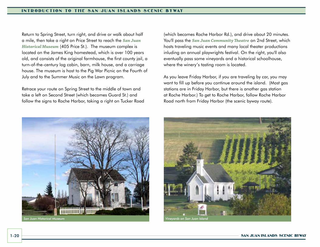
Return to Spring Street, turn right, and drive or walk about half a mile, then take a right on Price Street to reach the San Juan Historical Museum (405 Price St.). The museum complex is located on the James King homestead, which is over 100 years old, and consists of the original farmhouse, the first county jail, a turn-of-the-century log cabin, barn, milk house, and a carriage house. The museum is host to the Pig War Picnic on the Fourth of July and to the Summer Music on the Lawn program.
Retrace your route on Spring Street to the middle of town and take a left on Second Street (which becomes Guard St.) and follow the signs to Roche Harbor, taking a right on Tucker Road
(which becomes Roche Harbor Rd.), and drive about 20 minutes. You'll pass the San Juan Community Theatre on 2nd Street, which hosts traveling music events and many local theater productions inluding an annual playwrights festival. On the right, you'll also eventually pass some vineyards and a historical schoolhouse, where the winery’s tasting room is located.
As you leave Friday Harbor, if you are traveling by car, you may want to fill up before you continue around the island. (Most gas stations are in Friday Harbor, but there is another gas station at Roche Harbor.) To get to Roche Harbor, follow Roche Harbor Road north from Friday Harbor (the scenic byway route).
corridor ManageMent Plan 1-21
i ntroduct ion to the San Juan i S landS Scen ic Byway
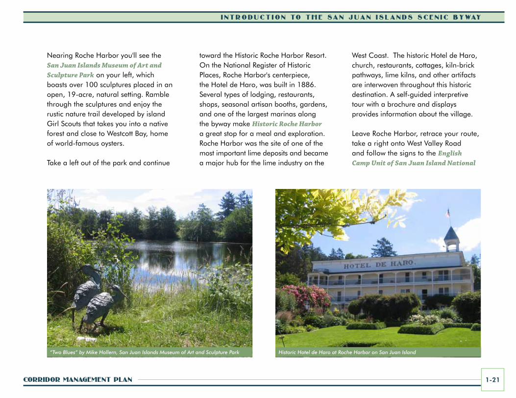
Nearing Roche Harbor you'll see the San Juan Islands Museum of Art and Sculpture Park on your left, which boasts over 100 sculptures placed in an open, 19-acre, natural setting. Ramble through the sculptures and enjoy the rustic nature trail developed by island Girl Scouts that takes you into a native forest and close to Westcott Bay, home of world-famous oysters.
Take a left out of the park and continue
toward the Historic Roche Harbor Resort. On the National Register of Historic Places, Roche Harbor's centerpiece, the Hotel de Haro, was built in 1886. Several types of lodging, restaurants, shops, seasonal artisan booths, gardens, and one of the largest marinas along the byway make Historic Roche Harbor a great stop for a meal and exploration. Roche Harbor was the site of one of the most important lime deposits and became a major hub for the lime industry on the
West Coast. The historic Hotel de Haro, church, restaurants, cottages, kiln-brick pathways, lime kilns, and other artifacts are interwoven throughout this historic destination. A self-guided interpretive tour with a brochure and displays provides information about the village.
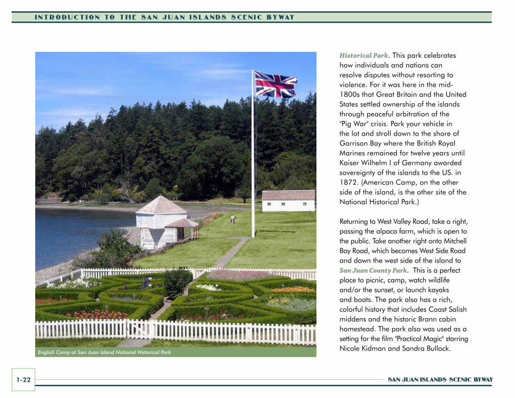
Leave Roche Harbor, retrace your route, take a right onto West Valley Road and follow the signs to the English Camp Unit of San Juan Island National
“Two Blues” by Mike Hollern, San Juan Islands Museum of Art and Sculpture Park Historic Hotel de Haro at Roche Harbor on San Juan Island
i ntroduct ion to the San Juan i S landS Scen ic Byway
San Juan iSlandS Scenic Byway1-22
Historical Park. This park celebrates how individuals and nations can resolve disputes without resorting to violence. For it was here in the mid-1800s that Great Britain and the United States settled ownership of the islands through peaceful arbitration of the "Pig War" crisis. Park your vehicle in the lot and stroll down to the shore of Garrison Bay where the British Royal Marines remained for twelve years until Kaiser Wilhelm I of Germany awarded sovereignty of the islands to the US. in 1872. (American Camp, on the other side of the island, is the other site of the National Historical Park.)
Returning to West Valley Road, take a right, passing the alpaca farm, which is open to the public. Take another right onto Mitchell Bay Road, which becomes West Side Road and down the west side of the island to San Juan County Park. This is a perfect place to picnic, camp, watch wildlife and/or the sunset, or launch kayaks and boats. The park also has a rich, colorful history that includes Coast Salish middens and the historic Brann cabin homestead. The park also was used as a setting for the film "Practical Magic" starring Nicole Kidman and Sandra Bullock.
English Camp at San Juan Island National Historical Park
corridor ManageMent Plan 1-23
i ntroduct ion to the San Juan i S landS Scen ic Byway
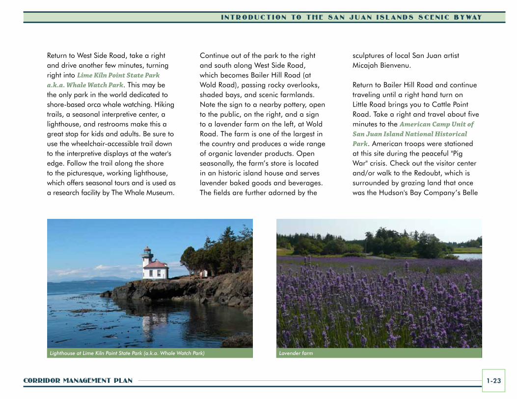
Return to West Side Road, take a right and drive another few minutes, turning right into Lime Kiln Point State Park a.k.a. Whale Watch Park. This may be the only park in the world dedicated to shore-based orca whale watching. Hiking trails, a seasonal interpretive center, a lighthouse, and restrooms make this a great stop for kids and adults. Be sure to use the wheelchair-accessible trail down to the interpretive displays at the water's edge. Follow the trail along the shore to the picturesque, working lighthouse, which offers seasonal tours and is used as a research facility by The Whale Museum.
Continue out of the park to the right and south along West Side Road, which becomes Bailer Hill Road (at Wold Road), passing rocky overlooks, shaded bays, and scenic farmlands. Note the sign to a nearby pottery, open to the public, on the right, and a sign to a lavender farm on the left, at Wold Road. The farm is one of the largest in the country and produces a wide range of organic lavender products. Open seasonally, the farm’s store is located in an historic island house and serves lavender baked goods and beverages. The fields are further adorned by the
Lighthouse at Lime Kiln Point State Park (a.k.a. Whale Watch Park)
sculptures of local San Juan artist Micajah Bienvenu.
Return to Bailer Hill Road and continue traveling until a right hand turn on Little Road brings you to Cattle Point Road. Take a right and travel about five minutes to the American Camp Unit of San Juan Island National Historical Park. American troops were stationed at this site during the peaceful "Pig War" crisis. Check out the visitor center and/or walk to the Redoubt, which is surrounded by grazing land that once was the Hudson's Bay Company’s Belle
Lavender farm
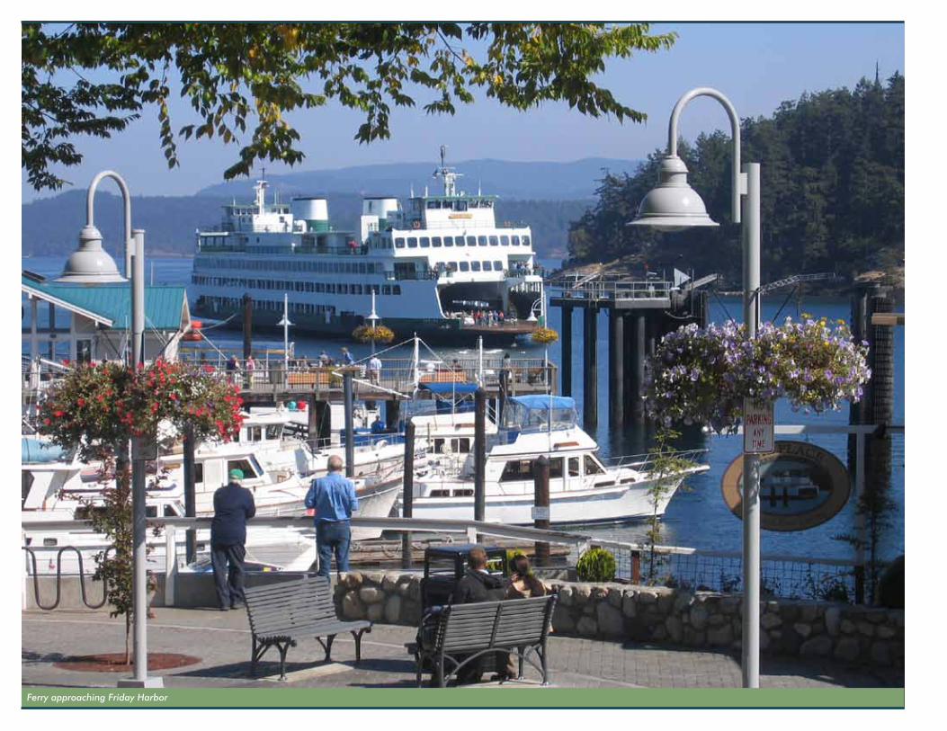
Ferry approaching Friday Harbor
corridor ManageMent Plan 1-25
i ntroduct ion to the San Juan i S landS Scen ic Byway
Vue Sheep Farm. This was also the site of the American encampment during the joint occupation of the island. Check out the three historic buildings from the camp. Watch for raptors that fly close by, as well as marine wildlife in the distance, and look for native prairie wildflowers in the spring.
Return to Cattle Point Road, take a right, (perhaps explore beautiful South Beach and/or Jakle's Lagoon/Mt. Finlayson hiking trails), then drive southeast to the Cattle Point Interpretive Area, just past the Cattle Point Lighthouse. Watch for deer, eagles, and marine mammals such as seals and sea lions from the picnic area shelter and beach below.
As you tour the island, look for remnants of the natural “Oak Prairie” landscape. Garry oaks (Quercus garryana) occur from Northern California to the southern tip of Vancouver Island, with the oaks in the San Juan Islands falling at the northern limit of the species’ range. The Oak Prairie landscape includes rare species of plants and wildflowers such as California buttercup and golden paintbrush, among others.
As you head back to Friday Harbor on Cattle Point Road, be sure to look for views of Mt. Baker in the far distance on the mainland. After Golf Course Road, turn right, toward the water, known locally as North or Griffin Bay. Between the road and the bay, traces of the old village of Argyle can be seen. Today the old village is a sleepy residential backwater of historic farmhouses, pastures, and contemporary homes with water views. Founded in 1873 after the Pig War crisis was resolved, Argyle had the island’s first grist (flour) mill and a post office, and was in competition with Friday Harbor for the island’s commercial hub. Eventually, Friday Harbor’s deeper bay won over commercial interests and prospered.
The lower section of Argyle Street (the next intersection) was built to connect Friday Harbor to the Argyle mill. Look also for little Dinner Island. As the story goes, a British vessel found a poor harbor where Argyle is now located. Its crew landed on the smaller island and ate their dinner. When the vessel moved on to Friday Harbor the men spoke of Dinner Island and that name found its way to the charts.
Take a right onto Spring Street and follow it into town. Stay a night or more, and/or take the Inter-island Washington State Ferry to Orcas Island by getting in the ferry lanes after taking a right on First Street. The inter-island ferry to Orcas Island departs several times each day with schedule changes seasonally.
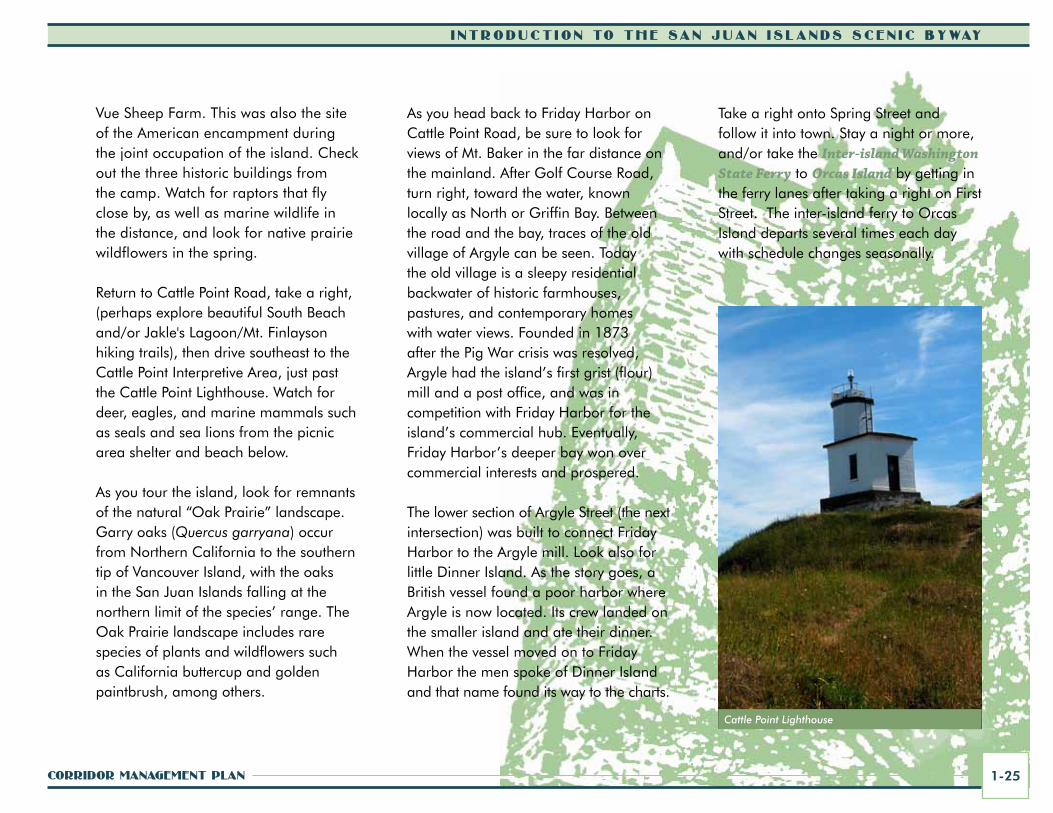
Cattle Point Lighthouse
i ntroduct ion to the San Juan i S landS Scen ic Byway
San Juan iSlandS Scenic Byway1-26
Orcas islandOrcas Village greets you upon your arrival at the ferry landing. The landing dates back to 1889. Lodging, shops, dining, groceries, and restrooms can be found here. Turn left when you leave the ferry (as directed by the ferry personnel) and drive slowly up the hill past the Historic Orcas Hotel (on the right), which was built in 1904 and is on the National Register of Historic Places. Keep following Orcas Road north from the ferry landing for approximately two miles. Take the first left-hand turn onto Deer Harbor Road and follow it to Deer Harbor. This fifteen-minute drive, with many water views, leads to the quiet hamlet of Deer Harbor, which includes lodging, dining, sea kayaking, whale watching, and fishing charters. When the first Europeans arrived in Deer Harbor they found a Lummi Indian encampment along the slough, which connects a shallow inner basin with the main harbor. Deer Harbor is home to several historic buildings from the late 1800s and early 1900s.
Retrace your route back to Orcas Road and take a left. Traveling past working farms and gardens you'll see the hanging sign for a local pottery on your left, nearly across from the golf course. Housed in a historic 1866 log cabin, this pottery first opened in 1959 and now continues seasonally under the second generation of family ownership. The shop and grounds feature the works of over seventy artists.
Continue north on Orcas Road, which will bring you to a right hand turn onto Main Street taking you into the historic village of Eastsound. This is the commercial hub of Orcas Island. Various artist studios, galleries, and potteries are located in downtown Eastsound, and many are open year round. The Orcas Island
Historical Museum is located in the center of the village by taking a left on North Beach Road. At the museum, six original homestead cabins, built during the 1870s and 1890s, are covered by a modern shell. Each cabin provides space for interpreting island history as told through the life stories and material culture of the First Peoples and early European-American settlers. Don't leave before seeing the 14,000-year-old bison skull.
The nearby Village Green in Eastsound is home to the architectural award-winning “Stage on the Green.” Islanders and visitors enjoy many special events at the park including concerts, the seasonal Farmers’ Market, the Heritage Orchard Picnic, the annual library book fair, and other activities. Families should be sure to stop by The Funhouse, a non-profit community center that fosters fun and learning with dozens of hands-on kid-friendly
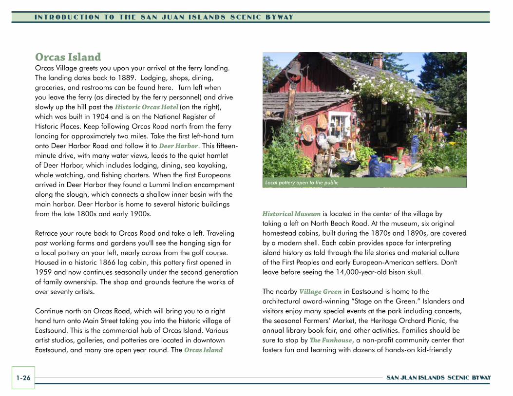
Local pottery open to the public
corridor ManageMent Plan 1-27
i ntroduct ion to the San Juan i S landS Scen ic Byway
science exhibits, computer activities, educational films, classes, and more.
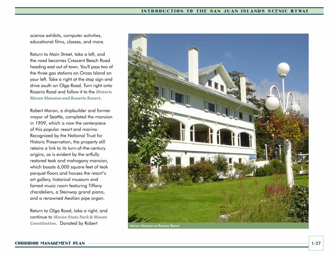
Return to Main Street, take a left, and the road becomes Crescent Beach Road heading east out of town. You'll pass two of the three gas stations on Orcas Island on your left. Take a right at the stop sign and drive south on Olga Road. Turn right onto Rosario Road and follow it to the Historic Moran Mansion and Rosario Resort.
Robert Moran, a shipbuilder and former mayor of Seattle, completed the mansion in 1909, which is now the centerpiece of this popular resort and marina. Recognized by the National Trust for Historic Preservation, the property still retains a link to its turn-of-the-century origins, as is evident by the artfully restored teak and mahogany mansion, which boasts 6,000 square feet of teak parquet floors and houses the resort’s art gallery, historical museum and famed music room featuring Tiffany chandeliers, a Steinway grand piano, and a renowned Aeolian pipe organ.
Return to Olga Road, take a right, and continue to Moran State Park & Mount Constitution. Donated by Robert
Moran Mansion at Rosario Resort
i ntroduct ion to the San Juan i S landS Scen ic Byway
San Juan iSlandS Scenic Byway1-28
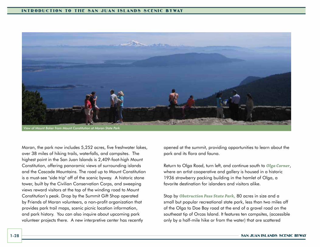
Moran, the park now includes 5,252 acres, five freshwater lakes, over 38 miles of hiking trails, waterfalls, and campsites. The highest point in the San Juan Islands is 2,409-foot-high Mount Constitution, offering panoramic views of surrounding islands and the Cascade Mountains. The road up to Mount Constitution is a must-see "side trip" off of the scenic byway. A historic stone tower, built by the Civilian Conservation Corps, and sweeping views reward visitors at the top of the winding road to Mount Constitution’s peak. Drop by the Summit Gift Shop operated by Friends of Moran volunteers, a non-profit organization that provides park trail maps, scenic picnic location information, and park history. You can also inquire about upcoming park volunteer projects there. A new interpretive center has recently
opened at the summit, providing opportunities to learn about the park and its flora and fauna.
Return to Olga Road, turn left, and continue south to Olga Corner,where an artist cooperative and gallery is housed in a historic 1936 strawberry packing building in the hamlet of Olga, a favorite destination for islanders and visitors alike.
Stop by Obstruction Pass State Park, 80 acres in size and a small but popular recreational state park, less than two miles off of the Olga to Doe Bay road at the end of a gravel road on the southeast tip of Orcas Island. It features ten campsites, (accessible only by a half-mile hike or from the water) that are scattered
View of Mount Baker from Mount Constitution at Moran State Park
corridor ManageMent Plan 1-29
i ntroduct ion to the San Juan i S landS Scen ic Byway
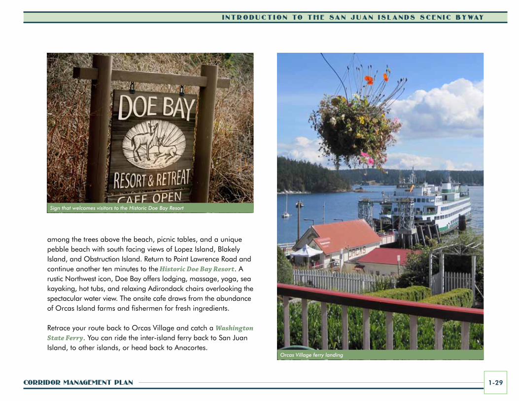
among the trees above the beach, picnic tables, and a unique pebble beach with south facing views of Lopez Island, Blakely Island, and Obstruction Island. Return to Point Lawrence Road and continue another ten minutes to the Historic Doe Bay Resort. A rustic Northwest icon, Doe Bay offers lodging, massage, yoga, sea kayaking, hot tubs, and relaxing Adirondack chairs overlooking the spectacular water view. The onsite cafe draws from the abundance of Orcas Island farms and fishermen for fresh ingredients.
Retrace your route back to Orcas Village and catch a Washington State Ferry. You can ride the inter-island ferry back to San Juan Island, to other islands, or head back to Anacortes.
Orcas Village ferry landing
Sign that welcomes visitors to the Historic Doe Bay Resort