Embed Size (px)
Citation preview
INTERPRETATION OF THE FUNCTION OF THE OBELISK OF AUGUSTUS IN ROME
FROM ANTIQUE TEXTS TO PRESENT TIME VIRTUAL RECONSTRUCTION
M. Hiermanseder
Hietzing Consult, Vienna, Austria - [email protected]
KEY WORDS: Astronomy, Line of Meridian, Historical Texts, Archeology, Simulation, Virtual World Heritage
ABSTRACT:
About the astronomical use of the obelisk of Augustus on Campo Marzio in Rome, which has already been described by Pliny, well
known astronomers and mathematicians like Euler, Marinoni or Poleni have given their expert opinion immediately after it's
unearthing in 1748. With the prevailing opinion, based on a brief chapter in "Historia naturalis", it would constitute a line of
meridian rather than a sundial, the question had been decided for more than 200 years.
In 1976, however, the prominent German archeologist Edmund Buchner established once more the assumption, that the obelisk has
been part of a gigantic sundial for the apotheosis of the emperor Augustus. Excavations of the German Archeological Institute in
1980/81, which brought to light parts of the inscriptions of the scale, were taken as a proof of his theory by Buchner.
Since 1990 works by physicists and experts for chronometry like Schütz, Maes, Auber, et.al., established the interpretation as a line
of meridian. Recent measurements and virtual reconstructions of the antique situation in 2013 provide valid evidence for this
argument as well.
The different approach to the problem mirrors the antagonism between interpretation of antique texts and the assessment of
archeological findings in the light of far fledged historical hypotheses.
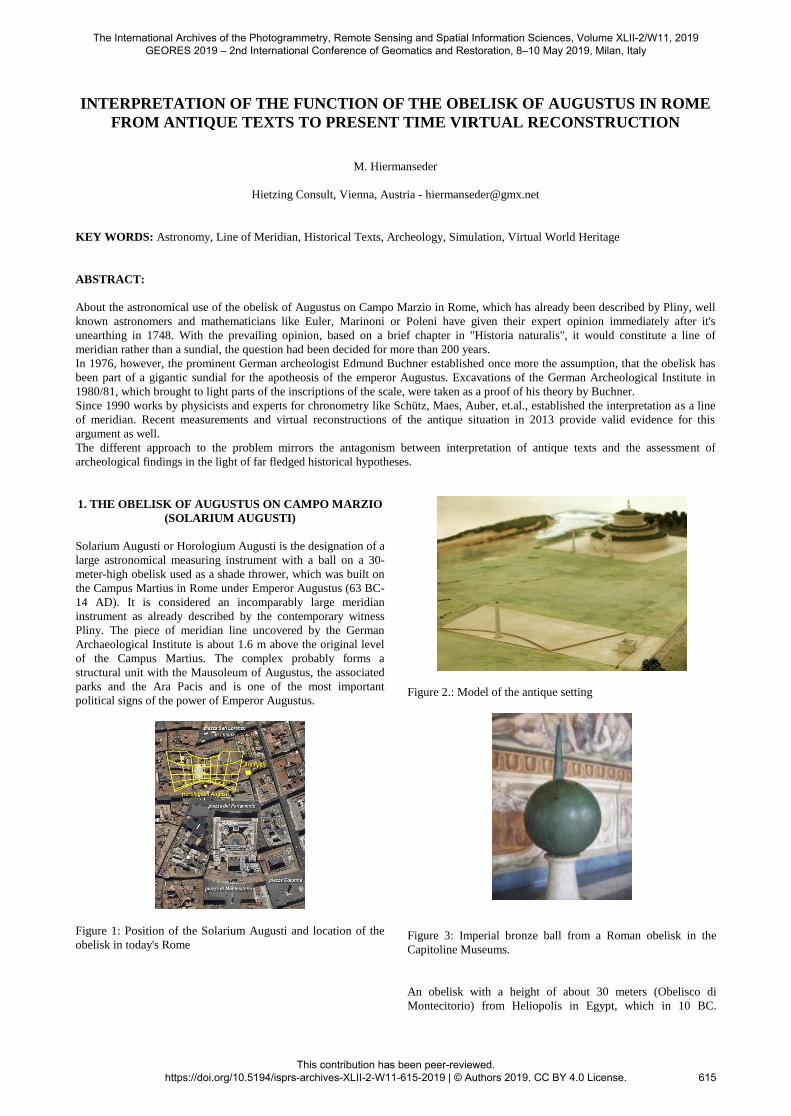
1. THE OBELISK OF AUGUSTUS ON CAMPO MARZIO
(SOLARIUM AUGUSTI)
Solarium Augusti or Horologium Augusti is the designation of a
large astronomical measuring instrument with a ball on a 30-
meter-high obelisk used as a shade thrower, which was built on
the Campus Martius in Rome under Emperor Augustus (63 BC-
14 AD). It is considered an incomparably large meridian
instrument as already described by the contemporary witness
Pliny. The piece of meridian line uncovered by the German
Archaeological Institute is about 1.6 m above the original level
of the Campus Martius. The complex probably forms a
structural unit with the Mausoleum of Augustus, the associated
parks and the Ara Pacis and is one of the most important
political signs of the power of Emperor Augustus.
Figure 1: Position of the Solarium Augusti and location of the
obelisk in today's Rome
Figure 2.: Model of the antique setting
Figure 3: Imperial bronze ball from a Roman obelisk in the
Capitoline Museums.
An obelisk with a height of about 30 meters (Obelisco di
Montecitorio) from Heliopolis in Egypt, which in 10 BC.
The International Archives of the Photogrammetry, Remote Sensing and Spatial Information Sciences, Volume XLII-2/W11, 2019 GEORES 2019 – 2nd International Conference of Geomatics and Restoration, 8–10 May 2019, Milan, Italy
This contribution has been peer-reviewed. https://doi.org/10.5194/isprs-archives-XLII-2-W11-615-2019 | © Authors 2019. CC BY 4.0 License.
615
Augustus has mounted, serves as a gnomon. Its addition to a
likewise large (at least 200 meters), flat dial to a solar clock has
not been proven. The overturned obelisk, broken in five pieces,
and its original pedestal were excavated in 1748. About 40
years later, it is reassembled, crowned with a new ball and
erected in 1792 with its pedestal at its present location, about
250 meters to the south, in front of the Italian Parliament in
Piazza di Montecitorio (Figure 1).
The core shadow of an original, similarly sized (about 75 cm in
diameter) and equally high (about 30 meters) placed ball as
Nodus extends about 80 meters. The midday shadow of this
globe, to be read on the belonging meridian line, is about 65
meters from the obelisk at the winter solstice in Rome. The line
of meridian is made of bronze in the floor slabs and has a length
of about 55 meters between the two solstice points. Crossing the
Meridian line, longer markers are used as dividing lines
between the signs of the zodiac and shorter ones for the 30
degrees division of the signs of the zodiac. The shadow of the
sphere thus shows the place of the sun in the zodiac. The
section of the meridian line exposed to this day under Via del
Campo Marzio no. 48 has a length of 6,60 m, divided by 27
short transverse lines for graduation and 1 long transverse line
as a separation between adjacent signs (Figure 14). It is
inscribed along the line of meridian with the Greek names of the
signs of the zodiac: on the west side it ranges from 19 ° [KRI]
OS (Aries) to 16 ° TAUR [OS] (Taurus), on the east side,
symmetrically to it, of 14 ° [ LE] ON (Leo) until 11 ° PARTH
[ENOS] (Virgin). The degree intervals increase from south to
north from 19 cm to 30 cm. From this, Schütz calculated in
1990 that the shadow-throwing ball crowning the obelisk must
have been located about 17.7 m south of the Leo-Virgin
dividing line at a height of about 30 to 31 m. On the long
dividing line Leo-Virgin is the Greek inscription ETESIAI
PAUONTAI (Figure 12), the Etesia stop. Etesia refers to the
regular summer winds (today: Meltemi). At the mark 15 °
Taurus is the inscription THEROUS ARCHE, beginning of
summer. According to ancient custom, summer does not start
with the summer solstice, this is the middle of summer. Summer
goes from 15 ° Taurus to 15 ° Leo. The original site of the Ara
Pacis faces the solarium, on the site to the east, between Via in
Lucina and Via del Corso, where today the Palazzo Fiano-
Almagià stands.
2. ASTRONOMICAL INTERPRETATION IN THE 18TH
CENTURY
The astronomers of the 18th century discuss after 1748 in detail
the use of the famous obelisk of Augustus at Campo Marzio
(formerly Campo Marzo) in Rome.1 Pliny writes: "Ei (obelisco)
qui est in Campo, divus Augustus addidit mirabilem usum ad
deprehendas solis umbras, dierumque ac noctium ita
magnitudines, strato lapide ad magnitudinem Obelisci cui par
fieret umbra brumae, consecto die, sexta hora." 2
1 [Imp(erator)] Caesar divi [f]il(ius) / Augustus / pontifex
maximus / imp(erator) XII co(n)s(ul) XI trib(unicia)
pot(estate) XIV / Aeg<y=U>pto in potestatem / populi
Romani redacta / Soli donum dedit // (Emperor Caesar
Augustus / son of the deified (Caesar) / Pontifex Maximus /
Emperor for the 12th, consul for the 11th, holder of the
tribunician power for the 14th time / after Egypt was brought
under the rule of the Roman people (this obelisk) of the Sun
given as a gift.) CIL 6, 702 2 Plinius, Naturalis historia, Lib 36, c.10. "To the (obelisk),
which stands on the field of Mars, the deified Augustus has
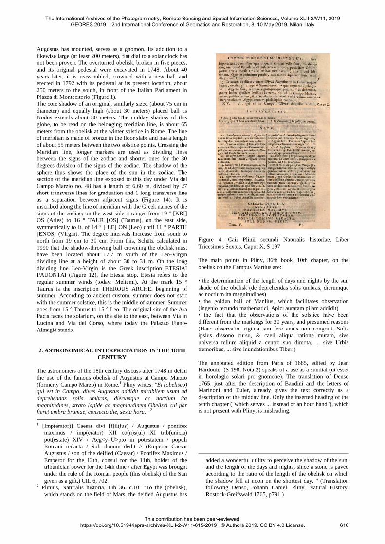
Figure 4: Caii Plinii secundi Naturalis historiae, Liber
Tricesimus Sextus, Caput X, S 197
The main points in Pliny, 36th book, 10th chapter, on the
obelisk on the Campus Martius are:
• the determination of the length of days and nights by the sun
shade of the obelisk (de deprehendas solis umbras, dierumque
ac noctium ita magnitudines)
• the golden ball of Manlius, which facilitates observation
(ingenio fecundo mathematici, Apici auratam pilam addidit)
• the fact that the observations of the solstice have been
different from the markings for 30 years, and presumed reasons
(Haec observatio triginta iam fere annis non congruit, Solis
ipsius dissono cursu, & caeli aliqua ratione mutato, sive
universa tellure aliquid a centro suo dimota, ... sive Urbis
tremoribus, ... sive inundationibus Tiberi)
The annotated edition from Paris of 1685, edited by Jean
Hardouin, (S 198, Nota 2) speaks of a use as a sundial (ut esset
in horologio solari pro gnomone). The translation of Denso
1765, just after the description of Bandini and the letters of
Marinoni and Euler, already gives the text correctly as a
description of the midday line. Only the inserted heading of the
tenth chapter ("which serves ... instead of an hour hand"), which
is not present with Pliny, is misleading.
added a wonderful utility to perceive the shadow of the sun,
and the length of the days and nights, since a stone is paved
according to the ratio of the length of the obelisk on which
the shadow fell at noon on the shortest day. " (Translation
following Denso, Johann Daniel, Pliny, Natural History,
Rostock-Greifswald 1765, p791.)
The International Archives of the Photogrammetry, Remote Sensing and Spatial Information Sciences, Volume XLII-2/W11, 2019 GEORES 2019 – 2nd International Conference of Geomatics and Restoration, 8–10 May 2019, Milan, Italy
This contribution has been peer-reviewed. https://doi.org/10.5194/isprs-archives-XLII-2-W11-615-2019 | © Authors 2019. CC BY 4.0 License.
616
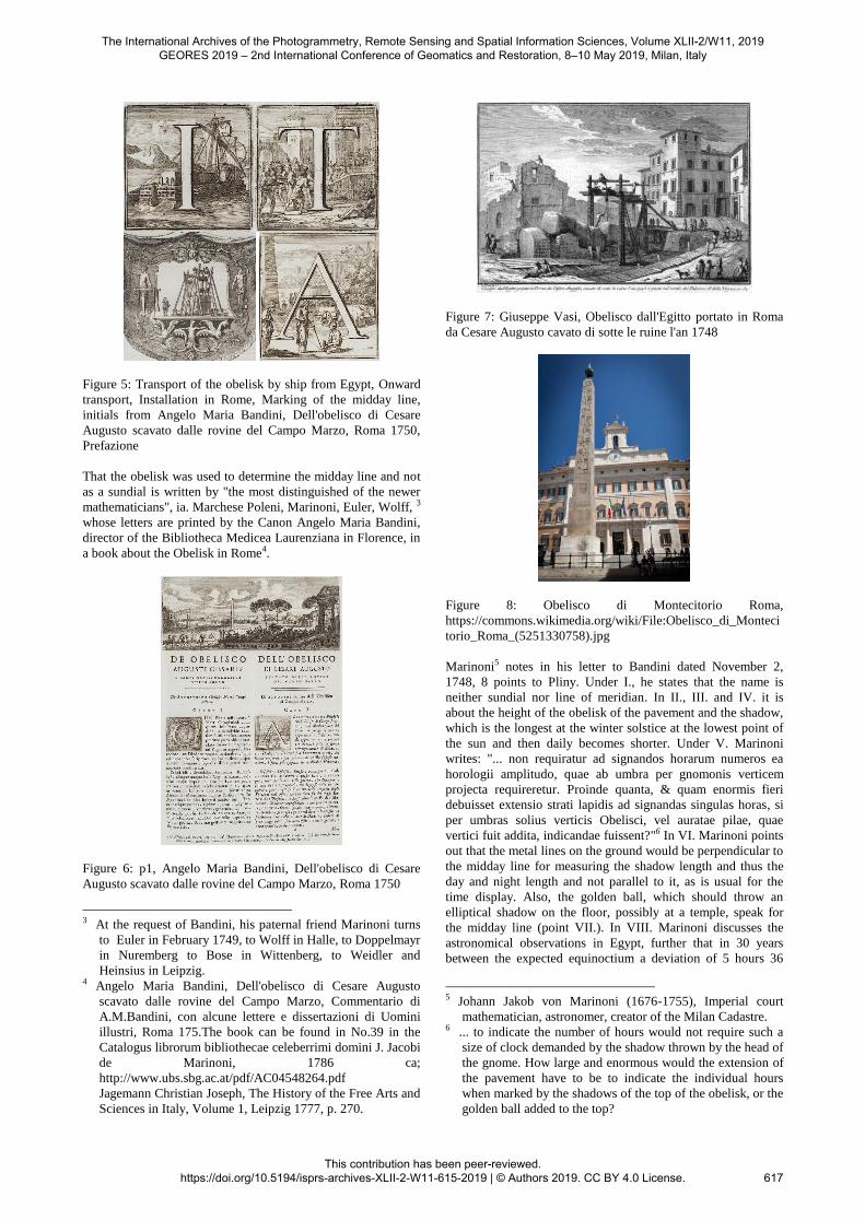
Figure 5: Transport of the obelisk by ship from Egypt, Onward
transport, Installation in Rome, Marking of the midday line,
initials from Angelo Maria Bandini, Dell'obelisco di Cesare
Augusto scavato dalle rovine del Campo Marzo, Roma 1750,
Prefazione
That the obelisk was used to determine the midday line and not
as a sundial is written by "the most distinguished of the newer
mathematicians", ia. Marchese Poleni, Marinoni, Euler, Wolff, 3
whose letters are printed by the Canon Angelo Maria Bandini,
director of the Bibliotheca Medicea Laurenziana in Florence, in
a book about the Obelisk in Rome4.
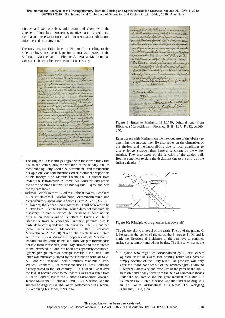
Figure 6: p1, Angelo Maria Bandini, Dell'obelisco di Cesare
Augusto scavato dalle rovine del Campo Marzo, Roma 1750
3 At the request of Bandini, his paternal friend Marinoni turns
to Euler in February 1749, to Wolff in Halle, to Doppelmayr
in Nuremberg to Bose in Wittenberg, to Weidler and
Heinsius in Leipzig. 4 Angelo Maria Bandini, Dell'obelisco di Cesare Augusto
scavato dalle rovine del Campo Marzo, Commentario di
A.M.Bandini, con alcune lettere e dissertazioni di Uomini
illustri, Roma 175.The book can be found in No.39 in the
Catalogus librorum bibliothecae celeberrimi domini J. Jacobi
de Marinoni, 1786 ca;
http://www.ubs.sbg.ac.at/pdf/AC04548264.pdf
Jagemann Christian Joseph, The History of the Free Arts and
Sciences in Italy, Volume 1, Leipzig 1777, p. 270.
Figure 7: Giuseppe Vasi, Obelisco dall'Egitto portato in Roma
da Cesare Augusto cavato di sotte le ruine l'an 1748
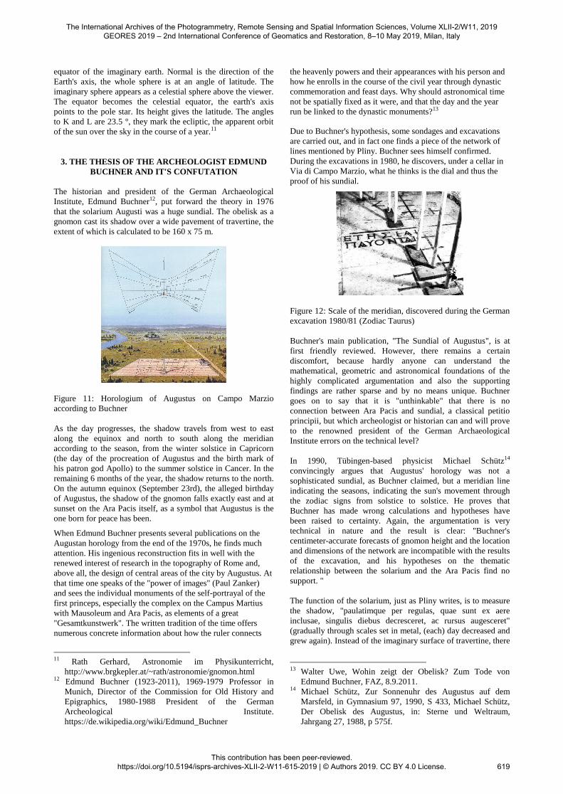
Figure 8: Obelisco di Montecitorio Roma,
https://commons.wikimedia.org/wiki/File:Obelisco_di_Monteci
torio_Roma_(5251330758).jpg
Marinoni5 notes in his letter to Bandini dated November 2,
1748, 8 points to Pliny. Under I., he states that the name is
neither sundial nor line of meridian. In II., III. and IV. it is
about the height of the obelisk of the pavement and the shadow,
which is the longest at the winter solstice at the lowest point of
the sun and then daily becomes shorter. Under V. Marinoni
writes: "... non requiratur ad signandos horarum numeros ea
horologii amplitudo, quae ab umbra per gnomonis verticem
projecta requireretur. Proinde quanta, & quam enormis fieri
debuisset extensio strati lapidis ad signandas singulas horas, si
per umbras solius verticis Obelisci, vel auratae pilae, quae
vertici fuit addita, indicandae fuissent?"6 In VI. Marinoni points
out that the metal lines on the ground would be perpendicular to
the midday line for measuring the shadow length and thus the
day and night length and not parallel to it, as is usual for the
time display. Also, the golden ball, which should throw an
elliptical shadow on the floor, possibly at a temple, speak for
the midday line (point VII.). In VIII. Marinoni discusses the
astronomical observations in Egypt, further that in 30 years
between the expected equinoctium a deviation of 5 hours 36
5 Johann Jakob von Marinoni (1676-1755), Imperial court
mathematician, astronomer, creator of the Milan Cadastre. 6 ... to indicate the number of hours would not require such a
size of clock demanded by the shadow thrown by the head of
the gnome. How large and enormous would the extension of
the pavement have to be to indicate the individual hours
when marked by the shadows of the top of the obelisk, or the
golden ball added to the top?
The International Archives of the Photogrammetry, Remote Sensing and Spatial Information Sciences, Volume XLII-2/W11, 2019 GEORES 2019 – 2nd International Conference of Geomatics and Restoration, 8–10 May 2019, Milan, Italy
This contribution has been peer-reviewed. https://doi.org/10.5194/isprs-archives-XLII-2-W11-615-2019 | © Authors 2019. CC BY 4.0 License.
617
minutes and 30 seconds should occur and closes with the
statement: "Omnibus perpensis sententiae eorum accedo, qui
meridianae lineae variationsem a Plinio memoratam soli tantum
vitio referendam arbitrantur."7
The only original Euler letter to Marinoni8, according to the
Euler archive, has been kept for almost 270 years in the
Biblioteca Marucelliana in Florence,9, because Marinoni had
sent Euler's letter to his friend Bandini in Tuscany.
7 "Looking at all these things I agree with those who think that
due to the terrain, only the variation of the midday line, as
mentioned by Pliny, should be determined." and to underline
his opinion Marinoni mentions other prominent supporters
of his theory: "The Marquis Poleni, the P.Colombi from
Padua, the P.Boscovich in Rome, Mr. Muratori and others
are of the opinion that this is a midday line. I agree and here
are my reasons..." 8 Juskevic Adolf/Smirnov Vladimir/Habicht Walter, Leonhard
Euler Briefwechsel, Beschreibung, Zusammenfassung und
Verzeichnisse, Opera Omnia Series Quarta A, Vol.I, S 257. 9 In Florence, the letter without addressee is still believed to be
a letter from Euler to Bandini, which does not facilitate his
discovery. "Come si evince dal catalogo e dalle notizie
ottenute da Manus online, la lettera di Euler a cui lei si
riferisce si trova nel carteggio Bandini e, pertanto, essa fa
parte della corrispondenza intercorsa tra Euler e Bandini."
(Sala Consultazione Manoscritti e Rari, Biblioteca
Marucelliana, 20.2.2018) "Credo che questa lettara e stato
scritto da Euler a Marinoni e dopo inviato da Marinoni a
Bandini chi l'ha stampata nel suo libro Allegato trovate parte
del mio manuscritto su questo. "My answer and the reference
to the letterhead in Bandini's book has apparently convinced:
"grazie per gli interessi dettagli fornitici." see. also "The
letter was mistakenly noted by the Florentine officials to A.
M. Bandini." Juskevic Adolf / Smirnov Vladimir / Hawk
Walter, Leonhard Euler correspondence l.c. Emil Fellmann
already stated in the last century: "... but when I went over
the text, it became clear to me that this was not a letter from
Euler to Bandini, but to the Viennese astronomer Giovanni
Jacopo Marinoni ..." Fellmann Emil, Euler, Marinoni and the
sundial of Augustus in Ad Fontes Arithmeticae et algebrae,
FS Wolfgang Kaunzner, 1998, p 67.
Figure 9: Euler to Marinoni 15.3.1749, Original letter from
Biblioteca Marucelliana in Florence, B, B._I.27._IV/22, cc.269-
270.
Euler agrees with Marinoni on the intended use of the obelisk to
determine the midday line. He also relies on the dimension of
the shadow and the impossibility due to local conditions to
display longer shadows than those at lunchtime on the winter
solstice. They also agree on the function of the golden ball.
Both astronomers explain the deviations due to the errors of the
Julian calendar.10
Figure 10: Principle of the gnomon (shadow staff)
The picture shows a model of the earth. The tip of the gnome G
is located in the center of the earth, the 3 lines to K, M and L
mark the direction of incidence of the sun rays to summer,
spring (or autumn) - and winter begins. The line to M marks the
10 "Anyone who might feel disappointed by Euler's" expert
opinion "must be aware that nothing better was possible
simply because of the Pliny text." The problem was only
after the "hard bone work" of the archaeologists (Edmund
Buchner) - discovery and exposure of the parts of the dial -
to master and finally solve with the help of Gnomonic means
Euler did not live to see this great moment of 1980/81. "
Fellmann Emil, Euler, Marinoni and the sundial of Augustus
in Ad Fontes Arithmeticae et algebrae, FS Wolfgang
Kaunzner, 1998, p 74.
The International Archives of the Photogrammetry, Remote Sensing and Spatial Information Sciences, Volume XLII-2/W11, 2019 GEORES 2019 – 2nd International Conference of Geomatics and Restoration, 8–10 May 2019, Milan, Italy
This contribution has been peer-reviewed. https://doi.org/10.5194/isprs-archives-XLII-2-W11-615-2019 | © Authors 2019. CC BY 4.0 License.
618
equator of the imaginary earth. Normal is the direction of the
Earth's axis, the whole sphere is at an angle of latitude. The
imaginary sphere appears as a celestial sphere above the viewer.
The equator becomes the celestial equator, the earth's axis
points to the pole star. Its height gives the latitude. The angles
to K and L are 23.5 °, they mark the ecliptic, the apparent orbit
of the sun over the sky in the course of a year.11
3. THE THESIS OF THE ARCHEOLOGIST EDMUND
BUCHNER AND IT'S CONFUTATION
The historian and president of the German Archaeological
Institute, Edmund Buchner12, put forward the theory in 1976
that the solarium Augusti was a huge sundial. The obelisk as a
gnomon cast its shadow over a wide pavement of travertine, the
extent of which is calculated to be 160 x 75 m.
Figure 11: Horologium of Augustus on Campo Marzio
according to Buchner
As the day progresses, the shadow travels from west to east
along the equinox and north to south along the meridian
according to the season, from the winter solstice in Capricorn
(the day of the procreation of Augustus and the birth mark of
his patron god Apollo) to the summer solstice in Cancer. In the
remaining 6 months of the year, the shadow returns to the north.
On the autumn equinox (September 23rd), the alleged birthday
of Augustus, the shadow of the gnomon falls exactly east and at
sunset on the Ara Pacis itself, as a symbol that Augustus is the
one born for peace has been.
When Edmund Buchner presents several publications on the
Augustan horology from the end of the 1970s, he finds much
attention. His ingenious reconstruction fits in well with the
renewed interest of research in the topography of Rome and,
above all, the design of central areas of the city by Augustus. At
that time one speaks of the "power of images" (Paul Zanker)
and sees the individual monuments of the self-portrayal of the
first princeps, especially the complex on the Campus Martius
with Mausoleum and Ara Pacis, as elements of a great
"Gesamtkunstwerk". The written tradition of the time offers
numerous concrete information about how the ruler connects
11 Rath Gerhard, Astronomie im Physikunterricht,
http://www.brgkepler.at/~rath/astronomie/gnomon.html 12 Edmund Buchner (1923-2011), 1969-1979 Professor in
Munich, Director of the Commission for Old History and
Epigraphics, 1980-1988 President of the German
Archeological Institute.
https://de.wikipedia.org/wiki/Edmund_Buchner
the heavenly powers and their appearances with his person and
how he enrolls in the course of the civil year through dynastic
commemoration and feast days. Why should astronomical time
not be spatially fixed as it were, and that the day and the year
run be linked to the dynastic monuments?13
Due to Buchner's hypothesis, some sondages and excavations
are carried out, and in fact one finds a piece of the network of
lines mentioned by Pliny. Buchner sees himself confirmed.
During the excavations in 1980, he discovers, under a cellar in
Via di Campo Marzio, what he thinks is the dial and thus the
proof of his sundial.
Figure 12: Scale of the meridian, discovered during the German
excavation 1980/81 (Zodiac Taurus)
Buchner's main publication, "The Sundial of Augustus", is at
first friendly reviewed. However, there remains a certain
discomfort, because hardly anyone can understand the
mathematical, geometric and astronomical foundations of the
highly complicated argumentation and also the supporting
findings are rather sparse and by no means unique. Buchner
goes on to say that it is "unthinkable" that there is no
connection between Ara Pacis and sundial, a classical petitio
principii, but which archeologist or historian can and will prove
to the renowned president of the German Archaeological
Institute errors on the technical level?
In 1990, Tübingen-based physicist Michael Schütz14
convincingly argues that Augustus' horology was not a
sophisticated sundial, as Buchner claimed, but a meridian line
indicating the seasons, indicating the sun's movement through
the zodiac signs from solstice to solstice. He proves that
Buchner has made wrong calculations and hypotheses have
been raised to certainty. Again, the argumentation is very
technical in nature and the result is clear: "Buchner's
centimeter-accurate forecasts of gnomon height and the location
and dimensions of the network are incompatible with the results
of the excavation, and his hypotheses on the thematic
relationship between the solarium and the Ara Pacis find no
support. "
The function of the solarium, just as Pliny writes, is to measure
the shadow, "paulatimque per regulas, quae sunt ex aere
inclusae, singulis diebus decresceret, ac rursus augesceret"
(gradually through scales set in metal, (each) day decreased and
grew again). Instead of the imaginary surface of travertine, there
13 Walter Uwe, Wohin zeigt der Obelisk? Zum Tode von
Edmund Buchner, FAZ, 8.9.2011. 14 Michael Schütz, Zur Sonnenuhr des Augustus auf dem
Marsfeld, in Gymnasium 97, 1990, S 433, Michael Schütz,
Der Obelisk des Augustus, in: Sterne und Weltraum,
Jahrgang 27, 1988, p 575f.
The International Archives of the Photogrammetry, Remote Sensing and Spatial Information Sciences, Volume XLII-2/W11, 2019 GEORES 2019 – 2nd International Conference of Geomatics and Restoration, 8–10 May 2019, Milan, Italy
This contribution has been peer-reviewed. https://doi.org/10.5194/isprs-archives-XLII-2-W11-615-2019 | © Authors 2019. CC BY 4.0 License.
619
is only a single straight line marking the farthest point of the
shadow at midday of the winter solstice (about 50 m).
There has long been speculation for a sundial, but also early
evidence of the mere existence of a meridian instrument. The
renewed interpretation as a sundial is still popular, which is
favored by the unusual, successful excavations to 8 meters
below today's level. It digs from a small cellar floor about 6
meters deep, that is, far below the foundations of the walls of a
multi-storey old house in the densely built-up today's city center
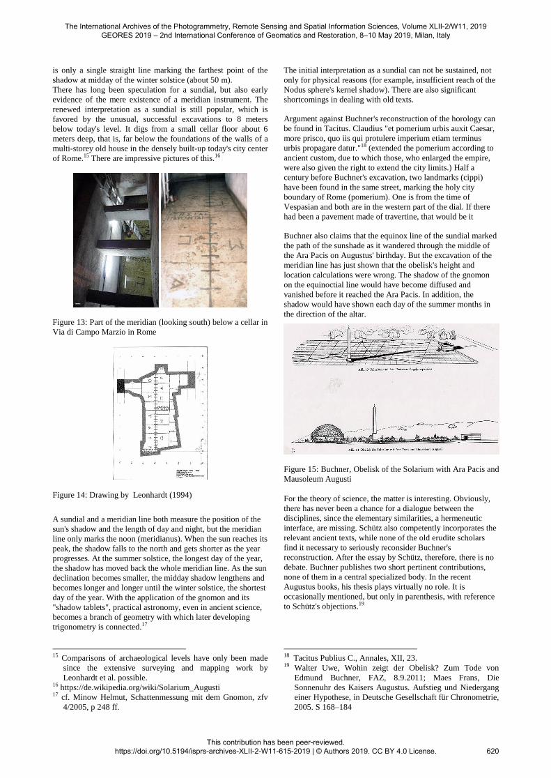
of Rome.15 There are impressive pictures of this.16
Figure 13: Part of the meridian (looking south) below a cellar in
Via di Campo Marzio in Rome
Figure 14: Drawing by Leonhardt (1994)
A sundial and a meridian line both measure the position of the
sun's shadow and the length of day and night, but the meridian
line only marks the noon (meridianus). When the sun reaches its
peak, the shadow falls to the north and gets shorter as the year
progresses. At the summer solstice, the longest day of the year,
the shadow has moved back the whole meridian line. As the sun
declination becomes smaller, the midday shadow lengthens and
becomes longer and longer until the winter solstice, the shortest
day of the year. With the application of the gnomon and its
"shadow tablets", practical astronomy, even in ancient science,
becomes a branch of geometry with which later developing
trigonometry is connected.17
15 Comparisons of archaeological levels have only been made
since the extensive surveying and mapping work by
Leonhardt et al. possible. 16 https://de.wikipedia.org/wiki/Solarium_Augusti 17 cf. Minow Helmut, Schattenmessung mit dem Gnomon, zfv
4/2005, p 248 ff.
The initial interpretation as a sundial can not be sustained, not
only for physical reasons (for example, insufficient reach of the
Nodus sphere's kernel shadow). There are also significant
shortcomings in dealing with old texts.
Argument against Buchner's reconstruction of the horology can
be found in Tacitus. Claudius "et pomerium urbis auxit Caesar,
more prisco, quo iis qui protulere imperium etiam terminus
urbis propagare datur."18 (extended the pomerium according to
ancient custom, due to which those, who enlarged the empire,
were also given the right to extend the city limits.) Half a
century before Buchner's excavation, two landmarks (cippi)
have been found in the same street, marking the holy city
boundary of Rome (pomerium). One is from the time of
Vespasian and both are in the western part of the dial. If there
had been a pavement made of travertine, that would be it
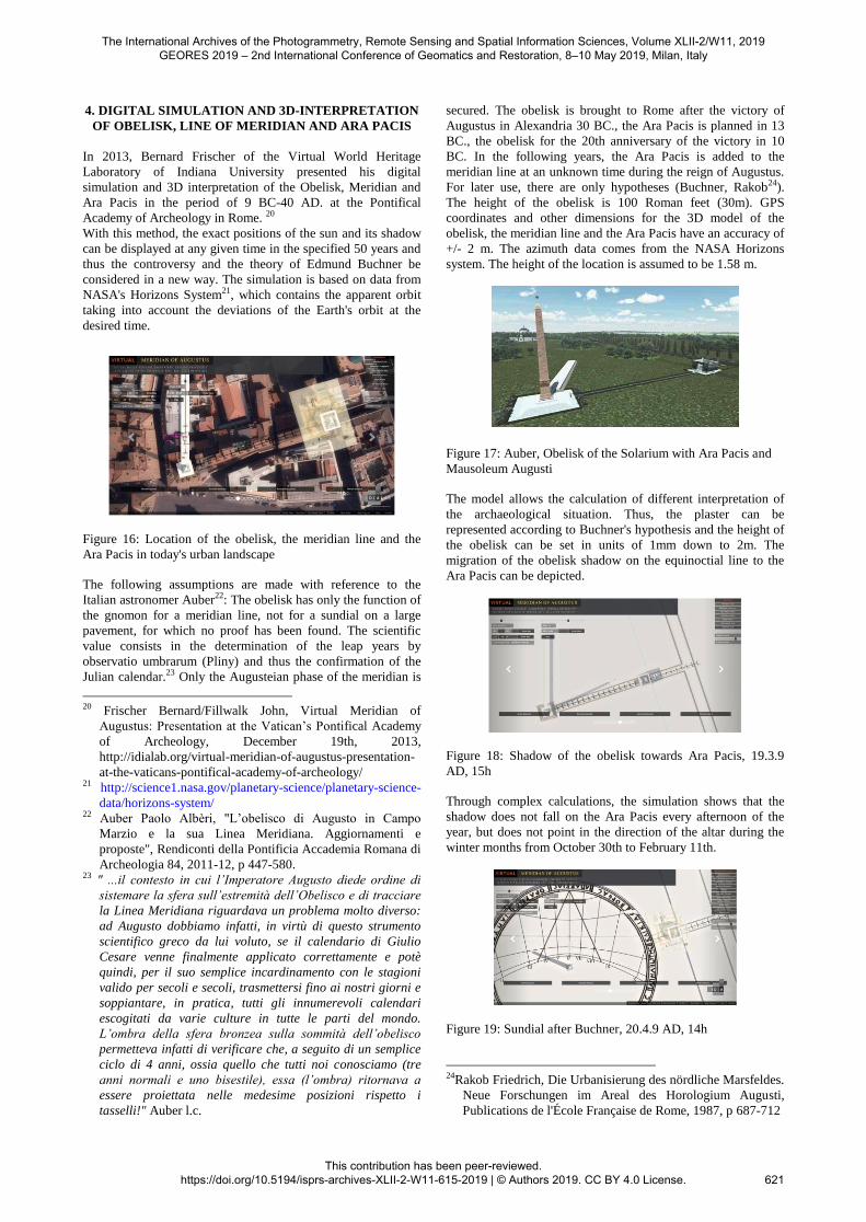
Buchner also claims that the equinox line of the sundial marked
the path of the sunshade as it wandered through the middle of
the Ara Pacis on Augustus' birthday. But the excavation of the
meridian line has just shown that the obelisk's height and
location calculations were wrong. The shadow of the gnomon
on the equinoctial line would have become diffused and
vanished before it reached the Ara Pacis. In addition, the
shadow would have shown each day of the summer months in
the direction of the altar.
Figure 15: Buchner, Obelisk of the Solarium with Ara Pacis and
Mausoleum Augusti
For the theory of science, the matter is interesting. Obviously,
there has never been a chance for a dialogue between the
disciplines, since the elementary similarities, a hermeneutic
interface, are missing. Schütz also competently incorporates the
relevant ancient texts, while none of the old erudite scholars
find it necessary to seriously reconsider Buchner's
reconstruction. After the essay by Schütz, therefore, there is no
debate. Buchner publishes two short pertinent contributions,
none of them in a central specialized body. In the recent
Augustus books, his thesis plays virtually no role. It is
occasionally mentioned, but only in parenthesis, with reference
to Schütz's objections.19
18 Tacitus Publius C., Annales, XII, 23. 19 Walter Uwe, Wohin zeigt der Obelisk? Zum Tode von
Edmund Buchner, FAZ, 8.9.2011; Maes Frans, Die
Sonnenuhr des Kaisers Augustus. Aufstieg und Niedergang
einer Hypothese, in Deutsche Gesellschaft für Chronometrie,
2005. S 168–184
The International Archives of the Photogrammetry, Remote Sensing and Spatial Information Sciences, Volume XLII-2/W11, 2019 GEORES 2019 – 2nd International Conference of Geomatics and Restoration, 8–10 May 2019, Milan, Italy
This contribution has been peer-reviewed. https://doi.org/10.5194/isprs-archives-XLII-2-W11-615-2019 | © Authors 2019. CC BY 4.0 License.
620
4. DIGITAL SIMULATION AND 3D-INTERPRETATION
OF OBELISK, LINE OF MERIDIAN AND ARA PACIS
In 2013, Bernard Frischer of the Virtual World Heritage
Laboratory of Indiana University presented his digital
simulation and 3D interpretation of the Obelisk, Meridian and
Ara Pacis in the period of 9 BC-40 AD. at the Pontifical
Academy of Archeology in Rome. 20
With this method, the exact positions of the sun and its shadow
can be displayed at any given time in the specified 50 years and
thus the controversy and the theory of Edmund Buchner be
considered in a new way. The simulation is based on data from
NASA's Horizons System21, which contains the apparent orbit
taking into account the deviations of the Earth's orbit at the
desired time.
Figure 16: Location of the obelisk, the meridian line and the
Ara Pacis in today's urban landscape
The following assumptions are made with reference to the
Italian astronomer Auber22: The obelisk has only the function of
the gnomon for a meridian line, not for a sundial on a large
pavement, for which no proof has been found. The scientific
value consists in the determination of the leap years by
observatio umbrarum (Pliny) and thus the confirmation of the
Julian calendar.23 Only the Augusteian phase of the meridian is
20 Frischer Bernard/Fillwalk John, Virtual Meridian of
Augustus: Presentation at the Vatican’s Pontifical Academy
of Archeology, December 19th, 2013,
http://idialab.org/virtual-meridian-of-augustus-presentation-
at-the-vaticans-pontifical-academy-of-archeology/ 21 http://science1.nasa.gov/planetary-science/planetary-science-
data/horizons-system/ 22 Auber Paolo Albèri, "L’obelisco di Augusto in Campo
Marzio e la sua Linea Meridiana. Aggiornamenti e
proposte", Rendiconti della Pontificia Accademia Romana di
Archeologia 84, 2011-12, p 447-580. 23 " ...il contesto in cui l’Imperatore Augusto diede ordine di
sistemare la sfera sull’estremità dell’Obelisco e di tracciare
la Linea Meridiana riguardava un problema molto diverso:
ad Augusto dobbiamo infatti, in virtù di questo strumento
scientifico greco da lui voluto, se il calendario di Giulio
Cesare venne finalmente applicato correttamente e potè
quindi, per il suo semplice incardinamento con le stagioni
valido per secoli e secoli, trasmettersi fino ai nostri giorni e
soppiantare, in pratica, tutti gli innumerevoli calendari
escogitati da varie culture in tutte le parti del mondo.
L’ombra della sfera bronzea sulla sommità dell’obelisco
permetteva infatti di verificare che, a seguito di un semplice
ciclo di 4 anni, ossia quello che tutti noi conosciamo (tre
anni normali e uno bisestile), essa (l’ombra) ritornava a
essere proiettata nelle medesime posizioni rispetto i
tasselli!" Auber l.c.
secured. The obelisk is brought to Rome after the victory of
Augustus in Alexandria 30 BC., the Ara Pacis is planned in 13
BC., the obelisk for the 20th anniversary of the victory in 10
BC. In the following years, the Ara Pacis is added to the
meridian line at an unknown time during the reign of Augustus.
For later use, there are only hypotheses (Buchner, Rakob24).
The height of the obelisk is 100 Roman feet (30m). GPS
coordinates and other dimensions for the 3D model of the
obelisk, the meridian line and the Ara Pacis have an accuracy of
+/- 2 m. The azimuth data comes from the NASA Horizons
system. The height of the location is assumed to be 1.58 m.
Figure 17: Auber, Obelisk of the Solarium with Ara Pacis and
Mausoleum Augusti
The model allows the calculation of different interpretation of
the archaeological situation. Thus, the plaster can be
represented according to Buchner's hypothesis and the height of
the obelisk can be set in units of 1mm down to 2m. The
migration of the obelisk shadow on the equinoctial line to the
Ara Pacis can be depicted.
Figure 18: Shadow of the obelisk towards Ara Pacis, 19.3.9
AD, 15h
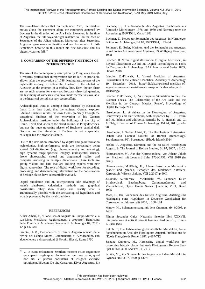
Through complex calculations, the simulation shows that the
shadow does not fall on the Ara Pacis every afternoon of the
year, but does not point in the direction of the altar during the
winter months from October 30th to February 11th.
Figure 19: Sundial after Buchner, 20.4.9 AD, 14h
24Rakob Friedrich, Die Urbanisierung des nördliche Marsfeldes.
Neue Forschungen im Areal des Horologium Augusti,
Publications de l'École Française de Rome, 1987, p 687-712
The International Archives of the Photogrammetry, Remote Sensing and Spatial Information Sciences, Volume XLII-2/W11, 2019 GEORES 2019 – 2nd International Conference of Geomatics and Restoration, 8–10 May 2019, Milan, Italy
This contribution has been peer-reviewed. https://doi.org/10.5194/isprs-archives-XLII-2-W11-615-2019 | © Authors 2019. CC BY 4.0 License.
621
The simulation shows that on September 23rd, the shadow
moves along the pavement along the equinoxes assumed by
Buchner in the direction of the Ara Pacis. However, in the time
of Augustus, the fall day-and-night matches fall on the 25th of
September of the Julian calendar. Moreover, after Suetonius,
Augustus gave name to Sextilis and not his month of birth
September, because in this month his first consulate and his
biggest victories fall.25
5. COMPARISON OF THE DIFFERENT METHODS OF
INTERPRETATION
The use of the contemporary description by Pliny, even though
it requires professional interpretation for its lack of precision,
allows, after the excavation of 1748, leading astronomers of the
eighteenth century, to define the function of the obelisk of
Augustus as the gnomon of a midday line. Even though there
are no such sources for every architectural-historical question,
the testimony of witnesses who have made themselves available
in the historical period is a very secure affair.
Archaeologists want to underpin their theories by excavation
finds. It is thus ironic that the eminent German explorer
Edmund Buchner refutes his own theses precisely through the
sensational findings of the excavation of his German
Archaeological Institute under the buildings of the city of
Rome. It will find labels of the meridian line, as Pliny describes,
but not the huge travertine plaster of Buchner's sundial dial.
Decisive for the refutation of Buchner is not a specialist
colleague but the physicist Schütz.
Due to the revolution introduced by digital and geoinformation
technologies, high-performance tools are increasingly being
spread: 3D digitisation (e.g., photogrammetry and scanning),
high dynamic range spherical imagery, multispectral sensors,
drone photography, virtual and augmented reality, and
computer rendering in multiple dimensions. These tools are
giving visions and data that are enticing experts with new
digital approaches. The role of digital workflows for recording,
processing, and disseminating information for the conservation
of heritage places have substantially evolved.
Digital simulation and 3D interpretation take advantage of
today's databases, calculation methods and graphical
possibilities. They show vividly and exactly what is
arithmetically possible with the archaeological hypotheses and
what is prevented by the local conditions.
REFERENCES
Auber Albèri, P., "L’obelisco di Augusto in Campo Marzio e la
sua Linea Meridiana. Aggiornamenti e proposte", Rendiconti
della Pontificia Accademia Romana di Archeologia 84, 2011-
12, p 447-580
Bandini, A.M., Dell'obelisco di Cesare Augusto scavato dalle
rovine del Campo Marzo, Commentario di A.M.Bandini, con
alcune lettere e dissertazioni di Uomini illustri, Roma 1750
25 "... in cuius ordinatione Sextilem mensem e suo cognomine
nuncupavit magis quam Septembrem quo erat natus, quod
hoc sibi et primus consulatus et insignes victoriae
optigissent."(Sueton, De vita Caesarum, Divus Augustus, 31)
Buchner, E., Die Sonnenuhr des Augustus. Nachdruck aus
Römische Mitteilungen 1976 und 1980 und Nachtrag über die
Ausgrabung 1980/1981, Mainz 1982
Buchner, E., Neues zur Sonnenuhr des Augustus, in Nürnberger
Blätter zur Archäologie, Bd 10, 1993/1994, p 77–84
Fellmann, E., Euler, Marinoni und die Sonnenuhr des Augustus
in Ad Fontes Arithmeticae et Algebrae, FS Wolfgang Kaunzner,
1998
Frischer, B.,"From digital illustration to digital heuristics", in
Beyond Illustration: 2D and 3D Digital Technologies as Tools
for Discovery in Archaeology, BAR International Series 1805,
Oxford 2008
Frischer, B./Fillwalk, J., Virtual Meridian of Augustus:
Presentation at the Vatican’s Pontifical Academy of Archeology
19. Dezember 2013, http://idialab.org/virtual-meridian-of-
augustus-presentation-at-the-vaticans-pontifical-academy-of-
archeology/
Frischer B./Fillwalk, J., "A Computer Simulation to Test the
Buchner Thesis. The Relationship of the Ara Pacis and the
Meridian in the Campus Martius, Rome", Proceedings of
Digital Heritage 2013
Haselberger, L., A debate on the Horologium of Augustus,
Controversy and clarifications, with responses by P. J. Heslin
and M. Schütz and additional remarks by R. Hannah and G.
Alföldy, in Journal of Roman Archaeology, Bd 24, 2011, p 47–
98
Haselberger, L./Auber Albèri, P., The Horologium of Augustus:
Debate and Context (Journal of Roman Archaeology,
Supplementum 99). Portsmouth (Rhode Island) 2014
Heslin, P., Augustus, Domitian and the So-called Horologium
Augusti, in The Journal of Roman Studies, Bd 97, 2007, p 1–20
Hiermanseder, M., Aus der Korrespondenz von Johann Jakob
von Marinoni mit Leonhard Euler 1736-1751, VGI 2018 (in
print).
Hiermanseder, M./König, H., Johann Jakob von Marinoni -
geadelt und getadelt, Schöpfer des Mailänder Katasters,
Kartograph, Wissenschaftler, VGI 2/2017, p 60ff.
Juskevic, A./Smirnov V./Habicht, W., Leonhard Euler
Briefwechsel, Beschreibung, Zusammenfassung und
Verzeichnisse, Opera Omnia Series Quarta A, Vol.I, Basel
1975
Maes, F., Die Sonnenuhr des Kaisers Augustus. Aufstieg und
Niedergang einer Hypothese, in Deutsche Gesellschaft für
Chronometrie, Jahresschrift 2005, p 168–184
Minow, H.,, Schattenmessung mit dem Gnomon, zfv 4/2005, p
248ff.
Plinius Secundus Gaius, Naturalis historiae libri XXXVII,
Interpretatione et notis illustravit Joannes Harduinus SJ, Tomus
5, Paris 1685
Rakob, F., Die Urbanisierung des nördliche Marsfeldes, Neue
Forschungen im Areal des Horologium Augusti, Publications de
l'École Française de Rome, 1987, p 687-712
Santana Quintero, M., Harnessing digital workflows for
conserving historic places. Int Arch Photogramm Remote Sens
Spat Inf Sci XLII-5/W1:9–14, 2017.
Schütz, M.,, Zur Sonnenuhr des Augustus auf dem Marsfeld, in
Gymnasium Bd 97, 1990, p 432ff.
The International Archives of the Photogrammetry, Remote Sensing and Spatial Information Sciences, Volume XLII-2/W11, 2019 GEORES 2019 – 2nd International Conference of Geomatics and Restoration, 8–10 May 2019, Milan, Italy
This contribution has been peer-reviewed. https://doi.org/10.5194/isprs-archives-XLII-2-W11-615-2019 | © Authors 2019. CC BY 4.0 License.
622