Embed Size (px)
Citation preview
Interim evaluation of the New IR Sensor Technology (NIRST)
as a wildfire monitoring tool
Joshua JohnstonForest Fire Analyst
Canadian Forest ServiceGreat Lakes Forestry CentreSault Ste. Marie, [email protected]
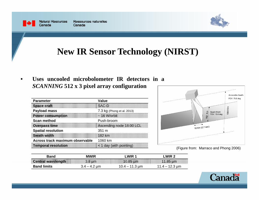
New IR Sensor Technology (NIRST)
• Uses uncooled microbolometer IR detectors in aSCANNING 512 x 3 pixel array configuration
(Figure from: Marraco and Phong 2006)
Parameter ValueSpace craft SAC-DPayload mass 7.3 kg (Phong et al. 2013)
Power consumption ~ 16 W/orbitScan method Push-broomOverpass time Ascending node 18:00 LCLSpatial resolution 351 m Swath width 182 kmAcross track maximum observable 1060 kmTemporal resolution < 1 day (with pointing)
Band MWIR LWIR 1 LWIR 2Central wavelength 3.8 µm 10.85 µm 11.85 µmBand limits 3.4 – 4.2 µm 10.4 – 11.3 µm 11.4 – 12.3 µm
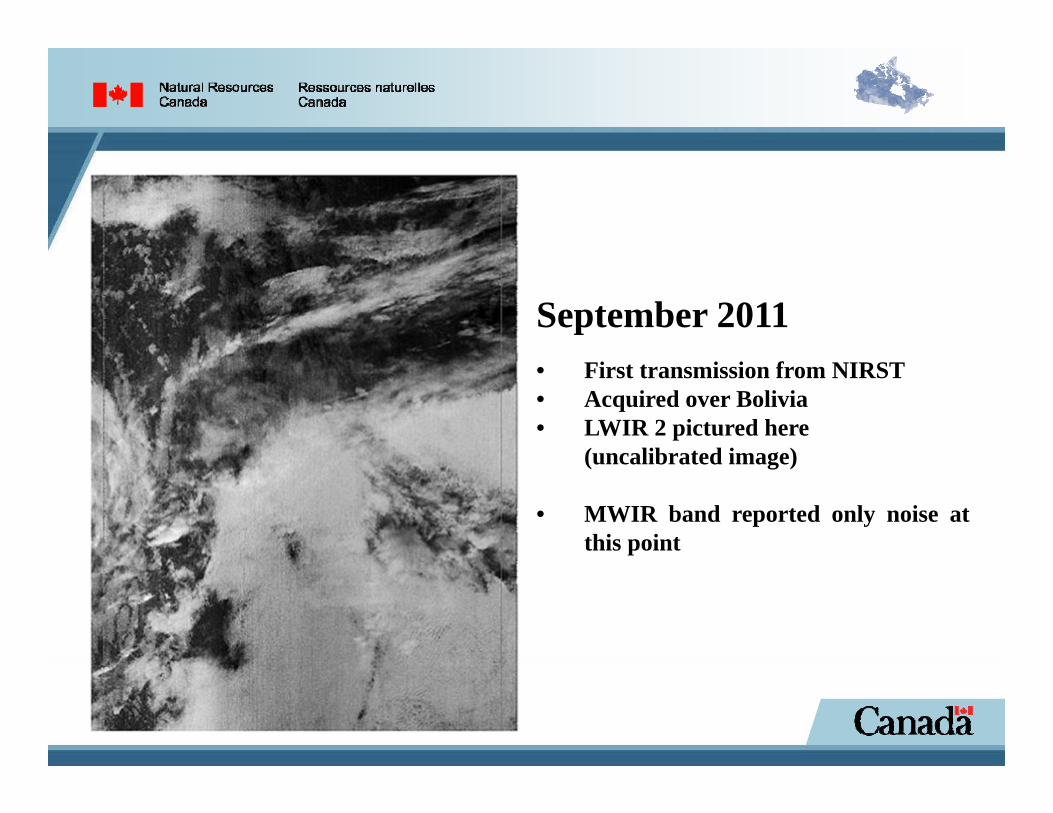
September 2011• First transmission from NIRST• Acquired over Bolivia• LWIR 2 pictured here
(uncalibrated image)
• MWIR band reported only noise atthis point

First wildfire detection
Uncalibrated imagery collected in bands 1 (a) and 2 (b) by NIRST of a wooded area just south of Lake Chad in the Central African Republic (March 19th, 2012).
CalibrationPre-launch• Universidad Nacional de la Plata,
Argentina• Blackbody in laboratory conditions• Counts measured for each band to
determine gain and offset values• BB scenes incremented in 10 K
intervals:o 390.15 – 600.15 K (MWIR)o 273.15 – 520.15 K (LWIR)
• Time constraints allowed for thiscalibration to be performed under onlya few ambient conditions
Inflight• In-orbit conditions were sufficiently
different from the laboratoryconditions to prevent direct use of theground calibration
• Absolute calibration was accomplishedusing ground truthing targets andcoincident overpasses of other sensors(MODIS and GOES-13)o Clearly successful with LWIR bandso Additional considerations wrt MWIR
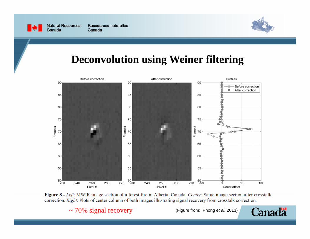
Deconvolution using Weiner filtering
~ 70% signal recovery (Figure from: Phong et al. 2013)
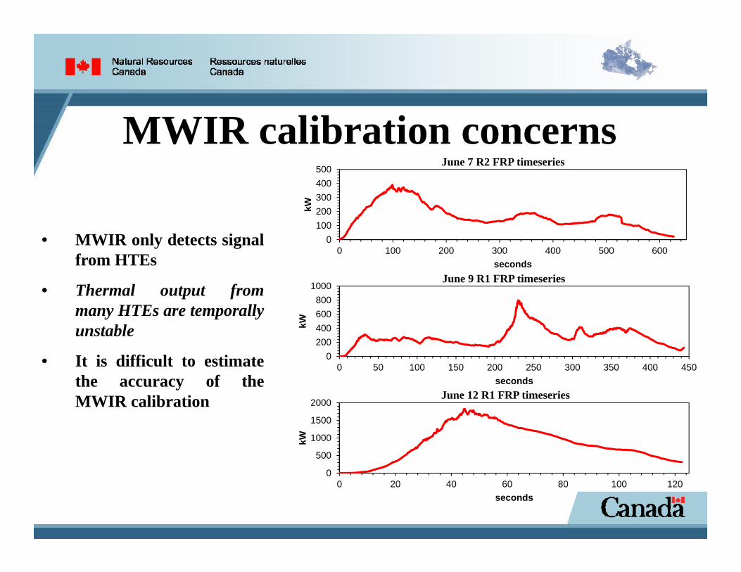
MWIR calibration concerns
• MWIR only detects signalfrom HTEs
• Thermal output frommany HTEs are temporallyunstable
• It is difficult to estimatethe accuracy of theMWIR calibration
0100200300400500
0 100 200 300 400 500 600
kW
seconds
June 7 R2 FRP timeseries
0200400600800
1000
0 50 100 150 200 250 300 350 400 450
kW
seconds
June 9 R1 FRP timeseries
0
500
1000
1500
2000
0 20 40 60 80 100 120
kW
seconds
June 12 R1 FRP timeseries
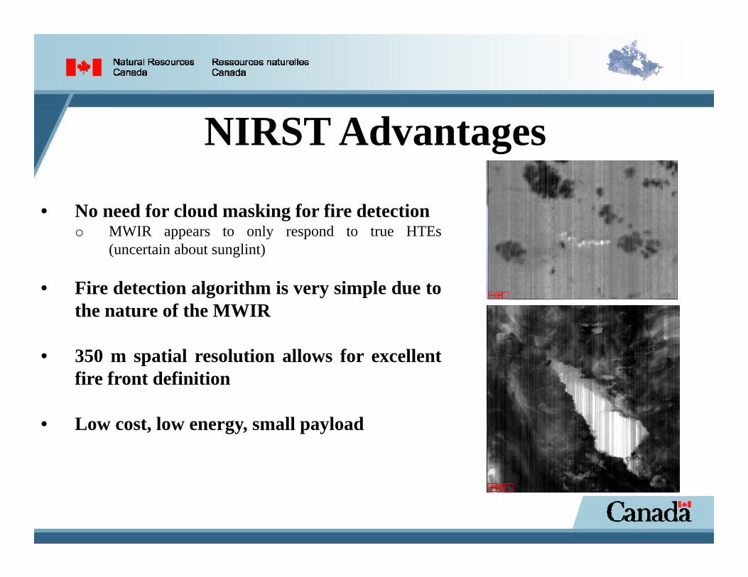
NIRST Advantages
• No need for cloud masking for fire detectiono MWIR appears to only respond to true HTEs
(uncertain about sunglint)
• Fire detection algorithm is very simple due tothe nature of the MWIR
• 350 m spatial resolution allows for excellentfire front definition
• Low cost, low energy, small payload
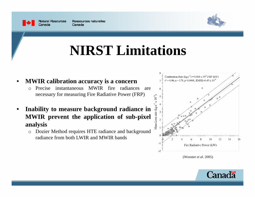
NIRST Limitations
• MWIR calibration accuracy is a concerno Precise instantaneous MWIR fire radiances are
necessary for measuring Fire Radiative Power (FRP)
• Inability to measure background radiance inMWIR prevent the application of sub-pixelanalysis
o Dozier Method requires HTE radiance and backgroundradiance from both LWIR and MWIR bands
(Wooster et al. 2005)
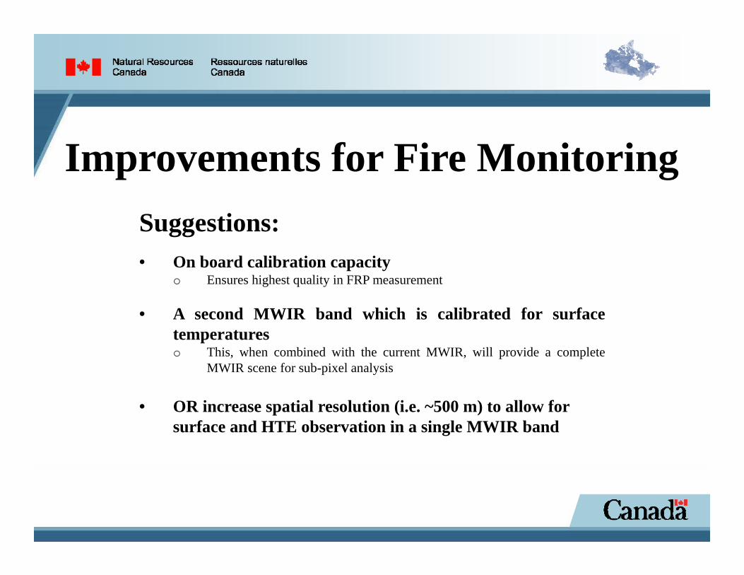
Improvements for Fire MonitoringSuggestions:• On board calibration capacity
o Ensures highest quality in FRP measurement
• A second MWIR band which is calibrated for surfacetemperatureso This, when combined with the current MWIR, will provide a complete
MWIR scene for sub-pixel analysis
• OR increase spatial resolution (i.e. ~500 m) to allow forsurface and HTE observation in a single MWIR band
ReferencesMarraco, H., & Phong, L. N. (2006). NIRST, a satellite based IR instrument for fire and sea surface temperature measurement. Paper presented at the Non-intrusive Inspection Technologies.
Phong, L. N., Pancrati, O., Marchese, L., & Châteauneuf, F. (2013). Spaceborne linear arrays of 512x3 microbolometers. Proc. of SPIE, 8614(86140N-1).
Wooster, M. J., Roberts, G., Perry, G. L. W., & Kaufman, Y. J. (2005). Retrieval of biomass combustion rates and totals from fire radiative power observations: FRP derivation and calibration relationships between biomass consumption and fire radiative energy release. Journal of Geophysical Research, 110. doi: 10.1029/2005JD006318
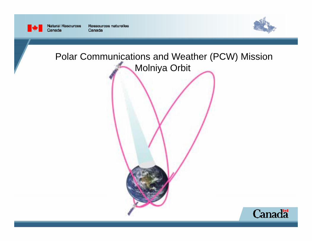
Polar Communications and Weather (PCW) MissionMolniya Orbit

Polar Communications and Weather (PCW) MissionMolniya Orbit
Slide 14
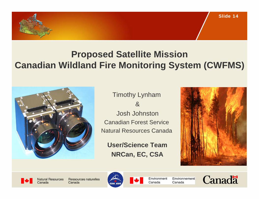
Proposed Satellite MissionCanadian Wildland Fire Monitoring System (CWFMS)
Timothy Lynham&
Josh JohnstonCanadian Forest Service
Natural Resources Canada
User/Science TeamNRCan, EC, CSA
Slide 15
CWFMS Mission Objectives
• To provide near real-time information in support of fire management.
• To provide emissions measurements in support of international requirements for carbon reporting and air quality forecasting.
Slide 16
CWFMS Mission Rationale
To Provide:
• Improved accounting of increasing fire frequency and intensity.• Assessment of socio-economic impacts.• Aid for decision-making between aggressive fire suppression
vs. monitoring.• Current and accurate data to decide on active fire mgt.
strategies.• Improved burned area mapping to deliver better fire statistics
and carbon emissions estimates.• Inputs for better smoke transport and air quality estimates.• Improved air quality advisories.
Slide 17
• GOES, MSG, MTSAT – 4 km res. with good coverage between 40ºN/S but res. deteriorates at northern latitudes. Resolution moving to 2 km.
• NASA MODIS (on Terra & Aqua) – 1 km res. Not an operational system despite operating since 1999 (Terra) and 2002 (Aqua). High & low gain MWIR bands avoids saturation with fires.
• NASA VIIRS – operational replacement for MODIS. 350 m res. in MWIR.• ESA Sentinel-3 – 1 km res. and the F1 fire channel (500ºK) will not saturate
in the MWIR (3.74 µm); CSA is a partner.• CONAE/CSA NIRST – experimental fire monitoring instrument on
AQUARIUS/SAD-D; no onboard calibration; pointing failed; MWIR not optimized for fire detection but LWIR is very sensitive. Provides background for Canadian Wildland Fire Monitoring System (CWFMS) mission concept.
• TET-1 and BIROS – experimental satellites from DLR that use the basic principles learned from BIRD.
• PCW – CSA, 2 satellites in molniya orbit. 50ºN to the N. pole at 2 km res. every 15 min. Includes MWIR & LWIR detectors. Uses ABI like GOES-R.
Existing and Planned Space-Based Systems
Slide 18
• Assists Provinces, Territories & Parks Canada with fire mgt. byoffering continuous monitoring of the whole of Canada, every day.
• Adds active fire detection and monitoring tool for remote regions of Canada that do not have organized detection.
• Covers the complete range of VIS-NIR-SWIR (150 m) and TIR (300 m) wavelengths.
• Supports the Fire Monitoring, Accounting and Reporting System (FireMARS) by supplying data for hotspots and VIS/SWIR for the National Burned Area Composite (NBAC).
Priority Applications and Services

Slide 19
SPOT VGT (coarse res.)
Agencies (Large Fire Database - LFDB)
Landsat (fine res.)
SPOT VGT
Landsat
Agencies
National Burn Area Composite (NABC)
…MODIS
Rules
Access to burn area products frommulti-sources, BUT at different times…
(Ensure the best available burn area products across-Canada at any time)

Slide 20
• Enable the use of hotspots for Rate of Spread estimates, especially for emerging fuel types (MPB & SBW mortality, peatlands) and for Fire Intensity estimates.
• Support the Canadian Wildland Fire Information System -CWFIS that tracks fire danger, fire behaviour and hotspots.
• Measurement of FRP to estimate trace gas and particulate emissions.
• Provide model inputs for improved Air Quality (Env. Canada) and smoke transport models (BlueSky).
Priority Applications and Services (Cont’d)
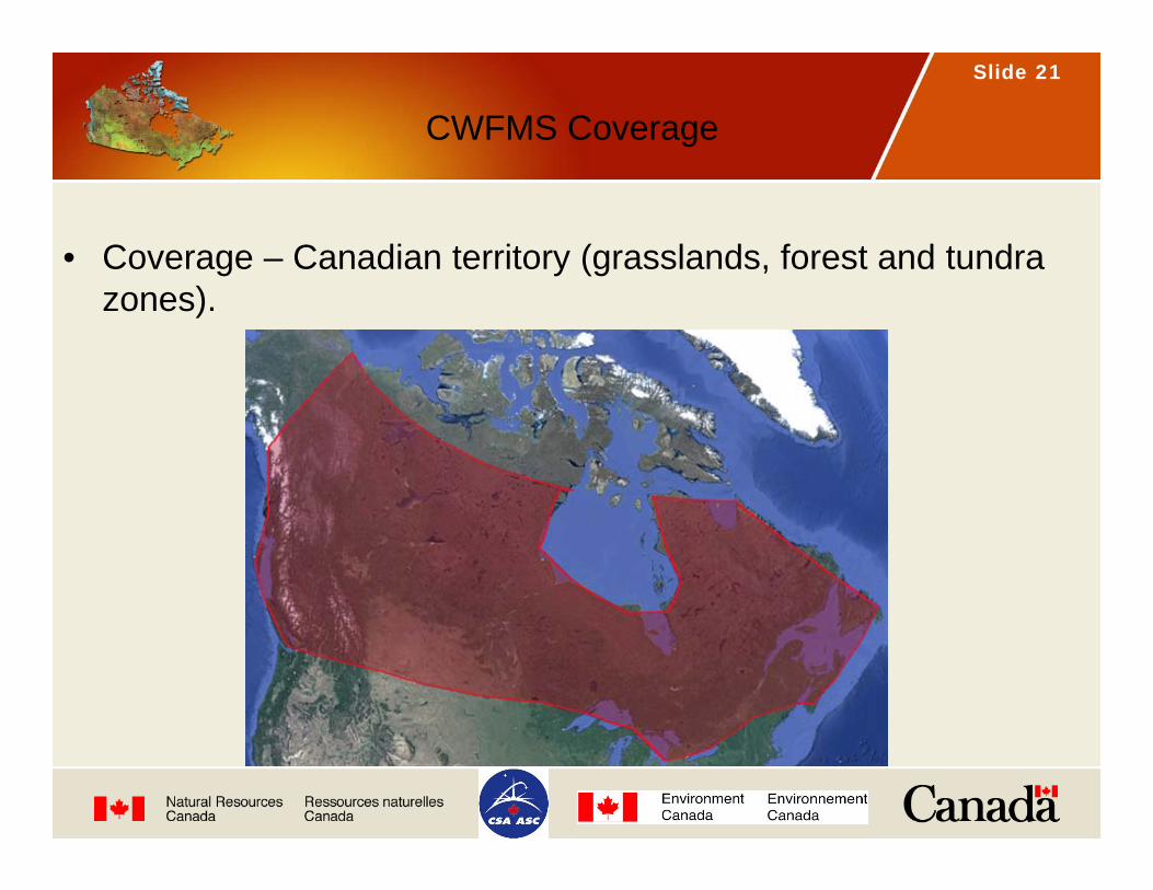
Slide 21
CWFMS Coverage
• Coverage – Canadian territory (grasslands, forest and tundra zones).

Thank You
Questions?