Embed Size (px)
Citation preview
Integrated Videos and Maps for Driving DirectionUIST 2009
Billy Chen, Boris Neubert, Eyal Ofek,Oliver Deussen, Michael F.CohenMicrosoft Research , University of Konstanz
Overview
• To make the first time navigating a route feel more familiar, they present a system that integrates a map with a video automatically
constructed from panoramic imagery captured at close intervals along the route.
Related work
• To See But Not to See: A Case Study of Visual Agnosia 1987
Glyn W. Humphreys and M. Jane Riddoch
• A paper discuss a patient who, because of an inability to form visual memories, has great difficulty finding his way along routes he commonly takes, even though he can draw a fairly accurate map of the route.
Related work
• Differences in cue use and spatial memory in men and women.
C. Jones and S. Healy.
• This paper show that women orient themselves more by remembering landmarks while man use more abstract features such as maps.
Related work
• Movie-maps: An application of the optical videodisc to computer graphics.
SIGGRAPH 1980
Andrew Lippman
• A seminal work in creating flexible video views of routes.
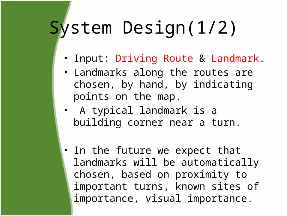
System Design(1/2)
• Input: Driving Route & Landmark.• Landmarks along the routes are chosen, by
hand, by indicating points on the map.• A typical landmark is a building corner near a
turn.
• In the future we expect that landmarks will be automatically chosen, based on proximity to important turns, known sites of importance, visual importance.
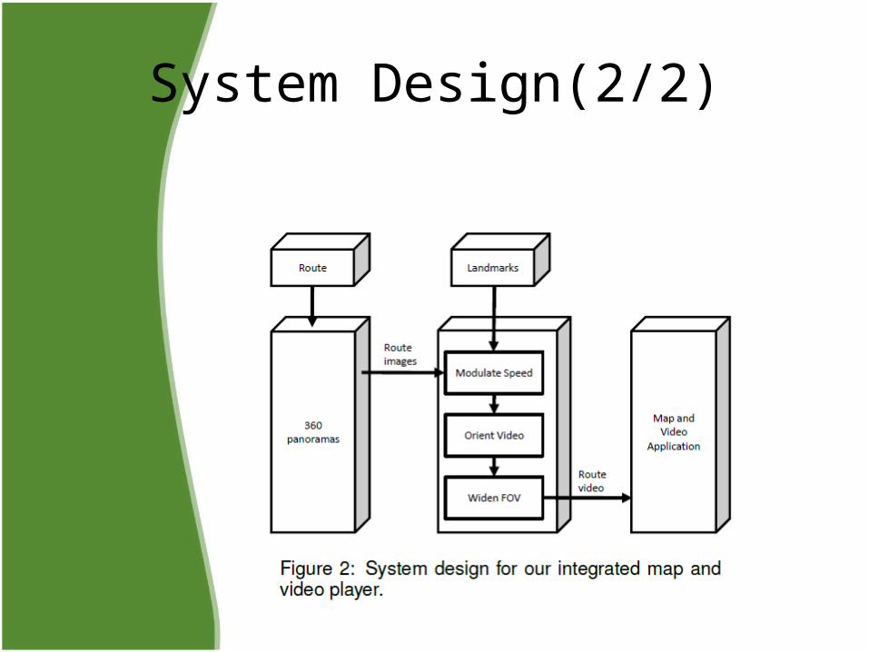
System Design(2/2)
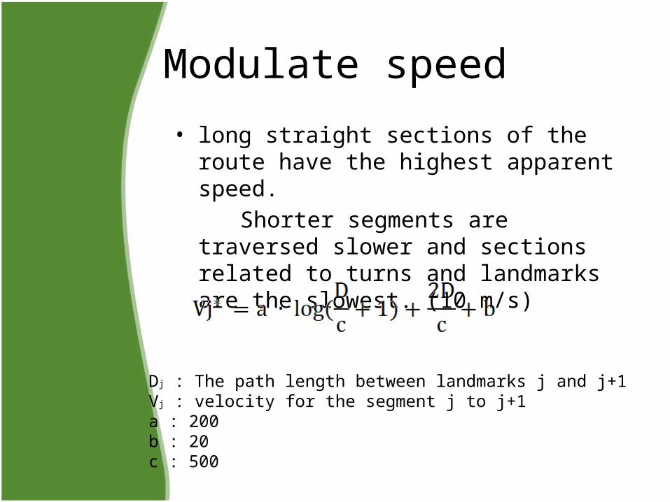
Modulate speed
• long straight sections of the route have the highest apparent speed.
Shorter segments are traversed slower and sections related to turns and landmarks are the slowest. (10 m/s)
Dj : The path length between landmarks j and j+1Vj : velocity for the segment j to j+1a : 200b : 20c : 500
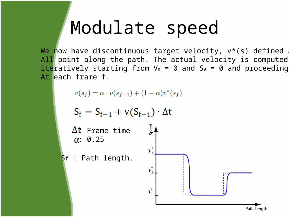
Modulate speed
: Frame time: 0.25
We now have discontinuous target velocity, v*(s) defined at All point along the path. The actual velocity is computed iteratively starting from V0 = 0 and S0 = 0 and proceedingAt each frame f.
Sf : Path length.
Field of view
• At each frame in the video we have full 360 degree panorama.
• We have found from informal experimentation that a 90 degree FOV achieves a good balance between providing a wide enough FOV to provide side to side context while exhibiting only mild wide angle distortion.
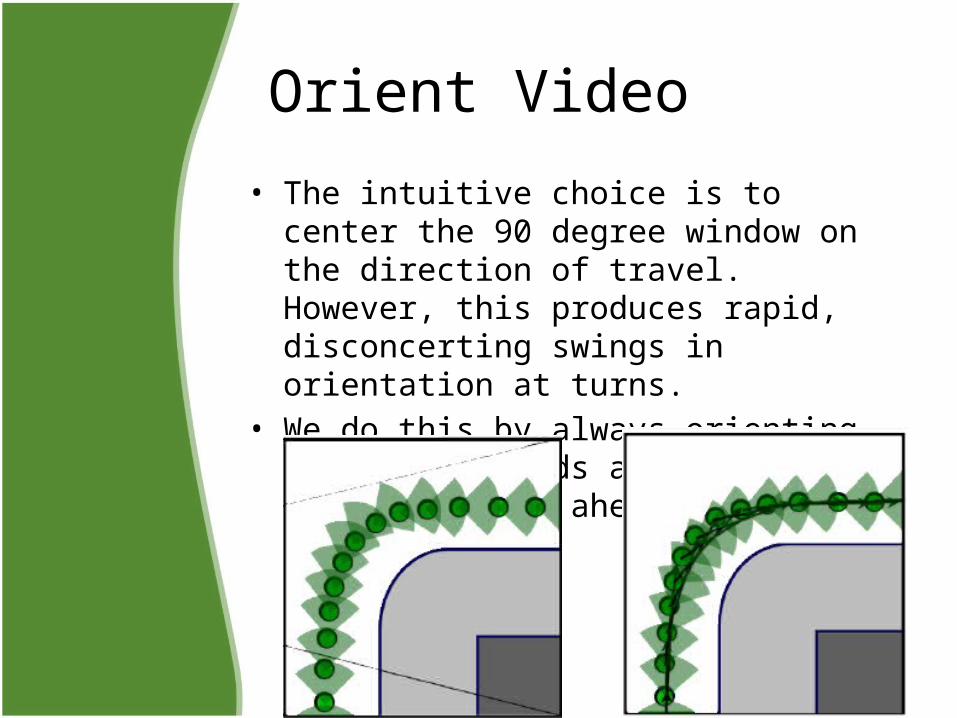
Orient Video
• The intuitive choice is to center the 90 degree window on the direction of travel. However, this produces rapid, disconcerting swings in orientation at turns.
• We do this by always orienting the view towards a point on the path 25 meters ahead.
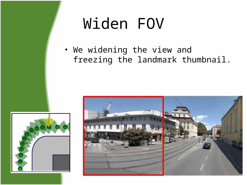
Widen FOV
• We widening the view and freezing the landmark thumbnail.
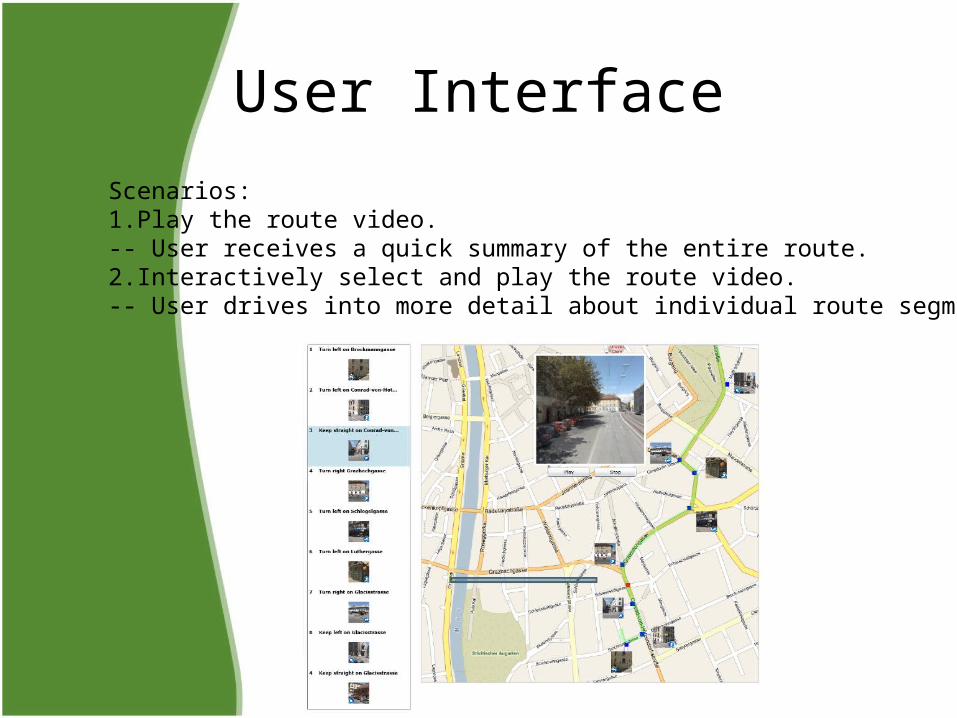
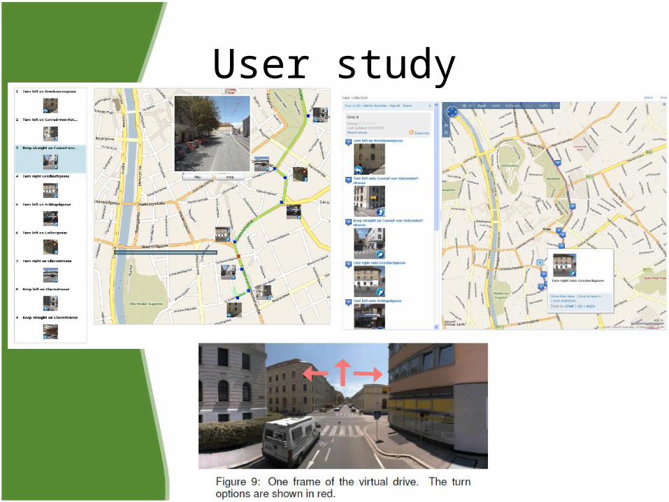
User InterfaceScenarios:1.Play the route video.-- User receives a quick summary of the entire route.2.Interactively select and play the route video.-- User drives into more detail about individual route segments.
User study
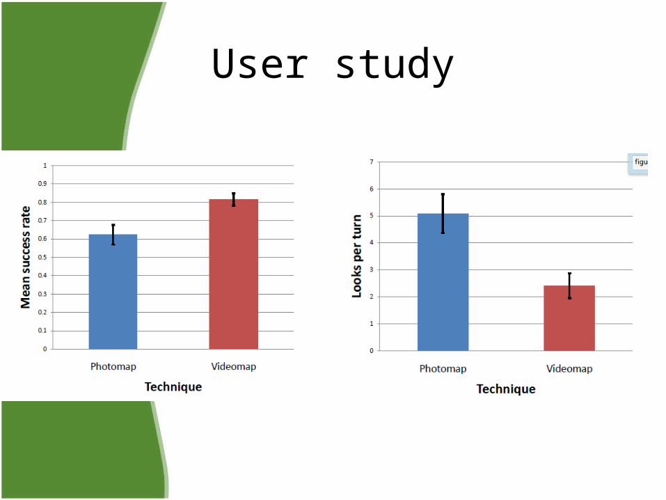
User study
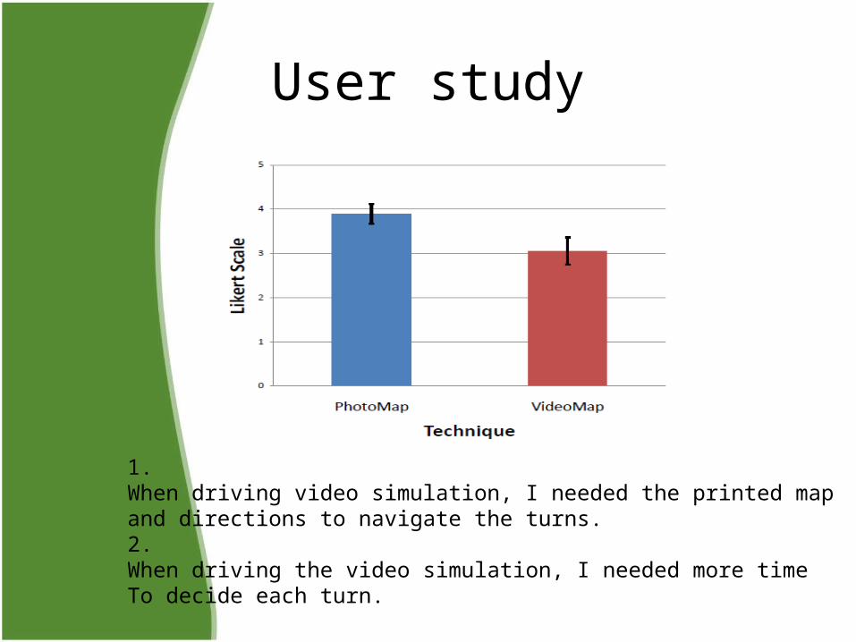
User study
1.When driving video simulation, I needed the printed map and directions to navigate the turns.2.When driving the video simulation, I needed more timeTo decide each turn.
Video
Conclusion• We have demonstrated a prototype that combines maps with
imagery assembled into a video to depict driving a route to help a user in wayfinding along the route.
• How long does the visual memory from the application last?• How will lighting differences effect the outcome?• How will the differing modalities between viewing a
video• and actually driving in a car effect the usefulness of the• video?• How long a route can one retain in memory?