Embed Size (px)
Citation preview
Sydney Office 78 George Street Redfern NSW Australia 2016 T +61 2 9319 4811
Canberra Office 2A Mugga Way Red Hill ACT Australia 2603 T +61 2 6273 7540
GML Heritage Pty Ltd ABN 60 001 179 362
www.gml.com.au
Ingleside Precinct
Heritage Interpretation Strategy
Report prepared for NSW Department of Planning and Environment
May 2016
GML Heritage
Report Register
The following report register documents the development and issue of the report entitled Ingleside
Precinct—Heritage Interpretation Strategy, undertaken by GML Heritage Pty Ltd in accordance with its
quality management system.
Job No. Issue No. Notes/Description Issue Date
14-0257 1 Draft Report 24 June 2015
14-0257 2 Final Report 13 May 2016
14-0257 3 Revised Final Report 30 May 2016
Quality Assurance
GML Heritage Pty Ltd operates under a quality management system which has been certified as
complying with the Australian/New Zealand Standard for quality management systems AS/NZS ISO
9001:2008.
The report has been reviewed and approved for issue in accordance with the GML quality assurance
policy and procedures.
Project Director & Reviewer: Sharon Veale
Issue No. 3
Signature
Position: Partner Partner
Date: 30 May 2016
Copyright
Historical sources and reference material used in the preparation of this report are acknowledged and
referenced at the end of each section and/or in figure captions. Reasonable effort has been made to identify,
contact, acknowledge and obtain permission to use material from the relevant copyright owners.
Unless otherwise specified or agreed, copyright in this report vests in GML Heritage Pty Ltd (‘GML’) and in the
owners of any pre-existing historic source or reference material.
Moral Rights
GML asserts its Moral Rights in this work, unless otherwise acknowledged, in accordance with the
(Commonwealth) Copyright (Moral Rights) Amendment Act 2000. GML’s moral rights include the attribution of
authorship, the right not to have the work falsely attributed and the right to integrity of authorship.
Right to Use
GML grants to the client for this project (and the client’s successors in title) an irrevocable royalty-free right to
reproduce or use the material from this report, except where such use infringes the copyright and/or Moral
Rights of GML or third parties.
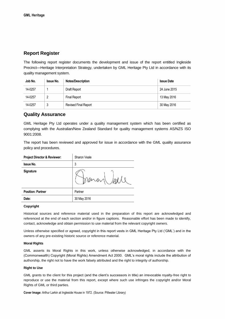
Cover Image: Arthur Larkin at Ingleside House in 1972. (Source: Pittwater Library)
GML Heritage
Ingleside Precinct—Heritage Interpretation Plan, May 2016
Contents Page
1.0 Introduction ................................................................................................................................................ 1
1.1 Background .............................................................................................................................................. 1
1.2 Pittwater and Northern Beaches Councils ............................................................................................. 1
1.3 The GreenStar—Communities Pilot ....................................................................................................... 1
1. Managing and Interpreting Culture, Heritage and Identity—Compliance Requirements: ........... 2
2. Developing and Enhancing Community Culture, Heritage and Identity ....................................... 2
1.4 Project Objectives .................................................................................................................................... 2
1.5 Ingleside Precinct ..................................................................................................................................... 2
1.6 Pittwater Community Based Heritage Study (2015) ............................................................................. 3
1.7 Methodology ............................................................................................................................................. 3
1.8 Authorship ................................................................................................................................................ 4
1.9 Endnotes .................................................................................................................................................. 6
2.0 Historical Overview ................................................................................................................................... 7
2.1 Introduction ............................................................................................................................................... 7
2.2 Aboriginal History ..................................................................................................................................... 7
2.3 Establishment of a European Community ............................................................................................. 8
2.4 The Early Residents and Industry of Ingleside ...................................................................................... 9
2.5 1920s–1950s Development: Market Gardens, Weekenders & Migrant Influences ......................... 10
2.6 Later Twentieth Century Development ................................................................................................ 12
2.6.1 1950s and 1960s subdivisions: Nurseries and Poultry Farms .................................................... 12
2.6.2 Government restrictions ................................................................................................................. 13
2.6.3 Religious Groups ............................................................................................................................ 13
2.6.4 National Parks and Cultural Landscapes ...................................................................................... 14
2.7 Historical Themes .................................................................................................................................. 14
2.8 Key Stories for Interpretation ................................................................................................................ 17
2.9 Endnotes ................................................................................................................................................ 19
3.0 Situation Analysis ................................................................................................................................... 20
3.1 Introduction ............................................................................................................................................. 20
3.2 Site Analysis ........................................................................................................................................... 20
3.3 Structure Plan ........................................................................................................................................ 20
3.4 Analysis of Key Sites ............................................................................................................................. 21
3.4.1 Ingleside House and the Powderworks Ruins .............................................................................. 22
3.4.2 The Baha’i House of Worship ........................................................................................................ 27
3.4.3 The Group of Monterey Pines (Waratah Farm) ............................................................................ 30
3.4.4 Cicada Glen Nursery, Formerly Klerk’s Garden ........................................................................... 32
3.4.5 Laterite Site ..................................................................................................................................... 34
3.4.6 Katandra Bushland Sanctuary ....................................................................................................... 35
3.4.7 Carving Survey Mark ...................................................................................................................... 36
3.4.8 Smoky Dawson’s Ranch Gates ..................................................................................................... 37
3.5 Endnotes ................................................................................................................................................ 38
GML Heritage
Ingleside Precinct—Heritage Interpretation Plan, May 2016
4.0 Interpretation Framework...................................................................................................................... 39
4.1 Objectives of Interpretation................................................................................................................... 39
4.2 Potential Interpretative Devices ........................................................................................................... 39
4.3 Potential Interpretation Locations ........................................................................................................ 40
4.4 Key Stories and Devices ...................................................................................................................... 41
Location 1—Ingleside House .................................................................................................................. 44
Location 2—Powderworks Ruins ........................................................................................................... 45
Location 3—The Baha’i House of Worship ........................................................................................... 46
Location 4—The Site of the Former Waratah Farm (Monterey Pines) ............................................... 47
Location 5—Cicada Glen Nursery (Formerly Klerk’s Garden) ............................................................. 48
Location 6—Pedestrian and Cycle Ways .............................................................................................. 49
Location 7—Nature Trails ....................................................................................................................... 50
Promotion and Marketing—Digital Interpretation .................................................................................. 51
4.5 Recommended Interpretive Initiatives ................................................................................................. 52
4.6 Conclusions ........................................................................................................................................... 52
GML Heritage
Ingleside Precinct—Heritage Interpretation Strategy, May 2015 1
1.0 Introduction
1.1 Background
GML Heritage Pty Ltd (GML) has been engaged by the Department of Planning and Environment
(DPE) to prepare a Heritage Interpretation Strategy (HIS) for the Ingleside Precinct. This HIS is
required by council to assist in the precinct planning process for Ingleside, and also as part of the
community cultural plan for Green Building Council of Australia (GBCA) GreenStar accreditation for the
Ingleside Precinct.
In parallel to this HIS report, GML has prepared a Non-Indigenous Heritage Assessment for the
Ingleside Precinct. The assessment report set out the historical development of the precinct, provided
an analysis of its documentary and physical evidence, assessed the heritage significance of a number
of heritage-listed items within the precinct, and outlined constraints and opportunities arising from the
significance of these items. The report was prepared to guide and inform the preparation of an
Indicative Layout Plan (ILP) and the Structure Plan (SP).
1.2 Pittwater and Northern Beaches Councils
In May 2016 Pittwater Council was merged into a new body, the Northern Beaches Council. As this
report was prepared prior to these changes, it makes reference to the former council. The plans and
strategies of the former council continue to apply to the former local government area until the new
council prepares its own plans and strategies.
1.3 The GreenStar—Communities Pilot
The Green Building Council of Australia (GBCA) was established in 2002 to develop a sustainable
property industry and drive the take up of green building practices through market-based initiatives.
The GreenStar—Communities Pilot rating tool was developed by the GBCA in 2012 to provide third-
party verification and best practice benchmarks for the property sector (both private and public). The
tool measures community-scale developments’ ability to manage sustainability issues (in both design
and construction phases) against the following categories:
Governance;
Liveability;
Environment;
Design;
Economic Prosperity; and
Innovation. 1
Cultural Heritage and Identity—which aims to encourage and recognise the interpretation and
celebration of culture, heritage and identity—is recognised under the Liveability category. In this credit
three Green Star rating points are available. One point is awarded where cultural heritage and identity
are managed and interpreted. Two points are awarded where the interpretation of the culture, heritage
GML Heritage
Ingleside Precinct—Heritage Interpretation Strategy, May 2016 2
and identity of the project site informs the design of the site in a way that strengthens the cultural and
heritage connections, and which will contribute to building a strong local community.2
1. Managing and Interpreting Culture, Heritage and Identity—Compliance Requirements:
To achieve the GreenStar rating points available in this area a cultural significance interpretation plan
(this HIS report) needs to be developed with the following elements;
clearly identify which places will be subject to interpretation (summary available at Table 4.1);
determine objectives for interpretation specific to the identified items of significance;
describe methods used for interpretation for each of the identified items and a program of
implementation. Examples should include–installations; landmarks; design guidelines that
promote the historic significance and cultural values of the place; tourism; information and
educational operations; plantings; landscaping; marketing events and merchandising (Section 4)
These are assessed by an independent panel to determine if the project has met the GreenStar—
Communities Pilot requirements.
2. Developing and Enhancing Community Culture, Heritage and Identity
This requirement could be implemented through the adaptive re-use of some of the identified places
such as indicated in the ILP. This includes the Cicada Glen Nursery and the Powderworks Ruins.
1.4 Project Objectives
The project objectives and aims are to review the precinct’s history and heritage places with reference
to the proposed layout and land use planning and, more specifically, to:
identify places and locations in the public domain likely to be suitable for interpretation as part of
the development of the precinct;
consider the local community/future residents as potential audience/s for interpretation;
identify objectives for interpretation; and
provide suggestions for potential interpretative options/devices that will connect with identified
audience/s.
1.5 Ingleside Precinct
The Ingleside Precinct comprises approximately 700 hectares surrounded by bushland:
Ku-ring-gai Chase National Park, which is included on the National Heritage List, is to the north
and west;
Garigal National Park is to the south; and
the Katandra Bushland Sanctuary and Ingleside Chase Reserve are to the east.
The precinct is located within the Pittwater Local Government Area (LGA), adjacent to neighbouring
suburbs Bayview, Warriewood, Terrey Hills and Elanora Heights. Mona Vale Road runs east to west
GML Heritage
Ingleside Precinct—Heritage Interpretation Strategy, May 2015 3
through Ingleside, bisecting the north and south areas of the precinct. A small number of properties in
Bayview Heights are also included within the defined boundary of Ingleside Precinct. The character of
the precinct is predominately rural residential, interspersed with areas of small-scale agricultural,
commercial and industrial use, and expanses of natural bushland.
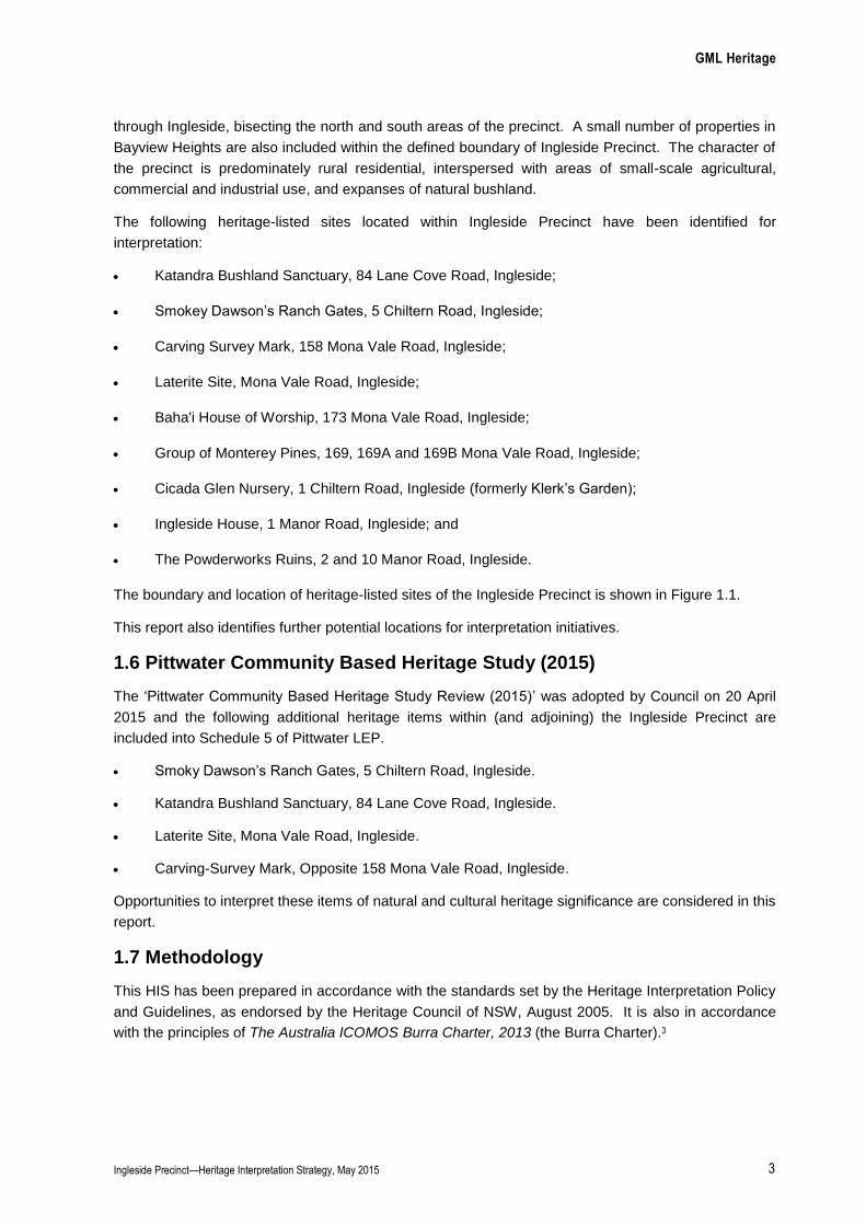
The following heritage-listed sites located within Ingleside Precinct have been identified for
interpretation:
Katandra Bushland Sanctuary, 84 Lane Cove Road, Ingleside;
Smokey Dawson’s Ranch Gates, 5 Chiltern Road, Ingleside;
Carving Survey Mark, 158 Mona Vale Road, Ingleside;
Laterite Site, Mona Vale Road, Ingleside;
Baha'i House of Worship, 173 Mona Vale Road, Ingleside;
Group of Monterey Pines, 169, 169A and 169B Mona Vale Road, Ingleside;
Cicada Glen Nursery, 1 Chiltern Road, Ingleside (formerly Klerk’s Garden);
Ingleside House, 1 Manor Road, Ingleside; and
The Powderworks Ruins, 2 and 10 Manor Road, Ingleside.
The boundary and location of heritage-listed sites of the Ingleside Precinct is shown in Figure 1.1.
This report also identifies further potential locations for interpretation initiatives.
1.6 Pittwater Community Based Heritage Study (2015)
The ‘Pittwater Community Based Heritage Study Review (2015)’ was adopted by Council on 20 April
2015 and the following additional heritage items within (and adjoining) the Ingleside Precinct are
included into Schedule 5 of Pittwater LEP.
Smoky Dawson’s Ranch Gates, 5 Chiltern Road, Ingleside.
Katandra Bushland Sanctuary, 84 Lane Cove Road, Ingleside.
Laterite Site, Mona Vale Road, Ingleside.
Carving-Survey Mark, Opposite 158 Mona Vale Road, Ingleside.
Opportunities to interpret these items of natural and cultural heritage significance are considered in this
report.
1.7 Methodology
This HIS has been prepared in accordance with the standards set by the Heritage Interpretation Policy
and Guidelines, as endorsed by the Heritage Council of NSW, August 2005. It is also in accordance
with the principles of The Australia ICOMOS Burra Charter, 2013 (the Burra Charter).3

GML Heritage
Ingleside Precinct—Heritage Interpretation Strategy, May 2016 4
1.8 Authorship
This HIS has been prepared by Michelle Richmond, Historian; Angela So, Graduate Consultant and
Suzy Pickles Graphics Consultant at GML. Sharon Veale, Partner, provided strategic advice and
reviewed the report.
GML Heritage
Ingleside Precinct—Heritage Interpretation Strategy, May 2015 5
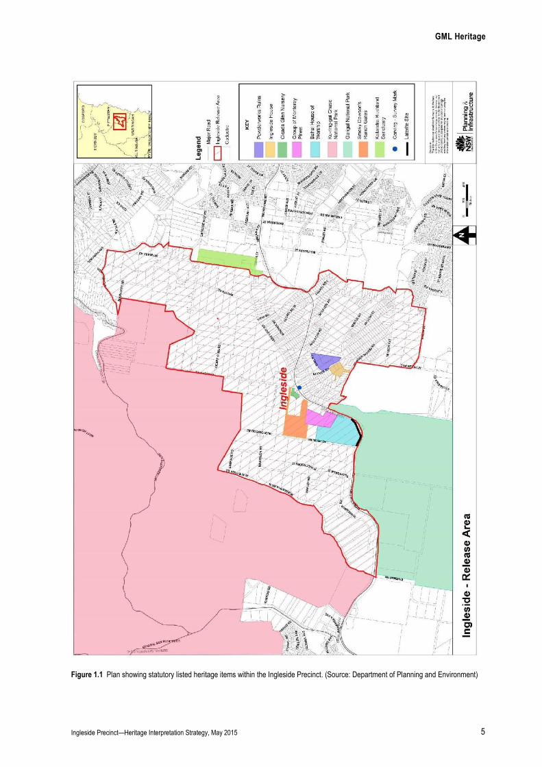
Figure 1.1 Plan showing statutory listed heritage items within the Ingleside Precinct. (Source: Department of Planning and Environment)

GML Heritage
Ingleside Precinct—Heritage Interpretation Strategy, May 2016 6
1.9 Endnotes
1 Green Star Communities Rating Tool <http://www.gbca.org.au/green-star/green-star-communities/rating-tool/> viewed 22 June 2015. 2 Green Star – Communities PILOT Submission Guideline Version 0.2/ Date Issues: Feb 2015 – Culture Heritage and Identity, p150. 3 Australia ICOMOS Inc, The Burra Charter: the Australia ICOMOS Charter for Places of Cultural Significance 2013, Australia ICOMOS Inc,
Burwood, VIC.
GML Heritage
Ingleside Precinct—Heritage Interpretation Strategy, May 2016 7
2.0 Historical Overview
2.1 Introduction
This section provides a summary history of the Ingleside
Precinct with specific reference to the five identified heritage
sites. It should be read in conjunction with the more detailed
history provided in the Non-Indigenous Heritage Assessment—
Stage 1 Summary Report for the Ingleside Precinct, produced
by GML in April 2014.
Ingleside lies on the hinterland above Warriewood and
Bayview on a plateau with steep inclines to the east and north.
Open forests are confined largely to the ridgelines, creeks and
gullies, with the remainder of the precinct comprising low
woodland and open scrub. The character of the precinct is
predominantly rural residential. The precinct feeds three
significant catchments which channel water from the site to the
Ku-ring-gai Chase and Garigal national parks and Narrabeen
Lagoon in the south, and the Pittwater waterway in the north.
Some of the channelled water is evidenced as waterfalls
including the waterfall on Greenhill Creek (near Powderworks
Road) which rises on Sugar Loaf Hill. There is also a rare and
significant laterite fossil soil site which evidences climate
change and continental drift. The site is part of the area’s
geoheritage associated with the Cenozoic period when more
humid tropical and humid conditions were prevalent. The site
extends south from the Baha’i Temple grounds.1 Evidence of
significant remnant native plant communities and habitats are
still in evidence and protected in local national parks and at
Katandra Sanctuary which is protected as a statutory listed
landscape item.
2.2 Aboriginal History
For thousands of years before the arrival of European settlers,
Aboriginal people lived in the area from Newcastle down to
Sydney, mostly along the foreshores of the harbour.
Whilst the ‘Guringai’ is commonly thought to be Aboriginal
language group associated with this land area, recent research
by the Aboriginal Heritage Office suggests otherwise.
Investigating early colonial documentary sources regarding
‘Guringai’, the Aboriginal Heritage Office found no
documentary evidence dating from the period between 1788
and 1800 of such a group or language.2 Rather, research
indicates that Guringai or ‘Kuringgai’ was first used in 1892 to
describe a large group extending from the Macleay River to the
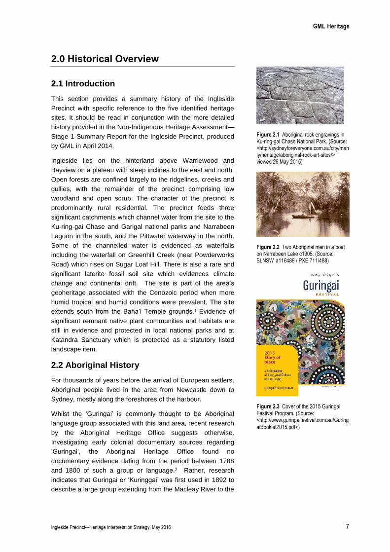
Figure 2.1 Aboriginal rock engravings in Ku-ring-gai Chase National Park. (Source: <http://sydneyforeveryone.com.au/city/manly/heritage/aboriginal-rock-art-sites/> viewed 26 May 2015)
Figure 2.2 Two Aboriginal men in a boat on Narrabeen Lake c1905. (Source: SLNSW a116488 / PXE 711/488)
Figure 2.3 Cover of the 2015 Guringai Festival Program. (Source: <http://www.guringaifestival.com.au/Guring
aiBooklet2015.pdf>)

GML Heritage
Ingleside Precinct—Heritage Interpretation Strategy, May 2016 8
south of Sydney. In fact, the Aboriginal Heritage Office note that the ‘Kuringgai’ comprised a number
of groups including the ‘Gringai’ (Guringay) group in the Hunter River area.3 Notwithstanding its
current and widespead usage, the Aboriginal Heritage Office conclude that the use of ‘Guringai’ is not
warranted and the use of clan names for local areas is more appropriate. Given this, the short history
below does not use ‘Guringai’ to refer to the Aboriginal group with connections to the Ingleside
Precinct.
Aboriginal people fished and hunted in the waters and harvested food from the surrounding bushland.4
They would have found the swamps of the Warriewood Valley rich in sustenance—fish, birds and fresh
water. It is believed that three main groups, interacted across this land area for trade and for
ceremonial occasions. Their frequented ‘Coastal Dreaming Track’ was roughly aligned with Pittwater
Road and linked with tracks to Ku-ring-gai, Middle Harbour and North Head.5 Local sites for food
collection or ceremonies included the Narrabeen beach and rock platform, Cromer and Eleanora
Heights, Deep Creek, and the ocean (for fishing). A known Aboriginal town camp existed at Middle
Creek (now the Narrabeen Sports Academy site) until the 1950s (Figure 2.2),6 and an earlier camp site
existed at Mactier Street, Narrabeen.
As a result of European contact, the traditions and customs of Aboriginal people were drastically
altered. Debilitating diseases such as smallpox swiftly diminished the local population. Their traditional
country was also irrecoverably changed when large land grants were taken up and the land was
cleared and settled by European farmers.
Aboriginal people resisted the settlers and maintained connections to their land where they could,
including at the Narrabeen Lake town camp.7 The surrounding national parks retain extensive
evidence of past Aboriginal use and occupation including rock engravings (Figure 2.1) and paintings,
grinding grooves and occupation sites. Twenty-eight Aboriginal archaeological sites have been
identified within the Ingleside precinct. Today, local communities and the Aboriginal Heritage Office
safeguard Aboriginal culture and heritage, which is celebrated annually at the Guringai Festival (Figure
2.3).8
2.3 Establishment of a European Community
Soon after the First Fleet landed at Sydney Cove the area from Manly to the Barrenjoey peninsula was
explored for potential agricultural development. It was not, however, until 1813 that the first land grants
were made in the district of Pittwater. Between this time and the 1830s, most of the arable land along
the coastline was granted and farmed while the hinterland above, near present-day Ingleside,
remained undeveloped (Figure 2.4). In 1848, there were still only 63 settlers living in the whole territory
between Manly Cove and Narrabeen. Aboriginal people still lived in the area and much of the
landscape remained untouched.

GML Heritage
Ingleside Precinct—Heritage Interpretation Strategy, May 2016 9
From the 1850s on, development in the area steadily increased—
especially as access to the area improved. The two main road
access routes were overland from the North Shore along what is
now Mona Vale Road (Figure 2.6) and along the coast track, now
Pittwater Road. Travelers had to ford Narrabeen Lake until the
1880s when the first bridge opened. Both Mona Vale and Pittwater
roads are thought to follow earlier Aboriginal tracks, and are
shown on early maps of the area.
Land within the suburb of Ingleside was granted from the 1860s to
the 1880s in farm lots of between 40 and 640 acres (Figure 2.5). A
survey mark dating from 1882, located on the southern side of
Mona Vale Road, Ingleside, is evidence of this period of land
subdivision. The survey mark was engraved into naturally
occurring sandstone by Mr L Burdett. It defines Portion 70 of the
Parish of Narrabeen, County of Cumberland. Mr James Joyce had
applied for this land under the Crown Lands Alienation Act 1861.9
Much of this land, however, was never developed and remained
as natural bushland for many years. The few landholders who
actually occupied their land cleared only small portions for
farming, and only a small number of residences were built.
Ku-ring-gai Chase National Park (covering 13,500 hectares) was
established in 1894 on the northern side of Mona Vale Road,
protecting this area from any future development.
2.4 The Early Residents and Industry of Ingleside
Of the few early Ingleside residents, the most famous by far was
Carl von Bieren, a Dutch American chemist who established a
powderworks factory on part of his land in the 1880s. The factory
was created with the latest technology and with no expense
spared. Its progress and impending opening excited the residents
and dignitaries of the area immensely, with many visiting to
inspect the works including the Governor of NSW (Figure 2.8).
Von Bieren also built for himself a substantial home on part of the
site with a prominent outlook towards to the ocean. He called his
residence Ingleside House, after which the suburb of Ingleside
was named (Figure 2.7). Here he cleared over five acres of dense
vegetation to construct his residence, an elaborate garden and
several out buildings which were built to house the workers at the
powderworks factory (Figure 2.9). Von Bieren entertained lavishly
and his house was referred to as ‘a marvel in the bush’ with ‘all the
requirements of a cultured and refined humanity’.10 Sadly, von
Bieren was declared bankrupt before one ounce of powder had
been made and spent two years in prison. His splendid factory
was left to fall into ruins while the house and land were sold. The
Figure 2.4 Parish Map showing James Jenkins’ Cabbage Tree farm on the coast— with the undeveloped hinterland of Ingleside above. (Source: Department of Lands)
Figure 2.5 1886 parish map of Narrabeen with the approximate location of the study area outlined in red— all the land within the study area had been granted by this time. (Source: Department of Lands)
Figure 2.6 Mona Vale Road in 1939 at Tumble Down Dick Hill near Ingleside. (Source: SLNSW)
Figure 2.7 The original Ingleside House 1884, home of Carl von Bieren. (Source: Part of a collection of archives owned by
Frank Vambuca-current owner)
GML Heritage
Ingleside Precinct—Heritage Interpretation Strategy, May 2016 10
access road to his property is now called Powderworks Road.
Isaac and Florence Larkin became the caretakers of Ingleside
house and two of their children were born there.
On the northern side of Mona Vale Road, farmer James Jones
cleared a small part of his 240 acre property in the 1880s,
opposite the entrance to Powderworks Road, to construct a house
(Figure 2.10). Ten years later he sold the house on eight acres to
Isaac Larkin. Jones retained the rest of his land but did not
develop it and it remained as natural bushland for many years to
come. Larkin moved his family from Ingleside House to the eight-
acre property, built a new house for his family and named the
property Waratah Farm (Figure 2.11). He cleared the land and
planted an orchard and it was here that he propagated the
Narrabeen Plum, a variety that was registered with the
Department of Agriculture and remains popular to this day. Larkin
sold his produce at the Sydney markets. The Larkin’s house was
called ‘The Pines’ and it remained on the site until the 1980s. 11
Aerial photographs also show another house on the property to
the south of The Pines which may have been Jones’ original
house.
2.5 1920s–1950s Development: Market Gardens, Weekenders & Migrant Influences
During the 1920s, subdivision began of some of the large
landholdings at Ingleside. Here, where the land was cheaper,
market gardening was undertaken, especially from the 1940s,
though not as intensely as in the Warriewood Valley where the
large number of tomato farms saw the area nick named ‘glass
city’. With the market gardens came migrant workers, especially
from former Yugoslavia (Figure 2.13), and the first Yugoslav club
in Australia was started in Warriewood in 1939.
Figure 2.8 1884 von Bieren’s Powderworks Factory Ingleside. (Source: Town and Country Journal 16 August 1884)
Figure 2.9 1885 picture of Ingleside House and out buildings from Powderworks Road. (Source: Warringah Library)
Figure 2.10 Part of an 1880s Crown Plan showing James Jone’s house and land (outlined) which became Waratah Farm. (Source: Crown Plan 412.2030, Department of Lands)
Figure 2.11 The Larkin Family at Waratah Farm. (Source: Warringah Library)
Figure 2.12 1930 aerial showing the limited development at Ingleside at this time. (Source: Department of lands)

GML Heritage
Ingleside Precinct—Heritage Interpretation Strategy, May 2016 11
Land surrounding the powderworks site and Ingleside House was
one of the first areas subdivided. In 1923, land either side of
Manor Road (where Ingleside House was located) was
subdivided—mostly into small-acre farm blocks of between 4 and
20 acres but also into some residential allotments (Figure 2.14). A
few other similar subdivisions took place at this time, mostly
adjoining the former powderworks site on land closer to
Warriewood. Several tomato-growing establishments were setup
on this land and a number of Yugoslav families operated them.
On the northern side of Mona Vale Road, the northern part of
James Jones’ land was subdivided in 1926 into 33 residential
allotments. Only a single lot, however, was sold—one acre on the
corner of Mona Vale and Chiltern Roads purchased by Dr Henry
Percy Pickerill, a Macquarie Street doctor in 1929. Here Pickerill
constructed a weekender for himself which he called ‘Caradoc’—
he rode to it by horse each weekend (Figure 2.15). Through the
property flows what is now called Cicada Glen Creek and here
Pickerill planted numerous trees, many of which still remain on the
property including the Hoop Pine, English Oak, Japanese Maple,
Canadian Maple and Liquid Amber.
Ingleside House was purchased by Rosa MacNamara in 1923.
After subdividing the surrounding land, she retained the house on
five acres. The house was in a ruinous state and fell further into
disrepair, as reported on by the Manly and Warringah Historical
Society in 1939.12 The five-acre house site was sold to the Rev
George Ingram-Pearson and his wife Margaret in 1937, and they
appear to have been responsible for the construction of a new
sandstone dwelling on the site of the original house, which they
also called Ingleside House (Figure 2.16). While the house was
new, much of the original 1880s garden was maintained (Figure
2.17).
Waratah Farm (The Pines) and an adjoining 3 acres were
resumed by the Crown in 1920. The land was still at this time an
isolated development surrounded by large areas of undeveloped
native bushland. It is not clear why the crown purchased the land
as aerial photographs show that the land continued to operate as
orchards and market gardens. By 1951 this land was back in
private ownership, and from 1953 operated as a poultry farm with
large sheds constructed on the site. This land was again resumed
by the Crown in 1971 as a possible site for the construction of
Ingleside High School—a development that never eventuated
(Figure 2.18). In recent years the site has been further subdivided
resulting in the construction of several new buildings and a
nursery on the site and the demolition of both Jones’ house and
The Pines. A group of existing Monterey Pines planted near The
Figure 2.13 Yugoslav tomato growers in the 1940s. (Source: Warringah Library)
Figure 2.14 DP12115 dated 1923. (Source: Department of lands)
Figure 2.15 Pickerill’s original cottage in the 1960s when part of Klerk’s Nursery. (Source: Tao Klerk’s private collection)
Figure 2.16 The new Ingleside House soon after it was constructed c1940. (Source: Pittwater Library).
GML Heritage
Ingleside Precinct—Heritage Interpretation Strategy, May 2016 12
Pines date from between 1930 and 1947.13 Trees along the south
and west boundaries of Waratah Farm could date back to the
establishment of the original farm in 1899 and are shown in aerial
photographs of the site from 1930 onwards.
2.6 Later Twentieth Century Development
2.6.1 1950s and 1960s subdivisions: Nurseries and Poultry Farms
Most of the large farms at Ingleside were not subdivided until the
1950s and 1960s, and again this was into small farm lots. Market
gardening continued in Ingleside while some former market gardens
were converted for use as poultry farms and plant nurseries (Figure
2.19). The semi-rural feel of Ingleside also attracted animal welfare
organisations, migrants, conservationists and wealthy individuals
who constructed large-scale dwellings in a semi secluded small
holding. There were also religious groups and specialised schools
who took advantage of the lower prices.
Pickering’s weekender was sold to market gardener’s Herbert
Bearse and Carman Sedgers in the 1950s, and they grew cut
flowers on the property for the Sydney Market. 14 The property was
sold to Dutch-born Theodorsus Klerk (Tao), nurseryman, and his
wife Jacoba (Kobe) in 1965 and they owned the property for over 40
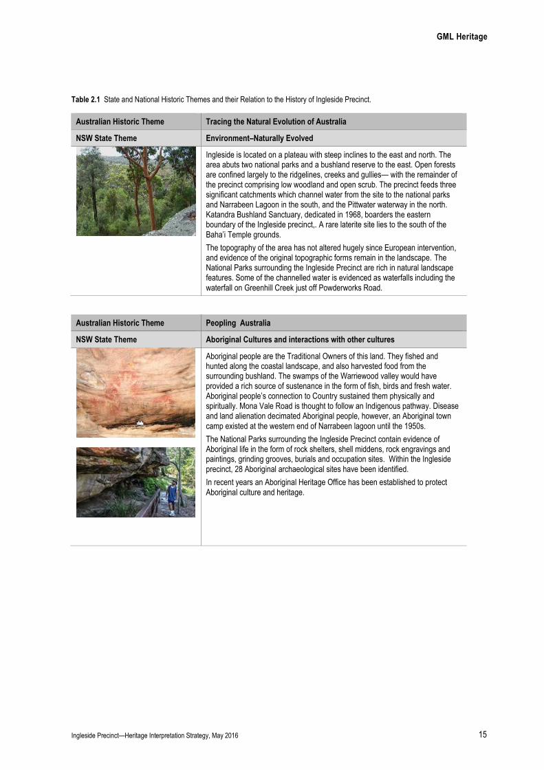
years (Figure 2.15 and 2.20). The Klerk’s enlarged Pickering’s
original cottage and operated Klerk’s Nursery from the site, planting
ornamental trees, and building a dam and water course that ran
down to Cicada Creek at the north of the property. This property
today operates as a retail/wholesale nursery known as the Cicada
Glen Nursery. Pickerill’s original fibro cottage and Klerk’s 1965
office remain on the site.
Some residents were dawn to the area because they appreciated
the natural environment. Roseville businessman, Harold Seymour,
purchased 25 acres on Lane Cove Road in 1946. As a
conservationist he was concerned about the advancing pace and
impact of development during the 1960s and, he donated 18 acres
of his land in 1964 to establish a wild life reserve choosing the
name ‘Katandra’ meaning ‘song of birds’. The site was officially
opened as Katandra Bushland Sanctuary by the Minister for Lands
in 1968. 15
Australia’s first cowboy, Smokey Dawson and his wife Dot, operated
a ranch at Chiltern Road, Ingleside from 1953 until it was destroyed
by a bushfire in 1979. The ranch operated for children with a rodeo
centre, a riding school and a camp. The original gates which went
missing in the fire, were reconstructed in 2002 following extensive
community involvement.
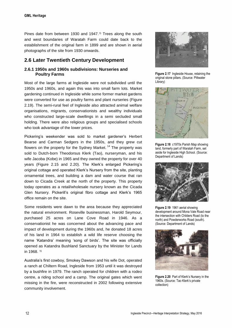
Figure 2.17 Ingleside House, retaining the original stone pillars. (Source: Pittwater Library)
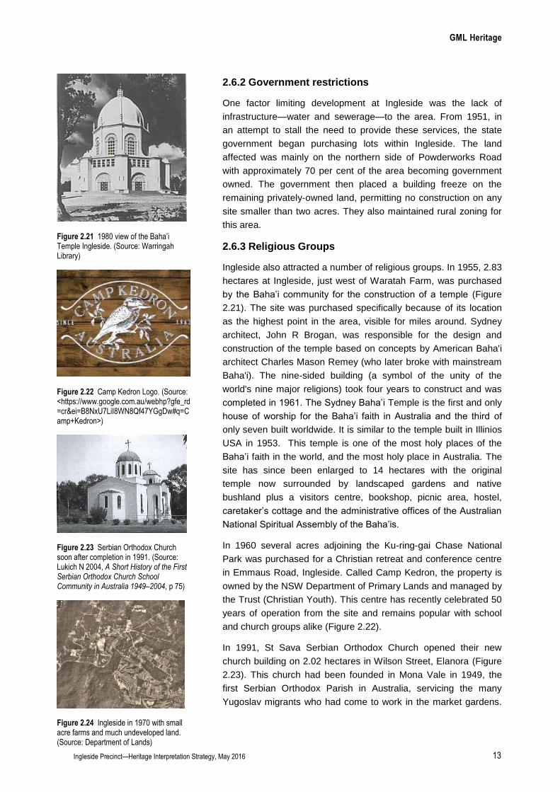
Figure 2.18 c1970s Parish Map showing land, formerly part of Waratah Farm, set aside for Ingleside High School. (Source: Department of Lands)
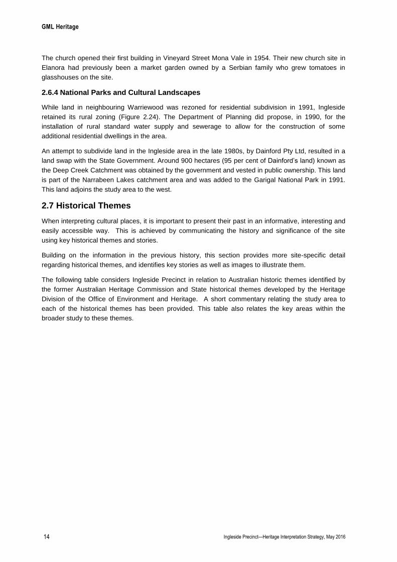
Figure 2.19 1961 aerial showing development around Mona Vale Road near the intersection with Childers Road (to the north) and Powderworks Road (south). (Source: Department of Lands)
Figure 2.20 Part of Klerk’s Nursery in the 1960s. (Source: Tao Klerk’s private collection)
GML Heritage
Ingleside Precinct—Heritage Interpretation Strategy, May 2016 13
2.6.2 Government restrictions
One factor limiting development at Ingleside was the lack of
infrastructure—water and sewerage—to the area. From 1951, in
an attempt to stall the need to provide these services, the state
government began purchasing lots within Ingleside. The land
affected was mainly on the northern side of Powderworks Road
with approximately 70 per cent of the area becoming government
owned. The government then placed a building freeze on the
remaining privately-owned land, permitting no construction on any
site smaller than two acres. They also maintained rural zoning for
this area.
2.6.3 Religious Groups
Ingleside also attracted a number of religious groups. In 1955, 2.83
hectares at Ingleside, just west of Waratah Farm, was purchased
by the Baha’i community for the construction of a temple (Figure
2.21). The site was purchased specifically because of its location
as the highest point in the area, visible for miles around. Sydney
architect, John R Brogan, was responsible for the design and
construction of the temple based on concepts by American Baha'i
architect Charles Mason Remey (who later broke with mainstream
Baha'i). The nine-sided building (a symbol of the unity of the
world's nine major religions) took four years to construct and was
completed in 1961. The Sydney Baha’i Temple is the first and only
house of worship for the Baha’i faith in Australia and the third of
only seven built worldwide. It is similar to the temple built in Illinios
USA in 1953. This temple is one of the most holy places of the
Baha’i faith in the world, and the most holy place in Australia. The
site has since been enlarged to 14 hectares with the original
temple now surrounded by landscaped gardens and native
bushland plus a visitors centre, bookshop, picnic area, hostel,
caretaker’s cottage and the administrative offices of the Australian
National Spiritual Assembly of the Baha’is.
In 1960 several acres adjoining the Ku-ring-gai Chase National
Park was purchased for a Christian retreat and conference centre
in Emmaus Road, Ingleside. Called Camp Kedron, the property is
owned by the NSW Department of Primary Lands and managed by
the Trust (Christian Youth). This centre has recently celebrated 50
years of operation from the site and remains popular with school
and church groups alike (Figure 2.22).
In 1991, St Sava Serbian Orthodox Church opened their new
church building on 2.02 hectares in Wilson Street, Elanora (Figure
2.23). This church had been founded in Mona Vale in 1949, the
first Serbian Orthodox Parish in Australia, servicing the many
Yugoslav migrants who had come to work in the market gardens.
Figure 2.21 1980 view of the Baha’i Temple Ingleside. (Source: Warringah Library)
Figure 2.22 Camp Kedron Logo. (Source: <https://www.google.com.au/webhp?gfe_rd=cr&ei=B8NxU7LiI8WN8Qf47YGgDw#q=Camp+Kedron>)
Figure 2.23 Serbian Orthodox Church soon after completion in 1991. (Source: Lukich N 2004, A Short History of the First Serbian Orthodox Church School Community in Australia 1949–2004, p 75)
Figure 2.24 Ingleside in 1970 with small acre farms and much undeveloped land. (Source: Department of Lands)
GML Heritage
Ingleside Precinct—Heritage Interpretation Strategy, May 2016 14
The church opened their first building in Vineyard Street Mona Vale in 1954. Their new church site in
Elanora had previously been a market garden owned by a Serbian family who grew tomatoes in
glasshouses on the site.
2.6.4 National Parks and Cultural Landscapes
While land in neighbouring Warriewood was rezoned for residential subdivision in 1991, Ingleside
retained its rural zoning (Figure 2.24). The Department of Planning did propose, in 1990, for the
installation of rural standard water supply and sewerage to allow for the construction of some
additional residential dwellings in the area.
An attempt to subdivide land in the Ingleside area in the late 1980s, by Dainford Pty Ltd, resulted in a
land swap with the State Government. Around 900 hectares (95 per cent of Dainford’s land) known as
the Deep Creek Catchment was obtained by the government and vested in public ownership. This land
is part of the Narrabeen Lakes catchment area and was added to the Garigal National Park in 1991.
This land adjoins the study area to the west.
2.7 Historical Themes
When interpreting cultural places, it is important to present their past in an informative, interesting and
easily accessible way. This is achieved by communicating the history and significance of the site
using key historical themes and stories.
Building on the information in the previous history, this section provides more site-specific detail
regarding historical themes, and identifies key stories as well as images to illustrate them.
The following table considers Ingleside Precinct in relation to Australian historic themes identified by
the former Australian Heritage Commission and State historical themes developed by the Heritage
Division of the Office of Environment and Heritage. A short commentary relating the study area to
each of the historical themes has been provided. This table also relates the key areas within the
broader study to these themes.
GML Heritage
Ingleside Precinct—Heritage Interpretation Strategy, May 2016 15
Table 2.1 State and National Historic Themes and their Relation to the History of Ingleside Precinct.
Australian Historic Theme Tracing the Natural Evolution of Australia
NSW State Theme Environment–Naturally Evolved
Ingleside is located on a plateau with steep inclines to the east and north. The area abuts two national parks and a bushland reserve to the east. Open forests are confined largely to the ridgelines, creeks and gullies— with the remainder of the precinct comprising low woodland and open scrub. The precinct feeds three significant catchments which channel water from the site to the national parks and Narrabeen Lagoon in the south, and the Pittwater waterway in the north. Katandra Bushland Sanctuary, dedicated in 1968, boarders the eastern boundary of the Ingleside precinct,. A rare laterite site lies to the south of the Baha’i Temple grounds.
The topography of the area has not altered hugely since European intervention, and evidence of the original topographic forms remain in the landscape. The National Parks surrounding the Ingleside Precinct are rich in natural landscape features. Some of the channelled water is evidenced as waterfalls including the waterfall on Greenhill Creek just off Powderworks Road.
Australian Historic Theme Peopling Australia
NSW State Theme Aboriginal Cultures and interactions with other cultures
Aboriginal people are the Traditional Owners of this land. They fished and hunted along the coastal landscape, and also harvested food from the surrounding bushland. The swamps of the Warriewood valley would have provided a rich source of sustenance in the form of fish, birds and fresh water. Aboriginal people’s connection to Country sustained them physically and spiritually. Mona Vale Road is thought to follow an Indigenous pathway. Disease and land alienation decimated Aboriginal people, however, an Aboriginal town camp existed at the western end of Narrabeen lagoon until the 1950s.
The National Parks surrounding the Ingleside Precinct contain evidence of Aboriginal life in the form of rock shelters, shell middens, rock engravings and paintings, grinding grooves, burials and occupation sites. Within the Ingleside precinct, 28 Aboriginal archaeological sites have been identified.
In recent years an Aboriginal Heritage Office has been established to protect Aboriginal culture and heritage.
GML Heritage
Ingleside Precinct—Heritage Interpretation Strategy, May 2016 16
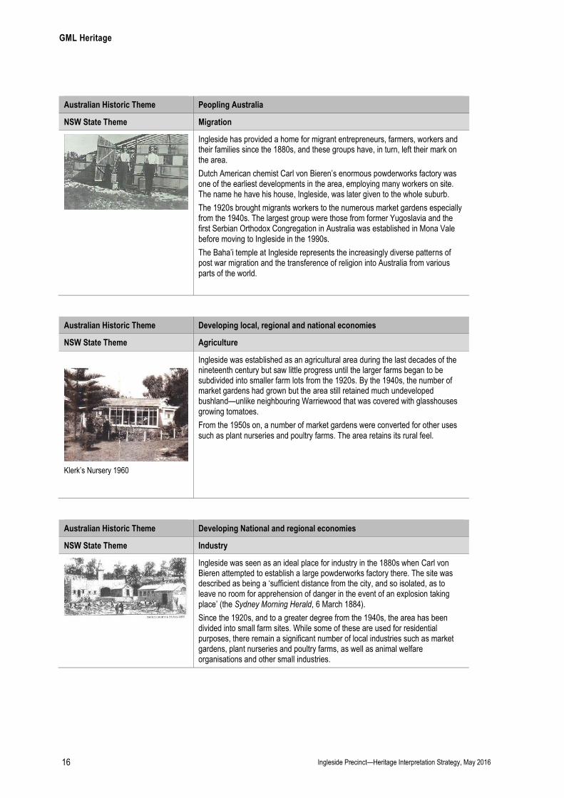
Australian Historic Theme Peopling Australia
NSW State Theme Migration
Ingleside has provided a home for migrant entrepreneurs, farmers, workers and their families since the 1880s, and these groups have, in turn, left their mark on the area.
Dutch American chemist Carl von Bieren’s enormous powderworks factory was one of the earliest developments in the area, employing many workers on site. The name he have his house, Ingleside, was later given to the whole suburb.
The 1920s brought migrants workers to the numerous market gardens especially from the 1940s. The largest group were those from former Yugoslavia and the first Serbian Orthodox Congregation in Australia was established in Mona Vale before moving to Ingleside in the 1990s.
The Baha’i temple at Ingleside represents the increasingly diverse patterns of post war migration and the transference of religion into Australia from various parts of the world.
Australian Historic Theme Developing local, regional and national economies
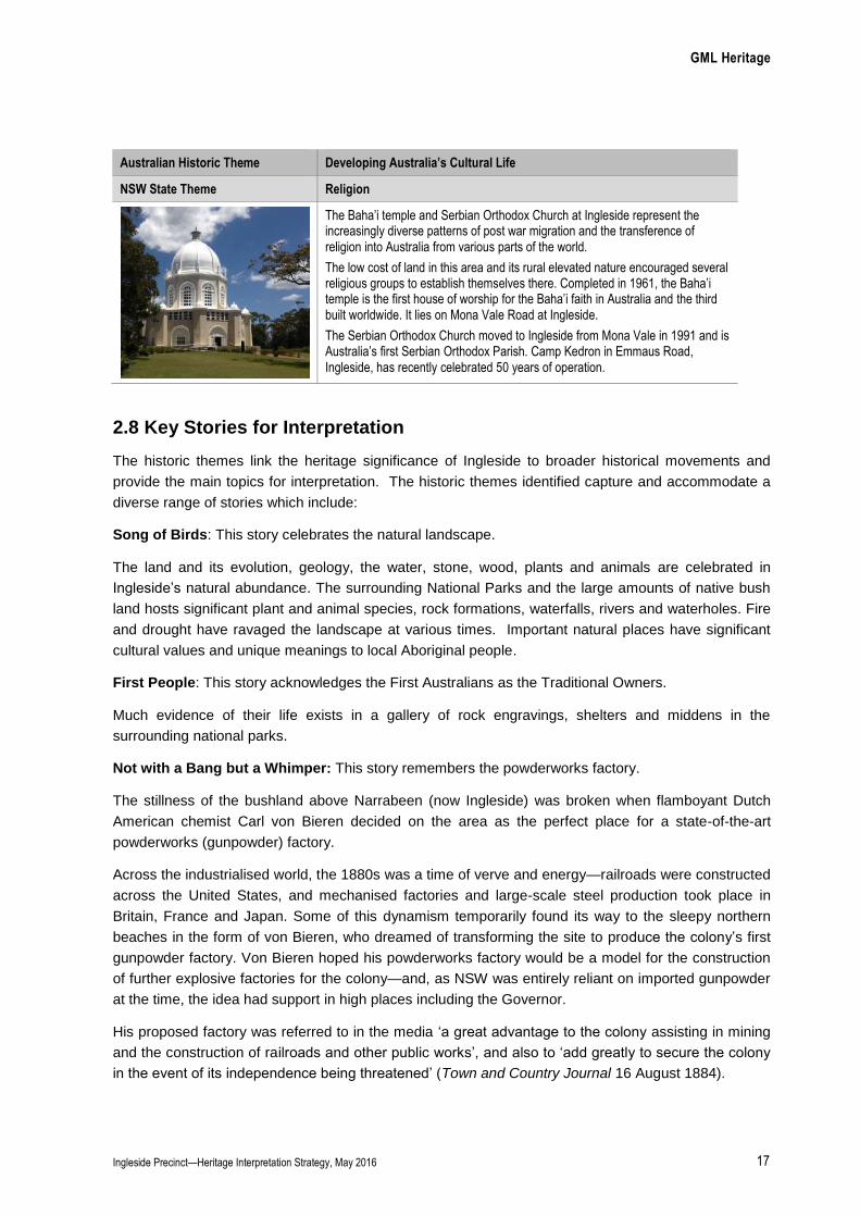
NSW State Theme Agriculture
Klerk’s Nursery 1960
Ingleside was established as an agricultural area during the last decades of the nineteenth century but saw little progress until the larger farms began to be subdivided into smaller farm lots from the 1920s. By the 1940s, the number of market gardens had grown but the area still retained much undeveloped bushland—unlike neighbouring Warriewood that was covered with glasshouses growing tomatoes.
From the 1950s on, a number of market gardens were converted for other uses such as plant nurseries and poultry farms. The area retains its rural feel.
Australian Historic Theme Developing National and regional economies
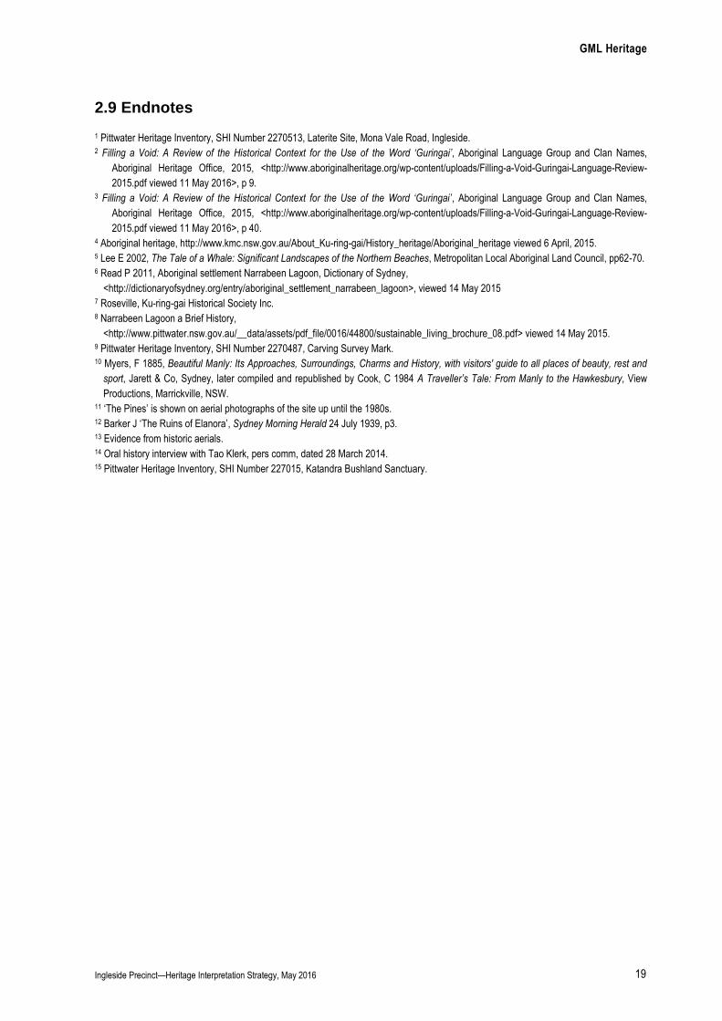
NSW State Theme Industry
Ingleside was seen as an ideal place for industry in the 1880s when Carl von Bieren attempted to establish a large powderworks factory there. The site was described as being a ‘sufficient distance from the city, and so isolated, as to leave no room for apprehension of danger in the event of an explosion taking place’ (the Sydney Morning Herald, 6 March 1884).
Since the 1920s, and to a greater degree from the 1940s, the area has been divided into small farm sites. While some of these are used for residential purposes, there remain a significant number of local industries such as market gardens, plant nurseries and poultry farms, as well as animal welfare organisations and other small industries.
GML Heritage
Ingleside Precinct—Heritage Interpretation Strategy, May 2016 17
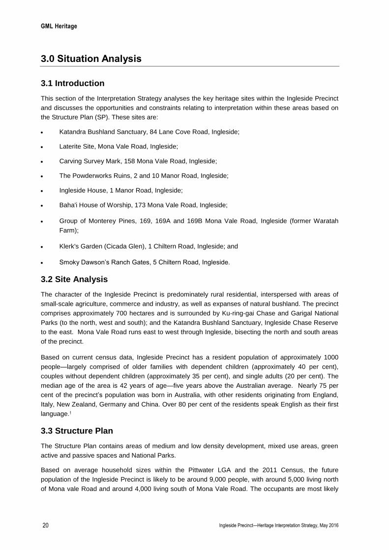
Australian Historic Theme Developing Australia’s Cultural Life
NSW State Theme Religion
The Baha’i temple and Serbian Orthodox Church at Ingleside represent the increasingly diverse patterns of post war migration and the transference of religion into Australia from various parts of the world.
The low cost of land in this area and its rural elevated nature encouraged several religious groups to establish themselves there. Completed in 1961, the Baha’i temple is the first house of worship for the Baha’i faith in Australia and the third built worldwide. It lies on Mona Vale Road at Ingleside.
The Serbian Orthodox Church moved to Ingleside from Mona Vale in 1991 and is Australia’s first Serbian Orthodox Parish. Camp Kedron in Emmaus Road, Ingleside, has recently celebrated 50 years of operation.
2.8 Key Stories for Interpretation
The historic themes link the heritage significance of Ingleside to broader historical movements and
provide the main topics for interpretation. The historic themes identified capture and accommodate a
diverse range of stories which include:
Song of Birds: This story celebrates the natural landscape.
The land and its evolution, geology, the water, stone, wood, plants and animals are celebrated in
Ingleside’s natural abundance. The surrounding National Parks and the large amounts of native bush
land hosts significant plant and animal species, rock formations, waterfalls, rivers and waterholes. Fire
and drought have ravaged the landscape at various times. Important natural places have significant
cultural values and unique meanings to local Aboriginal people.
First People: This story acknowledges the First Australians as the Traditional Owners.
Much evidence of their life exists in a gallery of rock engravings, shelters and middens in the
surrounding national parks.
Not with a Bang but a Whimper: This story remembers the powderworks factory.
The stillness of the bushland above Narrabeen (now Ingleside) was broken when flamboyant Dutch
American chemist Carl von Bieren decided on the area as the perfect place for a state-of-the-art
powderworks (gunpowder) factory.
Across the industrialised world, the 1880s was a time of verve and energy—railroads were constructed
across the United States, and mechanised factories and large-scale steel production took place in
Britain, France and Japan. Some of this dynamism temporarily found its way to the sleepy northern
beaches in the form of von Bieren, who dreamed of transforming the site to produce the colony’s first
gunpowder factory. Von Bieren hoped his powderworks factory would be a model for the construction
of further explosive factories for the colony—and, as NSW was entirely reliant on imported gunpowder
at the time, the idea had support in high places including the Governor.
His proposed factory was referred to in the media ‘a great advantage to the colony assisting in mining
and the construction of railroads and other public works’, and also to ‘add greatly to secure the colony
in the event of its independence being threatened’ (Town and Country Journal 16 August 1884).

GML Heritage
Ingleside Precinct—Heritage Interpretation Strategy, May 2016 18
Although von Bieren constructed a magnificent factory complex and a grand residence for himself, he
was declared bankrupt before one ounce of powder was ever made. He fled the country but was
subsequently captured in the English Channel by a Senior Constable from Manly Police.
Von Bieren was imprisoned and never returned to his house or factory. His beautiful factory, which had
offered such hope and promise, was left to fall into ruins.
A Marvel in the Bush: This story celebrates Ingleside House from which the suburb is named.
‘A marvel in the bush’ is how Ingleside House, von Bieren’s home, was described by the traveller and
writer, Francis Myers, in 1885.
Ingleside House was famed throughout Sydney for the scale and lavishness of its design. Elaborate
gardens were a feature, as were the extensive outbuildings constructed for the workers at the
associated powderworks factory. Von Bieren entertained extravagantly, on a scale that was notable in
the colony. The house and grounds were described by Myers as ‘like an actual shrine to some deity of
the flowers of the land … with all the requirements of a cultured and refined humanity’.
While the original house no longer exists, the replacement Ingleside House built in 1930 sits within von
Bieren’s landscaped garden with its carved stone fountain, terraces and stone entrance piers.
Revered in the Landscape: This story acknowledges the Baha’i House of Worship.
Australia’s only Baha’i House of Worship lies on the ridge line of the Ingleside Precinct, its gleaming
white dome visible from as far away as the Central Coast. The striking nine-sided building, symbolic of
the Baha’i belief of the unity of the world’s nine major religions, is one of only seven constructed
worldwide. The temple is situated in a peaceful bushland setting attuned to the central beliefs of the
Baha’i who promote world peace. It has been described by Sydney University architectural historian
Jennifer Taylor as ‘one of four major religious edifices constructed in Sydney during the twentieth
century’.
Local Bounty: This story celebrates the many producers of Ingleside.
From the propagation of the famous Narrabeen plum by Isaac Larkin to the Smokey Dawson’s Ranch
and to the growth of cut flowers and vegetables by market gardeners, Ingleside has been the home of
new initiatives and low-scale agricultural industry since development first began in the area. Poultry
farms and plant nurseries became prominent in the 1950s and 1960s, and a large number of nursery’s
still remain—a reflection of the area’s first grand old garden at Ingleside House.
Getting Away (or Hidden but not Hiding): This story acknowledges the alternative thinking of many
who have made Ingleside home.
For many years, the suburb has been home to those seeking some extra land or remoteness. Various
non-main stream religious organisations and schools have sites in the area plus the Animal Welfare
league, and a growing number of mansions.
GML Heritage
Ingleside Precinct—Heritage Interpretation Strategy, May 2016 19
2.9 Endnotes
1 Pittwater Heritage Inventory, SHI Number 2270513, Laterite Site, Mona Vale Road, Ingleside. 2 Filling a Void: A Review of the Historical Context for the Use of the Word ‘Guringai’, Aboriginal Language Group and Clan Names,
Aboriginal Heritage Office, 2015, <http://www.aboriginalheritage.org/wp-content/uploads/Filling-a-Void-Guringai-Language-Review-
2015.pdf viewed 11 May 2016>, p 9. 3 Filling a Void: A Review of the Historical Context for the Use of the Word ‘Guringai’, Aboriginal Language Group and Clan Names,
Aboriginal Heritage Office, 2015, <http://www.aboriginalheritage.org/wp-content/uploads/Filling-a-Void-Guringai-Language-Review-
2015.pdf viewed 11 May 2016>, p 40. 4 Aboriginal heritage, http://www.kmc.nsw.gov.au/About_Ku-ring-gai/History_heritage/Aboriginal_heritage viewed 6 April, 2015. 5 Lee E 2002, The Tale of a Whale: Significant Landscapes of the Northern Beaches, Metropolitan Local Aboriginal Land Council, pp62-70. 6 Read P 2011, Aboriginal settlement Narrabeen Lagoon, Dictionary of Sydney,
<http://dictionaryofsydney.org/entry/aboriginal_settlement_narrabeen_lagoon>, viewed 14 May 2015 7 Roseville, Ku-ring-gai Historical Society Inc. 8 Narrabeen Lagoon a Brief History,
<http://www.pittwater.nsw.gov.au/__data/assets/pdf_file/0016/44800/sustainable_living_brochure_08.pdf> viewed 14 May 2015. 9 Pittwater Heritage Inventory, SHI Number 2270487, Carving Survey Mark. 10 Myers, F 1885, Beautiful Manly: Its Approaches, Surroundings, Charms and History, with visitors' guide to all places of beauty, rest and
sport, Jarett & Co, Sydney, later compiled and republished by Cook, C 1984 A Traveller’s Tale: From Manly to the Hawkesbury, View
Productions, Marrickville, NSW. 11 ‘The Pines’ is shown on aerial photographs of the site up until the 1980s. 12 Barker J ‘The Ruins of Elanora’, Sydney Morning Herald 24 July 1939, p3. 13 Evidence from historic aerials. 14 Oral history interview with Tao Klerk, pers comm, dated 28 March 2014. 15 Pittwater Heritage Inventory, SHI Number 227015, Katandra Bushland Sanctuary.
GML Heritage
Ingleside Precinct—Heritage Interpretation Strategy, May 2016 20
3.0 Situation Analysis
3.1 Introduction
This section of the Interpretation Strategy analyses the key heritage sites within the Ingleside Precinct
and discusses the opportunities and constraints relating to interpretation within these areas based on
the Structure Plan (SP). These sites are:
Katandra Bushland Sanctuary, 84 Lane Cove Road, Ingleside;
Laterite Site, Mona Vale Road, Ingleside;
Carving Survey Mark, 158 Mona Vale Road, Ingleside;
The Powderworks Ruins, 2 and 10 Manor Road, Ingleside;
Ingleside House, 1 Manor Road, Ingleside;
Baha'i House of Worship, 173 Mona Vale Road, Ingleside;
Group of Monterey Pines, 169, 169A and 169B Mona Vale Road, Ingleside (former Waratah
Farm);
Klerk's Garden (Cicada Glen), 1 Chiltern Road, Ingleside; and
Smoky Dawson’s Ranch Gates, 5 Chiltern Road, Ingleside.
3.2 Site Analysis
The character of the Ingleside Precinct is predominately rural residential, interspersed with areas of
small-scale agriculture, commerce and industry, as well as expanses of natural bushland. The precinct
comprises approximately 700 hectares and is surrounded by Ku-ring-gai Chase and Garigal National
Parks (to the north, west and south); and the Katandra Bushland Sanctuary, Ingleside Chase Reserve
to the east. Mona Vale Road runs east to west through Ingleside, bisecting the north and south areas
of the precinct.
Based on current census data, Ingleside Precinct has a resident population of approximately 1000
people—largely comprised of older families with dependent children (approximately 40 per cent),
couples without dependent children (approximately 35 per cent), and single adults (20 per cent). The
median age of the area is 42 years of age—five years above the Australian average. Nearly 75 per
cent of the precinct’s population was born in Australia, with other residents originating from England,
Italy, New Zealand, Germany and China. Over 80 per cent of the residents speak English as their first
language.1
3.3 Structure Plan
The Structure Plan contains areas of medium and low density development, mixed use areas, green
active and passive spaces and National Parks.
Based on average household sizes within the Pittwater LGA and the 2011 Census, the future
population of the Ingleside Precinct is likely to be around 9,000 people, with around 5,000 living north
of Mona vale Road and around 4,000 living south of Mona Vale Road. The occupants are most likely
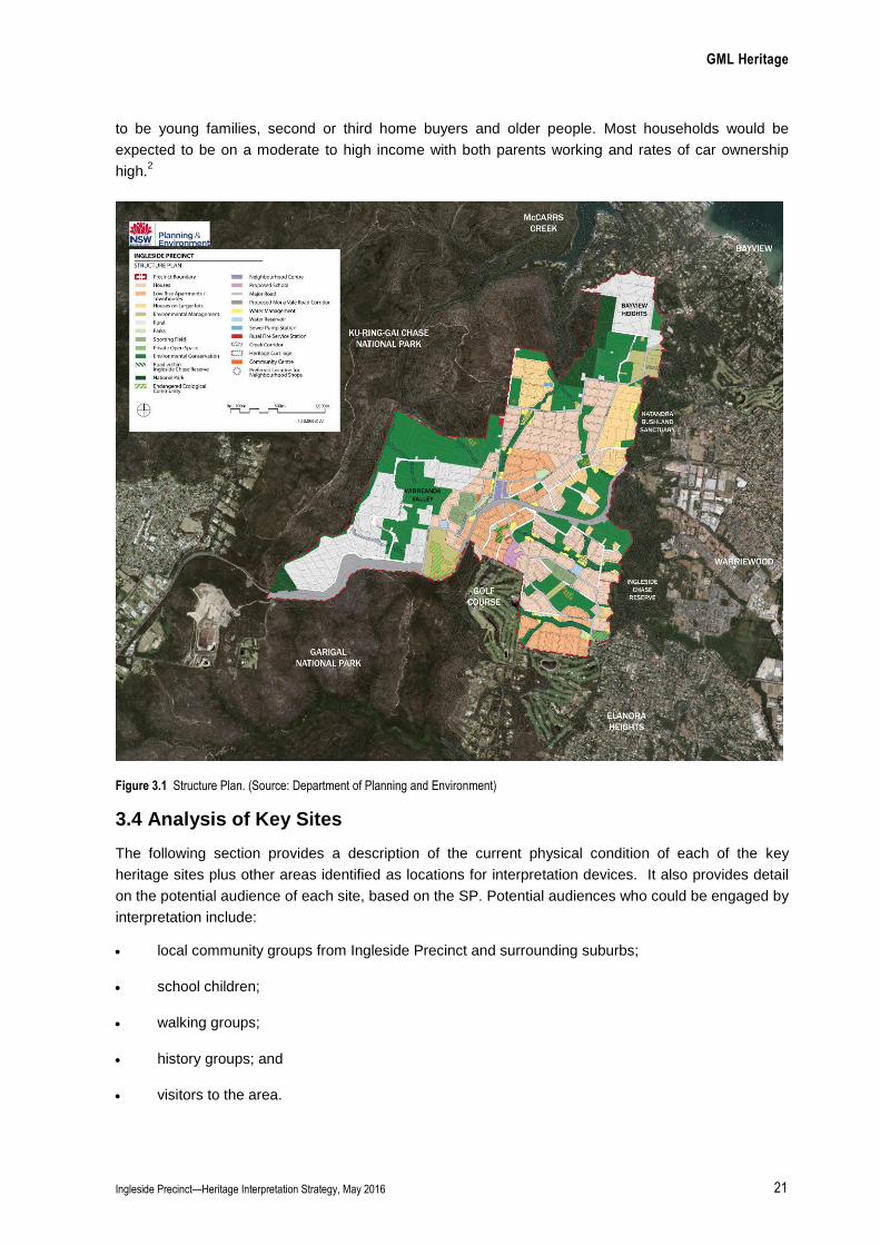
GML Heritage
Ingleside Precinct—Heritage Interpretation Strategy, May 2016 21
to be young families, second or third home buyers and older people. Most households would be
expected to be on a moderate to high income with both parents working and rates of car ownership
high.2
Figure 3.1 Structure Plan. (Source: Department of Planning and Environment)
3.4 Analysis of Key Sites
The following section provides a description of the current physical condition of each of the key
heritage sites plus other areas identified as locations for interpretation devices. It also provides detail
on the potential audience of each site, based on the SP. Potential audiences who could be engaged by
interpretation include:
local community groups from Ingleside Precinct and surrounding suburbs;
school children;
walking groups;
history groups; and
visitors to the area.
GML Heritage
Ingleside Precinct—Heritage Interpretation Strategy, May 2016 22
3.4.1 Ingleside House and the Powderworks Ruins
Physical Description
Ingleside House
Ingleside House is located at 1 Manor Road, Ingleside, south of Mona Vale Road and is in private
ownership. The house site slopes upwards from east to west, providing a prominent eastern outlook
over the precinct. The house is surrounded by landscaped gardens with a number of large marker
trees, including two Bunya Pines, Brush Box and various other species. Small areas of original
woodland vegetation exist in the vicinity of the house (Figures 3.2–3.3).
The landscaping and gardens are mature and reflect the original (1884) layout of the house and
garden. The earliest remnant fabric on the property are the octagonal sandstone entry pillars with
wide rounded heads located at the entry to the property (Figures 3.2), the carriage loop (Figure 3.4),
and the associated rusticated sandstone retaining walls and steps—with sandstone spheres
demarcating the end of the sandstone walling or garden edges (Figure 3.5). The lower gardens in
front of the house are separated out into a series of smaller planted gardens (Figure 3.6). Bordering
the steps to the house from the lower garden are two original substantial sandstone posts with
carvings depicting the initials of Carl von Bieren, ‘CVB’, floral wreaths, and ‘Advance Australia’ above a
powder keg carved into the post (Figures 3.7–3.8).
The current sandstone house was constructed c1939 on the site of the original timber Ingleside House
built by von Bieren. It has since had a later sandstone addition to the north. The interior of the house
is substantially altered with a modern kitchen and some contemporary joinery and finishes (Figure 3.9).
A contemporary steel-framed and steel-clad shed, designed by Cracknell and Lonergan Architects,
has been constructed further north of the c1939 house and additional wing. The shed references the
gable roof arrangement of Ingleside House, is screened by bamboo plantings and was designed to
respect the heritage significance of the c1939 house and landscape (Figure 3.7).
The revised draft SP dated 18 May 2015 located the site of Ingleside house as a potential school site
(Figure 3.1)
The Powderworks Ruins
The Powderworks Ruins currently lie in dense vegetation on private land on the eastern side of Manor
Road opposite Ingleside House and are overgrown and difficult to see (Figure 3.10). The Powderworks
site originally consisted of a suite of high-quality tooled stone buildings built in the early 1880s by Carl
von Bieren. The suite of buildings included Saltpetre House, Office and Magazine, the Machinery
Building, the Boiler Room and the Mixing Plant. When von Bieren was declared bankrupt in October
1885 the factory was abandoned, never to be used, and the buildings gradually fell into ruin and the
materials pilfered.
The Powderworks Ruins are located along a gorge that drops sharply to a small creek which would
have run beneath the former buildings. A driveway leading from the northeast corner of Ingleside
House formerly linked Ingleside House to the Powderworks site. Two sandstone walls (from two
separate buildings) remain on the edge of the gorge within the shallow creek, with one corner of each
building remaining (Figures 3.11–3.12). It is possible that additional areas of remnant structures and
stones relating to the Powderworks remain under the vegetation. Vegetation clearing would be
required to determine the extent of the remnant features.
GML Heritage
Ingleside Precinct—Heritage Interpretation Strategy, May 2016 23
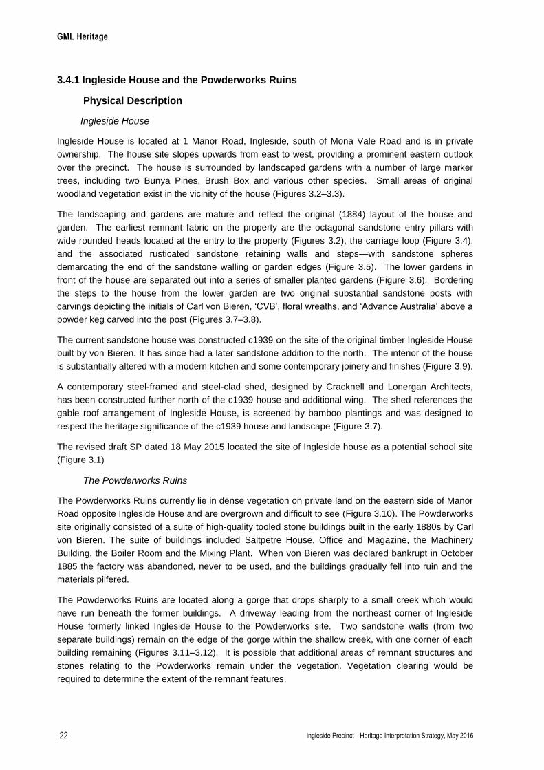
Potential Audience
A school site is proposed within the listed curtilage of Ingleside House and low-density residential
development is proposed partially within the curtilage of the Powderworks Ruins site. The potential
audiences include:
local residents (including families and children);
visitors to the area;
walking groups;
history groups and
school students from within the precinct and other areas.
Figure 3.2 View of Ingleside House from Manor Road, showing the sandstone entry pillars, carriage loop and east elevation of the house. (Source: GML 2014)
Figure 3.3 General view of the rear landscape looking southwest from the house. (Source: GML 2014)
GML Heritage
Ingleside Precinct—Heritage Interpretation Strategy, May 2016 24
Figure 3.4 East elevation of Ingleside House. The carriage loop is no longer used to convey vehicles. The additional sandstone wing is visible on the right. (Source: GML 2014)
Figure 3.5 Detailed view of one of the stone ‘cannonballs’ which adorn the carriage loop and gardens. (Source: GML 2014)
Figure 3.6 General view of the garden layout. The house location is marked by two mature Bunya Pines. (Source: GML 2014)
Figure 3.7 View of the decorative stone pillar in the foreground featuring the inscription ‘Advance Australia’ above a relief of a powder keg, the house in the background to the left and the recent steel shed to the right. (Source: GML 2014)
GML Heritage
Ingleside Precinct—Heritage Interpretation Strategy, May 2016 25
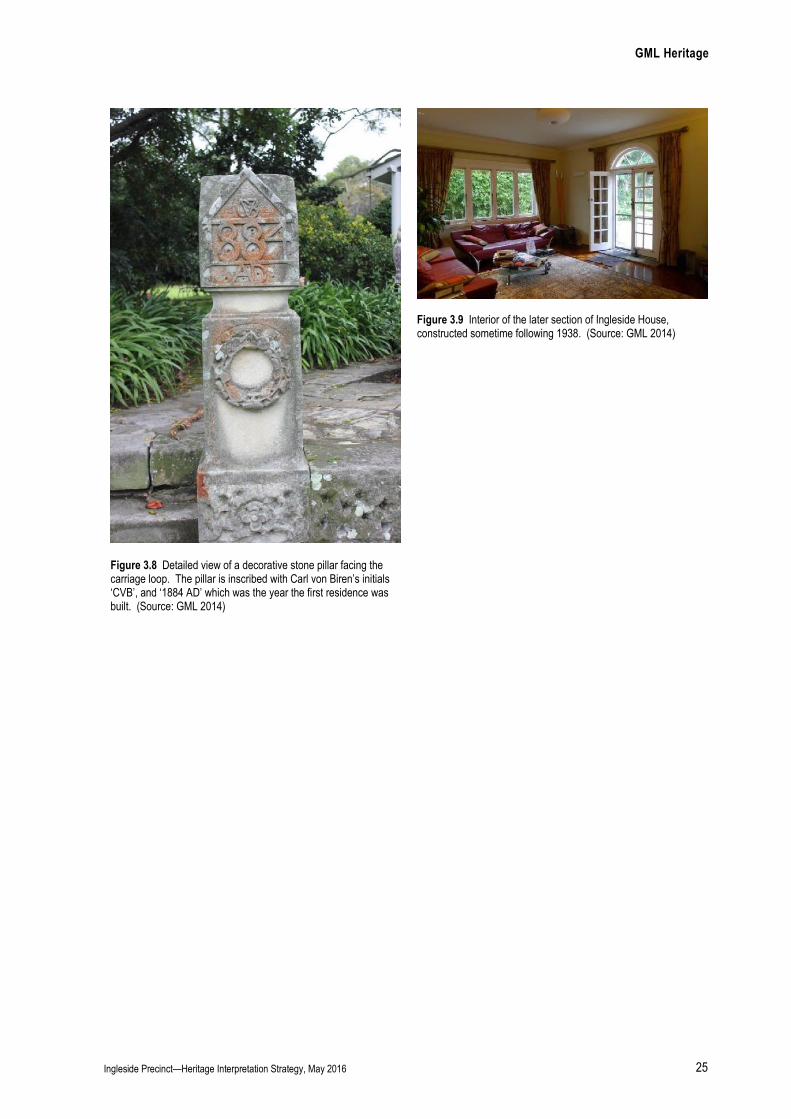
Figure 3.9 Interior of the later section of Ingleside House, constructed sometime following 1938. (Source: GML 2014)
Figure 3.8 Detailed view of a decorative stone pillar facing the carriage loop. The pillar is inscribed with Carl von Biren’s initials ‘CVB’, and ‘1884 AD’ which was the year the first residence was built. (Source: GML 2014)
GML Heritage
Ingleside Precinct—Heritage Interpretation Strategy, May 2016 26
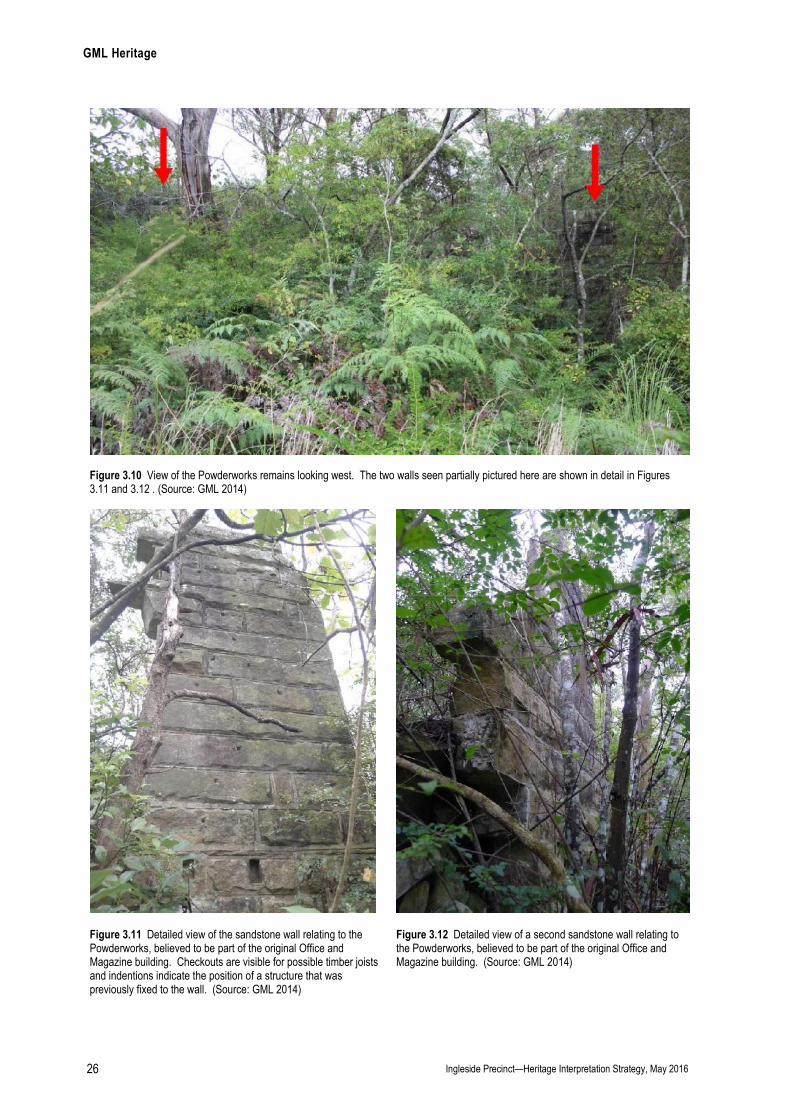
Figure 3.10 View of the Powderworks remains looking west. The two walls seen partially pictured here are shown in detail in Figures 3.11 and 3.12 . (Source: GML 2014)
Figure 3.11 Detailed view of the sandstone wall relating to the Powderworks, believed to be part of the original Office and Magazine building. Checkouts are visible for possible timber joists and indentions indicate the position of a structure that was previously fixed to the wall. (Source: GML 2014)
Figure 3.12 Detailed view of a second sandstone wall relating to the Powderworks, believed to be part of the original Office and Magazine building. (Source: GML 2014)
GML Heritage
Ingleside Precinct—Heritage Interpretation Strategy, May 2016 27
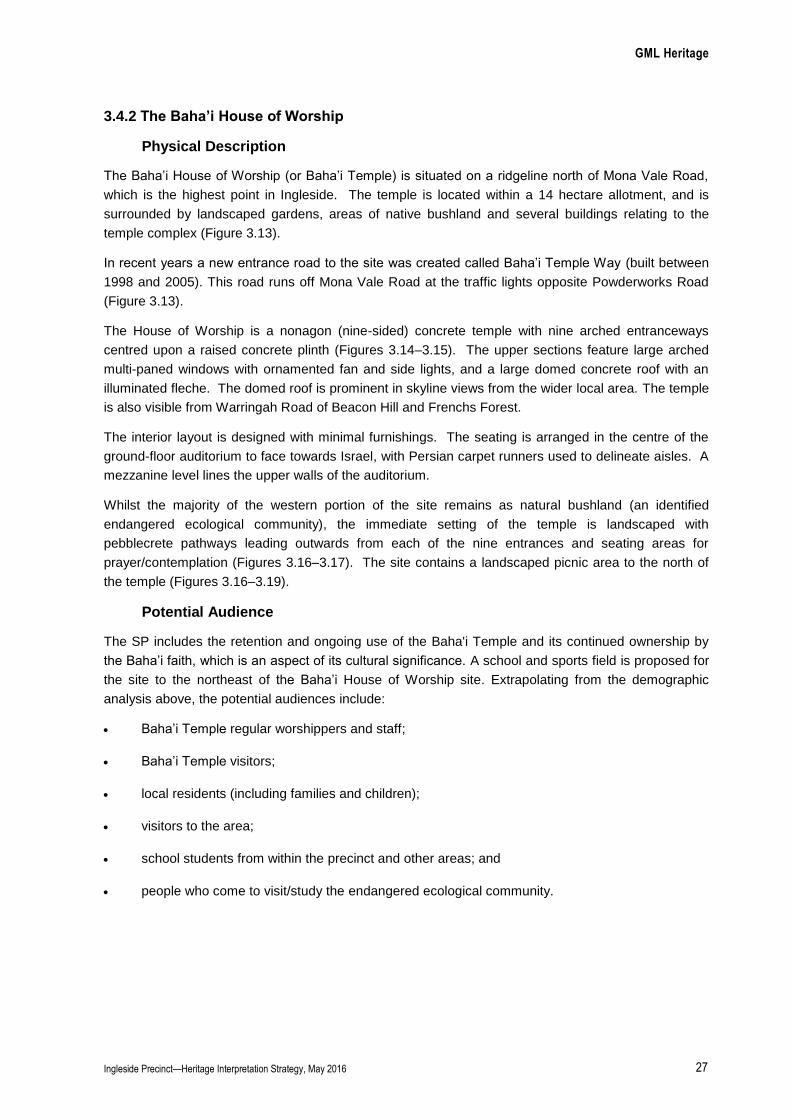
3.4.2 The Baha’i House of Worship
Physical Description
The Baha’i House of Worship (or Baha’i Temple) is situated on a ridgeline north of Mona Vale Road,
which is the highest point in Ingleside. The temple is located within a 14 hectare allotment, and is
surrounded by landscaped gardens, areas of native bushland and several buildings relating to the
temple complex (Figure 3.13).
In recent years a new entrance road to the site was created called Baha’i Temple Way (built between
1998 and 2005). This road runs off Mona Vale Road at the traffic lights opposite Powderworks Road
(Figure 3.13).
The House of Worship is a nonagon (nine-sided) concrete temple with nine arched entranceways
centred upon a raised concrete plinth (Figures 3.14–3.15). The upper sections feature large arched
multi-paned windows with ornamented fan and side lights, and a large domed concrete roof with an
illuminated fleche. The domed roof is prominent in skyline views from the wider local area. The temple
is also visible from Warringah Road of Beacon Hill and Frenchs Forest.
The interior layout is designed with minimal furnishings. The seating is arranged in the centre of the
ground-floor auditorium to face towards Israel, with Persian carpet runners used to delineate aisles. A
mezzanine level lines the upper walls of the auditorium.
Whilst the majority of the western portion of the site remains as natural bushland (an identified
endangered ecological community), the immediate setting of the temple is landscaped with
pebblecrete pathways leading outwards from each of the nine entrances and seating areas for
prayer/contemplation (Figures 3.16–3.17). The site contains a landscaped picnic area to the north of
the temple (Figures 3.16–3.19).
Potential Audience
The SP includes the retention and ongoing use of the Baha'i Temple and its continued ownership by
the Baha’i faith, which is an aspect of its cultural significance. A school and sports field is proposed for
the site to the northeast of the Baha’i House of Worship site. Extrapolating from the demographic
analysis above, the potential audiences include:
Baha’i Temple regular worshippers and staff;
Baha’i Temple visitors;
local residents (including families and children);
visitors to the area;
school students from within the precinct and other areas; and
people who come to visit/study the endangered ecological community.
GML Heritage
Ingleside Precinct—Heritage Interpretation Strategy, May 2016 28
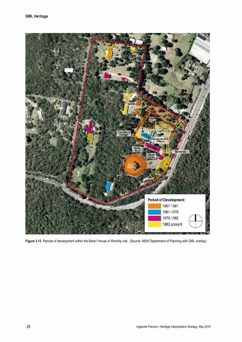
Figure 3.13 Periods of development within the Baha’i House of Worship site. (Source: NSW Department of Planning with GML overlay)

GML Heritage
Ingleside Precinct—Heritage Interpretation Strategy, May 2016 29
Figure 3.14 The Baha’i Temple and paved landscape, viewed from the west. (Source: GML 2013)
Figure 3.15 One of the nine entrances to the Baha’i Temple, with nine-pointed star motifs. (Source: GML 2013)
Figure 3.16 View facing west to the north of the Baha’i Temple, showing the interface between the building and its landscape. (Source: GML 2013)
Figure 3.17 Paved pathway leading towards seating for prayer/contemplation. (Source: GML 2013)
Figure 3.18 View from the picnic area looking south along one of the nine pathways towards the Baha’i Temple. (Source: GML 2013)
Figure 3.19 View facing west into the planted native garden near the northern entrance to the site. (Source: GML 2013)
GML Heritage
Ingleside Precinct—Heritage Interpretation Strategy, May 2016 30
3.4.3 The Group of Monterey Pines (Waratah Farm)
Physical Description
The Pittwater Council Heritage Inventory (1993) lists ‘a group of over 12 large Monterey pines (Pinus
radiata) approximately 40m high situated on the main ridge of Ingleside along Mona Vale Road near
the intersection with Powderworks Road’.3 The Heritage Inventory states that these pines mark the site
of a circa 1900 farm and orchard (Waratah Farm) owned for many years by the Larkin Family that
formerly occupied the site. 4
It is clear from historic aerial photographs that the group of Monterey pines referred to in this listing
were planted sometime between 1930 and 1947—they do not appear on the 1930 aerial photograph of
the site but do appear on the 1947 aerial. Of the 12 pines mentioned in the heritage listing, only four
remain due to the construction of Baha’i Temple Way built between 1998 and 2005) along the
southeastern portion of the former Waratah Farm site. The four remaining Monterey pines lie on the
Waratah Farm side of Baha’i Temple Way (Figures 3.21–3.22). They mark the location of the cottage
called ‘The Pines’ (home of the Larkin Family) when the site was part of Waratah Farm and also the
former garden to ‘The Pines’, which once extended into the eastern section of this allotment. Apart
from the four Monterey Pines no further evidence of this garden remains.
Waratah Farm previously contained the orchard, ‘The Pines’ cottage (built c1899 in the northeast
corner of the site) (Figure 3.20), and an additional cottage located further south—possibly built by the
original owner James Jones (c1880). This building is shown in historical aerials over many years. Part
of the original boundary of Waratah Farm is still evident—delineated by rows of planted trees along its
east, west and southern perimeter, and shown in historical aerial photographs dating from 1930
(Figure 3.23–3.24).
The site of the former Waratah Farm is currently divided into three allotments and used for animal
boarding (Lot 202 DP 1054875); a private residence comprised of a c1980s six-bedroom house with a
tennis court and swimming pool (Lot 4 DP1039775); and a small rectangular shed set in a generous
landscape used by the Peninsula Senior Citizens Toy Repair Group (Lot 201 DP 1054875) (Figure
3.20).
Potential Audience
In the Structure Plan, this site is proposed for a mix of open space, low density and medium density
housing. Extrapolating from the demographic analysis above, the potential audiences include:
local residents (including families and children);
visitors to the area;
walking groups; and
history groups.

GML Heritage
Ingleside Precinct—Heritage Interpretation Strategy, May 2016 31
Figure 3.20 Periods of development on the site of Waratah Farm. (Source: NSW Department of Planning with GML overlay)

GML Heritage
Ingleside Precinct—Heritage Interpretation Strategy, May 2016 32
Figure 3.21 The group of four Monterey pines viewed facing north from Bahai Temple Way. (Source: GML 2013)
Figure 3.22 View facing south along Mona Vale Road showing the Monterey Ppnes as prominent markers on the right. (Source: Google Maps
Figure 3.23 1930 aerial showing the historical tree planting along the southern, western and eastern boundary of the Waratah Farm site. (Source: Department of Lands)
Figure 3.24 1980 aerial showing remnants of the historical tree planting along the southern and western boundary of the Waratah farm Site (Source: Department of Lands)
3.4.4 Cicada Glen Nursery, Formerly Klerk’s Garden
Physical Description
Cicada Glen Nursery, formerly Klerk’s Garden, is in private ownership and comprises of a 7000m2 lot
located at the western corner of Mona Vale and Chiltern Roads, Ingleside. Cicada Glen Creek flows
across the rear of the property, running west towards Pittwater. The site contains an operating
retail/wholesale nursery with associated sculpture garden, gallery, residence, sheds, glasshouses and
shade houses (Figures 3.25–3.27).
A large well-established garden of high ornamental quality is located predominantly within the entrance
section and along the creek line. It features mature hoop pine, English oak, pine oak, Japanese
maple, Canadian maple and liquidamber trees dating from the 1930s occupation of the site by Dr
Pickerell (Figures 3.28–3.29). The gardens also include mature palms, tree ferns, bamboos,
GML Heritage
Ingleside Precinct—Heritage Interpretation Strategy, May 2016 33
fiddlewood, brushbox, golden cypress and fir, as well as sandstone lining of the dam and watercourse
(Cicada Creek) which were installed by Mr Klerk during his occupation of the property (between 1965
and 1999) (Figure 3.25).
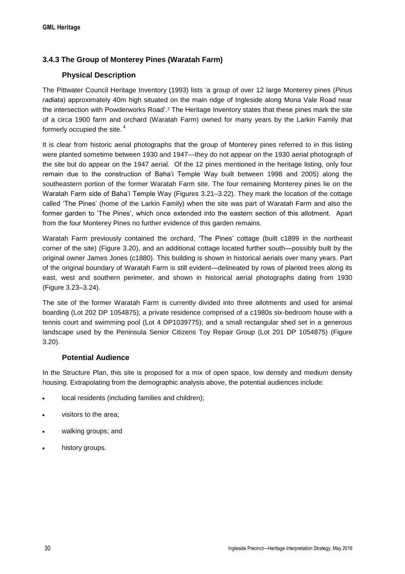
Hidden in the southwest corner of the site is the original fibro cottage constructed in the 1930s as Dr
Pickerill’s weekender. Adjoining the house is the1965 office built by the Klerk’s (Figure 3.26).
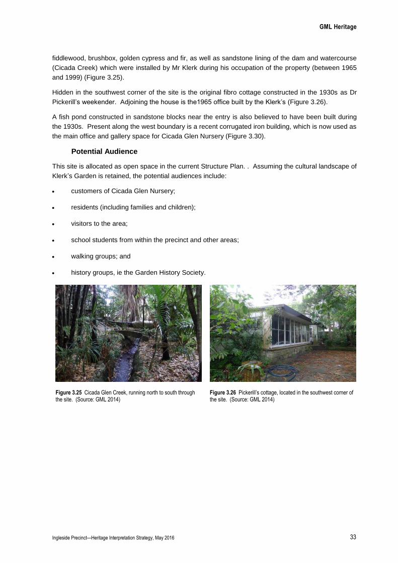
A fish pond constructed in sandstone blocks near the entry is also believed to have been built during
the 1930s. Present along the west boundary is a recent corrugated iron building, which is now used as
the main office and gallery space for Cicada Glen Nursery (Figure 3.30).
Potential Audience
This site is allocated as open space in the current Structure Plan. . Assuming the cultural landscape of
Klerk’s Garden is retained, the potential audiences include:
customers of Cicada Glen Nursery;
residents (including families and children);
visitors to the area;
school students from within the precinct and other areas;
walking groups; and
history groups, ie the Garden History Society.
Figure 3.25 Cicada Glen Creek, running north to south through the site. (Source: GML 2014)
Figure 3.26 Pickerill’s cottage, located in the southwest corner of the site. (Source: GML 2014)
GML Heritage
Ingleside Precinct—Heritage Interpretation Strategy, May 2016 34
Figure 3.27 A recent corrugated iron building located closer to the entrance, used as a gallery and office for the nursery and sculpture business. (Source: GML 2014)
Figure 3.28 Driveway leading towards the main office of Cicada Glen Nursery. (Source: GML 2014)
Figure 3.29 View facing east towards Chiltern Road. (Source: GML 2014)
Figure 3.30 A large pond near the entrance at Chiltern Road. (Source: GML 2014)
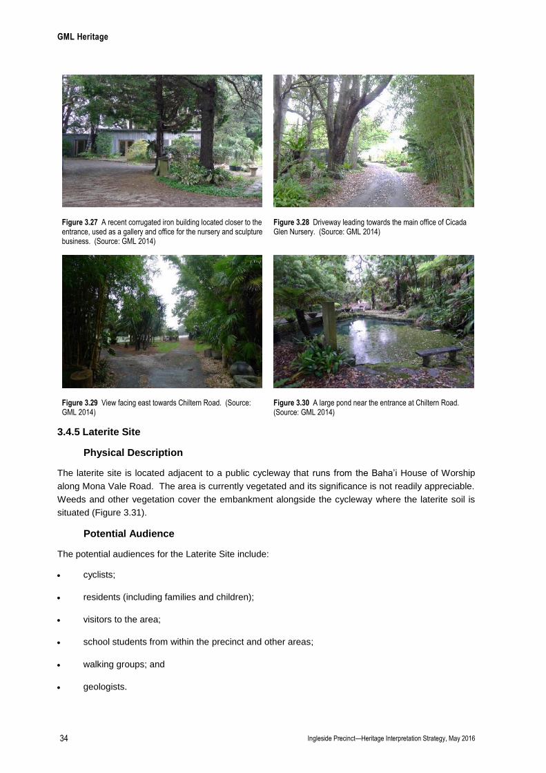
3.4.5 Laterite Site
Physical Description
The laterite site is located adjacent to a public cycleway that runs from the Baha’i House of Worship
along Mona Vale Road. The area is currently vegetated and its significance is not readily appreciable.
Weeds and other vegetation cover the embankment alongside the cycleway where the laterite soil is
situated (Figure 3.31).
Potential Audience
The potential audiences for the Laterite Site include:
cyclists;
residents (including families and children);
visitors to the area;
school students from within the precinct and other areas;
walking groups; and
geologists.
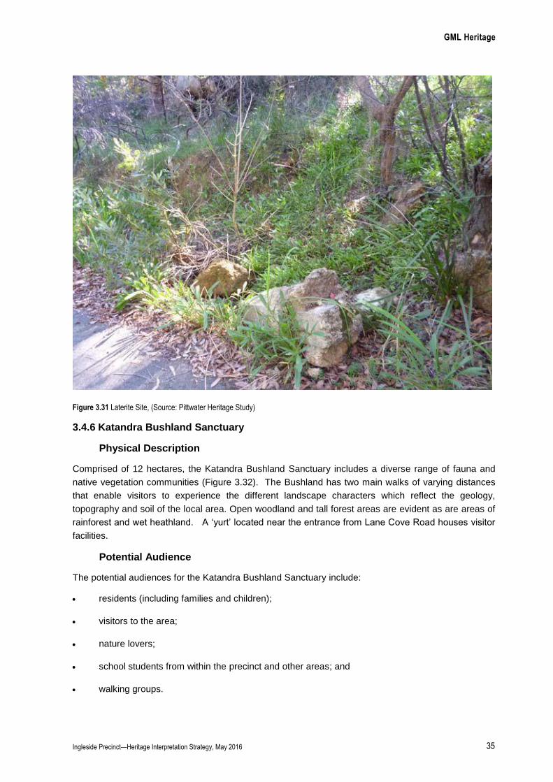
GML Heritage
Ingleside Precinct—Heritage Interpretation Strategy, May 2016 35
Figure 3.31 Laterite Site, (Source: Pittwater Heritage Study)
3.4.6 Katandra Bushland Sanctuary
Physical Description
Comprised of 12 hectares, the Katandra Bushland Sanctuary includes a diverse range of fauna and
native vegetation communities (Figure 3.32). The Bushland has two main walks of varying distances
that enable visitors to experience the different landscape characters which reflect the geology,
topography and soil of the local area. Open woodland and tall forest areas are evident as are areas of
rainforest and wet heathland. A ‘yurt’ located near the entrance from Lane Cove Road houses visitor
facilities.
Potential Audience
The potential audiences for the Katandra Bushland Sanctuary include:
residents (including families and children);
visitors to the area;
nature lovers;
school students from within the precinct and other areas; and
walking groups.
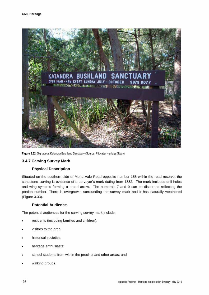
GML Heritage
Ingleside Precinct—Heritage Interpretation Strategy, May 2016 36
Figure 3.32 Signage at Katandra Bushland Sanctuary (Source: Pittwater Heritage Study)
3.4.7 Carving Survey Mark
Physical Description
Situated on the southern side of Mona Vale Road opposite number 158 within the road reserve, the
sandstone carving is evidence of a surveyor’s mark dating from 1882. The mark includes drill holes
and wing symbols forming a broad arrow. The numerals 7 and 0 can be discerned reflecting the
portion number. There is overgrowth surrounding the survey mark and it has naturally weathered
(Figure 3.33).
Potential Audience
The potential audiences for the carving survey mark include:
residents (including families and children);
visitors to the area;
historical societies;
heritage enthusiasts;
school students from within the precinct and other areas; and
walking groups.
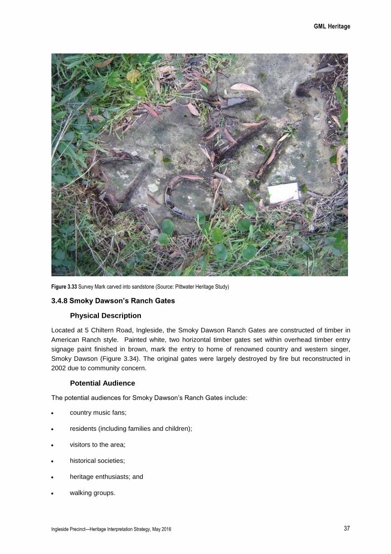
GML Heritage
Ingleside Precinct—Heritage Interpretation Strategy, May 2016 37
Figure 3.33 Survey Mark carved into sandstone (Source: Pittwater Heritage Study)
3.4.8 Smoky Dawson’s Ranch Gates
Physical Description
Located at 5 Chiltern Road, Ingleside, the Smoky Dawson Ranch Gates are constructed of timber in
American Ranch style. Painted white, two horizontal timber gates set within overhead timber entry
signage paint finished in brown, mark the entry to home of renowned country and western singer,
Smoky Dawson (Figure 3.34). The original gates were largely destroyed by fire but reconstructed in
2002 due to community concern.
Potential Audience
The potential audiences for Smoky Dawson’s Ranch Gates include:
country music fans;
residents (including families and children);
visitors to the area;
historical societies;
heritage enthusiasts; and
walking groups.
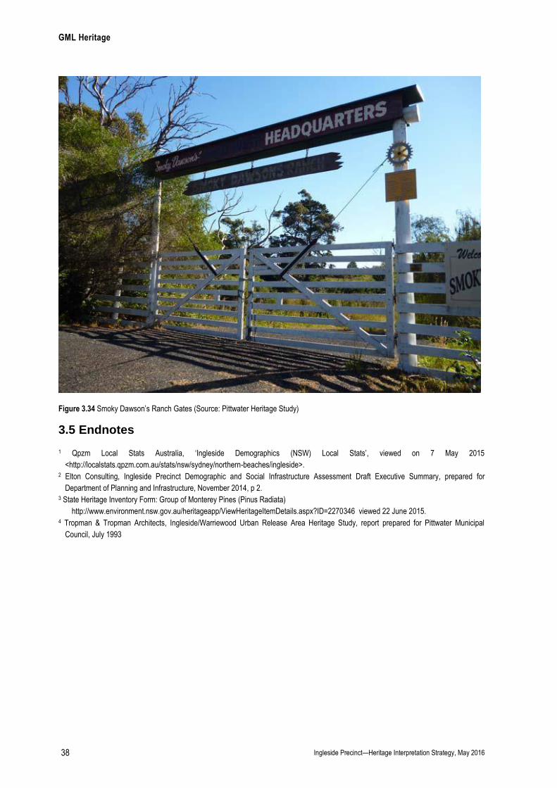
GML Heritage
Ingleside Precinct—Heritage Interpretation Strategy, May 2016 38
Figure 3.34 Smoky Dawson’s Ranch Gates (Source: Pittwater Heritage Study)
3.5 Endnotes
1 Qpzm Local Stats Australia, ‘Ingleside Demographics (NSW) Local Stats’, viewed on 7 May 2015
<http://localstats.qpzm.com.au/stats/nsw/sydney/northern-beaches/ingleside>. 2 Elton Consulting, Ingleside Precinct Demographic and Social Infrastructure Assessment Draft Executive Summary, prepared for
Department of Planning and Infrastructure, November 2014, p 2. 3 State Heritage Inventory Form: Group of Monterey Pines (Pinus Radiata)
http://www.environment.nsw.gov.au/heritageapp/ViewHeritageItemDetails.aspx?ID=2270346 viewed 22 June 2015. 4 Tropman & Tropman Architects, Ingleside/Warriewood Urban Release Area Heritage Study, report prepared for Pittwater Municipal
Council, July 1993
GML Heritage
Ingleside Precinct—Heritage Interpretation Plan, May 2016 39
4.0 Interpretation Framework
4.1 Objectives of Interpretation
This section of the Heritage Interpretation Strategy outlines the potential range of options for heritage
interpretation within the Ingleside Precinct and addresses the requirements for GreenStar listing–
Cultural Heritage and Identity. A range of methods and interpretative devices are identified across a
number of locations.
The primary aim for interpretation is to engage people to understand and connect with the history of an
area. By interpreting history with themes and stories there is an opportunity for people to celebrate and
experience the significance of the site and its context in new ways—developing and enhancing a
sense of community identity. Often, familiar places can take on new meanings, and understandings
are developed through interpretation. By making connections with the past, visitors and residents will
be better able to understand the course and pattern of development that shaped this relatively
unknown part of Sydney.
As well as the five key sites, mention is made of the four heritage items identified as part of the
Pittwater Community Based Heritage Study (2015) in April 2015. Additional locations for interpretation
have also been suggested.
4.2 Potential Interpretative Devices
A number of interpretative devices have been identified in this report that could be used to interpret the
history and heritage of the Ingleside Precinct. These include:
Interpretative plantings—a row of Narrabeen plums planted near the former site of the Larkin’s
Waratah Farm (near the Monterey Pines).
Pedestrian and cycle ways—As well as providing pedestrian and bicycle linkages between key
areas of the proposed development, the pedestrian/cycle ways will be an interpretive spine
through the precinct. Many of the key features identified for interpretation are located along the
proposed path, so their stories will be told via interpretive signage. These features and include:
Ingleside House;
The Powderworks Ruins;
Baha’i House of Worship;
Laterite Site;
Waratah Farm (Monterey Pines);
Smokey Dawson’s Gates;
The Carving Survey Mark; and
Cicada Glen Nursery.
Interpretative walkway balustrades and installations—these could be located along various
paths and bushwalking tracks and illustrate various components of the Ingleside story.
GML Heritage
Ingleside Precinct—Heritage Interpretation Strategy, May 2016 40
Interpretive Furniture—along public cycleways and footpaths public furniture could represent the
key historical stories, such as a seat called ‘The Larkin’s Bench’, a barrel labelled ‘Ingleside
Powderworks Factory’.
Nature Trails—locational signs for nature trails could interpret natural heritage.
Parks—-several areas within the Ingleside Precinct have been identified to be retained as open
space and parkland. These include the area surrounding the powderworks ruins which could
contain interpretative signage and furniture and also the area of Cicada Glen Nursery where
Pickerill’s original holiday cottage could be adaptively re-used.
Acknowledgement of the First Australians—Work with the Aboriginal Heritage Office to
acknowledge and interpret the Aboriginal history of the area.
4.3 Potential Interpretation Locations
The locations for interpretation provided relate to the identified heritage sites, as well as to new
locations that may develop as part of the future planning of the Ingleside Precinct. The locations
respond to how local people may approach and engage with the precinct in their journeys to and from
important locations such as the school, the neighbourhood centre and the newly created parks. They
also relate to potential future visitor use of the area. This segment may arrive to picnic in the area or to
walk and cycle along new pathways and nature trails.
The potential locations for interpretation initiatives are:
Location 1: Ingleside House.
Location 2: The Powderworks Ruins—now proposed for an environmental conservation land
use.
Location 3: The Baha’i House of Worship site.
Location 4: The site of the former Waratah Farm (Monterey Pines).
Location 5: The site of Cicada Glen Nursery—now proposed as a mix of open space, low
density residential and medium density land uses.
Location 6: Pedestrian and Cycle Ways.
Location 7: Nature Trails—including in the Katandra Bushland Sanctuary.
Promotion and Marketing: Digital Interpretation.
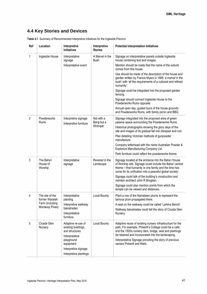
GML Heritage
Ingleside Precinct—Heritage Interpretation Plan, May 2016 41
4.4 Key Stories and Devices
Table 4.1 Summary of Recommended Interpretive Initiatives for the Ingleside Precinct.
Ref Location Interpretive Initiatives
Interpretive Stories
Potential Interpretation Initiatives
1 Ingleside House Interpretative signage
Interpretative event
A Marvel in the Bush
Signage on interpretative panels outside Ingleside house combining text and images.
Mention should be made that the name of the suburb comes from this house.
Use should be made of the description of the house and garden written by Francis Myers in 1885 ‘a marvel in the bush’ with ‘all the requirements of a cultured and refined humanity’.
Signage could be integrated into the proposed garden fencing.
Signage should connect Ingleside House to the Powderworks Ruins opposite.
Annual open day, guided tours of the house grounds and Powderworks Ruins, with family picnic and BBQ.
2 Powderworks Ruins
Interpretive signage
Interpretive furniture
Not with a Bang but a Whimper
Signage integrated into the proposed area of green passive space surrounding the Powderworks Ruins.
Historical photographs showing the glory days of the site and images of its gradual fall into disrepair and ruin.
Plan detailing Victorian methods of gunpowder manufacture.
Company letterhead with the name Australian Powder & Explosive Manufacturing Company Ltd.
Park furniture could reflect the powderworks theme.
3 The Baha’i House of Worship
Interpretative signage
Revered in the Landscape
Signage located at the entrance into the Baha’i House of Worship site. Signage could include the Baha’i central theme—‘that humanity is one family and the time has come for its unification into a peaceful global society’.
Signage could talk of the building’s construction and mention architect John R Brogden.
Signage could also mention points from which the temple can be viewed and distances.
4 The site of the former Waratah Farm (including Monterey Pines)
Interpretative planting
Interpretive walkway balustrades
Interpretative furniture
Local Bounty
Plant a row of the Narrabeen plums to represent the famous plum propagated there.
A seat on the walkway could be called ‘Larkins Bench’.
Walkway balustrades could tell the story of Cicada Glen Nursery.
5 Cicada Glen Nursery
Adaptive re-use of existing buildings, and structures
Interpretative playground equipment
Interpretive signage
Interpretive plantings
Local Bounty Adaptive reuse of existing nursery infrastructure for the park. For example, Pickerill’s Cottage could be a cafe; and the 1920s nursery dam, bridge, seat and plantings be retained and incorporated into the landscaping.
Interpretative Signage providing the story of previous owners Pickerill and Klerk.
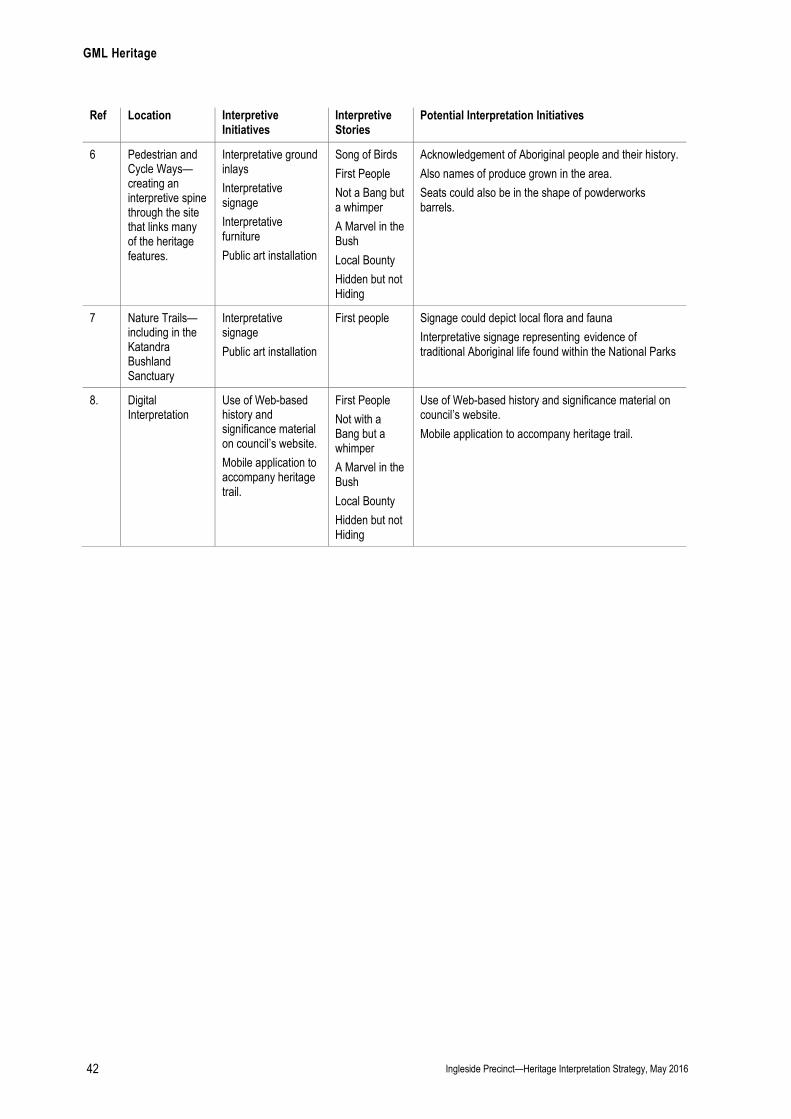
GML Heritage
Ingleside Precinct—Heritage Interpretation Strategy, May 2016 42
Ref Location Interpretive Initiatives
Interpretive Stories
Potential Interpretation Initiatives
6 Pedestrian and Cycle Ways—creating an interpretive spine through the site that links many of the heritage features.
Interpretative ground inlays
Interpretative signage
Interpretative furniture
Public art installation
Song of Birds
First People
Not a Bang but a whimper
A Marvel in the Bush
Local Bounty
Hidden but not Hiding
Acknowledgement of Aboriginal people and their history.
Also names of produce grown in the area.
Seats could also be in the shape of powderworks barrels.
7 Nature Trails—including in the Katandra Bushland Sanctuary
Interpretative signage
Public art installation
First people Signage could depict local flora and fauna
Interpretative signage representing evidence of traditional Aboriginal life found within the National Parks
8. Digital Interpretation
Use of Web-based history and significance material on council’s website.
Mobile application to accompany heritage trail.
First People
Not with a Bang but a whimper
A Marvel in the Bush
Local Bounty
Hidden but not Hiding
Use of Web-based history and significance material on council’s website.
Mobile application to accompany heritage trail.
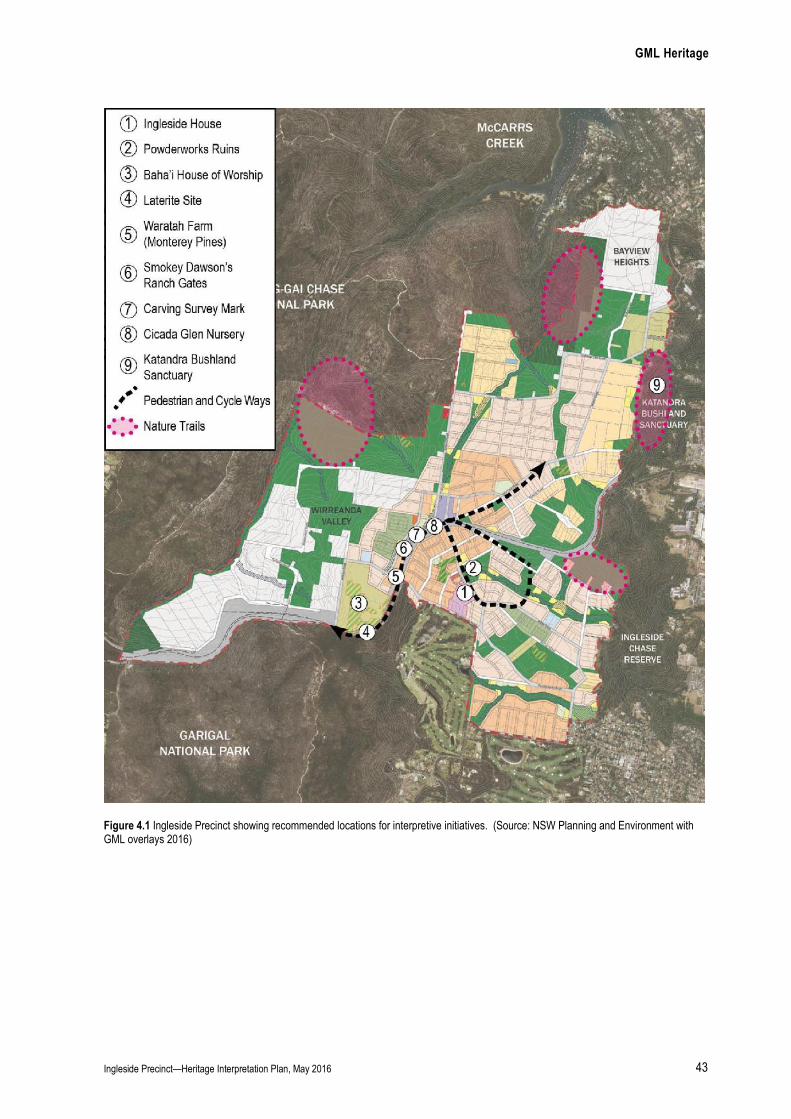
GML Heritage
Ingleside Precinct—Heritage Interpretation Plan, May 2016 43
Figure 4.1 Ingleside Precinct showing recommended locations for interpretive initiatives. (Source: NSW Planning and Environment with GML overlays 2016)

GML Heritage
Ingleside Precinct—Heritage Interpretation Plan—Draft Report, June 2015 44
Location 1—Ingleside House
Locations Ingleside House footpath
Ingleside House fencing
Audience Residents, school students, walking groups, history groups and visitors
Stories A Marvel in the Bush
GreenStar Interpretative Initiatives
Interpretive signage and historical photographs
Annual Open Day
Mr Von Bieren most courteously entertains all visitors in his charming little home. Those who roam in search of the beautiful will not be concerned with the powder works, but they will certainly halt before this chalet, as in sight of Narrabeen Waterfall or Manly Cove. It is like an actual shrine to some deity of the flowers of the land, and quite unlike any other house in or about Sydney, or Manly, or any other Australian town. You might imagine it imported as it stands, from the Tyrol, built under the inspiration of peaked mountains and tapering pines, and the grace and colour which the humanity of that high fair land loves to display. It is a little house that contains a lot of accommodation, long and lofty rooms, approached beneath peaked and gabled verandahs, or by quaintly carved flights of stone stairs, with a little octagon tower in the centre, containing boudoir below, study above, and over all a little gallery, beneath a steeple roof. Roof of a deep dull red, that suits the landscape as well as do the old red tiles, the tiles that Ruskin loves to praise, the village scenes of England. All this beauty M. Von Bieren designed for himself, as also the carved stone fountain, fed from a reservoir excavated in the hill above, and the terraces, parterres, and elaborate surroundings of the garden. It is indeed a marvel in the bush, and it is, in a certain sense, instructive to contrast these fair and adequate provisions for all the requirements of a cultured and refined humanity with the arrangements we are more usually familiar with in our bush; the uncouthness, the rudeness, the lack of any consideration for the higher, better life, which characterises, not the Australian pioneers only, but the wealthy settler of the second or third generation. It is to be hoped that Mr Von Bieren’s chalet, as his powder, will work in the land, to the shattering of many crude old notions, and parsimonious prejudices, that he may aid in the blowing away of that still old English notion of a house, which bars the way to a full development of the architecture natural to and worthy of our land.
Francis Myers, A Traveller’s Tale: From Manly to the Hawkesbury, 1885, http://www.pittwater.nsw.gov.au/library/local_history/Pittwaters_past/ingleside viewed 10 April 2014.

GML Heritage
Ingleside Precinct—Heritage Interpretation Plan—Draft Report, June 2015 45
Location 2—Powderworks Ruins
Location In the environmental conservation land use area surrounding the ruins.
Audience Residents, students, families and children, walking groups, history groups and visitors.
Stories Not with a Bang but a Whimper
GreenStar Interpretive Initiatives
Interpretive signage and photographs
Interpretive furniture
Interpretive playground equipment
Interpretive landscaping
In a visit to the site in July 1884 His Excellency the Governor (Lord Augustus Loftus), stated:
These works will not only materially assist in the development of commercial enterprise, but will help to give Australia, I may not yet say federated Australia, that independence which will be valuable not only in the time of peace, but still more so in the time of war. (Applause) We are I think, some 16,000 miles from England, whence, I believe, the bulk of the powder consumed in these colonies is obtained. This is, I believe, the first powder manufactory established in the Australian colonies. (Hear, hear) Hitherto the powder has come from abroad; in the first place the expense of transport has been very great, and secondly there is an increase of that expense in consequence of the great risks to life and the ships in which the powder is brought. I hope this manufactory will, in a very short time, prove its efficiency in being able to supply, not only New South Wales, but all these colonies, with sufficient powder for all mining and commercial purposes. (Hear, hear)
Sydney Morning Herald, July 1884.
[The] factory at Ingleside is likely to prove the model for similar establishments which the requirements of the near future may call into existence … the enterprise will not only supply a want long felt by both the Government and the community generally, but will give this colony great advantages over the sister colonies in mining operations and the construction of railroads and other public works, and will, as has been aptly observed by the Hon. W.B. Dalley in a speech he recently delivered at Ingleside, add greatly to the security of the colony in the event of its independence being threatened
Town and Country Journal, 16 August 1884 pp 338 and 340.
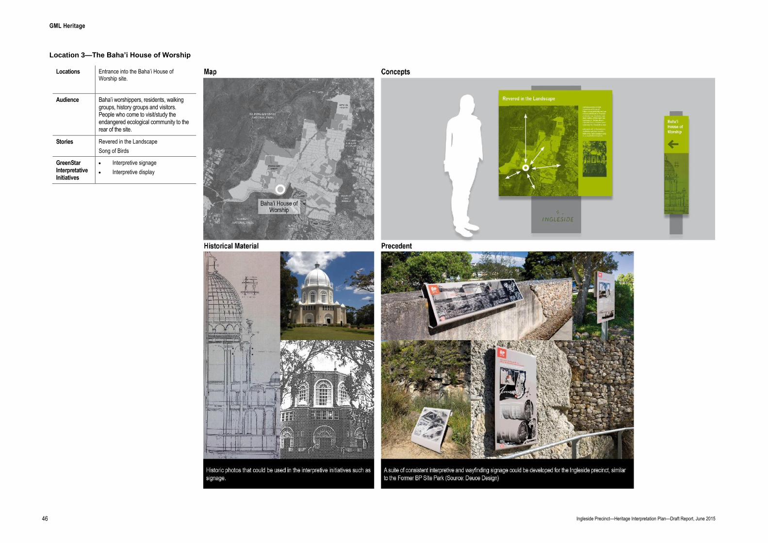
GML Heritage
Ingleside Precinct—Heritage Interpretation Plan—Draft Report, June 2015 46
Location 3—The Baha’i House of Worship
Locations Entrance into the Baha’i House of Worship site.
Audience Baha’i worshippers, residents, walking groups, history groups and visitors. People who come to visit/study the endangered ecological community to the rear of the site.
Stories Revered in the Landscape
Song of Birds
GreenStar Interpretative Initiatives
Interpretive signage
Interpretive display

GML Heritage
Ingleside Precinct—Heritage Interpretation Plan, May 2016 47
Location 4—The Site of the Former Waratah Farm (Monterey Pines)
Locations Near the former Waratah farm site
Audience Residents, school children, teachers, walking groups, history groups and visitors.
Stories Local Bounty
GreenStar Interpretative Initiatives
Interpretive plantings
Interpretive furniture
Education kit for students

GML Heritage
Ingleside Precinct—Heritage Interpretation Plan, May 2016 48
Location 5—Cicada Glen Nursery (Formerly Klerk’s Garden)
Locations Corner of Mona Vale and Chiltern Roads (now possible park site)
Audience Residents, school children, teachers, walking groups, history groups and visitors.
Stories Local Bounty
Song of Birds
GreenStar Interpretative Initiatives
Interpretive playground equipment
Interpretive signage
Interpretive plantings
Adaptive reuse of existing nursery infrastructure for the park. For example, Pickerill’s Cottage could be a cafe; and the 1920s nursery dam, bridge, seat and plantings be retained and incorporated into the landscaping.
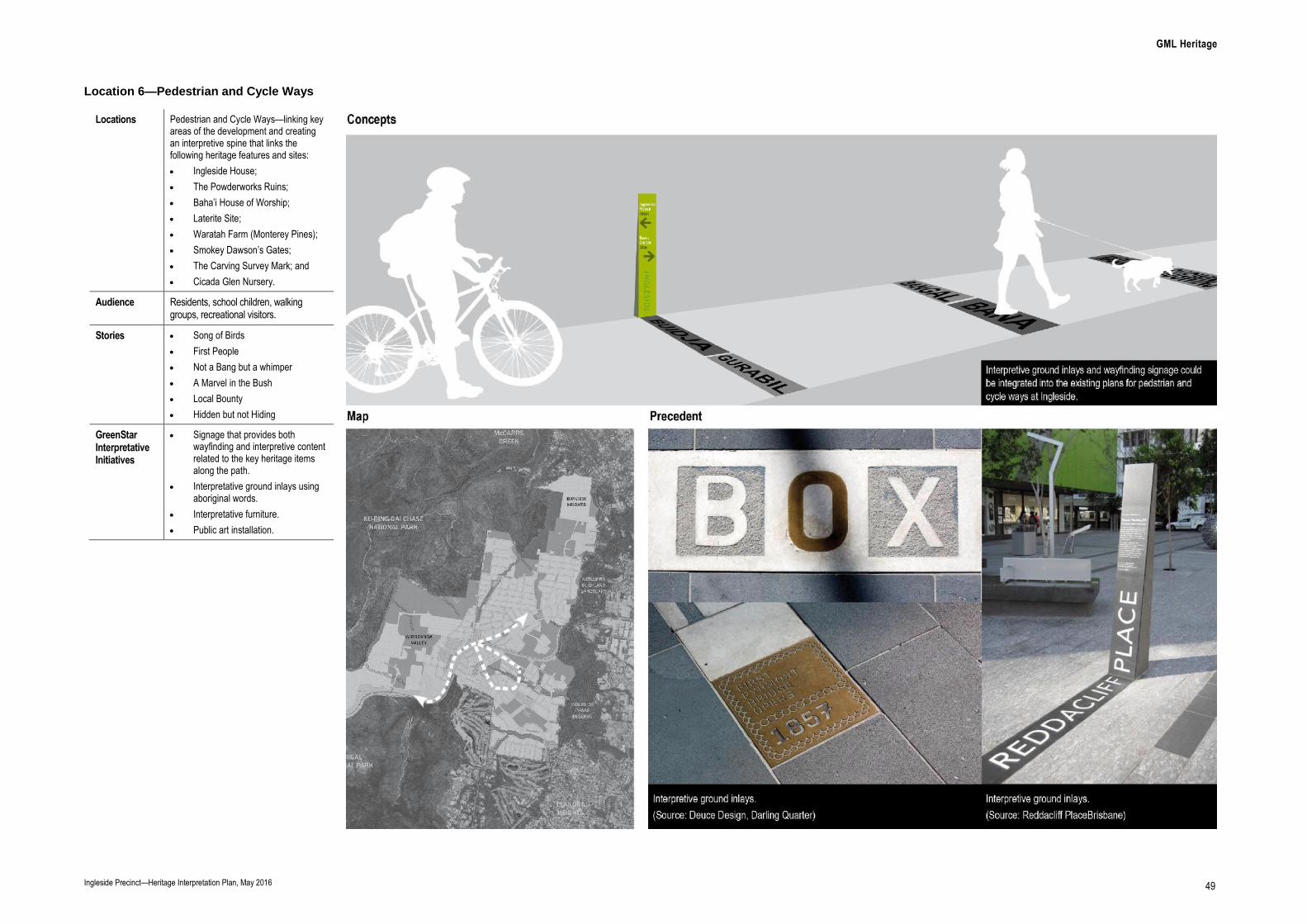
GML Heritage
Ingleside Precinct—Heritage Interpretation Plan, May 2016 49
Location 6—Pedestrian and Cycle Ways
Locations Pedestrian and Cycle Ways—linking key areas of the development and creating an interpretive spine that links the following heritage features and sites:
Ingleside House;
The Powderworks Ruins;
Baha’i House of Worship;
Laterite Site;
Waratah Farm (Monterey Pines);
Smokey Dawson’s Gates;
The Carving Survey Mark; and
Cicada Glen Nursery.
Audience Residents, school children, walking groups, recreational visitors.
Stories Song of Birds
First People
Not a Bang but a whimper
A Marvel in the Bush
Local Bounty
Hidden but not Hiding
GreenStar Interpretative Initiatives
Signage that provides both wayfinding and interpretive content related to the key heritage items along the path.
Interpretative ground inlays using aboriginal words.
Interpretative furniture.
Public art installation.
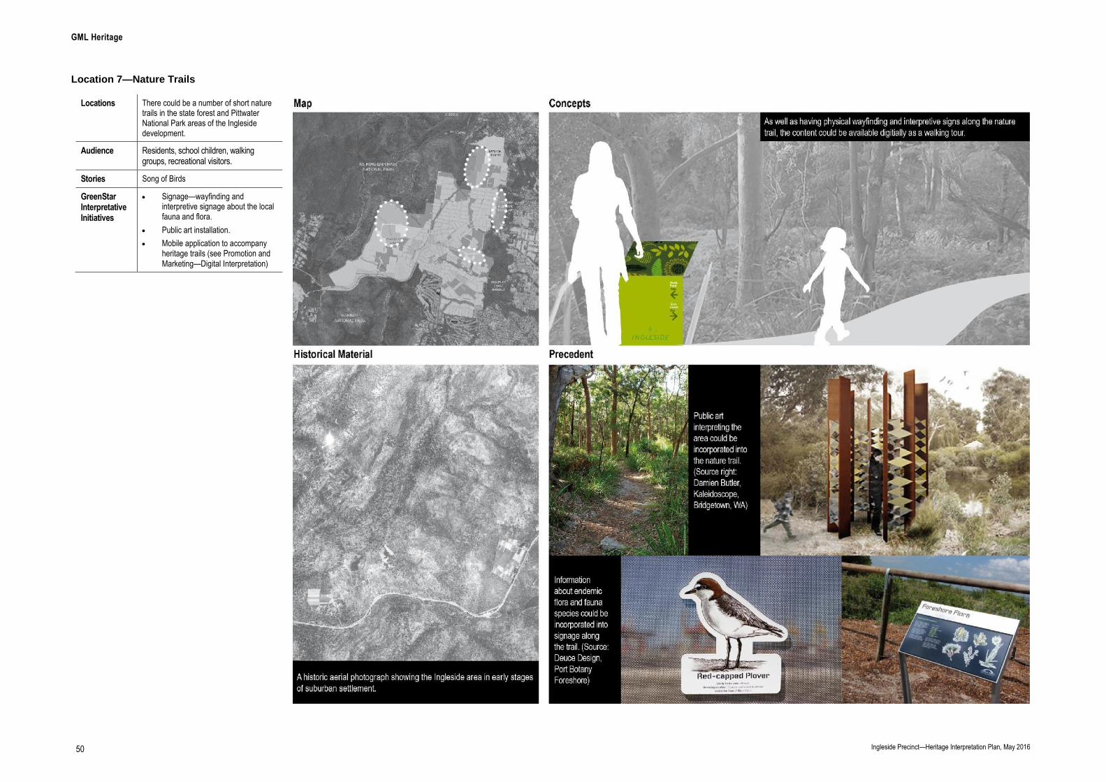
GML Heritage
Ingleside Precinct—Heritage Interpretation Plan, May 2016 50
Location 7—Nature Trails
Locations There could be a number of short nature trails in the state forest and Pittwater National Park areas of the Ingleside development.
Audience Residents, school children, walking groups, recreational visitors.
Stories Song of Birds
GreenStar Interpretative Initiatives
Signage—wayfinding and interpretive signage about the local fauna and flora.
Public art installation.
Mobile application to accompany heritage trails (see Promotion and Marketing—Digital Interpretation)

GML Heritage
Ingleside Precinct—Heritage Interpretation Plan, May 2016 51
Promotion and Marketing—Digital Interpretation
Locations Digital—responsively designed online content that displays on mobiles, tablets, laptops and desktop computers. Accessed via council’s website.
This off-site content could include categories such as ‘What’s On’, ‘Stories of Ingleside’ and a ‘Map’ of the interpretive initiatives, including a self-guided walking tour for the nature trail.
Audience Ingleside residents, visitors and researchers interested in the stories of Ingleside.
Stories Song of Birds
First People
Not a Bang but a whimper
A Marvel in the Bush
Local Bounty
Hidden but not Hiding
GreenStar Interpretative Initiatives
Web-based history and significance material on council’s website.
Mobile application to accompany heritage trails.
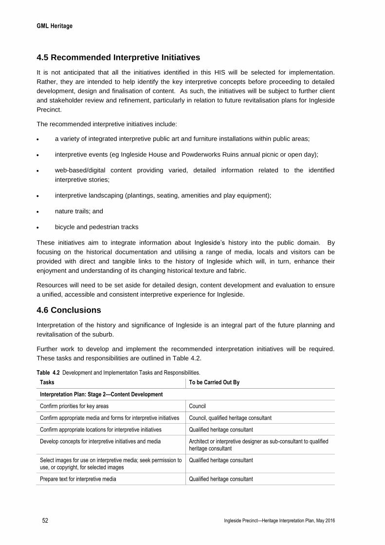
GML Heritage
Ingleside Precinct—Heritage Interpretation Plan, May 2016 52
4.5 Recommended Interpretive Initiatives
It is not anticipated that all the initiatives identified in this HIS will be selected for implementation.
Rather, they are intended to help identify the key interpretive concepts before proceeding to detailed
development, design and finalisation of content. As such, the initiatives will be subject to further client
and stakeholder review and refinement, particularly in relation to future revitalisation plans for Ingleside
Precinct.
The recommended interpretive initiatives include:
a variety of integrated interpretive public art and furniture installations within public areas;
interpretive events (eg Ingleside House and Powderworks Ruins annual picnic or open day);
web-based/digital content providing varied, detailed information related to the identified
interpretive stories;
interpretive landscaping (plantings, seating, amenities and play equipment);
nature trails; and
bicycle and pedestrian tracks
These initiatives aim to integrate information about Ingleside’s history into the public domain. By
focusing on the historical documentation and utilising a range of media, locals and visitors can be
provided with direct and tangible links to the history of Ingleside which will, in turn, enhance their
enjoyment and understanding of its changing historical texture and fabric.
Resources will need to be set aside for detailed design, content development and evaluation to ensure
a unified, accessible and consistent interpretive experience for Ingleside.
4.6 Conclusions
Interpretation of the history and significance of Ingleside is an integral part of the future planning and
revitalisation of the suburb.
Further work to develop and implement the recommended interpretation initiatives will be required.
These tasks and responsibilities are outlined in Table 4.2.
Table 4.2 Development and Implementation Tasks and Responsibilities.
Tasks To be Carried Out By
Interpretation Plan: Stage 2—Content Development
Confirm priorities for key areas Council
Confirm appropriate media and forms for interpretive initiatives Council, qualified heritage consultant
Confirm appropriate locations for interpretive initiatives Qualified heritage consultant
Develop concepts for interpretive initiatives and media Architect or interpretive designer as sub-consultant to qualified heritage consultant
Select images for use on interpretive media; seek permission to use, or copyright, for selected images
Qualified heritage consultant
Prepare text for interpretive media Qualified heritage consultant

GML Heritage
Ingleside Precinct—Heritage Interpretation Strategy, May 2016 53 53
Tasks To be Carried Out By
Provide summary of installation tasks and an overview maintenance strategy for interpretive media
Qualified heritage consultant and sub-consultant interpretive designer or Architect
Interpretation Plan: Stage 3—Implementation
Detailed design of interpretive media Architect or sub-consultant interpretive designer, briefed by a qualified heritage consultant
Produce interpretive media Producer/fabricator in collaboration with a qualified heritage consultant and Architect or a sub-consultant interpretive designer