Embed Size (px)
Citation preview
4th Pipeline Technology Conference 2009
Hannover, April 2009 www.msgis.com, © by ms.GIS 2009
PIP - Pipeline Information Platform
Information Management and GIS
for Pipelines
Operation Phaseand
Design Phase
Karim ELHANAFISenior Consultant
Page 1
Hannover, April 2009 www.msgis.com, © by ms.GIS 2009
Agenda
● Introduction of ms.GIS
● Why to use IT & GIS for Pipelines
● Challenges solved by PIP
● Strategies
● Solutions – MERO, NABUCCO
● Benefits
● Technology
Page 2
4th Pipeline Technology Conference 2009
Hannover, April 2009 www.msgis.com, © by ms.GIS 2009
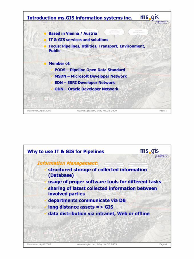
Introduction ms.GIS information systems inc.
● Based in Vienna / Austria
● IT & GIS services and solutions
● Focus: Pipelines, Utilities, Transport, Environment, Public
● Member of:
PODS – Pipeline Open Data Standard
MSDN – Microsoft Developer Network
EDN – ESRI Developer Network
ODN – Oracle Developer Network
Page 3
Hannover, April 2009 www.msgis.com, © by ms.GIS 2009
Why to use IT & GIS for Pipelines
Information Management:structured storage of collected information (Database)usage of proper software tools for different taskssharing of latest collected information between involved partiesdepartments communicate via DBlong distance assets => GISdata distribution via intranet, Web or offline
Page 4
4th Pipeline Technology Conference 2009
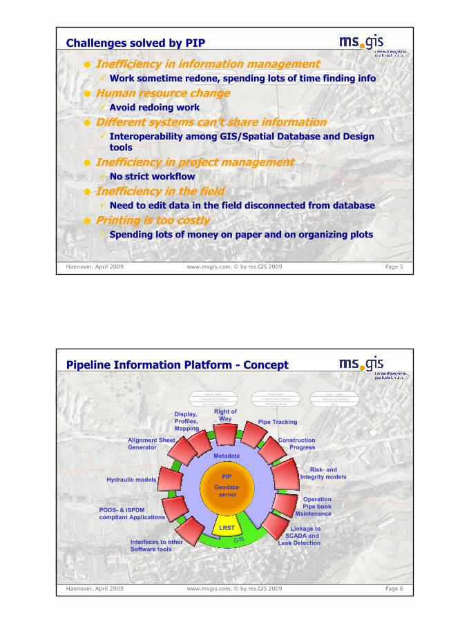
● Inefficiency in information managementWork sometime redone, spending lots of time finding info
● Human resource changeAvoid redoing work
● Different systems can’t share informationInteroperability among GIS/Spatial Database and Design tools
● Inefficiency in project management No strict workflow
● Inefficiency in the fieldNeed to edit data in the field disconnected from database
● Printing is too costlySpending lots of money on paper and on organizing plots
Challenges solved by PIP
Hannover, April 2009 www.msgis.com, © by ms.GIS 2009 Page 5
Hannover, April 2009 www.msgis.com, © by ms.GIS 2009
Pipeline Information Platform - Concept
LRST
Geodata-server
Metadata
Interfaces to otherSoftware tools
Pipe Tracking
ConstructionProgress
PODS- & ISPDMcompliant Applications
Risk- andIntegrity models
Display, Profiles,Mapping
Alignment SheetGenerator
OperationPipe book
Maintenance
GIS
Hydraulic models
Linkage toSCADA and
Leak Detection
Right ofWay
PIP
Page 6
4th Pipeline Technology Conference 2009
Hannover, April 2009 www.msgis.com, © by ms.GIS 2009
Pipeline Projects and their Phases
● Proposed Projects● Design / FEED● Construction● Operation,
Maintenance
ProcurementConstruction OperationDesign
New Pipeline Projects Existing Pipelines
● As Built Documentation
● Operation, Maintenance
Page 7
What do they have in common?Information and Data is Produced
which needs to be stored and managed
Management and Decision Support
Hannover, April 2009
Solutions – MERO, Middle European Crude Oil Pipeline
Desktop GIS Solution for all staff
Right-of-Way Management
Third Party Crossing Management
Corridor Maintenance Management
Pipe Book – ILI results
CP Maintenance & Survey Module
SCADA Linkage
Alignment Sheet Generator
MERO - Modules for Operation
www.msgis.com, © by ms.GIS 2009 Page 8www.msgis.com, © by ms.GIS 2009
4th Pipeline Technology Conference 2009
Hannover, April 2009
Solutions - NABUCCO
Data collection conceptData Format & Data Transfer SpecificationData harmonization for future phasesWEB PortalDocument Management System
NABUCCO - Design phase
www.msgis.com, © by ms.GIS 2009 Page 9www.msgis.com, © by ms.GIS 2009
Multi CountriesMulti RoutesMulti Versions (Revisions)Multi OrganizationsMulti SitesMulti UsersMulti InterfacesMulti SRS
Challenges
Hannover, April 2009 www.msgis.com, © by ms.GIS 2009
Benefits & Savings
no loss of information / sharing of informationfast access to latest informationincreased user productivityavoid of re-doing worksdata at-a-glancedecision supportprogress monitoringknowledge about the condition / statusbasis for reducing operational / overhead costsprotection of investment
Benefits
Page 10
4th Pipeline Technology Conference 2009
Hannover, April 2009 www.msgis.com, © by ms.GIS 2009 Page 11
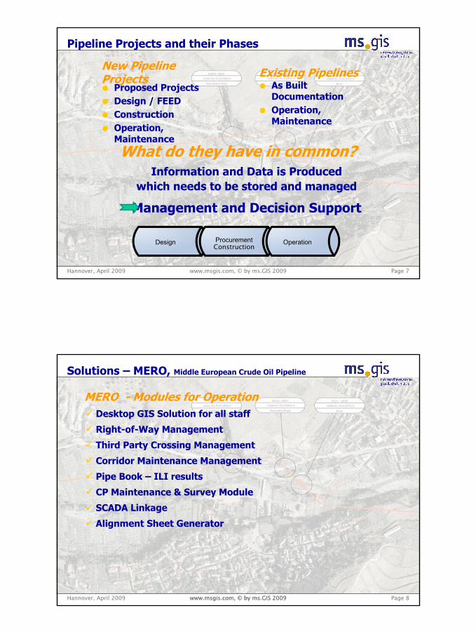
Example – Alarm Module
Identification of Pipeline Section
● Oil Spillage after 1, 2 & 3 h and the max. oil spillage
● Display of sections● display of location within map● Search (Docs & Data)● etc.
max. oil spillage
3h2h1h
Hannover, April 2009 www.msgis.com, © by ms.GIS 2009 Page 12
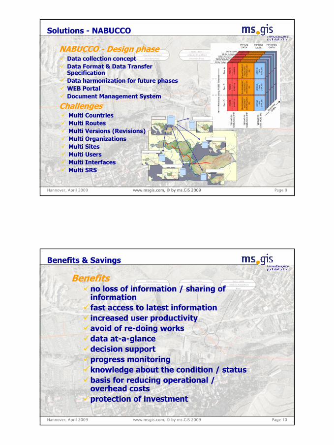
Example – Alarm Module
Controlled Operators Emergency Shutdown Procedure
controlled shutdowninstructions for
operators
4th Pipeline Technology Conference 2009
Hannover, April 2009 www.msgis.com, © by ms.GIS 2009 Page 13
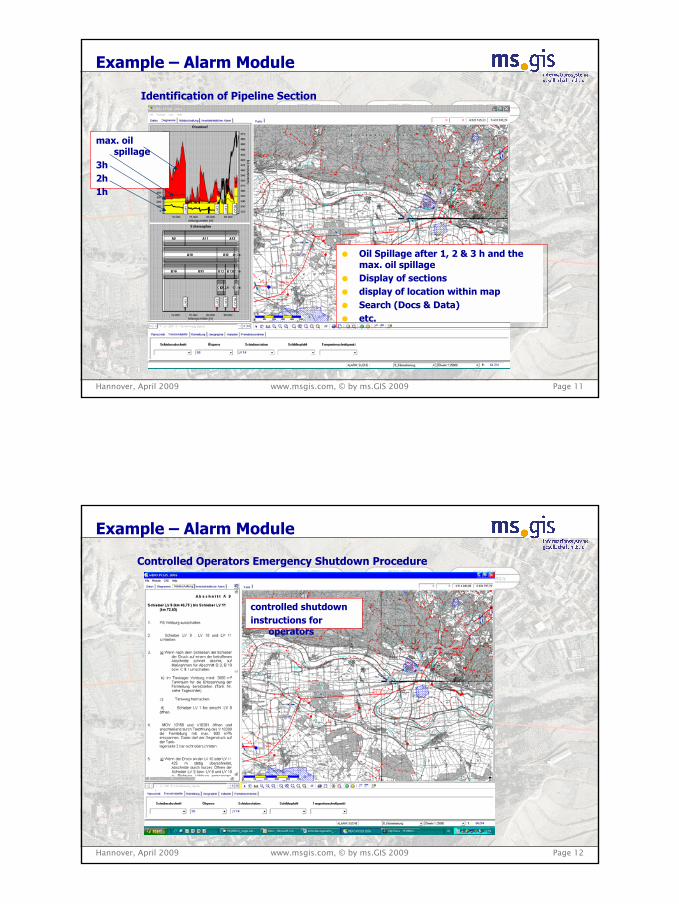
Example – Detail Drawing
Technical Information – Detail Drawing Oil Barrier
Display of detail drawings
i.e. oil barrier
Hannover, April 2009 www.msgis.com, © by ms.GIS 2009 Page 14
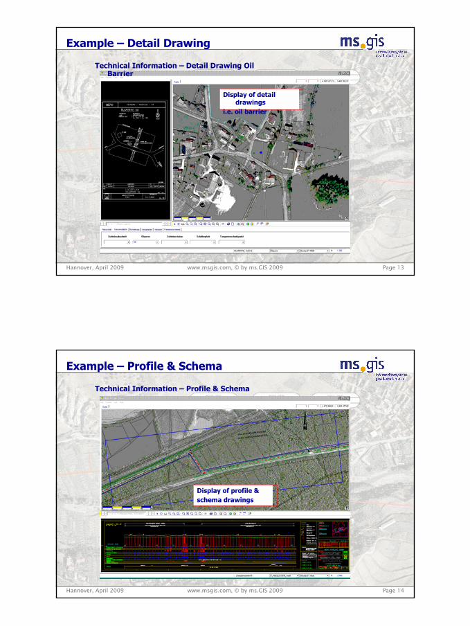
Example – Profile & Schema
Technical Information – Profile & Schema
Display of profile &schema drawings
4th Pipeline Technology Conference 2009
Hannover, April 2009 www.msgis.com, © by ms.GIS 2009
PIP - Pipeline Information Platform
Thank youfor your audience !
Page 15