Embed Size (px)
Citation preview
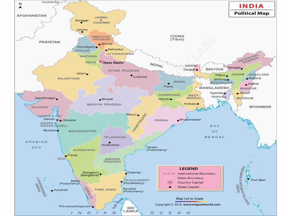
India – Size, Location, Neighboursand Political Map - Features
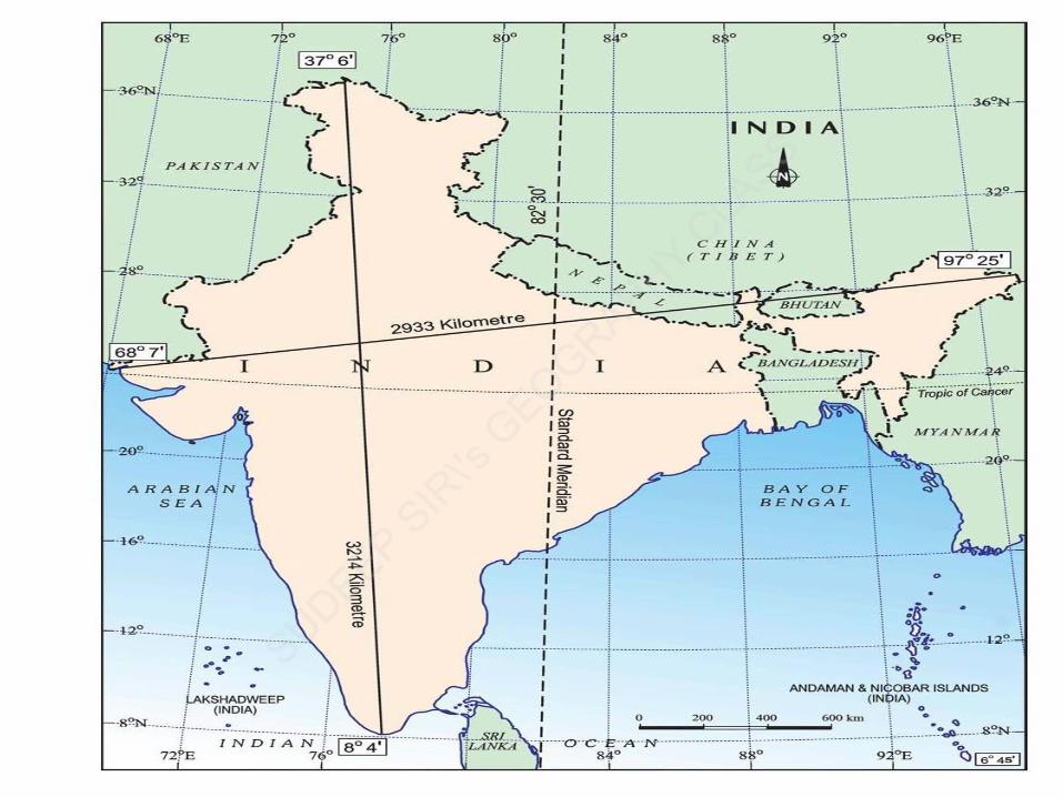


• India, the 7th largest country in the world, spread over an area 32,87,263 sq km.
• The country has about 2.4 percent of the global land area.
• India measures 3,214 km from north to south and 2,933 km from east to west.
• It has a land frontier of 15,200 km and a coastline of 7,516.6 km.


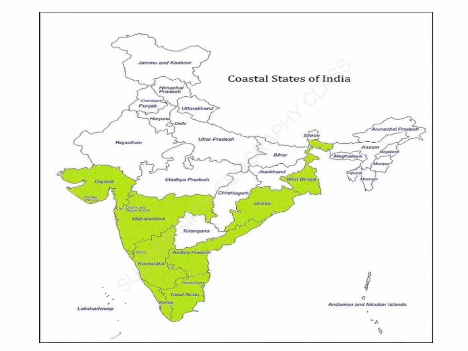

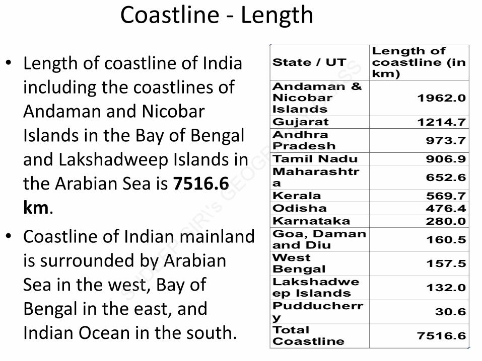
Coastline - Length
• Length of coastline of India including the coastlines of Andaman and Nicobar Islands in the Bay of Bengal and Lakshadweep Islands in the Arabian Sea is 7516.6 km.
• Coastline of Indian mainland is surrounded by Arabian Sea in the west, Bay of Bengal in the east, and Indian Ocean in the south.
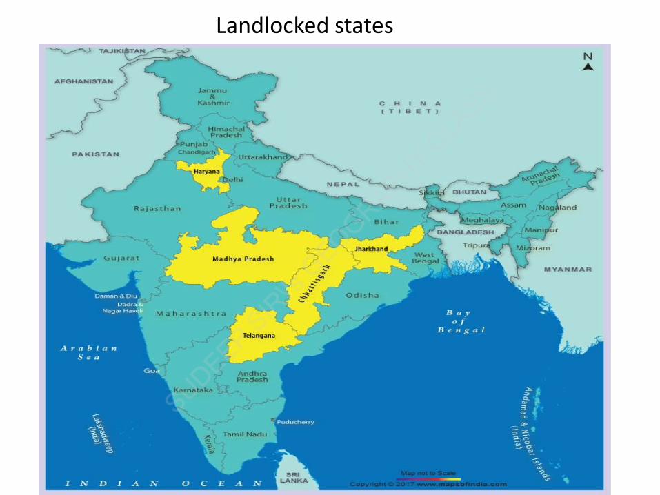
Landlocked states

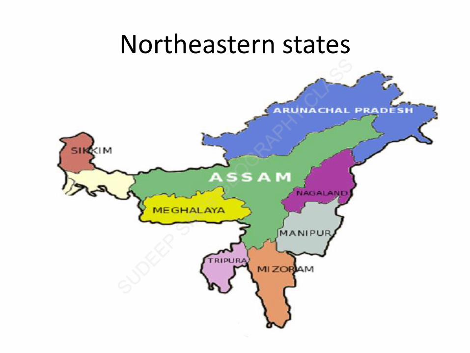
Northeastern states


Barren Island