Embed Size (px)
Citation preview
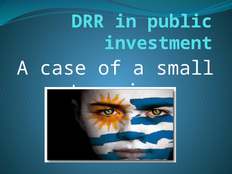
DRR in public investmentA case of a small
town in
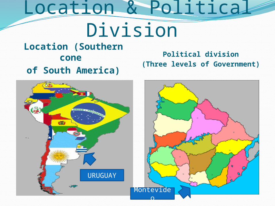
Location & Political Division Location (Southern
cone of South America)
Political division(Three levels of Government)
URUGUAY
Montevideo

ClimateTemperate and humid (17° C on average)
Four seasons are clearly differentiated (warm summers and cold winters)
Rio Negro (Black river) divides the country in 2 clearly differentiated climatic zones:North: Considerably hotter (average of 19° C)
with a “subtropical” climate.South: Considerably colder (16°C average) with
a “maritime” behavior.

URUGUAY - TopographySlightly rolling land Plains

URUGUAY - TopographyCathedral´s Hill – the highest
point in the country (513 mts.)
Typical cultural features of
URUGUAY

Meat (highly apprecited worldwide)

Mate (a Gaucho tradition and the national infusion)

Carnival (the longest in the world)
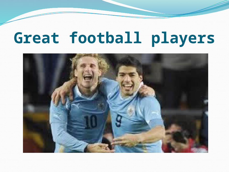
Great football players

Sun-and-sand tourism along its coast

Main Hazards in Uruguay
Affected area in the country
None Moderate High
Levels Levels
A Good Practice Case:
San Gregorio de Polanco - Tacuarembó
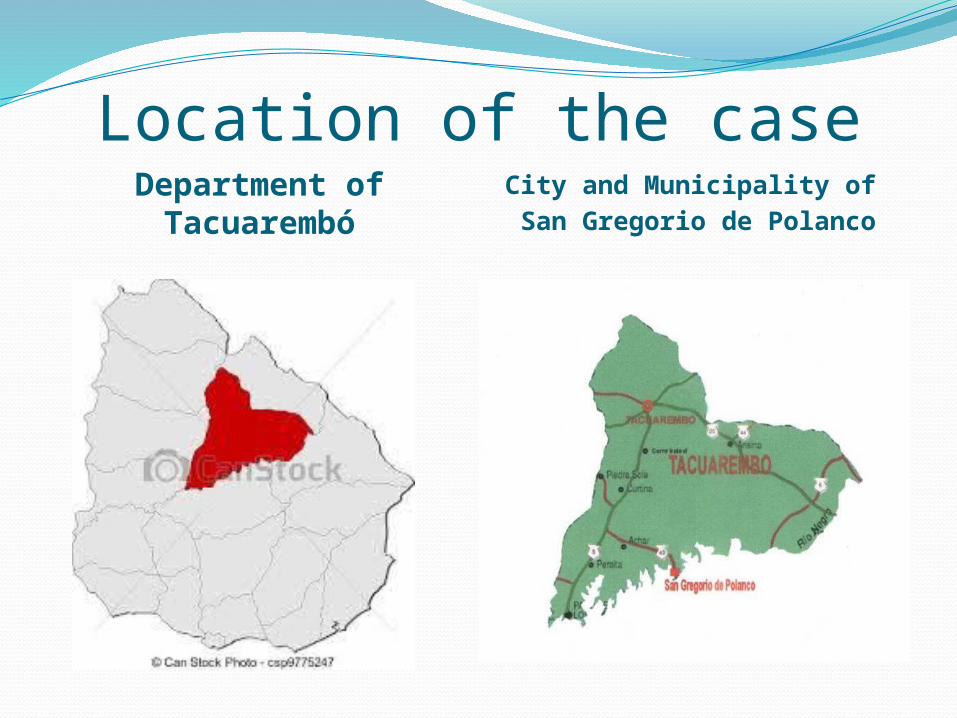
Location of the caseDepartment of Tacuarembó
City and Municipality of San Gregorio de Polanco

San Gregorio de Polanco´s Map
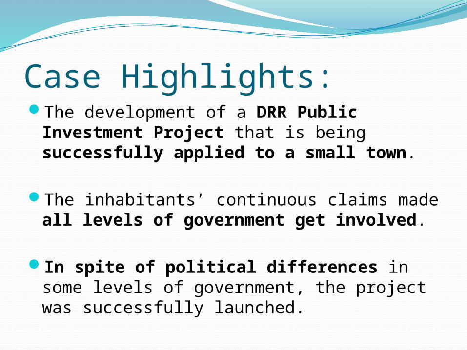
Case Highlights:The development of a DRR Public
Investment Project that is being successfully applied to a small town.
The inhabitants’ continuous claims made all levels of government get involved.
In spite of political differences in some levels of government, the project was successfully launched.

Historical summary since 1946 (1)
The building of the hydropower plant and it reservoir, led to worse means of transport and communications with the rest of the country.
These problems were solved by the public investment in infrastructure (national route 43), enabling the location to become a potential touristic attraction to be exploited, and this came true.

Historical summary since 1946 (2)The sun and sand tourism got strengthened
and soon it became the main local activity. San Gregorio de Polanco was first visited by tourists from the same department.
In the early nineties tourists from the hold country chose this town for their vacations/holidays.
In the most recent years European and American tourists find this Resort attractive in terms of other touristic activities like bird watching, contact with nature, among others.
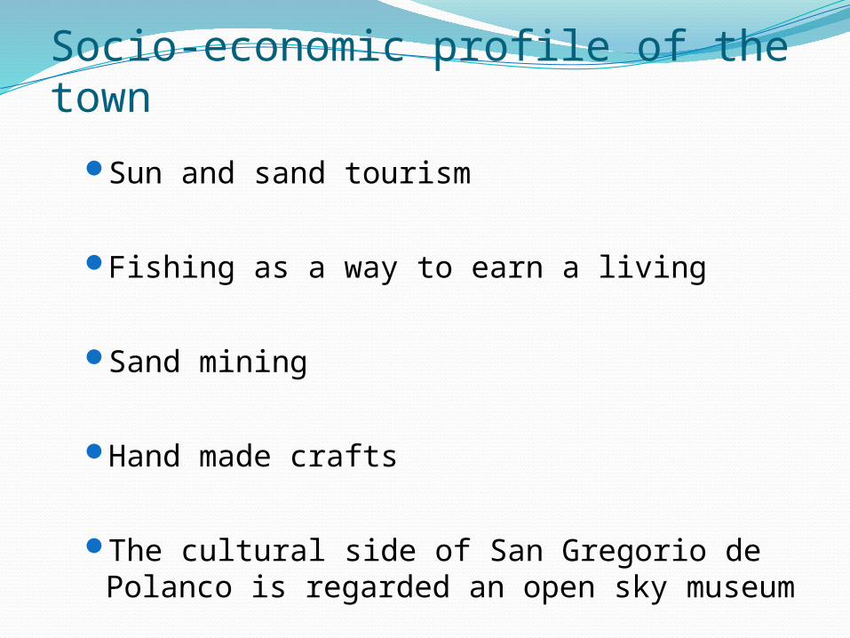
Socio-economic profile of the townSun and sand tourism
Fishing as a way to earn a living
Sand mining
Hand made crafts
The cultural side of San Gregorio de Polanco is regarded an open sky museum

Risks faced by San Gregorio de
Polanco

Socio-natural hazards
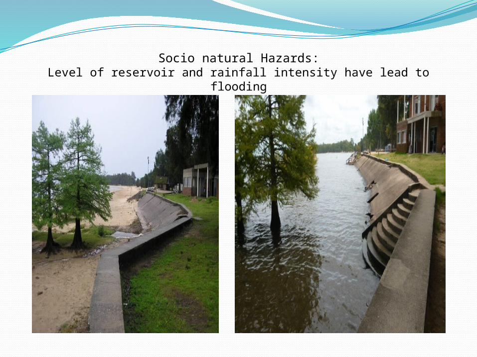
Socio natural Hazards:Level of reservoir and rainfall intensity have lead to flooding

Natural Hazard:Storng SE (southeast) winds have lead to coastal erosion

Vulnerabilities

Mains Vulnerabilities (1): Town design
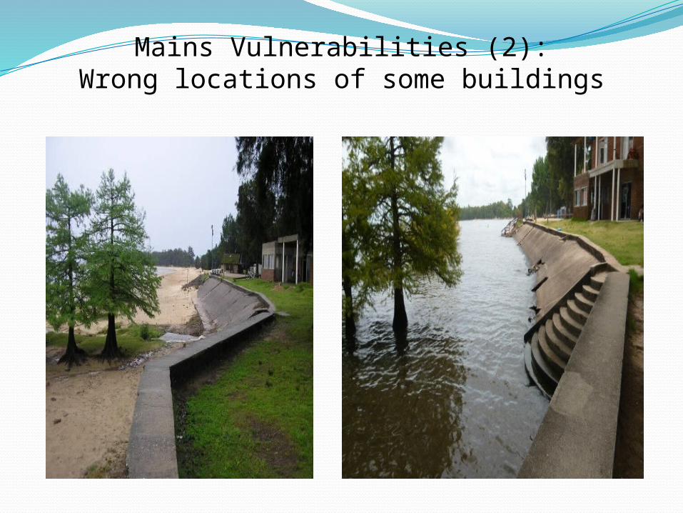
Mains Vulnerabilities (2):Wrong locations of some buildings

Which are the proposed solutions?The proposal carried out by the
Departamental government involves implementing investment along the coastline of the Río Negro (Barriers called “Gabions” and building other infrastructure) – ORIGINAL SOLUTION–
The pilot proposal by the Public Investment Office and the Ministry of Environment involves the recovery of beach width and sand quality
– COMPLEMENTARY SOLUTION–
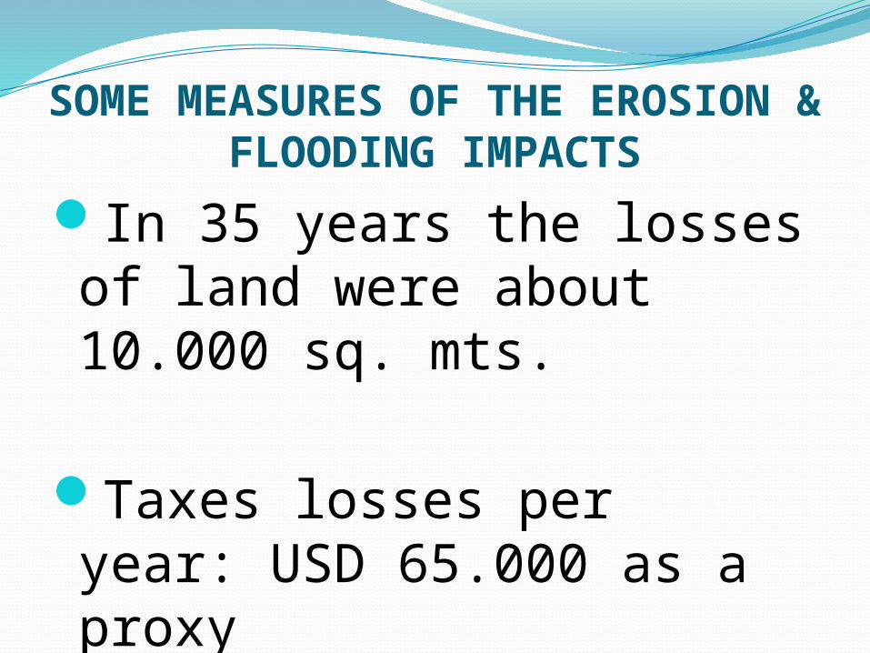
SOME MEASURES OF THE EROSION & FLOODING IMPACTS
In 35 years the losses of land were about 10.000 sq. mts.
Taxes losses per year: USD 65.000 as a proxy
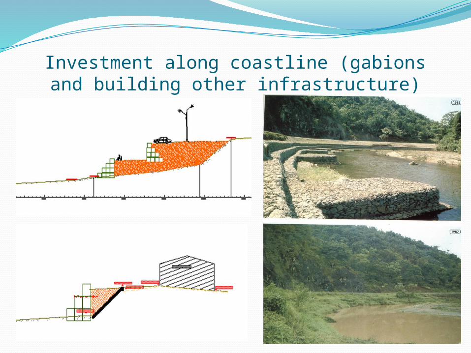
Investment along coastline (gabions and building other infrastructure)

Expected BenefitsImprovement of touristic offer by combining both
proposals (the one by the departamental government and the compelmentary one by the Public Investment Office and the Ministry of Enviroment)
Regularization of land
Improvement of inhabitants´ labour conditions
Increase of tax revenues by departamental government and in the near future by the municipality.
Creditswww.tacuarembo.gub.uy
Soc Leonardo Seijo y Ing Felipe Fajardo – O.P.P.-PDGS ([email protected] y
Bio Inti Carro, Climate Change Division Ministry of Environment (

Thank youJavier E. González Müller
Economist; Specialist on Sustainable Local Development and Disaster Risk Reduction
Campaign Advocate for Making Cities Resilient