Embed Size (px)
Citation preview

High-altitude Archeology,High-altitude Archeology,Peruvian Andes:Peruvian Andes:
Climate, glaciers, mummies and GISClimate, glaciers, mummies and GIS
Adina RacoviteanuDept. of Geography and INSTAAR,
University of Colorado

Inca Empire
• cca 1475 - 1532
• extended from present Columbia to N Chile
• Cuzco organizational and spiritual center
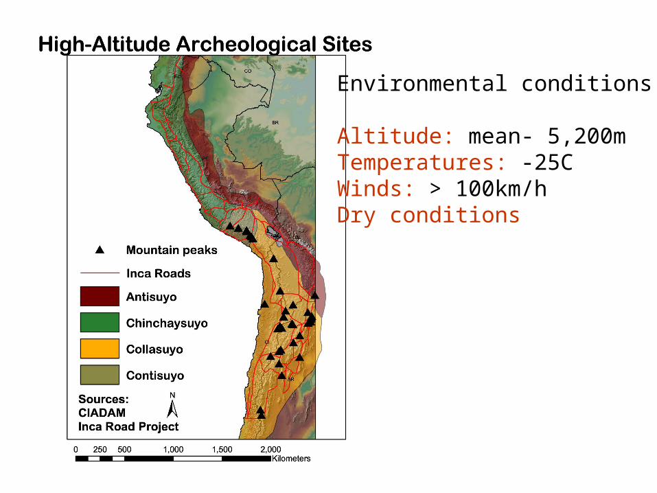
Environmental conditions
Altitude: mean- 5,200mTemperatures: -25CWinds: > 100km/hDry conditions

Glacier mummies: climate records?
500-year old mummy found in Peruvian Andes
Otzi- 5,000 year old mummy found in Tyrolean Alps, ItalyGlacier retreat revealed mummy

Ice core climate evidence
Source:Thompson 1994
INCA
Quelcaya Ice Cap, Peru


Study Area:
Cordillera Ampato, southern Peru.
Nevado Coropuna (stratovolcano complex covered by an ice cap and consisting of three peaks, with the highest one at 6,426m).

Why Coropuna? Archeological evidence from Spanish
chronicles•Highly worshipped mountain;
•Water source for nearby villages;
•Coropuna is believed to contain Inca ruins and human sacrifices offered to the mountain deity.
Source: Guaman Poma de Aylla [1613]

Criteria for archeological site prediction
• Slope: 0-5 deg (flat surfaces)
• Elevation: between 5000-6000m
• Accessibility: Inca roads/routes
proximity to least-
cost pathways
• Aspect (Orientation): East (NE or SE) direction
• Visibility: Pacific Ocean/other peaks visible

The effect of topography (slope) on movement across mountain
terrain
• Cost (Energy or Time) increases as terrain gets steeper
• Actual energy can be calculated by including physiological measurements, weight of individual and load carried.
Topographic cost
0
1
2
3
4
5
6
7
8
9
10
0 10 20 30 40 50 60 70
Slope (degrees)
Ener
gy (no
units)

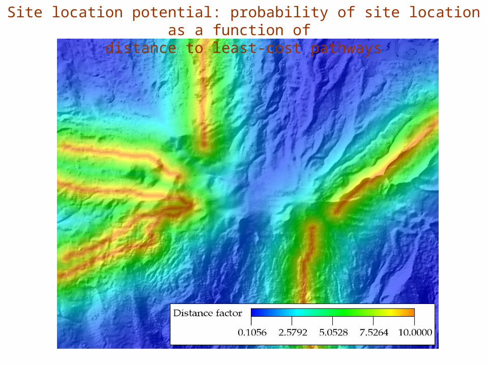
Site location potential: probability of site location as a function of
distance to least-cost pathways

The fun part: Adventures from fieldwork 2003
• French Ice-core expedition: June 2003
• archeological expeditions : August 2003