Embed Size (px)
Citation preview

Progress In Electromagnetics Research B, Vol. 34, 173–186, 2011
IMPROVING RAIN ATTENUATION ESTIMATION: MOD-ELLING OF EFFECTIVE PATH LENGTH USING KU-BAND MEASUREMENTS AT A TROPICAL LOCATION
A. Adhikari1, S. Das2, A. Bhattacharya1, and A. Maitra1, *
1S. K. Mitra Centre for Research in Space Environment, Institute ofRadio Physics and Electronics, University of Calcutta, Calcutta, India2Institute of Radio Physics and Electronics, University of Calcutta,Calcutta, India
Abstract—Rain attenuation is an important aspect of signalpropagation above 10GHz frequency. The attenuation time seriesgeneration from point rain rate measurement is crucial due tounavailability of actual signal measurements. In this paper, a simpleand realistic approach has been demonstrated for better estimation ofrain attenuation using Ku-band signal propagation data and groundrain rate measurements at Kolkata, India. The ITU-R model of rainattenuation has been modified by incorporating an effective slant pathmodel. The effective slant path has been estimated and modelledin terms of a power-law relationship of rain rate data of 2007–2008.The methodology has been validated with the measured data of 2006.Comparison with ITU-R and SAM clearly demonstrates the improvedpredictability of the proposed model at the present tropical location.
1. INTRODUCTION
With the requirement of large bandwidths in modern satellitecommunication technology, it has become utmost important to move-up along the frequency bands above 10 GHz. Consequently, at Ku-band and above, satellite communication is becoming increasinglypopular now-a-days for its own advantages like reduced equipment sizeand interference avoidance with terrestrial microwave communication
Received 25 July 2011, Accepted 10 September 2011, Scheduled 11 September 2011* Corresponding author: Animesh Maitra ([email protected]).

174 Adhikari et al.
systems. However, propagation impairments like rain attenuation isa serious concern in the design of high frequency (above 10 GHz)earth-space links as it increases severely with both rain rate andfrequency [1, 2]. This situation is more critical in tropical regions wherelarge convective rain is encountered [3]. Thus the possibility of efficientuse of satellite communication in tropics demands characterizationof rain attenuation and identification of suitable fade mitigationtechnique [3–5]. Further this type of study is also significant inmodern satellite-based remote sensing of rain parameters utilizing highfrequency bands [6].
Satellite signal strength measurements can provide an excellentopportunity of study and identification of suitable rain attenuationmodel [7] as well as fade mitigation technique. But unfortunately,actual signal measurements in tropical environment are very limited [3].In absence of actual signal measurements, modelling of rain attenuationnormally performed with the meteorological information [8]. Devisingan optimum mitigation technique for earth-space links requires detailedstudy of different rain parameters among which rain rate, drop sizedistribution are the most common ones [9]. An appropriate estimationof the amount of signal degradation due to rain also demands moreinsight to the rain characteristics. The vertical and horizontal extentsof the rain cell are two such parameters which control the amountof attenuation over terrestrial and satellite links [10]. Furthermore,rain characteristics vary with the type of rain (namely, stratiformand convective) and with the climatic zones (namely, tropical andtemperate) of the globe [11, 12]. Presently available attenuationprediction models like ITU-R, SAM (Simple Attenuation Model),Global Crane Model, DAH (Dissanayake, Allnutt, Haidara) Model— all were established by utilizing the rain attenuation data frommostly different temperate climatic zones. These available predictionmodels exhibit significant deviation while estimating rain degradationin the tropical regions [13]. Thus the existing models are needed to bemodified according to the tropical rain characteristics.
The objective of the present paper is to identify a simple approachto generate rain attenuation time series for tropical locations. In thispaper we attempt to obtain the distribution of rain cell dimensionalparameters (effective slant path length and effective horizontal extent)with respect to rain rates and, accordingly modify the existingattenuation prediction model for the present location by incorporatinga power-law relationship between the rain cell parameters and the rainrate. Finally, the proposed model is compared with the attenuationvalues obtained from ITU-R and SAM model to understand its relativeperformance with respect to other popular attenuation models.
Progress In Electromagnetics Research B, Vol. 34, 2011 175
2. EXPERIMENTAL SETUP
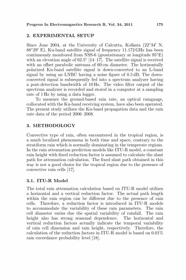
Since June 2004, at the University of Calcutta, Kolkata (22◦34′ N,88◦29′ E), Ku-band satellite signal of frequency 11.172 GHz has beencontinuously monitored from NSS-6 (geostationary at longitude 95◦E)with an elevation angle of 62.5◦ [14–17]. The satellite signal is receivedwith an offset parabolic antenna of 60 cm diameter. The horizontallypolarized Ku-band satellite signal is down-converted to an L-bandsignal by using an LNBC having a noise figure of 0.5 dB. The down-converted signal is subsequently fed into a spectrum analyzer havinga post-detection bandwidth of 10 Hz. The video filter output of thespectrum analyzer is recorded and stored in a computer at a samplingrate of 1Hz by using a data logger.
To measure the ground-based rain rate, an optical raingauge,collocated with the Ku-band receiving system, have also been operated.The present study utilizes the Ku-band propagation data and the rainrate data of the period 2006–2008.
3. METHODOLOGY
Convective type of rain, often encountered in the tropical region, isa much localized phenomena in both time and space, contrary to thestratiform rain which is normally dominating in the temperate regions.In the rain attenuation prediction models like ITU-R model, a constantrain height with fixed reduction factor is assumed to calculate the slantpath for attenuation calculation. The fixed slant path obtained in thisway is not a good choice for the tropical region due to the presence ofconvective rain cells [17].
3.1. ITU-R Model
The total rain attenuation calculation based on ITU-R model utilizesa horizontal and a vertical reduction factor. The actual path lengthwithin the rain region can be different due to the presence of raincells. Therefore, a reduction factor is introduced in ITU-R modelsto accommodate the variability of these rain parameters. The raincell diameter varies due the spatial variability of rainfall. The rainheight also has strong seasonal dependence. The horizontal andvertical reduction factors actually indicate the temporal variabilityof rain cell dimension and rain height, respectively. Therefore, thecalculation of the reduction factors in ITU-R model is based on 0.01%rain exceedance probability level [18].

176 Adhikari et al.
In ITU-R model, the horizontal reduction factor, r0.01, for 0.01%of the time:
r0.01 =1
1 + 0.78√
LG γRf − 0.38 (1− e−2LG)
(1)
where, LG is the horizontal projection of slant path, γR is the specificattenuation and f is the frequency of the propagated signal in GHz.The vertical adjustment factor, v0.01, for 0.01% of the time is calculatedby,
ζ = tan−1
(hR − hs
LG r0.01
)degrees (2)
hR and hS being respectively, the rain height and the height of theearth station above mean sea level in km.
For ζ > θ, LR =LGr0.01
cos θkm (3a)
Else, LR =(hR − hs)
sin θkm (3b)
Here θ is the elevation angle of the earth-space path in degrees.
If |ϕ |< 36◦ , χ = 36− |ϕ | degrees
Else, χ = 0 degreeswhere, ϕ is the latitude of the earth station in degrees
ν0.01 =1
1 +√
sin θ(31
(1− e−(θ/(1+χ))
) √LRγR
f2 − 0.45) (4)
Therefore, the effective path length is:LE = LRν0.01 km (5)
3.2. SAM Model
The simple attenuation model (SAM) [19], another popular model forattenuation prediction, incorporates the individual characteristics ofstratiform and convective type of rainfall and utilizes the point rainfallrate at the ground to calculate the attenuation time series as:
A = γLE , R ≤ 10 mm/h (6)
A = γ1− exp[−γb ln(R/10)LE cos θ]
γb ln(R/10) cos θ, R > 10mm/h (7)
Unlike ITU-R model, this model was initially proposed to predictrain attenuation from point rain rate measurements and thus did notrequire any long-term statistics of rain rate.

Progress In Electromagnetics Research B, Vol. 34, 2011 177
3.3. Proposed Rain Attenuation Model
The present location, Kolkata, being a tropical location, the natureof rain prevailing here is mostly convective. Figure 1 illustrates theearth-space communication system at the present location in presenceof convective rain.
H0
0 Isotherm Height
LE
LS
=62.5
NSS-6
o
o
(c)
θ
Figure 1. Schematic diagram of earth-space communication affectedby convective rain.
Let LE and X be respectively the effective slant length of theraining medium and the effective horizontal extent of the rain cellin Figure 1. The total slant path up to rain height according tothe standard ITU-R model is Ls, which is obviously greater than theeffective slant path through the raining medium. In ITU-R model, theeffective slant path is estimated assuming a constant reduction factorwhich depends upon the 0.01% rain probability of the location [18].This ITU-R model is applicable only for the calculation of annual rainattenuation characteristics. To generate a reliable rain attenuation timeseries, a rain rate dependent path length estimation technique is neededto be incorporated in the rain attenuation model.
Now, theoretically, the specific attenuation (γ) is expressed indB/km and can be evaluated by using the relation [20]:
γ = aRb (8)
where a and b are the parameter of the power-law relation and R isthe rain rate on the ground. For the present location the values of thetwo parameters at frequency 11.172 GHz are taken as a = 0.01772 andb = 1.2140 [8]. Consequently, the total attenuation along the path can

178 Adhikari et al.
be determined by the following relation:
A = γLE (9)
Therefore, the effective slant path length (LE) can be obtained as:
LE =A
γ(10)
Now, the effective horizontal extent of the rain cell (X) can becalculated from the horizontal projection of the effective slant pathlength as:
X = LE cos θ (11)
where θ is the elevation of the earth-space satellite signal propagationpath.
In this methodology, we assume that the rain cell extensions are inthe direction of the signal propagation, which is strictly not always thecase. But, the rain cells will be distributed evenly if a large number ofcases are considered and accordingly the effective slant path length willbe varying. Since our purpose is to predict the rain attenuation basedon the distribution of rain cells, a curve will be fitted with the observedvalues to obtain a relationship between the effective path length andthe rain rate. Similarly, it is also assumed that the rain cell extents arelimited within the actual slant path. This is also not very unrealisticsince normally cell diameters are within a few km. Thus the result ofthe analysis will be realistic statistically.
Further, the rainfall is not uniform throughout the rain cell. Thereexists a horizontal as well as vertical variability of rainfall within therain cell due to the presence of micro scale structures [21] and in-homogeneity of rain drop size distribution over the height range [22–24]. This type of spatial variability of rain within the rain cell is notexplicitly taken into account in our calculation of the effective pathlengths using Equations (10) and (11). However, when we model theeffective path length as a function of the rain rate, the variability isautomatically included in the formulation.
In our approach, the rain attenuation has been calculated usingthe ITU-R model by considering the instantaneous rain rates insteadof r0.01 and the effective path length is directly modified as a functionof rain rate as discussed in the following section.
4. RESULTS AND DISCUSSIONS
In order to find out the role of LE on the variation of rain attenuation,it is primarily necessary to examine the variation of LE with rainattenuation. The distribution of the effective slant path length is

Progress In Electromagnetics Research B, Vol. 34, 2011 179
Figure 2. The variation ofthe effective path length in slantdirection (LE).
Figure 3. Power-law curvefitting of mean values of theeffective slant path (LE).
determined from the measurements of rain attenuation (A) and rainrate (R) using Equations (8) and (10). As the calculation of theeffective slant path does not include the rain height information, itprovides the actual extent of the rain which affects the signal.
Figure 2 depicts the distribution of LE with R. The solid lineshows the mean value variation of LE and the vertical bars denote the±1 standard deviation about the mean value. It is quite evident fromFigure 2 that smaller rain rates are associated with greater effectiveslant path lengths in comparison to higher rain rates.
Figure 3 shows a power-law curve fitting corresponding to themean values of LE with minimum root mean square errors. Thevariation of LE with the rain rate is modelled by a power-lawrelationship as follows:
LE = 13.86R−0.48 (12)
Figures 2 and 3 pertain to all the rain events of the monsoon(June to September) of the years 2007 and 2008. Similar variability asdepicted in Figures 2 and 3 can be found in case of the horizontal extentof the rain cell (X) as it is linearly related to LE by Equation (11).
5. VALIDATION
The attenuation prediction from the point rain rate is performed usingthe new slant path model. The performance of the new model isevaluated using the attenuation data of 2006 for the present location.
Using Equations (8) and (9), rain attenuation (A) can beestimated with the new path length model. Figure 4(a) demonstrates

180 Adhikari et al.
an event with measured and estimated (predicted) rain attenuationvalues for the year 2006. The deviations of the proposed attenuationmodel, ITU model and SAM estimated values from actually measuredones are indicated by the error plots as depicted in Figures 4(b) to4(d) respectively. In order to provide some statistics of the errors, thestandard deviations (STD) and mean of the errors have been estimatedand accordingly depicted in the Figures 4(b) to 4(d). Overestimationsand underestimations of the predicted values from the measured
0 500 1000 1500
0
5
10
Rain
Att
enuation (
dB
)
0 500 1000 1500-10
-5
0
5
10
Pre
dic
tion E
rror
(dB
)
0 500 1000 1500-10
-5
0
5
10
ITU
Err
or
(dB
)
0 500 1000 1500-5
0
5
10
SA
M E
rror
(dB
)
Time (seconds)
STD: 0.5245
MEAN: 0.3891
STD: 0.6243
MEAN: 0.3850
STD: 0.8931
MEAN: 0.4684
(a)
(b)
(c)
(d)
Actual Attenuation
Predicted Attenuation
ITU Attenuation
SAM Attenuation
Figure 4. Example of estimated and actual attenuation for a rainevent on 15 June 2006.

Progress In Electromagnetics Research B, Vol. 34, 2011 181
rain attenuation are indicated by positive and negative error barsrespectively. Figures 5 and 6 demonstrate two more examples depictingthe errors of the three considered rain attenuation estimation model.
Statistical investigation of the proposed rain attenuation model ispursued in three different ways. Firstly, we compared the percentageexceedances of rain attenuation derived from three different models,namely, ITU-R, SAM and proposed rain attenuation model as depicted
0 500 1000 1500
10
20
30
40
50
60
0
70
Rain
Att
enuation (
dB
)
0 500 1000 1500-10
-5
0
5
10
Pre
dic
tion E
rror
(dB
)
0 500 1000 1500-5
0
5
10
15
ITU
Err
or
(dB
)
0 500 1000 1500
0
25
50
-5
SA
M E
rror
(dB
)
Time (seconds)
(a)
(b)
(c)
(d)
Actual Attenuation
Predicted Attenuation
ITU Attenuation
SAM Attenuation
STD: 1.1493
MEAN: 0.7448
STD: 2.7912
MEAN: 1.4142
STD: 8.3037
MEAN: 3.6862
Figure 5. Example of estimated and actual attenuation for a rainevent on 13 July 2006.

182 Adhikari et al.
0 500 1000 1500
0
10
20
30R
ain
Att
enuation (
dB
)
0 500 1000 1500-5
0
5
Pre
dic
tion E
rror
(dB
)
Time (seconds)
0 500 1000 1500-5
0
5
10
15
ITU
Err
or
(dB
)
0 500 1000 1500
0
5
10
-5
15
25
20
SA
M E
rror
(dB
)
Time (seconds)
(a)
(b)
(c)
(d)
Actual Attenuation
Predicted Attenuation
ITU Attenuation
SAM Attenuation
STD: 0.8227
MEAN: 0.6234
STD: 1.6015
MEAN: 0.7764
STD: 3.7273
MEAN: 1.5136
Figure 6. Example of estimated and actual attenuation for a rainevent on 15 July 2006.
in Figure 7. The percentage exceedances of actual and three differentmodel-derived rain attenuations are computed for the monsoon (Juneto September) of the year 2006 only. Figure 7 clearly shows that thoughthe performance of ITU model is the best for the rain attenuationvalues up to about 8 dB, but at higher rain attenuations the proposedmodel is an improved one in comparison to ITU at the present location.However, the proposed model clearly outperforms SAM model forentire attenuation range.

Progress In Electromagnetics Research B, Vol. 34, 2011 183
Secondly, we computed the percentage occurrences of modellingerrors for all the events pertaining to the year 2006 as shown inFigure 8. Here we first calculated the prediction errors for each instantusing the three models. Then we estimated the frequency of errorswithin equal error ranges for three different models each with a bin sizeof 1 dB. To realize the distribution of errors, we further calculated thepercentage occurrences of the errors in their respective bins. Figure 8suggests that the proposed model is more efficient than both ITU-Rand SAM which are commonly used attenuation prediction models.
0 5 10 15 20 2510
-6
10-5
10-4
10-3
10-2
10-1
100
Actual
Predicted
ITU
SAM
Attenuation (dB)Perc
enta
ge E
xceedance o
f ra
in a
ttenuation
in the m
onsoon o
f Y
ear
2006
Figure 7. Comparison of per-centage exceedance of rain atten-uation between predicted and ac-tual rain attenuation for all rainevents of the monsoon of the year2006.
0 2 4 6 8 10 12 14 16 1810
-3
10-2
10-1
100
101
102
Proposed Model
ITU-R Model
SAM Model
Error (dB)
Pe
rce
nta
ge
Occu
ran
ce
of
Err
or
(%)
Figure 8. Comparison of per-centage occurrence of errors be-tween predicted and actual rainattenuation for all rain events ofthe monsoon of the year 2006.
0 2 4 6 8 10 12 140
5
10
15
20
25
30
35
40
Propos ed
ITU-R
SAM
Attenuation (dB)
Err
or
(dB
)
Model
Model
Model
Figure 9. Comparison of average error of rain attenuation.

184 Adhikari et al.
Finally, the mean errors of the three models have been calculatedand plotted in Figure 9 for the same rain attenuation values incurredduring the monsoon (June to September) of the year 2006. This figurealso clearly depicts the improvement accomplished by the proposedmodel.
6. CONCLUSION
In this paper, a simplistic approach of rain attenuation time seriesgeneration has been demonstrated for a tropical location. Theattenuation is generated incorporating the model of the effective slantpath in the frame work of ITU-R attenuation prediction model. Theeffective slant path is modelled in power-law form. It is found thatthe performance of the new model is better than ITU-R and SAM forthe present location as established from the percentage exceedancesof rain attenuation, the percentage occurrences of the errors and themean error corresponding to different rain attenuation values derivedfrom three different models. Further validation of the proposed modelrequires satellite propagation data from other locations which we arepresently lacking.
ACKNOWLEDGMENT
This work has been supported by the grants from Indian SpaceResearch Organisation (ISRO), Bangalore, India, under the projects(i) Radio remote sensing of the tropical atmosphere, and (ii) SpaceScience Promotion Scheme, being carried out at S.K. Mitra Centre forResearch in Space Environment, University of Calcutta, India.
REFERENCES
1. Crane, R. K., Electromagnetic Wave Propagation through Rain,1st Edition, University of Oklahoma, 1996.
2. Ippolito, L. J., Radio Wave Propagation in Satellite Communica-tions, 1st Edition, Van Nostrand Reinhold Company, New York,1986.
3. Green, H. E., “Propagation impairment on Ka-band SATCOMlinks in tropical and equatorial regions,” IEEE Antennas andPropagation Magazine, Vol. 46, No. 2, 2004.
4. Maitra, A., S. Das, and A. K. Shukla, “Joint statistics of rainrate and event duration for a tropical location in India,” IndianJournal of Radio & Space Physics, Vol. 38, 353–360, 2009.

Progress In Electromagnetics Research B, Vol. 34, 2011 185
5. Abdulrahman, A. Y., T. A. Rahman, S. K. A. Rahim, andM. R. Ul Islam, “A new rain attenuation conversion techniquefor tropical regions,” Progress In Electromagnetics Research B,Vol. 26, 53–67, 2010.
6. Meneghini, R., T. Iguchi, T. Kozu, L. Liao, K. Okamoto,J. A. Jones, and J. Kwiatkowski, “Use of the surface referencetechnique for path attenuation estimates from the TRMMprecipitation radar,” Journal of Applied Meteorology, Vol. 39,2053–2070, 2000.
7. Moupfouma, F., “Rain induced attenuation prediction model forterrestrial and satellite-earth microwave links,” Vol. 42, 539–550,1987.
8. International Telecommunication Union, “Specific attenuationmodel for rain for use in prediction methods,” RecommendationITU-R, 838-3, Geneva, 2005.
9. Maitra, A., “Three-parameter raindrop size distribution modellingat a tropical location,” Electronics Letters, Vol. 36, No. 10, 906–907, May 2000.
10. Shukla, A. K., B. Roy, S. Das, A. R. Charania, K. S. Kavaiya,K. Bandyopadhyay, and K. S. Dasgupta, “Micro rain cellmeasurements in tropical India for site diversity fade mitigationestimation,” Radio Science, Vol. 45, RS1002, 2010.
11. Das, S., A. K. Shukla, and A. Maitra, “Investigation of verticalprofile of rain microstructure at Ahmedabad in Indian tropicalregion,” Advance in Space Research, Vol. 45, No. 10, 1235–1243,2010.
12. Ajayi, G. O. and F. Barbaliscia, “Prediction of attenuation due torain: Characteristics of the 0◦C isotherm in temperate and trop-ical climates,” International Journal of Satellite Communication,Vol. 8, 187–196, 1990.
13. Maitra A. and K. Chakravarty, “Ku-band rain attenuationobservation on an earth space path in the Indian region,” 28thURSI-GA, New Delhi, India, October 23–29, 2005.
14. Maitra, A., K. Chakravarty, S. Bhattacharya, and A. Bahgchi,“Propagation studies at Ku band over an earth–space path,”Proceedings of the International Conference on Computers andDevices for Communication, 645–648, Kolkata, India, 2006.
15. Maitra, A. and K. Chakravarty, “Rain depolarization measure-ments on low margin Ku- band satellite signal at a tropical loca-tion,” IEEE Antennas Wireless Propagation Letters, Vol. 8, 445–448, 2009.

186 Adhikari et al.
16. Chakravarty, K. and A. Maitra, “Rain attenuation studies over anearth-space path at a tropical location,” Journal of AtmosphericSolar Terrestrial Physics, Vol. 72, 135–138, 2010.
17. Adhikari, A. and A. Maitra, “Studies on the inter-relation of Ku-band scintillations and rain attenuation over an earth-space pathon the basis of their static and dynamic spectral analysis,” Journalof Atmospheric and Solar-Terrestrial Physics, Vol. 73, 516–527,2011.
18. Sharma, P., I. S. Hudiara, and M. L. Singh, “Estimation ofpath length reduction factor by using one year rain attenuationstatistics over a line of sight link operating at 28.75 GHz inAmritsar (INDIA),” Journal of Infrared, Millimeter and TerahertzWaves, Vol. 32, 137–142, 2011.
19. Stutzman, W. L. and W. K. Dishman, “A simple model for theestimation of rain-induced attenuation along earth-space paths atmillimeter wavelengths,” Radio Science, Vol. 17, 1465–1476, 1982.
20. Olsen, R. L., D. V. Rogers, and D. B. Hodge, “The aRb relationin the calculation of rain attenuation,” IEEE Transaction onAntennas and Propagation, Vol. 26, 318–329, 1978.
21. Shukla, A. K., B. Roy, S. Das, A. R. Charania, K. S. Kavaiya,K. Bandyopadhyay, and K. S. Dasgupta, “Micro rain cellmeasurements in tropical India for site diversity fade mitigationestimation,” Radio Science, Vol. 45, RS1002, 2010.
22. Das, S. and A. Maitra, “Rain characteristics with MRRobservation at a tropical location,” National Space ScienceSymposium, Rajkot, India, 2010.
23. Berne, A. and R. Uijlenhoet, “Path-averaged rainfall estimationusing microwave links: Uncertainty due to spatial rainfallvariability,” Geophysical Research Letters, Vol. 34, L07403, 2007.
24. Leijnse, H., R. Uijlenhoet, and A. Berne, “Errors and uncertaintiesin microwave link rainfall estimation explored using dropsize measurements and high-resolution radar data,” Journal ofHydrometeorology, Vol. 11, 1330–1344, 2010.