Embed Size (px)
Citation preview
Geodata origin
2010/2011 CGI�GIRS©
Understand and explain the main concepts of spatial
data and spatial data infrastructures
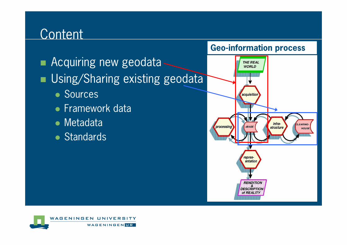
Content
� Acquiring new geodata
� Using/Sharing existing geodata
� Sources
� Framework data
� Metadata
� Standards
Geo�information process
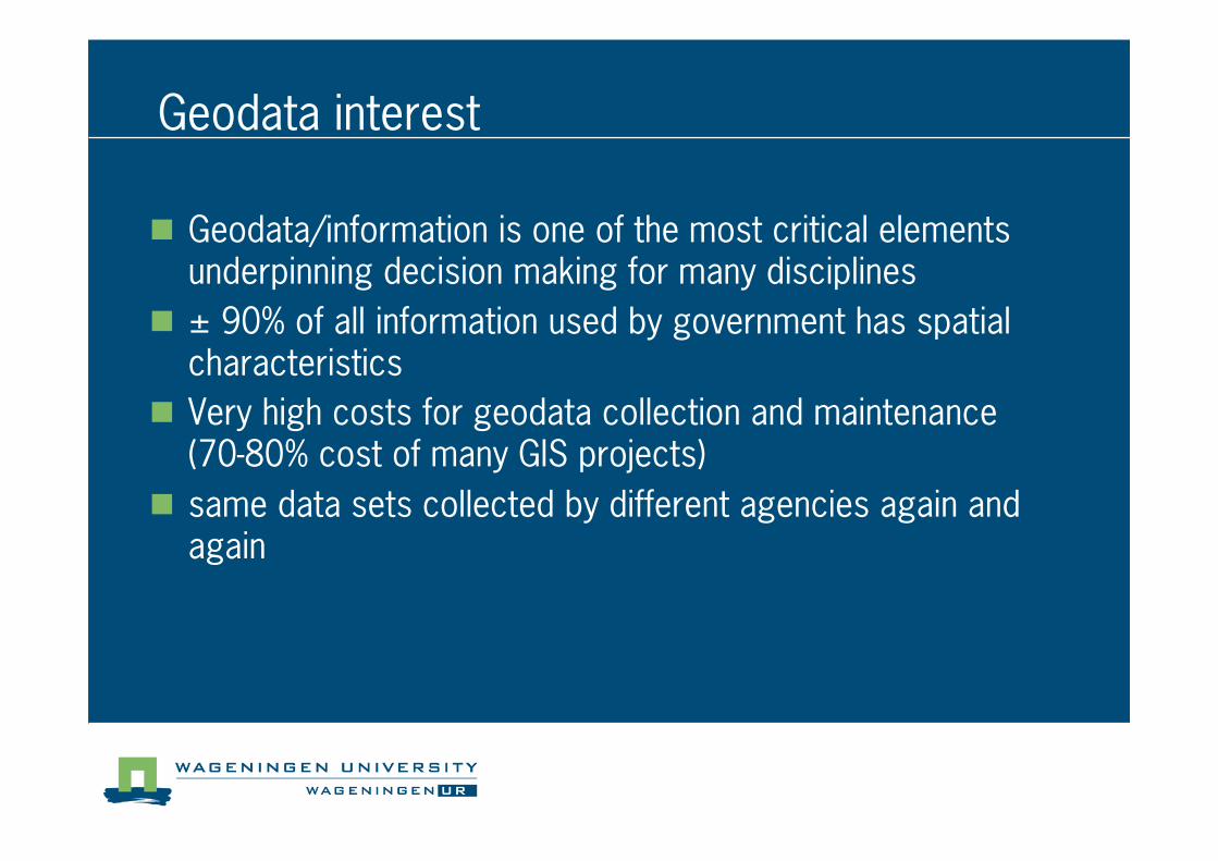
Geodata interest
� Geodata/information is one of the most critical elements underpinning decision making for many disciplines
� ± 90% of all information used by government has spatial characteristics
� Very high costs for geodata collection and maintenance(70�80% cost of many GIS projects)
� same data sets collected by different agencies again and again
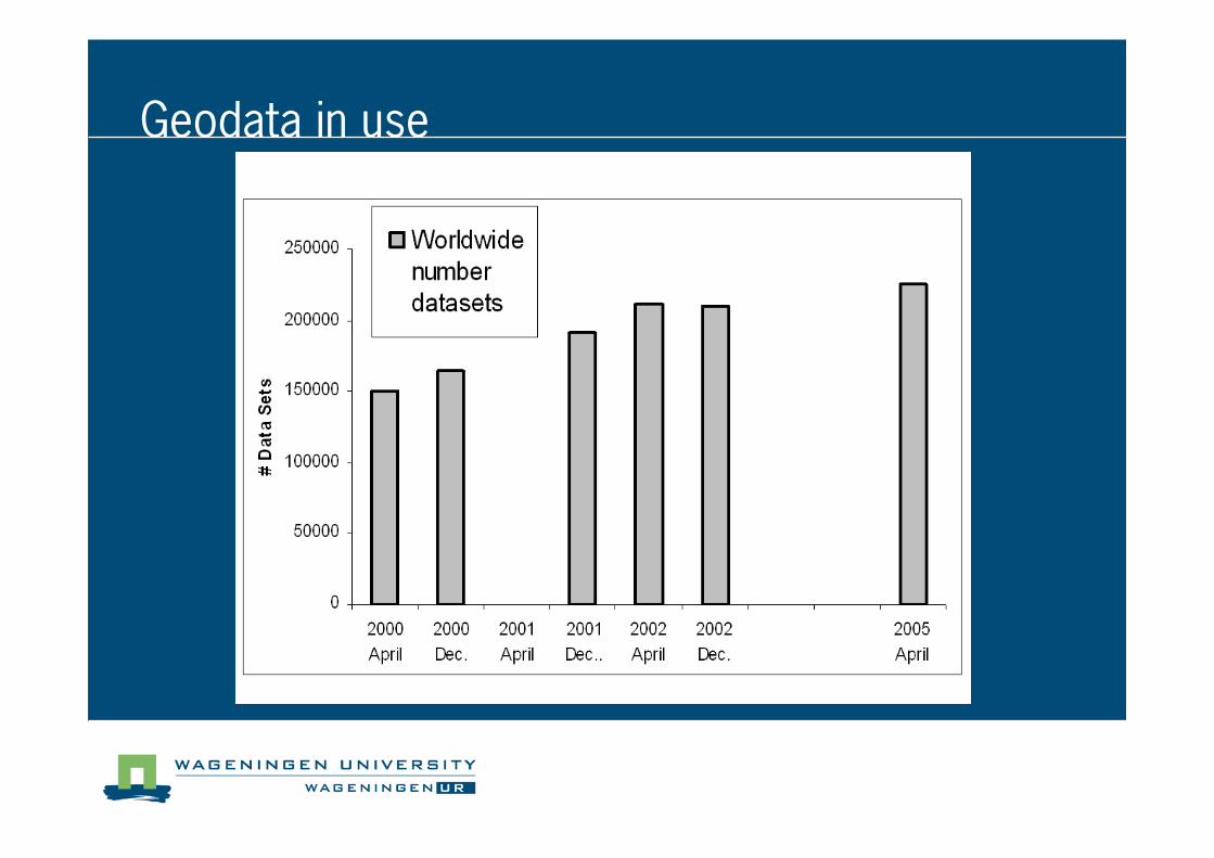
Geodata in use
� GEODATA AQUISITION
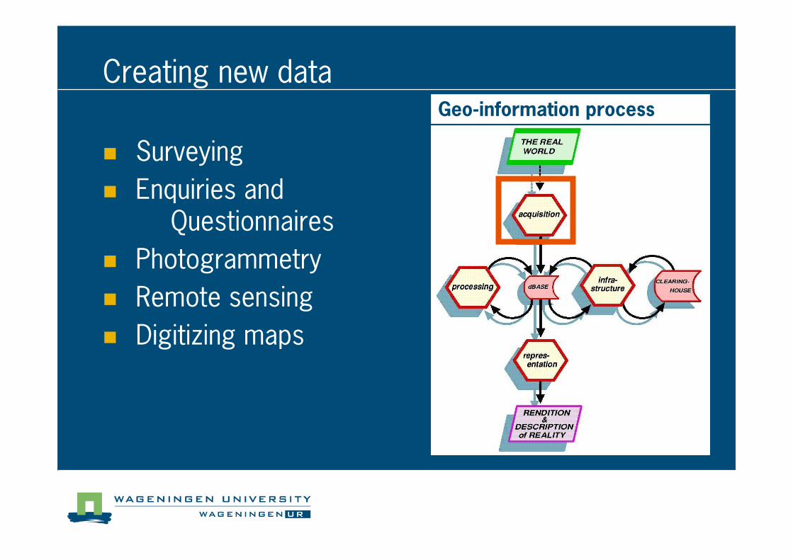
Creating new data
� Surveying
� Enquiries and Questionnaires
� Photogrammetry
� Remote sensing
� Digitizing maps
Geo�information process
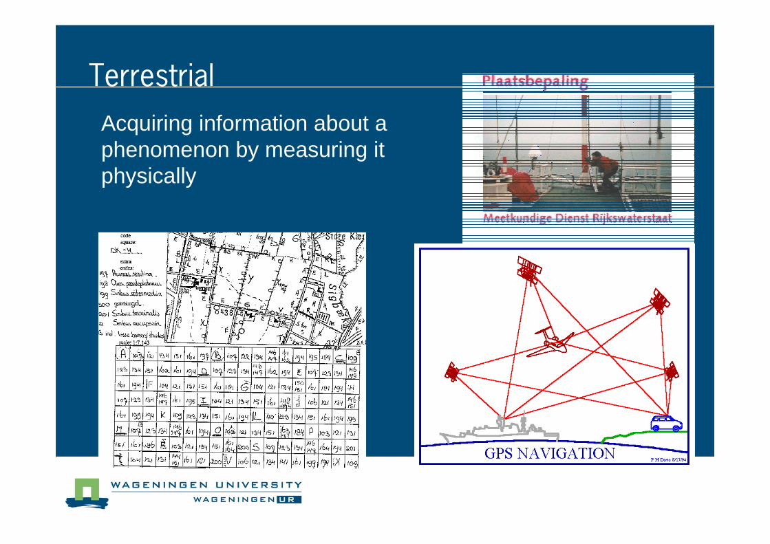
Terrestrial
Acquiring information about a phenomenon by measuring it physically
Acquiring information about a phenomenon by measuring it physically
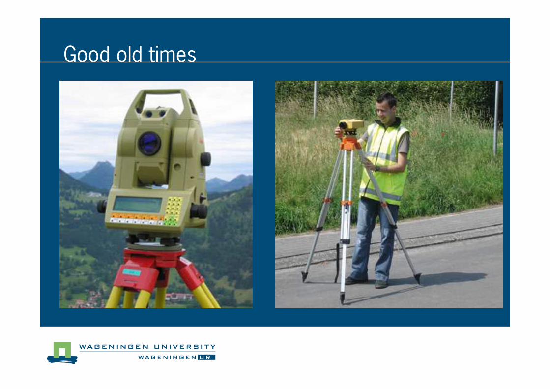
Good old times
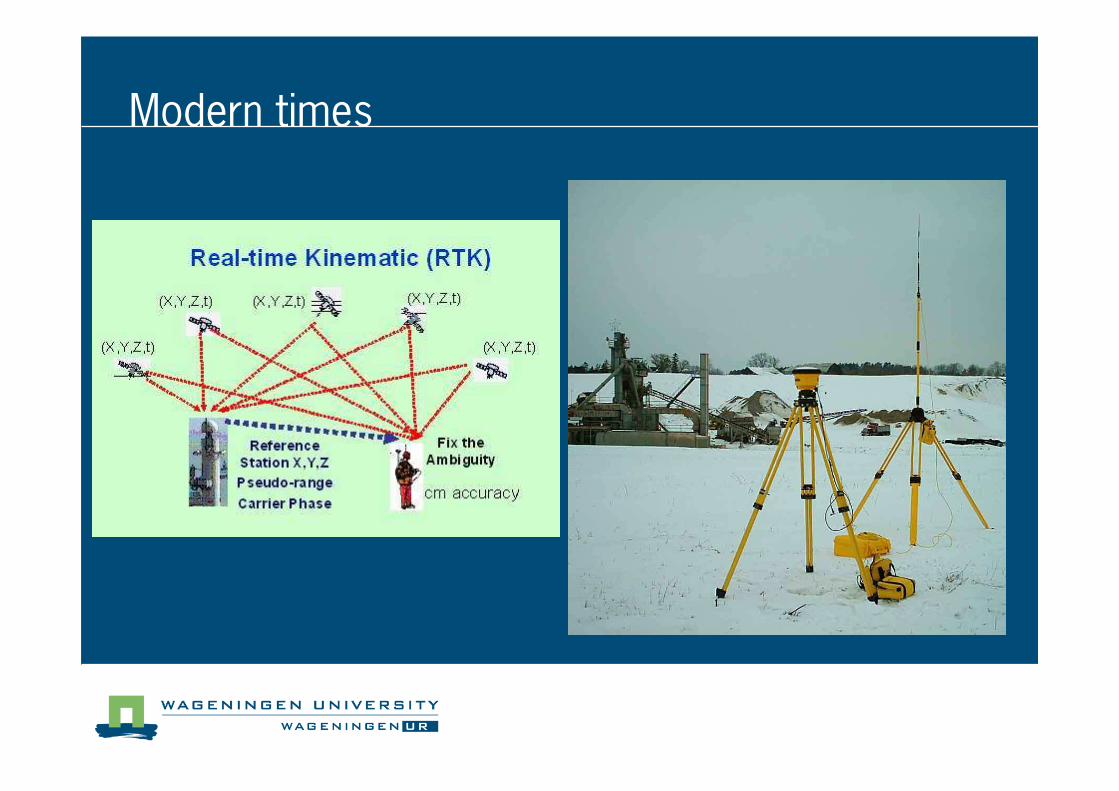
Modern times
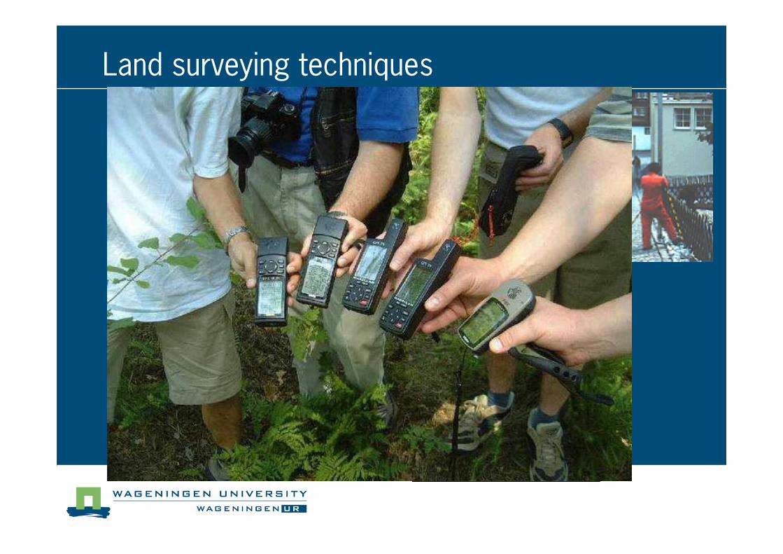
Land surveying techniques
Total station
Total Station
GPS
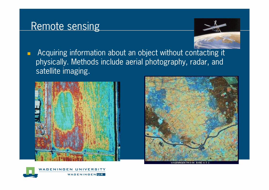
Remote sensing
� Acquiring information about an object without contacting it physically. Methods include aerial photography, radar, and satellite imaging.
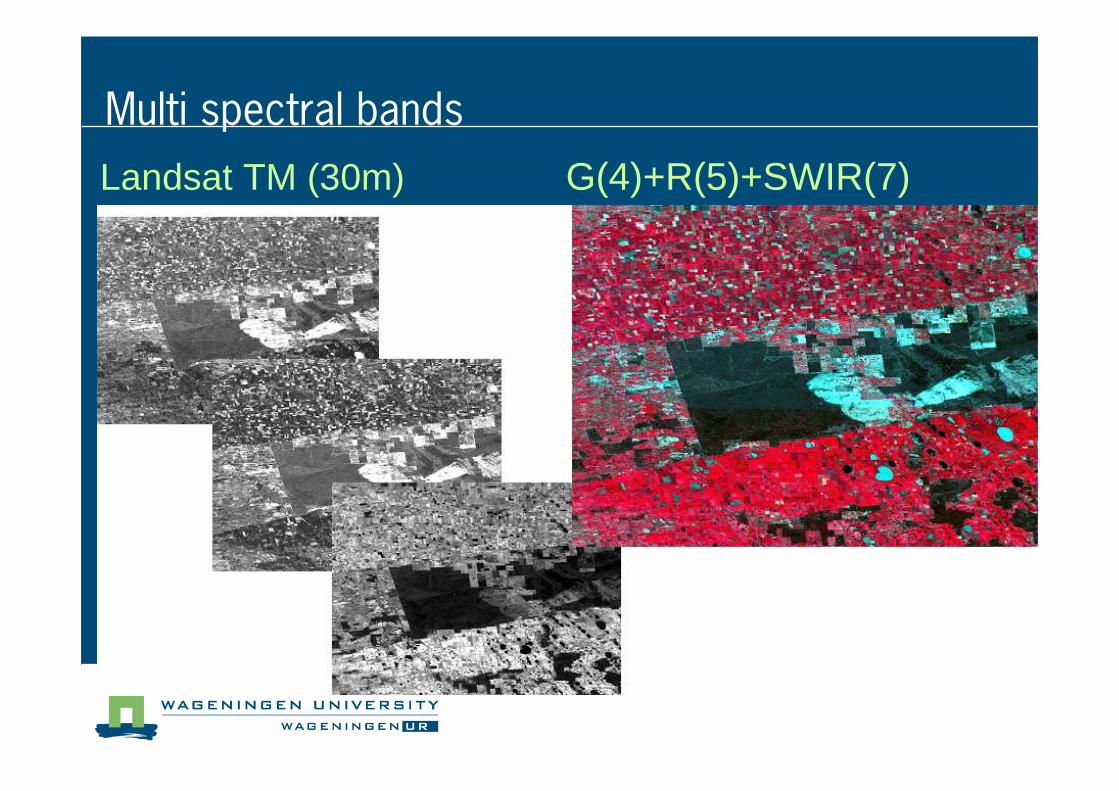
Landsat TM (30m) G(4)+R(5)+SWIR(7)
Multi spectral bands
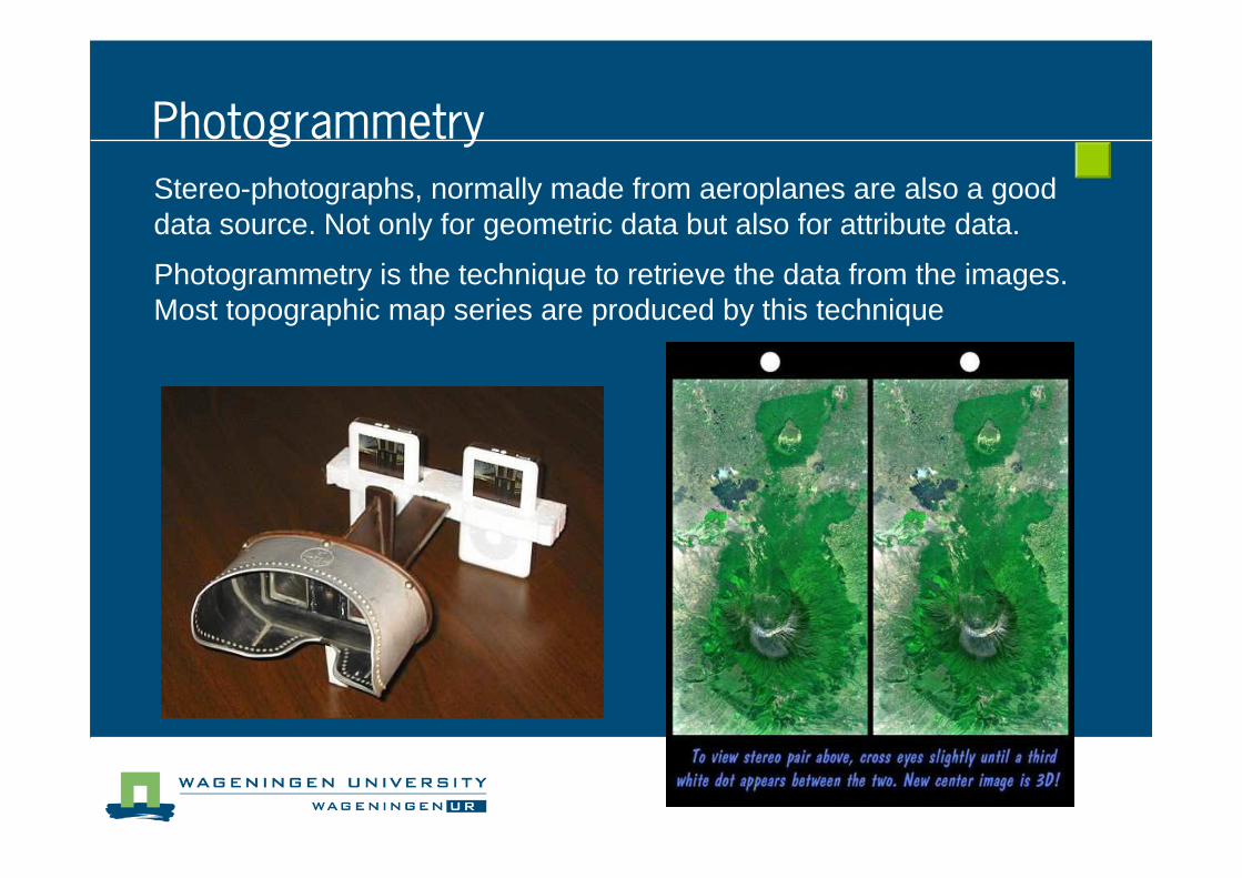
Photogrammetry
Stereo-photographs, normally made from aeroplanes are also a good data source. Not only for geometric data but also for attribute data.
Photogrammetry is the technique to retrieve the data from the images. Most topographic map series are produced by this technique
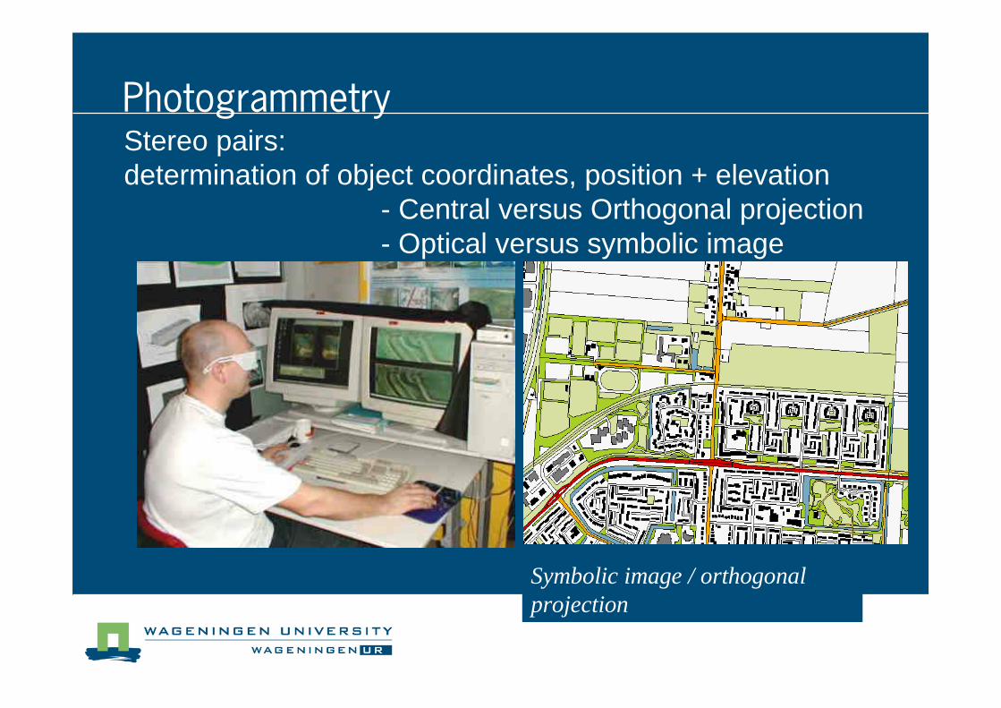
Stereo pairs:determination of object coordinates, position + elevation
- Central versus Orthogonal projection- Optical versus symbolic image
Optical image /central projectionSymbolic image / orthogonal projection
Photogrammetry
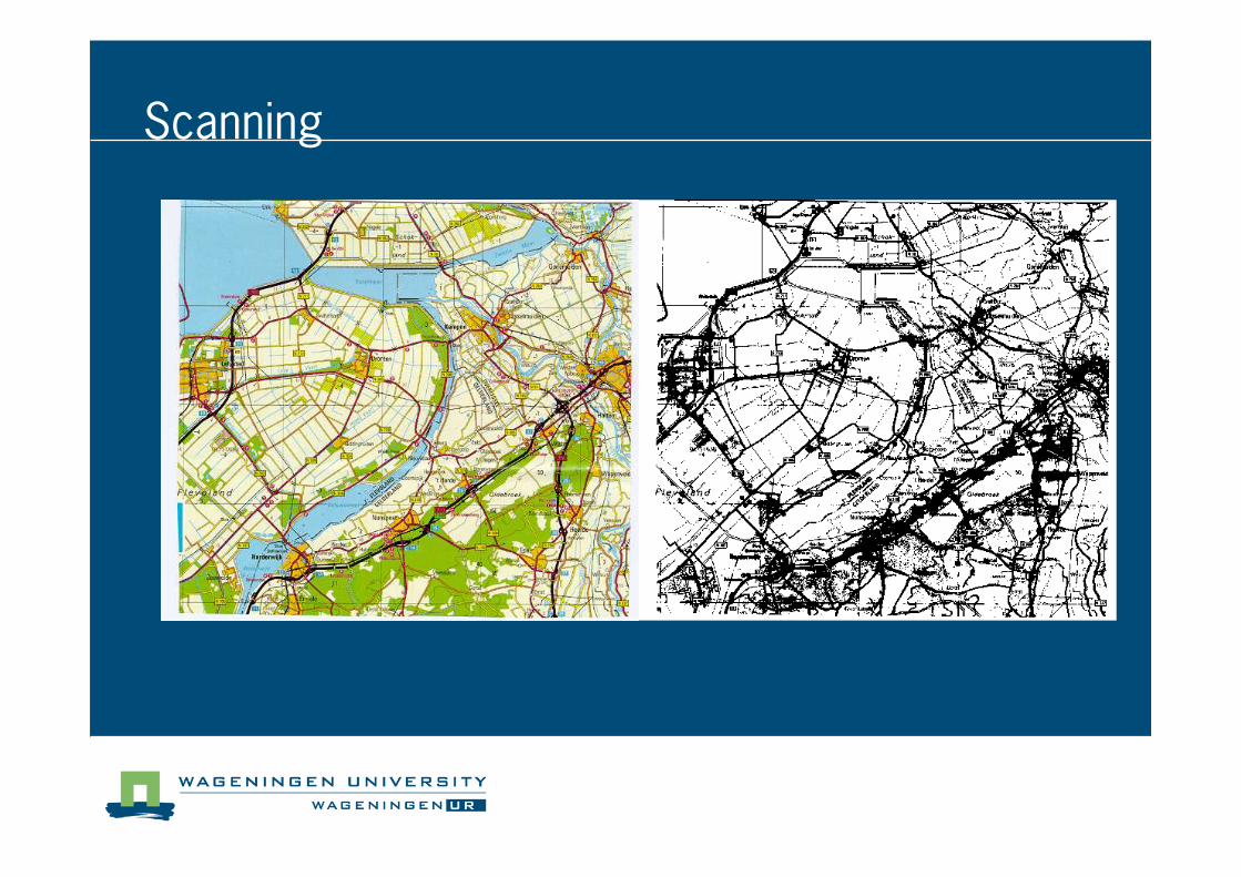
Scanning
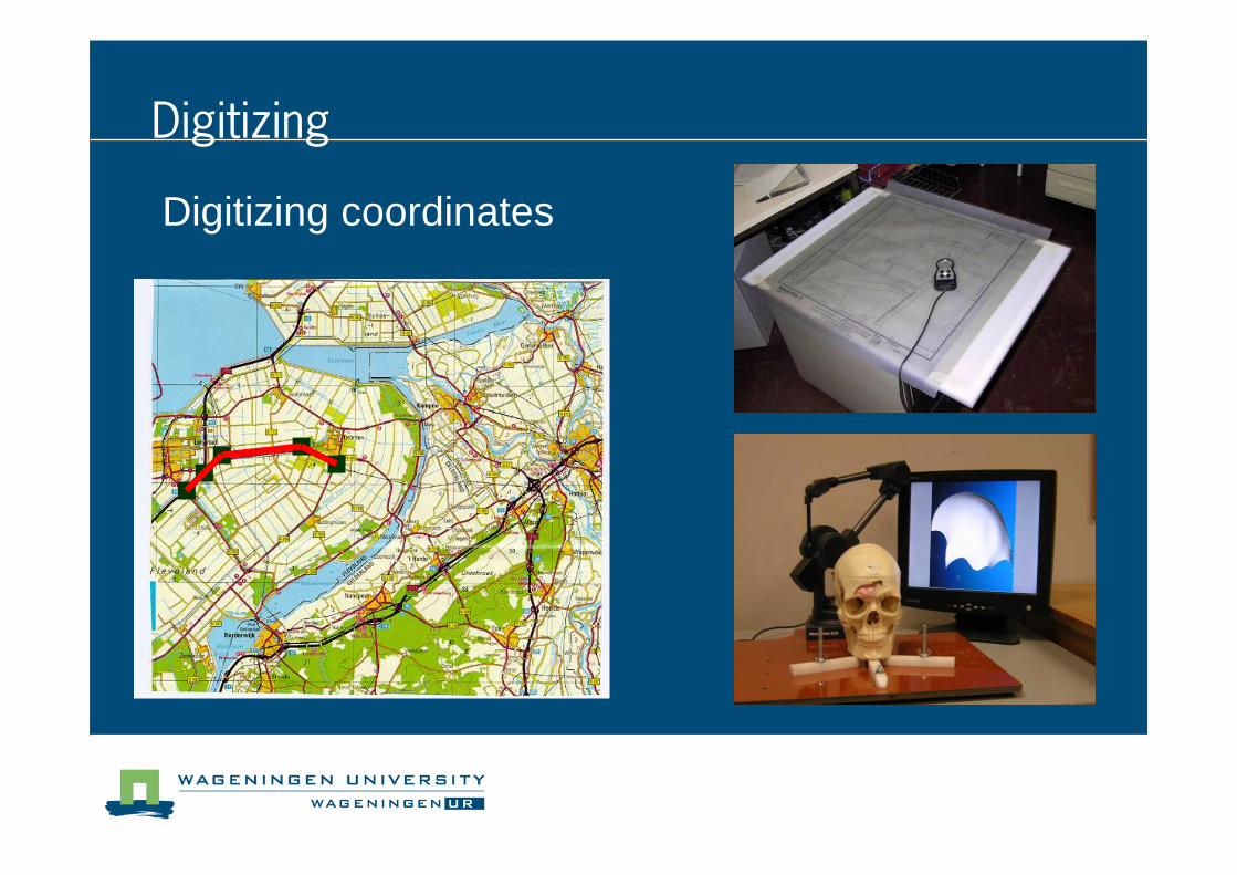
Digitizing coordinates
Digitizing
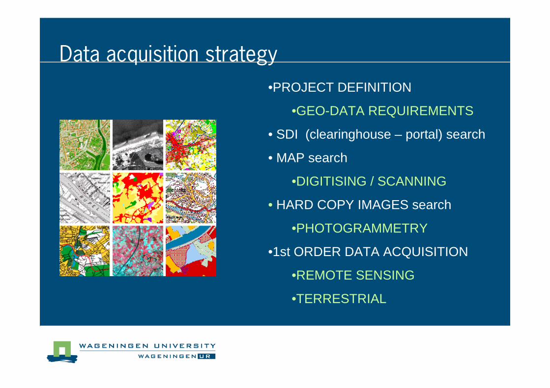
Data acquisition strategy
•PROJECT DEFINITION
•GEO-DATA REQUIREMENTS
• SDI (clearinghouse – portal) search
• MAP search
•DIGITISING / SCANNING
• HARD COPY IMAGES search
•PHOTOGRAMMETRY
•1st ORDER DATA ACQUISITION
•REMOTE SENSING
•TERRESTRIAL
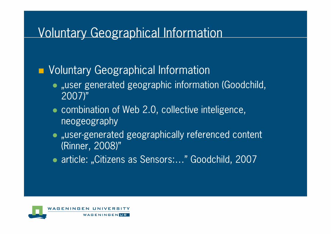
Voluntary Geographical Information
� Voluntary Geographical Information
� „user generated geographic information (Goodchild, 2007)”
� combination of Web 2.0, collective inteligence, neogeography
� „user�generated geographically referenced content (Rinner, 2008)”
� article: „Citizens as Sensors:…” Goodchild, 2007
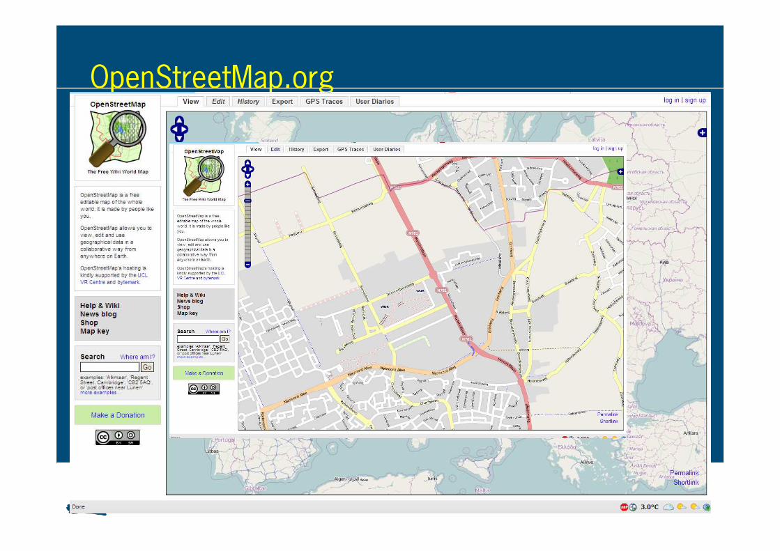
OpenStreetMap.org
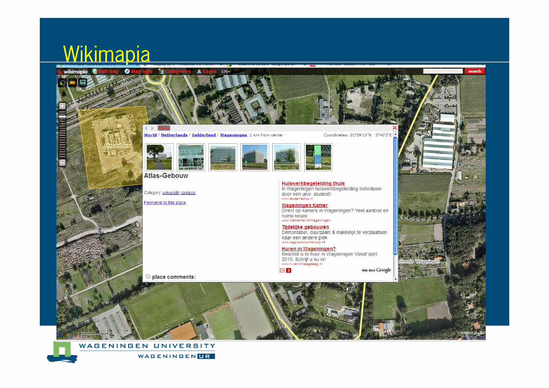
Wikimapia
� EXISTING GEODATA USE
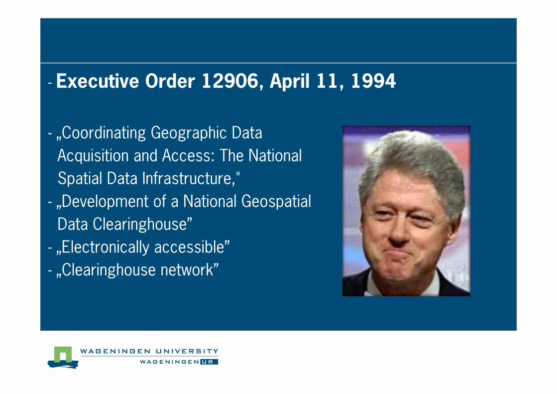
� Executive Order 12906, April 11, 1994
� „Coordinating Geographic Data
Acquisition and Access: The National
Spatial Data Infrastructure,"
� „Development of a National Geospatial
Data Clearinghouse”
� „Electronically accessible”
� „Clearinghouse network”
Definitions of SDI
� Utility view: SDI is a network facility for accessing and sharing spatial data.
� Component view: spatial data, standards, policies, technology and people
� Utility and goal: a network facility for supporting spatial issues in society accessing and sharing spatial data
Policy
Standards
Technology
Geodata People
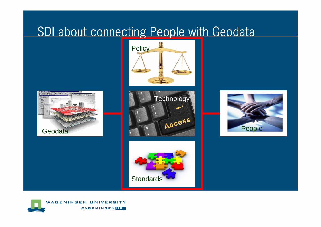
SDI about connecting People with Geodata
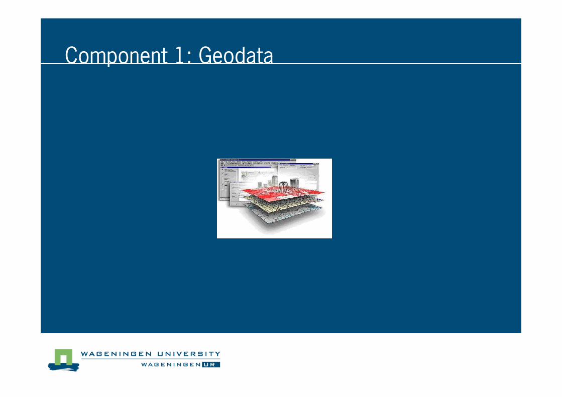
Component 1: Geodata
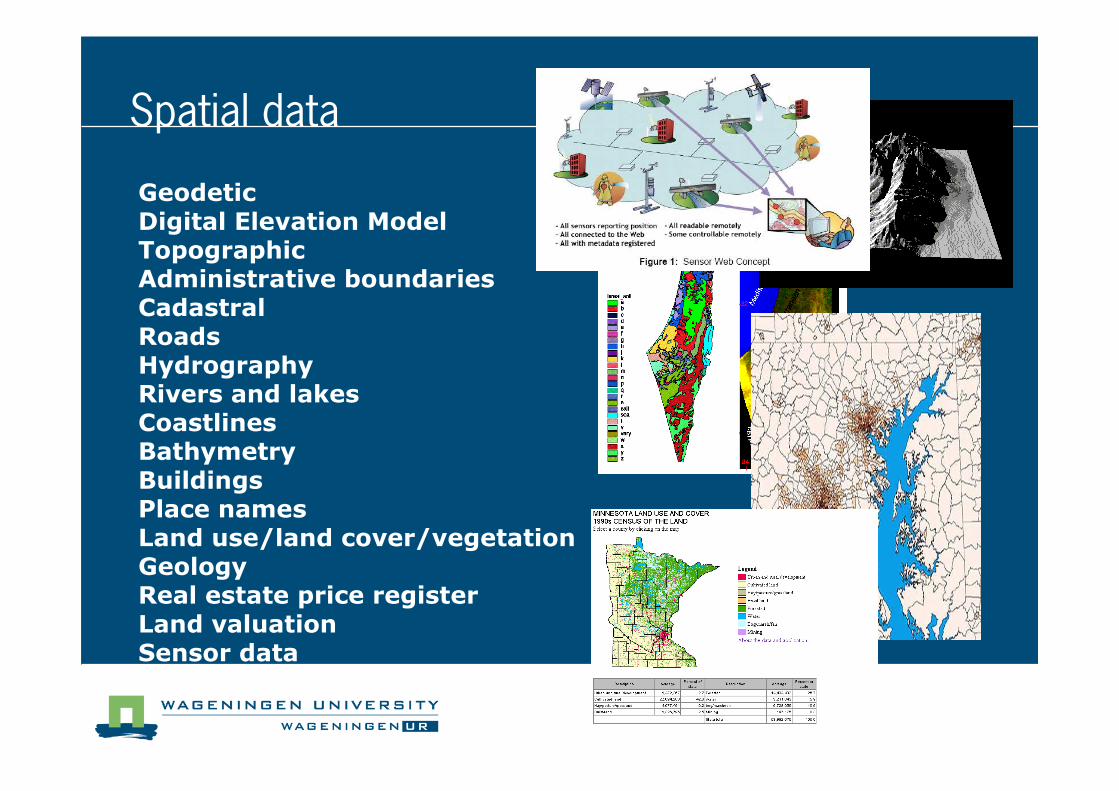
Geodetic
Digital Elevation ModelTopographicAdministrative boundariesCadastral
RoadsHydrographyRivers and lakesCoastlinesBathymetry
BuildingsPlace namesLand use/land cover/vegetationGeologyReal estate price register
Land valuationSensor data
Spatial data
Metadata
� “Information describing spatial data sets and spatial data services and making it possible to discover, inventory and use them” (INSPIRE directive)
� “The summary information or characteristics of a set
of data” (SDI cookbook)
or
� data about data
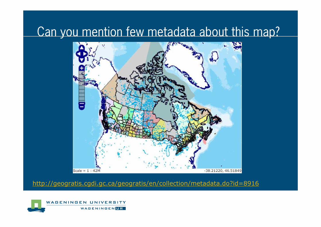
Can you mention few metadata about this map?
http://geogratis.cgdi.gc.ca/geogratis/en/collection/metadata.do?id=8916
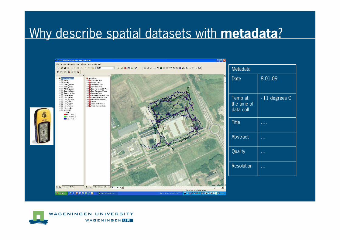
Metadata
Date 8.01.09
Temp at the time of data coll.
� 11 degrees C
Title ….
Abstract …
Quality …
Resolution …
Why describe spatial datasets with metadata?
Component 2: Policy
Policy Issues relating to Geodata
� Commercialization of public information
� Geodata often public (e.g. Cadastral, Topographic, etc)
� Dillema: sell or gratis
� Protection of investments
� Geodata require investment (money and effort)
� Dillema: how to protect it? Copyright? Licences?
� Privacy
� In Geodata easy to identify info of private character
� Dillema: How to deal with that?
� Liability
� Geodata as a basis for decisions
� Dillema: Responsebility for geodata errors?
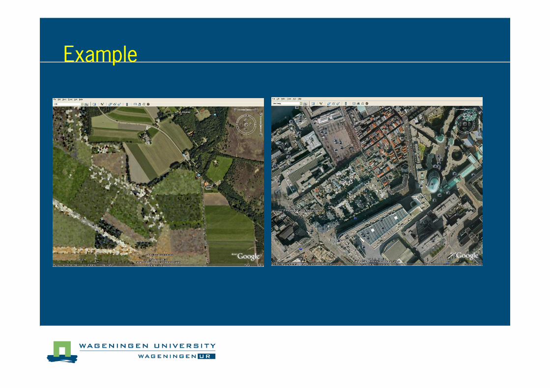
Example
source: Google Earth
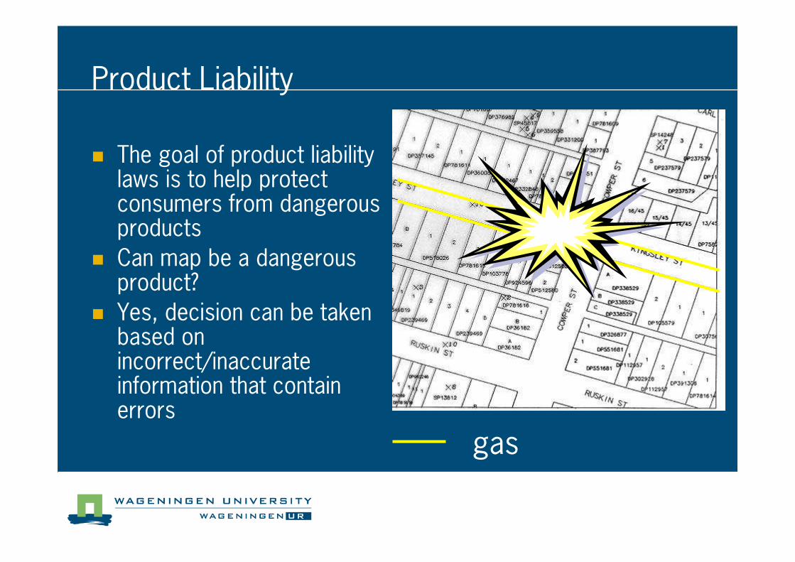
Product Liability
� The goal of product liability laws is to help protect consumers from dangerous products
� Can map be a dangerous product?
� Yes, decision can be taken based on incorrect/inaccurate information that contain errors
gas
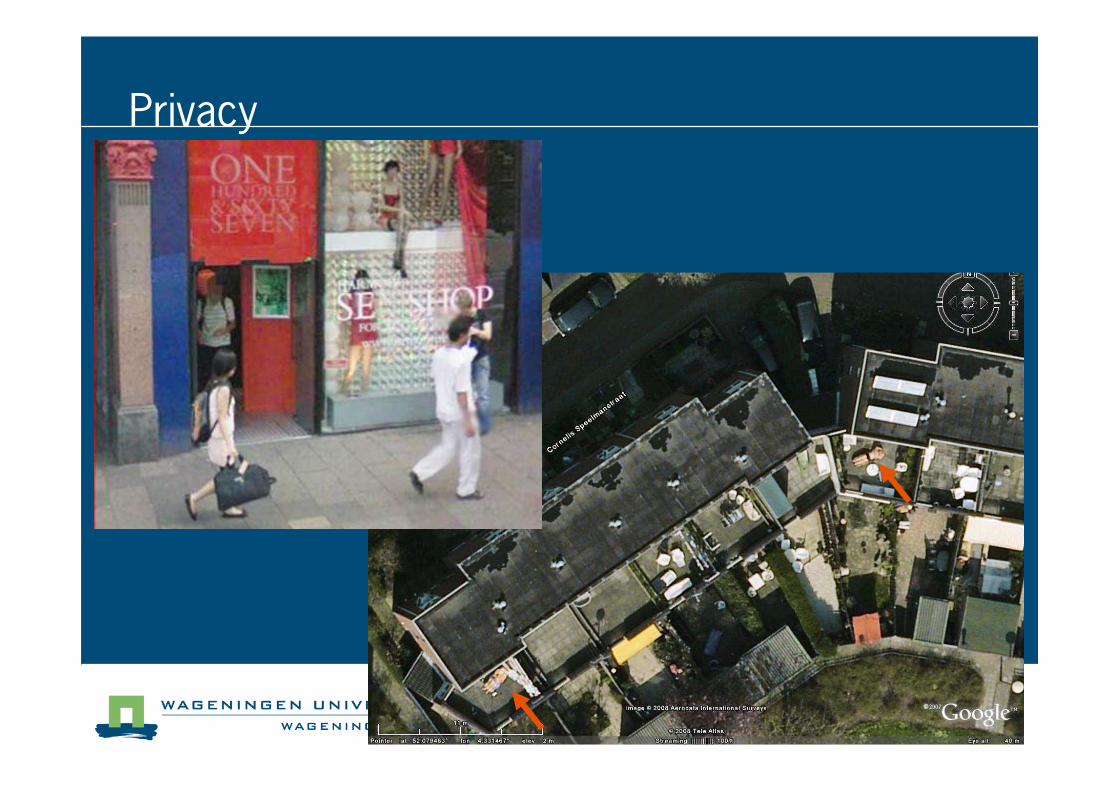
Privacy
source: Google Earth
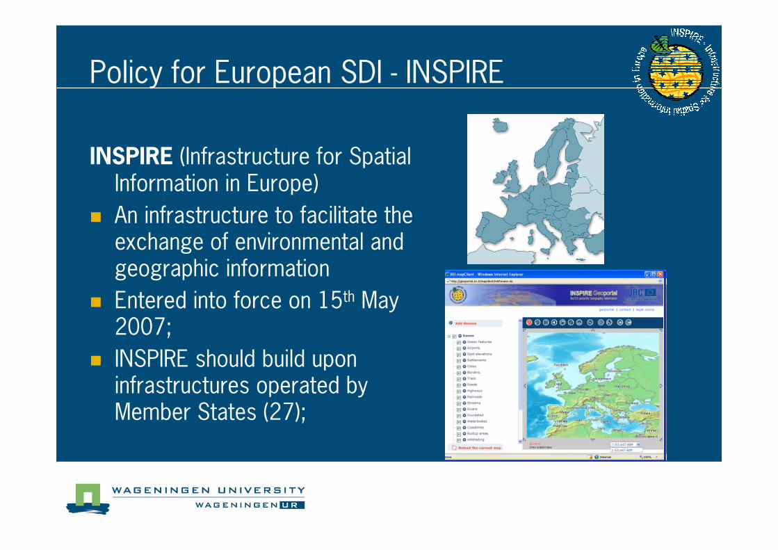
INSPIRE (Infrastructure for Spatial Information in Europe)
� An infrastructure to facilitate the exchange of environmental and geographic information
� Entered into force on 15th May 2007;
� INSPIRE should build upon infrastructures operated by Member States (27);
Policy for European SDI � INSPIRE
� The directive covers general rules for:
� Metadata
� Interoperability of Spatial Data Sets and Services
� Network services
� Data sharing
� Coordination and complementary measures
� Drafting Teams for specific Implementation Rules
Policy for European SDI � INSPIRE
Component 3: Technology
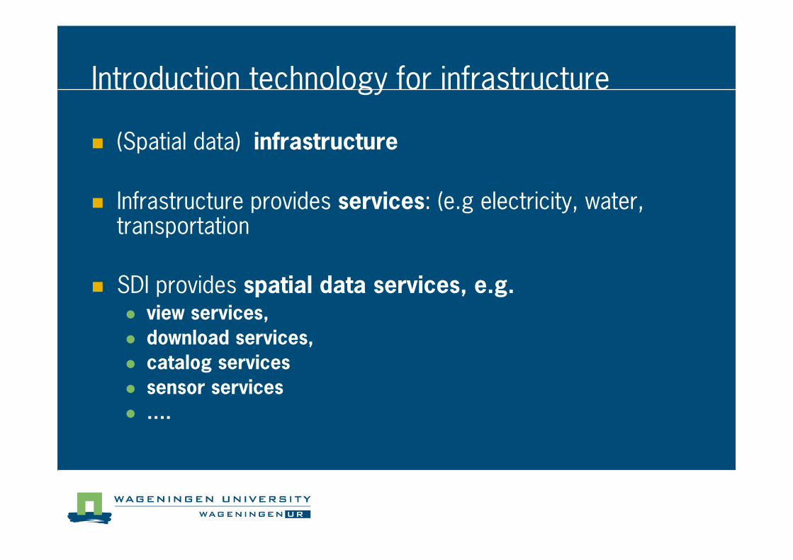
Introduction technology for infrastructure
� (Spatial data) infrastructure
� Infrastructure provides services: (e.g electricity, water, transportation
� SDI provides spatial data services, e.g.� view services,
� download services,
� catalog services
� sensor services
� ….
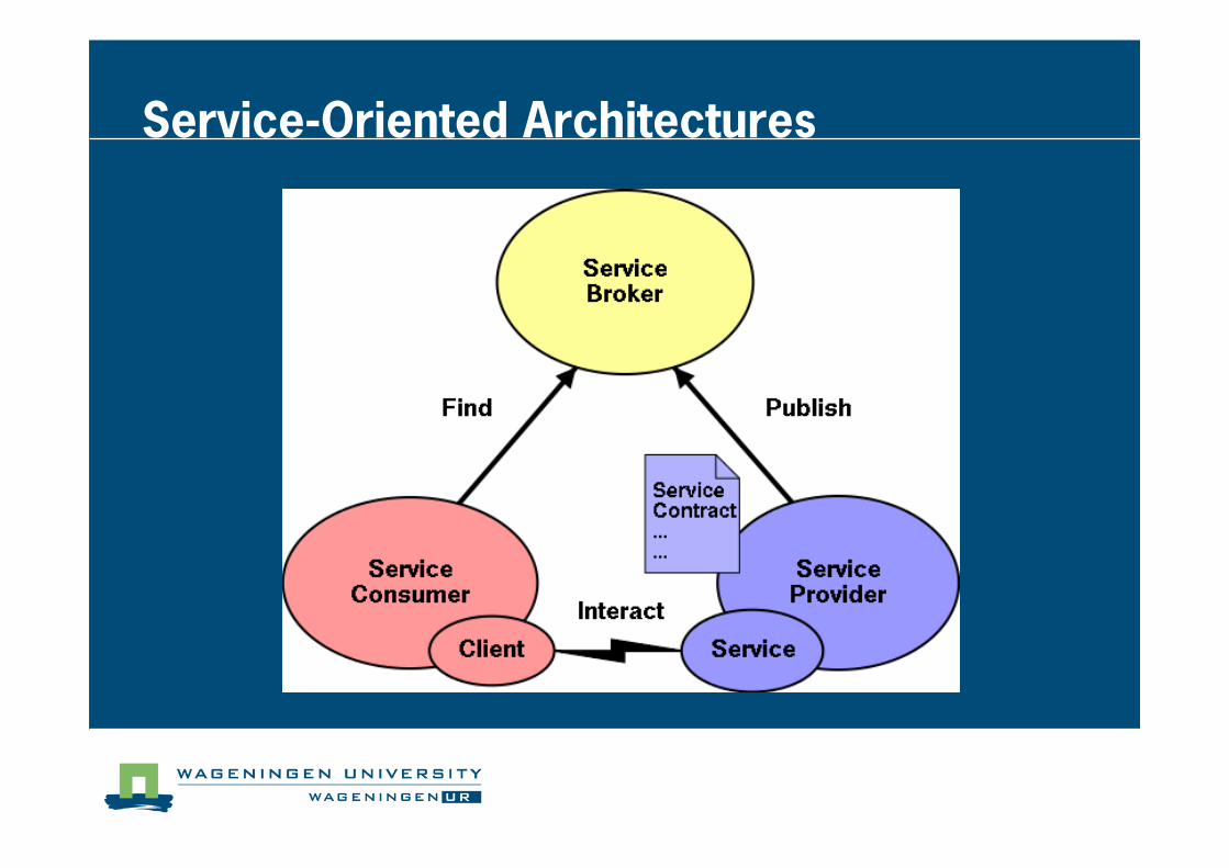
Service�Oriented Architectures
Internet
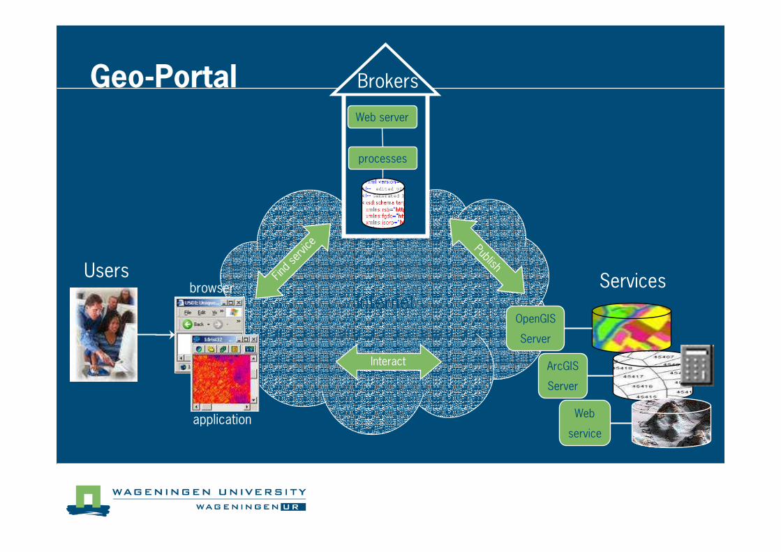
Geo�Portal
Usersbrowser
application
processes
Web server
Brokers
Find
serv
ice
Interact
PublishServices
OpenGIS
Server
ArcGIS
Server
Web
service
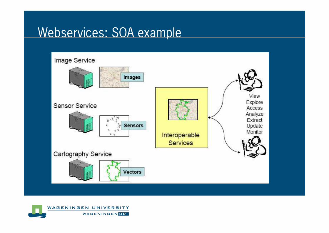
Webservices: SOA example
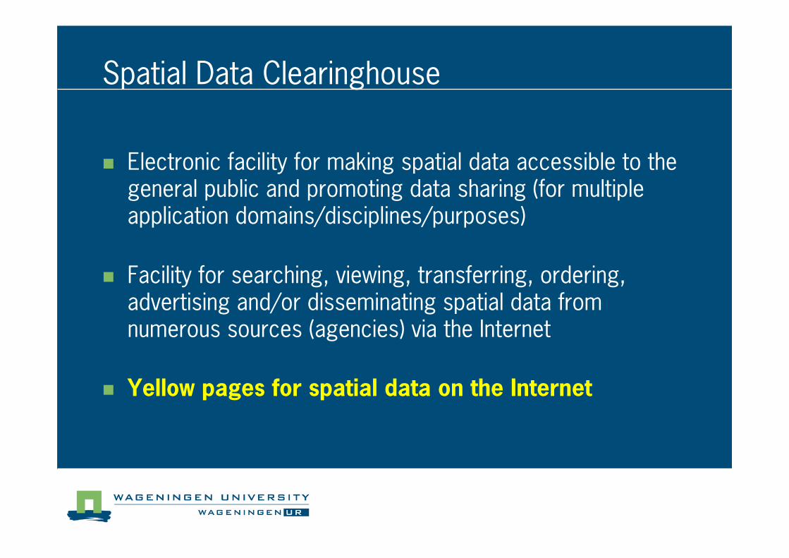
Spatial Data Clearinghouse
� Electronic facility for making spatial data accessible to the general public and promoting data sharing (for multiple application domains/disciplines/purposes)
� Facility for searching, viewing, transferring, ordering, advertising and/or disseminating spatial data from numerous sources (agencies) via the Internet
� Yellow pages for spatial data on the Internet
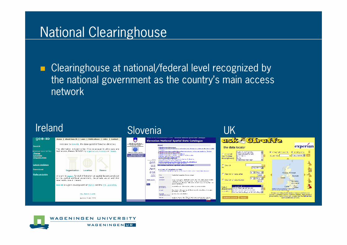
National Clearinghouse
Ireland Slovenia UK
� Clearinghouse at national/federal level recognized by the national government as the country’s main access network
Component 4: Standards
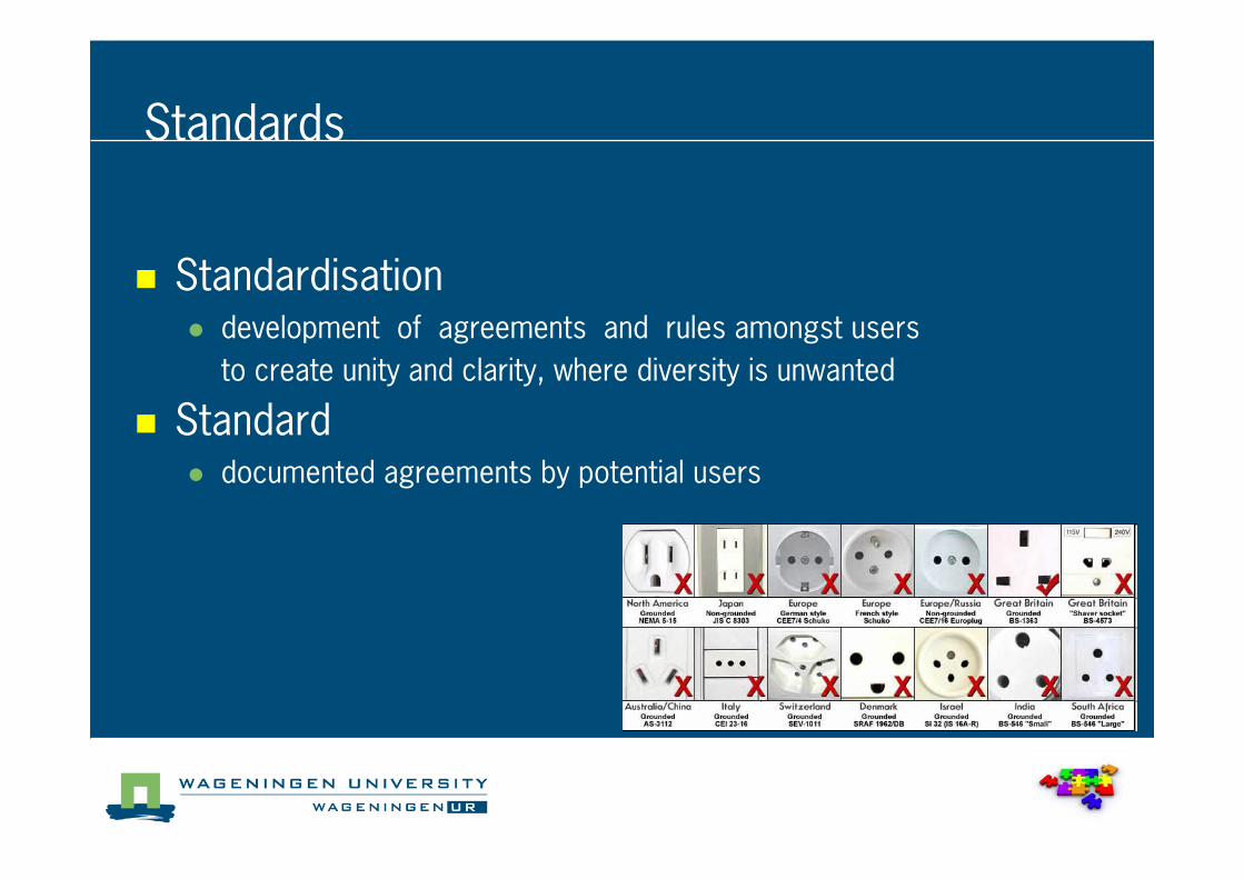
Standards
� Standardisation� development of agreements and rules amongst users
to create unity and clarity, where diversity is unwanted
� Standard� documented agreements by potential users
Standards for SDI/GIS, why?
� Large number of GIS data formats (many vendors)
� GIS software has data conversion functions
� Need for data standards to facilitate exchange
� Efficiency
� Increase connectivity
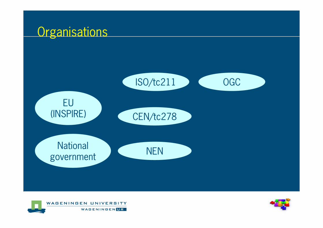
Organisations
ISO/tc211
CEN/tc278
NEN
OGC
EU (INSPIRE)
National government
Standards
Open Geospatial Consortium (OGC)
� Founded 1994
� Industry consortium
� Developing standards that enable open, vendor and format neutral geo�information discovery, accessand sharing.
� For instance: WMS, WFS, GML,

OGC
� Open Geospatial consortium
� Founded 1994
� Industry consortium
� Implementation specifications
� For instance: WMS, WFS, GML,
� http://www.opengeospatial.org/
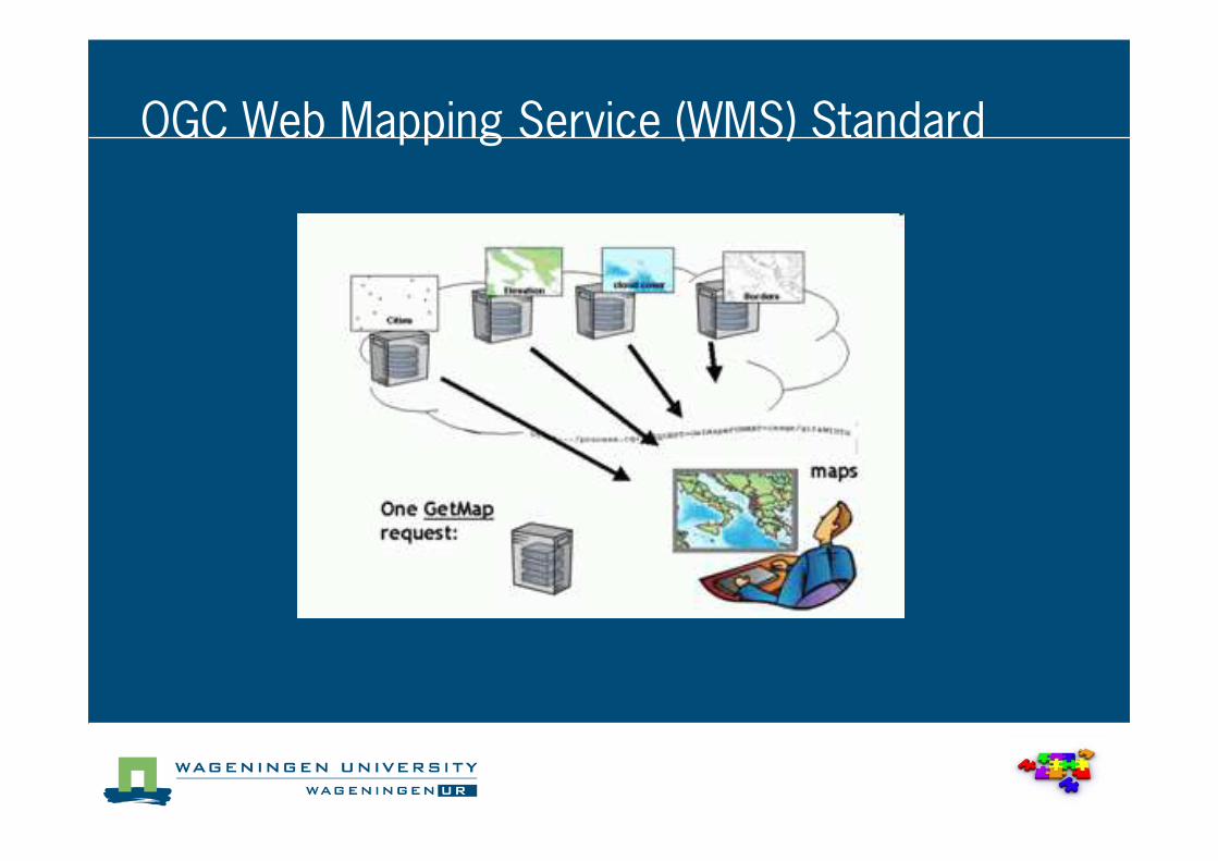
OGC Web Mapping Service (WMS) Standard
Component 5: People
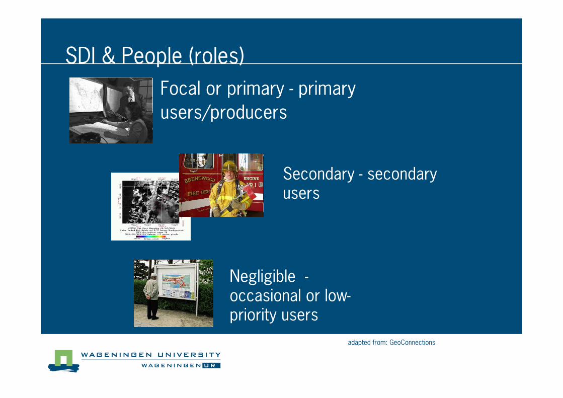
Focal or primary � primary
users/producers
adapted from: GeoConnections
Secondary � secondary users
Negligible �occasional or low�priority users
SDI & People (roles)
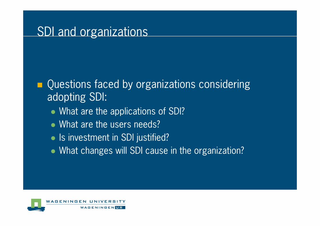
SDI and organizations
� Questions faced by organizations considering adopting SDI:
� What are the applications of SDI?
� What are the users needs?
� Is investment in SDI justified?
� What changes will SDI cause in the organization?
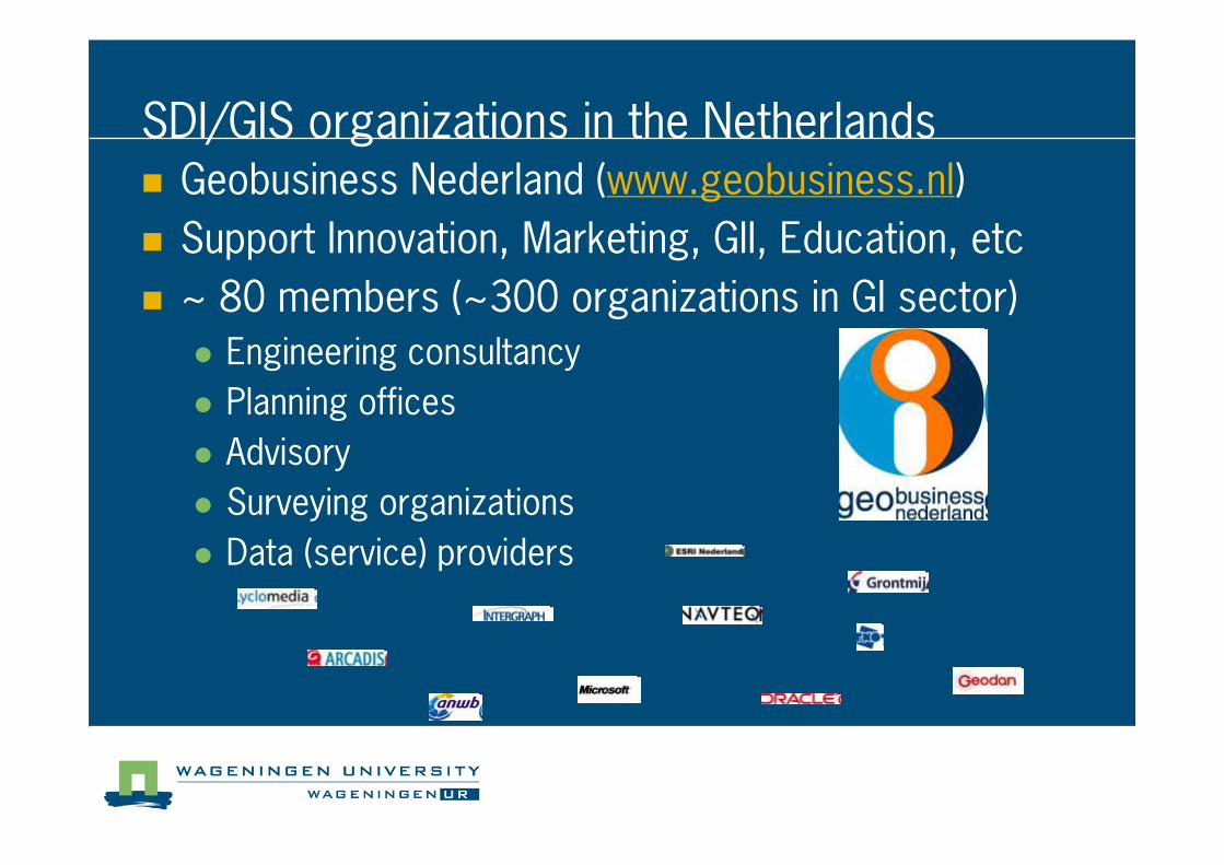
SDI/GIS organizations in the Netherlands� Geobusiness Nederland (www.geobusiness.nl)
� Support Innovation, Marketing, GII, Education, etc
� ~ 80 members (~300 organizations in GI sector)
� Engineering consultancy
� Planning offices
� Advisory
� Surveying organizations
� Data (service) providers
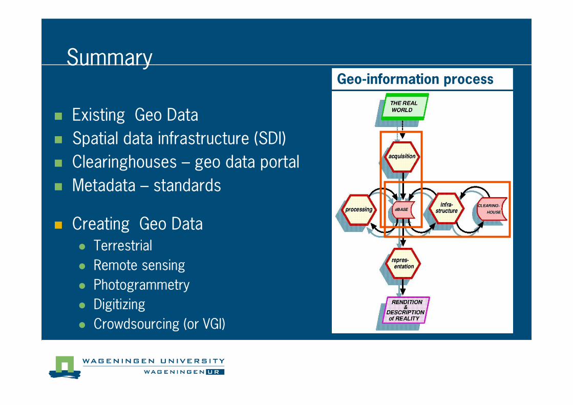
Summary
� Existing Geo Data
� Spatial data infrastructure (SDI)
� Clearinghouses – geo data portal
� Metadata – standards
Geo�information process
� Creating Geo Data
� Terrestrial
� Remote sensing
� Photogrammetry
� Digitizing
� Crowdsourcing (or VGI)
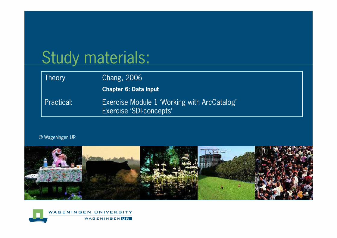
Study materials:
© Wageningen UR
Theory Chang, 2006
Chapter 6: Data Input
Practical: Exercise Module 1 ‘Working with ArcCatalog’Exercise ‘SDI�concepts’
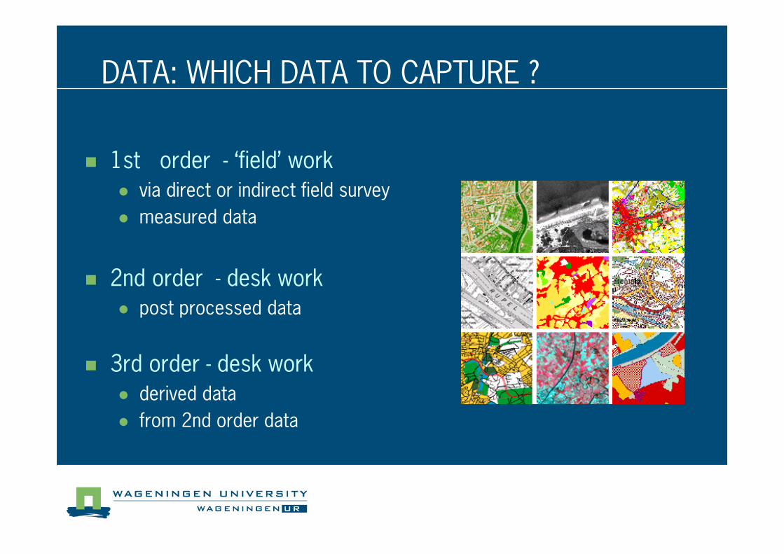
DATA: WHICH DATA TO CAPTURE ?
� 1st order � ‘field’ work
� via direct or indirect field survey
� measured data
� 2nd order � desk work
� post processed data
� 3rd order � desk work
� derived data
� from 2nd order data