Embed Size (px)
Citation preview

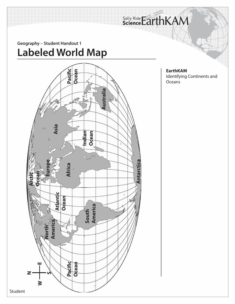
The students will learn about world geography. They will learn to identify the four major oceans (Pacific, Atlantic, Indian, and Arctic) and the seven continents (Asia, Europe, Africa, Antarctica, Australia, North America, and South America).
Materials/Resources:• Student Handouts 1 and 2: Labeled and Unlabeled World Maps
Time: 1 (50 minute) period
Level: Easy
Recommended Procedures:Challenge the students with remembering the locations of the major features on the map.
1. Have all the students look at the Labeled World Map provided.
• Ask them to identify the seven continents and four major oceans. • Have them locate the prime meridian (0º longitude) and the Equator (0º latitude) and notice which oceans and continents these lines pass through.
2. After they have studied the map and are sure they can identify these major world features, have them test themselves and each other by labeling as many continents and oceans as they can on the Unlabeled World Map.
• Remind them to label the prime meridian and the Equator.
3. Have the students use the compass on the maps to describe the relative locations of the continents and oceans.
• What major ocean is west of North America? Pacific Ocean • What continent is east of Europe? Asia • What ocean is south of Asia? The Indian Ocean • What continent is north of Africa? Europe
EarthKAMIdentifying Continents and Oceans
STANDARDS
Geography
The World in Spatial Terms
Standard 1: How to use mapsand other geographic representations, tools, and techniques to acquire, process, and reportinformation from a spatialperspective.
Geography – Educator Guide
Identifying Continents and Oceans
Educator
Student
EarthKAMIdentifying Continents and Oceans
Geography – Student Handout 1
Labeled World MapPa
cific
O
cean
Indi
an
Oce
an
Atl
anti
c O
cean
Arc
tic
Oce
an
Sout
h A
mer
ica
Nor
th
Am
eric
aEu
rope
A
sia
Afr
ica
Ant
arct
ica
Aus
tral
ia
Paci
fic
Oce
an
N
E
S
W

Student
EarthKAMIdentifying Continents and Oceans
Geography – Student Handout 2
Labeled World Map