Embed Size (px)
Citation preview
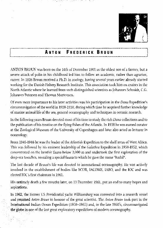
I ANTON FREDERICK BRUUN
ANTON BRUUN was born on the 14th of December 1901 as the oldest son of a farmer, but a severe attack of polio in his childhood led him to follow an academic, rather than agrarian, career. In 1926 Bruun received a Ph.D. in zoology, having several years earlier already started working for the Danish Fishery Research Institute. This association took him on cruises in the North Atlantic where he learned from such distinguished scientists as Johannes Schmidt, C.G. Johannes Petersen and Thomas Mortensen.
Of even more importance to his later activities was his participation in the Dana Expedition’s circumnavigation of the world in 1928-1930, during which time he acquired further knowledge of marine animal life of the sea, general oceanography and techniques in oceanic research.
In the following years Bruun devoted most of his time to study the rich Dana collections and to the publication of his treatise on the flying fishes of the Atlantic. In 1938 he was named curator at the Zoological Museum of the University of Copenhagen and later also acted as lecturer in oceanology.
From 1945-1946 he was the leader of the Atluntide Expedition to the shelf areas of West Africa. This was followed by his eminent leadership of the Galathea Expedition in 1950-1952, which concentrated on the benthic fauna below 3,000 m and undertook the first exploration of the deep-sea trenches, revealing a special fauna to which he gave the name “hadal”.
The last decade of Bruun’s life was devoted to international oceanography. He was actively involved in the establishment of bodies like SCOR, IACOMS, IABO, and the IOC and was elected IOC’s first chairman in 1961.
His untimely death a few months later, on 13 December 1961, put an end to many hopes and aspirations.
In 1962, the former US Presidential yacht Williamsburg was converted into a research vessel and renamed Anton Bruun in honour of the great scientist. The Anton Bruun took part in the International Indian Ocean Expedition (1959-1965) and, in the late 1960’s, circumnavigated the globe in one of the last great exploratory expeditions of modern oceanography.
c
.
__ .-- ,._,...,” .^.. ..“. .,. ..-.. _(
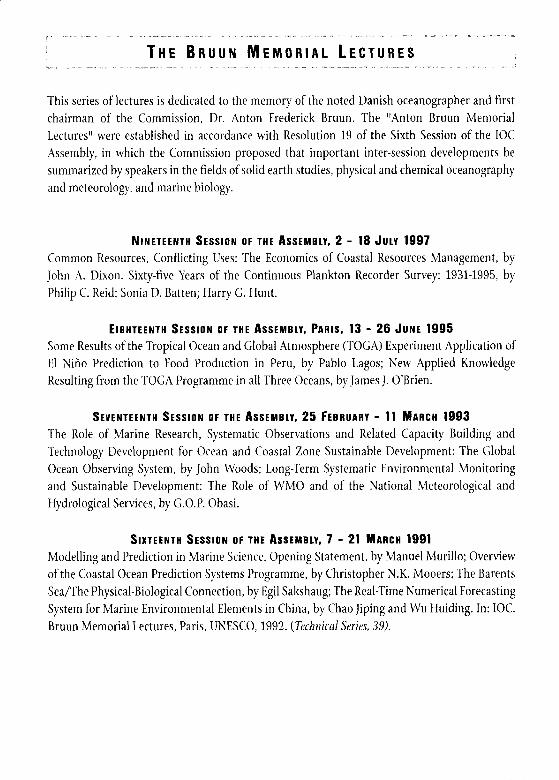
THE BRUUN MEMORIAL LECTURES .^_ _“, ._. ._ __ ““. -
This series of lectures is dedicated to the memory of the noted Danish oceanographer and first chairman of the Commission, Dr. Anton Frederick Bruun. The “Anton Bruun Memorial Lectures” were established in accordance with Resolution 19 of the Sixth Session of the IOC Assembly, in which the Commission proposed that important inter-session developments be summarized by speakers in the fields of solid earth studies, physical and chemical oceanography and meteorology, and marine biology.
NINETEENTH SESSION OF THE ASSEMBLY, 2 - 18 JULY 1997 Common Resources, Conflicting Uses: The Economics of Coastal Resources Management, by John A. Dixon. Sixty-five Years of the Continuous Plankton Recorder Survey: 1931-1995, by Philip C. Reid; Sonia D. Batten: Harry G. Hunt.
EIGHTEENTH SESSION OF THE ASSEMGLY, PARIS, 13 - 28 JUNE 1995 Some Results of the Tropical Ocean and Global Atmosphere (TOGA) Experiment Application of El Nina Prediction to Food Production in Peru, by Pablo Lagos; New Applied Knowledge Resulting from the TOGA Programme in all Three Oceans, by James J. O’Brien.
SEVENTEENTH SESSION OF THE ASSEMBLY, 25 FEBRUARY - 11 MARCH 1993 The Role of Marine Research, Systematic Observations and Related Capacity Building and Technology Development for Ocean and Coastal Zone Sustainable Development: The Global Ocean Observing System, by John Woods; Long-Term Systematic Environmental Monitoring and Sustainable Development: The Role of WMO and of the National Meteorological and Hydrological Services, by G.O.P. Obasi.
SIXTEENTH SESSION OF THE ASSEMBLY, 7 - 21 MARCH 1991 Modelling and Prediction in Marine Science, Opening Statement, by Manuel Murillo; Overview of the Coastal Ocean Prediction Systems Programme, by Christopher N.K. Mooers; The Barents Sea/The Physical-Biological Connection, by Egil Sakshaug; The Real-Time Numerical Forecasting System for Marine Environmental Elements in China, by Chao Jiping and Wu Huiding. In: IOC. Bruun Memorial Lectures, Paris, UNESCO, 1992. (Technical Series, 39).
-
.
JOHN WOODS ,
John Woods is Professor of Oceanography at Imperial College, Honorary
Professor of Oceanography at Southampton University, Fellow of the
Plymouth Marine Laboratory, Fellow of Linacre College Oxford University,
and Foundation Member of the Academia Europaea. From 1986 to 1994, he
was Director of Marine and Atmospheric Sciences of the UK Natural
Environment Research Council. Prior to that, he was a Research Fellow at
the Meteorological Of&e (1966-72) and Professor of Oceanography at
Southampton University (1972-77) and Kiel University (1977-86). He has
contributed to the development of the Global Ocean Observing System
(GOOS) as a member of the Joint Scientific and Technical Committee,
where he was responsible for the Prospectusfor GOOS 1998. He is President
of EuroGOOS. From 1995 to 1998, he was a member of the Scientific and
Technical Advisory Panel of the Global Environment Facility (GEF STAP),
where he chaired the International Waters section. He has served on the
steering committees of a number of international scientific programmes,
including the Global Atmospheric Research Programme (GARP), the
World Climate Research Programme (WCRP), the World Ocean
Circulation Experiment (WOCE) and the International Geosphere-
Biosphere Programme (IGBP). His work has been recognised by a number
of awards including: honorary doctorates from Liege & Plymouth
universities: and prizes from the Ministry of Defence, the Royal
Geographic Society and the Royal Meterological Society. In 1995, the
Queen made him a Commander of the British Empire. Professor Woods’s
research interests include ocean forecasting and plankton ecology.
. . 1
-


mp RESIDENT, DISTINGUISHED COLLEAGUES, LADIES AND GENTLEMEN,
It is a great honor to be invited to deliver the 1999 Anton Bruun Memorial
lecture. I thank you for your kind invitation.
I last delivered a Bruun lecture in February 1993. Then as now my
subject was the Global Ocean Observing System, which we affectionately
call GOOS. That lecture was published in the /ournaJ of Marine Policy
(1994, Vol. 18 (6) pages 445-452). It was based on a paper I had prepared
for the Intergovernmental Oceanographic Commission called The Case for
GOOS which addressed the economic arguments for the first time.
I recall the excitement at the Second World Climate Conference in 1990
when GOOS was launched by the Intergovernmental Oceanographic
Commission. There was a feeling that the oceanographers had, as it were,
captured the high ground in climate research. Our colleagues in
meteorology immediately set about creating a rival Global Climate
Observing System, which suffers from having a more elegant acronym:
GCOS. Since 1990, GOOS has extended its intellectual lead, with ’
pioneering studies of the science, technology and economics of ocean
observing. And it has established vigorous regional programmes in North
East Asia (NEAR-GOOS), Europe (EuroGOOS) and elsewhere.
.
This time my lecture will be based on the Prospectus for COOS 1998
(published by the IOC as GOOS Publication No. 42). I planned that
volume to provide a comprehensive and coherent account of this rather
complicated and ambitious international enterprise. The success of the
Prospectus owes much to the skill and hard work of its author, the
distinguished meteorologist, Dr Peter Ryder. We should all show our
appreciation of Dr Ryder’s great service to GOOS.
My theme today is Ocean Predictability, which must be thoroughly
understood before we can design an effective COOS. To many
oceanographers, predictability is a fiendish mathematical discipline
involving chaos theory, and having little immediate value in our great
enterprise. Yes, we know it is important, but there are many more urgent
practical problems to be solved before we reach the mathematical limits set
by predictability. I tend to agree with that sentiment. A scientific attack on
the limits to predictability of the ocean can only be mounted after we have
gathered sufficient data. And that will only happen when we have a
comprehensive ocean observing system in place.
Happily this ‘Catch 22’ situation need not impede progress in
developing GOOS. Like the great marine explorers of the past, we are not
daunted by the lack of a precise knowledge of our goal. However, like any
cautious navigator, we need to be aware of our level of ignorance, and to be
alert to the possibility of surprises.
4
.
At the start of the 21st century, the problem we face in not yet being
able to chart the limits of predictability reminds me of a similar problem in
the 18th century, namely the problem of determining longitude at sea. For
most of the 19th century, the ships of the East India Company (the famous
‘John Company’) set sail for Asia in the knowledge that they would not
know their longitude accurately. Seamen had to navigate cautiously
because of the ever-present risk of disaster through ignorance of longitude.
But, spurred on by the prospect of profitable trade, they lived with that
risk. The alternative would have been to stop investment in long-distance
maritime trade until the longitude problem was solved. The alternative
overland route was well-proven, but it posed different risks. The merchant
strategists of John Company balanced the risks of long-range maritime
trade against the benefits it promised, and built up a great enterprise on
the basis of their analysis. Happily, in 1760 John Harrison solved the
longitude problem with his H4 chronometer, and within twenty years
chronometers were being purchased in great numbers by the captains of
East Indiamen and men-of-war. A chronometer cost 80 pounds, which was
James Cook’s annual pay in 1762. But by 1815 there were 5,000 marine
chronometers in use (Sobell995).
The problem of ocean predictability is for GOOS what the longitude
problem was for mariners 200 years ago. We must invest in scientific
research and engineering to solve it. Meanwhile we must navigate
5
4
.
.--- - ._. . . . __ _ ..,. .I.. ..“. _. ,.I.I”. ...” ..” _..^ . .” “... .“.“.-. “.._- ,..... . 6
cautiously, always bearing in mind that our continuing vagueness about
ocean predictability may spring some surprises as we develop operational
oceanography.
We are not totally ignorant about the limits to predictability. We know
how it affects weather forecasting. Mathematicians and physicists are
making rapid progress in complexity theory: they are the Harrisons of
predictability. My lecture will not dwell on those difficult theoretical
issues. Rather, I shall focus on the immediate practical challenge. How
should we take account of our remaining ignorance about ocean
predictability in designing a Global Ocean Observing System?
I shall argue that we can adopt a robust design philosophy that will
reduce the risk of hitting the uncharted rocks of predictability. The prize
is too great to justify being over-cautious. We must go ahead vigorously
with globalization of operational oceanography. Once that is done, the
data flowing in routinely will provide the information we need to assess the
limits to our enterprise set by chaos theory. Those limits cannot be
discovered unless we go ahead and establish global operational
oceanography. By having courage now, we shall gain the resources needed
to cut through the Gordian knot, to blow away the “Catch 22” and then,
having charted the borders of what is theoretically possible, it will become
clear how to design a better GOOS.
My lecture will start by briefly revisiting some fundamental questions.
4
Why should we want to predict the ocean? What are the expected socio-
economic benefits? How in principle might it be done? How can we best
combine models and data at a local level and globally?
Following that introduction the lecture will review the status of ocean
prediction at the end of the 20th century and consider the prospects for the
next century. The emphasis will be on practical methods and on the real
issues confronting those involved in developing ocean prediction around
the world. The leitmotif of predictability will emerge at the end as the
dominant theme. I shall conclude that addressing it should have high
priority in GOOS. Predictability should be the subject of a series of
carefully designed scientific experiments.
r
.

FJRST~RECALLTI~ATMANKINDHASBEENATTEMPTINGTOPREDICTT~-IEOCEAN
for over two thousand years, starting with currents, tides and waves. In 322
B.C. Aristotle was commissioned to predict the oscillatory currents in the
Straits of Euripus, which he failed to do, and is said to have drowned
himself in despair. I do not have the time to go into a detailed history of
the subject, but refer you to books on Prediction of the Upper Ocean by
Eric Kraus (1977), on Wave Prediction by Komen et al. (1994) and on Tides
by David Cartwright (1999). The stimulus in every case has been a
combination of intellectual challenge, on the one hand, and practical
application, on the other.
Research in the past has produced effective methods for predicting the
tides, wind waves and upper ocean temperature structure for the benefit of
port management and coastal protection, shipping and naval operations.
Research continues on improving these forecasting systems, and applying
them to new regions.
In 1992, the focus for ocean prediction was dramatically changed by the
Rio Earth Summit, which emphasized issues which had not previously
been supported by ocean forecasting: coastal pollution, the health of the
ecosystem, and health problems in man caused by diseases in marine
organisms. These issues were spelled out in Chapter 17 of Agenda 21.
They have led to the International Agreement on Marine Pollution from
9
.
Land-based Sources (1996) and the plan for a Global International Waters
Assessment, the ocean equivalent of the Intergovernmental Panel on Climate
Change (IPCC) reports on climate.
At the end of the 20th century, governments are introducing legislation
designed to reduce the societal problems of pollution in coastal waters. The
need for accurate descriptions of today’s polluted environment, and the ability
to predict the likely consequences of proposed courses of action provide the
spur for forecasting water quality.
Predicting water quality presents the oceanographic community worldwide
with an inter-disciplinary challenge that is unprecedented in science. It can
only be achieved by combining know-how in the primary disciplines of physics,
chemistry, biology and sedimentology.
The oceanographers’ answer has been to introduce a rolling programme
that starts with forecasting the physics of ocean currents, then gradually
embraces chemistry, biology and sedimentology at increasing levels of
sophistication.
This plan is based throughout on the strategy of serving customers by
extracting products from mathematical models into which observations have
been assimilated.
Before we can make a convincing case to governments for funding a
permanent global system for ocean forecasting we shall need an explicit
statement of requirement, expressed as model products and accuracies, and a
tested design that will satisft those requirements. We need to demonstrate that
the underpinning science is sufhciently advanced to justify the investment.
As expected, the science of GOOS has benefited from the outstanding
success of the World Ocean Circulation Experiment. The WOCE
conference last year confirmed that the experiment had achieved and in
some respects exceeded our most optimistic plans. The WOCE data base
contains the first high-quality synoptic description of the physical
properties of the ocean, from top to bottom, from pole to pole. That
magnificent data set is not only consistently of the highest quality, but it
contains far more hydrographic profiles than had been collected in the
whole history of oceanography. WOCE data will serve as the primary
source for designing GOOS.
Twenty years ago, we decided that WOCE should be designed
conservatively using proven technology, in particular the techniques of
deep ocean soundings by Conductivity-Temperature-Depth profiler from
ships, deep ocean moorings, deep drifters based on John Swallow’s, and
surface drifters. All these were progressively refined before and during the
field phase of WOCE (1990-97) and all performed magnificently. But they
were labor-intensive and depended on expensive research ships. WOCE
signaled the end of the heroic age of oceanography. The future of
operational oceanography lies in automation, and in unmanned robotic
observing systems.
In my 1993 Bruun lecture, I drew on WOCE experience to assess the
resources needed for a permanent global ocean observing system: how
many satellites, current meters, floats and deep drifters? Nothing has
happened in the last six years to sharpen up that rough estimate. But one
11
1%
item is certain: the number of research ships. In 1993 and again in 1999 1
state that the number will be zero. In that sense GOOS will be very
different from WOCE.
In designing WOCE we had to predict how the observations would be
used. Our answer was that they would be used to test mathematical
models of the ocean circulation. We assumed that before the data had been
quality checked and assembled in international data centres,
oceanographers would have adopted the practice of meteorologists, who
do not seek understanding from the direct analysis of data, but from the
indirect technique whereby the observations are first assimilated into a
model, which is then used to simulate the atmosphere in far more detail
and more consistently than is possible with the original observations on
their own. Without the model, the data are mere numbers: with it they are
samples of Nature. The model provides added value through the Laws of
Nature, represented in its equations.
To use an ecological metaphor, this is like moving up one trophic level
in the food chain. The old oceanographers (trained to use the classical
dynamic method) were like herbivores, feeding directly on their
observations. The new oceanographers (who use data assimilation) are
like carnivores, which feed on the flesh of other herbivores: the models
serve as their cows, which digest the raw data and provide more energy-
rich food. Meteorologists became carnivores twenty years ago:
oceanographers are learning how to do so at the start of the 21st century.
The Global Ocean Data Assimilation Experiment (GODAE) is to help us
make that transition, which is a pre-requisite for GOOS.
4

Carnivory depends on the evolution of productive herbivores. In
oceanography it depends on the evolution of productive models, which in
turn depends on the availability of high performance computers. In 1980
we planned WOCE on the assumption that teraflops computers (capable of
10’” sums every microsecond) will be available within 20 years. That
gamble paid off: teraflops computers are now available commercially. They
make it possible to model the global ocean circulation with sufficient
resolution (say 10 km) to describe major currents like the Gulf Stream
realistically. Those models are now being used to extract information from
the WOCE data set. Such models will lie at the heart of GOOS.
Looking further ahead, models of water quality, with equations for
physics, chemistry, biology and sedimentology, demand computers with
much higher performance. Scaling up from the limited area models
available today, I estimate that we shall need petaflops computers capable
of 10” sums every microsecond, before it will be possible to adopt data
assimilation in global operational systems for water quality prediction.
Petaflops computers should be with us by 2020. Meanwhile we shall
remain herbivores in the water quality business.
WOCE has prepared the way for GOOS. We now have the technology
for making routine observations, and powerful computers for modelling
the ocean in sufficient detail to extract information from those data.
Analysis of the WOCE data set will improve our understanding of the
global circulation. And that will permit the design of smart sampling
schemes, to provide the data for the models to graze on.
4
13
q WHILE WOCE WAS IN THE FIELD, THE PLANNERS OF GOOS TURNED THEIR
attention to the economic question. They assumed that ultimately the
investment of public money would be needed to create a global observing
system, as in atmospheric weather forecasting, which costs about US$
2 billion per year. Various attempts were made to estimate the cost of GOOS.
They all concluded that it would cost more than atmospheric weather
forecasting, but estimates varied. We know that WOCE cost about US$
1 billion, but we hoped that an operational system could benefit from
economies of scale, and the benefits of technological developments.
Things are going well. For example, the cost of satellites is dropping fast
thanks to improved technology: so they will probably cost only one tenth of
the 1992 estimates of US$ 1 billion per year. Equally, the high cost of ship-
based hydrographic profiling is likely to be greatly reduced by adopting new
unmanned systems based on a judicious mix of pop-up drifters and
autonomous vehicles, which were not available for WOCE.
These developments in technology will help to make GOOS more
affordable. However we cannot estimate the annual cost until we have a
specification for the sampling rate. At present we have only the vaguest idea
of what density of observations in space and time will be needed. Before we
15
.

16
can begin to design that sampling strategy we need a clear statement of
requirement. What products, and with what accuracy, do we need to extract
routinely from the global model into which the operational observations are
being assimilated?
Once those products are specified we can use Observing System
Simulation Experiments (or OSSE’s) to discover what appears to be the most
economical mix of observations capable of constraining the models so that
they yield those products to the specified accuracies. And we can promote
field experiments to check out the predictions of those OSSE’s. Experience in
the Tropical Ocean and Global Atmosphere (TOGA) programme, aimed at
learning how to forecast the El Nina, shows what will be needed.
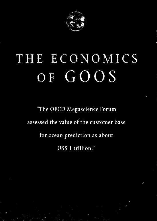
The Organisation for Economic Co-operation and Development
Megascience Forum assessed the value of the customer base for ocean
predictions as about US$ 1 trillion. A study by the UK Government’s Marine
Foresight Panel estimates that the existing global market for non-defense
ocean prediction is about L 10 million per year for open tendering and ten
times that for tied work by national agencies.
Analysis of the existing customer base and projections for the future
indicate that there are only two customers for truly global products. The first
is ship-routing, which is concerned with waves, currents, and ice. The second
is climate prediction, which is concerned with the global patterns of sea
surface temperature and the heat fluxes which create them.
All other customers (who provide 90% of the billings for marine
forecasting) are concerned with quite small (order 100 km) theatres of
operations, usually located in coastal waters. This large customer base
includes: off-shore extraction of minerals, oil and gas; defense; recreation;
fisheries and aquaculture; coastal shipping; and human health.
Tourism: Recreational use of the sea provides one of the most important
sources of maritime income in both industrialized and developing countries.
For example, in the UK it ranks second only to the national income from off-
shore oil and gas. In many countries it is top of the list. However, the
industry is notoriously volatile. Tourists switch away from locations that
have bad publicity because of environmental problems. Governments
sponsoring their tourist industry are responsible for maintaining standards
in their coastal waters.
Ofishore oil und gas: The industry started in relatively shallow water,
where there are now mature systems in place to provide the required marine ,.\fil 1,’
environmental information, notably on waves, currents, and sediment :
movement. But in recent years oil extraction has moved into deeper water, ,:i I,,
of order one kilometer at sites on the continental slopes, where there are
additional environment problems, in particular strong, fluctuating currents
running along the slope, and the risk of sediment slumping. :’ ‘;I ,,’
These customers are served by a combination of government agencies .:” 1.,
and commercial companies, who have developed local operations based on ’ i ‘. I,’ : ,a,,: ,*
17
observations and models which focus on the theatres of operation of their
customers. There are hundreds of such operations at locations all around the
world. The majority (about 90%) are managed by government-owned
agencies, but a growing fraction are served by commercial organisations.
The latter have billings of some US$ 10 million p.a., which is expected to
grow to US$ 100 million p.a. over the next decade or so.
The services that exist today are based on local observations in the
theatre of operations of their customer. In a few cases those data are
assimilated into operational models to generate the products required by the
customers. Examples are ship-routing and storm-surge prediction. However
operational services depend on direct interpretation of the local
observations: examples include current measurements around off-shore oil
fields and regular surveys of fish stocks and chemical contaminants in
coastal waters.
Most government customers are rather conservative in the systems they
specify. That is particularly true in the case of overseas aid agencies, like the
World Bank, which fund projects to address the problems identified in
Agenda2000.
There is considerable scope for improving the performance of these local
services, by switching to model-based generation of products. That normally
involves a re-design of the sampling strategy for observations.
The service provider finds the most economical way to deliver the
4
.
products his customers want, starting with local monitoring. Making
observations costs much more than modelling, so he may be able to generate
the products with fewer or cheaper observations when they are assimilated
into a model. As this system is refined, it will approach the limits of
predictability for local operations.
Many applications of ocean prediction are based on predicting wind
waves, which are generated, as their name suggests, by the wind. Examples
are ship-routing and coastal flooding by storm surges. Wind speed is also a
crucial factor in computing the depth of the surface mixed layer, which is
central to predicting water quality and sound propagation (for defense
applications).
Meteorologists have established that it is theoretically impossible to
predict the weather more than a week or two ahead. That discovery was the
start of chaos theory, which has since been applied to establish the limits to
prediction in many other systems, from medicine to ecology. Later I shall
discuss how we might apply chaos theory to the internal fluctuations of the
ocean; at this stage I shall merely state that we expect the limit to be much
longer than the week or two set by the weather.
19
4
.

THE MARINE ENVIRONMENT IN THE THEATRE OF OPERATIONS CAN ALSO KE
influenced by changes arriving through the water. These can arise in two ways:
advection by ocean currents, and propagation of waves. In some applications,
for which the local weather is less important, the products needed by the
customer may be more influenced by these internal changes.
For example, in oil recovery from deep sites on the continental slopes, the
kilometer-long riser (which carries the oil from seabed to ship) may be
vulnerable to ocean currents, the fluctuations in which are not controlled by
the local weather but by upstream influences inside the ocean.
Another example is the prediction of water quality in the North Sea, which
depends not only on inflow of contaminants from the surrounding land, but
also from the open Atlantic Ocean.
Thus, for some activities, the limits of prediction may be set not by the local
weather but by changes occurring in the ocean beyond the customer’s theatre
of operations. To improve the products he gives his customer, the service
provider will need to extend his area of monitoring and modelling beyond the
local theatre into an extended catchment from which the influences come.
The challenge is to develop a strategy for monitoring the changes occurring
in those catchments. They are potentially large, perhaps extending across a
21
.., _. “_. . . I ^ “. , .,. 22
whole ocean, so a strategy based on comprehensive forecasting in the
catchment is likely to be expensive; and probably more than the customer will
pay for the modest improvement it generates in the products he needs in his
local theatre of operations. So there is motivation to design a smart observing
scheme which will collect only the data which are most effective for improving
those products.
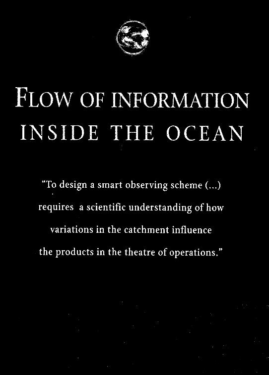
That requires scientific understanding of how variations in the cutchment
influence the products in the theatre of operations. We are still rather ignorant
of this process. However, we expect that there will be rapid progress as
oceanographers analyze the data sets created by high resolution models fed
with observations from WOCE and satellite remote sensing.
As the number of customers grows, each with a distinct theatre of
operations, their upstream cutchments start to overlap. It then makes sense to
share the cost of monitoring and modelling in these overlapping open ocean
cutchments. Already, some commercial operators are introducing regional
systems which serve a number of their customers at sites with overlapping
catchments. And the EuroGOOS consortium of 35 national agencies is
introducing collaborative operations in the Mediterranean, Baltic and NW
European regions.
There is an obvious economic benefit to be gained from such collaboration.
However, the cost of monitoring the open ocean is high, and so far
collaboration has been limited to regional catchments of modest extent.
Looking further ahead, the logical extension is to monitor and model whole
ocean basins. And eventually it might be useful to design a single global system
that will serve local operations all around the world.
Meanwhile it may be helpful to think of a simple “cartoon” which shows
how products in the customer’s theatre of operations are influenced by
variability in the open ocean. This cartoon is based on the idea of changes in one
oceanic location leading to others elsewhere at some later time. An example is
the change in mixed layer depth and temperature off Indonesia leading some
months later to an El Niiio off Peru.
We can think of this as a flow of information inside the ocean from one place
to another. At any instant, there is a vast number of such signals moving along
a variety of trajectories. The task for the service provider is to identify which of
these trajectories enters his theatre of operations, and what signals flow along
them, and which influence the products he supplies to his customers. His smart
monitoring system will focus on these signals. His aim will be to trace them
upstream along their trajectories to their source. The further he can go, the
earlier the warning of their arrival in his theatre of operations will be.
Assuming this cartoon is useful, the challenge is to understand the flow of
information through the ocean. Information is carried through the ocean by
two processes: teleconnexions and advection.
Teleconnexions involve the transmission of information by waves. Here are
two examples:
23

24
SHIP-ROUTING. In the case of wind wave forecasting (e.g. for ship-
routing) it has become necessary to predict the inflow of swell
generated by distant storms. This is done in the WAM system used
operationally at the European Centre for Medium Range Weather
Forecasting (ECMWF).
EL Ntfio. In the case of El Nifio forecasting, the information is carried by
Kelvin waves along the equator in the Pacific towards America. The skill
in forecasting El Nifio comes from a combination of monitoring and
modelling of this flow of information before it arrives at the theatre of
interest located in the Eastern Tropical Pacific.
Information is also advected across the ocean by ocean currents. This second
mechanism is necessary for the transport of chemicals and plantkon.
Uncertainty about the inflow of these properties into a local theatre of
operations can limit the predictability of water quality and fisheries
production. Again, the solution, in principle, is to monitor the ocean upstream
and to use those data in a model of the open ocean to predict future variations
in the chemical and biological properties at the boundary ofthe local theatre of
operations.
GOOS will be designed to collect information about the predictable
variations in ocean conditions entering a theatre of operations. We hope to
identify those signals in advance by looking upstream along the trajectories of
information flow. Looking further upstream should produce earlier warning.
However, we also know that information is progressively dissipated. So the
further we look upstream, the fainter will be the signal, and eventually it will
provide no value for operational forecasting. At present we do not know how
far upstream we can usefully monitor fluctuations. Answering that question
must be one of the primary goals of GOOS.
What causes the dissipation of useful signals radiating and advected across
the ocean? We assume that the primary mechanism is refraction and
dispersion by the unstable eddies, jets and fronts which make up the weather
inside the ocean. These transient motions have the same chaotic behaviour as
the weather inside the atmosphere. They can be described by a suitably high-
density of synoptic observations, including satellite altimetry and radiometry,
combined with hydrographic profiles and direct measurements of velocity.
When those observations are assimilated into a high resolution model (one
that has a horizontal grid spacing of 1 km) the development of the weather
systems can be predicted with useful skill for a few weeks. In practice this has
not yet been done, because of the difficulty of collecting a sufftcient density of
observations to initialize the integration, and to verify its predictions.
It is important to undertake such costly and onerous experiments to
establish the limits to predictability of ocean weather systems, which are
ultimately set by chaos theory. Assuming that the limit for ocean weather
scales with the limit for atmospheric weather according to the Lagrangian time
scale of ocean eddies, we expect the theoretical limits to prediction for ocean
25

26
weather to be of order of one month. Beyond that limit the ocean weather
becomes unpredictable noise, which can only be predicted statistically.
So even if it were possible to resolve the ocean weather within a future
operational GOOS, the large scale signals which we need to monitor and
predict would be subject to random noise when we attempt to trace them back
upstream for more than one month. It is not clear what impact that noise
would have on the usefulness of the upcoming signal. We need experiments
(under GOOS) to learn that.
However, the situation is likely to be worse than that. It is unlikely that
practical observing systems will resolve the ocean weather sufficiently to
permit its description and prediction to the limits set by chaos theory. So the
noise will start less than one month upstream.
To summarize, we want to look beyond the theatre of operations into the
catchment area, in the direction from which waves or advection bring external
changes, so that we can take them into account in our forecasts for the
customer. However, looking upstream is like looking into a fog. Close objects
are fairly distinct, but those further away are lost in the fog. In our case the
objects are fluctuations in the ocean environment whose arrival we would like
to be able to predict. We do not yet know how far we shall be able usefully to
look upstream. Discovering that should be the subject of experiments
promoted by GOOS.

THE CUSTOMER FOR OPEN OCEAN MONITORING IS I‘HE SERVICE PROVIDER WHO
operates local systems in his customers’ theatres of operation. The goal is
to focus on those open ocean signals that will improve the performance of
local operational forecasting systems. Will the customer be prepared to
pay more for the improved product?
Assessing the cost benefit of such operations is difficult. Usually it
depends on experiments that are funded by government. A good example
is the lo-year TOGA experiment which established the feasibility, cost and
value of monitoring the tropical Pacific in order to extend the prediction of
El Nifio from weeks to months. There is a need for similar experiments to
address forecasting of Agenda 21 problems.
The Global Ocean Observing System (GOOS) provides the
international framework for promoting such pre-operational experiments.
The goal for GOOS experiments will be to discover whether it is possible to
design an affordable system of ocean monitoring that can yield products
which improve the performance of existing local operational systems. For
example, a GOOS experiment in the Atlantic Ocean should be designed to
improve the performance of operational systems located along the coasts
of Europe, Africa and America, which lie downstream in the flow of
information by teleconnexions and advection.
29
.-^^-._.IX-..--l .._-_. ^^._-“l-..l. ._-_... __li..“- _..-. _-I l_._l ..-.._ ^-l_l_._” ..- - . II.._ . . .“^.. ..” -.-.-- ..-- X-.,.-.- 30
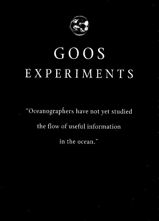
Interestingly, oceanographers have not yet studied the flow of useful
information in the ocean. The obvious exceptions are the information
carried by waves. We are still rather vague about what exploitable
information is carried by ocean currents. There is a need for basic scientific
research on the nature of information flow across the ocean.
The oceanographic research community has developed a number of
global models which do a good job of simulating the physical features of
the ocean described by the WOCE data set. They are being extended to
simulate chemical and biological properties. Computers of sufficient
power will soon be available, and their cost will then fall rapidly.
So modelling will become more affordable.
The cost of monitoring the open ocean is also expected to fall as
unmanned instruments communicating by satellite replace instruments
lowered from research ships. And the cost of remote sensing from satellites
is falling dramatically: this is particularly true for altimeters. It has been
estimated that these new systems would make it possible to repeat WOCE
for less than 10 % of the cost. So early estimates of the cost of a global ocean
monitoring system may have been unduly pessimistic.
These GOOS experiments are likely to be much more affordable than
20th century global experiments like WOCE. The task for those
experiments will be to discover the limits of predictability in the ocean,
expressed in terms of the benefits to local operations servicing paying
.
customers in the public and private sectors. The first GOOS experiments
will be based on observing systems that already exist, notably satellites,
plus some new systems, like the proposed 3,000 Argo undulating floats.
They will provide data which will allow us to design more focused
experiments in the future. At this stage it is unclear how many experiments
will be needed before we have a sufficient scientific understanding of the
flow and dissipation of information through the ocean to assess whether it
makes economic sense to invest in a permanent Global Ocean Observing
System. Perhaps the ocean is so dissipative that ocean forecasting will
remain for ever local, apart from short term predictions of wind waves.
.
LET ME CONCLUDE BY RESTATING THE CASE FOR INVESTING IN GOOS, AS
presented in the Prospectus for GOOS 1998.
It is built on three facts:
1. There is a substantial, and rapidly growing market which is paying for
ocean forecasting either directly by contracts to service providers, or
indirectly through taxes which governments spend on service
providers.
2. The customers require environmental information in their local
theatre of operations, which are mostly of order 100 km across.
3. Marine science and technology will be able to deliver those products
early in the 21st century. It will involve learning how to exploit
observations by data assimilation into models. I described this as
evolving from oceanographic herbivory to carnivory. GODAE will
show the way.
The limits to predictability of the products sold to customers depend on
two factors:
1. The local weather in the theatre of operations.
2. The inflow of disturbances from outside the theatre of operations.
33
We know the limits of atmospheric weather prediction: about one week:
but we do not yet know the limits set by the dissipation of signals as they
move around the ocean: the ocean weather. We assume the limits are
controlled by weather inside the ocean, which tends to have longer time
scales than atmospheric weather.
The working hypothesis is that we can extend operational
oceanography to the theoretical limits of ocean weather predictability by
making and analyzing routine observations in the open ocean.
However we have not yet begun to test that hypothesis. That is the
scientific challenge of GOOS.
Addressing that challenge will require a series of GOOS experiments
comparable to the TOGA experiment, which established the practical
design of an observing system to forecast El Nina.
To explain the purpose of these GOOS experiments, I used a “cartoon”,
in which information is radiated and advected along various trajectories
into a customer’s theatre of operations. Ideally it will be possible to predict
these incoming signals, and so to take account of them when forecasting
the environment in that theatre. We assume that the signals are themselves
disrupted by the oceanic weather. So there is a limit to how far one can
usefully search upstream for incoming signals. Further upstream offers
longer warning times, but increasing risk of error.
The purpose of the GOOS experiments is to discover how far upstream
one can usefully detect such signals. The experiments will establish the
scope of the catchment area around each operational theatre.
We assume that these catrhments will be substantial, and that
catchments of different local operational services will overlap. That will
justify collaboration in creating a shared open ocean observing system,
provided that a common system can satisfy the needs of each of the
customers each in a different location, and with their own priorities for
forecasting products. ~
The immediate task for GOOS is to design those experiments, and to
get them funded. They will reveal the limits to prediction in the ocean.
1~-----11 --_- -- __._-...-. __..l_._._.-.- -... ̂ . ..- --~_ .--..~.._ ..,.” -..-.___ I” .^..” .- .-_ .l”“ll.. .,,.... .I~
‘3 5
I 1 1 I REFERENCES 1
Advanced Study Institute on Modelling and Prediction of the upper layers of the Ocean, Urbino, Italy, 1975. Modeling and Prediction of the Upper Layers ufthe Ocean, ed. by E. B. Kraus. Oxford/New York, Pergamon Press, 1977. 325 pp.
Cartwright, David Edgar. Tides: a Scientific History. New York, Cambridge University Press, 1999. 292 pp.
Komen, G.J. et al. Dynamics and Modelling qf Ocean Waves. New York, Cambridge University Press, 1994. 532 pp.
Sobel, Dava. Longitude: the True Story $a Lone Genius Who Solved the Greatest Scientific Problem of His Time. New York, Walker, 1995. 184 pp.
The designation employed and the presentation of the material in this publication do not imply the expression of any opinion whatsoever on the part of the Secretariats of UNESCO and IOC concerning the legal status of any country or territory, or of its authorities, or concerning the delimitation oftheir frontiers or boundaries. The opinion expressed herein are those of the author and, as such, are not necessarily those of UNESCO or the Intergovernmental Oceanographic Commission.
For bibliographic purposes this document should be cited as follows: IOC Bruun Memorial Lectures, 1999. Ocean Predictability, J. Woods. IOC Terhnical Series 55, UNESCO 2000. (English only).
Photos (q-Dr. Bruun: Courtesy of the archives services of the Zoological Museum, University of Copenhagen.
Published in 2000 by the United Nations Educational, Scientific and Cultural Organization, 7 Place de Fontenoy, 75007 Paris
0 UNESCO 2000 Printed in Francr~
FIFTEENTH SESSION OF THE ASSEMBLY, PARIS, 4 - 19 JULY 1989 impact of New Technology on Marine Scientific Research, Opening Statement, by Manuel Murillo; Submersibles and Remotely-Operated Vehicles at the Service ofOceanological Research, by B. Grandvaux; The Shape of the Ocean Floor, by Anthony S. Laughton; Observing Change in the Global Ocean: the View from Space, by 1). James Baker. In: IOC. Bruun Memorial Lectures, Paris, UNESCO. 1991. (Tcdztticd Scrir’s, 36).
FOURTEENTH SESSION OF THE ASSEMBLY, PARIS, 17 MARCH - 1 APRIL 1987 Recent Advances in Selected Areas of Ocean Sciences in the Regions of the Caribbean, Indian Ocean and the Western Pacific. Opening Statement, by M.A. Martin-Sane; The Scientific Basis for the Assessment of Marine Pollution in the Caribbean Sea and Adjacent Kegions: the CARIPOL Experience, by Jorge E. Corredor; Monsoon and Currents in the Indian Ocean, by MichPle Fieux; Sea-level Changes, Environments, Tectonics, Marine Resources and Phosphorites. by Peter J. Cook. In: IOC. Bruun Memorial Lectures, Paris, IXESCO, 1988. (TdttticalSeria, 31).
THIRTEENTH SESSION OF THE ASSEMBLY, PARIS, 12 - 18 MARCH 1985 f’ast and Future Perspectives of the Commission, Opening Statement, by M.A. Martin-Sank; On the Benefits of Ocean Studies, by W.S. Wooster; What Steps Should Be Taken to Meet the Challenges of the Future in Ocean Services and Technology and in the Identification of Disturbances Caused by Men’? by S. Z. Qasim: How Can the International Scientific Community Work Together in the Era ofa~ Emerging Ocean Regime to I Ielp all Partners to Achieve a Better Understanding of Ocean Phenomena and their Impact on Man? b!, A. Yankov.
TWELFTH SESSION OF THE ASSEMBLY, PARIS, 3 - 19 NOVEMBER 1982 Ocean Science for the Year 2000, Opening Statement, by Neil J. Campbell; Future Research on the Ocean Floor and What Lies Beneath it, by M. Talwani; Future in Physical Oceanography and Climate, by I<. 1 lasselmann: Future Research in Ocean Chemistry, by I). Dyrssen; Future Research Biological Oceanography, by M.V. Angel. In: IOC. Bruun Memorial Lectures, Paris, UNESCO, 1984. (7khnircrl Srv+s. 28).
ELEVENTH SESSION OF THE ASSEMBLY, PARIS, 22 OCTOBER - 3 NOVEMBER 1979 Marine Environment and Resources in the Ocean, Opening Statement, by Neil J. Campbell; Non- Living Marine Resources, by E. Seibold; Ocean Energy, by Kenzo Takano; A Short-term Climatic Change: A Physical Oceanographer’s Point of View, by J.S. Godfrey; Living Marine Resources, by D.H. Cushing. In: IOC. Bruun Memorial Lectures, Paris, UNESCO, 1980. (Terhtticnl Suits, 21).
TENTH SESSION OF THE ASSEMBLY, PARIS, 27 OCTOBER - 10 NOVEMBER 1977 The Importance and Application of Satellite and Remotely Sensed Data to Oceanography, Opening Statement, by Agustin Ayala-Castaiiares; Past, Present and Future Capabilities of Satellites Relative to the Needs of Ocean Sciences, by John R. Apel; Remote Sensing of the Ocean in the USSR, by Boris Nelepo; Interaction of Electromagnetic Waves and Oceanic Waves, by Werner Alpers; Determination of Oceanic Tides from Space, by DE. Cartwright. In: IOC. Bruun Memorial Lectures, Paris, UNESCO, 1978. (7Pchnicrrl SetGs, 19).
NINTH SESSION OF THE ASSEMBLY, PARIS, 22 OCTOBER - 4 NOVEMBER 1975 Co-operative Study of the Kuroshio and Adjacent Regions (CSK), Opening Statement, by H.U. Roll; Co-operative Study of the Kuroshio and Adjacent Regions (CSK), by Ken Sugawara: Accuracy of the Determination of Nutrient Elements in Sea Water by Using CSK Standard Solutions, by Mitsuko Ambe; Dynamics of the Kuroshio Current: Experimental and Theoretical Studies from South of Kyushy to the Izu-ogasawara Ridge, by Allan R. Robinson; The Dynamics and Thermohaline Structure of the Waters of the Kuroshio and Adjacent Regions, by Vladimir G. Kort. In: IOC. Bruun Memorial Lectures, Paris, UNESCO, 1976. (Tdtt~ical &vies, 15).
EIGHTH SESSION OF THE ASSEMBLY, PARIS, 5 - 17 NOVEMBER 1973 Tropical Atlantic, from the Guinean Trawling Survey and the International Co-operative Investigations ofthe Tropical Atlantic (ICITA) to the Present day; Introduction, by T. Austin; The Equatorial Undercurrent in the Atlantic, by K. Voigt; Plankton of the Tropical Atlantic, by J. Krey; Fishery Resources of the Tropical Easter-Central Atlantic Ocean: Exploration, Utilization and Management since 1960, by F. Williams; Some Results of the Eastern Atlantic Continental Margin Programme, by K.O. Emery. In: IOC. Bruun Memorial Lectures, Paris, UNESCO, 1974. (Teclwical Series, 11).
SEVENTH SESSION OF THE ASSEMBLY, PARIS, 26 OCTOBER - 6 NOVEMGER 1971 The Biology of the Indian Ocean, by G.F. Humphrey; Recent Meteorological Results from the International Indian Ocean Expedition, by C.S. Ramage; A Review of Recent Physical Oceanographic Work in the Indian Ocean, by J.C. SwaIlo. In: JOC. Bruun Memorial Lectures, Paris, UNESCO, 1972. (Trrhnicd Swies, 10).