Embed Size (px)
Citation preview
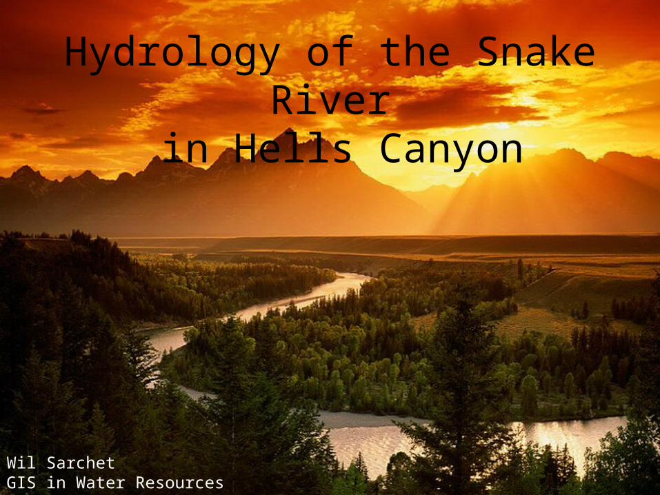
Hydrology of the Snake River in Hells Canyon
Wil SarchetGIS in Water Resources
introduction
methodology
conclusions
objective
results
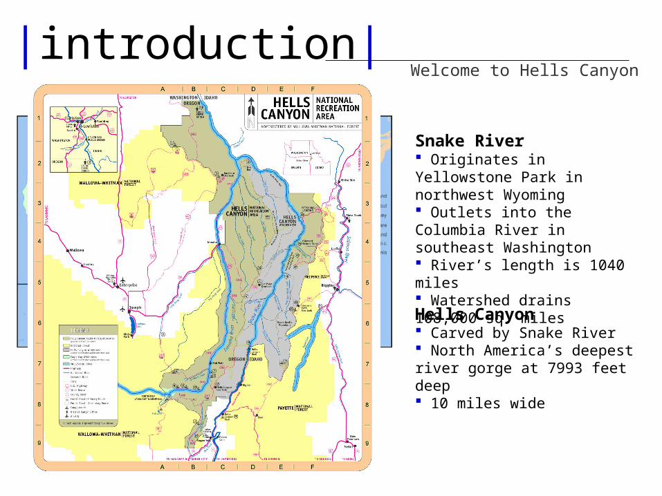
|introduction|
Snake River Originates in Yellowstone Park in northwest Wyoming Outlets into the Columbia River in southeast Washington River’s length is 1040 miles Watershed drains 108,000 sq. miles
Welcome to Hells Canyon
Hells Canyon Carved by Snake River North America’s deepest river gorge at 7993 feet deep 10 miles wide
flow
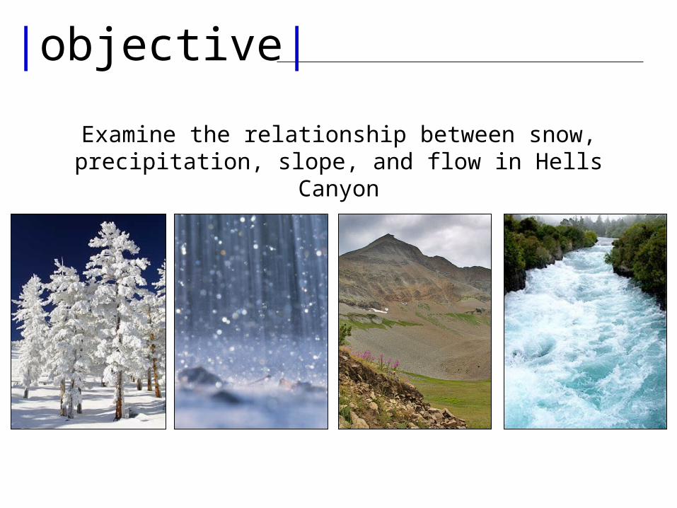
|objective|
Examine the relationship between snow, precipitation, slope, and flow in Hells Canyon
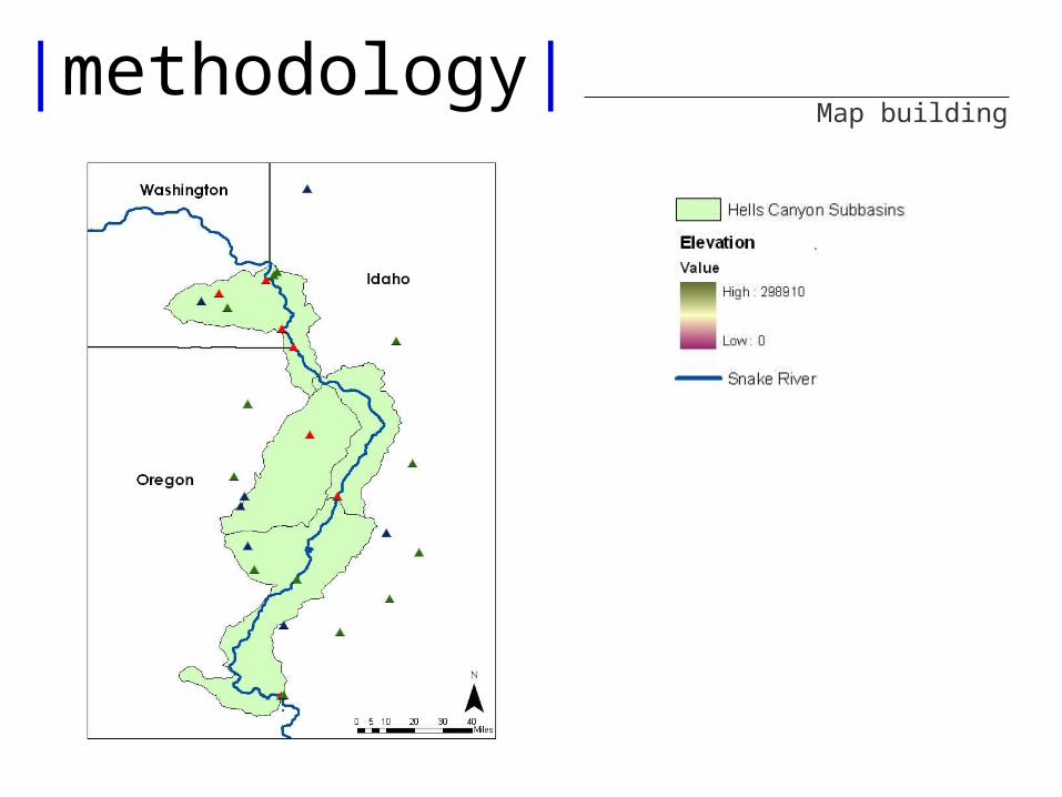
|methodology|Map building
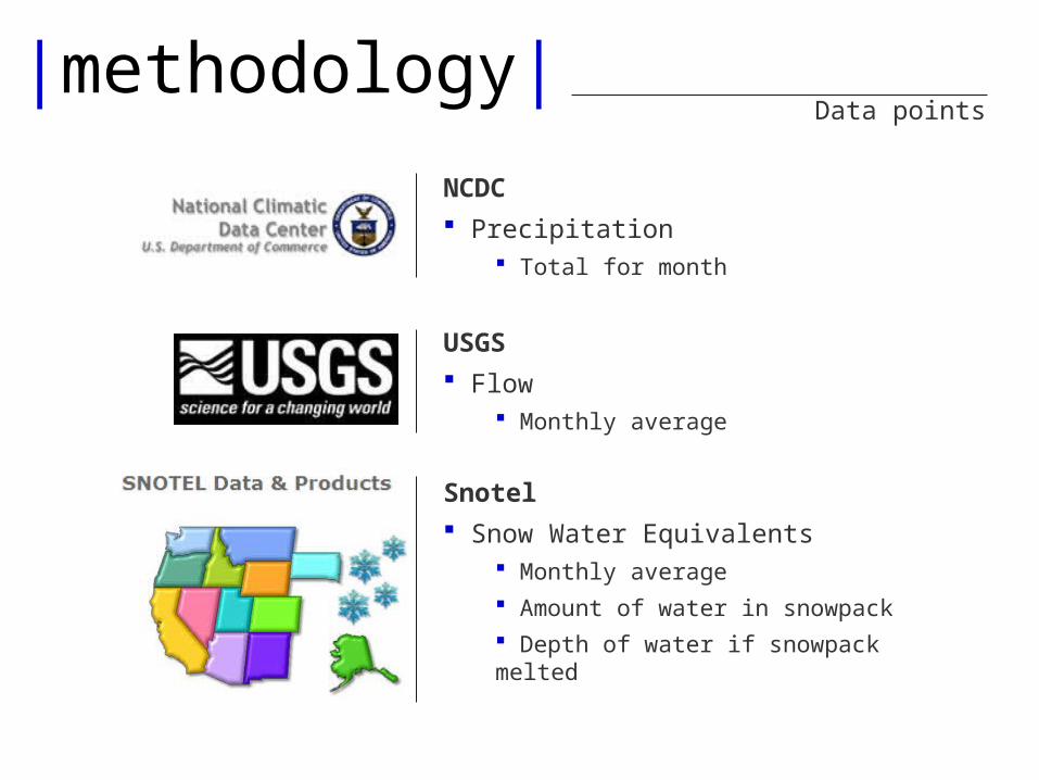
|methodology|Data points
NCDC Precipitation
Total for month
USGS Flow
Monthly average
Snotel Snow Water Equivalents
Monthly average Amount of water in snowpack Depth of water if snowpack melted
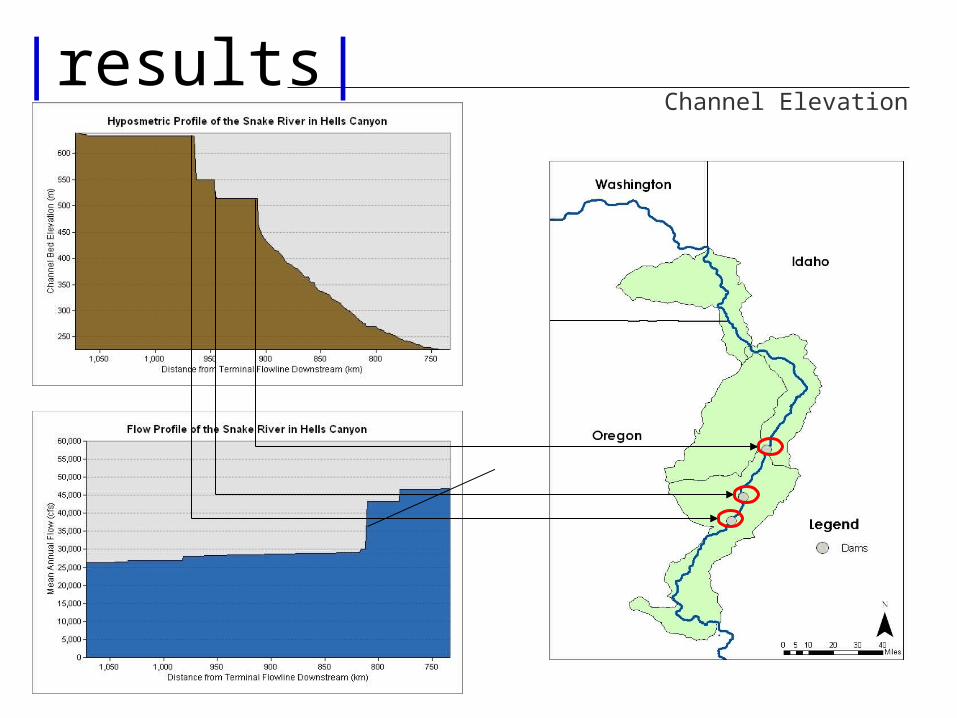
|results|Channel Elevation
MayJune
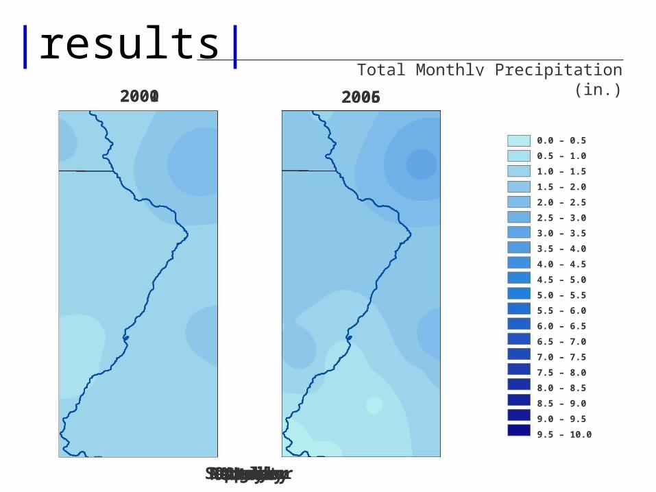
|results|Total Monthly Precipitation (in.)
0.0 – 0.5
0.5 – 1.0
1.0 – 1.5
1.5 – 2.0
2.0 – 2.5
2.5 – 3.0
3.0 – 3.5
3.5 – 4.0
4.0 – 4.5
4.5 – 5.0
5.0 – 5.5
5.5 – 6.0
6.0 – 6.5
6.5 – 7.0
7.0 – 7.5
7.5 – 8.0
8.0 – 8.5
8.5 – 9.0
9.0 – 9.5
9.5 – 10.0
JulyAugustSeptemberOctoberNovemberDecemberJanuaryFebruaryMarchAprilMayJune
2000 20052001 2006
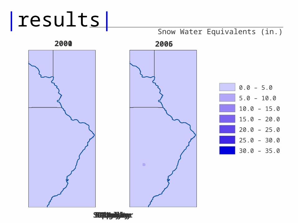
|results|Snow Water Equivalents (in.)
JulyAugustSeptemberOctoberNovemberDecemberJanuaryFebruaryMarchAprilMayJune
2000 20052001 2006
0.0 – 5.0
5.0 – 10.0
10.0 – 15.0
15.0 – 20.0
20.0 – 25.0
25.0 – 30.0
30.0 – 35.0
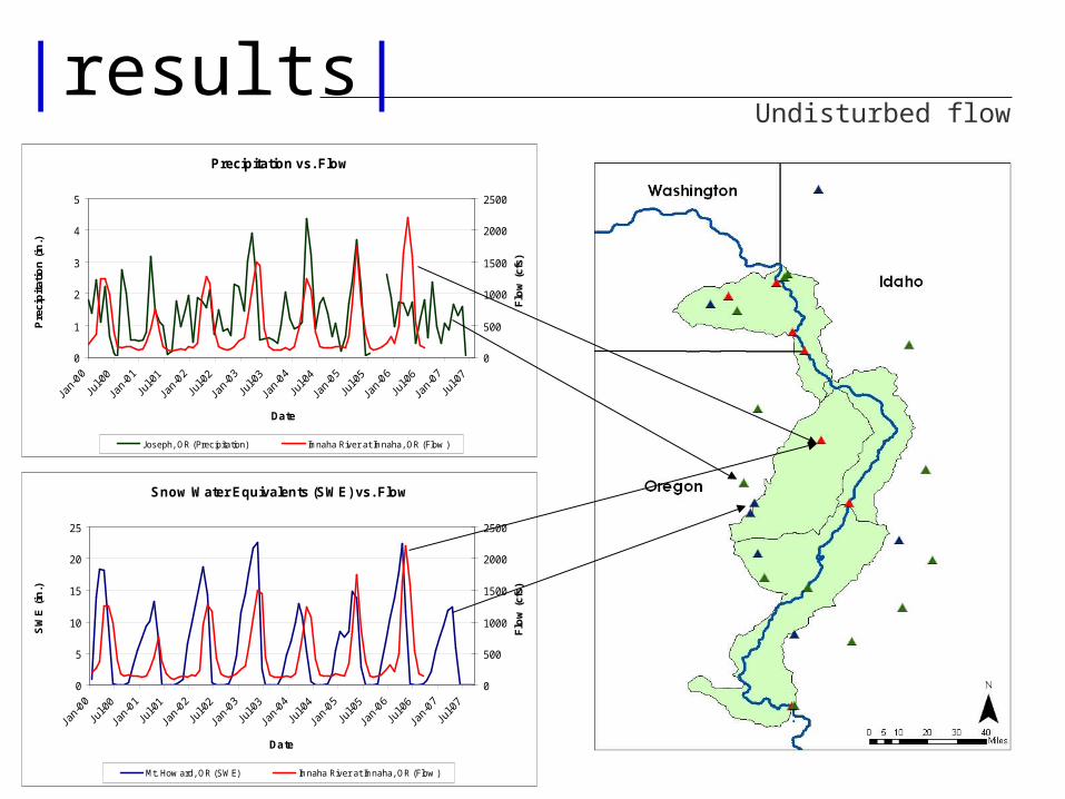
|results|Undisturbed flow
Snow Water Equivalents (SWE) vs. Flow
0
5
10
15
20
25
Date
SW
E (
in.)
0
500
1000
1500
2000
2500F
low
(cf
s)
Mt. How ard, OR (SWE) Imnaha River at Imnaha, OR (Flow )
Precipitation vs. Flow
0
1
2
3
4
5
Date
Pre
cip
itat
ion
(in
.)
0
500
1000
1500
2000
2500
Flo
w (
cfs)
Joseph, OR (Precipitation) Imnaha River at Imnaha, OR (Flow )
Precipitation vs. Flow
0
1
2
3
4
5
6
7
8
Date
Pre
cip
itat
ion
(in
.)
0
10,000
20,000
30,000
40,000
50,000
60,000
70,000
Flo
w (
cfs)
Riggins, ID (Precipitation) Snake River at Hells Canyon Dam (Flow )
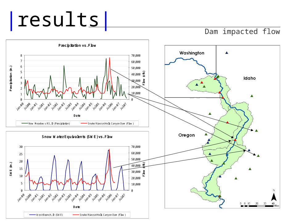
|results|Dam impacted flow
Precipitation vs. Flow
0
1
2
3
4
5
6
7
8
Date
Pre
cip
itat
ion
(in
.)
0
10,000
20,000
30,000
40,000
50,000
60,000
70,000
Flo
w (
cfs)
New Meadow s RS, ID (Precipitation) Snake River at Hells Canyon Dam (Flow )
Precipitation vs. Flow
0
1
2
3
4
5
Date
Pre
cip
itat
ion
(in
.)
0
500
1000
1500
2000
2500
Flo
w (
cfs)
Joseph, OR (Precipitation) Imnaha River at Imnaha, OR (Flow )
Snow Water Equivalents (SWE) vs. Flow
0
5
10
15
20
25
30
Date
SW
E (
in.)
0
10,000
20,000
30,000
40,000
50,000
60,000
70,000F
low
(cf
s)
West Branch, ID (SWE) Snake River at Hells Canyon Dam (Flow )
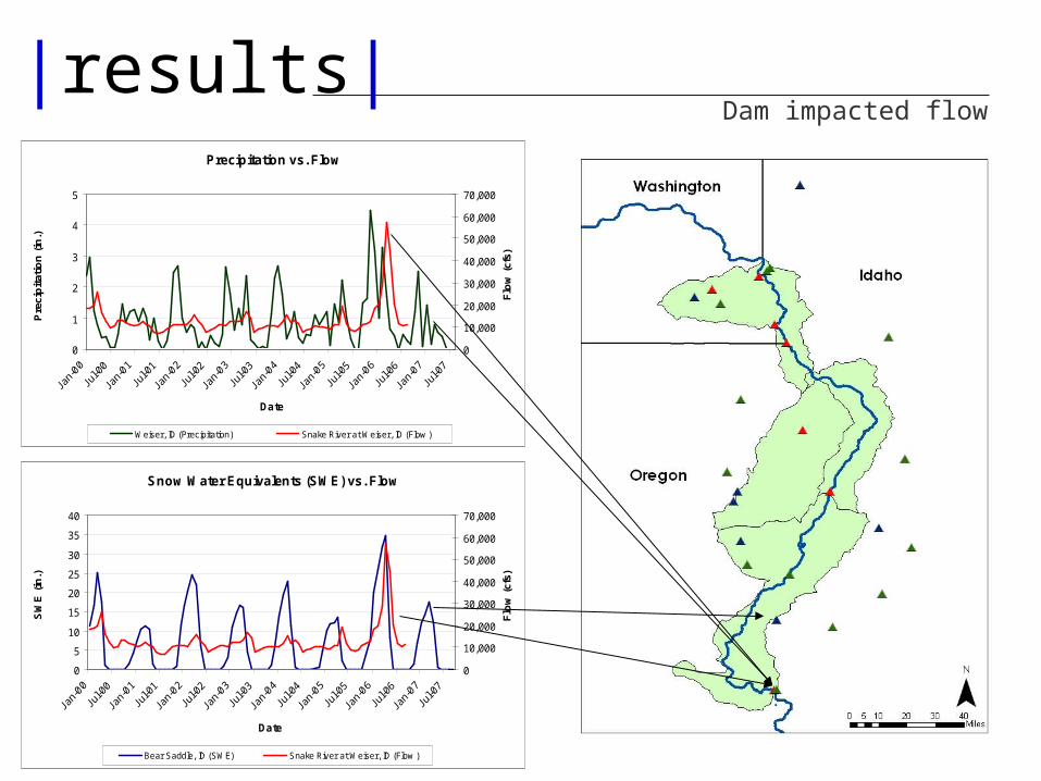
|results|Dam impacted flow
Precipitation vs. Flow
0
1
2
3
4
5
Date
Pre
cip
itat
ion
(in
.)
0
500
1000
1500
2000
2500
Flo
w (
cfs)
Joseph, OR (Precipitation) Imnaha River at Imnaha, OR (Flow )
Precipitation vs. Flow
0
1
2
3
4
5
Date
Pre
cip
itat
ion
(in
.)
0
10,000
20,000
30,000
40,000
50,000
60,000
70,000
Flo
w (
cfs)
Weiser, ID (Precipitation) Snake River at Weiser, ID (Flow )
Snow Water Equivalents (SWE) vs. Flow
0
5
10
15
20
25
30
35
40
Date
SW
E (
in.)
0
10,000
20,000
30,000
40,000
50,000
60,000
70,000F
low
(cf
s)
Bear Saddle, ID (SWE) Snake River at Weiser, ID (Flow )
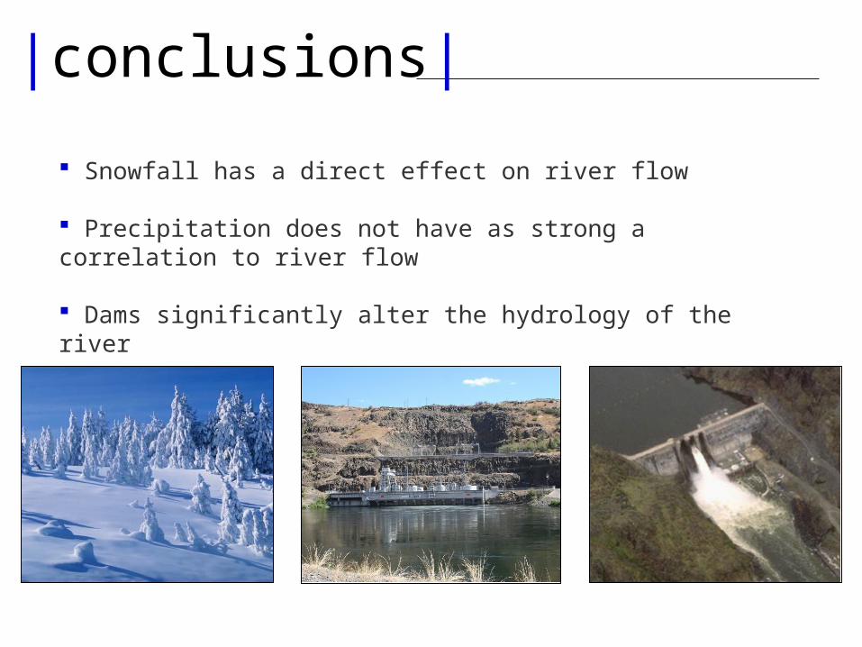
|conclusions|
Snowfall has a direct effect on river flow
Precipitation does not have as strong a correlation to river flow
Dams significantly alter the hydrology of the river
|references| http://www.fs.fed.us/hellscanyon/overview/maps.shtml
http://en.wikipedia.org/wiki/Image:Map_of_USA_with_state_names.svg
http://www.fs.fed.us/hellscanyon/overview/index.shtml
http://www.luminous-landscape.com/tutorials/exposing_snow.shtml
http://lennthompson.typepad.com/photos/uncategorized/rain_1.jpg
.http://www.desktopscenes.com/Scenes%20from%20Big%20Sky%20Country%20(200 3)/Lone%20Mountain%20Summit.jpg
http://www.icwhen.com/ncc14/topics/waikato/images/image-0001.jpg
http://geoimages.berkeley.edu/Waterfalls/Idaho/ShoshoneFallsL.html
http://www.visitusa.com/oregon/images/hellscanyonorpic.jpg
http://www.windingwatersrafting.com/gallery_app.php
http://209.20.186.111/images/Idaho/HellsCanyon2.jpg
http://en.wikipedia.org/wiki/Snake_river
Http://en.wikipedia.org/wiki/Image:Hells-canyon-dam-id-us.jpg
http://en.wikipedia.org/wiki/Image:Oxbow_Hydroelectric_dam.jpg
http://www.ifskiclub.com/Portals/0/Photos/Yellowstone.JPG
Images

|questions|