Embed Size (px)
Citation preview
Hydrologic Elements of the Taos Valley
Settlement
John Shomaker
John Shomaker & Associates
Albuquerque
March 4, 2017
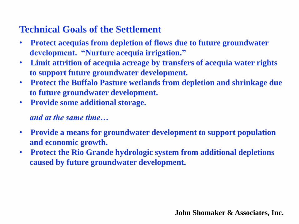
Technical Goals of the Settlement
• Protect acequias from depletion of flows due to future groundwater
development. “Nurture acequia irrigation.”
• Limit attrition of acequia acreage by transfers of acequia water rights
to support future groundwater development.
• Protect the Buffalo Pasture wetlands from depletion and shrinkage due
to future groundwater development.
• Provide some additional storage.
and at the same time…
• Provide a means for groundwater development to support population
and economic growth.
• Protect the Rio Grande hydrologic system from additional depletions
caused by future groundwater development.
John Shomaker & Associates, Inc.
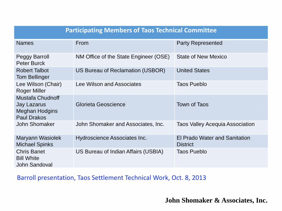
Participating Members of Taos Technical Committee
Names From Party Represented
Peggy Barroll
Peter Burck
NM Office of the State Engineer (OSE) State of New Mexico
Robert Talbot
Tom Bellinger
US Bureau of Reclamation (USBOR) United States
Lee Wilson (Chair)
Roger Miller
Lee Wilson and Associates Taos Pueblo
Mustafa Chudnoff
Jay Lazarus
Meghan Hodgins
Paul Drakos
Glorieta Geoscience Town of Taos
John Shomaker John Shomaker and Associates, Inc. Taos Valley Acequia Association
Maryann Wasiolek
Michael Spinks
Hydroscience Associates Inc. El Prado Water and Sanitation
District
Chris Banet
Bill White
John Sandoval
US Bureau of Indian Affairs (USBIA) Taos Pueblo
Barroll presentation, Taos Settlement Technical Work, Oct. 8, 2013
John Shomaker & Associates, Inc.
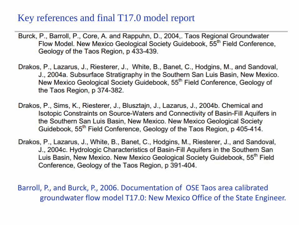
Barroll, P., and Burck, P., 2006. Documentation of OSE Taos area calibrated groundwater flow model T17.0: New Mexico Office of the State Engineer.
Key references and final T17.0 model report
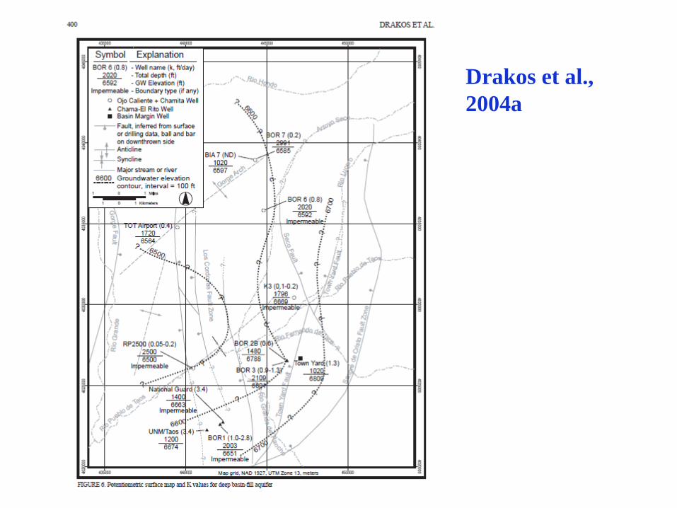
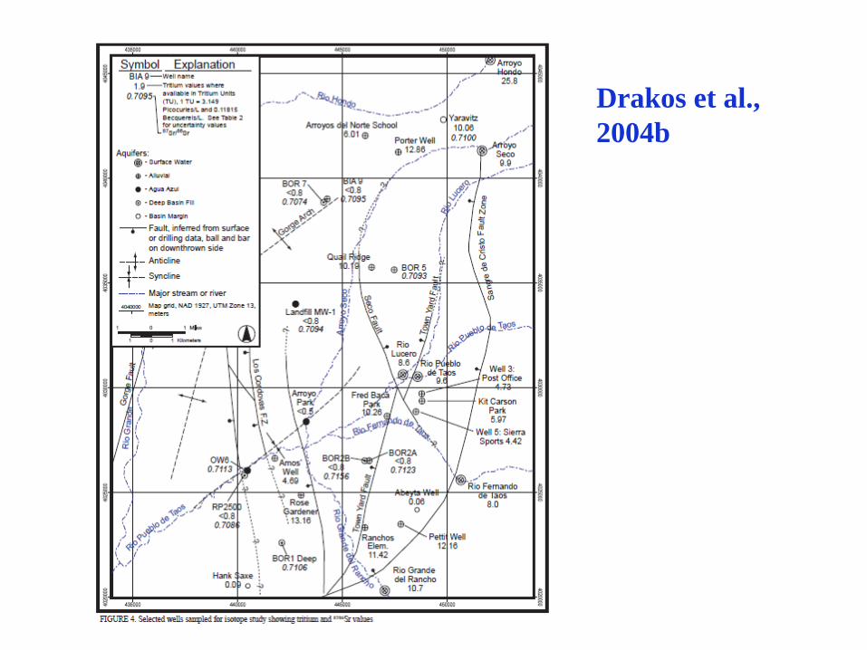
Drakos et al.,
2004a
Aquifer Compartmentalization
Several of the intrabasin faults act as hydrologic boundaries, and
result in some compartmentalization of the deep basin-fill aquifer. The Seco
fault acts as an impermeable boundary, and may act to separate a northeast
deeper aquifer system that has been recharged by modern to Holocene
precipitation separated from a southwest deep aquifer system that has been
recharged by older, possibly Pleistocene precipitation (Drakos et al., this
volume). Data from high-precision temperature logs also indicates
compartmentalization of the deep basin fill aquifer (Reiter and Sandoval, this
volume). Some Los Cordovas fault splays act as impermeable boundaries (e.g.
the eastern Los Cordovas fault near BOR1 and one or both of Los Cordovas
faults near RP2500), whereas other faults do not appear to affect groundwater
flow in the deep aquifer (e.g. the western Los Cordovas fault near the Airport
well and near UNM/Taos). This may indicate variable cementation along the
fault plane and/or variable offset along Los Cordovas fault strands.
Drakos et al., 2004a
Drakos et al.,
2004b
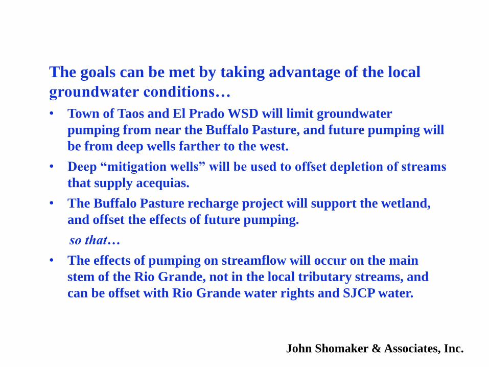
The goals can be met by taking advantage of the local
groundwater conditions…
• Town of Taos and El Prado WSD will limit groundwater
pumping from near the Buffalo Pasture, and future pumping will
be from deep wells farther to the west.
• Deep “mitigation wells” will be used to offset depletion of streams
that supply acequias.
• The Buffalo Pasture recharge project will support the wetland,
and offset the effects of future pumping.
so that…
• The effects of pumping on streamflow will occur on the main
stem of the Rio Grande, not in the local tributary streams, and
can be offset with Rio Grande water rights and SJCP water.
John Shomaker & Associates, Inc.
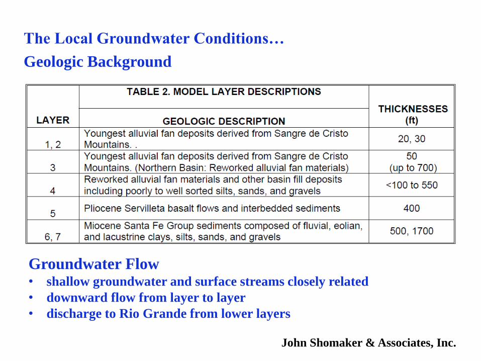
The Local Groundwater Conditions…
Geologic Background
Groundwater Flow• shallow groundwater and surface streams closely related
• downward flow from layer to layer
• discharge to Rio Grande from lower layers
John Shomaker & Associates, Inc.
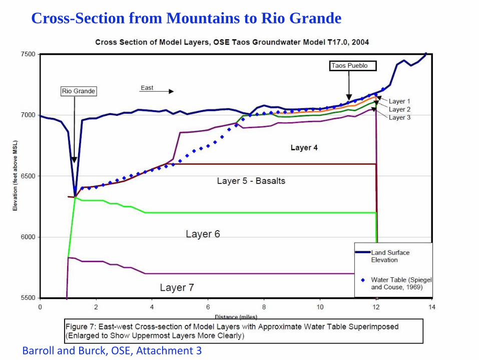
Cross-Section from Mountains to Rio Grande
Barroll and Burck, OSE, Attachment 3
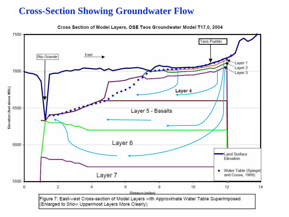
Cross-Section Showing Groundwater Flow
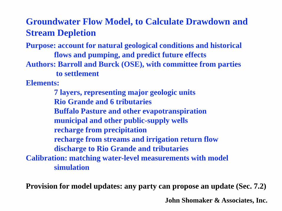
Groundwater Flow Model, to Calculate Drawdown and
Stream Depletion
Purpose: account for natural geological conditions and historical
flows and pumping, and predict future effects
Authors: Barroll and Burck (OSE), with committee from parties
to settlement
Elements:
7 layers, representing major geologic units
Rio Grande and 6 tributaries
Buffalo Pasture and other evapotranspiration
municipal and other public-supply wells
recharge from precipitation
recharge from streams and irrigation return flow
discharge to Rio Grande and tributaries
Calibration: matching water-level measurements with model
simulation
Provision for model updates: any party can propose an update (Sec. 7.2)
John Shomaker & Associates, Inc.
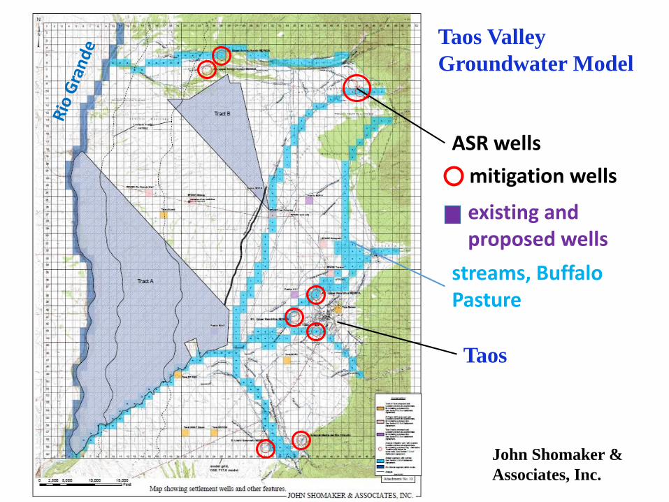
Taos Valley
Groundwater Model
Taos
ASR wells
mitigation wells
streams, Buffalo Pasture
existing and proposed wells
John Shomaker &
Associates, Inc.
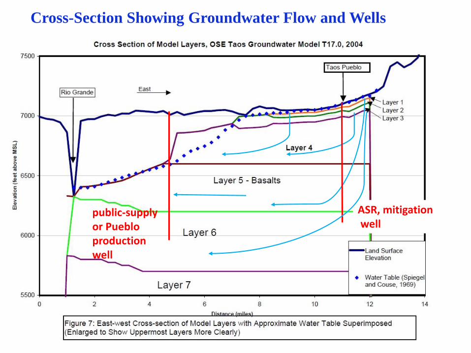
Cross-Section Showing Groundwater Flow and Wells
public-supplyor Puebloproductionwell
ASR, mitigationwell
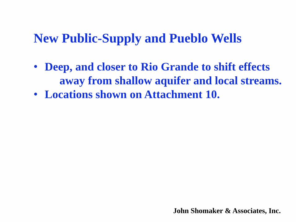
New Public-Supply and Pueblo Wells
• Deep, and closer to Rio Grande to shift effects
away from shallow aquifer and local streams.
• Locations shown on Attachment 10.
John Shomaker & Associates, Inc.
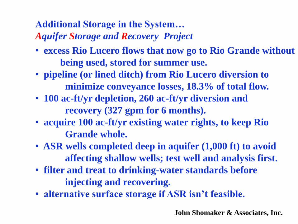
Additional Storage in the System…
Aquifer Storage and Recovery Project
• excess Rio Lucero flows that now go to Rio Grande without
being used, stored for summer use.
• pipeline (or lined ditch) from Rio Lucero diversion to
minimize conveyance losses, 18.3% of total flow.
• 100 ac-ft/yr depletion, 260 ac-ft/yr diversion and
recovery (327 gpm for 6 months).
• acquire 100 ac-ft/yr existing water rights, to keep Rio
Grande whole.
• ASR wells completed deep in aquifer (1,000 ft) to avoid
affecting shallow wells; test well and analysis first.
• filter and treat to drinking-water standards before
injecting and recovering.
• alternative surface storage if ASR isn’t feasible.
John Shomaker & Associates, Inc.
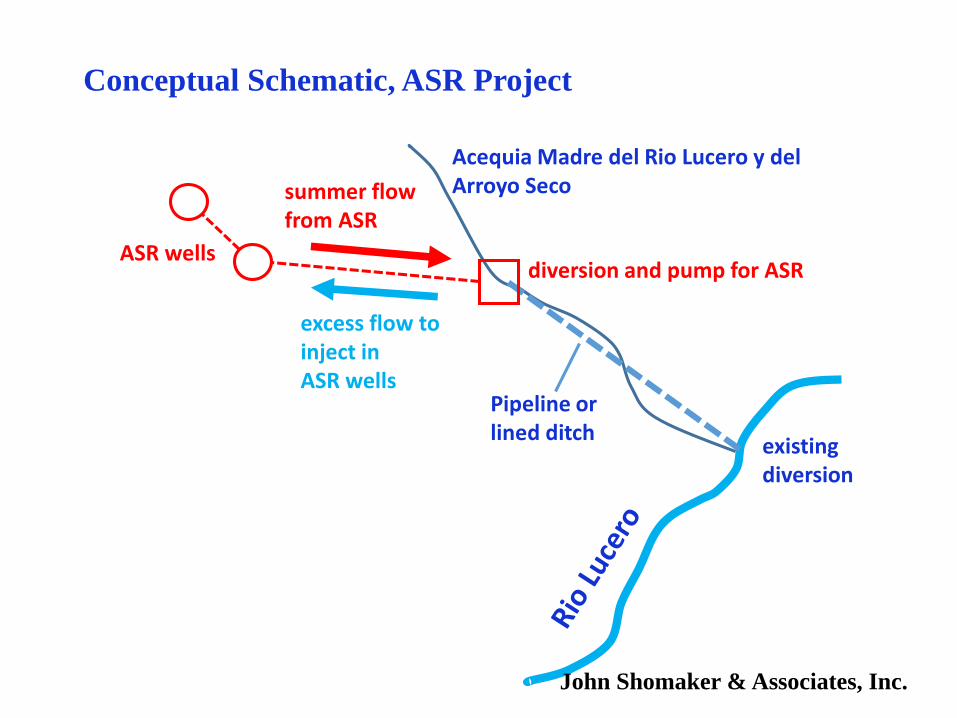
Conceptual Schematic, ASR Project
Acequia Madre del Rio Lucero y del Arroyo Seco
existing diversion
Pipeline or lined ditch
diversion and pump for ASRASR wells
excess flow to inject inASR wells
summer flowfrom ASR
John Shomaker & Associates, Inc.
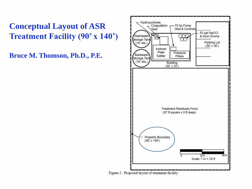
Conceptual Layout of ASR
Treatment Facility (90’ x 140’)
Bruce M. Thomson, Ph.D., P.E.
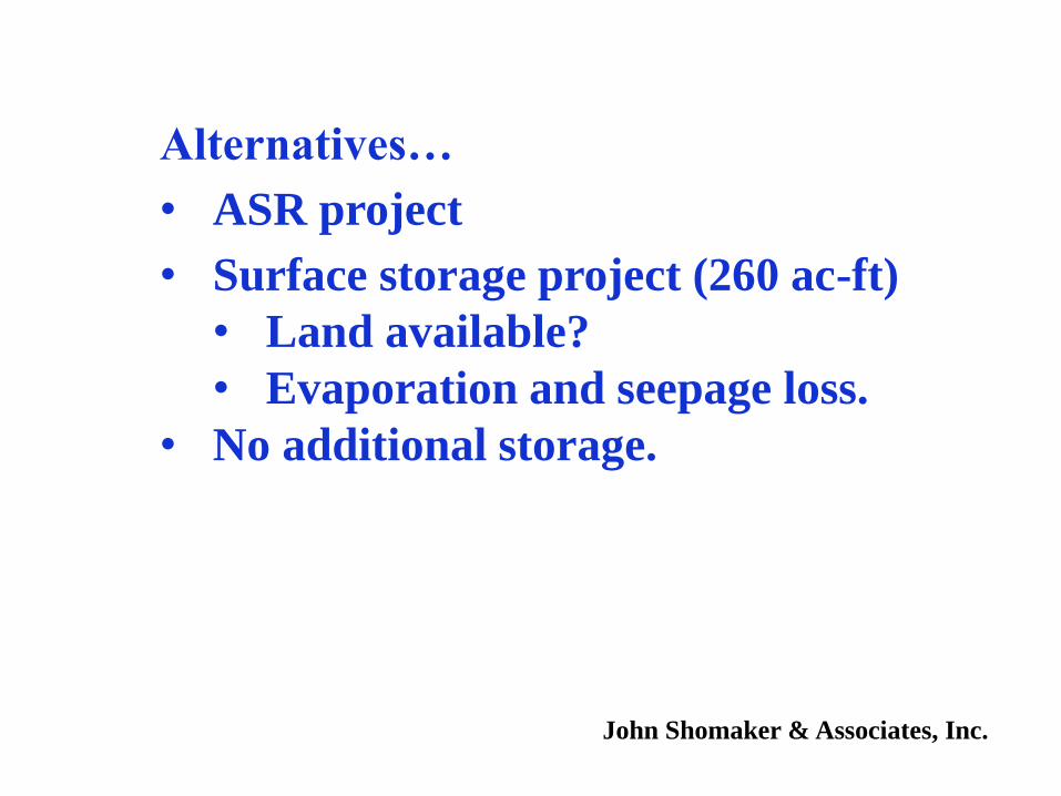
Alternatives…
• ASR project
• Surface storage project (260 ac-ft)
• Land available?
• Evaporation and seepage loss.
• No additional storage.
John Shomaker & Associates, Inc.
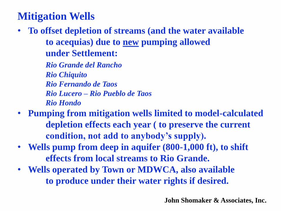
Mitigation Wells
• To offset depletion of streams (and the water available
to acequias) due to new pumping allowed
under Settlement:
Rio Grande del Rancho
Rio Chiquito
Rio Fernando de Taos
Rio Lucero – Rio Pueblo de Taos
Rio Hondo
• Pumping from mitigation wells limited to model-calculated
depletion effects each year ( to preserve the current
condition, not add to anybody’s supply).
• Wells pump from deep in aquifer (800-1,000 ft), to shift
effects from local streams to Rio Grande.
• Wells operated by Town or MDWCA, also available
to produce under their water rights if desired.
John Shomaker & Associates, Inc.
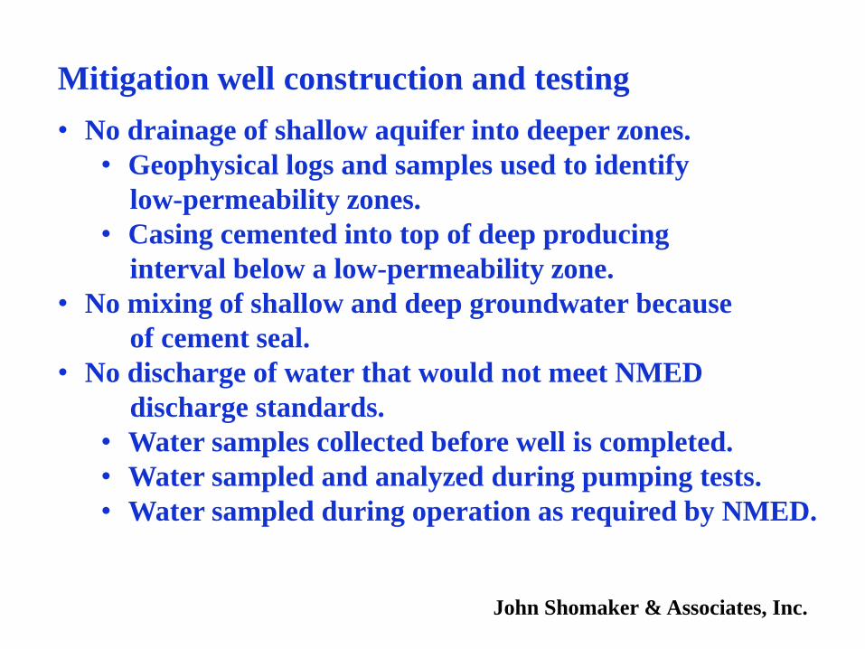
Mitigation well construction and testing
• No drainage of shallow aquifer into deeper zones.
• Geophysical logs and samples used to identify
low-permeability zones.
• Casing cemented into top of deep producing
interval below a low-permeability zone.
• No mixing of shallow and deep groundwater because
of cement seal.
• No discharge of water that would not meet NMED
discharge standards.
• Water samples collected before well is completed.
• Water sampled and analyzed during pumping tests.
• Water sampled during operation as required by NMED.
John Shomaker & Associates, Inc.
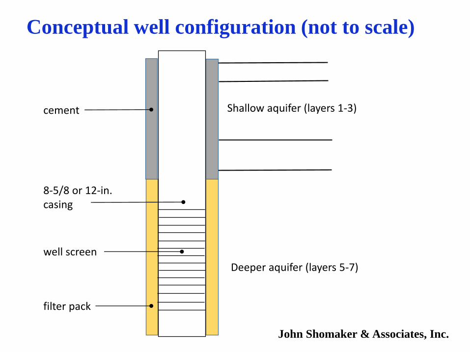
Shallow aquifer (layers 1-3)cement
8-5/8 or 12-in. casing
well screen
filter pack
Deeper aquifer (layers 5-7)
Conceptual well configuration (not to scale)
John Shomaker & Associates, Inc.
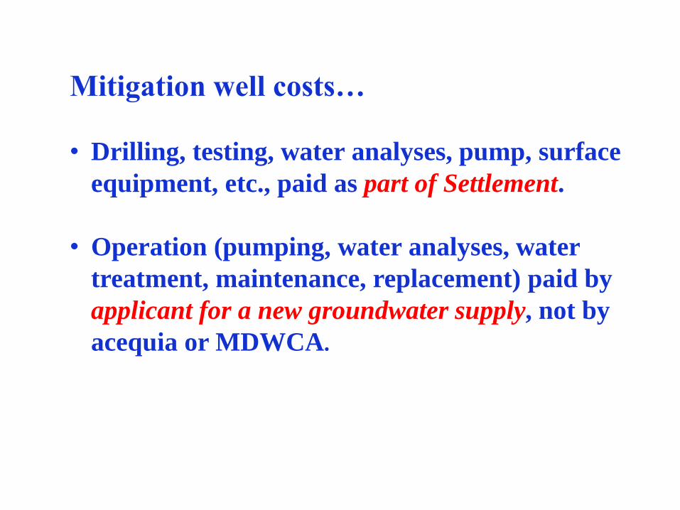
Mitigation well costs…
• Drilling, testing, water analyses, pump, surface
equipment, etc., paid as part of Settlement.
• Operation (pumping, water analyses, water
treatment, maintenance, replacement) paid by
applicant for a new groundwater supply, not by
acequia or MDWCA.
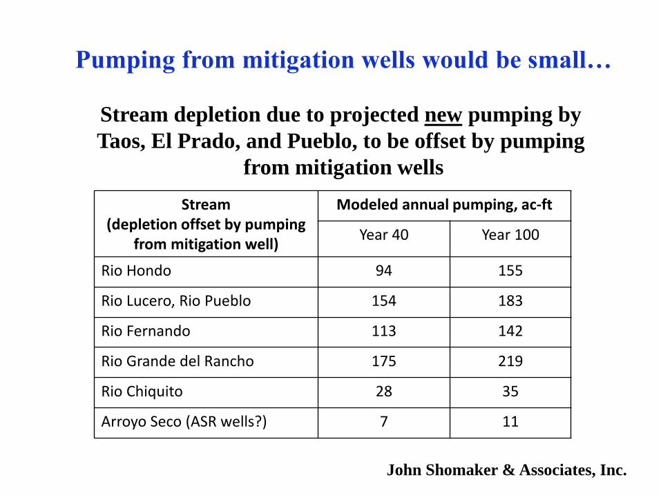
Pumping from mitigation wells would be small…
Stream depletion due to projected new pumping by
Taos, El Prado, and Pueblo, to be offset by pumping
from mitigation wells
Stream (depletion offset by pumping
from mitigation well)
Modeled annual pumping, ac-ft
Year 40 Year 100
Rio Hondo 94 155
Rio Lucero, Rio Pueblo 154 183
Rio Fernando 113 142
Rio Grande del Rancho 175 219
Rio Chiquito 28 35
Arroyo Seco (ASR wells?) 7 11
John Shomaker & Associates, Inc.
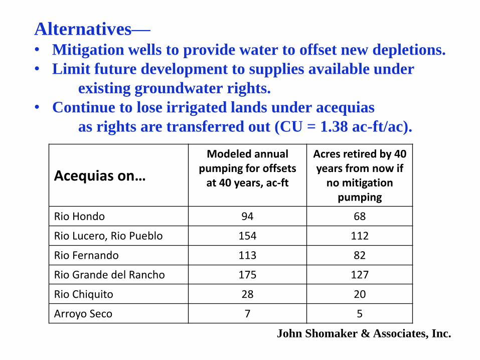
Alternatives—• Mitigation wells to provide water to offset new depletions.
• Limit future development to supplies available under
existing groundwater rights.
• Continue to lose irrigated lands under acequias
as rights are transferred out (CU = 1.38 ac-ft/ac).
John Shomaker & Associates, Inc.
Acequias on…
Modeled annual pumping for offsets
at 40 years, ac-ft
Acres retired by 40 years from now if
no mitigation pumping
Rio Hondo 94 68
Rio Lucero, Rio Pueblo 154 112
Rio Fernando 113 82
Rio Grande del Rancho 175 127
Rio Chiquito 28 20
Arroyo Seco 7 5
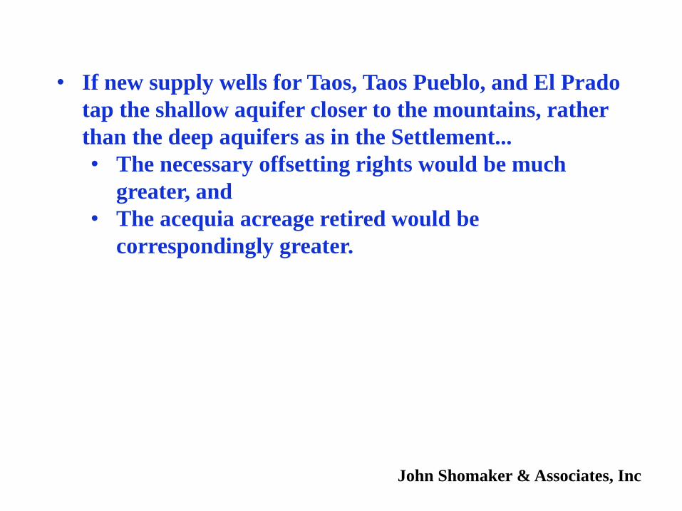
• If new supply wells for Taos, Taos Pueblo, and El Prado
tap the shallow aquifer closer to the mountains, rather
than the deep aquifers as in the Settlement...
• The necessary offsetting rights would be much
greater, and
• The acequia acreage retired would be
correspondingly greater.
John Shomaker & Associates, Inc
Taos Settlement: Domestic Wells
• Total shallow-aquifer drawdowns associated with all groundwater pumping under Settlement are less than 10 feet after 40 years.
• Protection of flows in streams and the acequia system helps maintain shallow-aquifer recharge.
John Shomaker & Associates, Inc.