Embed Size (px)
Citation preview

Hurricanes

And finally…
• JOURNAL COLLECTION
• How they develop• What they’re like• Where to find them• Andrew or Isabel
• Important test and other information

Tropical Wave in the Easterlies

Conditions for Tropical Wave Development
• The wave must be north or south of the equator.– Coriolis force is zero at the equator.
• Conditional Instability• Weak vertical shear
– This is different from what we want in the mid-latitudes.
• Warm sea-surface temperatures (SST)– Typically SSTs are greater than 26oC

Hurricane Development• Convergence at the surface leads to
convergence of moisture.
• The convection or thunderstorms that form release latent heat which intensifies the surface low.
• The warm core column of air will create an upper level high pressure center.
• The weak shear allows the storm to remain vertical and allows for the latent heat release to enhance the surface low.

Tropical Wave Development• Tropical Disturbance
– A collection of thunderstorms with a slight circulation.
• Tropical Depression– Closed circulation– Wind speeds between 20-34 knots.
• Tropical Storm– Closed circulation– Wind speeds between 35-64 knots.– The storm is named.

A Developing Tropical Depression!
TD #2

Hurricane Development
L
H
Heating
The energy for the growthof the storm comes fromthe ocean (evaporation).
Low shear will keep theheating in the core to remain
above the surface convergence.
Strong shear would rip thestorm apart.
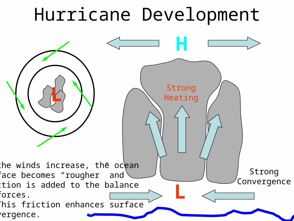
Hurricane Development
L
L
H
StrongHeating
As the winds increase, the oceansurface becomes “rougher” andfriction is added to the balanceof forces. This friction enhances surfaceconvergence.
StrongConvergence

Hurricane StructureThis feedback mechanism continues as long as the favorable conditions for
hurricane growth continue to exist.

Growth, Intensity, Cloud Structure
• Hurricanes build high cloud towers right before they intensify.
• The clouds in this picture have reached 59,000 feet above sea level.
• The image was taken by radar aboard the Tropical Rainfall Measuring Mission spacecraft.
Hurricane Bonnie – www.discovery.com

Hurricane Development• This feedback mechanism is called
CISK:– Conditional Instability of the Second Kind
• The Eye is the central region of the hurricane.– It is often cloud free and has relatively calm
winds.– The eye is associated with subsidence
that, in the strongest storms, keeps the eye cloud-free.

Eye of the Storm

Eye of the Hurricane
• The eye is an area of calm at the center of the storm
• Around the eye is the eye-wall
• This is where the strongest winds and heaviest rain is found

No eye
NOAA-12AVHRR
Channel 3

Birthplaces of Hurricanes
Hurricane birthplaces are near the equator but between 5-15 degreeslatitude away from the equator. The paths tend to be easterly as the
hurricanes develop and grow.

Hurricane Naming
• For some strange reason hurricanes are given names
• The lists are drawn up in advance and annual seasons start with a storm beginning with A
• Typhoons are given alphanumeric codes
• Hurricanes that bring back bad memories have their names retired

Other stuff
• Test: Pencil, eraser, ID (nothing else)
• Atmos majors please stay behind (for the last time)
• Justin’s office hours next week– MTW 12 – 2pm

Hurricane Tracking and Forecasting using GOES

Hurricane hunters

Hurricane hazards
• Strong Winds
• Typical hurricane winds are about 90 mph
• Winds can reach 200 mph
• Hurricanes are often found to have tornadoes within them

Hurricane hazards
• Storm surge– Atmospheric pressures at the center of
hurricanes is very low (have been measured below 900mb)
– This low pressure makes the sea surface rise– This can cause coastal flooding
• Waves– The strong winds can generate very large
waves

Hurricane hazards
• Intense and prolonged rainfall over the coastal area can cause rivers to flood
• The combination of raised sea level, high waves and river flooding creates the greatest danger from hurricanes

Area Covered
NOAA-12AVHRR
Channel 3


Saffir-Simpson Scale
Cat Pressure
(mb)
Wind speed (mph)
Storm surge (ft)
Damage
1 >980 74-95 4-5 Minimal
2 965-979 96-110 6-8 Moderate
3 945-964 111-130 9-12 Extensive
4 920-944 131-155 13-18 Extreme
5 <920 >155 >18 Catastrophic
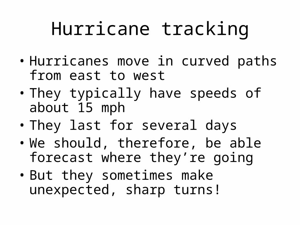
Hurricane tracking
• Hurricanes move in curved paths from east to west
• They typically have speeds of about 15 mph
• They last for several days• We should, therefore, be able forecast
where they’re going• But they sometimes make unexpected,
sharp turns!

Summary
• Hurricanes are the most powerful storms
• Single hurricanes can cause more devastation than any other form of weather
• The great red spot on Jupiter is a hurricane