Embed Size (px)
Citation preview

Greg Short Managing Director
Town Planner PIA
HOW TO READ DIFFERENT PLAN FORMATS AND DEFINITIONS OF LOTS & COMMON PROPERTY
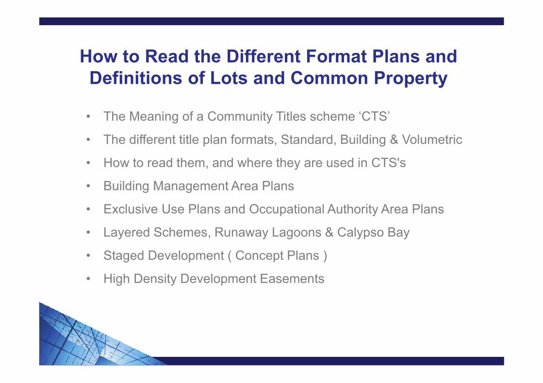
How to Read the Different Format Plans and Definitions of Lots and Common Property
• The Meaning of a Community Titles scheme ‘CTS’
• The different title plan formats, Standard, Building & Volumetric
• How to read them, and where they are used in CTS's
• Building Management Area Plans
• Exclusive Use Plans and Occupational Authority Area Plans
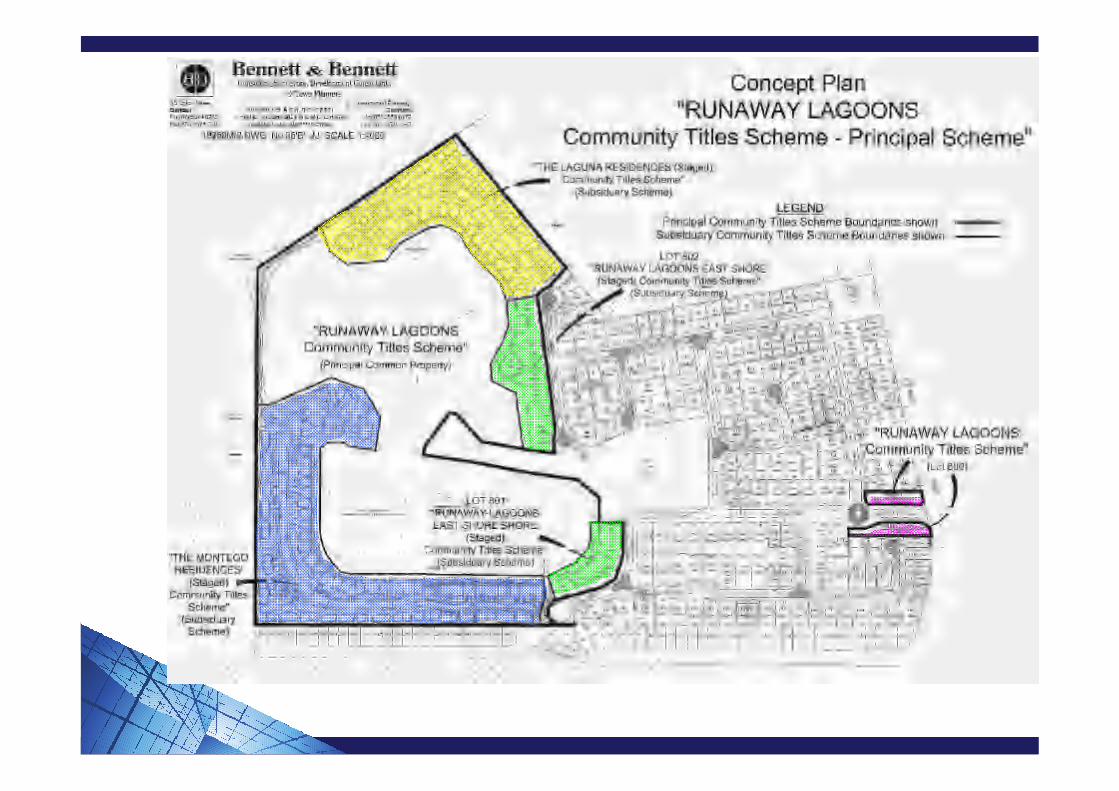
• Layered Schemes, Runaway Lagoons & Calypso Bay
• Staged Development ( Concept Plans )
• High Density Development Easements

Meaning of Community Titles Scheme (BCCM) ActPart 4 Section 10 of the BCCM Act 1997
1. A community titles scheme is:a) A singular community management statement recorded by the
registrar identifying land (the scheme land); and
b) The scheme land
4. For each community titles scheme, there must be-a) at least 2 lots;
b) Common property;
c) A single body corporate; and
d) A single community management statement
Section 66 of the BCCM Act defines the requirements for a Community Management Statement.
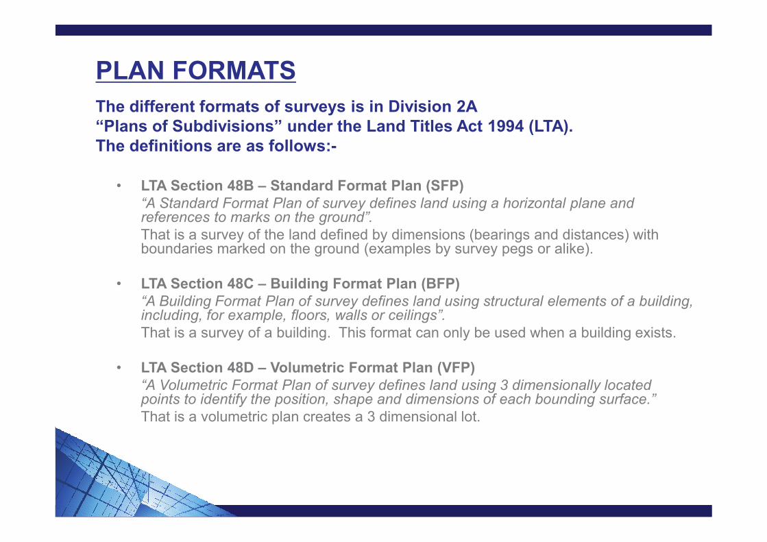
PLAN FORMATS
The different formats of surveys is in Division 2A “Plans of Subdivisions” under the Land Titles Act 1994 (LTA). The definitions are as follows:-
• LTA Section 48B – Standard Format Plan (SFP)“A Standard Format Plan of survey defines land using a horizontal plane and references to marks on the ground”.That is a survey of the land defined by dimensions (bearings and distances) with boundaries marked on the ground (examples by survey pegs or alike).
• LTA Section 48C – Building Format Plan (BFP)“A Building Format Plan of survey defines land using structural elements of a building, including, for example, floors, walls or ceilings”.That is a survey of a building. This format can only be used when a building exists.
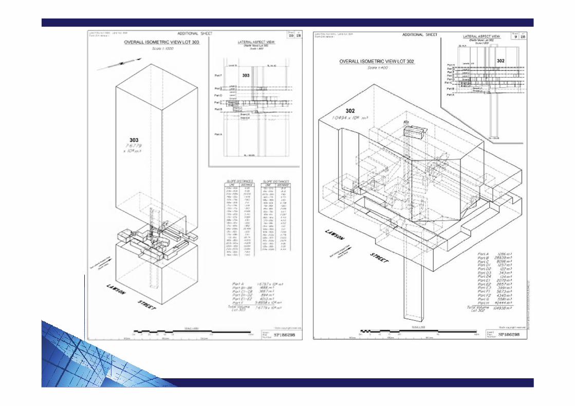
• LTA Section 48D – Volumetric Format Plan (VFP)“A Volumetric Format Plan of survey defines land using 3 dimensionally located points to identify the position, shape and dimensions of each bounding surface.”That is a volumetric plan creates a 3 dimensional lot.

STANDARD FORMAT PLAN – SFP
“A Standard Format Plan of survey defines land by using a horizontal plane and references to marks on the ground.”
• The simplest plan format
• Utilised for subdivision of land within or outside of a Community Titles Scheme ‘CTS’
• Group Titles Plan Lots under the prior legislation are considered Standard Format Lots, as they are defined by dimensions.
• Vertically, SFP Lots extend from the centre of the earth to the heavens.
• Horizontally SFP Lots are defined by dimensions.
• All boundary corners have been marked at one stage.
• SFP Lots can contain original dimensions.


BUILDING FORMAT PLAN – BFP
“A Building Format Plan of survey defines land using structural elements of a building, including for example, floors, walls or ceilings.”
• Well utilised in Community Title Schemes and more complex than SFP’s.• Utilised for the subdivision of a building and they must create a CTS.• In previous legislation, these surveys were Building Units Plans.• Acceptable structural elements (Registrars Directions 9.6)
Floors or ceilings, centre; Walls, full height, centre; Walls, not full height, centre; Doors or windows, centre, other than where incorporated into a wall, when
the boundary would be collinear with the centre of the wall; Balustrades or railings, outer face; Edge of a floor or a concrete base not abutting a wall, outer edge; Corners within a building or structure defined by the centres of posts which
are structurally required for the building or a wall.
• Registrar can approve other structural elements Acceptable structural elements (Registrars Directions 9.6)

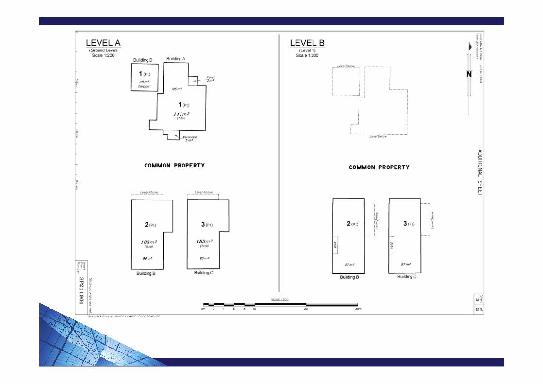
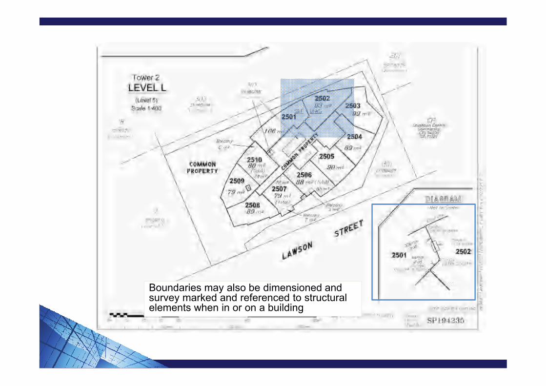
Boundaries may also be dimensioned and survey marked and referenced to structural elements when in or on a building.
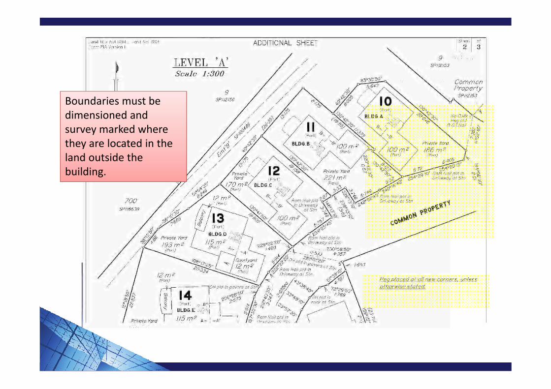
Boundaries must be dimensioned and survey marked where they are located in the land outside the building.

Vertical boundaries on roofs to be defined by a distance above the roof, where there is no ceiling of an adjoining lot.

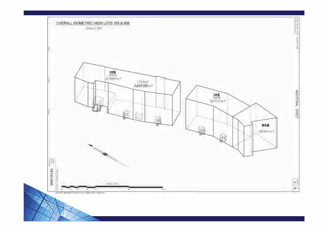
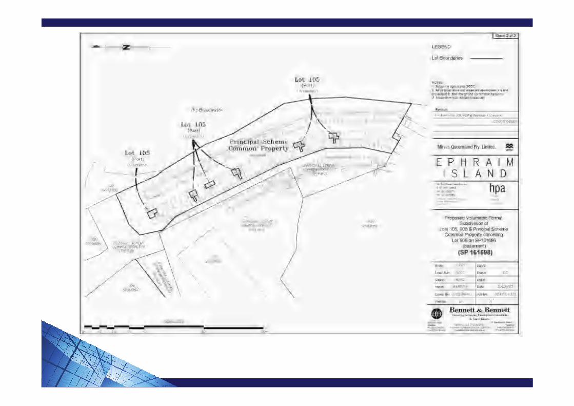
VOLUMETRIC FORMAT PLAN – VFP“A Volumetric Format Plan of survey defines land using 3 dimensionally located points to identify the position, shape and dimensions of each bounding surface.”
• The most complex format and least understood.• Utilised for subdivision of land within or outside of a CTS.• No prior legislation for this format, save for a few specialist Acts (e.g. HSP
Nominees Act, Southbank Act).• Volumetric Surveys do not need structural elements.• All dimensions horizontally and vertically are defined on the plan of survey.• Typically used in large scale mixed use projects, but this is not mandatory.• VFP are ideal where different land use ownership is required within or around a
building.• Extremely flexible in their potential shape, which allows developers to create a
title around anything.• The first VFP out of a Standard Format Parcel always creates a Standard
Format Remainder Lot.• Not all boundary corners will be marked, due to inaccessibility.• Marks may not always remain.• VFP Lot boundaries can contain original information.• Surveyors normally work through the building in slices to resolve the extent of
the volumetric Title


BUILDING MANAGEMENT STATEMENT PLANS -BMS
• The BMS is a document that regulates areas of the building shared between different volumetric lot owners
• Integral part of Volumetric Survey
• Plans define areas as described in the Building Management Statement

EXCLUSIVE USE PLANS
• Exclusive Use can be done by Document where not readily accessible & easily defined by description (e.g. sign of roof, outside face of building)

• Exclusive Use can be done by simple sketch, where not readily accessible and simple sketch provides sufficient clarity (e.g. tenant sign board)

All other Exclusive Use Plans are defined by detailed sketch in accordance with Registrars Direction.
Exclusive Use Plans have to be defined so there are no ambiguities in the area being defined.
Boundaries are defined by:-
• Structural elements (walls, balustrades, edge of concrete floor and centre of fences);
• References to structural elements where the exclusive use are in generally rectilinear (e.g. carparks);
• Marking the corners with survey marks and delineating by dimensions;• Any combination of the above;• Exclusive Use plans do not need to be prepared by a cadastral surveyor,
unless they have boundaries by dimensions;• Body corporate committee members are acceptable to prepare exclusive
use plans but not the Body Corporate Manager (Direction 11.11.16);• All plans are to be certified as being correct (i.e. in accordance with the
Registrars Directions)


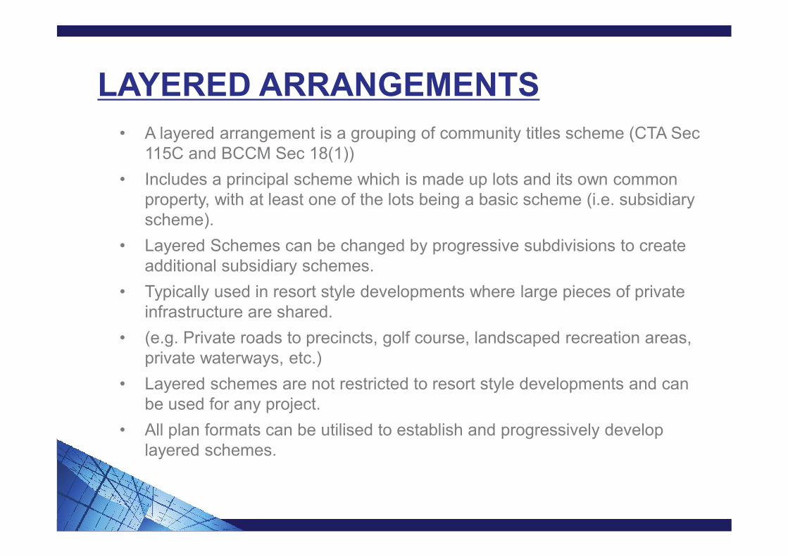
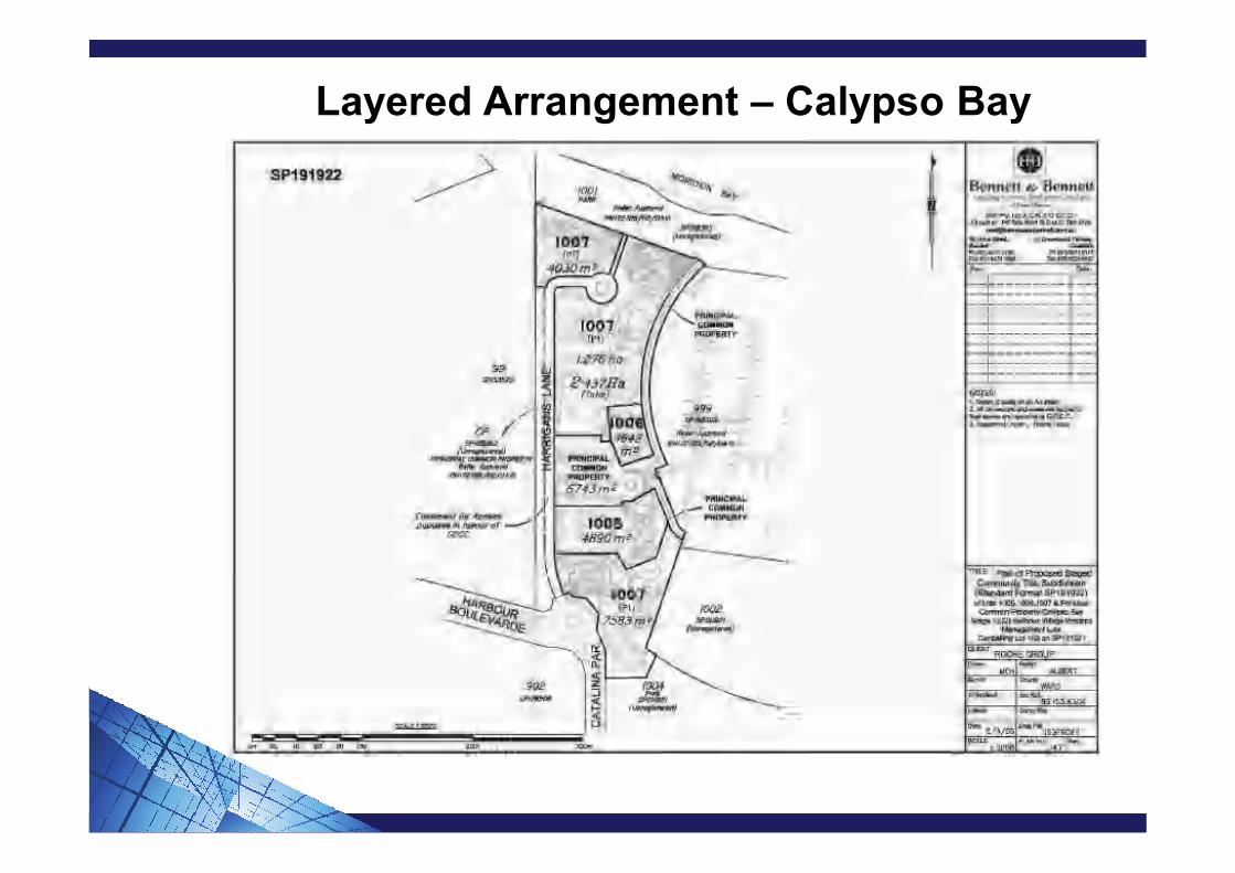
LAYERED ARRANGEMENTS
• A layered arrangement is a grouping of community titles scheme (CTA Sec 115C and BCCM Sec 18(1))
• Includes a principal scheme which is made up lots and its own common property, with at least one of the lots being a basic scheme (i.e. subsidiary scheme).
• Layered Schemes can be changed by progressive subdivisions to create additional subsidiary schemes.
• Typically used in resort style developments where large pieces of private infrastructure are shared.
• (e.g. Private roads to precincts, golf course, landscaped recreation areas, private waterways, etc.)
• Layered schemes are not restricted to resort style developments and can be used for any project.
• All plan formats can be utilised to establish and progressively develop layered schemes.
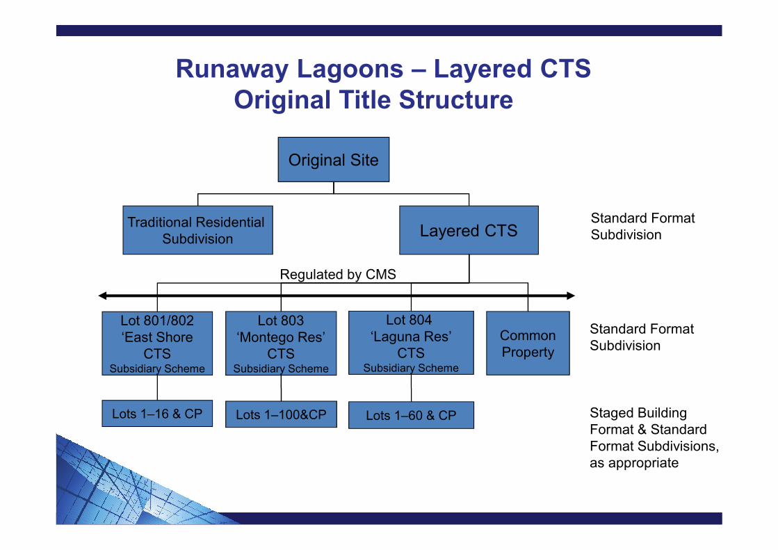
Runaway Lagoons – Layered CTSOriginal Title Structure
Lot 801/802‘East Shore
CTSSubsidiary Scheme
Lot 803‘Montego Res’
CTSSubsidiary Scheme
Lot 804 ‘Laguna Res’
CTSSubsidiary Scheme
CommonProperty
Traditional Residential Subdivision
Layered CTS
Original Site
Standard FormatSubdivision
Standard FormatSubdivision
Lots 1–16 & CP Lots 1–100&CP Lots 1–60 & CP Staged Building Format & Standard Format Subdivisions, as appropriate
Regulated by CMS


Layered Arrangement – Calypso Bay
PBC
1 – 92 etc.
CPRES
LANDCTS
CALYPSOBAY
APARTMENTS
DEV.LOTS
HARBOURVILLAGE
PBC
SUBMERGEDHARBOUR
LOT
SUPERMARKETLOT
CommonProperty
BoardwalkVillas CTS
Lot 2Commercial
Lot
Lot 3Commercial
Lot
Lot 4Commercial
Lot
CommonProperty
LotsCP
WaterfrontMarina
Apartments
Common Property
Key SiteCTSEtc.
CP Lots CP Lots
TAVERNLOT
To be progressively subdivided
To be progressively subdivided
To be progressively subdivided into further subsidiary scheme

Layered Arrangement – Calypso Bay
Layered Arrangement – Calypso Bay

Layered Arrangement – Calypso Bay
STAGED DEVELOPMENT (CONCEPT PLANS)
• Reasons for staging (i.e. Development Cashflow, construction completion times, flexibility for project modification due to changed market).
• Typically staging involves leaving a balance development lot, which is usually SFP or VFP.
• Building Format Plans can also create a Standard Format balance development lot.
• Schedule B of the CMS provides the relevant explanation for the progressive development of scheme land.
• Schedule B is often accompanied by a Concept Plan.
• Staging can also occur by bringing land into the scheme from outside of the scheme. This is the most flexible method for developers as their development parcels are not contained within the scheme.
• Where developers propose to leave future development land outside the scheme, they need to ensure they retain an interest (at least 1 lot) in the scheme.


HIGH DENSITY DEVELOPMENT EASEMENTSDivision 4AA Land Title Act 1994
• High Density Statutory Easement Legislation introduced for Standard Format lots under 300m2 – June 2013
• The Legislation applies to the principles of Statutory Easements for lots in a Community Titles Scheme (CTS) of support, shelter, projections, maintenance to attached townhouses not in a CTS
The Benefits
• A Community Titles Scheme does not need to be created
• Party wall easements are not required
• Cost savings, through less documentation and simpler ownership structure
“At the time we bought we didn’t know what an easement was”


Thank you for your attention
Greg Short – Town Planner