Embed Size (px)
Citation preview
1ESTUARYESTUARY
SAN FRANCISCO
W A T E R
E N V I R O N M E N T
C L I M A T E
E Q U I T Y
DECEMBER 2020
NEWS MAGAZINE
VOL. 29, NO. 4
ONLINE FEATURES
WWW.SFESTUARY.ORG/
ESTUARY-NEWS
How the Great Flood of 1862 Inspired Measure AA
A 1901 Ferry Crash
The Legacy of Sediment from the Gold Rush and Water Wealth Concentrated in Old Irrigation Districts
Girl Ranger Saves Watershed from Fire
A Duck Rare in the 1920s Now Common
Reporters Ask What Happened Next? Following Up on 11 Past Stories
DECEMBER 2020ESTUARY2
EDITOR’S DESKThis year has been so uncertain and
so unpleasant in so many ways, Estuary News decided to lighten up a bit for the December 2020 issue. We looked into some long-ago disasters and missteps for historical touchstones, and delved a little into how this colorful history relates to present times. It is from yes-terday’s floods, fires, crashes, and even human prejudice, now seen at a dis-tance, that we gain perspective beyond the Zoom meets and 275-character tweets of today.
Then instead of cute kittens we find solace in the local birds—bringing you good news as cormorants and terns expand nesting, and as waterfowl continue to stop over on their migrations, with some rarities now more common than in centuries past, and vice versa. Finally, because we are reporters with long attention spans, and because news in an estuary ecosystem is often an ever-changing story, we offer you updates on some of our past stories.
You will also notice how short this issue is. As men-tioned above, we don’t want to load you up with weighty reading material. But we are also sorely short of pub-lication funding as partners come and go or juggle shrinking budgets. As such, this issue will only appear online (though we are printing paper copies on demand, email me your address if you’d like one).
Hang tight, we are looking forward to a fresh start and reset next year. In the meantime, thank you to all of our partners and supporters, especially those who’ve been able to increase their support this year to cover the gap. Perhaps you’d like to join them?
Stay well and visit the water often!
Ariel Rubissow Okamoto
Thank Youwww.sfestuary.org/estuary-news/magazine-funders/
Virtual RMP Annual Meet Shows Real-Life Success
Instead of a fancy room with plush seats, a catered lunch, and speakers at a podium sharing their PowerPoints on a big screen, attendees at the 27th Annual Meeting of the Regional Monitoring Program experienced the report-out entirely virtually on their own computer screens, thanks to the Covid pandemic. Nevertheless, and despite Zoom burnout, the October event was a success, with many attendees voicing a preference for the virtual format.
“I think they did a great job of pulling the whole program together,” says RMP science advisor Maggie Dutch of the Washington State Department of Ecology. “The only thing I missed out on is the face-to-face conversations that you have afterwards, which are always really valuable.”
The format was not the only departure from business as usual; event organizers mixed things up by featuring expert speakers from beyond the Bay Area, who shared lessons from monitoring in Puget Sound and Chesapeake Bay. Attendees also heard about monitoring coronavirus and disinfectant chemicals in wastewater, managing sedi-ment quality and supply, and monitoring CECs in stormwa-ter and PFAS in the Bay, among other topics. The biennial RMP Update report, which provides a summary of RMP activities over the past two years, was released on the day of the meeting. The presentations and resources are avail-able on the Annual Meeting web page.
DEEPER DIVE
For a more detailed version of this story...
www.sfestuary.org/estuary-news-virtual-RMP-meet/
N E W P O D C A S T
Putting Nature, Not People, in the Path of Sea Level Rise Science-in-Short Series Interview with Julie Beagle
In this podcast, Estuary News reporter John Hart draws out Julie Beagle, a lead scientist at the San Francisco Estuary Institute, on ways of defending Bay shores in the era of sea level rise. Beagle describes several kinds of “nature-based” treatments that can delay and soften the onslaught; her special interest is in
the placement of wave-absorbing “coarse beaches.” She also addresses the problem of scale. While individual local governments like cities are typically too small to grapple with shared flooding problems, a unified regional vision is an elusive dream. Beagle urges cooperation at a middle level, organized around logical reaches of shoreline called Operational Landscape Units. The concept is gaining ac-ceptance. The Institute maintains an online Adaptation Atlas, suggesting a menu of treatments suited to each specific stretch of shore. Along the way, Beagle describes how her own focus widened from natural systems alone to the people likely to be displaced by rising tides and other effects of climate change. “These are wicked scary prob-lems when it’s people’s lives on the line,” she says. After 10 years with SFEI, Beagle moves to a new position with the Army Corps of Engineers early in 2020.
Podcast: www.sfestuary.org/science-in-short-podcast-julie-beagle-sea-level-rise/

ROBIN MEADOWS, REPORTER
When Hurricane Sandy hit New York City in 2012, it was a wake-up call for Bay Area Council members, who were glued to coverage of the devasta-tion from their tenth floor offices near San Francisco’s Ferry Building. “We were watching the subways fill up with water,” recalls Adrian Covert, vice president of public policy for the busi-ness-backed nonprofit, which helped lead the 2016 Measure AA campaign that will fund flood protection projects associated with habitat restoration. “We all looked out the window and saw all that water in the Bay.” They asked themselves if the disaster unfolding 3,000 miles away could strike here too.
Covert and his colleagues real-ized the answer was yes when they learned about the Great Flood of 1862, the worst in California’s recorded history. Heavy rains fell statewide on Christmas Day 1861, and kept pour-ing through January 1862, “just shy of the proverbial 40 days and 40 nights,” wrote meteorologists Jan Null and Joelle Hulbert in California Washed Away: the Great Flood of 1862. The rain was so warm it melted the snowpack in the Sierra Nevada, pushing the snow line up thousands of feet.
Between the rain of biblical pro-portions and the unseasonable snow melt, “every creek and rivulet became a rushing torrent, sweeping the hopes of men and everything destructible before it,” according to eyewitness accounts reported in a January 1862 California Farmer and Journal of Use-ful Sciences editorial. The Sacramento River topped its low water mark by 24 feet, and the American River rose even higher, topping its low water mark by 60 feet. The Central Valley, surrounded on all sides by mountains, rapidly filled with water. “The whole country, as far as the eye could reach, was one vast surging sea, covered with drifting debris and struggling animals,” the editorial continued. “This desolation extended over an area of 300 miles long by 40 or 50 broad.”
The only outlet to the ocean for all that water was the San Francisco
Bay, and a mind-boggling volume shot through the Golden Gate Strait. The city of San Francisco was already drowning under the 34 inches of rain that fell there during the Great Flood. Much of the land ringing the Bay was under water, and roads and bridges were swept away. Flooding was even worse in Sacramento, so the state capitol tem-porarily relo-cated to San Francisco’s Merchants Exchange Building at the corner of Battery and Washington streets.
A similar scenario played out in a US Geo-logical Survey model called ARkStorm, which posits a 1,000-year atmospheric river event. An ARkStorm could inundate the Bay Area, other coastal communities, and the Central Valley, at a cost up to $725 billion in damages—nearly triple that of a major Southern California earth-quake in the USGS ShakeOut scenario. In Atmospheric Rivers (Springer 2020), former USGS hydroclimatologist Mike Dettinger and colleagues detail the intense precipitation and consequent flooding from these extreme rain-storms.
In 2015, the Bay Area Council’s Economic Institute modeled the re-gional impact of a storm that drops 12 inches of rain over seven days, which is considerably smaller than either the Great Flood or an ARkStorm. The resulting report, Surviving the Storm, put the cost at more than $10 billion in damages. This is similar to the cost of the 1989 Loma Prieta earthquake, which fractured the Bay Bridge and
collapsed freeways. “This made the economic case for Measure AA,” Co-vert says. “You can do a lot to decrease the risk for $500 million.” Measure AA, which Bay Area voters passed in 2016, will raise half a billion dollars over 20 years to restore the tidal marshes that protect against flooding.
We’re well on our way. A few de-cades ago, the Bay was down to about 38,000 acres of tidal wetland, barely over one-third of the 100,000-acre goal. Since then another 18,000 acres have been restored to tidal action, and an additional 18,000 acres are current-ly in the planning or acquisition stages, according to the latest State Coastal Conservancy figures. Altogether, that puts us on track for 74,000 acres—al-most exactly three-quarters of the total salt marsh we need to weather the next great flood.
CONTACT: [email protected]; [email protected]
3
F L O O D
How the Great Flood of 1862 Inspired Measure AA
Flood of 1861-62 in Sacramento. Photo: Eugene Walter Hepting, Courtesy Calisphere.
DECEMBER 2020ESTUARY4
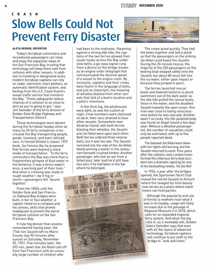
ALETA GEORGE, REPORTER
Today’s ferryboat commuters and recreational passengers can relax and enjoy the expansive views of the San Francisco Bay, trusting that technology will keep them safe from collision with other vessels. In addi-tion to traveling in designated lanes, modern ferryboat captains can rely on radar, electronic chart plotters, an automatic identification system, and backup from the U.S. Coast Guard’s vessel traffic service that monitors the Bay. “These safeguards reduce chances of a collision to as close to zero as you’re going to get,” says Jim Swindler of the ferry division of Golden Gate Bridge Highway and Transportation District.
These technologies were absent during the ferryboat heyday when as many as 25 ferry companies criss-crossed the Bay transporting people, goods, livestock, and even railroad cars. In Harold Gilliam’s classic 1957 book, San Francisco Bay, he proposed that ferries went beyond a mere mode of transportation. “To the ferry commuters the Bay was more than a fragmentary glimpse of blue water in the distance; it was a direct experi-ence, a working part of their lives.” And when a crossing was made in rough weather—be it fog or storm—passengers felt “bound together.”
From the 1850s until the Golden Gate and San Francis-co-Oakland Bay bridges were built, in fair or foul weather, a captain relied on a compass and his senses, skills that proved inadequate to prevent the worst ferryboat collision on the San Francisco Bay.
In tule fog denser than anyone remembered having seen, the 1766-ton Sausalito left its Marin County slip 90 minutes after sunset on Saturday, November 30, 1901. Five minutes later, the 692-ton, jewel-box San Rafael cast off from San Francisco with an unusu-ally large number of children who
had been to the matinees. Steaming against a strong ebb tide, the cap-tains of the two ferries plowed their usual routes across the Bay under slow bells, a go-easy signal rung from a device on the bridge known as an engine order telegraph that communicated the desired speed of a vessel to the engine room. By necessity, captains and their crews were fluent in the language of bells, and just as important, the meaning of whistles blasted from other ves-sels that told of a boat’s location and a pilot’s intentions.
In the thick fog, the pilothouses were dark, as was the custom at night. Crew members were stationed on deck, their ears strained to hear other vessels. Somewhere near Alcatraz Island, with both ferries blasting their whistles, the Sausalito and San Rafael were upon each other. Both ferries ordered three reverse bells, but it was too late. The Sausalito rammed into the side of the San Rafael, fatally pinning a waiter in the restau-rant beneath crushed timber. Another passenger, who lost an ear from a felled post, later said he’d still have two ears if he had been in the bar where he belonged.
The crews acted quickly. They tied the boats together and laid a plank so that the passengers on the sinking San Rafael could board the Sausalito. During the 20-minute rescue, the majority of the 250 passengers on the keeling boat stepped safely onto the Sausalito, but about 80 souls fell into the icy water, either upon impact or because they jumped in panic.
The ferries launched rescue boats and lowered lanterns to pluck swimmers out of the dark water as the ebb tide pulled the rescue boats, those in the water, and the disabled Sausalito towards the open ocean. One man was close to losing conscious-ness before he was rescued. Another wasn’t so lucky. His life-jacketed body was found on Angel Island a few days later. Without a detailed passenger list, the number of casualties could only be estimated, with up to five people reported dead.
The beloved San Rafael went down with her lights still burning, but the Sausalito returned to work. Four years after the collision Jack London trans-formed the infamous ferry boat acci-dent into a dramatic opening for one of his bestselling novels, The Sea Wolf.
In 1934, a year after the bridges opened, the Sportsmen Yacht Club moved the retired Sausalito to Antioch where the ravaged-by-time beauty now serves as a place where water lovers can hold parties.
Although the popularity and use of ferries is nowhere near what it was in its heyday, usage will likely increase due to the passage of Regional Measure 3 in 2018, which calls for an expanded regional ferry system. And when the fog rolls in, as it inevitably will, Golden Gate’s Swindler says that even with all the layers of advanced technology, ferryboat captains will continue to put staff on the bridge to “look and listen.”
C R A S H
Slow Bells Could Not Prevent Ferry Disaster
5
DANIEL MCGLYNN, REPORTER
Shortly after the new year began in 1848, a carpenter was working on a saw mill at Sutter’s Mill on the South Fork of the American River. He noticed a few gold pickers in the calm reaches of the river. And then a few more.
At first, the find was kept to a whis-per mainly for reasons of self interest. Eventually word got out, and news of the discovery—and of the bounty of California’s rivers—was broadcast around the world. By 1849, people from all corners of the planet began securing passage on ships bound for Monterey and San Francisco, the two main jumpoff points for the gold fields that lay on the shoulders of the Sierra Nevada. By the time it had run its course, the California Gold Rush would trigger one of the largest hu-man migrations in history.
The fortune seekers brought with them new ideas about how to make a living—and created the ethos of Cali-fornia as a forward-thinking land of opportunity long before Silicon Valley. But the leap into a future paved with gold came with consequences. There was conflict, and in some cases, dis-placement of people who had arrived earlier. The Gold Rush also had dra-matic environmental impacts, many of which linger today.
By 1853, the idea that a prospec-tor could pick nuggets out of Califor-nia’s rivers and streams had all but vanished. Plenty of gold remained, but as fine flakes—gold mixed with alluvial material washed down out of the Sierra over the thousands of years. To extract the dust-like mate-rial at scale, miners developed new techniques. High pressure water cannons, called hydraulic monitors, replaced hand panning to quickly strip sandy overburden and get to paydirt—a layer of gold-laden gravel. To enhance efficiency, miners added flasks of mercury to long sluice boxes built next to rivers and creeks. The mercury would chemically bind to the finest flecks of gold, helping trap the gold in the sluice’s riffles. The rest of the material—both sediment (called “mining slicken” at the time)
and excess mercury—would wash out of the sluice box and downstream, beginning a journey that would end, eventually, in San Francisco Bay and its main arteries.
So efficient were hydraulic moni-tors at blasting earth that according to a massive (and still often cited) 1917 study of the impacts of the California Gold Rush called Hydraulic Mining Debris in the Sierra Nevada, an estimated 1,146,000,000 cubic yards of sediment was deposited into the San Francisco Bay System between 1849 and 1914, mainly be-cause of mining activity.
By the 1860s, people’s chief con-cern about the increasingly noticeable sedimentation was its impact on the navigability of the Sacramento River. After all, the Sacramento River was the region’s highway. Early in the Gold Rush, sailing ships would arrive at what would become the city of Sacra-mento’s waterfront with people and cargo. The ships would be stripped of sailcloth, hard-ware, and anything else valuable or useful in the pursuit of gold, and then converted to hotels, shops, and in one case, a prison. In short order, and in part to deal with the shoals of sediment popping up along the twists and turns of the Sacramento River, sailing ships were replaced by shallow draft steamers.
Because it was the shortest route and a popu-lar choice among captains, the Middle Fork of the Sacra-mento River be-tween Rio Vista and Sutter Island be-
came known as Steamboat Slough. An account of what the slough was like survives in the travel book Scenes of Wonder and Curiosity in California, published in 1862. “As we pass through Steam-boat Slough, we are impressed with the narrowness of the channel for such large vessels, the luxuriant foli-age of the trees that adorn its banks, and the snug little cabins, nearly shut out from sight by wild vines and trees, that are seen at intervals on its mar-gin. Indeed the scenery, as you steam up or down the river, is picturesque in no slight degree. Here and there, as you turn with the sudden windings of the stream, you come upon the little boats of fishermen, and sloops, with their sails furled like the folded wings of a sea-bird, waiting for the wind.”
M U D
Slickens and Shoals Thicken the Estuary
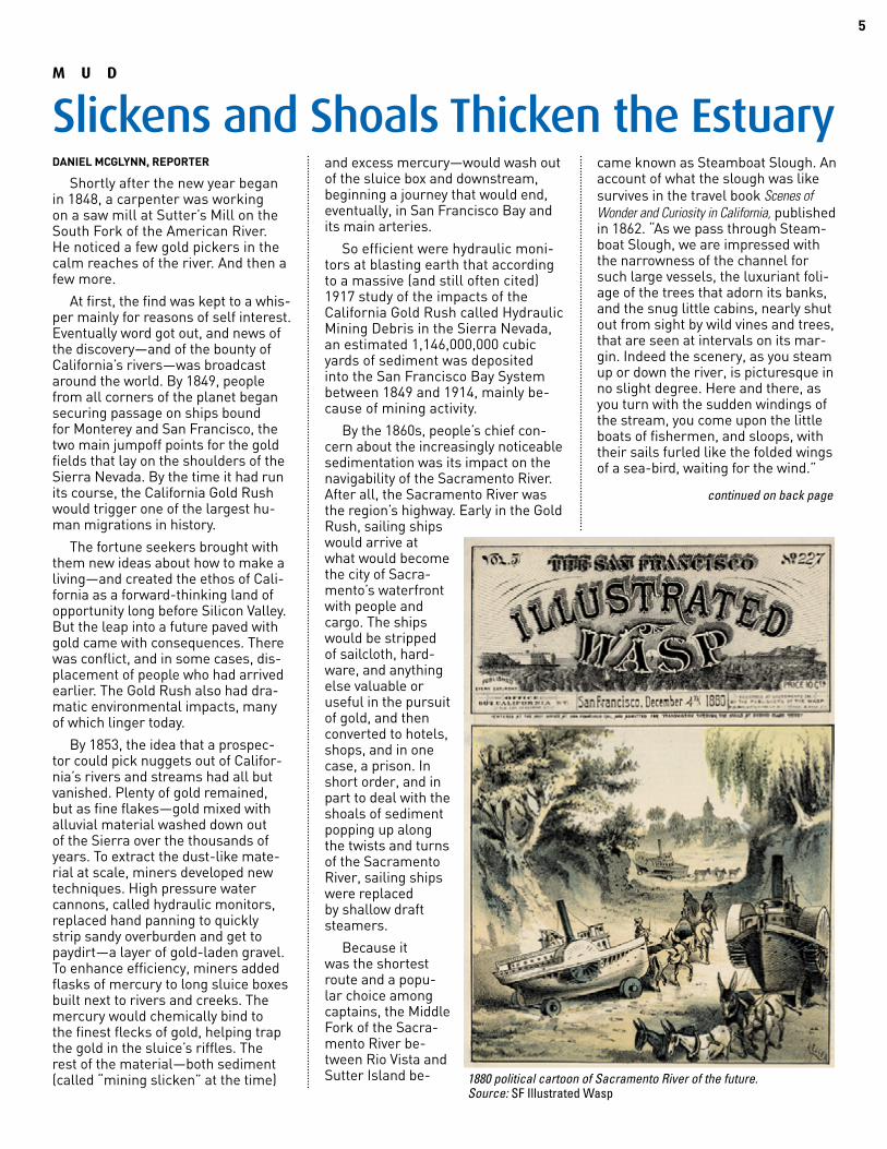
1880 political cartoon of Sacramento River of the future. Source: SF Illustrated Wasp
continued on back page
DECEMBER 2020ESTUARY6
JOE EATON, REPORTER
How many ducks and geese used the Estuary before the Gold Rush? The numbers are beyond conjecture, but they must have been mind-boggling. Observers writing about a hundred years ago noted major decreases during the era of market hunting, when waterfowl were shot to supply the restaurants and stores of California’s emerging cities, but offered no hard numbers. However, they recorded their observations of the abundance and seasonal pres-ence of different species.
Since then, government surveys, Audubon Society Christmas Bird Counts, and sport hunting records show a mix of change and continu-ity, with some duck species either scarce or common in the last century and now, and other common species becoming rare or vice versa. The US Fish and Wildlife Service’s (USFWS) Midwinter Waterfowl Survey has been the most authoritative source on the state of the Bay’s ducks, informing restoration planning. But the survey may be in jeopardy due to shifting priorities and safety con-cerns; its loss would mean a return to the era of guesswork.
The closest we have to a pre-Gold Rush baseline are anecdotes like pioneer George Yount’s description of San Pablo Bay in 1854: “The wild geese and every species of water foul [sic] darkened the surface of every bay…When disturbed, they arose to fly the sound of their wings was like distant thunder…” In another mid-19th-century account, settlers com-plained of being “greatly annoyed by the almost deafening, tumultuous, and confused noises of the innumer-able flocks of ducks and geese…at times blackening the very heavens with their increasing numbers.”
By the 1850s, those multitudes were already being reduced by com-mercial hunting. Before poultry and other livestock were raised for food in California, deer, elk, waterfowl, shorebirds, quail, even songbirds, turtles, and frogs were harvested for sale. One indicator of the impact of market hunting is the number of waterfowl sold in San Francisco:
300,000 in the 1911-12 season alone. The practice was banned in 1915, although “duckleggers” continued to operate for decades afterward. Three years after the ban, Joseph Grinnell, the first director of the University of California’s Museum of Vertebrate Zoology, wrote that waterfowl had “decreased by fully one-half during the past forty years.” Habitat loss also contributed, as tidal and fresh-water wetlands were filled or con-verted to agricultural use.
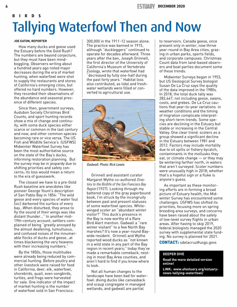
Grinnell and assistant curator Margaret Wythe co-authored Direc-tory to the Birdlife of the San Francisco Bay Region (1927). Looking through my battered copy of the gray paperbound book, I’m struck by the incongruity between past and present statuses of some waterfowl species. White-winged scoter an “abundant winter visitor?” This duck’s presence in the Bay is now worthy of a Rare Bird Alert mention. Gadwall a “rare winter visitant” to a few North Bay marshes? It’s now a year-round Bay-wide resident. Grinnell and Wythe reported wood ducks as “not known in a wild state in any part of the Bay region in recent years;” today they’ve made a remarkable comeback, nest-ing in most Bay Area counties, and aren’t hard to find if you know where to look.
Not all human changes to the landscape have been bad for water-fowl: diving ducks like canvasback and scaup congregate in managed wetlands, and gadwall are partial
to reservoirs. Canada geese, once present only in winter, now thrive year-round in Bay Area cities, graz-ing in urban parks, sports fields, and corporate campuses. Christmas Count data from land-based observ-ers and boat parties document some of these trends.
Midwinter Surveys began in 1953, but US Geological Survey biologist Susan De La Cruz says the quality of the data improved in the 1980s. In 2018, the total duck tally was 282,447, not including geese, swans, coots, and grebes. De La Cruz cau-tions that year-to-year variations in weather conditions and the timing of migration complicate interpret-ing short-term trends. Some spe-cies are declining in the Estuary but stable or increasing in the Central Valley. One clear trend: scoters as a group showed a significant decline in the Estuary between 1981 and 2012. Factors may include mortality due to oil spills or fishery bycatch, contaminants in the mollusks they eat, or climate change — or they may be wintering farther north, in waters that aren’t surveyed. Scoter numbers were unusually high in 2018; whether that’s a hopeful sign or a fluke is anyone’s guess.
As important as these monitor-ing efforts are in forming a broad picture of Estuary health, the Mid-winter Survey has encountered some challenges. USFWS has shifted its priorities, focusing more on spring breeding area surveys, and concerns have been raised about the safety of low-level survey flights in urban areas. After having to skip 2019, federal biologists managed the 2020 survey with supplemental state fund-ing. No survey is planned for 2021.
CONTACT: [email protected]
DEEPER DIVE
Read the more detailed version online!
LINK: www.sfestuary.org/estuary-news-tallying-waterfowl/
Gadwall. Photo: Rick Lewis
B I R D S
Tallying Waterfowl Then and Now

7
ARIEL RUBISSOW OKAMOTO, REPORTER
When the August 16 lightning strikes started forking from the sky to the ground in the Bay Area, Sarah Lenz was driving back from the scene of a vehicle accident and fire. It was pitch dark in the 23,000-acre Crystal Springs watershed in San Mateo County where she is a watershed keeper and super-visor, or what you might think of as a water ranger — something like a park ranger protecting source watersheds for drinking water, not parks.
Lenz’s main responsibility is to be fully present in the watershed when something happens—a first respond-er to crashes, fires, slides, floods, suicides, and trespassers. Crews coming in from the outside would just take too long to get to such events—opening locked gates, getting lost on branching fire roads, not knowing the lay of the land. “It’s always fun at night when I turn on the lights of the patrol vehicle, you might see a fox,” says Lenz, who just turned 50.
Lenz grew up in the Midwest, where thunderstorms are nothing special, so the flashes of light on the horizon on her drive back to the 100-year-old keeper cottage she now inhabits as part of her job didn’t worry her. But when she got home she only took her boots off. “It started storming, not just flashes but really intense wind gusts and lightning strikes. Just as I was ty-ing my shoelaces again so I could drive to higher ground, Cal-Fire called me to get out of there,” she recalls.
It was 2:00 a.m. Lenz checked the lightning strike map on her phone. “I could see in real time where they were hitting,” she says. She also checked wind speeds and humidity at the Spring Valley weather station. Then she donned her fire retardant Nomax suit and climbed in her patrol truck, which carries a fire pumper and 110 gallons of water. She chose a road to a high spot where she could see what was going on in the watershed.
A few minutes later Lenz changed direction to respond to a radio call about a fire on the golf course. “As I came up from the valley around the crest of the hill there was a wall of fire. I was surprised I didn’t know there was fire sooner, but the moun-tain just hid it, flames up at the tops of two pine trees. I checked to see if the scene was safe. I drove around the trees to see if the fire was on both sides, but it was only on one. I let dispatch know I was on Sawyer Ridge. Then fired up my pumper, knocked down the flames in the crown of the trees, and kept the fire contained to one side of road,” says Lenz.
Fire response is one thing that hasn’t changed about the job since the first watershed keepers were hired by Spring Valley Water Company in the late 1800s. Early keepers spent a lot of their time shooting “var-mints,” ejecting poachers, and stock-ing lakes with the favorite fish of the water company’s directors, who used the Crystal Springs area for private
recreation. The City of San Francisco acquired the company in 1930, as well as more than 38,000 acres of East Bay watersheds. Since then keepers have been tasked with everything from checking dams and opening valves to guiding firefighters, police, and more recently Bay Area Ridge Trail hikers, into remote backcountry.
Aiming her hose at the two pine trees this past August, Lenz soon ran out of water and radioed the dispatch-ers she was heading out for more. “We are responsible for any initial at-tack on the fires, we know the layout, the roads, where the water sources and fire hose bibs are. We have all this stuff set up strategically for fire-fighting,” she says.
As the night waned, her co-keep-ers came on duty and began to pitch in, finding four other fires. Two “street engines” from a nearby city respond-ed to the Sawyer Ridge fire, Lenz recalls. Later she brought a Cal-Fire crew to the golf course fire, where they all cut a line with hand tools.
“We had eight lightning strikes in our Peninsula watershed that night, but thanks to Sarah and other keep-ers and responding fire agencies none of them merged into a big fire like the SCU complex in our East Bay watershed,” says SFPUC’s Natural Resources Director Tim Ramirez.
“Our watershed keepers don’t need to run the drinking water system anymore, but they do need to live on the property and patrol it — eyes and boots on the ground.”
In his last 15 years overseeing the watersheds, Ramirez has expanded keeper roles to embrace more typical park ranger roles, such as working with trail docents and sharing natu-ral history with visitors. But it’s their finely tuned sense of the local land-scape and conditions that remains most valuable of all.
“Watching the ridge of the coast range, sometimes it’s hard to tell the difference between smoke and fog around here,” says Lenz.
Lenz put away her Nomax after the November rains. When winter storms hit her terrain, she’ll be on the look out for flash floods and downed trees. Eyes and ears on the ground year-round.
CONTACT: [email protected]
F I R E
A Century of First Responders
Photos courtesy SFPUC.
DECEMBER 2020ESTUARY8
MICHAEL ADAMSON, REPORTER
In “Hydraulic Society in Califor-nia: An Ecological Interpretation,” published in Agricultural History, envi-ronmental historian Donald Worster writes that an irrigation district was essentially “a public corporation brought into being by a majority of landowners and often coercing a recalcitrant minority to share the ex-pense.” While these districts enabled the transformation of California into an agricultural powerhouse, they also precipitated the concentration of water wealth into the hands of few. With the state now grappling with drought and critically-overdrafted groundwater basins, the very agen-cies tasked with addressing these crises may be perpetuating the historical legacy they were designed to address.
The conception of the irrigation districts began with the 1887 Wright Act. Faced with increasing numbers of farmers and dwindling tractable land in a dry landscape, the Wright Act enabled localities to set up de-facto governing bodies (the districts) to create public irrigation infrastruc-ture and to fund their projects by taxing the local populace.
Irrigated Californian farmers enjoyed a steady consolidation of wealth into the 1930s, when the introduction of federal funding for ambitious engineering projects set the stage for, as Worster describes, “the establishment of concentrated private hegemony over publicly developed engineering works...the individual farmer and small com-munity have become less than ever masters of their fate.”
Access to irrigated water and the corresponding decision-making pow-er came at a high price. Says Nataly Escobedo Garcia, water programs policy coordinator with the Lead-ership Counsel, “Native peoples, Mexican and Chinese farmers were heavily excluded from purchasing land and farming it. Smaller farms generally don’t have the capacity to purchase expensive sorts of water.”
Critical to the competitiveness of California’s farmers with industrial-ized agriculture elsewhere in the nation was the irrigating farmer’s access to a cheap and self-replacing immigrant workforce. “They kept those laborers firmly under control decade after decade,” writes Worster. “California’s polyglot, wage-based version of the Egyptian corvées [un-paid labor].”
“Hydraulic Society” was published in 1982, but Worster’s prediction for California’s farming future rings true: “The most likely prospect for major historical change at this point comes...directly and indirectly from nature.” With California wracked by fire and drought, the state passed the 2014 Sustainable Groundwater Management Act (SGMA) to ad-dress the latter’s effect (including increased groundwater reliance from big farming operations) on critically overdrafted aquifers.
Just as the 1887 Wright Act placed control of irrigation works in lo-cal hands, SGMA placed the fate of California’s groundwater basins in the hands of locally-formed Ground-water Sustainability Agencies. Many of these GSAs formed around the irrigation districts, putting those in control of California’s irrigation
in position to govern the future of California’s groundwater (see also Estuary News, September 2020).
Not every GSA was created equal. Some, like North Kings GSA, accord-ing to University of California small farms advisor Ruth Dahlquist-Wil-lard, made efforts to account for the myriad needs of a diverse population. Within the North Kings GSA, the City of Fresno “built two surface water drinking plants in Fresno to treat snowmelt from the Sierra Nevada mountains,” says Dahlquist-Willard. This enabled them to better provide drinking water for Fresno citizens, “reducing groundwater pumping and overall demand for groundwater.” North Kings also has collaborated with local nonprofit and extension
partners in outreach to users such as disad-vantaged communities and small farms.
Other GSAs repre-sent a far narrower range of interests. The New Stone Water Dis-trict GSA, in western Madera County, ap-pears to be the politi-cal body of a single rai-sin maker called Lion Raisins (all members of the GSA’s board are in the Lion family). Nonetheless, they have had an outsized impact on the fate of the
Madera subbasin. New Stone refused to sign a Coordination Agreement with the other GSAs in the Madera subbasin. Their refusal temporarily cost Madera County a $500,000 grant for development of domestic wells and forced a mediation effort.
It remains to be seen whether California’s local control of water wealth is sustainable, let alone equitable. If the history of other once-great hydraulic societies is any guide, then a new approach to water management may be neces-sary. As Worster surmises, “It seems unlikely, in any case, that a massive, intricate irrigated agriculture, es-pecially one tied to an expansionary marketplace engine, can save itself forever from self-destruction, though it may be that the trap’s closing could be evaded for a long while yet.”
CONTACT: [email protected]; [email protected]
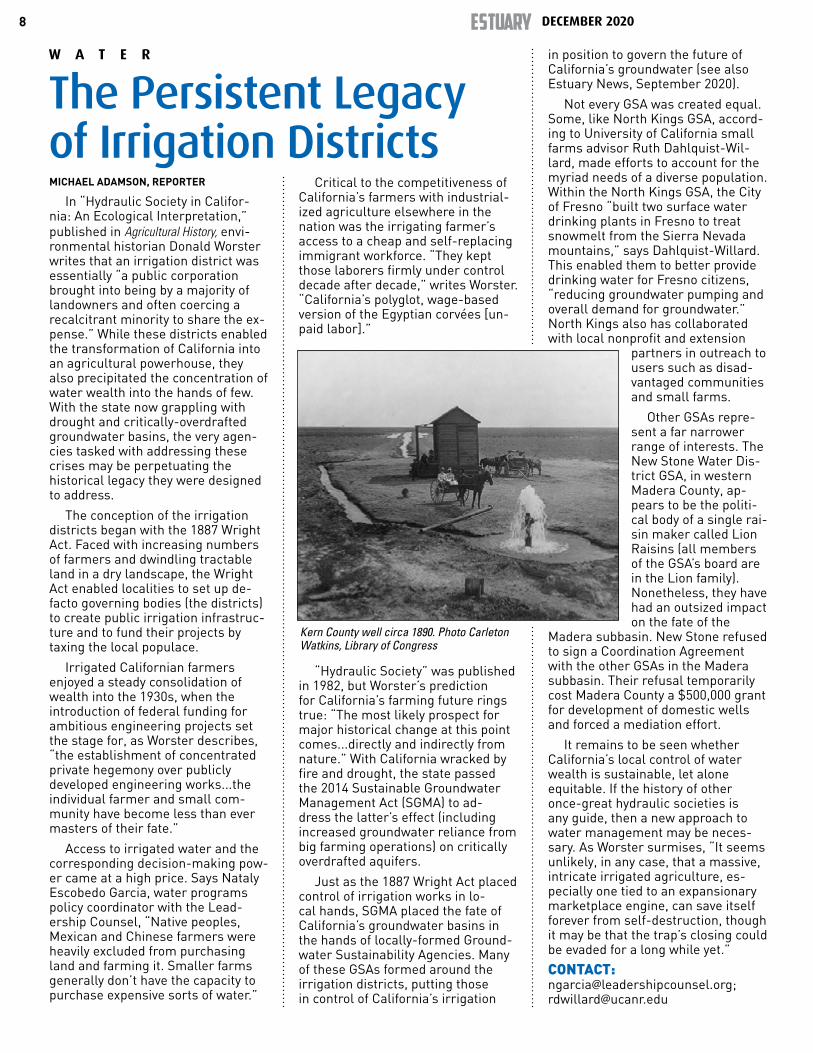
Kern County well circa 1890. Photo Carleton Watkins, Library of Congress
W A T E R
The Persistent Legacy of Irrigation Districts
9
Mercury in Trout Diet?While studying steelhead at the
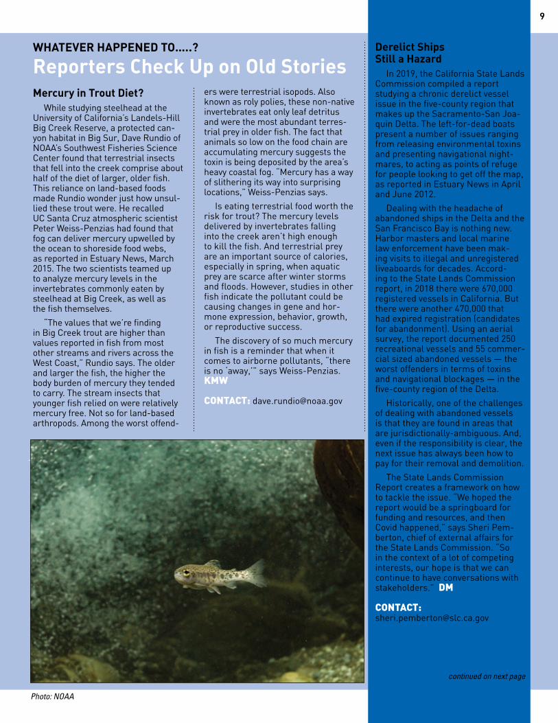
University of California’s Landels-Hill Big Creek Reserve, a protected can-yon habitat in Big Sur, Dave Rundio of NOAA’s Southwest Fisheries Science Center found that terrestrial insects that fell into the creek comprise about half of the diet of larger, older fish. This reliance on land-based foods made Rundio wonder just how unsul-lied these trout were. He recalled UC Santa Cruz atmospheric scientist Peter Weiss-Penzias had found that fog can deliver mercury upwelled by the ocean to shoreside food webs, as reported in Estuary News, March 2015. The two scientists teamed up to analyze mercury levels in the invertebrates commonly eaten by steelhead at Big Creek, as well as the fish themselves.
“The values that we’re finding in Big Creek trout are higher than values reported in fish from most other streams and rivers across the West Coast,” Rundio says. The older and larger the fish, the higher the body burden of mercury they tended to carry. The stream insects that younger fish relied on were relatively mercury free. Not so for land-based arthropods. Among the worst offend-
ers were terrestrial isopods. Also known as roly polies, these non-native invertebrates eat only leaf detritus and were the most abundant terres-trial prey in older fish. The fact that animals so low on the food chain are accumulating mercury suggests the toxin is being deposited by the area’s heavy coastal fog. “Mercury has a way of slithering its way into surprising locations,” Weiss-Penzias says.
Is eating terrestrial food worth the risk for trout? The mercury levels delivered by invertebrates falling into the creek aren’t high enough to kill the fish. And terrestrial prey are an important source of calories, especially in spring, when aquatic prey are scarce after winter storms and floods. However, studies in other fish indicate the pollutant could be causing changes in gene and hor-mone expression, behavior, growth, or reproductive success.
The discovery of so much mercury in fish is a reminder that when it comes to airborne pollutants, “there is no ‘away,’” says Weiss-Penzias. KMW CONTACT: [email protected]
Derelict Ships Still a Hazard
In 2019, the California State Lands Commission compiled a report studying a chronic derelict vessel issue in the five-county region that makes up the Sacramento-San Joa-quin Delta. The left-for-dead boats present a number of issues ranging from releasing environmental toxins and presenting navigational night-mares, to acting as points of refuge for people looking to get off the map, as reported in Estuary News in April and June 2012.
Dealing with the headache of abandoned ships in the Delta and the San Francisco Bay is nothing new. Harbor masters and local marine law enforcement have been mak-ing visits to illegal and unregistered liveaboards for decades. Accord-ing to the State Lands Commission report, in 2018 there were 670,000 registered vessels in California. But there were another 470,000 that had expired registration (candidates for abandonment). Using an aerial survey, the report documented 250 recreational vessels and 55 commer-cial sized abandoned vessels — the worst offenders in terms of toxins and navigational blockages — in the five-county region of the Delta.
Historically, one of the challenges of dealing with abandoned vessels is that they are found in areas that are jurisdictionally-ambiguous. And, even if the responsibility is clear, the next issue has always been how to pay for their removal and demolition.
The State Lands Commission Report creates a framework on how to tackle the issue. “We hoped the report would be a springboard for funding and resources, and then Covid happened,” says Sheri Pem-berton, chief of external affairs for the State Lands Commission. “So in the context of a lot of competing interests, our hope is that we can continue to have conversations with stakeholders.” DM CONTACT: [email protected]
WHATEVER HAPPENED TO…..?
Reporters Check Up on Old Stories
continued on next page
Photo: NOAA
DECEMBER 2020ESTUARY10
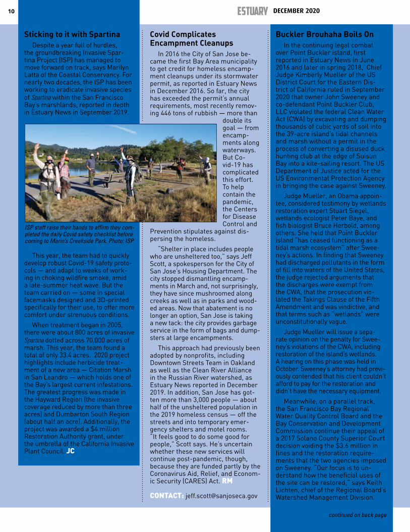
Sticking to it with SpartinaDespite a year full of hurdles,
the groundbreaking Invasive Spar-tina Project (ISP) has managed to move forward on track, says Marilyn Latta of the Coastal Conservancy. For nearly two decades, the ISP has been working to eradicate invasive species of Spartina within the San Francisco Bay’s marshlands, reported in depth in Estuary News in September 2019.
This year, the team had to quickly develop robust Covid-19 safety proto-cols — and adapt to weeks of work-ing in choking wildfire smoke, amid a late-summer heat wave. But the team carried on — some in special facemasks designed and 3D-printed specifically for their use, to offer more comfort under strenuous conditions.
When treatment began in 2005, there were about 800 acres of invasive Spartina dotted across 70,000 acres of marsh. This year, the team found a total of only 33.4 acres. 2020 project highlights include herbicide treat-ment of a new area — Citation Marsh in San Leandro — which holds one of the Bay’s largest current infestations. The greatest progress was made in the Hayward Region (the invasive coverage reduced by more than three acres) and Dumbarton South Region (about half an acre). Additionally, the project was awarded a $4 million Restoration Authority grant, under the umbrella of the California Invasive Plant Council. JC
Covid Complicates Encampment Cleanups
In 2016 the City of San Jose be-came the first Bay Area municipality to get credit for homeless encamp-ment cleanups under its stormwater permit, as reported in Estuary News in December 2016. So far, the city has exceeded the permit’s annual requirements, most recently remov-ing 446 tons of rubbish — more than
double its goal — from encamp-ments along waterways. But Co-vid-19 has complicated this effort. To help contain the pandemic, the Centers for Disease Control and
Prevention stipulates against dis-persing the homeless.
“Shelter in place includes people who are unsheltered too,” says Jeff Scott, a spokesperson for the City of San Jose’s Housing Department. The city stopped dismantling encamp-ments in March and, not surprisingly, they have since mushroomed along creeks as well as in parks and wood-ed areas. Now that abatement is no longer an option, San Jose is taking a new tack: the city provides garbage service in the form of bags and dump-sters at large encampments.
This approach had previously been adopted by nonprofits, including Downtown Streets Team in Oakland as well as the Clean River Alliance in the Russian River watershed, as Estuary News reported in December 2019. In addition, San Jose has got-ten more than 3,000 people — about half of the unsheltered population in the 2019 homeless census — off the streets and into temporary emer-gency shelters and motel rooms. “It feels good to do some good for people,” Scott says. He’s uncertain whether these new services will continue post-pandemic, though, because they are funded partly by the Coronavirus Aid, Relief, and Econom-ic Security (CARES) Act. RM CONTACT: [email protected]
Buckler Brouhaha Boils OnIn the continuing legal combat
over Point Buckler island, first reported in Estuary News in June 2016 and later in spring 2018, Chief Judge Kimberly Mueller of the US District Court for the Eastern Dis-trict of California ruled in September 2020 that owner John Sweeney and co-defendant Point Buckler Club, LLC violated the federal Clean Water Act (CWA) by excavating and dumping thousands of cubic yards of soil into the 39-acre island’s tidal channels and marsh without a permit in the process of converting a disused duck hunting club at the edge of Suisun Bay into a kite-sailing resort. The US Department of Justice acted for the US Environmental Protection Agency in bringing the case against Sweeney.
Judge Mueller, an Obama appoin-tee, considered testimony by wetlands restoration expert Stuart Siegel, wetlands ecologist Peter Baye, and fish biologist Bruce Herbold, among others. She held that Point Buckler island “has ceased functioning as a tidal marsh ecosystem” after Swee-ney’s actions. In finding that Sweeney had discharged pollutants in the form of fill into waters of the United States, the judge rejected arguments that the discharges were exempt from the CWA, that the prosecution vio-lated the Takings Clause of the Fifth Amendment and was vindictive, and that terms such as “wetlands” were unconstitutionally vague.
Judge Mueller will issue a sepa-rate opinion on the penalty for Swee-ney’s violations of the CWA, including restoration of the island’s wetlands. A hearing on this phase was held in October. Sweeney’s attorney had previ-ously contended that his client couldn’t afford to pay for the restoration and didn’t have the necessary equipment.
Meanwhile, on a parallel track, the San Francisco Bay Regional Water Quality Control Board and the Bay Conservation and Development Commission continue their appeal of a 2017 Solano County Superior Court decision voiding the $3.6 million in fines and the restoration require-ments that the two agencies imposed on Sweeney. “Our focus is to un-derstand how the beneficial uses of the site can be restored,” says Keith Lichten, chief of the Regional Board’s Watershed Management Division.
continued on back page
ISP staff raise their hands to affirm they com-pleted the daily Covid safety checklist before coming to Marin’s Creekside Park. Photo: ISP
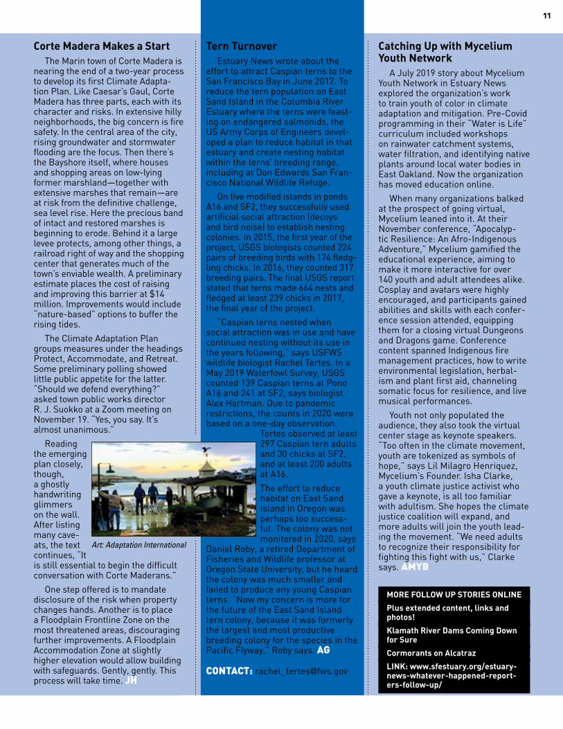
Corte Madera Makes a StartThe Marin town of Corte Madera is
nearing the end of a two-year process to develop its first Climate Adapta-tion Plan. Like Caesar’s Gaul, Corte Madera has three parts, each with its character and risks. In extensive hilly neighborhoods, the big concern is fire safety. In the central area of the city, rising groundwater and stormwater flooding are the focus. Then there’s the Bayshore itself, where houses and shopping areas on low-lying former marshland—together with extensive marshes that remain—are at risk from the definitive challenge, sea level rise. Here the precious band of intact and restored marshes is beginning to erode. Behind it a large levee protects, among other things, a railroad right of way and the shopping center that generates much of the town’s enviable wealth. A preliminary estimate places the cost of raising and improving this barrier at $14 million. Improvements would include “nature-based” options to buffer the rising tides.
The Climate Adaptation Plan groups measures under the headings Protect, Accommodate, and Retreat. Some preliminary polling showed little public appetite for the latter. “Should we defend everything?” asked town public works director R. J. Suokko at a Zoom meeting on November 19. “Yes, you say. It’s almost unanimous.”
Reading the emerging plan closely, though, a ghostly handwriting glimmers on the wall. After listing many cave-ats, the text continues, “It is still essential to begin the difficult conversation with Corte Maderans.”
One step offered is to mandate disclosure of the risk when property changes hands. Another is to place a Floodplain Frontline Zone on the most threatened areas, discouraging further improvements. A Floodplain Accommodation Zone at slightly higher elevation would allow building with safeguards. Gently, gently. This process will take time. JH
Tern TurnoverEstuary News wrote about the
effort to attract Caspian terns to the San Francisco Bay in June 2017. To reduce the tern population on East Sand Island in the Columbia River Estuary where the terns were feast-ing on endangered salmonids, the US Army Corps of Engineers devel-oped a plan to reduce habitat in that estuary and create nesting habitat within the terns’ breeding range, including at Don Edwards San Fran-cisco National Wildlife Refuge.
On five modified islands in ponds A16 and SF2, they successfully used artificial social attraction (decoys and bird noise) to establish nesting colonies. In 2015, the first year of the project, USGS biologists counted 224 pairs of breeding birds with 174 fledg-ling chicks. In 2016, they counted 317 breeding pairs. The final USGS report stated that terns made 664 nests and fledged at least 239 chicks in 2017, the final year of the project.
“Caspian terns nested when social attraction was in use and have continued nesting without its use in the years following,” says USFWS wildlife biologist Rachel Tertes. In a May 2019 Waterfowl Survey, USGS counted 139 Caspian terns at Pond A16 and 241 at SF2, says biologist Alex Hartman. Due to pandemic restrictions, the counts in 2020 were based on a one-day observation.
Tertes observed at least 297 Caspian tern adults and 30 chicks at SF2, and at least 200 adults at A16.
The effort to reduce habitat on East Sand Island in Oregon was perhaps too success-ful. The colony was not monitored in 2020, says
Daniel Roby, a retired Department of Fisheries and Wildlife professor at Oregon State University, but he heard the colony was much smaller and failed to produce any young Caspian terns. “Now my concern is more for the future of the East Sand Island tern colony, because it was formerly the largest and most productive breeding colony for the species in the Pacific Flyway,” Roby says. AG CONTACT: [email protected]
Catching Up with Mycelium Youth Network
A July 2019 story about Mycelium Youth Network in Estuary News explored the organization’s work to train youth of color in climate adaptation and mitigation. Pre-Covid programming in their “Water is Life” curriculum included workshops on rainwater catchment systems, water filtration, and identifying native plants around local water bodies in East Oakland. Now the organization has moved education online.
When many organizations balked at the prospect of going virtual, Mycelium leaned into it. At their November conference, “Apocalyp-tic Resilience: An Afro-Indigenous Adventure,” Mycelium gamified the educational experience, aiming to make it more interactive for over 140 youth and adult attendees alike. Cosplay and avatars were highly encouraged, and participants gained abilities and skills with each confer-ence session attended, equipping them for a closing virtual Dungeons and Dragons game. Conference content spanned Indigenous fire management practices, how to write environmental legislation, herbal-ism and plant first aid, channeling somatic focus for resilience, and live musical performances.
Youth not only populated the audience, they also took the virtual center stage as keynote speakers. “Too often in the climate movement, youth are tokenized as symbols of hope,” says Lil Milagro Henriquez, Mycelium’s Founder. Isha Clarke, a youth climate justice activist who gave a keynote, is all too familiar with adultism. She hopes the climate justice coalition will expand, and more adults will join the youth lead-ing the movement. “We need adults to recognize their responsibility for fighting this fight with us,” Clarke says. AMYB
MORE FOLLOW UP STORIES ONLINE
Plus extended content, links and photos!
Klamath River Dams Coming Down for Sure
Cormorants on Alcatraz
LINK: www.sfestuary.org/estuary-news-whatever-happened-report-ers-follow-up/
11
Art: Adaptation International
San Francisco Estuary Partnership 375 Beale Street, Suite 700 San Francisco, California 94105
San Francisco Bay and the Sacramento-San Joaquin River Delta comprise one of 28 “estuaries of national significance” recognized in the federal Clean Water Act. The San Francisco Estuary Partnership, a National
Estuary Program, is partially funded by annual appropria-tions from Congress. The Partnership’s mandate is to pro-tect, restore, and enhance water quality and habitat in the Estuary. To accomplish this, the Partnership brings together resource agencies, non-profits, citizens, and scientists committed to the long-term health and preservation of this invaluable public resource. Our staff manages or oversees more than 50 projects ranging from supporting research into key water quality concerns to managing initiatives that prevent pollution, restore wetlands, or protect against the changes anticipated from climate change in our region. We have published Estuary News since 1993.
Estuary News DECEMBER 2020, Vol. 29, No. 4
www.sfestuary.org/estuary-news/
MANAGING EDITOR Ariel Rubissow Okamoto
SENIOR EDITORASSISTANT EDITOR Lisa Owens Viani
WRITERS Audrey Brown, Jacoba Charles, Joe Eaton, Aleta George, John Hart, Daniel McGlynn, Robin Meadows, Kathleen Wong
DESIGNER Darren Campeau
COVER PHOTO Courtesy Wikimedia Commons 1862 flood in downtown Sacramento
www.sfestuary.org
PRESORTEDSTANDARD
U.S. POSTAGE
P A I DOakland, CA
Permit No. 2508
Cariad Hayes Thronson
SLICK AND THICK, cont’d from page 5
DUE TO COVID CONSTRAINTS WE ARE NOT PRINTING AND MAILING THIS ISSUE OF ESTUARY NEWS EXCEPT ON DEMAND (email [email protected] your address)
But because of the sediment situation, the bucolic river scene—and its utility as a major transportation corridor—was in jeopardy. In 1880, a political cartoon ap-peared in the San Francisco Wasp, an il-lustrated satirical magazine. The cartoon depicted the future of the Sacramento River if the heavy loads of fine mining tailings kept washing through it, and was published as the backdrop to an increas-ingly public debate over what to do about the mining slickens. The illustration shows steamers being pulled over a dry riverbed of dirt by teams of draft horses. Meanwhile, points that used to show up on navigational charts, like Hogsback Shoal in Steamboat Slough, started collecting so much sediment that they became connected to land as peninsulas.
By 1884, a judge named Lorenzo Saw-yer issued what became known as the Sawyer Decision, which was an injunc-tion halting hydraulic mining in Califor-nia. The California Mining Association ap-pealed the decision to federal authorities, writing that in part, it was the gold from California in the Union’s treasury that helped decide the outcome of the Civil War, and that erosion and sedimentation were part of the dynamism of Califor-nia’s natural ecology. In 1893, Congress passed the Caminetti Act, which, among other things, allowed limited hydraulic
gold mining in California. The legisla-tion also created a new regulator—the California Debris Commission—which was responsible for making sure that the sediment loads created by gold mining stayed in retaining ponds and behind specially built catchments and out of the state’s creeks and rivers.
For most of the 1900s, sediment in the watershed was viewed as a prob-lem. Sediment began accumulating behind the dams that were built along the tributaries of the Central Valley watershed. Flood control districts were created to deal with sediment dredging and removal. In 1935, Steamboat Slough and the main Sacramento River channel were dredged for navigation for the first time. The combination of hydraulic min-ing and mercury extraction continued, in parts of the San Francisco Bay water-shed, until 1950.
Eventually, things changed. In the latter half of the century, scientists began to notice a decrease in sediment concentration.
Today, researchers are looking at a va-riety of potential causes of reduced sedi-ment transport including how invasive aquatic plants in the Delta are slowing the sediment flows that remain. There is also a concern that without enough new sediment delivery, marshes and other critical wetlands will get annihilated in
the face of rising seas. Now, more than a century and a half after water monitors first started stripping earth to get to gold, people are realizing the value of what was flushed down the watershed. “Sedi-ment was considered a nuisance for a really long time,” says Maureen Down-ing-Kunz, a research hydrologist with the USGS. “Only recently has sediment been looked at as a resource.”
CONTACT: [email protected]
Although not a party to either suit,
San Francisco Baykeeper has been following the cases. Staff attorney Nicole Sasaki welcomed Judge Muel-ler’s decision: “The violations on Point Buckler Island were both brazen and unapologetic, and inflicted severe damage on 30 acres of wetland.” She also commented on the role of the federal agencies: “It is heartening that EPA and DOJ diligently prosecuted the case, and there was no sign of undue political interference.” JE
CONTACT: [email protected]; [email protected]
BUCKLER, cont’d from page 10


![New York Tribune (New York, NY) 1901-09-11 [p 2]chroniclingamerica.loc.gov/lccn/sn83030214/1901-09-11/ed...name with the greatest ease) -Czolgosz may have been Inspired by me. but](https://img.pdfslide.us/doc/110x75/5b2a8a5d7f8b9a1a298b485c/new-york-tribune-new-york-ny-1901-09-11-p-2-with-the-greatest-ease-czolgosz.jpg)
![Book of land Revenue act 1901 - U.Pbor.up.nic.in/pdf/Book of land Revenue act 1901.pdf · The Uttar Pradesh Land Revenue Act, 1901 (U.P. Act No. 3 of] 901) 1901 (1901 3) alongwith](https://img.pdfslide.us/doc/110x75/5af0e50e7f8b9a8b4c8e115c/book-of-land-revenue-act-1901-upborupnicinpdfbook-of-land-revenue-act-1901pdfthe.jpg)


![[XLS] Web view1/1/1901. 1/1/1901. 1/1/1901. 1/1/1901. 1/1/1901. 1/1/1901. 1/1/1901 10001. 1/1/1901. 1/1/1901 10101. 1/1/1901. 1/1/1901 10201. 1/1/1901 …](https://img.pdfslide.us/doc/110x75/5aaa1d557f8b9a86188db0af/xls-view111901-111901-111901-111901-111901-111901-111901-10001.jpg)