Embed Size (px)
Citation preview
HOOSIER SURVEYORQUARTERLY PUBLICATION OF THE
INDIANA SOCIETY OFPROFESSIONAL LAND SURVEYORS, INC.
AFFILIATED WITH THEAMERICAN CONGRESS ON
SURVEYING & MAPPING
VOLUME 35
NUMBER 4
SPRING 2009
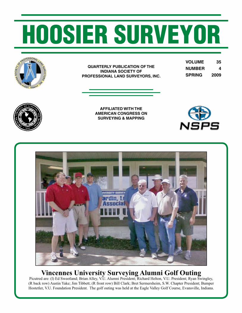
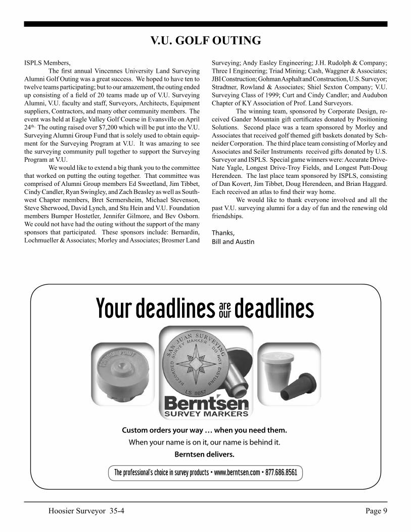
Vincennes University Surveying Alumni Golf OutingPicutred are: (l) Ed Sweetland; Brian Alley, V.U. Alumni President; Richard Helton, V.U. President; Ryan Swingley,(R back row) Austin Yake; Jim Tibbett; (R front row) Bill Clark; Bret Sermersheim, S.W. Chapter President; Bumper Hostetler, V.U. Foundation President. The golf outing was held at the Eagle Valley Golf Course, Evansville, Indiana.
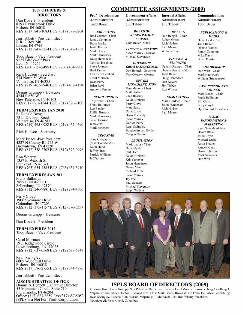
2009 OFFICERS & DIRECTORS
Dan Kovert - President8193 Fawnsbrook DriveFishers, IN 46038RES: (317) 841-1083 BUS: (317) 577-8204
Jim Tibbett - President ElectR.R. 2 Box 240Linton, IN 47441RES: (812) 847-3254 BUS: (812) 847-1952
Todd Bauer - Vice President9125 Blackwolf PassLeo, IN 46765RES: (260) 627-2495 BUS: (260) 484-9900
Rich Hudson - Secretary574 North 50 WestValparaiso, IN 46385RES: (219) 462-2946 BUS: (219) 462-1158
Dennis Grumpp - Treasurer4244 S 650 WNew Palestine, IN 46163RES:(317) 861-1844 BUS: (317) 826-7100
TERM EXPIRES JAN 2010E. Donald Bengel73 E. Division RoadValparaiso, IN 46383RES: (219) 465-0988 BUS: (219) 462-0690
Rich Hudson - Secretary
Mark Isaacs -Past President4337 N County Rd 275 WBrowntown, IN 47220RES: (812) 358-2702 BUS: (812) 372-0996
Ron Wharry 1357 E. Wabash St.Frankfort, IN 46041RES: (765) 654-4385 BUS: (765) 654-5910
TERM EXPIRES JAN 2011Frank Ballintyn 2855 Plantation Ct.Sellersburg, IN 47170RES: (812) 246-9881 BUS: (812) 294-4306
Perry Cloyd3906 Sycamore DriveColumbus, IN 47203RES: (812) 375-1157 BUS: (812) 376-6357
Dennis Grumpp - Treasurer
Dan Kovert - President
TERM EXPIRES 2012Todd Bauer - Vice President
Carol Morman1911 Ridgewood CircleLawrenceburg, IN 47025RES: (812) 637-0568 BUS: (812) 637-6349
Ryan Swingley6005 Woodmill DriveFishers, IN 46038RES: (317) 596-2755 BUS: (317) 544-4996
Jim Tibbett - President ElectADMINISTRATIVE OFFICEDianne S. Bennett, Executive Director55 Monument Circle, Suite 719 Indianapolis, IN 46204Office: (317) 687-8859 Fax:(317)687-5053ISPLS is a Not For Profit Corporation
COMMITTEE ASSIGNMENTS (2009)Government AffairsAdministrator:Jim Tibbett
BOARD OF REGISTRATION
LIAISONTodd Bauer - Chair
COUNTY SURVEYORSSteve Murray - LiaisonMichael Stevenson
GOVERNORGREAT LAKES COUNCILDon Bengel - GovernorTony Gregory - Alternate
GPS-GIS MONUMENTATION
Tom Mahon - ChairMatt BadgerZach BeasleyKevin BreitzkePerry CloydMatt HealyDavid LauerBrian MatherlySteve MurrayGordon PerryRyan SwingleyBoudewijn van GelderCraig Williams
LEGISLATIONMark Isaacs - ChairDavid AyalaPhil BeerKevin BreitzkeKris ConoverJason HendersonDuane MastRichard MillerSteve MurrayJay PoePaul SandersMichael StevensonRalph Wallem
Internal AffairsAdministrator: Jim Tibbett
BY LAWSDon Bengel - ChairRobert GrossRich HudsonPaul MaurerWilliam Stine
FINANCE & PLANNING
Dennis Grumpp - ChairDianne Bennett-ExDir.Todd BauerDoug HerendeenDan KovertJim TibbettRon Wharry
NOMINATIONSMark Gardner - ChairJason Henderson Rich Hudson Paul Maurer
CommunicationsAdministrator:Todd Bauer
PUBLICATIONS & MEDIA
David Best - ChairTodd BauerDianne BennettRandy ComptonMike DavisBruce Franke
MEMBERSHIPDon West - ChairMark HennesseyWilliam Griepenstroh
PAST PRESIDENT’S COUNCIL
Mark Isaacs - ChairFrank BallintynBill ClarkPerry CloydOpen to Past Presidents
PUBLIC INFORMATION &
MARKETINGRyan Swingley-ChairDaniel BlannJason CoyleMichael DuffyJustin FrazierRandell GannOrwic JohnsonMark SchepersDon West
Prof. DevelopmentAdministrator:Todd Bauer
EDUCATIONBrad Cramer - ChairRandy ComptonBruce FrankeJustin FrazierMark HealyMark HennesseyDoug HerendeenNorman HiselmanSteve JohnsonBrad KramerLawrence LambertCarol MormanRyan PerryBrian RaylAnthony Toscani
SCHOLARSHIPSTroy Smith - ChairFrank BallintynLee BenderPhillip BurressMark HennesseySteve JohnsonJames OrrMark Schepers
TRIG STARTony Gregory -(State Coordinator)Keith HoodJeffrey TroutPatrick WilliamsJeff Yatsko
ISPLS BOARD OF DIRECTORS (2009)First row, l to r: Dennis Grumpp, New Palestine; Dan Kovert, Fishers; Carol Morman, Lawrenceburg; Don Bengel, Valparaiso; Jim Tibbett, Linton; Second row:, l to r: Mark Isaacs, Brownstown; Frank Ballintyn, Sellersburg; Ryan Swingley, Fishers; Rich Hudson, Valparaiso; Todd Bauer, Leo; Ron Wharry, Frankfort. Not pictured: Perry Cloyd, Columbus.
Hoosier Surveyor 35-4 Page 1
Masthead ..............................................................................................................................................1President’s Thoughts ............................................................................................................................2ISPLS Board of Directors Meeting Highlights ....................................................................................3Surveyors: Unsung Heroes, or Out of Touch? .....................................................................................5Thomas Jefferson: His Adjunct Career ................................................................................................6-7The Indiana Map Turns 52 ...................................................................................................................11Walking In The Footsteps Of The Colonial Surveyor ........................................................................13-17Completed Careers ...............................................................................................................................21Calendar/Sustaining Members/New ISPLS Members .........................................................................22Firm Members ......................................................................................................................................23-25
HOOSIER SURVEYOR
CONTENTS
VOLUME 35 NUMBER 4 SPRING 2009
EDITORS NOTE Deadlines for copy for various planned issues of the Hoosier Surveyor are as follows: Winter - December 31; Spring - March 31; Summer - June 30; Fall - September 30. The Hoosier Surveyor is published quarterly by the Indiana Society of Professional Land Surveyors to inform land surveyors and related professions, government officials, educational institutions, libraries, contractors, suppliers and associated businesses and industries about land surveying affairs. Articles and columns appearing in this publication do not necessarily reflect the viewpoints of ISPLS or the Hoosier Surveyor staff, but are published as a service to its members, the general public and for the betterment of the surveying profession. No responsibility is assumed for errors, misquotes or deletions as to its contents.
Editorial Advertising Offices David B. H. Best - Editor55 Monument Circle, Suite 719 5402 Washington BoulevardIndianapolis, IN 46204 Indianapolis, IN 46220Phone:(317) 687-8859 Fax: (317) 687-5053 Phone: (317) 251-5136 Web Page: www.ispls.org EMail: [email protected] E-Mail: [email protected]
Hoosier Surveyor 35-4Page 2
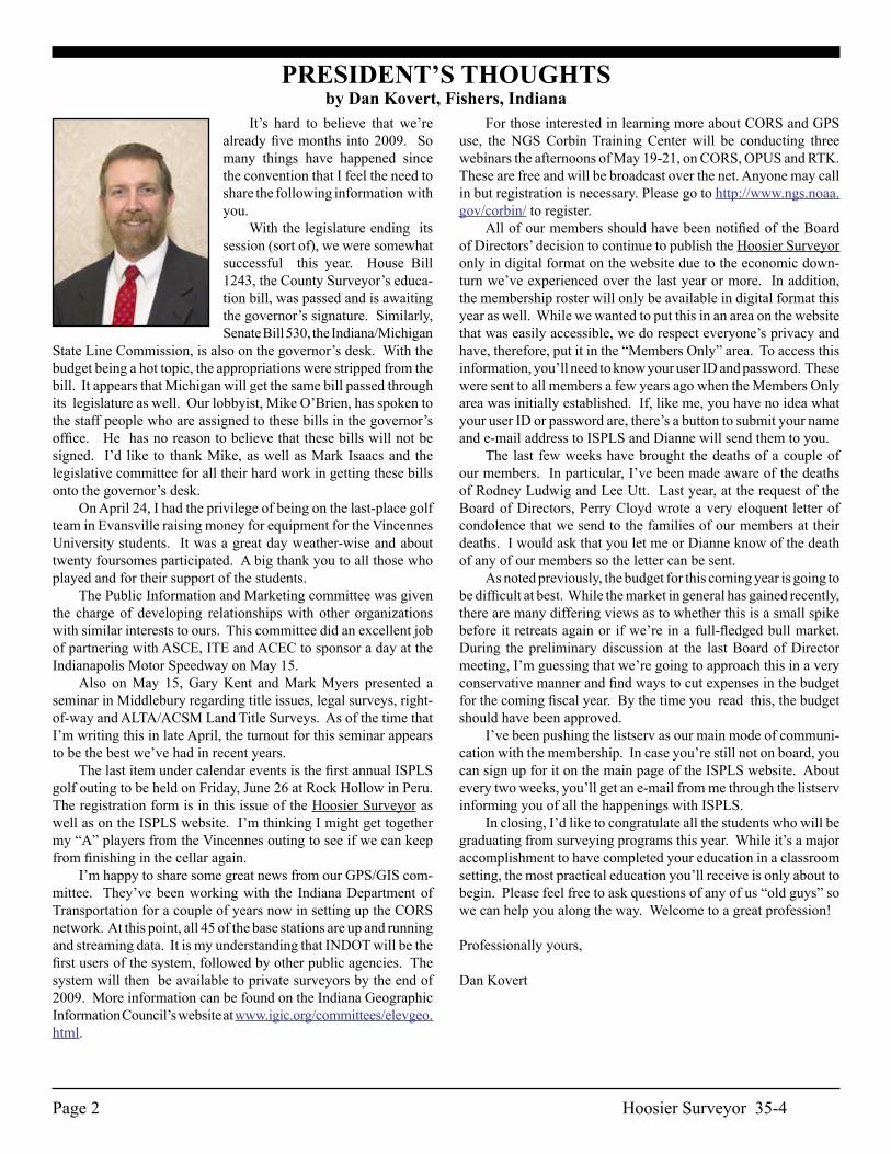
PRESIDENT’S THOUGHTSby Dan Kovert, Fishers, Indiana
It’s hard to believe that we’re already five months into 2009. So many things have happened since the convention that I feel the need to share the following information with you. With the legislature ending its session (sort of), we were somewhat successful this year. House Bill 1243, the County Surveyor’s educa-tion bill, was passed and is awaiting the governor’s signature. Similarly, Senate Bill 530, the Indiana/Michigan
State Line Commission, is also on the governor’s desk. With the budget being a hot topic, the appropriations were stripped from the bill. It appears that Michigan will get the same bill passed through its legislature as well. Our lobbyist, Mike O’Brien, has spoken to the staff people who are assigned to these bills in the governor’s office. He has no reason to believe that these bills will not be signed. I’d like to thank Mike, as well as Mark Isaacs and the legislative committee for all their hard work in getting these bills onto the governor’s desk. On April 24, I had the privilege of being on the last-place golf team in Evansville raising money for equipment for the Vincennes University students. It was a great day weather-wise and about twenty foursomes participated. A big thank you to all those who played and for their support of the students. The Public Information and Marketing committee was given the charge of developing relationships with other organizations with similar interests to ours. This committee did an excellent job of partnering with ASCE, ITE and ACEC to sponsor a day at the Indianapolis Motor Speedway on May 15. Also on May 15, Gary Kent and Mark Myers presented a seminar in Middlebury regarding title issues, legal surveys, right-of-way and ALTA/ACSM Land Title Surveys. As of the time that I’m writing this in late April, the turnout for this seminar appears to be the best we’ve had in recent years. The last item under calendar events is the first annual ISPLS golf outing to be held on Friday, June 26 at Rock Hollow in Peru. The registration form is in this issue of the Hoosier Surveyor as well as on the ISPLS website. I’m thinking I might get together my “A” players from the Vincennes outing to see if we can keep from finishing in the cellar again. I’m happy to share some great news from our GPS/GIS com-mittee. They’ve been working with the Indiana Department of Transportation for a couple of years now in setting up the CORS network. At this point, all 45 of the base stations are up and running and streaming data. It is my understanding that INDOT will be the first users of the system, followed by other public agencies. The system will then be available to private surveyors by the end of 2009. More information can be found on the Indiana Geographic Information Council’s website at www.igic.org/committees/elevgeo.html.
For those interested in learning more about CORS and GPS use, the NGS Corbin Training Center will be conducting three webinars the afternoons of May 19-21, on CORS, OPUS and RTK. These are free and will be broadcast over the net. Anyone may call in but registration is necessary. Please go to http://www.ngs.noaa.gov/corbin/ to register. All of our members should have been notified of the Board of Directors’ decision to continue to publish the Hoosier Surveyor only in digital format on the website due to the economic down-turn we’ve experienced over the last year or more. In addition, the membership roster will only be available in digital format this year as well. While we wanted to put this in an area on the website that was easily accessible, we do respect everyone’s privacy and have, therefore, put it in the “Members Only” area. To access this information, you’ll need to know your user ID and password. These were sent to all members a few years ago when the Members Only area was initially established. If, like me, you have no idea what your user ID or password are, there’s a button to submit your name and e-mail address to ISPLS and Dianne will send them to you. The last few weeks have brought the deaths of a couple of our members. In particular, I’ve been made aware of the deaths of Rodney Ludwig and Lee Utt. Last year, at the request of the Board of Directors, Perry Cloyd wrote a very eloquent letter of condolence that we send to the families of our members at their deaths. I would ask that you let me or Dianne know of the death of any of our members so the letter can be sent. As noted previously, the budget for this coming year is going to be difficult at best. While the market in general has gained recently, there are many differing views as to whether this is a small spike before it retreats again or if we’re in a full-fledged bull market. During the preliminary discussion at the last Board of Director meeting, I’m guessing that we’re going to approach this in a very conservative manner and find ways to cut expenses in the budget for the coming fiscal year. By the time you read this, the budget should have been approved. I’ve been pushing the listserv as our main mode of communi-cation with the membership. In case you’re still not on board, you can sign up for it on the main page of the ISPLS website. About every two weeks, you’ll get an e-mail from me through the listserv informing you of all the happenings with ISPLS. In closing, I’d like to congratulate all the students who will be graduating from surveying programs this year. While it’s a major accomplishment to have completed your education in a classroom setting, the most practical education you’ll receive is only about to begin. Please feel free to ask questions of any of us “old guys” so we can help you along the way. Welcome to a great profession!
Professionally yours,
Dan Kovert
Hoosier Surveyor 35-4 Page 3
January 14, 2009 The ISPLS Board of Directors met on Wednesday, January 14, 2009 at the Marriott East , Indianapolis. President Mark Isaacs called the meeting to order at 8:47 a.m. The minutes and treasurer’s report were reviewed and approved. Staff Activity Report - A written report was submitted for review. Communications - Publications - Any articles for the next is-sue are due January 26th. There was discussion about the Hoosier Surveyor and the roster no longer being printed. Membership - The BOD reviewed and approved the member-ship applications submitted by the membership committee. Professional Development - Education - The Tecumseh Chapter submitted a letter requesting to host the 2011 ISPLS Convention. A motion was made and passed to accept the Tecumseh Chapter as host for the 2011 Convention. Government Affairs - Board of Registration - The 2009 BOR meet-ing dates are January 9th, April 17th, July 10th and October 9th. Todd Bauer will be the 2009 registration board liaison for ISPLS. County Surveyors - There will be a meeting at the conven-tion of the County Surveyors Association to discuss the “County Surveyors” issue. ISPLS board members were invited to attend. A motion was made and defeated by a vote of 6 to 5 to support the County Surveyors Assocation efforts as stated in a letter from the County Association’s president. NSPS Governor- The next meeting is at the end of February in Salt Lake City. GPS-GIS Monumentation - A report was presented on the activities for 2009. Legislation - An update was given on the “”Right-of-Entry” and the “Indiana/Michigan Line Survey, Stateline Commission”. A motion was made and passed to accept the Bose McKinney 2009 lobbying contract. Internal Affairs - Nominations - The 2009 BOD winners are Todd Bauer, Carol Morman and Ryan Swingley. A motion was made and passed to destroy the 2009 BOD election ballots. Old Business - ISPLS Foundation - Bose McKinney has a draft for review and there will be something ready for the March BOD meeting. Registry of Deceased Land Surveyors - Currently working on setting up the registry and expect to have something to present to the BOD at the March meeting. New Business - A presentation was made from the Purdue Stu-dent Chapter regarding attending the upcoming ACSM Convention in Salt Lake City on February 19-23, 2009. A motion was made and passed to give the student chapter $2000 for travel expenses if the student chapter comes up with $2000. Professor Johnson gave an update on the Purdue University Land Surveying program.January 14, 2009 - Special County Surveyor/HB 1243 Meeting President Mark Isaacs called the meeting to order at 6:10 p.m. at the Marriott East, Indianapolis. There was board discussion on SJR #7 and HB #1243 regarding the County Surveyors position on the County Surveyors Association meeting held prior to this meeting. A motion was made and passed
ISPLS BOARD OF DIRECTORS MEETING HIGHLIGHTSby Dianne Bennett, Executive Director
...continued Page 21
that “ISPLS support the County Surveyors position to remain an elected position subject to HB#1243 which increases the education requirements”. A motion was made and passed that ISPLS AD HOC commit-tee work with the County Surveyors Association.March 7, 2009 The ISPLS Board of Directors met on Saturday, March 9, 2009 at ISPLS headquarters. President Dan Kovert called the meeting to order at 9:02 a.m. The minutes and treasurer’s report were reviewed and approved. Staff Activity Report - A written report was submitted for review. Communications-Publications- The winter issue of the Hoosier Surveyor is at the printer. Membership Roster - A motion was made and passed to print the roster every 2 years starting in 2010 with updates on line. The motion was defeated 6 to 3. Membership - The board reviewed the memberships submitted by the membership committee. The BOD approved the members as long as they reverse the membership categoy of the two members submitted. Past Presidents Council - The new foundation papers should be ready for the April BOD meeting. Public Information and Marketing - An update was given on the Listserv, the Google Group and Reenactments. Professional Development - Education - The 2009 convention was reviewed. A motion was made and passed to deny the requests submitted for partial credit. A motion was made and passed to reimburse INDOT for reg-istration fees for an attendee due to his having major surgery. There was discussion regarding the Surveyors Historical So-ciety/Illinois/Indiana Stateline seminar on July 17th & 18th. There was board discussion regarding the proposed seminar by Gary Kent on May 15th. A report was given by Dianne Bennett on the ACSM Conven-tion in Salt Lake City. There was discussion on the cost of speakers at the 2009 Convention. A written report was reviewed on the ISPLS LSIT/LS review sessions. A motion was made and passed to support the program presented. Carol Morman will be the board liaison. The spring session will be April 4th at Pudue Calumet. Government Affairs - Board of Registration - Their next meet-ing date is April 17, 2009. NSPS Governor - A verbal report was presented on the ACSM National Convention held in Salt Lake City. GPS-GIS - A report was given on the Height Modernization project. Legislation - An update on the ISPLS bills; “Right-of-Entry” is dead, the Indiana/Michigan Line Survey, Stateline Commisson is continuing, the County Surveyors Education Requirements is still alive and the County Surveyors Elected/Appointed issue is dead for 2009. ByLaws - The committee was directed to review the Affiliate and Associate membership classifications. Finance and Planning - The preliminary budget will be presented

Hoosier Surveyor 35-4Page 4
Hoosier Surveyor 35-4 Page 5
...continued Page 17
Recently, a fellow surveyor asked me the following question “Why does no one ever ask who surveyed that new building, bridge, park, road, etc.” True enough, the public is often (if not typically) aware of the architect who designed a structure, or park, and the engineer who designed a bridge, scenic highway, or site plan. They are even likely to know the contractor who built it! Meanwhile, the surveyor who provided the data for other professionals to design, and the contractor to build, remains anony-mous!!!!! Throughout history, the surveyor (with a few notable exceptions) has been in the background of the development of our country. All the while, being a vital component of the Backbone of Society!
Why is this the case? Certainly, we surveyors don’t have to tell each other of the im-portance of the work of our predecessors, and indeed of ourselves. We are proud of our heritage. We worship at the alter of Mount Rushmore where our surveying heroes Washington, Jefferson, and Lincoln are immortalized (along with that “other guy”). In fact, we revel in the self-shared glory of considering ourselves to be the “Last of the Rugged Individualists”. We consider ourselves to be that honest, and true, and selfless group of professionals who live by our own code of honor that can result in financial hardship to ourselves while we are in service to our fellow citizens. In our interaction with other professionals, we are often expected to correct their work (or at least bring errors to light), and to hold the hand of the contractor to avoid costly mistakes, or catastrophe! Surveyors have traditionally been the buffer between an ap-provable (but not buildable) plan, and one that can be constructed. In my 40+ years of surveying, I don’t recall ever being presented with a plan from an architect in which all of the incremental dimen-sions added up to equal the overall total dimension shown. Likewise, rarely have I seen a design plan from an engineer that doesn’t require some level of recalculation. It almost seems as though the better technology becomes, the more plans tend to be “cartoons” that look good, but are often not mathematically or geometrically sound. In spite of the importance of the services surveyors provide to fellow professionals, and to the public at large, we are often held in low esteem by our fellow professionals and others with whom we must work, even those for whom we toil in apparent selflessness!
Why do we not get the respect that we think we deserve? There are several schools of thought with regard to this ques-tion. Some say it is due to the low requirement for the formal education necessary as a prerequisite by more than half of the 50 states to qualify for taking the examinations to attain licensure as a surveyor. Some even question the professionalism of surveyors due to a lack of formal education. While I understand that the title “professional” may be defined to be applicable only to those who have attained some prescribed academic degree requirements, I do
Surveyors: Unsung Heroes, or Out of Touch?An article condensed from a Keynote Address Presented by Curt Sumner, LS, Executive Director ACSM/NSPS
not believe that formal education and professionalism are synony-mous. Professionalism, as it is typically understood to be defined relative to the services one provides, is a personal achievement that is based on character and the manner in which individuals conduct themselves in the pursuit of their work. It is not based on the number or hierarchy of degrees one holds. There are many instances in which this is evident in society. Still, the concept of aligning the title of professional with for-mal education is becoming more and more prevalent, and should not be discounted. It is certainly true that exposure to the broad opportunities in surveying practice is much more available to stu-dents in surveying-related college and university programs than it is to an individual who merely gains experience while working for a licensed surveyor whose services are limited to only one, or a few, of those areas of practice. Others say it is because we bid our services against our compe-tition to the ultimate lowest price. There is much evidence of this, also. Why would clients perceive that our services are worth more than we seem to believe them to be? When someone continues to lower the cost of services in order to “get the job”, clients will think one of two things: 1) this person must not think his/her services are worth much; or 2) this person must have been trying to cheat me with the first price quoted since it has now been lowered. Neither perception is a good one for the surveyor, and our profession in general. Even if one “bids” for work it makes sense as professionals for us to understand the cost of doing business and the value to the client, and the public, of the services we provide. Still others say it is because we don’t present ourselves to the public in the same manner as do other professionals. Many believe it is a result of our relative inability to articulate well what it is that we do, and that our work is much more than simple ap-plications of mathematics. Additionally, it is perceived that we do not dress appropriately for the situation at hand. An uncle of mine once stated that people are supposed to judge you based on what is on the inside, not on your appearance outside. One of his sisters remarked, “If they don’t like what they see on the outside, they may never bother to look at what is inside.” How many times have we heard it said, “We are our own worst enemies?” There is some element of truth in all of these things regarding us as a whole. However, other professionals suffer from negative perceptions also. Doctors get sued more often than we do. Lawyers are reviled constantly. Engineers are sometimes considered by some to be Nerdy. Some consider architects to be aloof and illogical. Contractors are sometimes put into the category with those who are considered unscrupulous.The list goes on and on! So why are all of them more well-known, and in spite of the criticisms, much more prominent (and yes, respected) in the minds of the public, and young people who are planning for their future?
Hoosier Surveyor 35-4Page 6
Thomas Jefferson: His Adjunct CareerBy: David B. H. Best, R. L. S.
When he designed his tombstone Thomas Jefferson scribed the words to be placed upon it when he passed: “Here lies Thomas Jefferson Author of the American Declaration of Independence, of the Virginia Declaration of Religious Freedom, and Father of the University of Virginia.” The latter reference reflected Jefferson’s intense interest in and demand for an educated populace. From an early age his inquisitive mind sought answers to an endless array of perplexing problems. During his lifetime of some eighty-three years he achieved due recognition in many fields of scientific inquiry. As Merrill D. Peterson states in the preface to his monumental biography of Jefferson, Thomas Jefferson and the New Nation, “. . . He was a prodigy of talents. The tributaries of his mind ran in all direc-tions. To trace their channels into the main stream is only half the problem, for the terrain itself belongs to another intellectual world, which challenges understanding on its own terms and yet must be translated into the grammar of our own time. . .” Jefferson belonged to what Peterson refers to as “. . . the cosmopolitan fraternity of science and philosophy.” His contemporaries sought him out as the repository of scientific knowledge in the fields of botany, geology, paleontology, mathematics, architecture and mechanical invention. To the list we must add surveying and cartography. These, perhaps, represent Jefferson’s adjunct career. Jefferson’s abiding interest in the measurement and mapping of land we trace back to his father Peter Jefferson. He was a local magistrate, the county surveyor of Albemarle County, the chief military officer of the county, and a member of the House of Bur-gesses. From his father he acquired the habits of industry, systematic study, and responsibility. His father taught Jefferson to read and write. By the age of six he had read all of the books in his father’s small library. Jefferson recalls his father’s account of extending the Fairfax Line across the northern neck of Virginia. Peter Jefferson had led a 40-man survey party on horseback to delineate the vast holdings of Lord Fairfax. From September 10, 1746 to February 22, 1747 the party traversed 76 miles and back under the most difficult conditions. All of the horses starved and many of the survey party members either dropped out or were simply left behind. His father survived the wilderness ordeal by the shear force of his personality and will. Implanted in Jefferson’s mind were thoughts of duplicat-ing his father’s intense productivity as a surveyor. Peter Jefferson taught and demonstrated the principles of surveying to his son. In his will he bequeathed his surveying instruments to Jefferson. Peter Jefferson died in 1757 when Jefferson was fourteen. From the age of nine until he was sixteen Jefferson studied under the tutelage of two tutors, the Reverend William Douglas and the Reverend James Maury. Maury planted the seed of an idea in Jef-ferson’s mind to explore the West unto the Pacific Ocean. At the age of sixteen Jefferson enrolled in the College of William and Mary in Williamsburg, graduating two years later. There he was introduced to the ideas of the European Enlightenment: free inquiry into the pursuit of knowledge; the discovery of the natural order of things; and the use of reason as the method of verifying criticism and inquiry. Jefferson adopted as his heroes the three leading lights of the Enlightenment: John Locke, Sir Isaac Newton, and Lord Bacon. The ideas of the Enlightenment formed the basis of Jefferson’s keen
interest in things scientific, including all aspects of surveying. Thomas Jefferson applied his knowledge of surveying to what became his project with no apparent predictive end: the building of Monticello. He performed a topographic survey of the little mountain and in 1768 began to level its summit. In surveying the site Jefferson determined the building site’s latitude, longitude and elevation. Mon-ticello’s design is based on ideas gleaned from architectural books by Robert Morris, James Gibbs, and in particular the four-volume set authored by Italian architect Andrea Palladio. Jefferson’s skill in the preparation of his architectural plans and the drawings of his surveys he learned from his father. He also surveyed the lands of his neighbors Abraham Lewis and Nicholas Meriwether. Jefferson often made reference to a map titled: “A Map of the most inhabited part of VIRGINIA containing the whole Province of MARYLAND with Part of Pensilvania, New Jersey and North Carolina, drawn by Joshua Fry & Peter Jefferson in 1751. Engraved in Thomas Jeffries.” The map reflects the expertise and care with which his father and Fry prepared the map after spending many months in the field surveying the area. Fry, in addition to being a surveyor, was a professor of mathematics at the College of William and Mary. In 1784 while serving as the American minister to France Jefferson compiled a map of Virginia. The map was to be included in the only book Jefferson wrote and titled Notes on the State of Virginia that was ready for publication. The map included regions of North Carolina north of Albemarle Sound, all of the states of Maryland, Delaware and Pennsylvania, the western regions of New York and New Jersey and territory west of the confluence of the Ohio and Kanhawa Rivers. Jefferson’s collection of maps was the finest in the country. During his term as governor of Virginia in 1781 Jefferson proposed to the federal government that the portion of Virginia situated west of the Ohio River to Lake Erie on the north to St. Louis on the south be transferred to the central government. The area in question was too vast for Virginia to govern properly. The transfer to the central government included a reservation: Virginia would cede its claims to the U. S. government alone! Only the U. S. government would have the legal right to acquire ownership of the lands from the Native Americans natives residing therein. Any claims by pre-Revolutionary land companies would be ruled invalid. Congress refused to accept the deal. A year’s stalemate ensued. General Rufus Putnam favored the reservation of eighteen million acres of the proposed territory for Colonial Army veterans. In 1784 the Continental Congress of which Jefferson was a member was seeking a resolution to the country’s enormous debt of forty million dollars. The annual income was a meager $4.5 million. The Congress finally capitulated to Jefferson’s offer. On March 1, 1784 Jefferson led Virginia’s Congressional delegation as he handed over Virginia’s Western Territory to the U. S. government. The 1783 Treaty of Paris had officially ended the Revolutionary War. Included in the treaty was a proviso that ceded all British claims to all of the western country to the Mississippi River to the Americans. This land was now officially and legally owned by the U. S. government. Included in Virginia’s agreement to cede the land to the United States was Jefferson’s appointment as chairman of a com-
Hoosier Surveyor 35-4 Page 7
mittee charged with preparing a report on the means whereby the Western Territory was to be governed. The committee’s final report recommended that the area be subdivided into smaller territories. Jefferson prepared a map outlining the proposed territorial subdivi-sion. The committee’s report included the means for a subdivided territory to become a state by reaching a population of 20,000. Thomas Jefferson recognized a critical problem for the future states: How to measure the land? Jefferson was adamant on one issue. It was not to be metes and bounds land! He proposed a system of squares similar to what could be found in several of the new England states. Jefferson’s townships would be “hundreds,” e.g. ten by ten mile squares or one hundred square miles each. Surveyor Rufus Putnam favored a township of thirty-six square miles, e.g. six by six mile squares. The basic disagreement between Jefferson and Putnam was the length of the mile. During the winter of 1783-84 Jefferson jotted down his ideas about a new decimal American system of weights and measures. He titled it “Some Thoughts on a Coinage.” It read in part: “(The Western Territory) shall be divided into Hundreds of ten geographical miles square, each mile containing 6086 feet and four tenths of a foot, by lines to be run and marked due north and south, and others crossing these at right angles. . . .these hundreds shall be subdivided into lots of one mile square each, or 859 acres and four tenths of an acre, by marked lines.” Jefferson was offering to Congress the first decimalized system of measurement the world had ever known. Putnam asked Jefferson how he had arrived at 6086.4 feet as the standard length of a mile? Jefferson’s reply related to the New-tonian principle that a pendulum 39.1682 inches in length takes exactly one second to swing through its arc. Jefferson’s mile was a “geographical mile” similar to the nautical mile of the navigators. Jefferson’s notes and tables ran down the page, followed on a separate line by his calculation for the length of a minute, or “geographical mile.” Jefferson wrote, “Then a geographical mile will be 6086.4 feet.” The length of his new mile could be checked by “a pendulum vibrating seconds is by Sr I. Newton 39.2 inches.” Jefferson further divided his American mile decimally into a furlong (608.64 feet), a chain (60.864 feet), and a pace (6.0864 feet). Putnam disagreed. He proposed the English mile of 5280 feet with its furlong of 660 feet, its chain of 66 feet, and its pace of 6 feet. Jefferson’s decimalized system of weights was accepted by Congress. Congress accepted his proposal to use the Spanish dollar as the basic monetary unit, but instead of the division into eight bits it was to be decimalized. However, on May 7, 1784 Jefferson was appointed Minister Plenipotentiary to join Benjamin Franklin, Ambassador to France, and John Adams, Ambassador to England, in the negotiation of trea-ties of amity and commerce with European nations. The following year on May 17, 1785 Jefferson presented his credentials to Louis XVI as he succeeded Franklin as Minister to France. In Jefferson’s absence William Grayson of Virginia was appointed to replace Jef-ferson as chairman of the Congressional public lands committee. Reluctantly, Jefferson had given up this chairmanship. Changes were made in his proposals to measure the lands of the Western Territory. Jefferson’s grid system remained with east-west lines cutting the north-south lines at right angles. The dimensions were no longer decimal in nature. They were Gunter instead. Edmund Gunter’s 66-foot chain ruled. The Land Ordinance of May 20, 1785 read: “. . .the surveyors shall proceed to divide the said territory into town-
ships of 6 miles square, by lines running due north and south, and others crossing these at right angles, as near as may be. . . .The lines shall be measured with a chain; shall be plainly marked by chaps (blazes) on the trees, and exactly described on the plat.” The mile squares were to be known as “sections” and were to be sold for a price of one dollar an acre. The surveyors were also to make note of prominent features such as salt licks, mills, mines, mountains and the quality of the soil. The surveyors were to adjust their compasses to due north. The final proposals were almost exactly what Putnam had proposed. In a report to Jefferson in Paris, James Monroe very discreetly wrote: “It (the adopted plan) deviates I believe essentially from your (recommendations).” Only Thomas Jefferson could have defended the 6086.4-foot mile! In the intervening years Jefferson’s mind still had not receded from his vision of mapping the country. In 1791 he was serving as President George Washington’s Secretary of State. Mapping the country required a prime meridian, a reference line for determina-tion of longitude. Jefferson felt strongly that its location should be in the Federal City of Washington. In 1783 Congress selected the site for the federal capitol. It was to be 6100 acres in Maryland and Virginia. The “Capitol House” on “Jenkins Hill” was to be the principal structure to be built on the site. President Washington is-sued the proclamation officially establishing the site of the Capitol City. Commissioners were appointed to oversee development of the Capitol. The next step was to survey precisely the City’s boundary and then to lay out the City. As Secretary of State Jefferson was designated to direct the project. President Washington appointed Major Andrew Ellicott, a lead-ing astronomer and surveyor, to conduct the survey of the preliminary and permanent lines. The French engineer Pierre Charles L’Enfant was selected to design the City. In March 1791 Jefferson submitted his own proposal for design of the City, the first plan of the City of Washington ever drafted. His was a rectangular site between Tiber Creek and Rock Creek. The Commissioners accepted L’Enfant’s plan. Jefferson notified Ellicott of his appointment as the City’s surveyor by a letter dated February 2, 1791. He was instructed to proceed as rapidly as possible. He commenced his survey soon thereafter. Ellicott selected Jones Point in Alexandria as his point of beginning. He followed Jefferson’s instructions to establish a prime meridian line. It passed through the center of the site selected for the “Congress House.” He proceeded no further with the line. Ellicott noted its longitude as 0* 0’ and that it was 77* 00’ 33.533” west of Greenwich, England. Jefferson was firm in his conviction that the prime meridian was not to be related to any European reference lines. We were now an independent nation and in Jefferson’s mind with no need to maintain ties of any kind with Great Britain. History was to prove otherwise. From 1791 to 1804 the prime meridian experienced a checkered career. Surveyors selected three different locations. Originally the location was Ellicott’s center of the “Capitol House” site. On his city plan L’Enfant designated its location by the letter “B” one mile west of the “Capitol House” site. The final location was established by Isaac Briggs in 1804. The line passed through the center of the “President’s House” and was intersected by an east-west line through the center of the “Capitol House.” Briggs authorized a stone to be set at the intersection of the two lines. On the stone was
...continued Page 18
Hoosier Surveyor 35-4Page 8
Hoosier Surveyor 35-4 Page 9
Custom orders your way … when you need them.
When your name is on it, our name is behind it.
Berntsen delivers.
Your deadlines deadlines
The professional’s choice in survey products • www.berntsen.com • 877.686.8561
areour
ISPLS Members,The first annual Vincennes University Land Surveying
Alumni Golf Outing was a great success. We hoped to have ten to twelve teams participating; but to our amazement, the outing ended up consisting of a field of 20 teams made up of V.U. Surveying Alumni, V.U. faculty and staff, Surveyors, Architects, Equipment suppliers, Contractors, and many other community members. The event was held at Eagle Valley Golf Course in Evansville on April 24th.. The outing raised over $7,200 which will be put into the V.U. Surveying Alumni Group Fund that is solely used to obtain equip-ment for the Surveying Program at V.U. It was amazing to see the surveying community pull together to support the Surveying Program at V.U.
We would like to extend a big thank you to the committee that worked on putting the outing together. That committee was comprised of Alumni Group members Ed Sweetland, Jim Tibbet, Cindy Candler, Ryan Swingley, and Zach Beasley as well as South-west Chapter members, Bret Sermersheim, Michael Stevenson, Steve Sherwood, David Lynch, and Stu Hein and V.U. Foundation members Bumper Hostetler, Jennifer Gilmore, and Bev Osborn. We could not have had the outing without the support of the many sponsors that participated. These sponsors include: Bernardin, Lochmueller & Associates; Morley and Associates; Brosmer Land
Surveying; Andy Easley Engineering; J.H. Rudolph & Company; Three I Engineering; Triad Mining; Cash, Waggner & Associates; JBI Construction; Gohman Asphalt and Construction, U.S. Surveyor; Stradtner, Rowland & Associates; Shiel Sexton Company; V.U. Surveying Class of 1999; Curt and Cindy Candler; and Audubon Chapter of KY Association of Prof. Land Surveyors.
The winning team, sponsored by Corporate Design, re-ceived Gander Mountain gift certificates donated by Positioning Solutions. Second place was a team sponsored by Morley and Associates that received golf themed gift baskets donated by Sch-neider Corporation. The third place team consisting of Morley and Associates and Seiler Instruments received gifts donated by U.S. Surveyor and ISPLS. Special game winners were: Accurate Drive-Nate Yagle, Longest Drive-Troy Fields, and Longest Putt-Doug Herendeen. The last place team sponsored by ISPLS, consisting of Dan Kovert, Jim Tibbet, Doug Herendeen, and Brian Haggard. Each received an atlas to find their way home.
We would like to thank everyone involved and all the past V.U. surveying alumni for a day of fun and the renewing old friendships.
Thanks,Bill and Austin
V.U. GOLF OUTING

Hoosier Surveyor 35-4Page 10
Hoosier Surveyor 35-4 Page 11
THE INDIANAMAP TURNS 52!by Phil Worrall, IGIC Executive Director
March 18, 2009 - Indianapolis, IN. Fifty-two Indiana counties now share data with IndianaMap. The IndianaMap is a statewide electronic map used to help manage everything from hiking trails to new business development to highway construction projects. It is especially valuable for emergency response and recovery, show-ing the National Guard where to sandbag against floodwaters or helping coordinate volunteer fire departments battling a blaze in an unfamiliar county. If you’ve ever zoomed in on your house on Google Maps, you may be surprised to find out you’ve been looking at aerial photography provided to Google from the IndianaMap. The IndianaMap is digital, which means the same information you find on www.indianamap.org is also available to real estate profes-sionals, engineers, demographers, and even school kids.
An essential component of the IndianaMap’s usefulness is having local governments participate. Information is invariably better when it comes from the people who live there. Who knows a neighborhood, city or town better than its own inhabitants? Find-ing a way to make that local information interoperable with other information is vital. During the September 11th terrorist attacks, the lack of interoperable communications compounded already tragic circumstances. When Hurricane Katrina hit New Orleans, the public was outraged at the lack of coordination among local, state, regional and federal agencies during the response effort. Taking map information that is created and maintained by local data stewards, and stitching it together with other federal and state information, creates a single statewide, interoperable map acces-sible to all levels of government, and to anyone who relies on it for decision-making.
After a request last year by Jim Sparks, the Indiana Geographic Information Officer, and the nonprofit Indiana Geographic Infor-mation Council (IGIC), counties started signing up to voluntarily participate and share non-sensitive map information. “Meetings were held around the state to share and help counties make the decision to participate,” said Phil Worrall, Director of IGIC. The Indiana Department of Homeland Security (IDHS) provides grants to counties to assist them in connecting to the technical infrastruc-ture of the IndianaMap. As the administrative barriers to sharing the maps are slowly peeled away, more local data, like roads and boundaries, will be seen in the IndianaMap.
And as the IndianaMap turns 52 there is much to celebrate. Over 65% of Indiana’s population will be covered by the local maps with the current level of participation, and many more counties are expected to join. This was made possible by the cooperation of over a dozen organizations, including the Indiana Geographic Information Office/Indiana Office of Technology, IGIC, IDHS, the Indiana State Government Center for GIS Excellence, the Indiana Geological Survey, and University Information Technology Services at Indiana University, to name a few, in addition to the participating counties.
As a result of this unprecedented level of cooperation, the IndianaMap is saving Hoosier dollars. Sharing information rather than reproducing it over and over again - is efficient and pays off in taxpayer savings. A study last year by IGIC showed a remark-able 34:1 return on the investment made in the 2005 statewide mapping project which produced the pictures you see on Google Maps. Additionally, the study revealed a staggering $1.7 billion worth of projects and programs being supported by the map. Jill Saligoe-Simmel, PhD, who conducted the study said, “The initial investment of $8.5 million in the IndianaMap supports over 200 times its value in projects and operations - with 90% of users indicating they could not do their projects without it.” Ongoing maintenance of the IndianaMap is currently unfunded, even though access and use of the IndianaMap is free. The full report is available at www.igic.org.
While governments around the country pursue statewide maps and local data participation with mixed results, Indiana is well on its way to an interoperable IndianaMap for all levels of government. As Jim Sparks puts it, “The more the maps are used the more value they deliver to Indiana. I am deeply appreciative of the willingness of these counties and their private sector consultants to make the IndianaMap richer by sharing their local data. Everyone benefits when we all work together to make sure that consistent, accurate geographic information is freely and widely available.”
###
About the Geographic Information Office
On July 1, 2007, a state Geographic Information Office was created by Indiana Code 4-23-7.3 and located within the Indiana Office of Technology to coordinate GIS activities statewide, spe-cifically, to:
Facilitate GIS data cooperation among units of the federal, state, and local governments:
Integrate GIS data and framework data developed and main-tained by state agencies and political subdivisions into the statewide base map;
Acquire, publish, store, and distribute GIS data: Coordinate with state educational institutions to promote
formal GIS education opportunities and informal GIS learn-ing opportunities throughout Indiana.
About the Indiana Geographic Information Council (IGIC)
The Indiana Geographic Information Council is a 501(c)(3) nonprofit membership organization of GIS users, professionals and educators. Administered by an elected board of directors, IGIC is recognized as the official statewide coordinating body for Indiana geographic information.

Hoosier Surveyor 35-4Page 12
www.avatech.com
Autodesk Technology.Avatech Expertise.Better Results.
Technology for the World You Build
• Consulting• Implementation• Surveying Technologies• Training and Technical Support• Software and Custom Development
• Increase production without additional staff• Reduce cost, rework, redundancies, and errors• Proven results to increase your bottom line
What can our solutions do for you? Call our Indianapolis office at 317-846-2900 tofind out more.
Hoosier Surveyor 35-4 Page 13
...continued Page 15
Walking In The Footsteps Of The Colonial SurveyorWhy setting additional corners is not always the correct answer!
by Milton Denny, PLS
Let me paint a picture for you as a professional surveyor. Picture yourself standing in front of a stone monument about ten inches square, protruding out of the ground one foot. This monument is shown on an old plat you have obtained that indicates it has been in this location since 1806. Now look at the ground around the monument. Hidden from your view by two hundred years of change are the footprints of the original surveyor. You are standing directly in his footsteps. It almost makes the hair on the back of your neck stand up. The decision you are faced with is, do I accept the stone or plunk an iron pipe in the ground one foot away? Or, do you try to find reasons to accept the location of the stone when your computer shouts out to you, “plunk in a new pipe.” The answer is to not only stand in the footprints of the original surveyor, but to walk in his shoes and to understand how he did his work. Our forefathers surveyed in a very different world. Differ-ent equipment, accuracy standards and land value – these all play a role in understanding his work. The contents of this article are dedicated to the early surveyors who dragged their chains from one end of this country to the other. The hardships endured are almost unimaginable, from the harsh conditions in the winter to the tropical heat in the summer. They had to live outside most of their lives wrapped in a buf-falo rug at night to stay warm, on an almost starvation diet of hard tack bread and whatever meat they could kill. Many hardy souls dedicated their 40-year careers to surveying, thus many are buried in unmarked graves nearby where they died. Many surveyors suffered the indignity of having to borrow money to finance a years work only to find out when finished pay-ing all expenses, including the crew’s wages, that there was no money left to support a family or finance the next contract. Most lost families from maltreatment and after forty years of work they ended up old, broke and in poor health. There is no hall of fame for these great Americans. In fact, their names can only be found in some dusty archives or on an old plat. What a great debt we owe the men who suffered from the same affliction that most of us suffer from; the love of surveying. Maybe in some small way the information contained in this article can shine the light of respect on their careers, because they all de-serve the Medal of Honor. They gave their all so this great country could sell the land and become the great nation it is today.
Accuracy of Original Surveys
The conclusions presented in this article are part of my ongoing research work on the subject of accuracy of distance measurements. All the information provided deals only with distance measuring tools. The author acknowledges that other factors such as magnetic declination and compass accuracy affect the final correctness of original surveys. These tools will be addressed in future additions of the Walking in the Footsteps series. I think we need to define a few terms (based on ACSM definitions) before we start to develop our conclusions.
Accuracy- degree of conformity with a standard or accepted value. Accuracy relates to the quality of a result, and is distinguished from precision which relates to the quality of the operation by which the result is obtained.
Precision- the degree of refinement in the performance of an opera-tion, or the degree of perfection in the instruments and methods used when making the measurements, measure of the uniformity or reproducibility of the results. Precision relates to the quality of the operation by which a result is obtained, and is distinguished from accuracy which relates to the quality of the results.
Note: Based on the above definitions we will focus on the preci-sion of measuring devices and not on the accuracy. The precision shown for each period is based on the equipment and surveying information shown on the survey records and plats from the time period. The additional information presented is found in the books quoted and is used to help draw conclusions. I acknowledge that there are exceptions to all these conclusions. This information is presented to help surveyors understand the conditions and tools used to perform original and retracement surveys.
Accuracy of the Survey Chain
I have owned original survey chains since 1969. It took me a while to figure out that chains were made in both 33 and 66 foot lengths and also made in 50- and 100-foot lengths. It did not take me long to place a steel tape next to a chain and find out that it measured longer than the original manufactured length. Since starting to build chains in 1995, I have checked the length of many original chains from many different time periods. The following are some conclusions I have drawn from this research.
Chain wear from use- the biggest problem with any chain is the wear that develops between the point where the links and rings join together. Very early chains with three rings between links had about 410 wear points dependent on how many rings and partial links were used to join the handles to the chain. On early chains that had round rings, the wear developed slower because the rings could turn. Chains after 1830 also used oval rings, and this increased the wear because the ring could not turn. I have never checked a 66 -foot chain that had been used in the field that was not at least two inches longer than it should have been. Many chains that I have checked for length, that show signs of considerable field use are 6-8 inches longer than their original length. I do not find many chains longer than eight inches, but I do find instances in which the surveyor removed a link to shorten the chain to within one link of being the correct length. I think the unwritten standard of care was that the chain should be within one link of being correct. I believe that the surveyors knew they were measuring long, but there was plenty of land, the land was cheap, and they did not want to short anyone’s acreage.

Hoosier Surveyor 35-4Page 14
Hoosier Surveyor 35-4 Page 15
...continued Page 17
Footsteps...continued from Page 13
New old stock original chain – I have had the opportunity to check a number of chains that were still in their original packaging and never been used in the field. The results of placing them on my check bench show that they are within a quarter inch of being the correct length. The 1914 English book titled Stanley’s Surveying Instruments states:
Examination and Adjustment of Chains- Respectable makers send out chains tested to within half of one of the small links of standard, that is within quarter of an inch, but in use this error may increase either by the bending of the long links of the chain, when it becomes shorter, or in the more general case of friction from wear and from strain, by which it becomes longer. The fact that chains have had trouble retaining their correct length has been known for a long time. This can be contributed to both the links and the rings (the rings between the links are also called short links or jump links). There are two types of rings – those that are round, and those that are oblong. In a chain where the rings are round the wear occurs mainly at the end point of the links, while the wear on a chain with oblong rings occurs at the end of the links and also at the ends of the oblong rings. This is because the rings cannot rotate and distribute the wear throughout the ring.
Accuracy by Time Period
Let’s examine each time period based on the development of technology used to build measuring equipment.
Early English Accuracy 1620-1720 The need for the accuracy we have come to expect was not necessary for the estate and manor surveys being done in England during this time. Most early plats only show lines to hedgerows and stones piled along the boundaries. I have never been able to find evidence of an actual corner point being set for a property corner. Many of these early surveys were done with a wooden pole, and many of these poles have been of different lengths. The plats of estate or manor surveys many times show the distance to the nearest pole and the angle to the even degree. The surveys that were done with a survey chain show the same dimensioning on the plats as the surveys done with a pole, distances to the nearest pole and angles to the nearest degree. There are some that also show the distance to the one half pole. The truth is, in most cases it is impossible to determine the type of equipment used on a survey.
Conclusion: Based on the need of this time period relating to accuracy and the equipment used, I have determined that most of these early surveys had accuracy between 1: 1 00 or less at the lower end to 1: 2 000 feet for the better surveys.Colonial Accuracy 1720-1800 Keeping in mind the fact that the Colonial surveyor was a direct descendent of English surveying, and who for the most part used the same equipment and books of instruction, his results were
most likely to be the same. A few differences that would affect Colonial surveying were the less accurate wooden compass and chain made in blacksmiths shops without the benefit of accuracy standards provided by the government. Most early Colonial surveys show distances to the nearest pole or half pole and directions to the nearest degree. In my collection I have a number of wire handle Colonial two pole chains; one of these chains measures about one and one half feet short of 33 feet. Because of the lack of a standard by which to check the length of a chain, I am not sure the surveyor knew how short the chain was that he was using on the surveys he was performing. Most Colonial surveys were original surveys. Since there seemed to be an endless supply of land, most surveyors were satisfied with an accuracy standard of about one foot per two pole chain.
Philadelphia Regulators/Pennsylvania Chain 1720-1800 Another wrinkle that affected the accuracy of field surveys is some major cities such as Philadelphia were the use of different measurement standard. The city was surveyed by Thomas Homes with a standard of 100 feet 3 inches per 100 feet. Another item worth considering was the Wing/Pennsylvania chain. This chain was 66 feet long but contained 80 links per 66 feet instead of 100 links as the Gunter chain.
Government Land Office 1796-1920 The Government Land Office surveys started in 1796 with the same equipment and procedures as used by the Colonial surveyors. In fact, most of the first GLO surveyors were Colonial surveyors. It did not take long for the land offices to start writing letters of instructions to the field personnel spelling out the type of equipment to be used along with field procedures. Most of the work in Ohio was done according to Colonial practices. By the time the work in Indiana and Alabama was started in the very early 1800s, there was a need for conformity and standards, if the work was going to be acceptable to the federal government. The first major step forward was the set of instructions set out by Surveyor General Tiffin in 1815. While this set of instructions dealt mainly with the mid-western states, many other instruction sets were issued to different states as the states were subdivided by the GLO. In 1855 the first of many manuals was published laying out complete procedures to show how the work was to be performed. In general, the work would have a linear accuracy of one chain per mile. Since most of the work was being done with a two pole chain there is some confusion as to whether the instruc-tions specified 33 feet per mile or 66 feet per mile. I feel that 66 feet per mile was to be the standard which spelled out an accuracy of one foot in eighty feet, not very high by today’s standards but adequate by the standards of the time. While New York is not a GLO state, I think many of these standards were used. They became the standard in many early college textbooks and were used in the Colonial states.
Steel Tape Surveying and Retracement Surveys 1900 to 1950 Along with the introduction of the steel tape came many changes

Hoosier Surveyor 35-4Page 16
Your source for site productivity tools
Positioning Solutions Co. | Productivity Tools for Survey and Construction Professionals
Phone: 888-313-6111 | Fax: 317-542-7784| www.1psc.com
Total StationsLasers
GPSMachine Control
SuppliesSalesServiceRentalTraining
7522 E. 39th Street, Indianapolis, IN 46226
Hoosier Surveyor 35-4 Page 17
...continued Page 19
Surveyors: Unsung Heroes...continued from Page 5
Footsteps...continued from Page 15
What do they have that we don’t have? What do they do that we don’t do? How many times have we heard the radio commercials ex-tolling the virtues of the architect? How much press is there for EWEEK and MATHCOUNTS? While personal, local, and state efforts are critical for present-ing ourselves as professionals, and our profession as a viable career option, without a national effort similar to those of doctors, lawyers, architects, engineers, and even contractors, our chances of gaining the recognition and respect due to us remain seriously hampered. Why are organizations such as the AMA (doctors), ABA (lawyers), AIA (architects), NSPE and ASCE (engineers), AGC (contractors), and even MAPPS (professional photogrammetric surveyors) more effective than are our national organizations (ACSM and NSPS) in their efforts to influence legislation and policy, pres-ent the professions they represent as viable career options, and be well recognized by the general public. I think a very important reason is because the practitioners they represent recognize that, while the registration laws governing their practice are state laws, and unity of effort at the state level is critically important, they will only have an impact on a national scale by acting collectively. The reason that these other organizations are so effective isn’t because they care more, or that they have more talented and persistent flag bearers than do we. It is because their constituents support their national efforts to a higher degree. A higher percentage of potential members support all of these organizations than do those of our national organiza-tion. I don’t want this to come across as a sermon chastising those who are not members of ACSM/NSPS. While that would be a wonderful thing, in my opinion, the message here is that we must find a way to act together, not against each other. It is a proven fact that what we seek will not just come our way. We have to work for it. We must temper our desire to think of ourselves as rugged individualists with the reality that only by banding together will we be able to make a difference in our quest for more prominence and respect as a profession. As we gather here tonight, Department of Labor Auditors in Maine are refusing to recognize surveyors (licensed or not) as professionals. FEMA has decided to allow practitioners in Flood Determina-tion companies to file Letters of Map Amendment using the on-line eLOMA option. Surveyors are being cast by some as being irrelevant due to new technologies that allow almost anyone to gather geospatial data and integrate it into documents that appear to the public to have the same (if not higher) reliability than those prepared by surveyors. Surveyors are being asked to bid their services to other profes-sionals, although those professionals were selected using Quali-fication Based Selection (QBS) criteria, commonly known as the Brooks Act.
in how survey field procedures were performed. One major change was taking into consideration the temperature on the survey tape. While temperature would have also affected a survey chain, the chain was such an inaccurate measurement device, temperature was not considered. As the original GLO surveys moved westerly into flat terrain that allowed for long measuring devices, tapes of 300, 500 and even 1,000 feet were used with greatly improved accuracy. All of these improvements resulted in accuracy of a few feet per mile. In this time period the need arose for retracement surveys or updated surveys of original lands. Improved procedures using plumb bobs, the hand level for checking plumbing of the tape, temperature correction and calibration of tape length led to greatly improved accuracy. With the invention of the electronic distance meter, surveyors now are able to evaluate the accuracy of the work performed far above that with a steel tape. Much of the work with a steel tape was done in the accuracy range of one foot per mile or 1 in 5,000 feet.
Where Does This Leave Us Today?
How does this original equipment affect a modern survey? Under normal conditions you can always expect to find distances to be longer than the recorded value. In a retracement survey, a value for the chain length should be established by measurement between existing monuments and used to find or prorate corners that need to be set. In hilly country you need to determine if the surveyor measured along the ground or made some attempt to plumb the chain. This also can be determined by measuring between found corners. It is here where the true art of surveying comes into play. I know many surveyors today who think the answer is found in the computer or the total station. The answer has always been, and always will be, in the field evidence and by following in the footsteps of the original surveyor.
Credits:
Much of the information contained in this article is from a book being written by Milton Denny titled “Surveying the Land, Survey Measurement Devices 1620 to 1920.”
Editor’s note: Milton Denny presented a 6-hour seminar on Co-lonial Surveying Techniques, using antique survey equipment from the 1800s, at the 50th Annual Surveyors Conference January 14, 2009 in Albany, NY.
Milton Denny, LS is a professional land surveyor and frequent lecturer around the country. He can be reached at [email protected].
Reprinted from the Georgia Land Surveyor, March/April 2009 issue.
Hoosier Surveyor 35-4Page 18
Thomas Jefferson...continued from Page 7
inscribed: “Longitude West from Greenwich 76* 56’ 5”.” The stone was designated as the “Jefferson Stone.” In 1802 Jefferson had ap-pointed Nicholas King as the surveyor of the City of Washington. King assisted Briggs in establishing the meridian line through the “President’s House” and supervised the setting of the three monu-ments relating to the meridian line, e.g. the Jefferson Stone, the Capitol Stone and the Meridian Stone. On October 15, 1804 King prepared a report describing the survey in great detail and submit-ted it to Jefferson. President Jefferson reviewed it that day and then forwarded it to the State Department. It was filed as the “Record of Demarcation of the First or Prime Meridian of the United States.” Jefferson took no further action on the prime meridian project. His duties and responsibilities as president took precedence. During his first term as president Thomas Jefferson fulfilled a long sought goal: To discover a centuries old dream of a Northwest Passage. Little was known of the land west of the Mississippi River. Maps of the expanse of land to the Pacific Ocean were the work of imaginary minds of seas, mountains, rivers, and deserts. On three occasions Jefferson had attempted to organize an expedition up the Missouri River. In 1783 he approached George Rogers Clark to no avail. Then in 1786 while he served as Minister to France he was propositioned by an eccentric Yankee traveler John Ledyard. The result was an aborted trek eastward across Russia en route to the Atlantic coast. Finally in 1793 an expedition ended just beyond the Mississippi when Jefferson discovered the leader, Andre Michaux, to be a French spy. The account of Alexander MacKenzie’s suc-cessful journey across Canada almost to the Pacific Ocean in the early 1790’s was published in London in 1800. Jefferson read the account in 1801 and immediately submitted a secret message to Congress requesting that body to underwrite an expedition to the Pacific Ocean. Congress agreed with the understanding that this would be a military expedition for scientific purposes. Chosen to lead the expedition was Captain Meriwether Lewis, Jefferson’s private secretary. Preparations for the expedition began in November 1802. Lewis who had served in the 1st Infantry knew the posts above the Ohio. His knowledge of the western country and Jefferson’s long acquaintance with Lewis’ family and his upbringing in Albemarle sealed Jefferson’s decision to select Lewis to lead the expedition. Jefferson later wrote to a friend, “To fill up the measure desired he (Lewis) wanted nothing but a greater familiarity with the technical language of the natural sciences, and readiness in the astronomical observations necessary for the geography of his route.” Jefferson sent Lewis to Philadelphia and placed him under the tute-lage of its eminent scientists: Benjamin Smith Barton and Caspar Wistar in natural history, Robert Patterson and Andrew Ellicott (in Lancaster) in astronomy, and Benjamin rush in medicine. Surveyor William Clark was selected by Lewis to be his co-leader. Paramount in his copious expedition instructions to Lewis were the observations of latitude and longitude to be taken with “great precision and accuracy” at all points along the route, care-fully recorded, and kept in multiple copies. The field notes kept by both Lewis and Clark, principally Clark, at the conclusion of the expedition were utilized by William Clark for the drawing of more than 100 maps depicting the route of the expedition. Not until 1904-05 were Clark’s maps discovered and subsequently reproduced for
public viewing. Then in 1983 “The Journals of the Lewis and Clark Expedition, Volume 1” was published by the University of Nebraska Press. Included in this volume are some 53 maps not available in 1904. Though Thomas Jefferson indicated in his message to Congress that the expedition was a scientific endeavor, and certainly it was in Jefferson’s mind, but principally he was seeking the discovery of a continuous waterway to the Pacific Ocean. Jefferson was convinced by viewing the maps in his famous collection that such a waterway existed. That there was no such continuous waterway became appar-ent to the members of the expedition when in August 1805 they saw before them from Lemhi Pass at the Continental Divide snow-clad mountains, range upon range to the horizon, stretching for some 350 miles. Struggling westward and later saved from starvation by a band of Nez Perce Indians the expedition finally sighted the Pacific Ocean on November 6, 1805. William Clark wrote in his journal: “Great joy in camp we are in view of the Ocian, this great Pacific Octean which we been So long anxious to See. Ocian 4142 Miles from the Mouth of Missouri R.” After spending the winter of 1805-06 in hastily-built Fort Clatsop the expedition departed on March 23, 1806 to make their return trip, arriving in St. Louis on September 22, 1806 having traversed some 8000 miles in 28 months! In 1814 a book written by Nicholas Biddle titled A History of the Expedition Under the Commands of Captains Lewis and Clark was published. The book was a narrative and paraphrase of the journals kept by Lewis and Clark. Included in the book was a map of the expedition drawn by Clark. This was the only map of the expedition’s route made available to the public until 1904. In 1773 Jefferson was appointed surveyor of Albemarle County by the president and faculty of the College of William and Mary. He replaced Nicholas Lewis who had resigned the position. The ap-pointment included the selection of a deputy. There is no evidence that Jefferson executed the duties assigned to him since no surveys signed by him were returned and filed. He allowed the appointment to lapse in the spring of 1774. Reasons for the lapse appear to be twofold: Little profit would be realized from surveys in the county because most of the land was already under private ownership; and for Jefferson to be active as a surveyor would require extensive periods away from Monticello. However, in 1777 Jefferson did survey the boundary of Albemarle County for the purpose of determining the area to be assigned for the creation of a new county to be known as Fluvanna. On the map of Albemarle County prepared by Jefferson he designated the area for Fluvanna by means of a line extending from the southwest corner of Louisa County to the downstream side of Scotts Ferry on the Fluvanna River. As noted previously Jefferson surveyed Monticello and the lands of several neighboring plantations. Throughout his adult lifetime Jefferson’s collection of survey-ing and astronomical instruments was reputably the finest and most extensive in the country. Among the instruments was a theodolite made by Jesse Ramsden in London. Jefferson used it extensively in his surveys of Monticello and surrounding properties. Acquired by Jefferson late in his life was another Ramsden-made instrument, a Universal Equatorial Instrument. It was recognized as one of the most sophisticated scientific instrument at that time. Jefferson purchased it second-hand in 1792 from John William Gerard De Brahm, a German military surveyor and engineer of Georgia. It was the only
...continued Page 19
Hoosier Surveyor 35-4 Page 19
Thomas Jefferson...continued from Page 18
Surveyors: Unsung Heroes...continued from Page 17
There is concern that our profession is dying because we can-not attract enough young people to sustain it. Those are but a few of the challenges that we face. What form the collective effort will take to accomplish our goals is less important than the fact that it must occur. So, are we unsung heroes, or are we out of touch with the realities that surround us? I suppose it is a little bit of both. Our contributions to the well-being of our fellow citizens are clearly under-recognized, if not unappreciated. On the other hand, we must understand that only through substantial effort on our part will that recognition come. These are tough economic times, and it is natural for us to look inward toward the sustainability of our respective businesses. I wish that I had a simple solution that would restore the confidence necessary to overcome the situation. Unfortunately, it appears that finding that solution will be difficult. All of the tenets on which I have always depended for a successful surveying business are still valid, but without consumer confidence, obtaining work will still be difficult. Still, I am confident that you share my concern for the present, and future, well-being of our profession. Now, at the beginning of my 11th year as the Executive Direc-tor of ACSM/NSPS, my resolve to address the challenges we face remains undeterred. I trust that you will, if not immediately, then as times get better, join me in banding together through a stronger and more sustainable national presence that is not only desirable, but essential. Some of you have heard me speak before, and therefore, you know that I often end presentations using advice from my Mom years ago when I asked her what I could say to a large audience that would leave the most positive impression. She said, “Tell them you’re done, they’ll really like that”. So, I’m done.
instrument of its kind in the United States. Jefferson also owned a theodolite made by W. & T. Gilbert of London. Because he trav-eled extensively Jefferson developed a fascination with odometers to measure distances. He purchased odometers from Philadelphia clockmaker Robert Leslie and from David Rittenhouse. In 1807 Jefferson collaborated with James Clarke, a landowner and inventor living in Powhatan, Virginia, who “had invented and made a machine to be fixed behind a carriage for counting the revolutions of the wheel while traveling.” In a letter to David Rittenhouse dated July 19, 1778 Jefferson wrote: “. . . to remind you of your kind promise of making me an accurate clock; which being intended for astronomical purposes only, I would have divested of all apparatus for striking or for any other purpose, which by increasing it’s complication might disturb it’s accuracy. A companion to it, for keeping seconds, and which might be moved easily, would greatly add to it’s value. The theodolite, for which I spoke to you also, I can now dispense with, having since purchased a most excellent one. . .” We conclude this brief dissertation and albeit incomplete in full detail of Thomas Jefferson’s life-long interest and involvement in surveying and mapping by adding a notation on what was perhaps his last surveying project. We refer once again to the third inscription on his tombstone: “. . . and Father of the University of Virginia.” Jefferson’s quest to found the University of Virginia began when he was 71 in 1814. Jefferson was placed on the board of Albemarle Academy in Charlottesville. The Academy became Central College in 1816. Jefferson’s ultimate aim was to convert the college into a state university to rival the likes of Harvard College. In that same year the Central College board under the direction of Jefferson as Rector of the college purchased a 200-acre site on high ground just west of Charlottesville. Jefferson prepared the plans for his “aca-demic village,” surveyed the site and staked out the first buildings to be erected on the site. Jefferson through the efforts of Joseph C. Cabell gained approval of the Virginia legislature to locate the state university in Charlottesville on the site of Central College. Central College became the University of Virginia. In what was perhaps his final exercise as a surveyor Thomas Jefferson aided by his trusted servant Jupiter staked out the Rotunda building on the University grounds and made daily visits to the site when weather and his failing health permitted to supervise the building’s construction. The building, to become internationally famous, was destroyed by fire in 1795. It was rebuilt to its original specifications and plans several years later. It stands today as a reflection of the genius of its designer. As a many-faceted creative genius, Thomas Jefferson was rooted to the ground. His lifelong attachment to surveying and cartography provide inspiration for surveyors present and future. He provides a legacy of dedicated devotion to the enhancement of the ages-old art of land surveying.
BibliographyAmbrose, Stephen E.: Undaunted Courage. (New York: Simon and Schuster, 1996).Bedini, Silvio A.: Jefferson and Science. Monticello Monograph Series. (The Thomas Jefferson Foundation, 2002).
Bedini, Silvio A.: The Jefferson Stone. (Frederick, MD: Professional Surveyors Publishing Co., 1999).DeVoto, Bernard: The Journals of Lewis and Clark. (Boston, New York: Houghton Mifflin Company, 1953).Jefferson Writings. (New York: Literary Classics of the United States, 1984).McLaughlin, Jack: Jefferson and Monticello. (New York: Henry Holt and Company, 1988).Peterson, Merrill D.: Thomas Jefferson and the New Nation. (London, Oxford, New York: Oxford University Press, 1970).Ronda, James P.: Jefferson’s West, A Journey with Lewis and Clark. Monticello Monograph Series. (The Thomas Jefferson Foundation, 2000).Stein, Susan R.: The Worlds of Thomas Jefferson at Monticello. (New York: Harry N. Abrams, Inc., 1993).Truett, Randle Bond: Monticello, Home of Thomas Jefferson. (To-ronto: S. J. Reginald Saunders, Publishers, 1957).
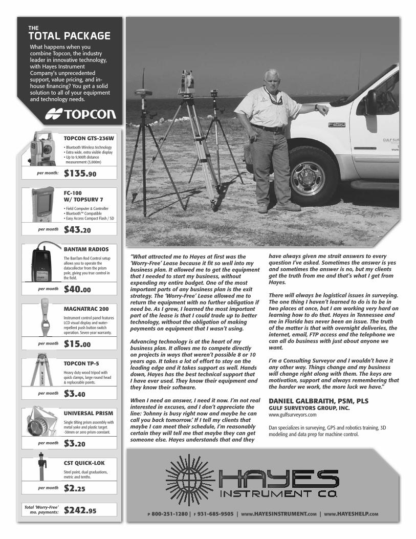
Hoosier Surveyor 35-4Page 20 P 800-251-1280 | F 931-685-9505 | WWW.HAYESINSTRUMENT.COM | WWW.HAYESHELP.COM
What happens when you combine Topcon, the industry leader in innovative technology, with Hayes Instrument Company’s unprecedented support, value pricing, and in-house financing? You get a solid solution to all of your equipment and technology needs.
have always given me strait answers to every question I’ve asked. Sometimes the answer is yes and sometimes the answer is no, but my clients get the truth from me and that’s what I get from Hayes.
There will always be logistical issues in surveying. The one thing I haven’t learned to do is to be in two places at once, but I am working very hard on learning how to do that. Hayes in Tennessee and me in Florida has never been an issue. The truth of the matter is that with overnight deliveries, the internet, email, FTP access and the telephone we can all do business with just about anyone we want.
I’m a Consulting Surveyor and I wouldn’t have it any other way. Things change and my business will change right along with them. The keys are motivation, support and always remembering that the harder we work, the more luck we have.”
DANIEL GALBRAITH, PSM, PLSGULF SURVEYORS GROUP, INC.www.gulfsurveyors.com
Dan specializes in surveying, GPS and robotics training, 3D modeling and data prep for machine control.
“What attracted me to Hayes at first was the ‘Worry-Free’ Lease because it fit so well into my business plan. It allowed me to get the equipment that I needed to start my business, without expending my entire budget. One of the most important parts of any business plan is the exit strategy. The ‘Worry-Free’ Lease allowed me to return the equipment with no further obligation if need be. As I grew, I learned the most important part of the lease is that I could trade up to better technology, without the obligation of making payments on equipment that I wasn’t using.
Advancing technology is at the heart of my business plan. It allows me to compete directly on projects in ways that weren’t possible 8 or 10 years ago. It takes a lot of effort to stay on the leading edge and it takes support as well. Hands down, Hayes has the best technical support that I have ever used. They know their equipment and they know their software.
When I need an answer, I need it now. I’m not real interested in excuses, and I don’t appreciate the line: ‘Johnny is busy right now and maybe he can call you back tomorrow.’ If I tell my clients that maybe I can meet their schedule, I’m reasonably certain they will tell me that maybe they can get someone else. Hayes understands that and they
TOTAL PACKAGETHE
TOPCON GTS-236W
per month: $135.90
FC-100W/ TOPSURV 7
per month $43.20
BANTAM RADIOS
allows you to operate the datacollector from the prism pole, giving you true control in the field.
per month $40.00
MAGNATRAC 200
Instrument control panel features
repellent push button switch operation. Seven year warranty.
per month $15.00
TOPCON TP-5
Heavy duty wood tripod with quick clamps, large round head
per month $3.40
UNIVERSAL PRISM
Single tilting prism assembly with metal yoke and plastic target.
per month $3.20
CST QUICK-LOK
Steel point, dual graduations, metric and tenths.
per month $2.25
Total ‘Worry-Free’ mo. payments: $242.95
Hoosier Surveyor 35-4 Page 21
COMPLETED CAREERS ISPLSLife Member
Rodney H. Ludwig, PE-PLS, Seymour (81)
Rodney H. Ludwig, 81, Seymour, passed away Thursday, April 2, 2009, at home, with his family by his side, after battling pancreatic cancer for more than a year. Mr. Ludwig was a member of Immanuel Lutheran Church, Seymour, and was a veteran of the U.S. Army, serving during World War II from 1945 to 1947. He graduated from Tri State University with a civil engineering degree. After graduating and working jobs in California and Fort Wayne, he relocated to Seymour in 1959 to help build Interstate 65. He then established RH Ludwig & Company, and was Seymour city engineer for four years. He developed Mutton Creek Estates, built bridges and homes and managed property. Other adventures included establishing and owning Jackson Concrete and Ludwig Stone companies, and Masa Ichi Japanese Steakhouse in Indianapolis. He also became a pilot with an interest in aerial photography. His entrepreneurship and never-ending ambition are traits that will be cherished by all. Rodney’s zest and love for life included his passion and talent of playing the piano and music. This was one of God’s gifts, as he learned to play by ear at an early age. He wrote and recorded several songs and even wrote a play. Rod competed in many piano competitions and won first place at the Golden Gala Talent Show in 2000, where Debbie Reynolds was the mistress of ceremonies. He volunteered and shared his musical gift by playing at the Jackson County Fair, several nursing homes and area clubs. He will be truly missed by his beloved family, friends and community. Born May 25, 1927, in Oil City, Pa., he was the son of Joseph and Anna Moore Ludwig, who preceded him in death. On July 4, 1953, he married Arlene Lanzer, who preceded him in death in 1981. On March 11, 1988, he married Joyce Williams Mills, who survives. Other survivors include children, Tom (Lori) Ludwig, Dan Ludwig, Amy Ludwig, Terry (Jon) Cole, Jeff Mills, Kelly Mills and Lisa (Tom) Dyer; grandchildren, Miranda, Halle, Lincoln, Jordan, Rheilly and Jonathon; and sisters, Edith Korb and Joann Waters, North Carolina. As a grandpa, he loved to share stories and life lessons. The Rev. Ralph Blomenberg, the Rev. Philip Bloch, the Rev. Jimmy Rodriguez and Vicar Michael Edwards conducted funeral services at Immanuel Lutheran Church, Seymour. Burial took place at Im-manuel Lutheran Cemetery, Seymour, with full military graveside rites conducted by Veterans of Foreign Wars Post 1925, American Legion Post 89, Disabled American Veterans 47 and Korean and Vietnam Veterans, all of Seymour, and a Voss dove tribute followed. Memorials may be given to the American Cancer Society for pancreatic cancer research.
Minutes...continued from Page 3
to the board for review at the April board meeting for approval at the May board meeting. A motion was made and passed that the Hoosier Surveyor be printed in Digital form for the remainder of the current budget session and that a letter be sent to the membership stating that the board is looking at extreme cost cutting measures for the next budget year. A motion was made and passed to get an ISPLS credit card to be held by the Society executive. A copy of the Wallington Asset Management report was pre-sented and discussed. Old Business - A written report was presented from the Purdue University Student Chapter on attending the ACSM Convention in Salt Lake Ctiy. Land Surveyors Records Registry - An update was given and a preliminary form layout was presented. There was discussion on the 2009 ISPLS Convention wrap-up. New Business - IUPUI Construction Engineering Managment Technology Program will attend the April BOD meeting.
ISPLS Life MemberAlfred “Lee” Utt, PLS, Bloomington (80)
Alfred “Lee” Utt, 80 of Bloomington, died Sunday, April 26, 2009, at Bell Trace Health and Living Center. Born, December 3, 1928 in Bicknell, IN; he was the son of Robert and Laverne (Salters) Utt. Lee was a registered land surveyor and a lifelong member of the Indiana Society of Professional Land Surveyors. He practiced in the Bloomington area from 1970 to 2008. He was the cornerstone of his family and to the surveying community. Lee enjoyed being with his family and friends and sharing his life experiences. He also enjoyed the outdoors, surveying, and mowing his lawn on his John Deere tractor. He will be greatly missed by his family, friends, and the com-munity. He was a great influence to his grandsons, and he profoundly passed along his legacy to them. They both have followed in his footsteps being licensed land surveyors in the state of Indiana. Survivors include his best friend of 47 years, Netha I. (Hol-lars) Utt, two daughters, Diana O’Rourke of Metamora, IN; Kathy Robbins of Bloomington, two son-in-laws, Daniel (Dan) O’Rourke, Frank (Robbie) Robbins III, one sister, Robertine Croy of Greene County, one nephew, Wayne Adams, two grandsons, Eric Deckard, Jason Deckard, one step-grandson, Brian Masterson, three great grandchildren, Colin, Ryan, and Chloe Deckard, one step-great grandson, Maverick Masterson. Lee was preceded in death by his parents, his step-father, Samuel “Pop” Reeves, and a nephew, Garrett Adams. Memorial contributions may be made to the Lee Utt Scholarship fund a scholarship at Vincennes University for the advancement of future land surveyors. In care of Vincennes University Survey Dept., Vincennes, Indiana 47591.
Hoosier Surveyor 35-4Page 22
CALENDAR SUSTAINING MEMBERS
AVATECH SOLUTIONS, INC. Indiana, LLC9465 Counselors Row, Suite 100
The Precedent Office ParkIndianapolis, IN 46240
(317) 846-2900“an Avatech Solutions Company”
BERNTSEN INTERNATIONAL, INC.P. O. Box 8670
Madison, WI 53708(800) 356-7388
HARRISON MARKER AND INSTRUMENT COMPANY
P.O. Box 66Anoka, Minnesota 55303
(763) 421-1445
HAYES INSTRUMENT CO.502 S. Cannon Blvd.
Shelbyville, Tennessee 37160(800) 251-1280
POSITIONING SOLUTIONS CO.7522 E. 39th Street
Indianapolis, Indiana 46226(317) 542-7673
SEILER INSTRUMENT &MANUFACTURING COMPANY
9454 Harrison Park LaneIndianapolis, Indiana 46216
(317) 545-7090
SURV-KAPP. O. Box 27367
Tucson, AZ 85726(800) 445-5320
TRIMBLE NAVIGATION LTD-SURVEY DIV10355 Westmoor Drive, Suite 100
Westminister, CO 80021(720) 887-6100
June 13, 2009ISPLS Board of Directors Meeting, ISPLS headquartersJune 26, 2009ISPLS 2009 Golf Outing; Place: Rock Hollow Golf Club, CR 250 W, Peru, Indiana; Time: 8:00 check in; 9:00 (local time) Shotgun Start; 2:00 Lunch; Format: 4 person Scramble; Cost: $80 per player-no refunds. (Includes 18 hole-green fees, cart & lunch) Print flyer out on line: http://ispls.org/pdf/ISPLS_Golf_Outing2009.pdfAugust 5-7, 2009Surveyors Review Course. Campus the Missouri University of Science and Technology (MS&T), Rolla, MO. Cosponsored by MS&T and the Missouri Society of Professional Surveyors. Top-ics: Exam Preparation, Legal Principles, USPLSS, Errors Analy-sis, Route Surveys, Instrumentation, GPS Surveys, State Plane Coordinates, Problems Session, Practice NCEES-like Exam. 2.2 CEU’s, 22 PDU’s. Instructors: Dr. Dick Elgin, Dr. Joe Paiva, Norman Brown, Mike Flowers. $795.00. Contact: Distance and Continuing Education; MS&T; Rolla, MO 65409; 573.341.4442. [email protected] 15, 2009ISPLS Board of Directors Meeting, ISPLS headquartersSeptember 19, 2009ISPLS Board of Directors Meeting, ISPLS headquartersSeptember 23, 2009/September 28, 2009ACSM Fall Conference, Holiday Inn, Gaithersburg, MDThis year’s ACSM Fall Conference will take place at the Gaith-ersburg Holiday Inn http://www.higaithersburg.com/ which is across the parking lot from ACSM Headquarters.There is a room block set up at the Holiday Inn Gaithersburg. The room block expires Tuesday, September 8, 2009. If you plan to attend the meeting, you’re urged to book soon.January 13-15, 2010ISPLS 58th Annual Convention, Indianapolis Marriott East Hotel, Indianapolis, IN.
Phillip Banton - AssociateDaniel Blann - ProfessionalBrian Block - AssociateBrian Campbell - AssociateChad Coughenour - AssociateKeith Ethridge - AssociateTodd Freund - ProfessionalMichael Fruth - ProfessionalRaymond Grangier - AssociateMark Hanna - AffiliateBrian Lieberg - Professional
WELCOME NEWISPLS MEMBERS
Donald Mosson - ProfessionalTravis Norman - ProfessionalChris Siebern - ProfessionalDavid Thomas - AssociateNityn Timble - ProfessionalRandal Vugteveen - ProfessionalRichard Wall - AssociateDonald Warner - AssociateEric White - ProfessionalRodney Young - Professional
Hoosier Surveyor 35-4 Page 23
FIRM MEMBERS
Hoosier Surveyor 35-4Page 24
FIRM MEMBERS
Hoosier Surveyor 35-4 Page 25
FIRM MEMBERS
"Excellence in Engineering Since 1975"
www.mdwessler.com
Evansville5401 Vogel Road, Suite 710
Evansville, IN 47715 Phone 812.475.1690
Fax 812.475.1691
Indianapolis6219 South East Street, Suite A
Indianapolis, IN 46227Phone 317.788.4551
Fax 317.788.4553
Connersville117 East Sixth Street
Connersville, IN 47331Phone 765.827.4435
Fax 765.827.8996
West Lafayette144 Sagamore Parkway West
West Lafayette, IN 47906Phone 765.463.2400
Fax 765.463.2455
THE HOOSIER SURVEYORIndiana Society of Professional Land Surveyors, Inc.55 Monument Circle, Suite 719Indianapolis, Indiana 46204
PRESORTEDSTANDARD
U. S. Postage PAIDIndianapolis, INPermit No. 4056