Embed Size (px)
Citation preview

OCS Study MMS 89-0023
Historic Shipwrecks and Magnetic Anomalies of the Northern Gulf of Mexico
Reevaluation of Archaeological Resource Management Zone 1
Volume I : Executive Summary
U .S . Department of the Interior Minerals Management Service
law Gulf of Mexico OCS Region

OCS Study MMS 89-0023
Historic Shipwrecks and Magnetic Anomalies of the Northern Gulf of Mexico
Reevaluation of Archaeological Resource Management Zone 1
Volume I : Executive Summary
Authors
Ervan G. Garrison Charles P Giammona Frank J. Kelly Anthony R . Tripp Gary A. Wolff
Prepared under MMS Contract 14-12-0001-30330 by The Texas A&M Research Foundation Box 3578 College Station, Texas 77843
Published by
U.S . Department of the Interior Minerals Management Service New Orleans Gulf of Mexico OCS Regional Office September 1989
DISCLAIMER
This report was prepared under contract between the Minerals Management Service (MMS) and the Texas A&M Research Foundation . This report has been technically reviewed by the MMS and approved for publication . Approval does not signify that contents necessarily reflect the views and policies of the Service, nor does mention of trade names or commercial products constitute endorsement or recommendation for use. It is, however, exempt from review and compliance with MMS editorial standards .
REPORT AVAILABILITY
Extra copies of the report may be obtained from the Public Information Unit (Mail Stop OPS-3-4) at the following address :
U.S Department of the Interior Minerals Management Service Gulf of Mexico OCS Regional Office Attention : Public Information Unit (OPS-3-4) 1201 Elmwood Park Boulevard New Orleans, Louisiana 70123-2394 Telephone : (504) 736-2519 or (FTS) 680-9519
CITATION
Suggested citation :
Garrison, E.G ., C.P . Giammona, F.J . Kelly, A.R . Tripp, and G.A. Wolff. Historic shipwrecks and magnetic anomalies of the northern Gulf of mexico: reevaluation of archaeological resource management zone 1 . Volume I executive summary. OCS Study/MMS 89-0023. U .S . Dept . of the Interior, Minerals Management Service, Gulf of Mexico OCS Regional Office, New Orleans, La . 3 Volumes, 6 pp .

ABSTRACT
As a result of Minerals Management Service (MMS) remote sensing surveys, numerous unidentified magnetic anomalies and side-scan sonar contacts which could represent historic shipwrecks have been recorded in the Gulf of Mexico (GOM). The objectives of this study are divided into two tasks. Task I provides a collection, evaluation, and synthesis of archaeological, environmental, and geographic data to evaluate and redefine the Cultural Resource Management Zone 1 (CRMZ1) in the Gulf . The CRMZ1 is an area considered to have a high probability for the occurrence of historic shipwrecks .
Task II was designed to establish an interpretive framework that would help identify the nature of magnetic anomalies and side-scan sonar contacts within the CRMZ1 . Field studies were conducted to determine the relationship between linespacing of magnetometer and side-scan surveys and the percentage of objects detected on the seafloor. These data were then analyzed to investigate whether remote sensing data gathered during a cultural resource survey could discriminate between a cultural resource and recent debris .
The results from Task I indicate : (1) an increased distribution of shipwrecks in the eastern Gulf beyond the present CRMZ1 boundary but a low preservation potential at these wreck sites, and (2) a higher potential of finding shipwrecks around historic port areas in the central and western Gulf because of higher preservation potential .
Recommendations to relocate the CRMZ1 based upon both the distribution of reported shipwreck locations and their preservation potential are made. It is proposed that the CRMZ1 be moved to within 10 km of the Gulf coast and that specific higher probability zones be delineated outside the CRMZ1 that reflect the increased frequency of wrecks in the vicinity of ports and certain hazards .
The results of Task II indicate : (1) magnetic anomalies increase in direct proportion to area surveyed, i .e . the 150 m line interval detects one-third of the anomalies compared to a 50 m line interval survey, (2) survey areas with oil and gas structures have higher numbers of magnetic anomalies than undeveloped survey areas, and (3) the present survey methods used for cultural resource surveys are not sensitive enough to differentiate between modern debris and a potential cultural resource .
Other methods can more confidently differentiate between modern debris and shipwrecks . One method forms the basis of our recommendations on Task II which suggest using 50 m lane spacing for survey areas having a high potential for shipwrecks. The recommendations in both Task I and II combine to reduce the general survey area on the Outer Continental Shelf (OCS) but increase the effectiveness of the surveys in areas that have a high probability of both shipwreck density and preservation potential .

iv
TABLE OF CONTENTS
PAGE
ABSTRACT . . . . . . . . . . . . . . . . . . . . . . . . . . . . . . . . . . . . . . . . . . . . . . . . . . . . iii TABLE OF CONTENTS . . . . . . . . . . . . . . . . . . . . . . . . . . . . . . . . . . . . . . . . . . . . . . . i v UST OF FIGURES . . . . . . . . . . . . . . . . . . . . . . . . . . . . . . . . . . . . . . . . . . . . . . . . . iv ACKNOWLEDGEMENTS . . . . . . . . . . . . . . . . . . . . . . . . . . . . . . . . . . . . . . . . . . . . . . v EXECUTIVE SUMMARY . . . . . . . . . . . . . . . . . . . . . . . . . . . . . . . . . . . . . . . . . . . . . 1-1
LIST OF FIGURES
Figure I-1 . . . . . . . . . . . . . . . . . . . . . . . . . . . . . . . . . . . . . . . . . . . . . . . . . . . . 1-2

v
ACKNOWLEDGEMENTS
The program manager and all of the principal investigators would like to acknowledge the assistance of the research assistants, secretaries, clerks, student technicians, student workers, laboratory technicians, draftpersons, and others who have been so instrumental in assembling this report for the Minerals Management Service .
The management staff on this project are involved in purchasing, report writing, and clerical duties which make it possible for the researchers to implement the procedures which are described in this report and their fine work is appreciated . The assistance of Mr . Mike Huddleson in coordinating project business with the Texas A8M Research Foundation, the Minerals Management Service, and outside vendors is most appreciated . Mr. William Crow coordinated many project logistics . The contribution of Ms. Susan Hulse in organizing, typing, and editing this report is most appreciated . The special help and extended efforts of Sherry Garvey, Andrea Hapeman, and Joanna Fritz are examples of how projects cannot be successful without the teamwork of wonderful staff . The work of the project field staff and the crew of the University research vessel, the R/V EXCELLENCE II, is acknowledged . Their assistance in the implementation of field sampling procedures has been very valuable and is greatly appreciated .
Acknowledgement is given to student assistance Karen Trossel, Nancy Hitchcock, Susie Riley, Robert Lightfoot, Sherry Garvey, Kyle Baden, Karen Martin, and Diane Midge for their invaluable assistance in data analysis, compilation, and transmission . Eri Weinstein participated in the 1988 field surveys of lease blocks 313 and 332 as partial fulfillment of course requirements in his graduate studies . Mr . Ron Pierce gave his usual fine effort in locating materials and equipment necessary for the successful field studies . Mr . Ben Thigpen provided expert council on survey problems, drawing on exhaustive experience in the geophysical industry .
Several vendors and their representatives provided timely service and assistance . These include Mr. Terry S . Snyder (EG&G), Mr. John Fett (John D. Fett Instruments), Mr. Alistair Helme (Harvey-Lynch, Inc.), Mr . Larry Stephenson (Harry-Lynch, Inc.), Mr. Chuck Edgington (Del Norte Technology, Inc.), Mr . Andy Bogle (STARFIX), Mr. Jack Rhodes (STARFIX), Mr. Dick Smith (STARFIX), Mr. Jeff Raspberry (STARFIX), and particularly Mr . Max Huff (STARFIX) . The tow-depth sensor used during the field studies was graciously provided by Teledyne Exploration, Inc. through the offices of Mr . Carl Bergland . EG&G Geometrics gave its usual fine product support and is thanked for updating our G-866 magnetometer .
Our thanks go to Mr. James Baker and Mr. James Orr for preparing the excellent DISSPLA graphics included in this report . The staff of the Engineering Computer Services (ECS) of the Engineering Program, Texas A&M University, provided technical and advisory assistance over the course of the study . In particular, Mr. J. Robert Shaeffer (now with Boeing Computing Services), Mr. Jeff Cox (ECS) and the director of ECS, Dr. Donald Maxwell, are thanked. Dr . Maxwell authorized the acquisition of the NUMONICS digitizer and DEC 220/240 terminals so important to the manipulation and presentation of the large digital databases used in this study. The study benefited from his complete support as Interim Department Head, Civil Engineering Department, Texas A&M University .
Dr . Robert Bruner of the Geotechnical Area, Civil Engineering Department, erected the geodetic controls used in the resurvey of lease blocks GA 313 and GA 332. Dr . Bruner and his son, Bill, cheerfully rode boats and helicopters to erect the offshore positions to the highest degree of accuracy . The control points were erected on properties of Santa Fe Minerals and

Exploration Co., Lorac, a division of John E . Chance Associates, and the United States Coast Guard (Surfside, Texas) . Each of these organizations is thanked for this courtesy.
We gratefully recognize ARMS, Inc. whose personnel, Mr. Nathan Gautheir (President), Mr. Randy Ducote, and Mr. Robert Simon were always able to accommodate our requests .
During the summer field studies several divers volunteered their assistance . Most were students of Texas A&M University and include : Mike Halpin, Marianne Franklin, Kenan Heideke, Alan Haubaker, Jim Hobling and Kathleen McLaughlin-Neyland .
Excellent examples of graphic displays of magnetic anomalies were provided by Mr. Robert Gearhart and Mr. Clell Bond of Espey-Huston and Associates, Inc., and by Mr. Rick Anuskiewicz . A photo of the machinery of the WILL O'THE WISP was generously loaned by Mr. Larry R. Martin .
Finally, we wish to thank those members of the Minerals Management Service we worked with most closely over the course of the study. They are: Dr . Norman Froomer, Ms . Melanie Stright, Dr. Richard Defenbaugh and Dr. Rick Anuskiewicz. Their counsel and assistance greatly enhanced the conduct and relults of this study .
EXECUTIVE SUMMARY
As a result of Minerals Management Service (MMS) required lease block remote sensing surveys, numerous unidentified magnetic anomalies and side-scan sonar contacts which could represent historic shipwrecks have been recorded in the Gulf of Mexico (GOM) . These surveys also recorded numerous examples of relict landforms (fluvial channels, terraces, point bars, bays, lagoons, barrier islands, natural levee ridges, salt diapirs, and sinkholes) where there is a high probability for associated prehistoric sites.
Avoidance of further investigation of archaeologically sensitive areas is usually required prior to approval of lease permits; however, because industry has generally chosen avoidance rather than further investigation of these areas, little data have been collected which would help in building an interpretive framework for the evaluation of unidentified magnetic anomalies and side-scan sonar contacts, or in evaluating the predictive model for prehistoric site occurrence .
The objectives of this study are:
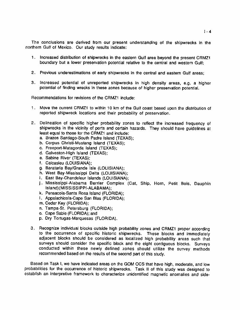
a . To reevaluate and make recommendations to change, if necessary, the location of Cultural Resource Management Zone 1 (CRMZ1) in the GOM (Figure 1) .
b . To determine the relationship between linespacing of magnetometer readings and side-scan sonar and the detection of objects at or below the seafloor .
c. To investigate whether remote sensing data gathered during a cultural resource survey in the GOM can be analyzed to discriminate between a cultural resource and recent
debris .
This study was divided into two major tasks : Task I, Evaluation of Cultural Resource Management Zone 1 ; and Task 11, Establishing an interpretive framework to characterize unidentified magnetic anomalies and side-scan sonar contacts .
The data from primary and secondary materials collected at the various archives were merged and a master file of historic shipwrecks of the northern Gulf of Mexico was created. This file, with over 4,000 entries, represents the largest such data base for the Gulf .
Determining spatial patterns of shipwrecks in the Gulf of Mexico does not explain the causes for these patterns . These factors are not always independent. For example, increased frequency of shipwrecks along trade routes does not explain why the vessels were lost, only why they were there in the first place . Factors such as poor seamanship, poor navigation, scuttling, explosions, and fire cause shipwrecks .
An interesting aspect of the analyses conducted on the data in this study shows an increase in the number of losses over time. This contradicts conclusions in previous studies where the peak for shipwreck losses was expected to lie between 1880 and 1910 . New data suggests that shipwreck loss continues to increase through the 20th century . This fact is somewhat surprising if one assumes that improvements in the technology of ship design, the use of diesel engines, and better navigational tools would reduce the number of ships lost over time . However, the rate of shipwrecks actually increases because of improved technology. Improved technology may allow more vessels to be exposed to risks that early mariners would avoid because of recognized shortcomings in their ships or navigational aids .

33° B_ Dal las
\ T E X A 3
F' 30 °
I- 27"
Cor
`GO
Houston
A rwwas Bay
ARKANSAS
49.1
"
e
'P 00 Charts
?A
'0
Galveston Bay
G
y'Do
4
`y 46
by
Natchez
New rlear rel.~
0 F
SOLrrH CA.ROLINA Atlanta
ALABAMA LAB AA GEORGIA L P
tu Area Mobile F L .T~It~hassre~~~
Paseogoula R ,Q
t Lake PonkhoKrotn y ApclatAieolo R.
Tampa O
IV C' r
0 K
SGIE .140 200 300
Mill*$
'
m arni
FIGURE I-1, Study area, CEI 1977.
N

I-3
The number of ships lost in the open sea versus those lost nearshore were discussed by Muckelroyl, Bascom2, CEI3, and Marx4 . Marx estimated that approximately 98 percent of all shipping losses in the western hemisphere prior to 1825 occurred in less than 10 m of water and within 1 .5 km of the coast. CEI's authors followed this proposition when developing the CRMZ1 . Muckelroy suggested that the 10 m boundary probably underestimated the potential for deep-water archaeology . Bascom concluded from a study of 19th century losses at Lloyds of London that about 20 percent of all sinkings occur away from the coast . This figure probably better approximates the correct order of magnitude for all sinkings in the open sea at any period. The data in this study support Bascom. An inspection of our shipwreck distribution plots shows that 75 percent of shipwrecks occur in nearshore waters and the remainder in the open sea . They conclude that wrecks are associated with the approaches to seaports, straits, shoals, reefs, and along the maritime routes . As we have seen in this study, the foregoing assumptions are largely supported by the data, but the authors deviate from their assumptions in the actual drawing of CRMZ1 .
The potential for shipwreck site preservation is another important consideration in the overall analysis of the CRMZ1 . If an area with a high potential for historic shipwrecks lacks the potential for preservation, that area may not need to be included within the boundary of the CRMZ1 . An example of an area with negative environmental factors for site preservation is the region at the mouth of the Mississippi River . By historic accounts, it was an area of high ship concentration . The tremendous sediment deposits off the Mississippi Delta militate against finding a shipwreck in that area due to sediments of a depth that would insulate it from discovery .
Ships falling on areas of moderate to high sediment depths, hypoxic burial conditions, and low current regimes have good preservation potential. These conditions characterize much of the western and the west-central areas of the northern Gulf . It cannot be stated unequivocally that vessels sinking in sediment starved areas of the shelf, such as that of the eastern Gulf area, cannot be preserved, but based on results of this inquiry that probability seems low. In an area where burial or protection by fouling organisms exist, biofouling must be rapid in order to preserve vessel fabric or cargo . Until better data is available for the eastern Gulf, our expectation is that much of that area will be characterized by poor preservation of historic shipwrecks . Records for shipwreck locations were merged with our assumptions concerning shipwreck
preservation to derive a model for the potential of finding shipwrecks in the GOM.
K. Muckelroy . 1977 . Maritime Archaeology. Cambridge University Press. Cambridge.
W. Bascom. 1971 . "Deep Water Archaeology." Science . 174(4006) : p . 261-269 .
Coastal Environments, Inc. 1977. "Cultural Resources Evaluation of the Northern Gulf of Mexico Continental Shelf." 3 Volumes . Baton Rouge, Louisiana. National Technical Information Services (NTIS) as : Vol. I, Prehistoric Cultural Resource Potential, PB276773/AS ; Vol. II, Historic Cultural Resources, PB-2767741AS ; and Vol . III, Maps, PB-286-874/AS.
Marx, R.F . 1971 . Shipwrecks of the Western Hemisphere . 1492-1825 . David McKay Company, Inc., New York, NY.
I-4
The conclusions are derived from our present understanding of the shipwrecks in the northern Gulf of Mexico. Our study results indicate :
1 . Increased distribution of shipwrecks in the eastern Gulf area beyond the present CRMZi boundary but a lower preservation potential relative to the central and western Gulf ;
2 . Previous underestimations of early shipwrecks in the central and eastern Gulf areas ;
3 . Increased potential of unreported shipwrecks in high density areas, e .g . a higher potential of finding wrecks in these zones because of higher preservation potential.
Recommendations for revisions of the CRMZ1 include:
1 . Move the current CRMZ1 to within 10 km of the Gulf coast based upon the distribution of reported shipwreck locations and their probability of preservation.
2 . Delineation of specific higher probability zones to reflect the increased frequency of shipwrecks in the vicinity of ports and certain hazards . They should have guidelines at least equal to those for the CRMZ1 and include : a Brazos Santiago-South Padre Island (TEXAS) ; b . Corpus Christi-Mustang Island (TEXAS) ; c. Freeport-Matagorda Island (TEXAS) ; d. Galveston-High Island (TEXAS) ; e. Sabine River (TEXAS) ; f . Calcasieu (LOUISIANA) ; g. Barataria Bay/Grande Isle (LOUISIANA) ; h . West Bay-Mississippi Delta (LOUISIANA); i . East Bay-Chandeleur Islands (LOUISIANA) ; j . Mississippi-Alabama Barrier Complex (Cat, Ship, Horn, Petit Bois, Dauphin
Island) (MISSISSIPPI-ALABAMA) ; k . Pensacola-Santa Rosa Island (FLORIDA) ; I . Appalachicola-Cape San Blas (FLORIDA) ; m . Cedar Key (FLORIDA) ; n . Tampa-St . Petersburg (FLORIDA) ; o. Cape Sable (FLORIDA); and p. Dry Tortugas-Marquesas (FLORIDA).
3 . Recognize individual blocks outside high probability zones and CRMZ1 proper according to the occurrence of specific historic shipwrecks. These blocks and immediately adjacent blocks should be considered as localized high probability areas such that surveys should consider the specific block and the eight contiguous blocks . Surveys conducted within these newly defined zones should utilize the survey methods recommended based on the results of the second part of this study.
Based on Task I, we have indicated areas on the GOM OCS that have high, moderate, and low probabilities for the occurrence of historic shipwrecks . Task II of this study was designed to establish an interpretive framework to characterize unidentified magnetic anomalies and side-

I-5
scan sonar contacts within the CRMZ1 . It has the following two efforts : (1) Information collection ; and (2) information analysis and synthesis . Two previously surveyed lease blocks (one that was not subsequently developed, and one that has been developed) were resurveyed for magnetometer and side-scan sonar data with survey linespacing at 50 m and navigation system accuracy at t5 m . These data and the data from the original lease block survey were analyzed to determine the following :
1 . The percentage of anomalies recorded during the survey at 50 and 100 m linespacings that was recorded during the original lease block survey at 150 m linespacing ;
2 . The correlation in anomaly locations, amplitude, duration, and signature (dipolar/monopolar) between the original and new surveys ; and
3 . The number of new magnetic anomalies and/or side-scan contacts that were recorded within the developed lease block, and the location of these anomalies relative to oil and gas structures .
Sites within lease blocks were selected for groundtruthing and signature characterization of unidentified magnetic anomalies and side-scan sonar contacts . Anomalies were chosen from the resurvey sites as discussed above. Groundtruthing and signature characterization included the following :
1 . Relocating the anomaly or contact and collecting magnetometer and/or side-scan sonar data at a linespacing of 50 m or less ;
2 . Constructing a three-dimensional magnetic contour map of the unidentified magnetic anomalies, and magnetic anomalies with associated side-scan sonar contacts ;
3 . Identifying the source of the anomalous contact through diver inspection, using a hand held metal detector ; and
4 . Photographing any marine debris and historic shipwrecks where observable at the seafloor .
The results of the resurvey and groundtruth efforts include :
1 . Post-plot maps that show the track of the survey vessel and navigational fix points at a 1 :1200 scale and compare the findings of the original lease block survey with the resurvey data; and
2 . Contour maps with a two gamma contour spacing of each magnetic anomaly that was investigated, and a catalogue of magnetic signatures for each object . ( a ) The survey and groundtruthing methods, and the instrumentation used is
described and survey findings are discussed. ( b ) All the data collected during the field surveys were analyzed to determine the
relationship between survey linespacing and anomaly detection, the influence of oil and gas structures on magnetic anomaly distribution and to characterize the changes at different distances and orientations to the magnetic sensors. The goal of the pattern recognition analysis of magnetic and side-scan sonar signatures is to develop a method that differentiates resources, and that can be used by MMS cultural resource analysts in the cultural resource survey review process.

I-6
The following is a summary of the results :
1 . The detection of magnetic anomalies increases in direct proportion to the lanespacing used, e.g . the 150 m line interval detects one-third of the anomalies found using a 50 m line interval . This result may be specific to this particular study and the linear trend may differ with other data.
2 . The survey of the developed lease block with oil and gas structures had the highest number of magnetic anomalies relative to the two undeveloped blocks surveyed . We conclude that development increases the number of anomalies of modern origin .
3 . The present survey methodology is not developed enough to differentiate, at a high confidence level, between modern ferromagnetic debris and potential cultural resources . It represents a compromise between scientific and economic goals.
The present study demonstrates methods by which one can more confidently characterize modern ferromagnetic debris and potential cultural resources . Pattern recognition has been demonstrated by using 50 m or less lanespacing by other state and federal agencies such as the Texas Antiquities Committee, the National Park Service, and the U.S. Army Corps of Engineers or by use of groundtruthing .
Recommendations to alter the present methodology have been made in the past MMS sponsored studies notably CEI and SAIs that still have merit . These include : conducting side-scan, magnetometer, and sub-bottom profiling surveys using 50 m linespacing in high shipwreck potential areas and limiting vessel speed to 2-3 m/s (4-6 knots). The recommendations in both Tasks I and II combine to reduce the general survey area on the OCS but increase the effectiveness of the surveys in lease block areas of reported shipwrecks with a high potential for their preservation .
Science Applications, Inc. 1981 . "A Cultural Resource Survey of the Continental Shelf from Cape Hatteras to Key West." 4 Volumes. McLean, VA.

~N,ENT oFTy ° The Department of the Interior Mission ~P ~ ...,~F
As the Nation's principal conservation agency, the Department of the Interior has responsibility for a most of our nationally owned public lands and natural resources. This includes fostering sound use
of our land and water resources; protecting our fish, wildlife, and biological diversity; preserving the
4 9
environmental and cultural values of our national parks and historical places ; and providing for the qCH 3 ~ enjoyment of life through outdoor recreation . The Department assesses our energy and mineral
resources and works to ensure that their development is in the best interests of all our people by encouraging stewardship and citizen participation in their care . The Department also has a major responsibility for American Indian reservation communities and for people who live in island territories under U .S . administration .
The Minerals Management Service Mission
As a bureau of the Department of the Interior, the Minerals Management Service's (MMS) primary ' responsibilities are to manage the mineral resources located on the Nation s Outer Continental Shelf
. ~ (OCS), collect revenue from the Federal OCS and onshore Federal and Indian lands, and distribute those revenues .
~t r~Ey~~ Moreover, in working to meet its responsibilities, the Offshore Minerals Management Program administers the OCS competitive leasing program and oversees the safe and environmentally sound exploration and production of our Nation's offshore natural gas, oil and other mineral resources . The MMS Royalty Management Program meets its responsibilities by ensuring the efficient, timely and accurate collection and disbursement of revenue from mineral leasing and production due to Indian tribes and allottees, States and the U .S . Treasury .
The MMS strives to fulfill its responsibilities through the general guiding principles of: (1) being responsive to the public's concerns and interests by maintaining a dialogue with all potentially affected parties and (2) carrying out its programs with an emphasis on working to enhance the quality of life for all Americans by lending MMS assistance and expertise to economic development and environmental protection .