Embed Size (px)
Citation preview

Historic Resources Survey Report
San Pedro Community Plan Area Prepared for:
City of Los Angeles Department of City Planning Office of Historic Resources Prepared by:
July 2012

SurveyLA San Pedro Community Plan Area
Table of Contents
Project Overview 1 SurveyLA Methodology Summary 1 Project Team 3 Survey Area 3 Designated Resources 9 Community Plan Area Survey Methodology 11
Summary of Findings 13 Summary of Property Types 13 Summary of Contexts and Themes 14
For Further Reading 31
Appendices Appendix A: Individual Resources Appendix B: Non-Parcel Resources Appendix C: Historic Districts & Planning Districts

SurveyLA 1 San Pedro Community Plan Area
Project Overview This historic resources survey report (“Survey Report”) has been completed on behalf of the City of Los Angeles Department of City Planning’s Office of Historic Resources (OHR) for the SurveyLA historic resources survey of the San Pedro Community Plan Area (CPA). This project was undertaken from September 2011 to July 2012 by Historic Resources Group (HRG). This Survey Report provides a summary of the work completed, including a description of the survey area; an overview of the field methodology; a summary of relevant contexts, themes and property types; and complete lists of all surveyed resources. This Survey Report is intended to be used in conjunction with the SurveyLA Field Results Master Report (“Master Report”) which provides a detailed discussion of SurveyLA methodology and explains the terms used in this report and associated appendices. In addition, a Survey Results Map has been prepared which graphically illustrates the boundaries of the survey area and the location and type of all resources identified during the field surveys. The Master Report, Survey Report, Appendices, and Results Map are available at www.surveyla.org.
SurveyLA Methodology Summary Below is a brief summary of SurveyLA methodology. Refer to the Master Report discussed above for more information. Field Survey Methods Properties surveyed for SurveyLA are evaluated for eligibility for listing in the
National Register of Historic Places, California Register of Historical Resources, and for local designation as City Historic-Cultural Monuments (HCM) or Historic Preservation Overlay Zones (HPOZ), commonly known as historic districts.
Field surveyors cover the entire area within the boundaries of a CPA. However, only resources that have been identified as significant within the contexts developed for SurveyLA are recorded.
Consultants making resource evaluations meet professional qualification standards in Architectural History, History, or a related field.
Surveys focus on identifying significant resources dating from about 1850 to 1980.
All surveys are completed from the public right-of-way (from vehicles or on foot as needed).
Digital photographs are taken of all evaluated resources.
SurveyLA 2 San Pedro Community Plan Area
Field Surveys do not include:
Individual resources and historic districts (including HPOZs) that are already designated (listed in the National, California or local registers).
Community Redevelopment Area (CRA) surveys conducted within the last five years.
Potential Historic Preservation Overlay Zone (HPOZ) areas which have been surveyed in the last five years and are in the process of being designated.
Industrial properties, which will be surveyed as a group in a later phase of SurveyLA.
SurveyLA Resources Types SurveyLA identifies individual resources, non-parcel resources, historic districts and district contributors and non-contributors. Each of these is described below. Appendices A, B, and C are organized by resource type. Individual Resources are generally resources located within a single assessor
parcel such as a residence or duplex. However, a parcel may include more than one individual resource, if each appears to be significant.
Non-Parcel Resources are not associated with Assessor Parcel Numbers (APNs) and generally do not have addresses. Examples include street trees, street lights, landscaped medians, bridges, and signs.
Historic Districts are areas that are related geographically and by theme. Districts may include single or multiple parcels, depending on the resource. Examples of resources that may be recorded as historic districts include residential neighborhoods, garden apartments, commercial areas, large estates, school and hospital campuses, and industrial complexes.
District Contributors and Non-Contributors are buildings, structures, sites, objects, and other features located within historic districts. Generally, non-contributing resources are those that are extensively altered, built outside the period of significance, or that do not relate to historic contexts and themes defined for the district.
Planning Districts are areas that are related geographically and by theme, but do not meet eligibility standards for designation. This is generally because the majority of the contributing features have been altered, resulting in a cumulative impact on the overall integrity of the area that makes it ineligible as a Historic District. The Planning District determination, therefore, is used as a tool to inform new Community Plans being developed by the Department of City Planning. These areas have consistent planning features – such as height, massing, setbacks, and street trees – which warrant consideration in the local planning process.

SurveyLA 3 San Pedro Community Plan Area
Project Team The San Pedro CPA survey was conducted by Historic Resources Group. Historic Resources Group personnel included Christy Johnson McAvoy, Founding Principal; Kari Michele Fowler, Senior Preservation Planner; Christine Lazzaretto, Senior Architectural Historian; Laura Janssen, Senior Architectural Historian; Paul Travis, Senior Preservation Planner; and Robby Aranguren, Planning Associate; with additional assistance provided by intern Debi Howell-Ardila. Kari Fowler served as the project manager.
Survey Area The identified survey area (“Survey Area”) corresponds with the boundary for the San Pedro Community Plan Area (CPA). Located approximately 20 miles south of downtown Los Angeles on the Palos Verdes Peninsula, the San Pedro CPA forms an irregular boundary enclosed generally by Westmont Drive and Front Street on the north, Harbor Boulevard, Via Cabrillo Marina, and Shoshonean Road on the east, Point Fermin and Paseo Del Mar Avenue on the south, and Western Avenue and Miraleste Drive on the west. The contours of the San Pedro CPA along the east and south are defined by the coastline, with the Cabrillo Marina and harbor marking the border along the east, and the coastal bluffs of the Pacific Ocean along the south. (See Survey Area Map below.) The San Pedro CPA consists of a total of 17,803 parcels. Of these, 16,081 were surveyed by SurveyLA. SurveyLA generally does not include properties constructed after 1980; individual resources or historic districts (including Historic Preservation Overlay Zones, or HPOZs) designated at the federal, state, or local levels; and proposed HPOZs surveyed within the last five years. The San Pedro CPA has one designated district, the Vinegar Hill HPOZ, which includes approximately 20 contributing properties.1 This area, bounded by Ninth Street (north), Palos Verdes (east), Tenth Street (south), and Centre Street (west), was not surveyed. In addition, an extension to the Vinegar Hill HPOZ, which is generally bounded by Eighth Street (north), Beacon Street (east), Twelfth Street (south), and Pacific Avenue (west), was recently proposed and therefore was not re-surveyed. Also excluded were approximately 200 parcels falling within the Pacific Corridor Redevelopment Project area that was recently surveyed by the CRA. Centered on the north-south corridor of Pacific Avenue, this area is generally bounded by Sixth Street on the north (extending eastward to Centre Street along Sixth and Seventh Streets) and Twelfth Street on the south.2
1 The Vinegar Hill HPOZ is an early residential suburb of San Pedro developed between 1886 and 1927
and representing a variety of architectural styles from the period. 2 Note that the Port of Los Angeles is located within a separate Community Plan Area and will be
surveyed in a later phase of SurveyLA.

SurveyLA 4 San Pedro Community Plan Area

SurveyLA 5 San Pedro Community Plan Area
The topography of the San Pedro CPA is varied. Enclosed by the coastline and harbor, the CPA has a series of low rolling hills and plateaus. The northeastern corner of the CPA is characterized primarily by a flat plain with rectilinear streets; the flat plain gives way to a sloping hillside beginning at Sixth Street. Along the eastern harbor, the shoreline is narrow and relatively flat. Moving westward from the harbor, the CPA slopes upward, with flat plateaus in some sections, and streets lined with primarily residential neighborhoods throughout. Along the western periphery of the CPA, hillside areas, occupied primarily by residential neighborhoods, offer panoramic views of the port and ocean. The southern border follows the contours of the coastline, which consists of steep coastal bluffs, with trails descending to the beach and park areas located along plateaus overlooking the ocean. Landslides have long been an issue along the coastal bluffs. A significant landslide in the 1930s occasioned the nickname of the “Sunken City” for land lost near Point Fermin Park, with additional landslides throughout the twentieth-century constantly altering the coastline. The street patterns of the San Pedro Survey Area reflect its development history. An orthogonal street grid extends generally from the northeastern through southeastern areas. This pattern reflects the street configuration and block sizes established in the late-19th century when the town was platted and the earliest development was concentrated near the harbor and rail depot. Moving westward, the street grid gives way to curvilinear streets with culs de sac, reflecting street patterns more common in mid-20th century urban planning. Major north-south thoroughfares include Pacific Avenue and Gaffey Street, both of which have been significant transportation corridors since earliest phases of the area’s development. In 1907, Pacific Avenue became the artery for the Point Fermin Line, a Pacific Electric streetcar that connected the harbor area and original business district with neighborhoods extending south to the ocean. In terms of coastal access, Harbor Boulevard follows the curving shoreline to the east, and Paseo Del Mar reflects the irregular shape of the coastline to the south. The San Pedro Survey Area is accessed via two principal transportation routes, each terminating in the northeastern area: the Harbor Freeway (Interstate 110), which joins Gaffey Street near Summerland Avenue, and the Seaside Freeway (State Route 47), which proceeds east along the Vincent Thomas Bridge to connect with the Long Beach Freeway (Interstate 710). A number of parks provide open space throughout what is otherwise a dense urban environment. Peck Park and the adjacent Leland Park are two of the largest parks, traversing roughly eight blocks from Western Avenue to Gaffey Street in the northwestern portion of the CPA. They include sparsely improved hillside areas lined with hiking trails, as well as landscaped areas and recreational facilities. The southern portion of the CPA has four coastal parks: Cabrillo Beach Park, at the southeastern corner of the CPA; Point Fermin Park; Angel’s Gate Park; and White Point State Park, which is nestled in the coastal ranges near the ocean. These parks are home to several designated resources, including the 1932 Cabrillo Beach Bathhouse, the 1874 Point Fermin Lighthouse in Point Fermin Park, and the Upper Reservation of Fort MacArthur and Korean Friendship Bell in Angel’s Gate Park.

SurveyLA 6 San Pedro Community Plan Area
The neighborhoods of the San Pedro Survey Area are diverse in use and character. Resource types found throughout the survey area include single- and multi-family residences, interspersed with commercial, civic, institutional, and religious properties. Major arteries, such as Pacific Avenue and Gaffey Street, are lined with dense commercial development. Given its topography, public staircases were found in the hillside residential communities. Near the harbor, some early commercial development remains along Sixth Street and Pacific Avenue, which formed the intersection of two Pacific Electric streetcar lines in the early 20th century. Concentrations of post-World War II development, including large residential developments and commercial strips, are primarily found in the western area of the CPA. Industrial areas are concentrated primarily along the harbor and in the northeastern corner of the survey area.3 The San Pedro Survey Area falls within the boundaries of three historic ranchos: Rancho San Pedro, Rancho Los Palos Verdes, and Rancho Los Cerritos. Platted in 1882, one year after the Southern Pacific Railway line arrived, San Pedro benefited from the region-wide real estate boom of the 1880s. By the time of its 1888 incorporation as a city, San Pedro was roughly bounded by Front Street on the north, Harbor Street and the harbor itself on the east, Point Fermin Park on the south, and Gaffey, Leland, and Meyler Streets on the west. Centered on the rail depot, an early business district developed just west of the harbor, in the area roughly bounded by Fourth Street on the north, Harbor Street on the east, Sixth Street on the south, and Palos Verdes Street on the west (though a substantial portion of this area was demolished in 1970 as part of urban redevelopment). Two events in the late-19th century were especially influential in shaping the development history of the San Pedro CPA: the 1888 establishment of a federal military reservation near the harbor, a presence that expanded throughout the twentieth century, and the selection of San Pedro over Santa Monica in the late 1890s as the site of the official port for the City of Los Angeles, along with the allocation of $2.9 million for port improvements. The 1888 military reservation, which included the Mexican-era reservation, 500 Varas Square, was renamed Fort MacArthur in 1914; this area represents the “Middle Reservation” of Fort MacArthur, a collection of buildings and structures listed in the National Register of Historic Places. San Pedro’s strategic importance was affirmed as the military presence continued to expand throughout the twentieth century. Starting in World War I, when Fort MacArthur secured the harbor, the military presence in the area increased to encompass a satellite of Fort MacArthur near Paseo Del Mar (called the “Upper Reservation”) and White Point’s NIKE Missile Launcher Site, located in the southwestern corner of the CPA.
3 The Port of Los Angeles and other areas that are zoned for industrial use were not surveyed as part of
the San Pedro CPA. The Port of Los Angeles is a separate CPA and is included in a later phase of SurveyLA; other areas zoned for industrial use within the San Pedro CPA will also be surveyed in a later phase of the project.
SurveyLA 7 San Pedro Community Plan Area
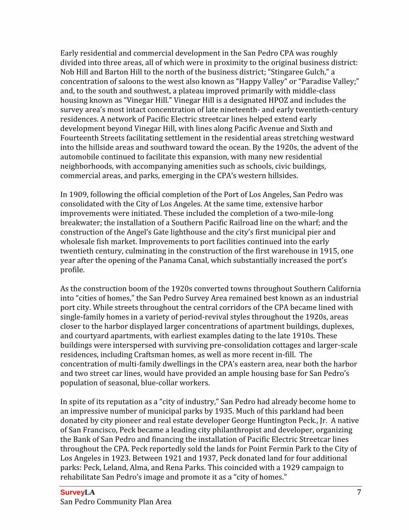
Early residential and commercial development in the San Pedro CPA was roughly divided into three areas, all of which were in proximity to the original business district: Nob Hill and Barton Hill to the north of the business district; “Stingaree Gulch,” a concentration of saloons to the west also known as “Happy Valley” or “Paradise Valley;” and, to the south and southwest, a plateau improved primarily with middle-class housing known as “Vinegar Hill.” Vinegar Hill is a designated HPOZ and includes the survey area’s most intact concentration of late nineteenth- and early twentieth-century residences. A network of Pacific Electric streetcar lines helped extend early development beyond Vinegar Hill, with lines along Pacific Avenue and Sixth and Fourteenth Streets facilitating settlement in the residential areas stretching westward into the hillside areas and southward toward the ocean. By the 1920s, the advent of the automobile continued to facilitate this expansion, with many new residential neighborhoods, with accompanying amenities such as schools, civic buildings, commercial areas, and parks, emerging in the CPA’s western hillsides. In 1909, following the official completion of the Port of Los Angeles, San Pedro was consolidated with the City of Los Angeles. At the same time, extensive harbor improvements were initiated. These included the completion of a two-mile-long breakwater; the installation of a Southern Pacific Railroad line on the wharf; and the construction of the Angel’s Gate lighthouse and the city’s first municipal pier and wholesale fish market. Improvements to port facilities continued into the early twentieth century, culminating in the construction of the first warehouse in 1915, one year after the opening of the Panama Canal, which substantially increased the port’s profile. As the construction boom of the 1920s converted towns throughout Southern California into “cities of homes,” the San Pedro Survey Area remained best known as an industrial port city. While streets throughout the central corridors of the CPA became lined with single-family homes in a variety of period-revival styles throughout the 1920s, areas closer to the harbor displayed larger concentrations of apartment buildings, duplexes, and courtyard apartments, with earliest examples dating to the late 1910s. These buildings were interspersed with surviving pre-consolidation cottages and larger-scale residences, including Craftsman homes, as well as more recent in-fill. The concentration of multi-family dwellings in the CPA’s eastern area, near both the harbor and two street car lines, would have provided an ample housing base for San Pedro’s population of seasonal, blue-collar workers. In spite of its reputation as a “city of industry,” San Pedro had already become home to an impressive number of municipal parks by 1935. Much of this parkland had been donated by city pioneer and real estate developer George Huntington Peck., Jr. A native of San Francisco, Peck became a leading city philanthropist and developer, organizing the Bank of San Pedro and financing the installation of Pacific Electric Streetcar lines throughout the CPA. Peck reportedly sold the lands for Point Fermin Park to the City of Los Angeles in 1923. Between 1921 and 1937, Peck donated land for four additional parks: Peck, Leland, Alma, and Rena Parks. This coincided with a 1929 campaign to rehabilitate San Pedro’s image and promote it as a “city of homes.”

SurveyLA 8 San Pedro Community Plan Area
By the 1920s, commercial fishing had become one of the principal activities at the harbor, and the San Pedro Survey Area reportedly became the largest supplier of canned fish in the United States. With the broad employment base provided through the fishing and canning industries, as well as port and military activities, a diverse group of settlers, including many immigrants, arrived in San Pedro in the first half of the 20th century. The new immigrant communities included, in particular, many Italian, Yugoslavian, Serb-Croatian, Scandinavian, Greek, and Japanese residents and seasonal workers. There are a small number of resources related to these immigrant communities remaining in the CPA, including social clubs and other gathering places. In 1942, a significant Japanese settlement on Terminal Island was dissolved when the residents were sent to internment camps. Demographic shifts continued in the post-World War II period, with an influx of new residents from Latin American. Throughout the 20th century, the CPA’s primary economic engine remained the industrial and shipping concerns of the port. During World War II, the port represented one of the chief sources of employment for the Los Angeles area. Shipbuilding enterprises, including the Southwestern Shipbuilding Company, began producing large quantities of vessels for the war effort. As a result, the population of San Pedro increased during the war and in the immediate postwar period. With large portions of the CPA already developed in the first half of the 20th century, most post-World War II expansion took place in the relatively undeveloped areas in the northernmost portion of the CPA and in the hillside areas west of Weymouth Street and Western Avenue, extending south to the Paseo Del Mar. Residential expansion in this area was accompanied by new infrastructure and commercial, institutional, and religious buildings to serve the new residents. The population continued to increase through the 1950s, due in part to the expansion and increased importance of Fort MacArthur during the Cold War. In 1954, the White Point Military Reservation, which was originally established in 1942, was converted to a NIKE Missile launching site. This brought a new generation of military personnel to the area, necessitating additional residential development. Today, the San Pedro Survey Area includes a wide range of property types reflecting the area’s rich development history. Properties include single- and multi-family dwellings, commercial, institutional, and civic properties, and resources related to the harbor and the area’s military history. The CPA has abundant parkland, giving it a unique quality. Overall, property types remain from most of the significant eras of the CPA’s development, representing a variety of historic contexts and themes.
SurveyLA 9 San Pedro Community Plan Area
Designated Resources The following map depicts designated resources within the San Pedro CPA at the time of the survey. These include properties listed in the National Register of Historic Places (NR) and/or the California Register of Historical Resources (CR), as well as locally designated Los Angeles Historic-Cultural Monuments (HCM) and Historic Preservation Overlay Zones (HPOZ). The PDF-format map of survey findings for this CPA (available at www.surveyla.org) provides more detailed information on resources already designated at the time of the survey. For the most up-to-date information on designated resources contact the Office of Historic Resources.

SurveyLA 10 San Pedro Community Plan Area

SurveyLA 11 San Pedro Community Plan Area
Community Plan Area Survey Methodology The field survey was conducted using the methodology established by the Office of Historic Resources for SurveyLA, which includes the citywide Historic Context Statement and customized mobile Field Guide Survey System (FiGSS).4 A number of other community plan areas were being surveyed concurrently with the San Pedro CPA. Prior to commencing fieldwork in San Pedro, the project managers of these CPAs coordinated to conduct a group reconnaissance of each area. Project managers included Christy McAvoy and Kari Fowler of Historic Resources Group; Leslie Heumann of Sapphos Environmental, Inc.; and Teresa Grimes of Galvin Preservation Associates. The purpose of this group reconnaissance was to establish consistency among the various survey areas, specifically regarding the application of the historic context statement and establishment of integrity thresholds. Following this group reconnaissance, each team developed a work plan specific to their survey area. In order to create a more manageable organizational structure for the field survey, the Survey Area was divided into four smaller geographic sub-areas based upon the area that was consolidated with the City of Los Angeles in 1909. These sub-areas were: Pre-Consolidation North, Pre-Consolidation South, Outside Consolidation North, and Outside Consolidation South. The field work was conducted in two phases: Identification and Documentation. The Identification Phase was conducted by a team of two qualified survey professionals, both of whom meet the Secretary of the Interior’s Professional Qualifications Standards. Using the sub-area framework, this phase involved a detailed and methodical review of each neighborhood, street, and individual property within the Survey Area. It was during this phase that decisions were made about which properties and districts should be documented, and how those properties should be evaluated. By making these decisions up front and as a team, this methodology ensured a more thoughtful approach to resource identification and evaluation, created greater consensus among the field survey teams, and produced more consistent survey results. It also substantially streamlined the documentation process, enabling the field teams to document large numbers of properties quickly and efficiently. Once the Identification Phase was completed, the Documentation Phase began. During this phase, field work was conducted by teams of two. Properties that were identified during the previous phase, along with those that had significant associative qualities identified in pre-loaded data in FiGSS, were documented and evaluated for potential historic, cultural, or architectural significance. The field surveys were conducted from the public right-of-way. Documentation included a digital photograph, recordation of historic features and subsequent
4 For more information about the SurveyLA methodology, see the SurveyLA Field Results Master Report.

SurveyLA 12 San Pedro Community Plan Area
alterations, and the reason for a property’s potential historic significance. Surveyed properties include residential, commercial and institutional buildings; infrastructural features such as bridges and public stairways; and important landscape features such as street trees and parks. Following the completion of field work, all survey data was reviewed in detail by a qualified survey professional to ensure accuracy and consistency throughout. Survey teams conducted research on individual properties and neighborhoods throughout the field survey process. When specific information was needed in order to complete an evaluation, additional research was conducted using building permits, historical newspapers and periodicals, Sanborn maps, as well as the collections of the San Pedro Bay Historical Society, the Online Archive of California, and the Los Angeles Public Library Photo Collection. Additional information was also gleaned from past historic resources surveys of the area commissioned by the City of Los Angeles and the Los Angeles Community Redevelopment Agency. Several topics warranted specific research: the impact of particular ethnic groups that historically resided in San Pedro, including Italian Americans, Norwegian Americans, Croatian and Yugoslav Americans, and Japanese Americans; local industries related to the port, such as fishing and canning; and area pioneers such as George Huntington Peck, Jr., who donated much of San Pedro’s parklands. This research drew upon the above-listed sources as well as a variety of secondary sources.5
5 Secondary sources included the California Japantowns website (http://www.californiajapantowns.org),
which provides lists properties with known historic associations with the Japanese American community throughout the state. This research suggested that there were a number of properties in the survey area that had an association with the Japanese-American community in San Pedro. However, fieldwork determined that many of these properties have been demolished or substantially altered such that they no longer meet eligibility standards for listing.

SurveyLA 13 San Pedro Community Plan Area
Summary of Findings The following discussion of Property Types, Contexts, and Themes relates to the resources identified and recorded as eligible for designation.
Summary of Property Types As noted above, the San Pedro Survey Area contains a diverse range of extant property types, representing a number of periods of development and displaying a wide variety of integrity levels. The following is a brief summary of those property types that were documented and evaluated as historically, culturally, or architecturally significant.
Residential Properties The survey identified a large number of intact single-family residences dating from the period prior to San Pedro’s consolidation to the City of Los Angeles in 1909. Identified examples are typically surrounded by later development, and display features of the various popular Victorian-era styles of the period. San Pedro has a substantial amount of single-family residential development from this period; therefore, only those examples with little or no alteration were identified. San Pedro also retains numerous examples of intact multi-family residential properties, these dating from the pre-war period. Most of these are apartment houses, although several examples of bungalow courts were identified as well. These properties reflect the prevalent styles of the period, including Craftsman, American Colonial Revival, and Spanish Colonial Revival. The survey area also contains an intact example of a World War II-era public housing complex. No residential districts were identified. Additionally, numerous residential properties were identified for their architectural merit. Most of these properties date from the 1910s through the 1930s, and display the prevalent styles from the period, including Queen Anne, Craftsman, American Colonial Revival, Spanish Colonial Revival, Tudor Revival, Storybook, and Streamline Moderne. Commercial Properties The survey identified numerous intact examples of commercial properties, constructed between the 1920s and the 1950s, primarily serving adjacent residential neighborhoods. Typically located along major commercial corridors, examples include early neighborhood markets, pre-World War II auto-related properties (service stations and auto showrooms), a neighborhood branch bank building, and a post-World War II courtyard office building. A small number of commercial properties were identified as long-time neighborhood businesses that have remained in continuous operation since they were first established decades ago. A neighborhood market was identified for its

SurveyLA 14 San Pedro Community Plan Area
association with the Japanese-American community that historically resided in San Pedro. In addition, one neighborhood commercial planning district was identified. No commercial historic districts were identified. Institutional Properties The survey identified several intact LAUSD school buildings and campuses that date to the period immediately following the 1933 Long Beach Earthquake; most of these are elementary schools and reflect the PWA Moderne style widely used in the school rebuilding program of the 1930s.6 Several churches were identified for their architectural merit. One church building was identified for its association with the Norwegian-American community that historically resided in San Pedro. Isolated examples of municipal service and public utility buildings were identified, including postwar fire stations and a telephone building. Three examples of early social clubs were identified, one for its association with a fraternal organization, and two for their association with San Pedro’s Croatian American, Yugoslav American, and Italian American communities. Several World War II and Cold War-era air raid sirens were found in the survey area. Also, San Pedro is home to an impressive system of early municipal parks. In all, seven parks were identified in the survey area. Of these, four were developed on land donated by early city pioneer and land developer George H. Peck between 1921 and 1937. Other examples are the result of early civic improvement projects by the city. Other Properties The survey identified a number of unique or unusual property types, including several early public stairways, two concrete bridges, and an impressive allée of palm trees.
Summary of Contexts and Themes Many of the Contexts and Themes developed for the SurveyLA Citywide Historic Context Statement are represented in the San Pedro Survey Area. The following is a representative sampling of some of the more common Context/Theme combinations used in the survey, as well as some examples that are specific to San Pedro. Each Context/Theme is illustrated with specific examples from the Survey Area. For a complete list of individual resources identified as meeting eligibility standards and criteria for the National Register, California Register, and/or local listing, see Appendix A.
6 In some cases, existing buildings are substantial remodels of 1920s buildings that suffered extensive
earthquake damage but were repaired; in other cases, the existing buildings replaced earlier structures that were destroyed or damaged beyond repair.

SurveyLA 15 San Pedro Community Plan Area
For a complete list of non-parcel resources identified as meeting eligibility standards and criteria for the National Register, California Register, and/or local listing, see Appendix B. For a complete list of historic districts identified as meeting eligibility standards and criteria for the National Register, California Register, and/or local listing, see Appendix C. This appendix also includes Planning Districts, which do not meet eligibility standards and criteria for listing but may warrant special consideration for local planning purposes.

SurveyLA 16 San Pedro Community Plan Area
Context: Pre-Consolidation Communities of Los Angeles, 1850-1932 Theme: San Pedro, 1850-1909 Sub-Theme: Important Events in San Pedro History, 1850-1909 This Context/Theme was used to evaluate properties representing development from San Pedro’s pre-consolidation period. This includes properties that are located within the geographic area that was incorporated as its own city prior to being consolidated with the City of Los Angeles, and were constructed prior to 1909. Identified examples are exclusively single-family residences and are typically surrounded by later development.
Address: 332 W. 14th Street Address: 890 W. 6th Street Name: None Name: Duffy House Date: circa 1900 Date: circa 1900
Address: 339 N. Grand Avenue Address: 262 W. 17th Street Name: None Name: Widow’s Walk Date: 1907 Date: 1895

SurveyLA 17 San Pedro Community Plan Area
Context: Residential Development & Suburbanization, 1850-1980 Sub-Context: Multi-Family Residential Development, 1910-1980 Theme: Multi-Family Residential, 1910-1980 Sub-Theme: Apartment Houses, 1910-1980 Significant examples of apartment houses were evaluated under this Context/Theme. Apartment houses from the 1920s and 1930s have particular significance in San Pedro, where the local economy was closely tied to the port. In the early decades of the 20th century, San Pedro was primarily known as an industrial center rather than as a residential community. Work in those industries was often seasonal, creating a particularly strong demand for apartment houses in this area of the city. Most examples were located along primary thoroughfares, particularly those that had a streetcar line. Today, most apartment houses from this period have been substantially altered, such that intact examples are noteworthy.
Address: 409-423 W. 22nd Street Address: 4001-4007 Pacific Avenue Date: 1921 Date: 1922
Address: 615 W. 40th Street Address: 4005 S. Carolina Street Date: 1923 Date: 1922
SurveyLA 18 San Pedro Community Plan Area
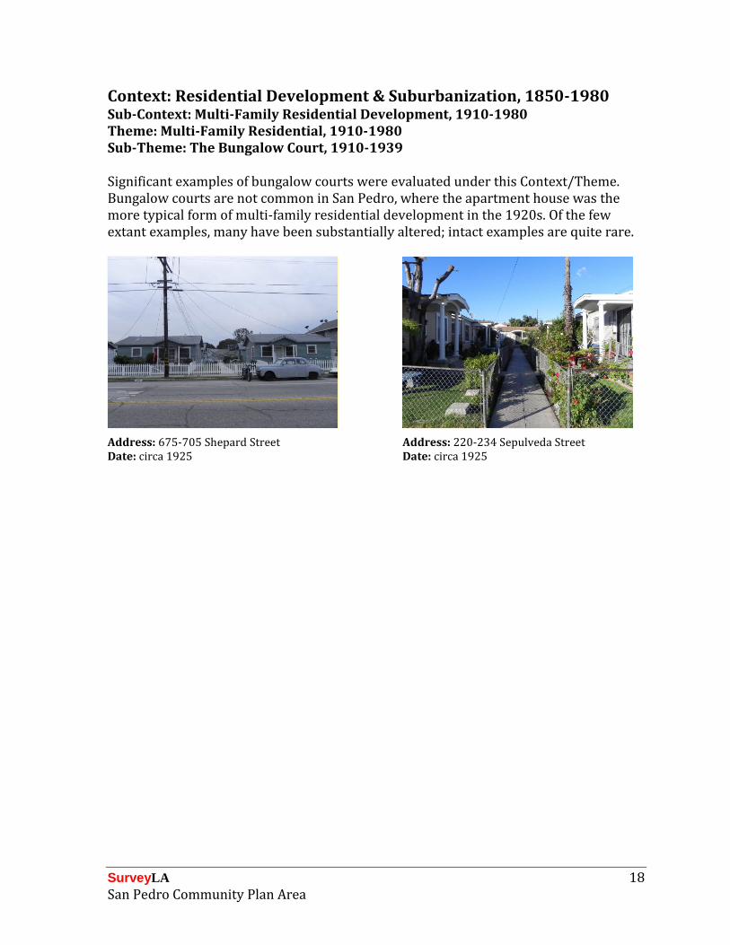
Context: Residential Development & Suburbanization, 1850-1980 Sub-Context: Multi-Family Residential Development, 1910-1980 Theme: Multi-Family Residential, 1910-1980 Sub-Theme: The Bungalow Court, 1910-1939 Significant examples of bungalow courts were evaluated under this Context/Theme. Bungalow courts are not common in San Pedro, where the apartment house was the more typical form of multi-family residential development in the 1920s. Of the few extant examples, many have been substantially altered; intact examples are quite rare.
Address: 675-705 Shepard Street Address: 220-234 Sepulveda Street Date: circa 1925 Date: circa 1925

SurveyLA 19 San Pedro Community Plan Area
Context: Residential Development & Suburbanization, 1850-1980 Theme: Automobile Suburbanization, 1908-1937 Suburban Planning and Development, 1908-1937 This Context/Theme was used to evaluate public stairways as features of early residential subdivision development. Public stairways are unique features of early hillside development in various communities throughout Los Angeles, including San Pedro. Examples typically date from the 1920s and 1930s and were developed to provide pedestrian access from hillside residential neighborhoods to streetcar and bus lines below.
Location: 27th Street and Peck Avenue Location: 29th Street and Peck Avenue Name: 27th/Peck Public Stairway Name: 29th/Peck Public Stairway Date: Unknown Date: Unknown

SurveyLA 20 San Pedro Community Plan Area
Context: Commercial Development, 1850-1980 Theme: Commercial Development and the Automobile, 1910-1980 Sub-Theme: The Car and Car Service, 1910-1969 This Context/Theme was used to evaluate significant examples of auto-related commercial development. In San Pedro, such properties are located along Pacific Avenue, one of the area’s major auto corridors. Intact examples of early auto-related development are very rare. Identified properties include two early auto showrooms and a pre-World War II service station.
Address: 1525 S. Pacific Avenue Address: 1640 S. Pacific Avenue Name: British European Auto Name: Century Motorcycles Date: 1938 Date: 1927
Address: 303 N. Pacific Avenue Name: Luis Auto Service Date: 1940

SurveyLA 21 San Pedro Community Plan Area
Context: Commercial Development, 1850-1980 Theme: Markets, 1880-1980 This Context/Theme was used to evaluate a significant example of a neighborhood market with an important ethnic/cultural association. This former Market Basket building was identified for its association with the Japanese-American and Norwegian American communities that historically resided in San Pedro. It was also evaluated as a rare surviving example of a 1930s neighborhood market in the area.
Address: 1231 S. Pacific Avenue Name: Garden Basket #2 Date: 1935

SurveyLA 22 San Pedro Community Plan Area
Context: Public & Private Institutional Development, 1850-1980 Sub-Context: Education, 1876-1980 Theme: Public Schools & the LAUSD, 1876-1980 Sub-Theme: Post-1933 Long Beach Earthquake, 1933-1945 Public schools dating from the period following the 1933 Long Beach Earthquake were evaluated under this Context/Theme. The earthquake destroyed or damaged beyond repair some forty LAUSD schools, including nearly all schools in nearby San Pedro. In some cases, damaged buildings were repaired and substantially remodeled in a contemporary style. In other cases, original school buildings were destroyed or damaged beyond repaired and replaced by new construction. In both instances, existing buildings were evaluated as dating from the post-1933 period.
Address: 423 N. Pacific Avenue Address: 425 N. Bandini Street Name: Barton Hill Elementary School Name: Bandini Street Elementary School Date: 1933 Date: 1935
Address: 2120 S. Leland Street Name: Leland Street Elementary School Date: 1935

SurveyLA 23 San Pedro Community Plan Area
Context: Public & Private Institutional Development, 1850-1980 Sub-Context: Social Clubs & Organizations, 1850-1980 Theme: Social Clubs and Ethnic/Cultural Associations, 1850-1980 This Context/Theme was used to evaluate significant examples of social clubs with an important ethnic/cultural association. The Dalmatian-American Club of San Pedro was founded in 1926 as the Yugoslav Club; the Italian-American Club of San Pedro originally opened as the Yugoslav Women’s Club. Both of these properties were identified for their association with important ethnic/cultural communities that historically resided in San Pedro.
Address: 1639 S. Palos Verdes Street Address: 1903 S. Cabrillo Avenue Name: Dalmatian-American Club of San Pedro Name: Italian-American Club of San Pedro Date: 1935 Date: 1937

SurveyLA 24 San Pedro Community Plan Area
Context: Public & Private Institutional Development, 1850-1980 Sub-Context: Government Infrastructure and Services, 1850-1980 Theme: Municipal Parks, Recreation, and Leisure, 1886-1978 Sub-Theme: Municipal Parks, 1904-1931 This Context/Theme was used to evaluate significant examples of municipal parks. San Pedro has an impressive system of neighborhood and bluff-side parks which take advantage of the hilly topography as well as ocean and harbor views. Identified examples include Plaza Park, one of San Pedro’s oldest parks, established in 1889; and Point Fermin Park, which contains the Point Fermin Lighthouse, which is a designated Historic-Cultural Monument. In addition, the survey identified four parks (Peck Park, Leland Park, Alma Park, Rena Park) developed in the 1920s and 1930s on lands donated by early city pioneer and developer George Huntington Peck, Jr. These parks were developed as part of an initiative to promote San Pedro as a livable “city of homes,” in addition to its reputation as a place of industry. Park features include mature trees and decorative plantings, light posts, pedestrian pathways and foot bridges, concrete walls and stone retaining walls, bandstands and amphitheaters, water features, recreation facilities and children’s playgrounds, and other service buildings.
Location: On the bluff below Paseo del Mar Location: On the bluff east of Beacon Street Name: Point Fermin Park Name: San Pedro Plaza Park Date: circa 1925 Date: 1889

SurveyLA 25 San Pedro Community Plan Area
Location: 21st Street between Alma and Myler Streets
Location: 13th Street and Weymouth Avenue Name: Averill Park
Name: Alma Park Date: circa 1925 Date: circa 1925

SurveyLA 26 San Pedro Community Plan Area
Context: Public & Private Institutional Development, 1850-1980 Sub-Context: Military Institutions & Activities, 1850-1980 Theme: Air Raid Sirens & Civil Defense, 1939-1960 This Context/Theme was used to evaluate extant examples of air raid sirens. Air raid sirens were installed throughout Los Angeles during the World War II and Cold War periods and have generally remained untouched since then. Two examples of the Federal Model SD-10 “Wire Spool” type were identified in San Pedro, both installed on a freestanding support pole.
Location: Park Western Avenue between Via La Paz and Via Cordova
Location: 7th Street, just west of Weymouth
Name: Air Raid Siren 83 Name: Air Raid Siren 84 Date: circa 1940 Date: circa 1940

SurveyLA 27 San Pedro Community Plan Area
Context: Architecture & Engineering, 1850-1980 Theme: Late 19th and Early 20th Century Architecture, 1865-1950 Sub-Theme: Queen Anne, 1885-1905 This Context/Theme was used to evaluate significant examples of Queen Anne architecture that exhibit high quality of design and craftsmanship. The best examples are a pair of “twin” residences built by Captain Mitchell “Mike” Duffy, owner and operator of the first harbor ferry service in San Pedro. The Atchinson and Pons houses are outstanding examples of the Queen Anne style with Carpenter Gothic influences.
Address: 1192 W. 17th Street Address: 949 W. 7th St. Name: Atchinson House Name: Pons House Date: 1907 Date: 1905

SurveyLA 28 San Pedro Community Plan Area
Context: Architecture & Engineering, 1850-1980 Theme: Arts & Crafts Movement, 1895-1930 Sub-Theme: Craftsman, 1905-1930 This Context/Theme was used to evaluate significant examples of Craftsman architecture that exhibit high quality of design and craftsmanship. In San Pedro, the best examples are of the two-story variation, which typically possess more of the architectural details commonly associated with the Arts and Crafts movement, including horizontal wood sizing, overhanging eaves, wood eave brackets, exposed rafter tails, and wide front porches.
Address: 3900 S. Carolina Street Address: 718 W. Shepard Street Date: 1914 Date: 1908

SurveyLA 29 San Pedro Community Plan Area
Context: Architecture & Engineering, 1850-1980 Theme: Arts & Crafts Movement, 1895-1930 Sub-Theme: Tudor Revival, 1895-1929 Theme: Period Revival, 1919-1940 Sub-Theme: Storybook, 1919-1939 These Context/Themes were used to evaluate significant examples of Tudor Revival and Storybook architecture that exhibit high quality of design and craftsmanship. These styles are not common in San Pedro. However the survey did identify four single-family residences, two in each style. Both styles are characterized by steeply-pitched front-gable roofs and arched window and door openings. The Tudor Revival examples feature tall brick chimneys; the Storybook examples are distinguished by rolled eaves designed to mimic a thatched roof.
Address: 935 S. Weymouth Avenue Address: 1440 S. Patton Avenue Date: 1933 Date: 1927
Address: 1167 W. 10th Street Address: 1175 W. 10th Street Date: 1925 Date: 1925

SurveyLA 30 San Pedro Community Plan Area
Context: Other Context, 1850-1980 Theme: Design/Construction, 1850-1980 The Other Context is used to capture property types for which a specific context/theme has not yet been developed. In San Pedro, this Context/Theme was used to evaluate two arched concrete bridges as excellent examples of pre-World War II public works civic improvement projects. The Gaffey Street Bridge and the Elberon Avenue Bridge both date from 1935 and share many physical characteristics, including fluted concrete piers, concrete balustrades, and integrated lampposts with original globes.
Location: Gaffey Street between Summerland Avenue and Oliver Street
Location: Elberon Avenue over Gaffey Street Name: Elberon Avenue Bridge
Name: Gaffey Street Bridge Date: 1935 Date: 1935

SurveyLA 31 San Pedro Community Plan Area
For Further Reading The following is a list of general sources on the history and development of San Pedro. This list is not comprehensive but is being provided for informational purposes. Baker, Flora Twyman, Arthur Almeida, William Olesen and Kathryn Schultz. San Pedro: The First 100 Years. San Pedro: Copley Los Angeles Newspapers, 1988. Creason, Glen. Los Angeles in Maps. New York: Rizzoli International Publications, Inc., 2010. Fogelson, Robert M. Fragmented Metropolis: Los Angeles, 1850-1930. Berkeley and Los Angeles: University of California Press, 1967. Isaac, Jim and Tom Herrera. Then and Now: San Pedro. Charleston, SC: Arcadia Publishing, 2007. McKinzie, Joe. Postcard History Series: San Pedro. Charleston, SC: Arcadia Publishing, 2011. San Pedro Bay Historical Society website: http://sanpedrobayhistoricalsociety.com/. Silka, Henry P. San Pedro: A Pictorial History. San Pedro, California: San Pedro Bay Historical Society, 1984.

SurveyLA San Pedro Community Plan Area