Embed Size (px)
Citation preview
Hiking tour B05456
Schellenursli Trail
www.engadin.stmoritz.ch and GPS-Tracks.com / Page 1
Difficulty:Fitness:Popularity:
Distance: 2.3 kmTime requirement: ¾ h
Descent: 208 mHighest point: 2048 m.a.s.l.
Region: Engadin St.MoritzStarting point: Salastrains, St. Moritz
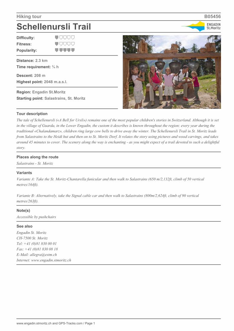
Tour descriptionThe tale of Schellenursli («A Bell for Ursli») remains one of the most popular children's stories in Switzerland. Although it is setin the village of Guarda, in the Lower Engadin, the custom it describes is known throughout the region: every year during thetraditional «Chalandamarz», children ring large cow bells to drive away the winter. The Schellenursli Trail in St. Moritz leadsfrom Salastrains to the Heidi hut and then on to St. Moritz Dorf. It relates the story using pictures and wood carvings, and takesaround 45 minutes to cover. The scenery along the way is enchanting - as you might expect of a trail devoted to such a delightfulstory.
Places along the routeSalastrains - St. Moritz
VariantsVariante A: Take the St. Moritz-Chantarella funicular and then walk to Salastrains (650 m/2,132ft, climb of 50 verticalmetres/164ft). Variante B: Alternatively, take the Signal cable car and then walk to Salastrains (800m/2,624ft, climb of 90 verticalmetres/263ft).
Note(s)Accessible by pushchairs
See alsoEngadin St. MoritzCH-7500 St. MoritzTel: +41 (0)81 830 00 01Fax: +41 (0)81 830 08 18E-Mail: [email protected]: www.engadin.stmoritz.ch

Schellenursli Trail
www.engadin.stmoritz.ch and GPS-Tracks.com / Page 2
© G
PS
-Tra
cks.
com
. © s
wis
stop
o (5
7040
0216
2). O
nly
for y
our p
erso
nal a
nd p
rivat
e us
e. D
isse
min
atio
n on
the
Inte
rnet
is re
stric
ted
to G
PS
-Tra
cks.
com
lice
nsee
s (fe
e-ba
sed
serv
ice)
. Sca
le: 1
:25'
000

Hiking tour B05456
Schellenursli Trail
www.engadin.stmoritz.ch and GPS-Tracks.com / Page 3
Elevation profile
Download this tour with topo maps on your smartphone (iPhone, Android)Scan the QR code. As a result, you will receive on your smartphone tour dates and all necessarySwissTopo-maps from scale 1: 25'000, so you can use anything without cell phone reception.
Weather in the area from 22.10.2016
Saturday, in the morning sunny periods. In the afternoon sunny intervals.Sunshine 3½ h (32 %). Precipitation 0 mm (Prob. 10 %). Max. temperature 3° C. Wind 19 km/h from sw.
Sunday, sunny intervals.Sunshine 1½ h (12 %). Precipitation 0 mm (Prob. 30 %). Max. temperature 5° C. Wind 22 km/h from sw.
Monday, sunny intervals.Sunshine 2½ h (22 %). Precipitation 0 mm (Prob. 27 %). Max. temperature 9° C. Wind 24 km/h from sw.
Tuesday, in the morning sunny intervals with repeated showers of rain. Later on cloudy and rainy.Sunshine 1¼ h (10 %). Precipitation 1 mm (Prob. 73 %). Max. temperature 11° C.
Source: SRF Meteo. Powered by Bündner Tourismus / Bergbahnen Graubünden
Tour created on: 19.04.2013Last change: 27.05.2014Origin: www.engadin.stmoritz.ch / GPS-Tracks.com