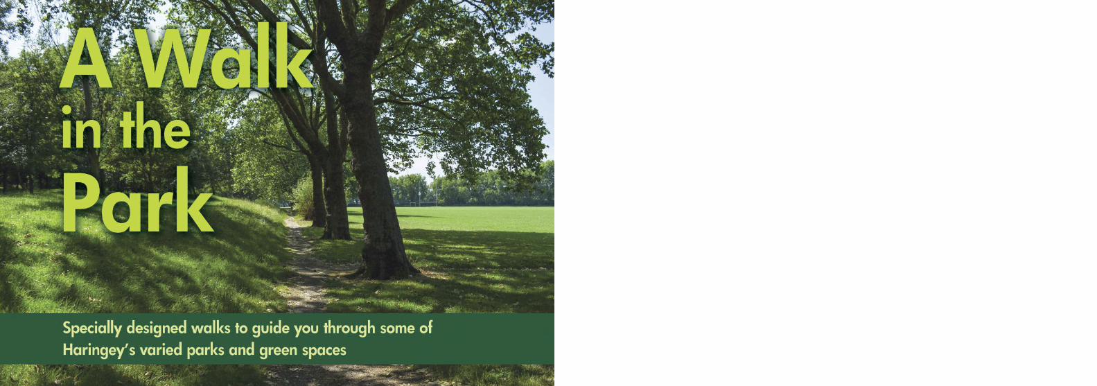
Embed Size (px)
Citation preview
ContentsIntroduction…………………………………………2 Haringey Map ……………………………………4 Gallery ……………………………………………5 Circular Walk west of the Borough ………………6 Circular Walk in Wood Green area …………12 Parks & Green Spaces in West Haringey …14-15 Circular Walk Lea Valley and Paddock ………16 Railway Fields ……………………………………19 Circular Walk Finsbury Park and New River …20 Linear Walk Parkland Walk ……………………22 Linear Walk Tottenham Park Café Trail ………24 Alexandra Park …………………………………29 Greens and Commons …………………………30 Between Lordship Lane and Wood Green
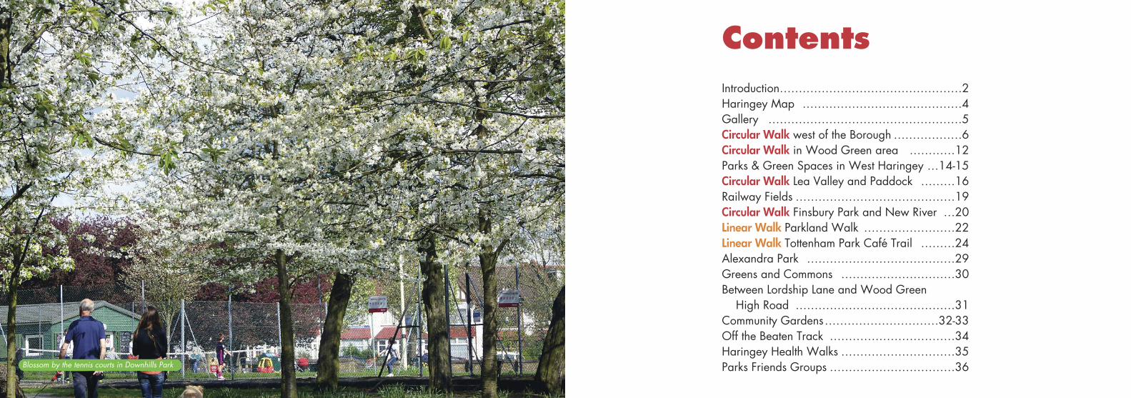
High Road ……………………………………31 Community Gardens…………………………32-33 Off the Beaten Track ……………………………34Haringey Health Walks …………………………35Parks Friends Groups ……………………………36Blossom by the tennis courts in Downhills Park
2
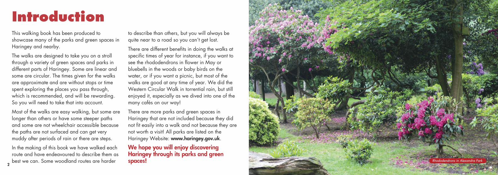
IntroductionThis walking book has been produced to showcase many of the parks and green spaces inHaringey and nearby.
The walks are designed to take you on a strollthrough a variety of green spaces and parks indifferent parts of Haringey. Some are linear andsome are circular. The times given for the walksare approximate and are without stops or timespent exploring the places you pass through,which is recommended, and will be rewarding.So you will need to take that into account.
Most of the walks are easy walking, but some arelonger than others or have some steeper pathsand some are not wheelchair accessible becausethe paths are not surfaced and can get verymuddy after periods of rain or there are steps.
In the making of this book we have walked eachroute and have endeavoured to describe them asbest we can. Some woodland routes are harder
to describe than others, but you will always bequite near to a road so you can’t get lost.
There are different benefits in doing the walks atspecific times of year for instance, if you want tosee the rhododendrons in flower in May orbluebells in the woods or baby birds on thewater, or if you want a picnic, but most of thewalks are good at any time of year. We did theWestern Circular Walk in torrential rain, but stillenjoyed it, especially as we dived into one of themany cafés on our way!
There are more parks and green spaces inHaringey that are not included because they didnot fit easily into a walk and not because they arenot worth a visit! All parks are listed on theHaringey Website: www.haringey.gov.uk.
We hope you will enjoy discoveringHaringey through its parks and greenspaces! Rhododendrons in Alexandra Park
5
Friends Groups in HaringeyThere are 40+ Friends Groups active in parks andgreen spaces in Haringey. They do everything fromclearing litter and conservation work to organisingevents, talks and walks. If you want to get informationabout a Friends Group near you then see:www.haringeyfriendsofparks.org.uk.
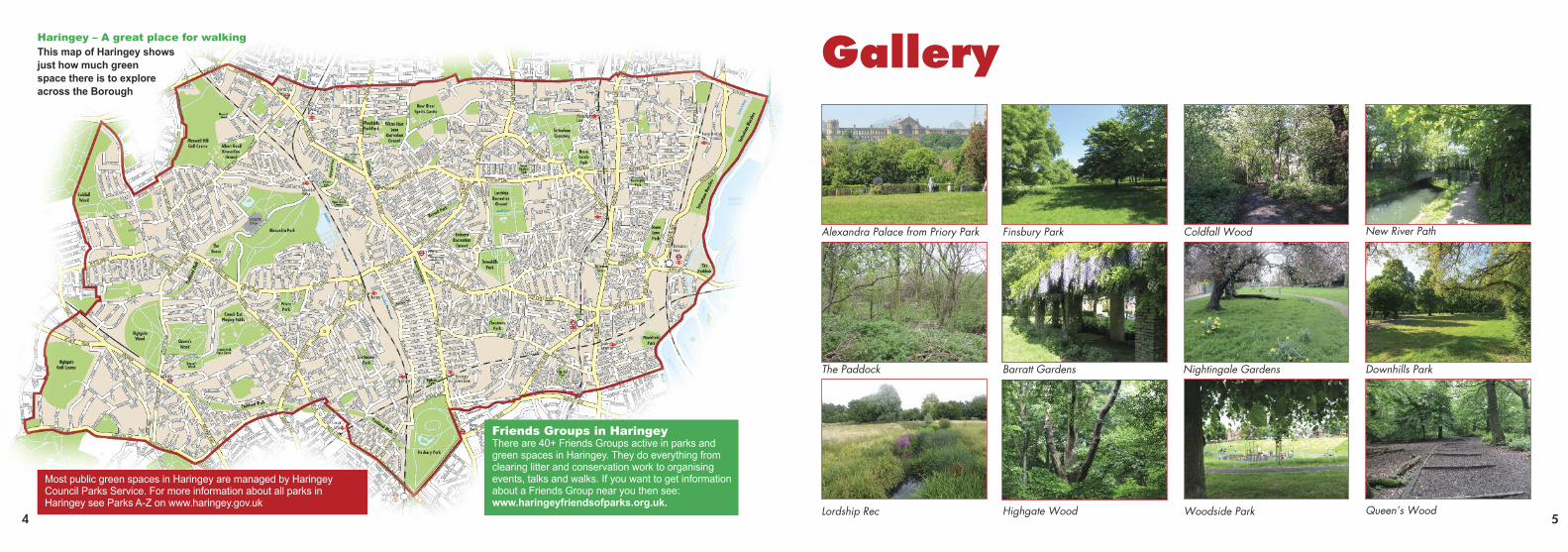
Haringey – A great place for walking
This map of Haringey shows
just how much green
space there is to explore
across the Borough
Gallery
Alexandra Palace from Priory Park
The Paddock Barratt Gardens
Highgate Wood Queen’s Wood
Downhills ParkNightingale Gardens
Woodside ParkLordship Rec
Finsbury Park New River PathColdfall Wood
Most public green spaces in Haringey are managed by HaringeyCouncil Parks Service. For more information about all parks inHaringey see Parks A-Z on www.haringey.gov.uk
4
76
A Circular Walk in the West of the BoroughTaking in 2 public parks, woods, meadows, and wildlife nature reserves.
Distance 7.45km (4.6miles) Time 2.5hrs Moderate Only parts of this walk are accessible
Circular Walk
Transport LinksAlexandra Palace overgroundstation can be reached from stations between Hertford Northand Moorgate (via FinsburyPark). There is no step free access at this station. The W3bus goes there from FinsburyPark or Wood Green Tube or184 from Wood Green, Turnpike Lane or Bounds Green.
144, W7, 134, 43 or 102 bus allgo to Muswell Hill Broadway ifyou want to start this walk fromParkland Walk North Sectionfrom the top of Muswell Hill (onyour right looking down the Hill).
Alexandra Park
This historic park includeswoodland, open grassland,formal gardens, pitch and putt,boating lake, cafés, skate park, children’s playground,landscaped gardens, soft playadventure playground and TreeTop Adventure to entertain thekids! It also includes AlexandraPalace itself, see:www.alexandrapalace.com, forwhat is on offer. You can getsome of the best views of London (on a good day).
We start our walk at AlexandraPalace Overground Station onBuckingham Road. You canstart at Wood Green Tube,Piccadilly Line, and walk toAlexandra Palace Station goingup Station Road or get a W3 or184 bus. Being a circular walk,you can join the walk anywherealong the route.
From the bus stop atAlexandra Palace Station walkto the station and go over therailway via the footbridge thatleads you onto Bedford Roadand turn left there. Thisbecomes the main road throughthe park, Alexandra PalaceWay. Walk a little way up theroad and pass a parking bayand 2 rough roads on your left.Take the first small unsurfacedpath down to your left. Keep onthis path with meadow on yourleft and it continues on intowoodland on your left and thepitch and putt on your right.
Almost at the end of thepitch and putt the path dividesand you take the right fork thatheads steeply up to AlexandraPalace. Below the road, takethe first surfaced path to the leftand carry on walking parallel tothe road. This path goes thelength of the Palace and takesyou back to the road opposite
the Palace’s Palm Courtentrance. You will get greatLondon views along this path.
Cross the road carefully atthe bus stop and then turn left.Around the bend you will seethe Grove Car Park. Turn rightbefore the steps to the car parkalong a narrow hedged pathkeeping the car park on yourleft. Before a brick bridgeleading to a park exit take apath uphill on your leftfollowing another side of thecar park.
For information about Alexandra Park see the Friends of Alexandra Park website:www.friendsofalexandrapark.org/You will find maps and information aboutwalks you can do around Alexandra Park.
AlexandraPark
Wood GreenCommon
The Grove
Muswell Hill
Archway Road
Cranley Gardens
Woodland Rise
Woodland Gardens
Onslow Gardens
Muswell Hill Pl
Fortis Green Road
St James’s
Buckingham Rd
Lane
Muswell Hill Ro
ad
Way
Alexan
dra P
alace
Alexandra
Pitch andPutt Alexandra
Palace
BoatingLake
SportsField
NatureReserve
PalaceWay
Wood V
ale
Wood L
ane
Priory Gardens Shepherd’s
Hill
Queen’s Wood Road
Park Road
Priory Road
StationRoad
Nightin
gale
Lane
PrioryPark
Crouch endopen Space
HighgateWood
Park
land W
alk
Queen’s Wood
MAP KEY
Looking out across London fromAlexandra Park.
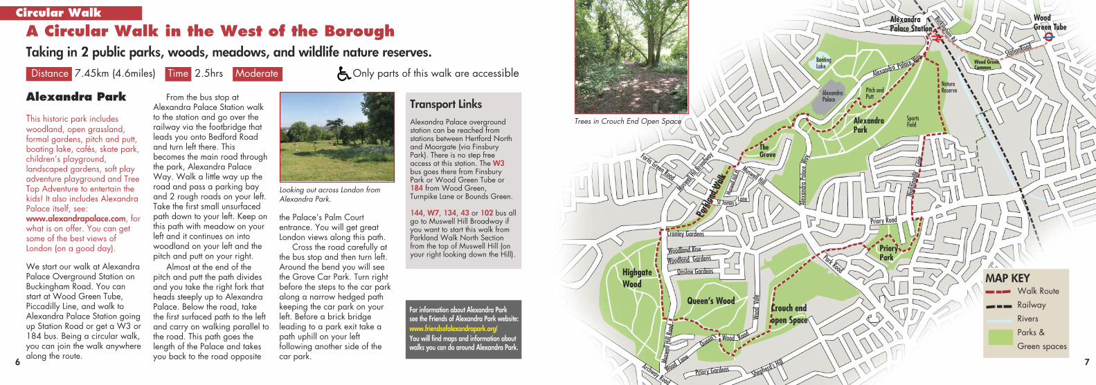
Trees in Crouch End Open Space
Muswe
ll Hil Broa
dway
Wood Green Tube
AlexandraPalace Station
Walk Route
Railway
Rivers
Parks &
Green spaces
98
This path takes you past theFriends information centre onyour right, open on Sundaysand first saturday of the month11-1pm. You will pass a smallcafé. Stay on this path and youcome to a covered bridge thattakes you down and through atunnel under Muswell Hill, abusy main road. You will be inthe Northern part of ParklandWalk, a long strip of land thatwas once partly a railway andis now kept as a nature reserve.
Parkland Walk
This northern section of theParkland Walk nature reserve isonly 750 metres long and endsat Cranley Gardens where itmeets Muswell Hill Road.
Depending on the season youcan see a variety of trees andwildflowers.
At the end of the ParklandWalk you will go under abridge and up onto MuswellHill Road. You will see theornate metal gates to HighgateWood (Cranley Gate) on yourright just before a row of shops.Enter the wood here.
Highgate Wood
Highgate wood is an ancientwoodland. It is a haven forwildlife, with many accessiblewoodland trails. There is asports ground where formalcricket and informal picnics andball games can be enjoyed andalso a well equipped children’splayground. There is also agood café with toilets and aninformation hut with leaflets andtrail guides nearby.
Once through the Cranley Gatetake the path to the left. Thispath runs along the edge of thewood with houses visible onyour left. Ignore any signsfurther on to the café and toiletsto the right unless you want tovisit them.
Take the third exit on theleft, New Gate, leaving thewood at pedestrian lightsacross Muswell Hill Road whereyou enter Queen’s Wood.
Queen’s Wood
Queen's Wood is an ancientwoodland, continuouslywooded since at least AD1600. The wood principallyconsists of hornbeams andoaks. A wide variety of birds
live in the wood. This is alsowhere the Moselle, Haringey’shidden river, has its source.
This part of the walk will notbe good for wheelchair users orthose with mobility problems assome of the paths are quitesteep, uneven or cut into steps.
You will see the Café onyour left and take the right forkof the 2 paths ahead, which ispart of the Capital Ring. Stayon this path, passing a smallpond on your right. You cometo a sign post and go straighton signposted Queens Wood
Road. The path bends up to theroad on your right. Emerging atthe road, you will see a smallpath across from you which youtake. This widens out and bendsoff to the left and becomessteps. At the bottom of the stepsyou come to a junction with alow wall to your right. Turn lefthere and take the smallunsurfaced path towards ametal gate. Through the gatethe path runs through woodlandbetween backs of houses andallotments. At the end of thispath turn left and you will soon
For information about Highgate Wood see the City of London website:https://www.cityoflondon.gov.uk/things-to-do/green-spaces/highgate-wood
For information about Parkland Walk see the Friends of Parkland Walk website:https://www.parklandwalk.org.uk/You will find maps and information aboutParkland walk and what trees and flowersyou are likely to see.
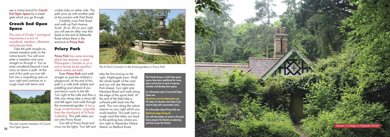
Lush green trees in Highgate WoodThe Parkland Walk at the Northernend near Muswell Hill Wildlife pond in Queen’s Wood.
Footballandcricketfield
Info andwildlife Hut
Café andtoilets
CranleyGate
NewGate
ARCHWAY ROAD
ARCHWAY ROAD
Children’s
playgroun
d
Queens Wood Road
HighgateWood Café &
toilets
Turn off here for CrouchEnd Open Space and playing fields
Hill R
oad
Muswell
Wood Va
le
Onslow GardensHighgateTube
Muswell Hill Road
Highgate Wood
Queen’s Wood
For information aboutQueen’s Wood see the Friends ofQueen’s Wood website:www.fqw.org.uk/You will find maps andinformation aboutQueen’s wood andwhat you can do andsee there.
Capital Ring
see a notice board for CrouchEnd Open Space by a metalgate which you go through.
Crouch End OpenSpaceThis area of Grade 1 ecologicalimportance is a mix ofwoodland, meadow, allotmentsand playing fields.
Take the path straight on,named meadow path on thenotice board. You will soonenter a meadow and carrystraight on through it. You re-enter woodland beyond it andcarry on down a path. At theend of this path you turn left.Exit into a carparking area onyour right and continue on arough road with tennis and
cricket clubs on either side. Thispath joins up with another pathat the junction with Park Road.
Carefully cross Park Roadand walk up Park AvenueSouth. At no. 82 on your rightyou will see an alley way thatleads to the end of AbbevilleRoad where there is theentrance to Priory Park.
Priory Park
Priory Park has some stunningplane tree avenues, a quietPhilosopher’s Garden to sit inand a former bowls pavillionwhere events are held.
Enter Priory Park and walkstraight on past the children’splayground. At the end of thispath is a café (with toilets) andpaddling pool ahead of youand tennis courts to the left.Turn right at the café and then alittle way along take a sharp leftand left again and walk throughthe ornamental garden. It has alarge ornate fountain, originallyfrom the churchyard of St PaulsCathedral. This path takes youout onto Priory Road.
Turn left at Priory Road andcross via the lights. Turn left and
take the first turning on theright, Nightingale Lane. Walkthe whole length of the roadand you will see AlexandraPark ahead. Turn right ontoNewland Road and walk alongthe edge of the sports field. Atthe end of the field take asurfaced path back into thepark. This runs along the naturereserve on your right which youcould explore. This path joins arough road that takes you backto the parking bay where youturn right to Alexandra PalaceStation on Bedford Road.10
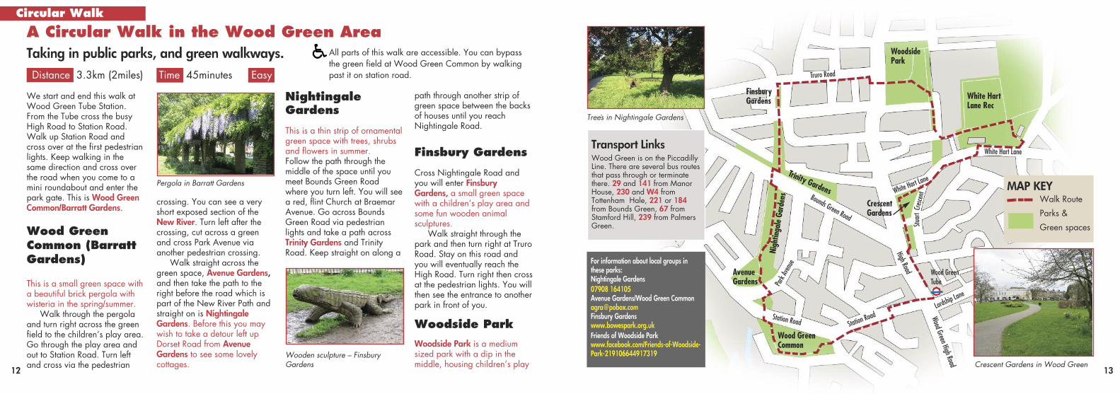
The St Paul’s Fountain in the formal gardens in Priory Park
The lush summer meadow of CrouchEnd Open Space
The Friends Groups in both these greenspaces have been established for manyyears and do lots of work to improve,maintain and develop their spaces.
For information about Crouch End OpenSpace see:http://www.crouchendopenspace.orgFor dates of volunteer work days if youwant to help with conservation work.
For information about Priory Park see:http://www.fopp-n8.org.uk/You will information on events in the park,future projects the Friends are planning and how to join the Friends
Keeper’s Cottage in Highgate Wood
Crescent Gardens in Wood Green
.
path through another strip ofgreen space between the backsof houses until you reachNightingale Road.
Finsbury Gardens
Cross Nightingale Road andyou will enter FinsburyGardens, a small green spacewith a children’s play area andsome fun wooden animalsculptures.
Walk straight through thepark and then turn right at TruroRoad. Stay on this road andyou will eventually reach theHigh Road. Turn right then crossat the pedestrian lights. You willthen see the entrance to anotherpark in front of you.
Woodside ParkWoodside Park is a mediumsized park with a dip in themiddle, housing children’s play
12 13
A Circular Walk in the Wood Green AreaTaking in public parks, and green walkways.
Distance 3.3km (2miles) Time 45minutes Easy
Circular Walk
We start and end this walk atWood Green Tube Station.From the Tube cross the busyHigh Road to Station Road.Walk up Station Road andcross over at the first pedestrianlights. Keep walking in thesame direction and cross overthe road when you come to amini roundabout and enter thepark gate. This is Wood GreenCommon/Barratt Gardens.
Wood GreenCommon (BarrattGardens)
This is a small green space witha beautiful brick pergola withwisteria in the spring/summer.
Walk through the pergolaand turn right across the greenfield to the children’s play area.Go through the play area andout to Station Road. Turn leftand cross via the pedestrian
crossing. You can see a veryshort exposed section of theNew River. Turn left after thecrossing, cut across a greenand cross Park Avenue viaanother pedestrian crossing.
Walk straight across thegreen space, Avenue Gardens,and then take the path to theright before the road which ispart of the New River Path andstraight on is NightingaleGardens. Before this you maywish to take a detour left upDorset Road from AvenueGardens to see some lovelycottages.
NightingaleGardens
This is a thin strip of ornamentalgreen space with trees, shrubsand flowers in summer. Follow the path through themiddle of the space until youmeet Bounds Green Roadwhere you turn left. You will seea red, flint Church at BraemarAvenue. Go across BoundsGreen Road via pedestrianlights and take a path acrossTrinity Gardens and TrinityRoad. Keep straight on along a
Wooden sculpture – Finsbury Gardens
White HartLane Rec
Wood GreenCommon
AvenueGardens
CrescentGardens
Trinity Gardens
WoodsidePark
FinsburyGardens
Nigh
tinga
le Ga
rden
s
Truro Road
Lordship L
ane
Wood GreenTube
Wood Green High Road
High Road
White Hart
Lane
White Hart Lane
StuartC
resce
ntBounds Green Road
Station Roa
dStation Road
Park Avenue
Transport LinksWood Green is on the PiccadillyLine. There are several bus routesthat pass through or terminatethere. 29 and 141 from ManorHouse, 230 and W4 fromTottenham Hale, 221 or 184from Bounds Green, 67 fromStamford Hill, 239 from PalmersGreen.
For information about local groups in these parks:Nightingale Gardens07908 164105Avenue Gardens/Wood Green [email protected] Gardenswww.bowespark.org.ukFriends of Woodside Parkwww.facebook.com/Friends-of-Woodside-Park-219106644917319
Pergola in Barratt Gardens
Trees in Nightingale Gardens
MAP KEYWalk Route
Parks &
Green spaces
All parts of this walk are accessible. You can bypass the green field at Wood Green Common by walkingpast it on station road.
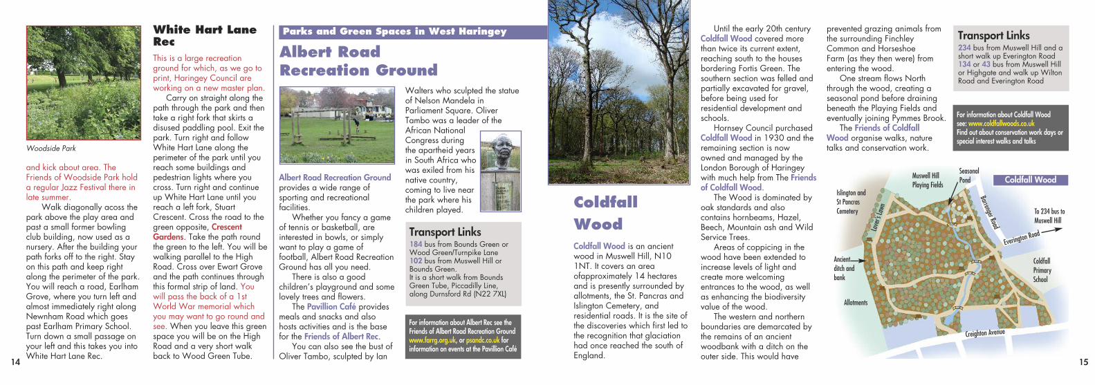
Coldfall Wood is an ancientwood in Muswell Hill, N101NT. It covers an areaofapproximately 14 hectaresand is presently surrounded byallotments, the St. Pancras andIslington Cemetery, andresidential roads. It is the site ofthe discoveries which first led tothe recognition that glaciationhad once reached the south ofEngland.
Until the early 20th centuryColdfall Wood covered morethan twice its current extent,reaching south to the housesbordering Fortis Green. Thesouthern section was felled andpartially excavated for gravel,before being used forresidential development andschools.
Hornsey Council purchasedColdfall Wood in 1930 and theremaining section is nowowned and managed by theLondon Borough of Haringeywith much help from The Friendsof Coldfall Wood.
The Wood is dominated byoak standards and alsocontains hornbeams, Hazel,Beech, Mountain ash and WildService Trees.
Areas of coppicing in thewood have been extended toincrease levels of light andcreate more welcomingentrances to the wood, as wellas enhancing the biodiversityvalue of the wood.
The western and northernboundaries are demarcated bythe remains of an ancientwoodbank with a ditch on theouter side. This would have
prevented grazing animals fromthe surrounding FinchleyCommon and Horseshoe Farm (as they then were) fromentering the wood.
One stream flows Norththrough the wood, creating aseasonal pond before drainingbeneath the Playing Fields andeventually joining Pymmes Brook.
The Friends of Coldfall Wood organise walks, naturetalks and conservation work.
and kick about area. TheFriends of Woodside Park holda regular Jazz Festival there inlate summer.
Walk diagonally acoss thepark above the play area andpast a small former bowlingclub building, now used as anursery. After the building yourpath forks off to the right. Stayon this path and keep rightalong the perimeter of the park.You will reach a road, EarlhamGrove, where you turn left andalmost immediately right alongNewnham Road which goespast Earlham Primary School.Turn down a small passage onyour left and this takes you intoWhite Hart Lane Rec.
White Hart LaneRecThis is a large recreationground for which, as we go toprint, Haringey Council areworking on a new master plan.
Carry on straight along thepath through the park and thentake a right fork that skirts adisused paddling pool. Exit thepark. Turn right and followWhite Hart Lane along theperimeter of the park until youreach some buildings andpedestrian lights where youcross. Turn right and continueup White Hart Lane until youreach a left fork, StuartCrescent. Cross the road to thegreen opposite, CrescentGardens. Take the path roundthe green to the left. You will bewalking parallel to the HighRoad. Cross over Ewart Groveand the path continues throughthis formal strip of land. Youwill pass the back of a 1stWorld War memorial whichyou may want to go round andsee. When you leave this greenspace you will be on the HighRoad and a very short walkback to Wood Green Tube.
Albert Road Recreation Groundprovides a wide range of sporting and recreational facilities.
Whether you fancy a gameof tennis or basketball, are interested in bowls, or simplywant to play a game of football, Albert Road RecreationGround has all you need.
There is also a good children’s playground and somelovely trees and flowers.
The Pavillion Café providesmeals and snacks and alsohosts activities and is the basefor the Friends of Albert Rec.
You can also see the bust ofOliver Tambo, sculpted by Ian
Walters who sculpted the statueof Nelson Mandela in Parliament Square. OliverTambo was a leader of theAfrican National Congress during the apartheid yearsin South Africa whowas exiled from hisnative country, coming to live nearthe park where hischildren played.
14 15
Woodside Park
Albert Road Recreation Ground
ColdfallWood
Parks and Green Spaces in West Haringey
Transport Links184 bus from Bounds Green orWood Green/Turnpike Lane102 bus from Muswell Hill orBounds Green.It is a short walk from BoundsGreen Tube, Piccadilly Line,along Durnsford Rd (N22 7XL)
For information about Albert Rec see theFriends of Albert Road Recreation Groundwww.farrg.org.uk, or psandc.co.uk for information on events at the Pavillion Café
Transport Links234 bus from Muswell Hill and ashort walk up Everington Road134 or 43 bus from Muswell Hillor Highgate and walk up WiltonRoad and Everington Road
For information about Coldfall Woodsee: www.coldfallwoods.co.ukFind out about conservation work days or special interest walks and talks
Muswell HillPlaying Fields
To 234 bus toMuswell Hill
Islington andSt PancrasCemetery
Allotments
SeasonalPond
Ancientditch andbank
Lover’s La
wn
Barrenger Road
Everington Roa
d
Creighton Avenue
Coldfall PrimarySchool
Coldfall Wood
16
.
.
16 17
Pymmes Brook, River Lea, Marshes and the PaddockTaking in rivers, a nature reserve and marsh meadows
Distance 4km (2.5miles) Time 1 hour Easy Accessibility could be difficult in wet weather
Circular Walk
We start and end this walk atTottenham Hale tube station onthe Victoria Line. From the tubeor bus, exit the bus station intoFerry Lane and turn left up thehill over the railway. Cross overMill Mead Way via traffic lightsand almost immediately gothrough a metal gate on yourleft which takes you up thePymmes Brook. The Brook willbe on your right along with aLea Valley information board.
Pymmes Brook
The Pymmes Brook is a tributaryof the River Lea which it joins atTottenham Hale. It starts inHadley Wood, Barnet.
Walk along the towpath byPymmes Brook and you willsoon see some well usedallotments on your left, one ofwhich is run by Living UnderOne Sun, a local charity andcommunity organisation.
TottenhamMarshes
At the end of the allotments, thepath enters Tottenham Marshes.This is large area of grassland,wildflower meadows andwaterways with a variety ofplants trees and wildlife. Youwill soon reach a picnic areawith a couple of public artinstallations where you turnright to Stonebridge Lock.
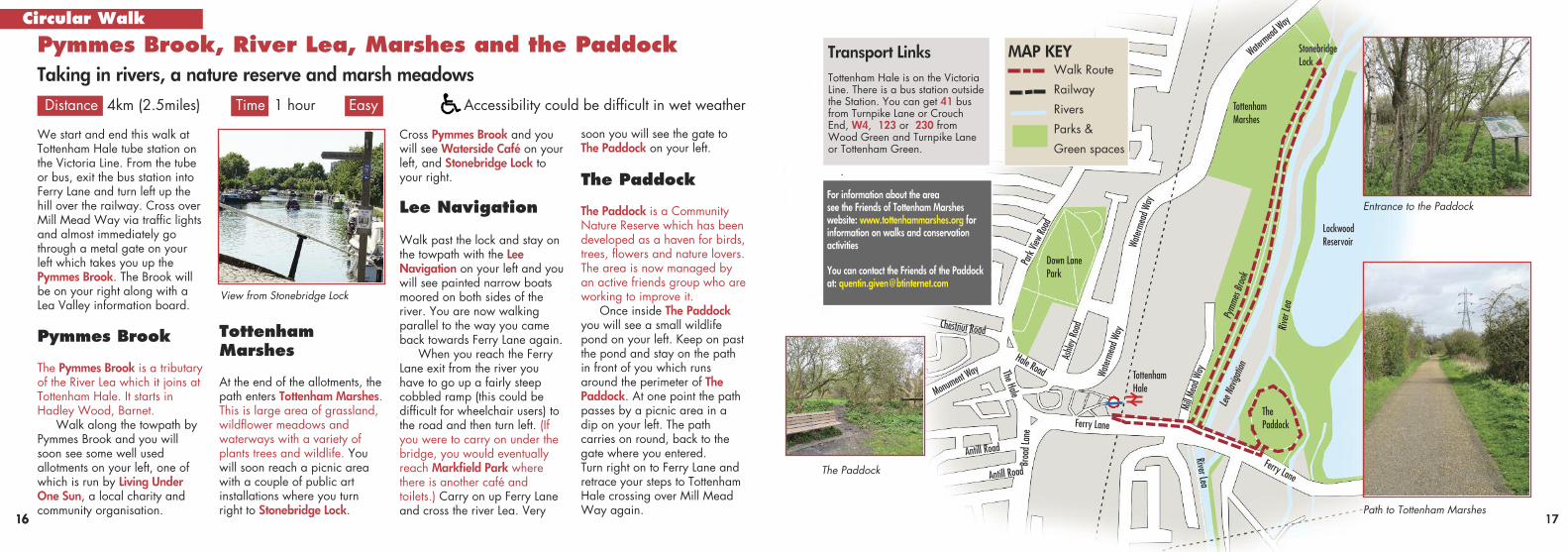
Cross Pymmes Brook and youwill see Waterside Café on yourleft, and Stonebridge Lock toyour right.
Lee Navigation
Walk past the lock and stay onthe towpath with the LeeNavigation on your left and youwill see painted narrow boatsmoored on both sides of theriver. You are now walkingparallel to the way you cameback towards Ferry Lane again.
When you reach the FerryLane exit from the river youhave to go up a fairly steepcobbled ramp (this could bedifficult for wheelchair users) tothe road and then turn left. (Ifyou were to carry on under thebridge, you would eventuallyreach Markfield Park wherethere is another café andtoilets.) Carry on up Ferry Laneand cross the river Lea. Very
View from Stonebridge Lock
Ferry Lane
Broad L
ane
Antill Road
Antill Road
Monume
nt Way
Chestnut Road
The Hale
Hale Road
Park
View Road
Ashle
y Road
Water
mead Way
Waterm
ead Wa
y
Water
mead Way
Mill M
ead W
ay
Lee N
aviga
tion
River
Lea
River Lea
TottenhamMarshes
Down LanePark
The Paddock
Lockwood Reservoir
StonebridgeLock
TottenhamHale
Ferry Lane
Transport LinksTottenham Hale is on the VictoriaLine. There is a bus station outsidethe Station. You can get 41 busfrom Turnpike Lane or CrouchEnd, W4, 123 or 230 fromWood Green and Turnpike Laneor Tottenham Green.
For information about the area see the Friends of Tottenham Marshes website: www.tottenhammarshes.org forinformation on walks and conservation activities
You can contact the Friends of the Paddock at: [email protected]
soon you will see the gate toThe Paddock on your left.
The Paddock
The Paddock is a CommunityNature Reserve which has beendeveloped as a haven for birds,trees, flowers and nature lovers.The area is now managed byan active friends group who areworking to improve it.
Once inside The Paddockyou will see a small wildlifepond on your left. Keep on pastthe pond and stay on the pathin front of you which runsaround the perimeter of ThePaddock. At one point the pathpasses by a picnic area in adip on your left. The pathcarries on round, back to thegate where you entered. Turn right on to Ferry Lane andretrace your steps to TottenhamHale crossing over Mill MeadWay again. Path to Tottenham Marshes
Entrance to the Paddock
The Paddock
MAP KEYWalk Route
Railway
Rivers
Parks &
Green spaces
Pymm
es Br
ook
. 19
Railway Fields, for 100 years,was a coal and railway goodsyard and the overground railwaystill passes by it today.
The site was bought byHaringey Council in 1970,and in 1975 was used as aSocial Services communitycentre. After this closed asmall group of localecologists took an interest inthe site in the 1980s andstarted to develop it as awildlife area. They plantedtrees, dug a pond and built awooden education hut.Railway Fields gained LocalNature Reserve status in1990.
The site was closed due tobudget cuts in 1991 but itwas soon opened again withgreat local support and it was
used as a base for Haringey’sConservation Officer.
Now, the site has gonefrom strength to strength andit gains a Green Flag forenvironmental excellenceevery year and is now aprotected area. It is the basefor an active conservationcharity, The ConservationVolunteers (TCV) who supportFriends Groups in many otherparks across Haringey.
Railway fields is extremelybiodiverse which is mainlydue to its urban location nextto the railway line and nearthe New River. There are avariety of habitats includingwoodland, meadows, apond, scrubland and marsh.
Over 200 different typesof wildflowers have been
recorded at Railway Fields.There are several differenttypes of trees, most plantedsince the site was adoptedbut at least one tree, a fieldmaple, survives from theoriginal 19th century plot.
As well as plants, thereare numerous mini-beasts inloggeries and the ‘BugSkyscraper’, amphibians inand around the pond and avariety of birds and bats.
Railway Fields is openMon-Fri 9-5pm and specialweekend openings forevents can be found on theFriends of Railway Fieldswebsite on the ForthcomingEvents page:www.friendsofrailwayfields.wordpress.com
RailwayFieldsLocal Nature Reserve and Education Centre
Wild roses along the path
Minibeast ‘village’
Remains of the tracks from whenRailway fields was a goods yard. Wildlife pond.
381 Green LanesHarringay, N4 1ESBuses: 29, 141, 341 and W5 allpass by the entrance.
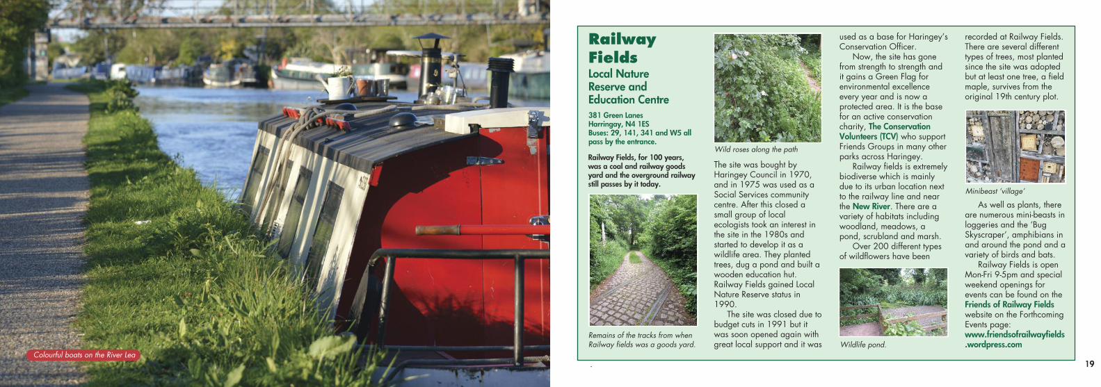
Colourful boats on the River Lea
..
Hertford to New River Head, Islington. It was built in the 17thCentury to bring fresh waterinto London and still has a roleto play to this day.
Follow the New River Pathalong the river (This is notwheelchair accessible as thepath is rough grass and can bemuddy and there are somesteps). You will have to exit thepath at Seven Sisters Road andwill see the entrance to the continuing path on the oppositeside of the road but turn left andgo across 2 sets of lights to getthere as this is a very busyroad. The river bends round tothe right and you continue untilyou reach a bridge. At thispoint you can either carry onalong the New River Path ortake a slight detour to goaround the East Reservoir inWoodberry Wetlands. You willrejoin the New River Path further along.
20 21
Finsbury Park and New River PathTaking in a Park, a waterway and a reservoir.
Distance 4.6km (2.9miles) Time 1.5 hours Easy The New River part of walk is not accessible
Circular Walk
Transport LinksManor House is on the Piccadilly Line, one stopfrom Finsbury Park on the Victoria Line. Severalbus routes that stop at Manor House: 29 and 141from Wood Green/Turnpike Lane, 253 fromStamford Hill and 254 or 279 from Seven Sisters
We start this walk at ManorHouse Tube. If coming by Tubetake the exit for The Park, exit6. Enter Finsbury Park throughthe large gate with the ParkView Café on your right.
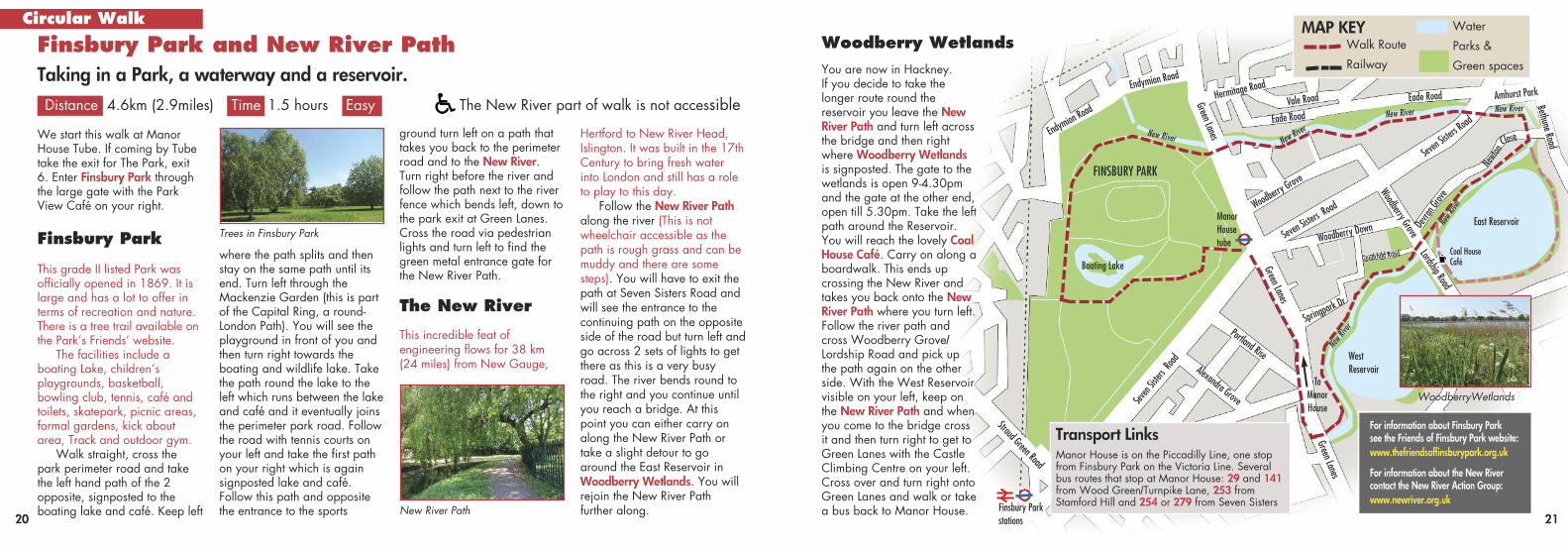
Finsbury Park
This grade II listed Park wasofficially opened in 1869. It islarge and has a lot to offer interms of recreation and nature.There is a tree trail available onthe Park’s Friends’ website.
The facilities include aboating Lake, children’splaygrounds, basketball,bowling club, tennis, café andtoilets, skatepark, picnic areas,formal gardens, kick aboutarea, Track and outdoor gym.
Walk straight, cross thepark perimeter road and takethe left hand path of the 2opposite, signposted to theboating lake and café. Keep left
For information about Finsbury Park see the Friends of Finsbury Park website:www.thefriendsoffinsburypark.org.uk
For information about the New River contact the New River Action Group:www.newriver.org.uk
where the path splits and thenstay on the same path until itsend. Turn left through theMackenzie Garden (this is partof the Capital Ring, a round-London Path). You will see theplayground in front of you andthen turn right towards theboating and wildlife lake. Takethe path round the lake to theleft which runs between the lakeand café and it eventually joinsthe perimeter park road. Followthe road with tennis courts onyour left and take the first pathon your right which is againsignposted lake and café.Follow this path and oppositethe entrance to the sports
ground turn left on a path thattakes you back to the perimeterroad and to the New River.Turn right before the river andfollow the path next to the riverfence which bends left, down tothe park exit at Green Lanes.Cross the road via pedestrianlights and turn left to find thegreen metal entrance gate forthe New River Path.
The New River
This incredible feat of engineering flows for 38 km(24 miles) from New Gauge,
Trees in Finsbury ParkManorHousetube
Green Lanes
Green Lanes
Green Lanes
To ManorHouse
Alexandra Grove
Portland Rise
Seven Sisters R
oad
Seven Sis
ters Roa
d
Amhurst Park
Woodberry Down
Springpark
Dr
Goodchild Road
New R
iver
New Ri
ver
New RiverNew River
New River New River
Seven S
isters R
oad
Woodber
ry Grove Woodberry Grove
Lordship Road
Devra
n Grov
e
East Reservoir
Coal HouseCafé
WestReservoir
Newto
n
Close
Hermitage Road
Eade Road
Eade Road Bethune Road
Vale RoadEndymion Road
You are now in Hackney.If you decide to take thelonger route round thereservoir you leave the NewRiver Path and turn left acrossthe bridge and then rightwhere Woodberry Wetlandsis signposted. The gate to thewetlands is open 9-4.30pmand the gate at the other end,open till 5.30pm. Take the leftpath around the Reservoir.You will reach the lovely CoalHouse Café. Carry on along aboardwalk. This ends upcrossing the New River andtakes you back onto the NewRiver Path where you turn left.Follow the river path andcross Woodberry Grove/Lordship Road and pick upthe path again on the otherside. With the West Reservoirvisible on your left, keep onthe New River Path and whenyou come to the bridge crossit and then turn right to get toGreen Lanes with the CastleClimbing Centre on your left.Cross over and turn right ontoGreen Lanes and walk or takea bus back to Manor House.
Boating Lake
Finsbury Parkstations
FINSBURY PARK
Stroud Green Road
Endymion
Road
New River Path
Woodberry Wetlands
WoodberryWetlands
MAP KEYWalk Route
Railway
Water
Parks &
Green spaces
22 23
Parkland WalkA long nature reserve and a wood
Distance 6.5km (4 miles) Time 1.5 hours Easy
FINSBURY PARK
HIGHGATEWOOD
QUEEN’SWOOD
ManorHouse
Finsbury Park
HighgateTubeThe Woodman Pub Stroud Green Road
Hornsey RiseHor
nsey La
ne
Horns
ey
GdnsLane
Crou
ch En
d Hill
Cranley Ga
rdens
Elling
ton Rd
Wood Ln
Queen
s
Wood Vale
Muswell Hill Rd Crouch Hill
Crouch Hill
Green Lanes
Archway Road
Archway Road
Endymion
Staple
ton
Warltersville
Ashley Road
Road Ha
ll
Oakfield Road
Oxford Rd
Ferme Park Road
Pleasant Vs
Mount
Mount
Shephe
rds Hill
Claremont RdStan
Priory G
dns
View R
oad
Haslemere
Road
Hannay
Crescent Rd
Avenue
Road
Milton Pk
Wood Rd
Stanhope RoadHolmesdale Road
Lancaster RoadFlorence Road
Upper Tolling
ton Pa
rk
Woodstock Rd
Muswell Hill
Road
Road
Blythw
ood
Ossian Roa
d
Seven S
isters R
oad
Cranley G
ardens
ALEXANDRA PARK
Musw
ellHill R
d
Remains of the station platform onparkland walk at Crouch Hill
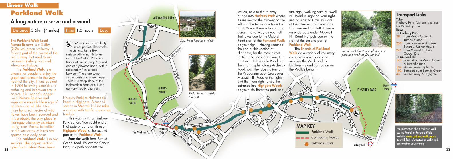
View from Parkland Walk
Wild flowers besidethe path.
Wheelchair accessibilityis not perfect. The whole
route now has a firm surface with almost level ac-cess at the Oxford Road en-trance at the Finsbury Park endand at Blythwood Road, with areasonably firm surface between. There are somestoney parts and a few slopes.There is a steep slope at theHolmesdale Road exit. It canget very muddy after rain.
hope Gdn
s
Transport LinksTubeFinsbury Park - Victoria Line andthe Piccadilly Line. BusesTo Finsbury Park29 from Wood Green &
Turnpike Lane259 from Edmonton via Seven
Sisters & Manor HouseW7 from Muswell Hill via
Crouch EndTo Muswell Hill144 Edmonton via Wood Green
& Turnpike Lane134 via Archway/Highgate102 Edmonton via Bounds Green 43 via Archway & Highgate
For information about Parkland Walksee the Friends of Parkland Walkwebsite: www.parkland-walk.org.ukYou will find information on walks and conservation volunteering.
station, next to the railwaybridge into Finsbury Park whereit runs next to the railway on theleft and the tennis courts on theright. You will see a footbridgeacross the railway on your leftthat takes you to the OxfordRoad start of the Parkland Walkon your right. Having reachedthe end of this section atHighgate, for the most directroute to the second section, turnright into Holmesdale Road andthen right, uphill along ArchwayRoad, past the tube station tothe Woodman pub. Cross overMuswell Hill Road at the lightsand then turn right to see theentrance into Highgate Woodson your left. Enter the park and
The Parkland Walk LocalNature Reserve is a 3.5km(2.2miles) green walkway. Itfollows part of the course of theold railway that used to runbetween Finsbury Park andAlexandra Palace.
The Parkland Walk is achance for people to enjoy thegreen environment in the veryheart of the city. It was openedin 1984 following extensive re-surfacing and improvements toaccess. It is London's longestLocal Nature Reserve andsupports a remarkable range ofhabitats and wildlife. Overthree hundred species of wildflower have been recorded andit is probably the only place inHaringey where ivy clambersup fig trees. Foxes, butterfliesand a vast array of birds arespotted on a daily basis.
The Parkland Walk is in twosections. The longest sectiongoes from Oxford Road (near
Finsbury Park) to HolmesdaleRoad in Highgate. A secondsection in Muswell Hill includesa viaduct with terrific views overLondon.
This walk starts at FinsburyPark station. You could end atHighgate or carry on throughHighgate Wood to the secondpart of the Parkland Walk.
Start the walk from StroudGreen Road. Follow the CapitalRing Link path opposite the
MAP KEYParkland Walk
Connecting Routes
Entrances/Exits
Linear Walkturn right, walking with MuswellHill Road in sight on your rightuntil you get to Cranley Gate at the other end of the woods.Exit here and turn left. There isan underpass under MuswellHill Road that puts you on thestart of the second part ofParkland Walk.
The Friends of ParklandWalk do a variety of voluntaryconservation work days toimprove the Walk and itsbiodiversity and campaign onthe Walk’s behalf.
..
24 25
good for a full english breakfastto see you on your way!
The Friends of Chestnutspark have done a lot of workimproving the park, includingplanting an orchard.
Leaving the café behind youwalk towards the children’splay area. Follow the patharound the main field with theplayground on your right. Turn left at the community centreand pass the outdoor gym onyour right. The path continuesthrough an avenue ofplane trees. Turn right atthe end on the perimeterpath which bends right.With the basketball courton your right turn downa short alley on your leftto Cornwall Road. Turnleft and walk the lengthof road to West GreenRoad. Turn left and crossthe road via the crossing.Turn right and then very
soon on your left you will seethe gated entrance to DownhillsPark before a café.
Downhills ParkThis is another historic park with a very established FriendsGroup who have done much totransform the space.
Take the gated entrancewith a commercial café on theright. Walk up this path andstraight on around a circle withpicnic tables and past a
This amble through Tottenhamis all on paths or pavements sois accessible to wheelchairusers. We are describing thewalk from Chestnuts Park inSt.Ann’s Road, N15 toMarkfield Park near TottenhamHale but the walk can be donein either direction or done insections.
Chestnuts ParkOur walk starts at the ChestnutsCafé on St Ann’s Road oppositeSt. Ann’s Hospital. This café is
.Tottenham Park Café TrailTaking in 8 Parks, Tottenham Marshes, Pymmes Brook and the River Lea (and cafés)
Distance 9.53km (6 miles) Time 3hrs Easy All parts of this walk are accessible
Linear Walk
Transport LinksChestnuts Park buses:67 from Wood Green,Turpike Lane orStamford Hill or 341 fromNorthumberland Parkor Manor House stopsat St Ann’s Hospital, St Ann’s Roadopposite park Café
Markfield Park:Tottenham Hale TubeSeven Sisters Tube41 bus to TottenhamHale via TurnpikeLane, Crouch EndW4, 230 and 123 busto Tottenham Hale viaTurnpike Lane/WoodGreen
There are Friends Groups in most Tottenham Parks, see:Friends of Chestnuts Park www.friendsofchestnuts.org.ukFriends of Downhills Park www.ccurrie.me.uk/downhillsFriends of Lordship Rec www.lordshiprec.org.ukLordship Hubwww.lordshiphub.org.ukFriends of Bruce Castle Park www.friendsofbrucecastlepark.org.ukFriends of Down Lane Parkfdlp.org.ukLiving Under One Sunwww.livingunderonesun.co.uk/Friends of Tottenham Marsheswww.tottenhammarshes.orgFriends of Markfield Parkwww.friendsofmarkfieldpark.org.ukMarkfield Beam Enginewww.mbeam.org
Lordship Lane
All Hallows
Higham Road
Tower Gardens Rd Tower Gardens Rd
Risley Road
The Roundway
Lordship LaneLordship Lane
Church
Lane
Bruce Grove
The Avenue
The Ave
nueAdams Road
Lansdowne Road
Mafeking Rd
Dowsett Rd
Parkhurst Rd
Ladysm
ith Rd
StonebridgeLock
PymmesBrook
Lee NavigationRiver Lea
To WoodGreen Tube
To TurnpikeLane Tube
River Lea
Downhills Pk Road
West Green Road
BlackBoyLane
West Green Road
Cornwall Avenue
Monumen
t Way
Park View
Road
Broad Lane
Tynemouth Road
Broad LaneMarkfield Rd
Water
mead W
ay
Waterm
ead Wa
y
Ashle
y Road
Seven S
isters Ro
adSt Ann’s RoadSt Ann’s Road
Ferry Lane
Ferry LaneThe Hale
Hale Rd
Mill M
ead R
dDownhills Pk Road
Philip Lan
e
Philip Lane
Totte
nham
High
Road
Totte
nham
High
Road
Totte
nham
High
Road
LORDSHIP RECREATIONGROUND
BRUCECASTLE PARK
DOWNLANEPARK
TOTTENHAMMARSHES
TOTTENHAMCEMETERY
HARTINGTONPARK
DOWNHILLSPARK
CHESTNUTSPARK
TOWERGARDENSPARK
TOTTENHAMGREEN
TottenhamHale
SevenSisters
SouthTottenham
BruceGrove
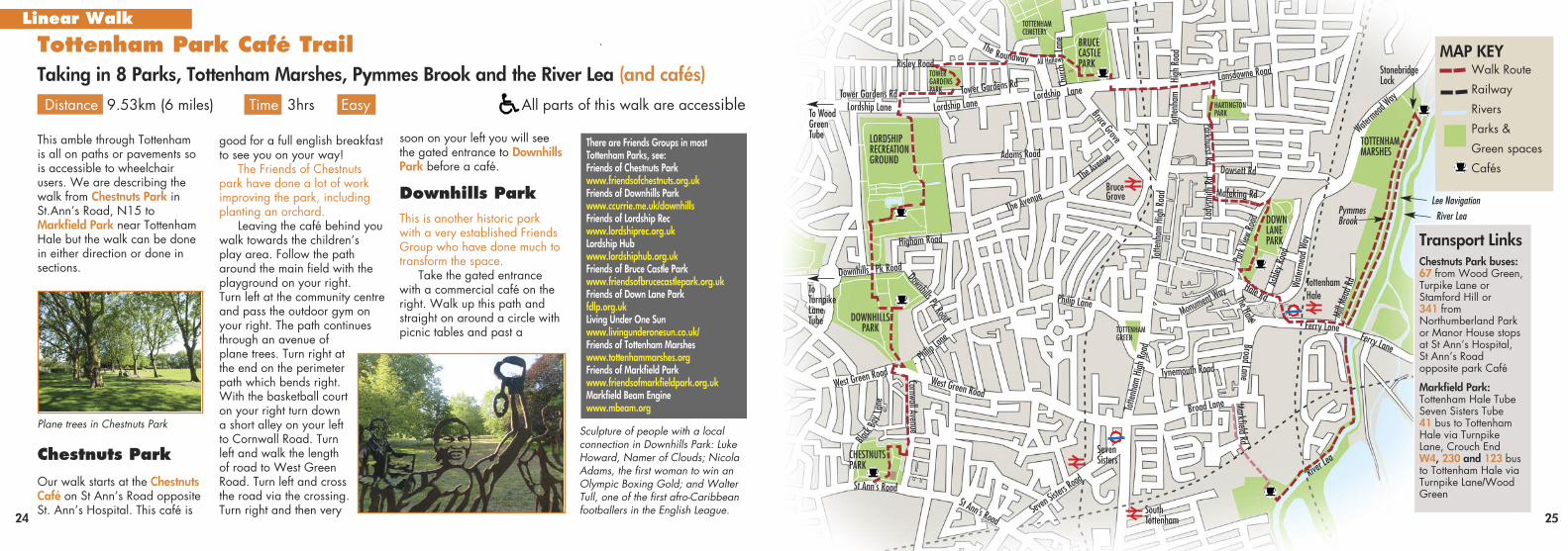
Plane trees in Chestnuts ParkSculpture of people with a local connection in Downhills Park: LukeHoward, Namer of Clouds; NicolaAdams, the first woman to win anOlympic Boxing Gold; and WalterTull, one of the first afro-Caribbeanfootballers in the English League.
MAP KEYWalk Route
Railway
Rivers
Parks &
Green spaces
Cafés
children’s play area. After theplay area take the second rightpath before the gated gardens(The Italian Gardens) whichgoes past the tennis courts tothe Downhills Café with tablesoutside. This café does meals,sandwiches, cakes and snacksand has public toilets.
After visiting the café retraceyour steps to the ItalianGardens and turn right intothem. Half way along there is alow gate on your left whichtakes you into a wooded area.There is a rough path straighton across the wood that takesyou to a wide path where youturn right. At the end of thispath is Downhills Park Road.
Lordship RecGo across the pedestrian lightsand then you will enter LordshipRecreation Ground (the Rec forshort). This park was totallyregenerated in 2012 aftersuccessful campaigning by localresidents in the Friends Group.Walk down the path with thewoodland on your right or walkin the woodland along the rusticpath to enjoy the trees. Take a
spur off to the left to return tothe main path. Walk past apark entrance on your left andyou will see a large gap in thehedge on your right. Turn righthere and enter the model trafficarea. (Watch out for kids onbikes). This is a historic areathat was opened by the Ministerof Transport in 1938. Walkalong the central path and pasta paddling pool and children’splayground and you will see alake and a yellow building,
Lordship Hub, where there is acafé and public toilets. You canget toasties and other snackshere and also bird food forfeeding the birds on the lake.
Pass Lordship Hub with theoutdoor gym on your left. Takea left at the end of this path andgo across the Moselle River viaa wooden bridge (this isHaringey’s hidden river whichis mostly underground fromHighgate). Carry on straightwith the skate park and open
air theatre, The Shell, on yourright. Stay on this path with ahedged football field on yourright. At the end of the paththere is a small building which is a bike project and to the leftof that is the main park exit outonto Lordship Lane. CrossLordship Lane via the crossingand go straight on alongWaltheof Avenue. At the firstmini roundabout turn right upTower Gardens Road and crossit. You are now in TowerGardens, a historic conservationarea, built for London workers inthe early 20th Century.
Tower GardensParkSome way along TowerGardens Road on your left youwill see the red brick entrance toTower Gardens Park. Follow thepath round the park to the exitopposite and slightly to your leftonto Risley Avenue. Turn rightand carry on to the end wherethere are a few shops and somepedestrian lights on theRoundway on your left. Crossthe Roundway, turn right andcarry on up All Hallows Road
26 27
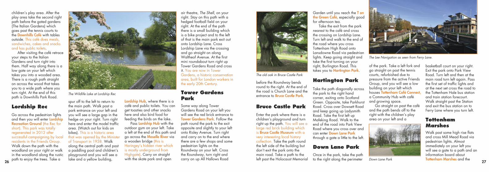
The old oak in Bruce Castle Park
The Wildlife Lake at Lordship Rec
before the Roundway bendsround to the right. At the end ofthe road is Church Lane and theentrance to Bruce Castle Park.
Bruce Castle ParkEnter the park where there is achildren’s playground and turnright up the path. You will see alarge red brick building whichis Bruce Castle Museum with avery interesting local historycollection. Take the path roundthe left side of the building butdon’t exit the park onto themain road. Take a path to theleft past the Holocaust Memorial
Garden until you reach the T onthe Green Café, especially goodfor afternoon tea.
Take the exit from the parknearest to the café and crossthe crossing on Lordship Lane.Turn left and walk to the end ofthe road where you crossTottenham High Road ontoLansdowne Road via pedestrianlights. Keep going straight andtake the first turning on yourright, Burlington Road. Thistakes you to Hartington Park.
Hartington ParkTake the path diagonally acrossthe park to the right handcorner, exiting onto ScotlandGreen. Opposite, take ParkhurstRoad. Cross over Dowsett Roadand keep going up LadysmithRoad. Take the first left upMafeking Road. Walk to theend of the road into Park ViewRoad where you cross over andcan enter Down Lane Parkthrough a gate a little to the left.
Down Lane ParkOnce in the park, take the pathto the right along the perimeter
of the park. Take a left fork andgo straight on past the tenniscourts, refurbished due topressure from the active FriendsGroup, and you will see a lowbuilding on your left whichhouses Tottenham Café Connect,a Community Hub with caféand growing space.
Go straight on past the caféand the path bends off to theright with the children’s playarea on your left and a
basketball court on your right.Exit the park onto Park ViewRoad. Turn left and then at themain road turn left again. Passthe first set of traffic lights andat the next set cross the road tothe Tottenham Hale bus stationand train station forecourt.Walk straight past the Stationand exit the bus station on toFerry Lane where you turn left.
TottenhamMarshesWalk past some high rise flatsand cross Mill Mead Road viapedestrian lights. Almostimmediately on your left youwill see a gate to a path and aninformation board aboutTottenham Marshes and theDown Lane Park
The Lee Navigation as seen from Ferry Lane.
28 29
River Lea. Follow this path witha stream on your right which isPymmes Brook. On your left,through the fence, you will seeallotments, some of whichbelong to a communityorganisation which is calledLiving Under One Sun.
Along the path you willenter an area of marshmeadow. Keep straight on untilyou reach a picnic area withpublic art installations and thereis a path off to the right leadingto Stonebridge Lock. You goacross the Pymmes Brook overto the Lee Navigation with theWaterside Café to your left.
Turn right and walk past thelock on the towpath, with theriver on your left. You will seelots of colourful narrow boats.You are now walking back toFerry Lane but this time alongthe Lee Navigation.
At Ferry Lane, do not exit upthe cobbled ramp to the roadbut go on under the road. Youwill then have the river on yourleft and Pymmes Brook on yourright as they come together.You will pass lots of residentialbuildings and pass under 2railway bridges and soon youwill see the gate to MarkfieldPark on your right. Markfield Park
Entering the park from the river,you will pass some brightlypainted walls and past theseyou will see the Markflield Caféwith toilets.
Next to the café there is amuseum housing a VictorianBeam Engine, as the site wasonce a sewage pumpingstation. You can still see theremains of the filter beds. Onsome Sundays you are able tosee the beam engine in action.Check [email protected] or call 017 0726 0695.
This is the end of the walk.Either walk back along the riverto Ferry Lane and TottenhamHale or walk past the café andthe Museum and then turn rightpast the car park and then leftagain. You go under the railwayinto Markfield Road. Keep on tothe end of the road where youwill join Broad Lane. There arebuses there or you can walk leftfor Seven Sisters or right forTottenham Hale. On a Sunday,if you finish at Seven Sisters,you could walk up TottenhamHigh Road to Tottenham Greenfor the Sunday Market, 11-4pm.
Some of thebrightlypainted wallsof the formerfilter beds in Markfield Parkthat you willsee as youenter the parkfrom the RiverLea
Stonebridge lock on the Lee Navigation
Alexandra Park was openedas a Victorian leisure Parkover 150 years ago.
The ‘People’s Park’ haspanoramic views of London’sskyline which are second tonone, stretching from CanaryWharf to St Paul’s Cathedraland the Shard and on a clearday you can even see theCrystal Palace’s transmitter.There are a huge variety ofactivities on offer and it is afantastic place to spend awhole day!
There is a pitch and puttcourse, a boating lake, avariety of places to eat, aFarmer’s Market mostsundays, a skate park,landscaped gardens, anindoor soft play area and arecent addition, ‘Go Ape’.
In addition to activities inthe Park there are also eventsin the Palace itself, with itsindoor skating rink and newlyrefurbished Victorian Theatrewhich is scheduled to reopenin December 2018.
The Park’s 196 acres ofGrade II listed EnglishHeritage parkland ismanaged by the AlexandraPark and Palace CharitableTrust, with support from anactive, local volunteer group,the Friends of AlexandraPark, who host nature walksand activities within thegrounds throughout the yearand help run an informationcentre at the weekends.
Go Ape
NatureReserve
Boating Lake and Café
AlexandraPalace
InformationCentreGrove
Café
indoor Adventureplay
Muswell Hill
Newland Road
SportsField
The GrovePitch andPutt
Friends of Alexandra Park website:www.friendsofalexandrapark.org/
Green below the palace whereyou can get great views of London
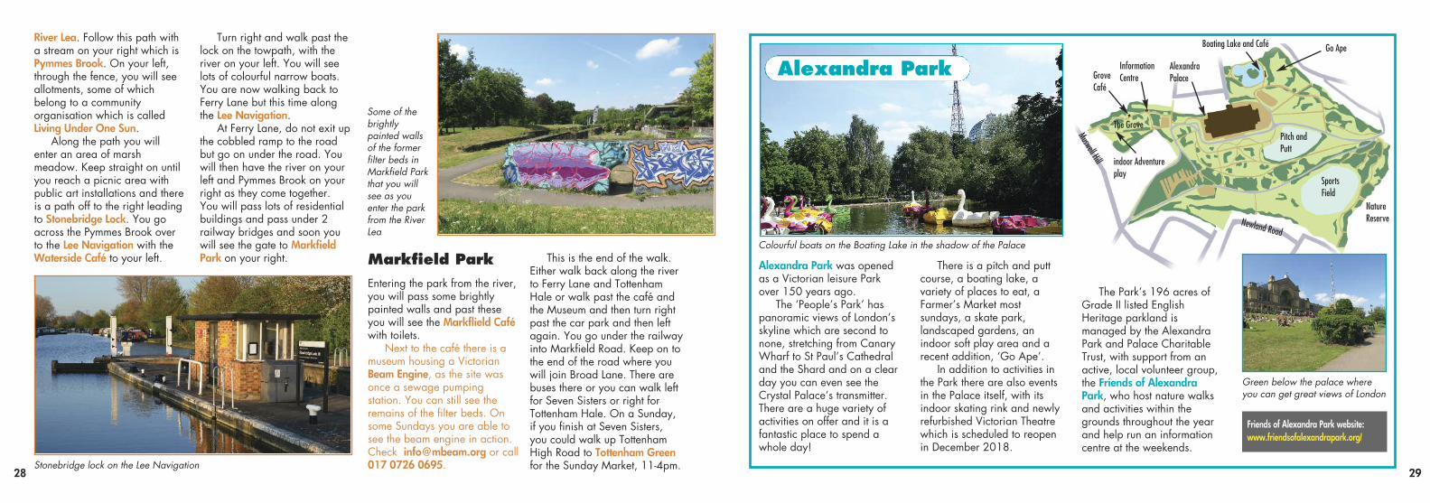
Colourful boats on the Boating Lake in the shadow of the Palace
Alexandra Park
.
30 31
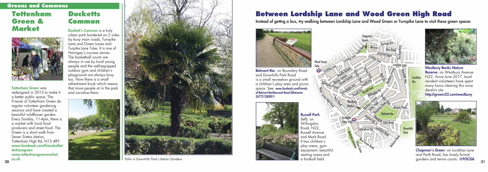
Tottenham Green wasredesigned in 2015 to make ita better public space. TheFriends of Tottenham Green doregular volunteer gardeningsessions and have created abeautiful wildflower garden.Every Sunday, 11-4pm, there isa market with local foodproducers and street food. TheGreen is a short walk fromSeven Sisters station,Tottenham High Rd, N15 4RY.www.facebook.com/friendsoftottenhamgreenwww.tottenhamgreenmarket.co.uk
Duckett’s Common is a trulyurban park bordered on 2 sidesby busy main roads, TurnpikeLane and Green Lanes andTurpike Lane Tube. It is one ofHaringey’s success stories. The basketball courts arealways in use by local youngpeople and the well-equippedoutdoor gym and children’splayground are always busytoo. Now there is a smallrefreshment kiosk which meansthat more people sit in the parkand socialise there.
TottenhamGreen &Market
DuckettsCommon
Greens and Commons
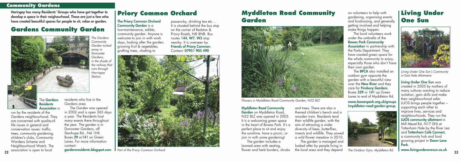
Between Lordship Lane and Wood Green High RoadInstead of gettng a bus, try walking between Lordship Lane and Wood Green or Turnpike Lane to visit these green spaces
Westbury Banks Nature Reserve: on Westbury AvenueN22. Since June 2017, localresident volunteers have spentmany hours clearing this oncederelict site. http://grown22.com/westbury
Chapman’s Green: on Lordship Laneand Perth Road, has lovely formalgardens and tennis courts. @FOCG6
Belmont Rec: on Boundary Roadand Downhills Park Road is a small recreation ground witha children’s play area and picnicspace. See: www.facebook.com/Friends-of-Belmont-RecMannock-Road-Allotments-267731280891/
Russell Park(left): on Willingdon Road, N22,Russell Avenueand Mark Road. It has children’s play areas, gymequipment, beautifulseating areas and a football field.
Lordship L
aneLord
ship Lane
WoodGreen High Road
Lordship Lane
Granville Road
New Road
Norman AveMelrose
Perth Road
Russell P
ark
Belmont Rec
West Green Road
Carlingford RdLangham Road
Belmont Road
Graham Rd
Green Lanes
TurnpikeLane Tube
Wood GreenTube
Westbury
Avenu
e
Bounda
ry Roa
d
Sirdar R
oad
Downhills Park Road
Rusper Road
Rusper Road
Westb
ury A
venue Downhills Way
The R
ound
way
Chapman’sGreen
Lordship Lane
Willingdon
RdRus
sell Ave
Hewittl A
ve
Lymmin
gton Ave
Gladstone Avenue
Bury Road
Moselle
Avenue
Morley
Avenue
Farrant
Avenue
Mark Rd
Darwin Road
Salisbury Road
LordshipRec
DownhillsParkDucketts Common
WestburyBanks
Palm in Downhills Park’s Italian Gardens
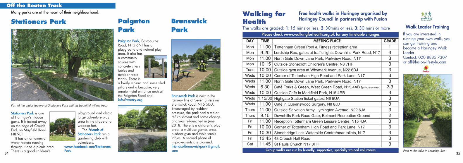
Myddleton Road CommunityGarden on Myddleton Road,N22 8LZ was opened in 2003.It is a welcoming green spacein the heart of Bowes Park. It’s aperfect place to sit and enjoythe sunshine, have a picnic, orjoin in with some gardening!
The garden includes alawned area with seating,flower and herb borders, shrubs
and trees. There are also athemed children’s bench and awooden train. Residents tendtheir wildlife garden, with theaim of attracting a widerdiversity of bees, butterflies,insects and wildlife. They soweda wild flower meadow in 2010.
The garden is managed andlooked after by people living inthe local area and they depend
on volunteers to help withgardening, organising eventsand fundraising, and generallygetting involved and helpingmake things happen.
The local volunteers workunder the umbrella of theBowes Park CommunityAssociation in partnership withthe Parks Department. Theyhave created green space forthe whole community to enjoy,especially those who don’t havetheir own garden.
The BPCA also installed anoutdoor gym opposite thegarden with a beautiful viewover the New River and theycare for Finsbury Gardens.Buses 329 or 141 up GreenLanes to end of Myddleton Rd.www.bowespark.org.uk/groups/myddleton-road-garden-group.
The GardensResidentsAssociation is
run by the residents of theGardens neighbourhood. Theyare concerned with quality-of-life issues in general andconservation issues: traffic,trees, community gardening,children's clubs, CommunityWardens Scheme andNeighbourhood Watch. Theassociation is open to local
residents who live in theGardens area.
The Garden was opened in 2002 and is open 365 daysa year. The Residents host many events there throughoutthe year. The garden is inDoncaster Gardens, offStanhope Rd., N4 1HX.Buses 29 or141 on GreenLanes. For more informationcontact:gardensresidents.blogspot.com.
32 33
Gardens Community Garden
Myddleton Road CommunityGarden
Priory Common Orchard
The GardensCommunity Garden tuckedaway in Doncaster Gardens, in the shade ofthe railway thatruns throughHarringay Station.
Part of the Priory Common Orchard
Flowers in Myddleton Road Community Garden, N22 8LZ
Living Under One Sun’s Communityin East Hale Allotments
The Outdoor Gym, Myddleton Rd.
Haringey has many Residents’ Groups who have got together todevelop a space in their neighourhood. These are just a few whohave created beautiful spaces for people to sit, relax or garden. The Priory Common Orchard
Community Garden is a low-maintenance, edible,community garden. Anyone iswelcome to join in with workdays, looking after the garden,growing fruit & vegetables,grafting trees, chatting to
passers-by, drinking tea etc... It is situated behind the bus stopon the corner of Redston & Priory Roads, N8 8NB. Busroutes 144, W7, W3 stopnearby. It is overseen byFriends of Priory Common. Contact: 07951 905 490
Living Under One Sun wascreated in 2005 by mothers ofmany cultures wanting to reduceisolation, gain skills and maketheir neighbourhood safer.LUOS brings people together –supporting each other toimprove lives, services andneighbourhoods. They run theLUOS community allotment inMill Mead Rd, N17 0HJ atTottenham Hale by the River Leaand Tottenham Café Connect, a community hub and foodgrowing project in Down LanePark. www.livingunderonesun.co.uk
Living UnderOne Sun
Community Gardens
.
34 35
DAY TIME MEETING PLACE GRADEMon 11.00 Tottenham Green Pool & Fitness reception area 1Mon 9.20 Lordship Rec, gates at traffic lights Downhills Park Road, N17 3Mon 11.00 North Gate Down Lane Park, Parkview Road, N17 3Mon 10.15 Outside Stonecroft Children’s Centre, N8 7HR 3Tues 10.00 Outside gym area at Whymark Avenue, N22 6DJ 3Weds 10.00 Corner of Tottenham High Road and Park Lane, N17 3Weds 11.00 North Gate Down Lane Park, Parkview Road, N17 3Weds 6.30 Café Forks & Green, West Green Road, N15 4AB Spring/summer 2-3Weds 10.00 Outside Café in Markfield Park, N15 4RB 3Weds 1.15/30 Highgate Station ticket gates, N6 5UA 3Weds 11.00 Café in Queenswood Surgery, N8 8JD 3Thurs 11.00 Outside Salvation Army, Lymington Avenue, N22 6JA 3Thurs 9.15 Downhills Park Road Gate, Belmont Recreation Ground 2
Fri 11.00 Reception Tottenham Green Leisure Centre, N15 4JA 3Fri 10.00 Corner of Tottenham High Road and Park Lane, N17 3Fri 10.30 Stonebridge Lock Waterside Centre/near toilets, N17 3Fri 12.45 48 Crouch Hall Road 3Sat 11.45 St Pauls Church N17 0HH 3
Walking forHealth
Free health walks in Haringey organised byHaringey Council in partnership with Fusion
The walks are graded: 1: 15 mins or less, 2: 30mins or less, 3: 30 mins or morePlease check www.walkingforhealth.org.uk for any timetable changes
Group walks are run by friendly, supportive, specially trained volunteers
Walk Leader TrainingIf you are interested in running your own walk, youcan get training and become a Haringey WalkLeader.Contact: 020 8885 7307or [email protected]
Path to the lake in Lordship Rec
Stationers Park is oneof Haringey’s hiddengems. It is tucked awayon the edge of CrouchEnd, on Mayfield RoadN8 9LP.
It has an ornamentalwater feature runningthrough it and a picnic area.There is a good children’s
playground and also alarge adventure playarea in the shape of awooden fort.
The Friends ofStationers Park run agardening club withvolunteers.
www.facebook.com/StationersPark
Stationers Park
Part of the water feature at Stationers Park with its beautiful willow tree.
Paignton Park, EastbourneRoad, N15 6NT has aplayground and natural playarea. It also hasa communitysquare withconcrete chesstables andoutdoor tabletennis. There isa lovely mosaic and some tiledpillars and a bespoke, veryornate metal entrance arch atthe Paignton Road [email protected]
PaigntonPark
Brunswick Park is next to therailway line at Seven Sisters onBrunswick Road, N15 5DD. Encouraged by residentpressure, the park had a majorrefurbishment and name changeand was re-launched in June2018. There is a children’s playarea, a multi-use games area,outdoor gym and table tennistables. A second phase ofimprovements are planned. [email protected]
BrunswickPark
Many parks are at the heart of their neighbourhood.Off the Beaten Track
Parks need ‘Friends’! Its allabout raising our voices about what matters to ourcommunities and taking‘ownership’ of our lives, localfacilities and areas and thenseeking improvements.
EVERY PARK AND GREENSPACE NEEDS FRIENDS:If you value your local park orgreen space, want to see improvements and more peopleusing it, then get together withother park users to form aFriends Group, or join anexisting one! Park users workwith the Council, local schools,conservation and communitygroups to promote, protect andimprove their local spaces.
Some of the things Friends do:• discuss views and concerns• lobby the Council for better maintenance, and alsoimprovements • publicise their park andFriends’ activities throughwebsites, blogs or leaflets • organise volunteer work daysor park events
• research the history of thepark and produce pamphlets• apply for grants for some ofthe above and other projects
The Haringey Friends of ParksForum is the umbrellaorganisation/network of FriendsGroups supporting all publicgreen spaces throughout theborough of Haringey. Thesespaces have a vital role in thelives of all sections of thecommunity. The Forum discussesissues of common concern, andways to improve and sustain theborough's green spaces. Seemore on Friends Groups on:www.haringeyfriendsofparks.org.ukThere is also a London wideorganisation, the LondonFriends of Green SpacesNetwork – www.lfgn.org.ukand a National organisation:The National Federation ofParks and Green Spaces –www.natfedparks.org.uk. Thisis the umbrella organisationthat aims to amplify andrepresent the voices of FriendsGroups across the UK.
36
Friends of Lordship Rec, planting trees andworking in the lake
Parks Friends Groups Credits
Devised, designed and written by Joan Curtis, Friends of Lordship Rec
Photographs
The following photos provided by members of Tottenham Photography Club:
Gary Oland: FC Stephen Furner: IFC, p16, p29 top left,
p30 top left, p30 right Glynis Kirkwood-Warren: p3, p8 bottom
right, p11Mustafa Suleman: p18, p27 top right,
p28 bottom left, BCMark Bambridge: p27 top left
Linda Alliston: p5 3rd from left, top row Jae Davis: p15 top left Living Under One Sun: p33 top right Friends of Lordship Rec: p36
All other photos: Joan Curtis
Printed by Premier Print Group Wildlife Habitats ‘to let’ in Priory Common Orhard

Published in July 2018 by Friends of Lordship Recwww.lordshiprec.org.uk
In partnership with: Haringey Friends of Parks Forumwww.haringeyfriendsofparks.org.ukLordship Hubwww.lordshiphub.org.uk
Funded by
£1wheresold
Bruce Castle Museum in Bruce Castle Park