Embed Size (px)
Citation preview

Gunnedah Solar Farm765 Orange Grove Road, Gunnedah
Presented by Nick Guzowski from Photon Energy /Polpo InvestmentsIn attendance with Chelsea Milles from Canadian Solar;
Malinda Facey and Adam Bishop from pitt&sherry (EIS and RtS)
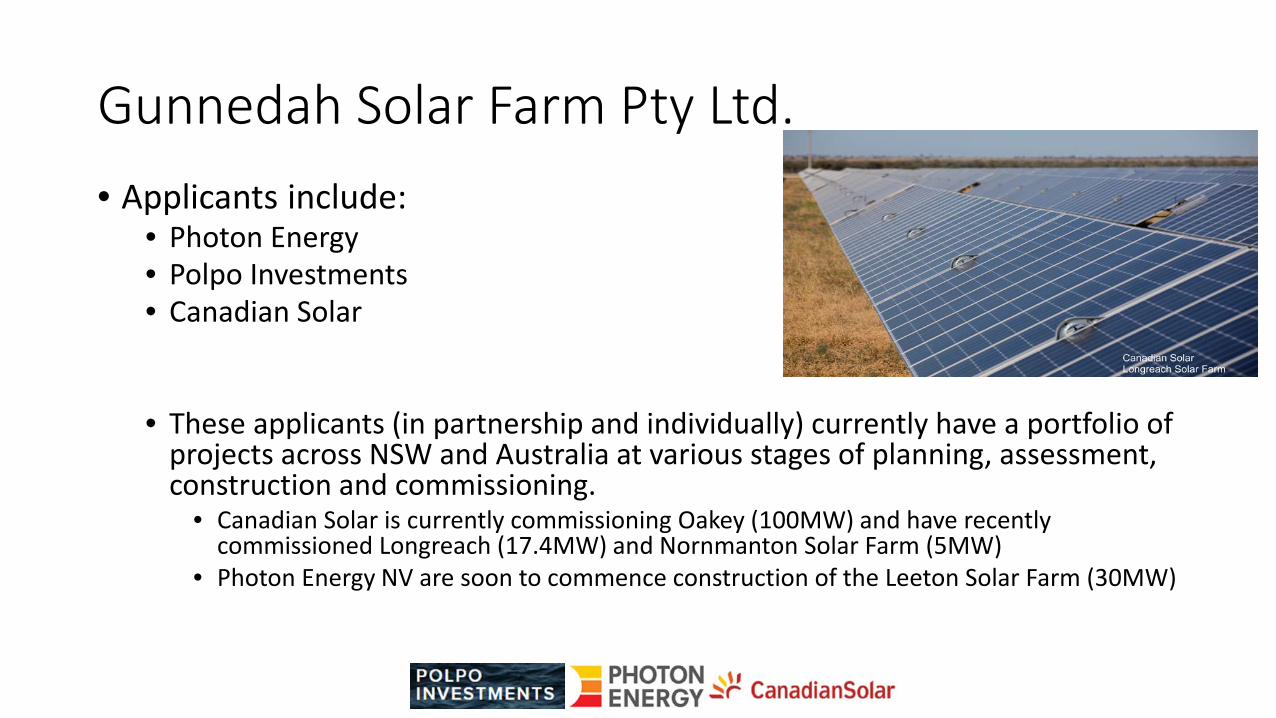
Gunnedah Solar Farm Pty Ltd. • Applicants include:
• Photon Energy• Polpo Investments• Canadian Solar
• These applicants (in partnership and individually) currently have a portfolio of projects across NSW and Australia at various stages of planning, assessment, construction and commissioning.
• Canadian Solar is currently commissioning Oakey (100MW) and have recently commissioned Longreach (17.4MW) and Nornmanton Solar Farm (5MW)
• Photon Energy NV are soon to commence construction of the Leeton Solar Farm (30MW)
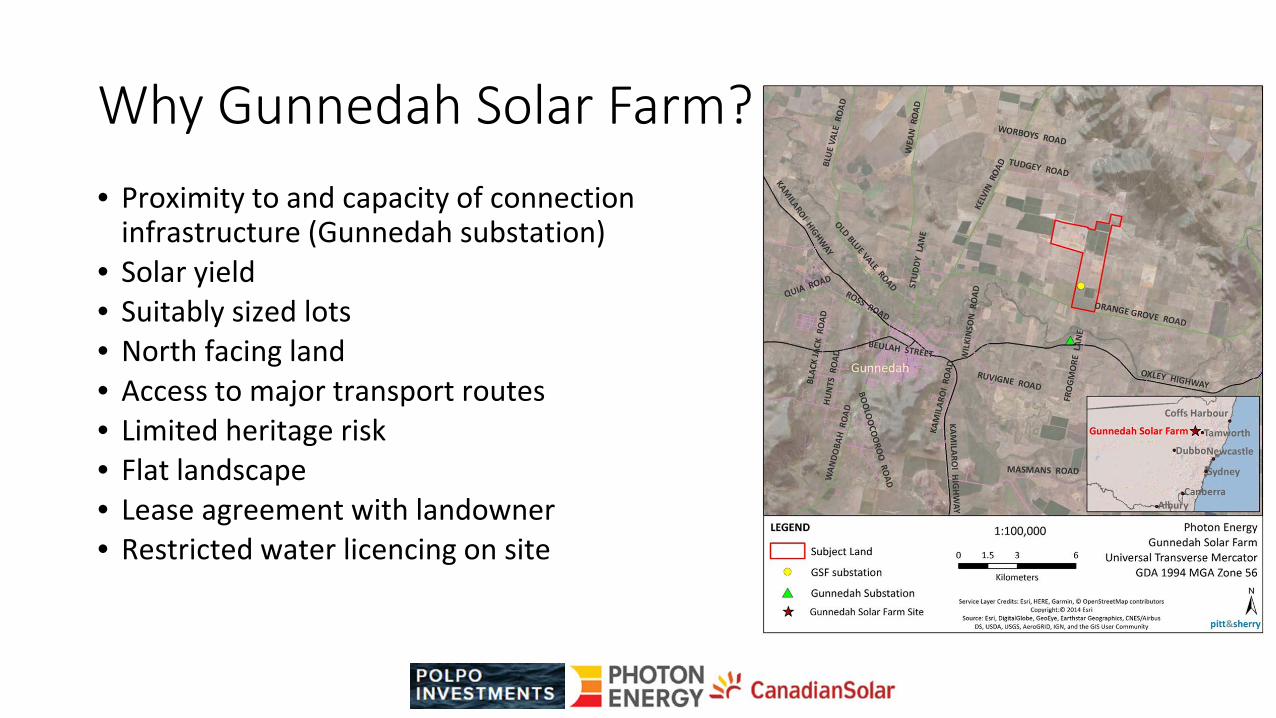
Why Gunnedah Solar Farm?• Proximity to and capacity of connection
infrastructure (Gunnedah substation) • Solar yield• Suitably sized lots• North facing land • Access to major transport routes • Limited heritage risk• Flat landscape• Lease agreement with landowner• Restricted water licencing on site
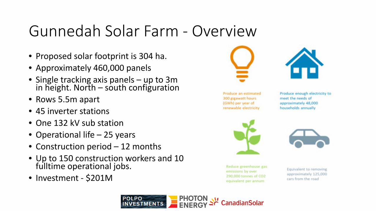
Gunnedah Solar Farm - Overview• Proposed solar footprint is 304 ha.• Approximately 460,000 panels • Single tracking axis panels – up to 3m
in height. North – south configuration• Rows 5.5m apart• 45 inverter stations• One 132 kV sub station • Operational life – 25 years • Construction period – 12 months • Up to 150 construction workers and 10
fulltime operational jobs. • Investment - $201M
Construction Overview
• Construction phase to commence in 2019 (pending approval)• 12 month program • Pile driving; trenching; firming roads, limited earthworks, fencing;
electrical works; commissioning.• Transport to site will be via an access route.• Construction hours will be 0700 – 1800 Monday – Friday and 0800 –
1300 on Saturday.• Will be up to 150 workers during peak construction.
Project Decommissioning
• 25 year operation. • If the site is decommissioned a remediation plan will be developed in
consultation with stakeholders and the Gunnedah Shire Council. • The plan will include management strategies; staging / program for
decommissioning; community engagement; contingency plans; regulatory compliance; and reporting.
• The sub-station may not be decommissioned – this will depend on TransGrid.
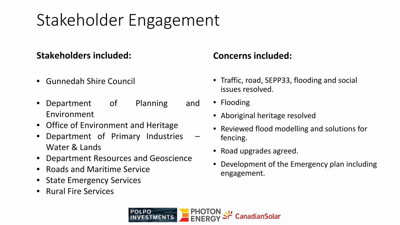
Stakeholders included:
• Gunnedah Shire Council
• Department of Planning andEnvironment
• Office of Environment and Heritage• Department of Primary Industries –
Water & Lands• Department Resources and Geoscience• Roads and Maritime Service• State Emergency Services• Rural Fire Services
Concerns included:
• Traffic, road, SEPP33, flooding and social issues resolved.
• Flooding
• Aboriginal heritage resolved • Reviewed flood modelling and solutions for
fencing. • Road upgrades agreed.
• Development of the Emergency plan including engagement.
Stakeholder Engagement
Indigenous consultation• The archaeological assessment for the Gunnedah Solar Farm was conclusive in determining the
proposed activity would not harm Aboriginal objects or places.
• Following the Office of Environment and Heritage (OEH) guidelines, formal consultation with the local Aboriginal community was not undertaken; however the assessment and survey were completed with the assistance of Red Chief Local Aboriginal Land Council.
• Some members of the local Aboriginal community have subsequently contacted OEH and would like to be directly consulted.
• Gunnedah Solar Farm has committed to inviting local aboriginal stakeholders identified by OEH to undertake a site visit with a heritage consultant prior to commencing construction.
Community Engagement Included: • Community meeting –
August 2017• Emails• Phone Calls• Letter • One on One meetings –
January 2018 and March/April 2018
• Group meeting• Website• Hotline• Factsheets• Newspaper• Social Media
Responses:• 29 register attendees
• Methods used to contact 34 residents within the locality of the site
• 26 Community members (15 neighbouring residents)
• Methods used to reach the wider community.
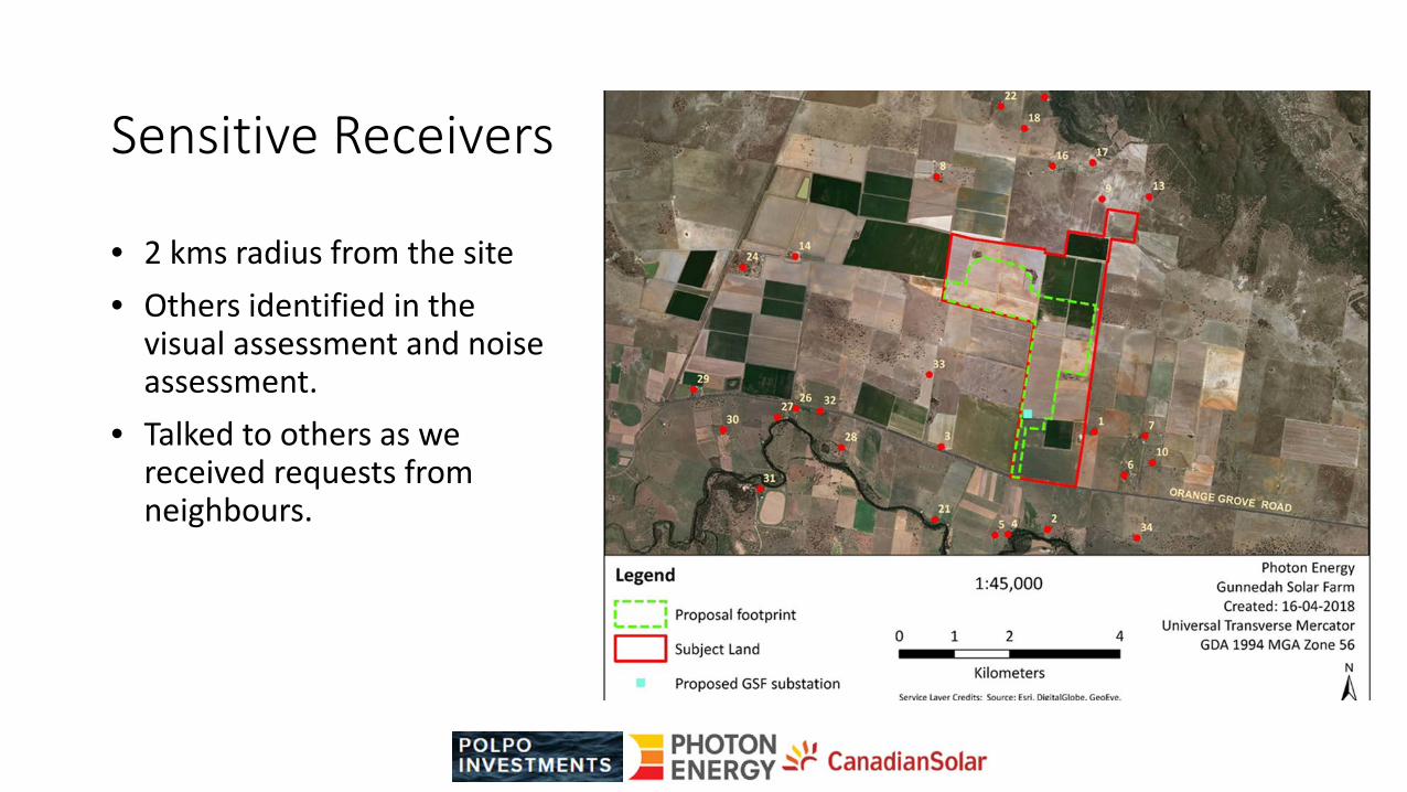
Sensitive Receivers
• 2 kms radius from the site • Others identified in the
visual assessment and noise assessment.
• Talked to others as we received requests from neighbours.
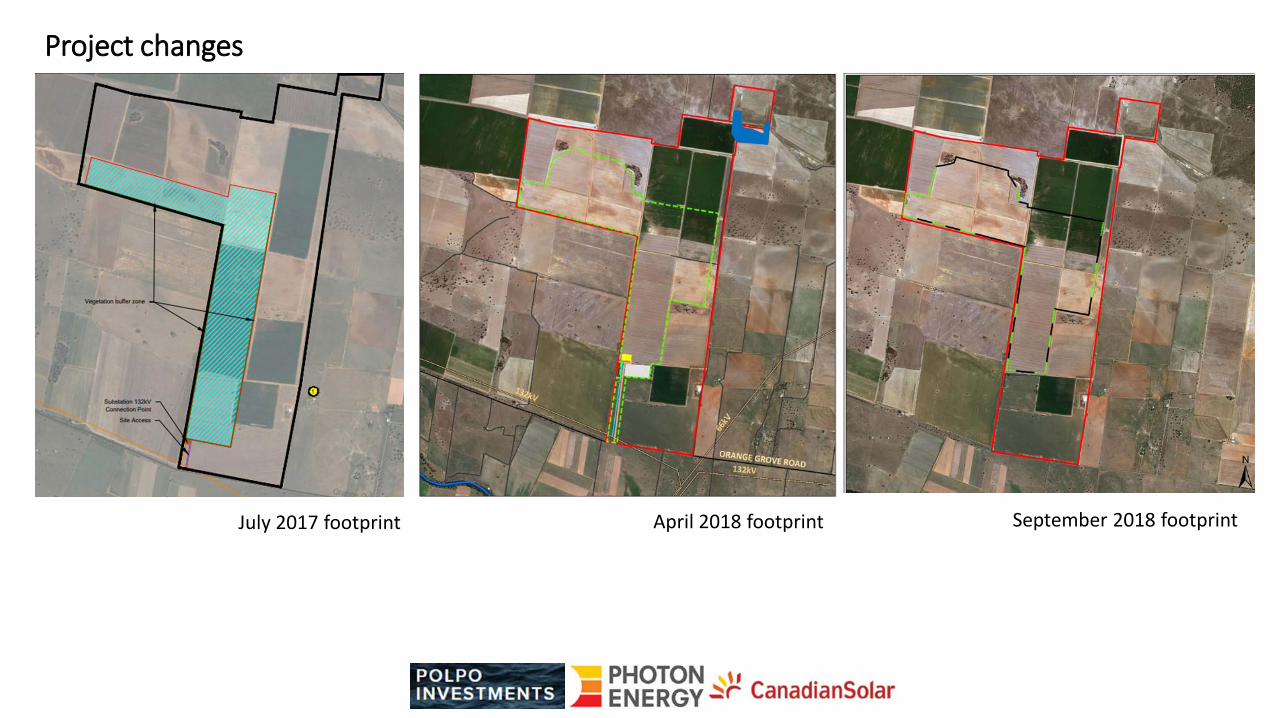
Project changes
July 2017 footprint April 2018 footprint September 2018 footprint
Flooding • Flood modelling undertaken during the EIS phase and engagement with adjacent landholders and
Council. Considered drop down / sacrificial fencing / farm fencing. • Moved proposed development footprint north to minimise impacts from flooding.
• Assessed different options including installing gates every 100m along the perimeter and 20m corridors running east – west through the property to enable water flow.
• Further flood modelling to support the Response to Submissions report. • Optioneering of design to include drop down fencing at strategic locations around the perimeter.
• Collaboration with a fencing contractor to design a practicable, resilient, safe, secure and affordable solution.
• Extension of fencing following discussions with Department of Planning and Environment.• Department of Industry – Land and Water considers project would have a negligible impact on the
flow and velocity of floodwaters.
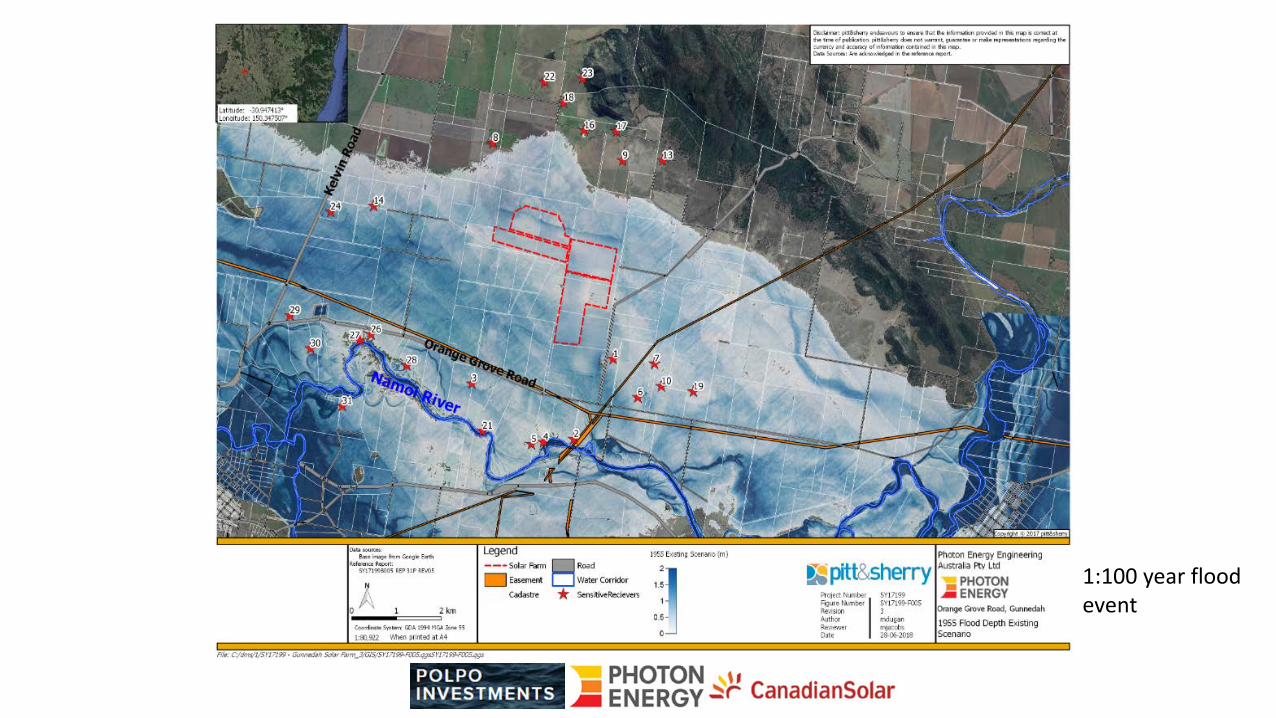
1:100 year flood event
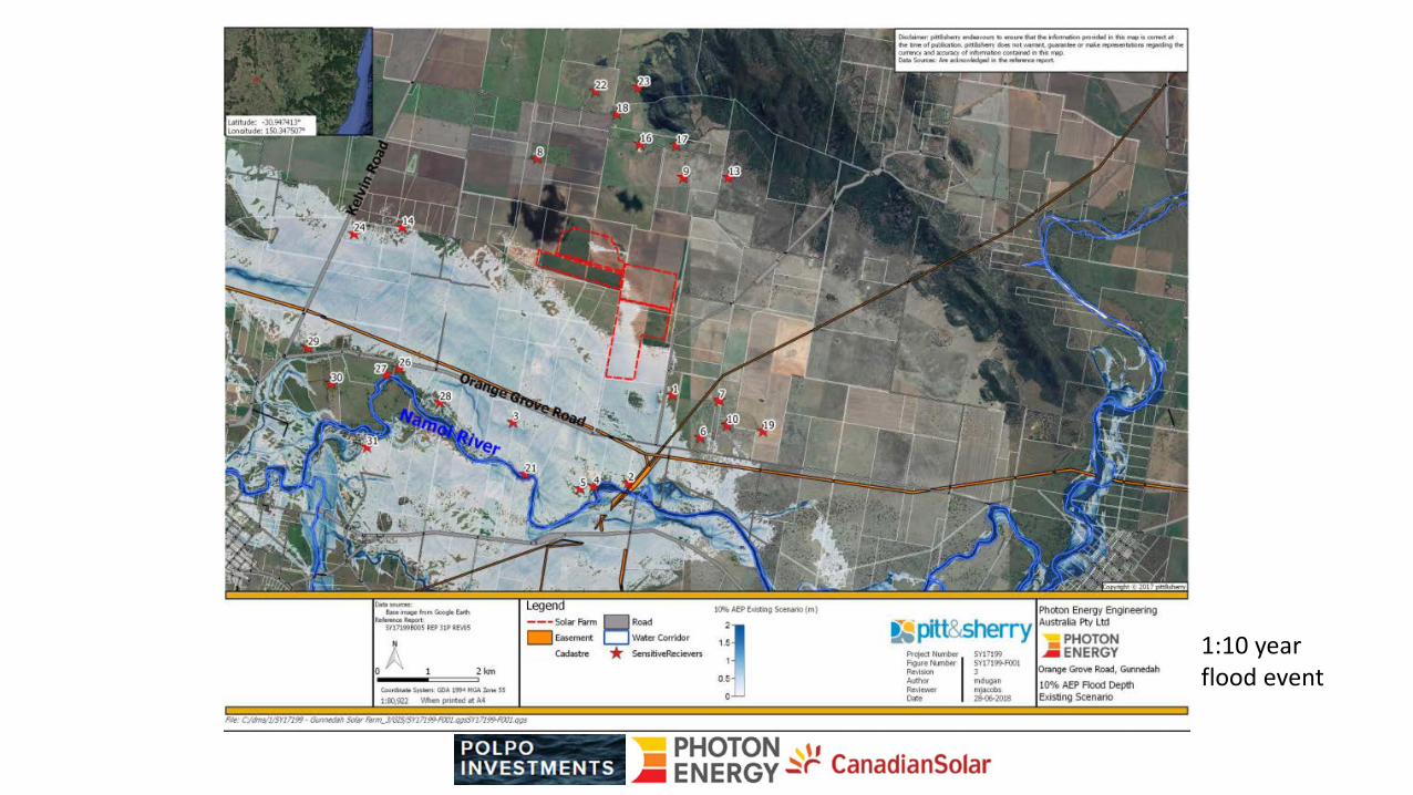
1:10 year flood event
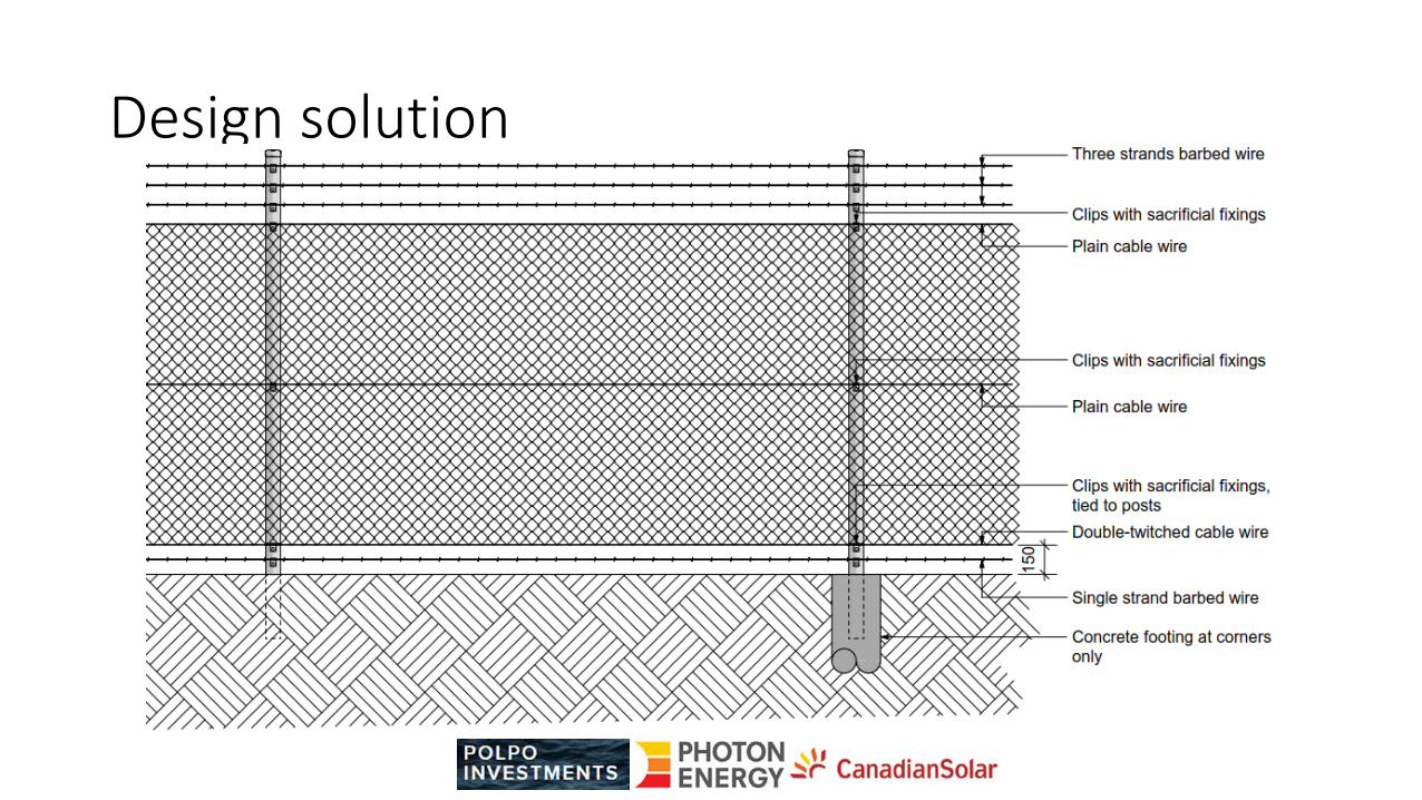
Design solution
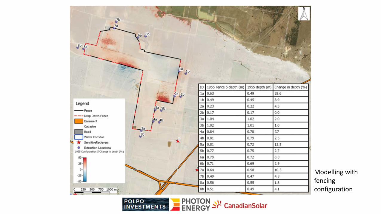
Modelling with fencing configuration
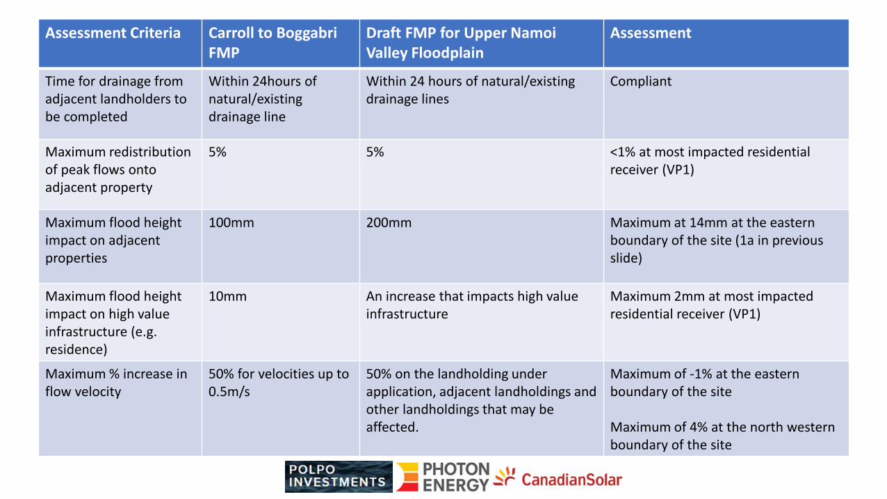
Assessment Criteria Carroll to Boggabri FMP
Draft FMP for Upper Namoi Valley Floodplain
Assessment
Time for drainage from adjacent landholders to be completed
Within 24hours of natural/existing drainage line
Within 24 hours of natural/existing drainage lines
Compliant
Maximum redistribution of peak flows onto adjacent property
5% 5% <1% at most impacted residential receiver (VP1)
Maximum flood height impact on adjacent properties
100mm 200mm Maximum at 14mm at the eastern boundary of the site (1a in previous slide)
Maximum flood height impact on high value infrastructure (e.g. residence)
10mm An increase that impacts high value infrastructure
Maximum 2mm at most impacted residential receiver (VP1)
Maximum % increase in flow velocity
50% for velocities up to 0.5m/s
50% on the landholding under application, adjacent landholdings and other landholdings that may be affected.
Maximum of -1% at the eastern boundary of the site
Maximum of 4% at the north western boundary of the site
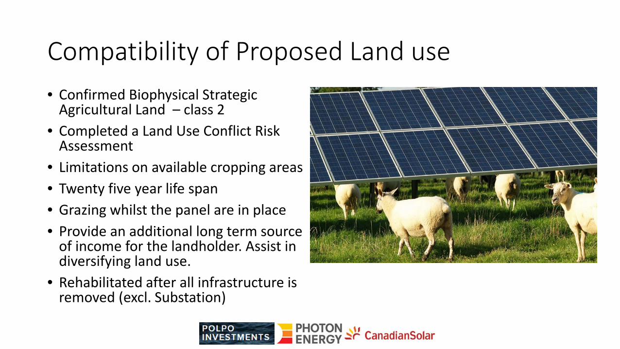
Compatibility of Proposed Land use• Confirmed Biophysical Strategic
Agricultural Land – class 2• Completed a Land Use Conflict Risk
Assessment • Limitations on available cropping areas • Twenty five year life span • Grazing whilst the panel are in place• Provide an additional long term source
of income for the landholder. Assist in diversifying land use.
• Rehabilitated after all infrastructure is removed (excl. Substation)
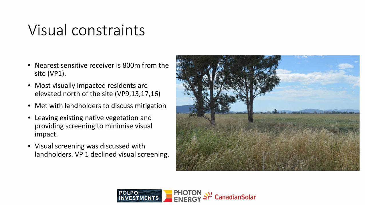
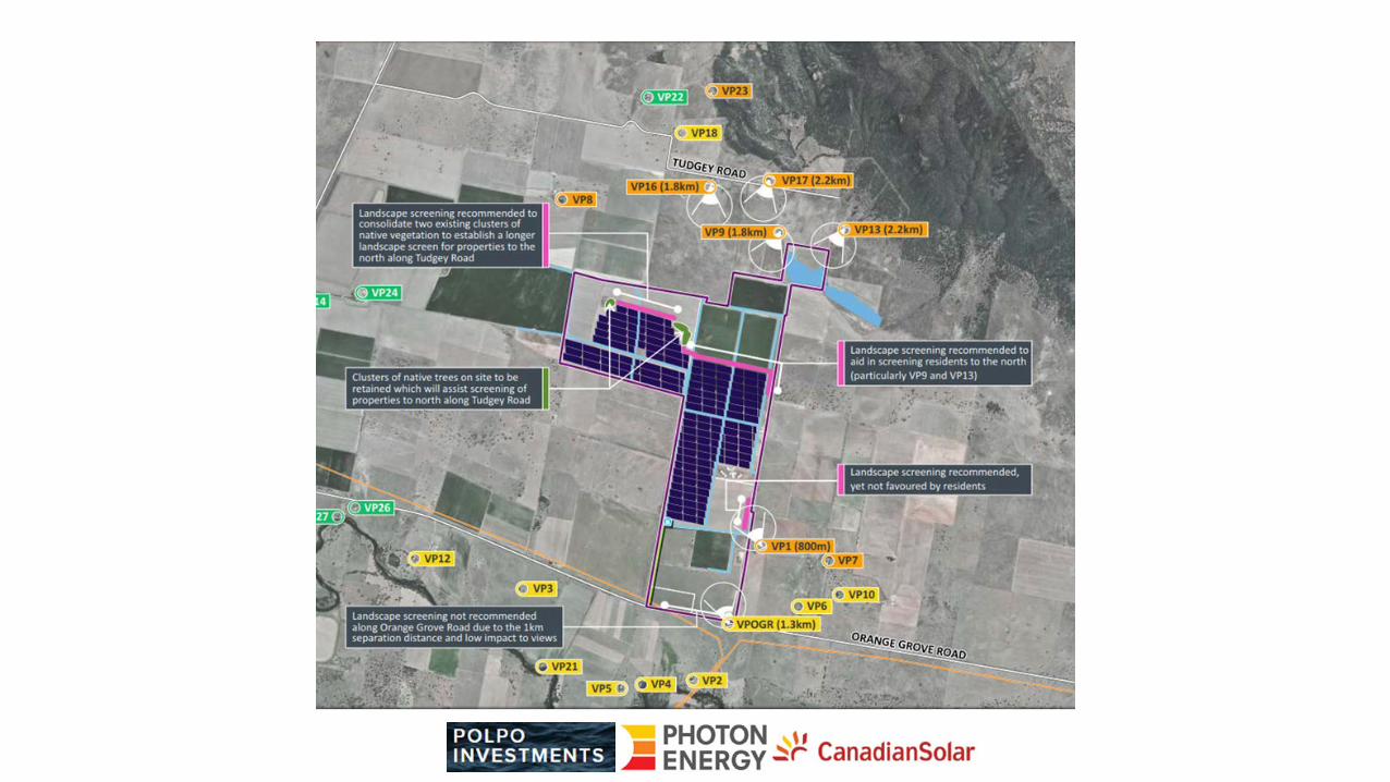
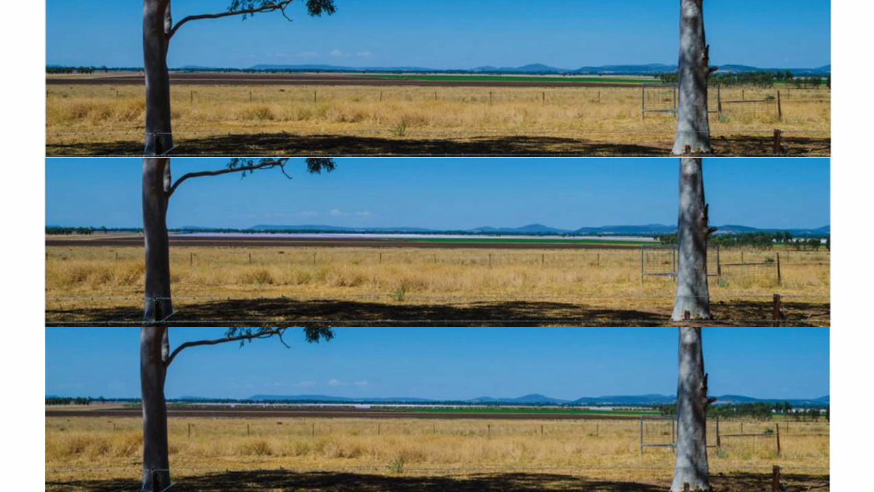
Visual constraints
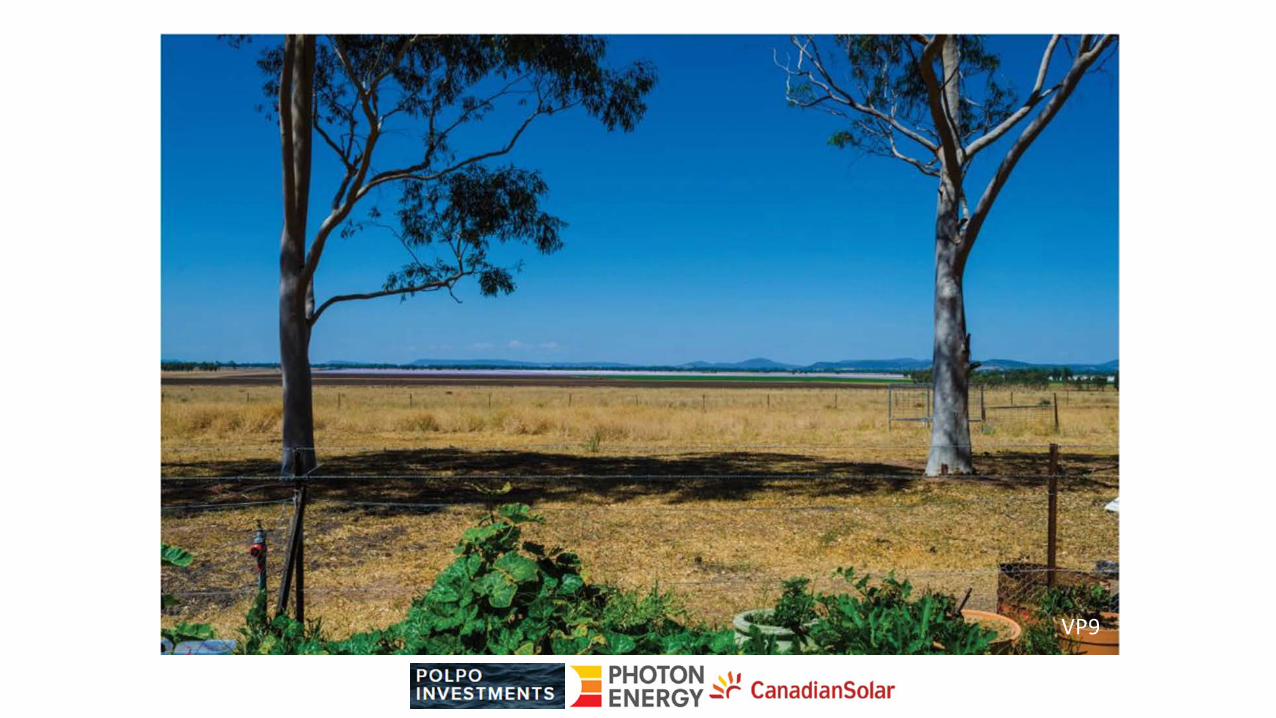
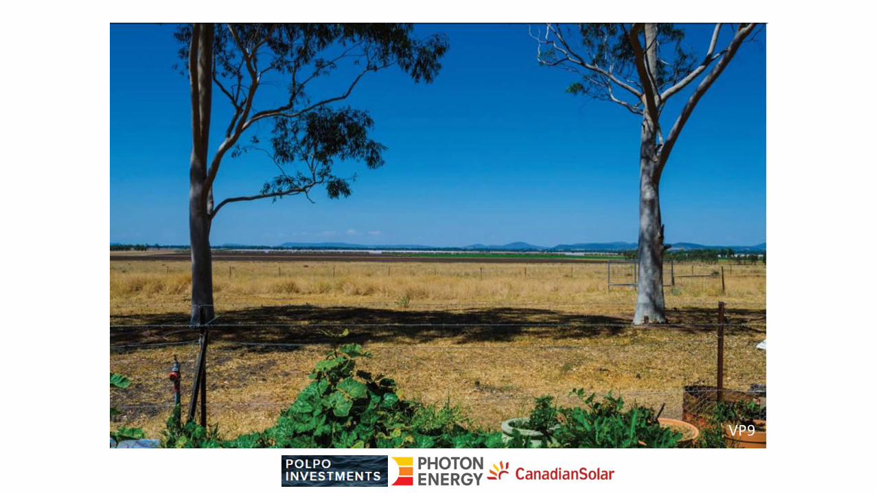
• Nearest sensitive receiver is 800m from the site (VP1).
• Most visually impacted residents are elevated north of the site (VP9,13,17,16)
• Met with landholders to discuss mitigation • Leaving existing native vegetation and
providing screening to minimise visual impact.
• Visual screening was discussed with landholders. VP 1 declined visual screening.
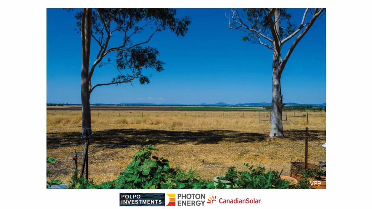
VP9
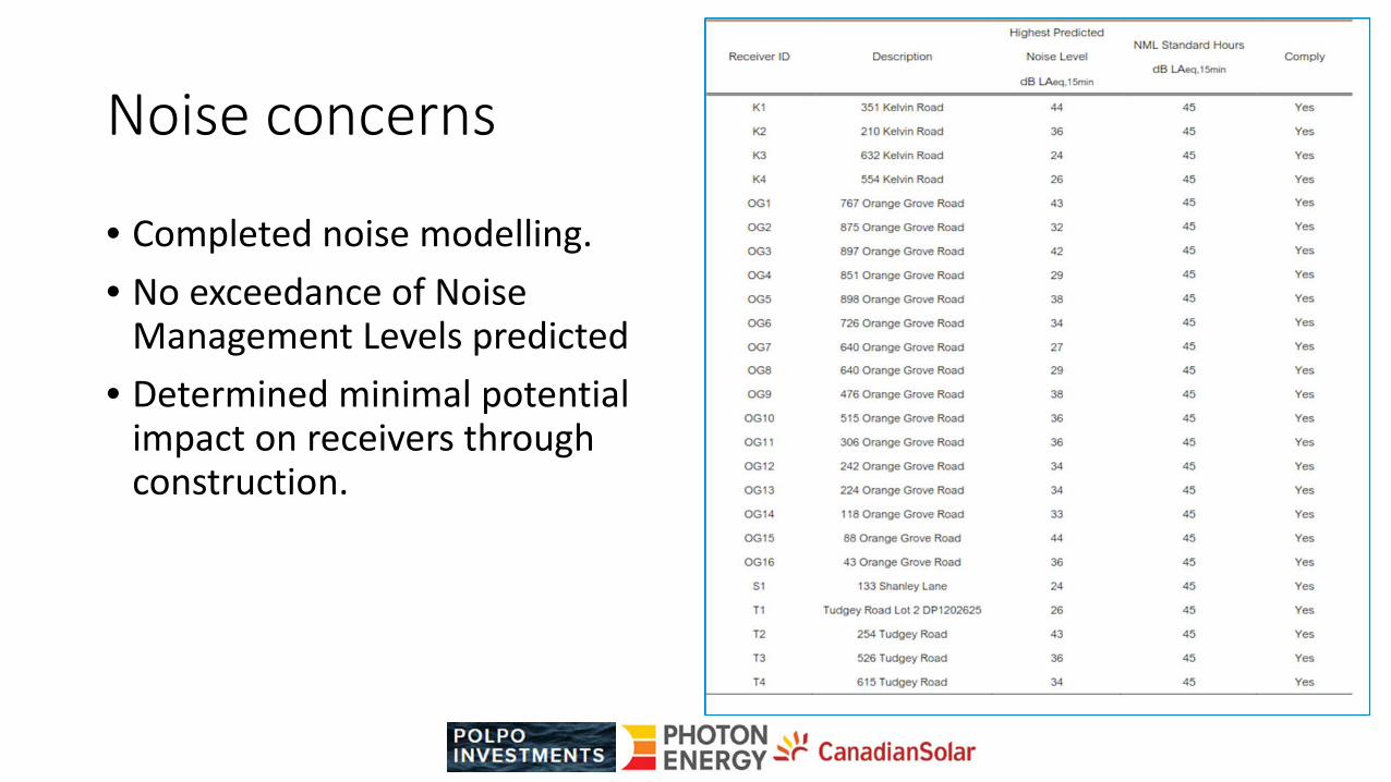
Noise concerns
• Completed noise modelling.• No exceedance of Noise
Management Levels predicted • Determined minimal potential
impact on receivers through construction.
Summary of other environmental constraints
• Biodiversity – no outstanding concerns • Heritage – no outstanding concerns • Hazards – Bushfire assessment completed and no outstanding
concerns. • Soils – no outstanding concerns• Ground water – no outstanding concerns• Lighting – at the substation. • Traffic – through consent conditions.
Progress since July 2018
• Responding to Department of Planning and Environment requests for information and refinement of fencing design
• Responding to local newspaper requests
Draft Conditions of Consent
• No issues identified • Agree with the draft Conditions of Consent• The Gunnedah Solar Farm will include the Condition of Consent in the
contractual requirements for the Contractor.
Community Benefits
Generating employment:• 150 construction jobs (at peak) as
well as indirect supply chain jobs.
• Contractor opportunities
• Support up to 10 operational jobs.
Encouraging regional development:• Employee expenditure in the Gunnedah region (fuel
supply, vehicle servicing, uniform suppliers, hotels/motels, B&B’s, cafés, pubs, catering and cleaning companies)
• Maximising the use of local contractors and equipment hire
• Increasing local skills and trades through project experience.
• Gunnedah solar farm community solar program