Embed Size (px)
Citation preview
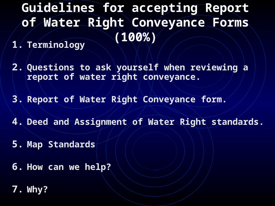
Guidelines for accepting Report of Water Right Conveyance
Forms (100%)1. Terminology
2. Questions to ask yourself when reviewing a report of water right conveyance.
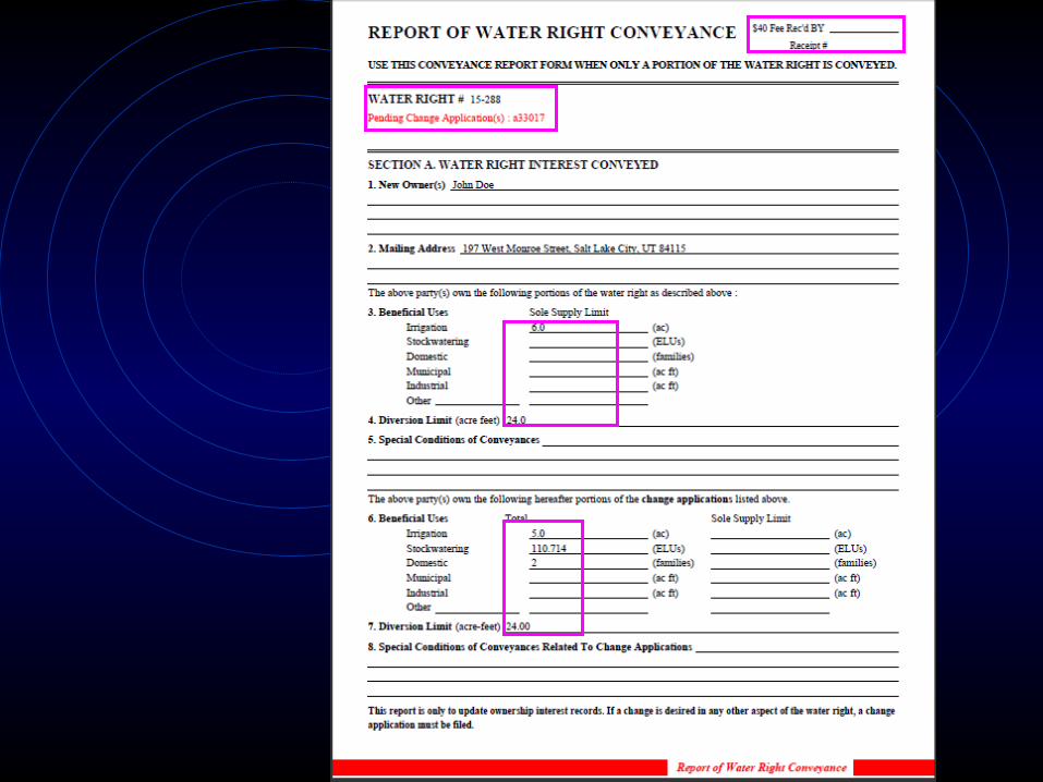
3. Report of Water Right Conveyance form.
4. Deed and Assignment of Water Right standards.
5. Map Standards
6. How can we help?
7. Why?
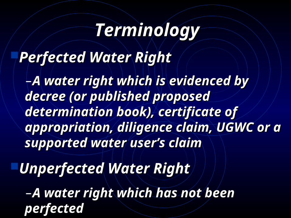
Terminology Terminology Perfected Water RightPerfected Water Right
–A water right which is evidenced A water right which is evidenced by decree (or published proposed by decree (or published proposed determination book), certificate of determination book), certificate of appropriation, diligence claim, appropriation, diligence claim, UGWC or a supported water user’s UGWC or a supported water user’s claimclaim
Unperfected Water RightUnperfected Water Right
–A water right which has not been A water right which has not been perfected perfected
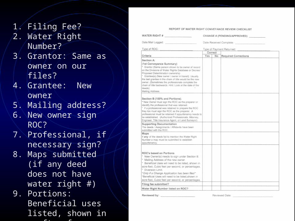
1. Filing Fee?2. Water Right Number?3. Grantor: Same as owner
on our files?4. Grantee: New owner5. Mailing address?6. New owner sign ROC?7. Professional, if
necessary sign?8. Maps submitted (if any
deed does not have water right #)
9. Portions: Beneficial uses listed, shown in ac-ft, cfs or percentage.
10. If there is a change need to complete change portion of ROC.
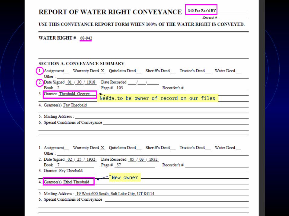
Needs to be owner of record on our files
New owner
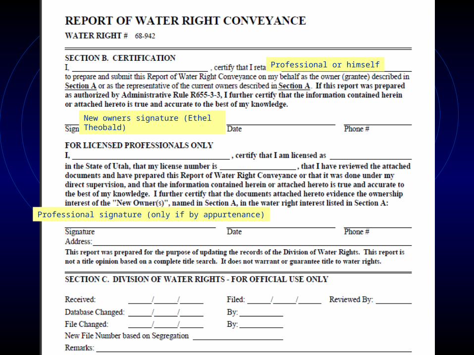
New owners signature (Ethel Theobald)
Professional or himself
Professional signature (only if by appurtenance)
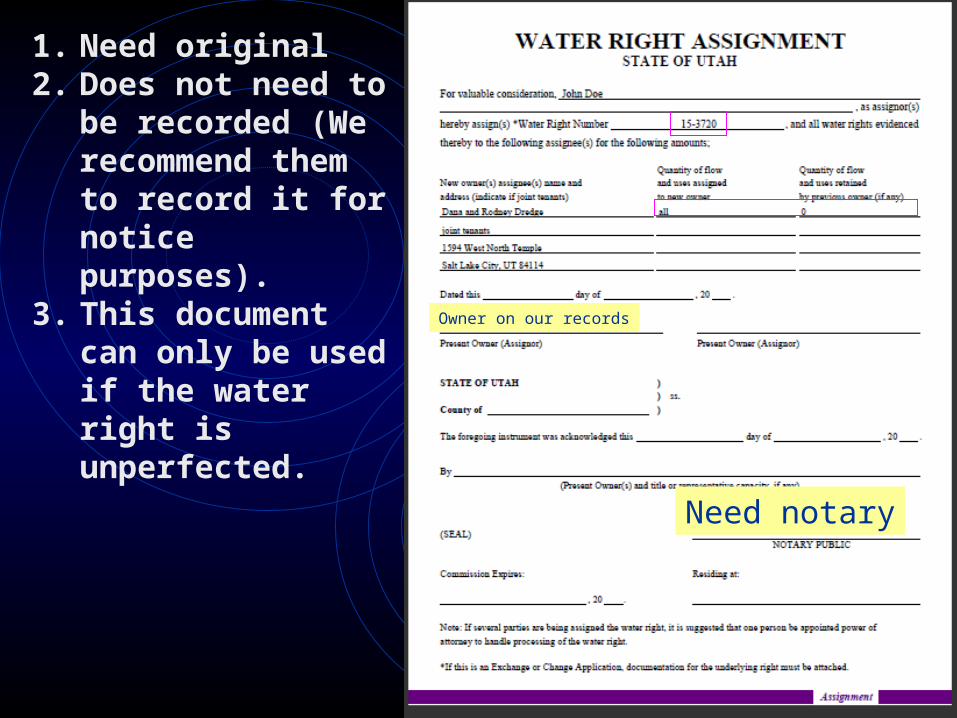
Owner on our records
Need notary
1. Need original2. Does not need to
be recorded (We recommend them to record it for notice purposes).
3. This document can only be used if the water right is unperfected.
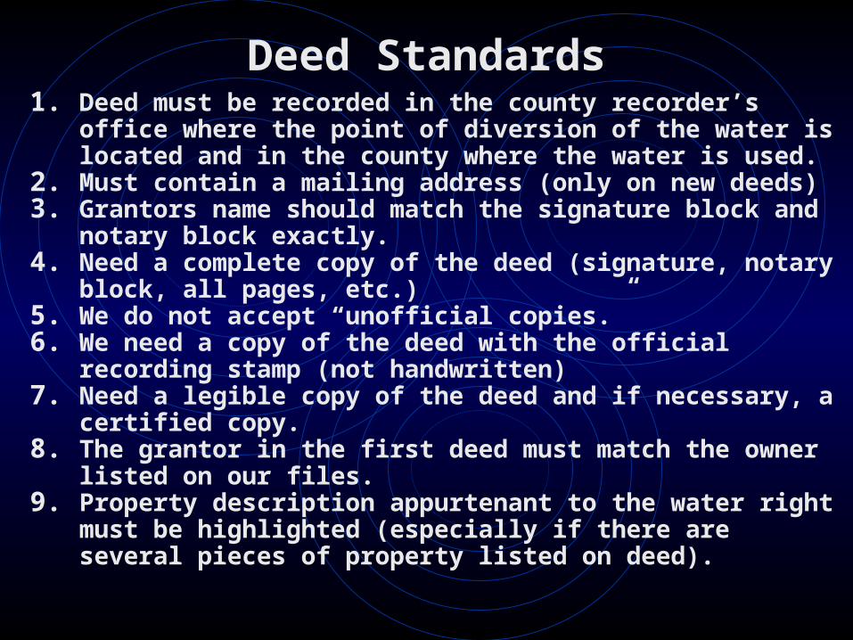
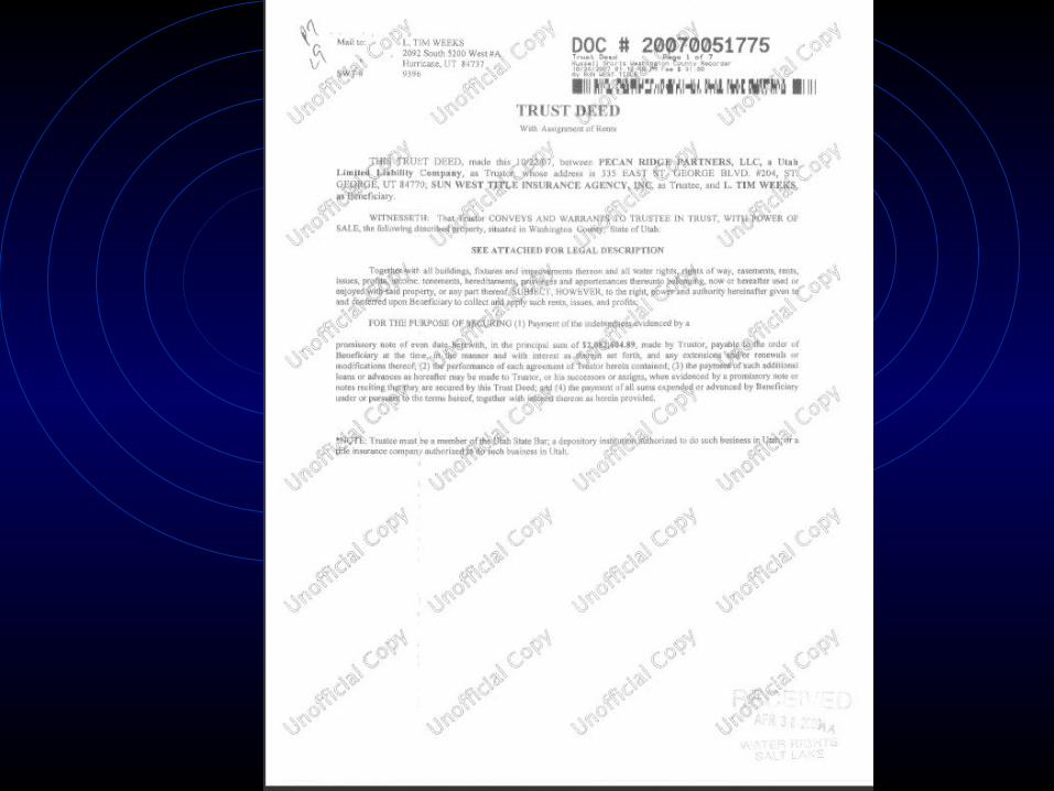
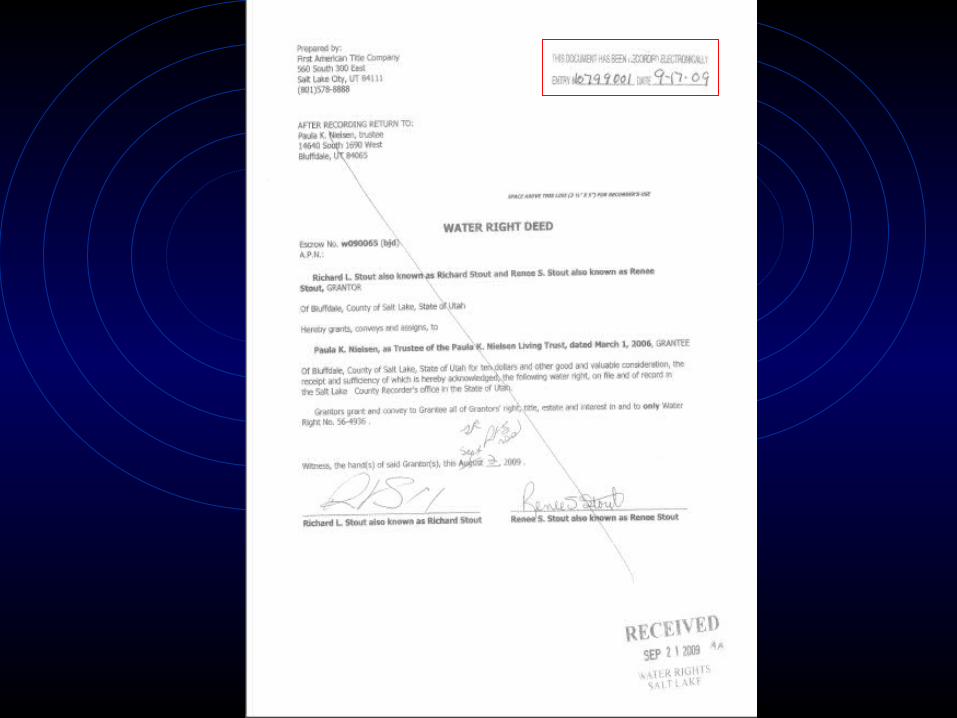
Deed Standards1. Deed must be recorded in the county recorder’s
office where the point of diversion of the water is located and in the county where the water is used.
2. Must contain a mailing address (only on new deeds)3. Grantors name should match the signature block
and notary block exactly.4. Need a complete copy of the deed (signature, notary
block, all pages, etc.)5. We do not accept “unofficial copies.”6. We need a copy of the deed with the official
recording stamp (not handwritten)7. Need a legible copy of the deed and if necessary, a
certified copy.8. The grantor in the first deed must match the owner
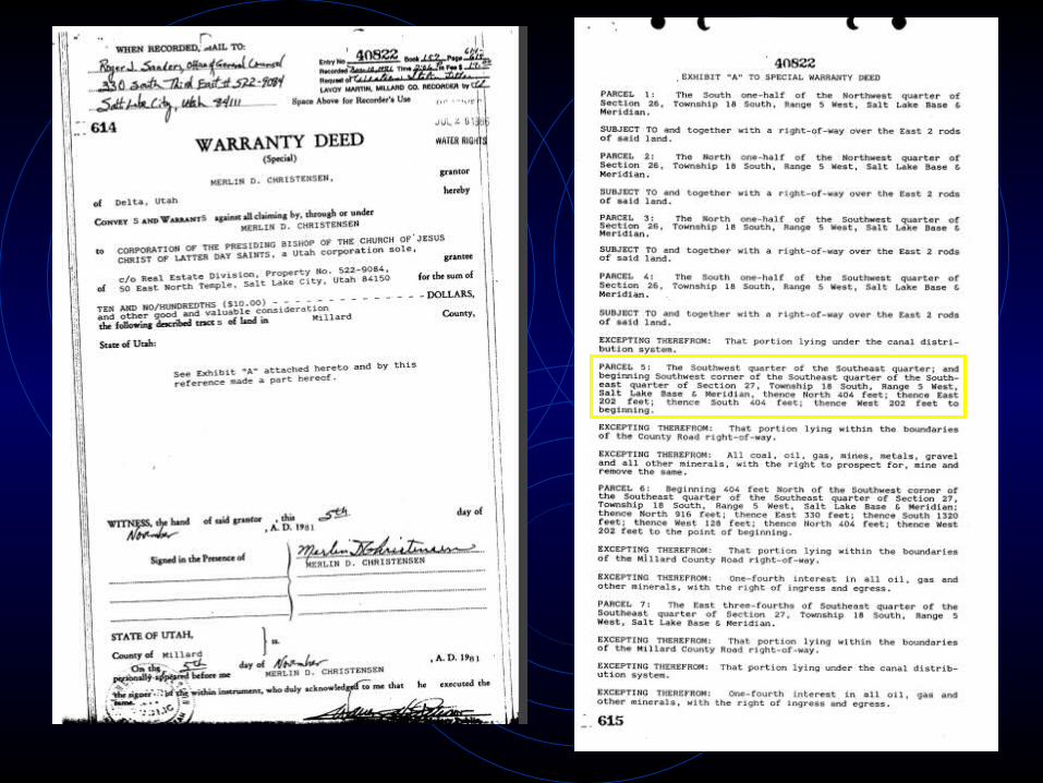
listed on our files.9. Property description appurtenant to the water right
must be highlighted (especially if there are several pieces of property listed on deed).
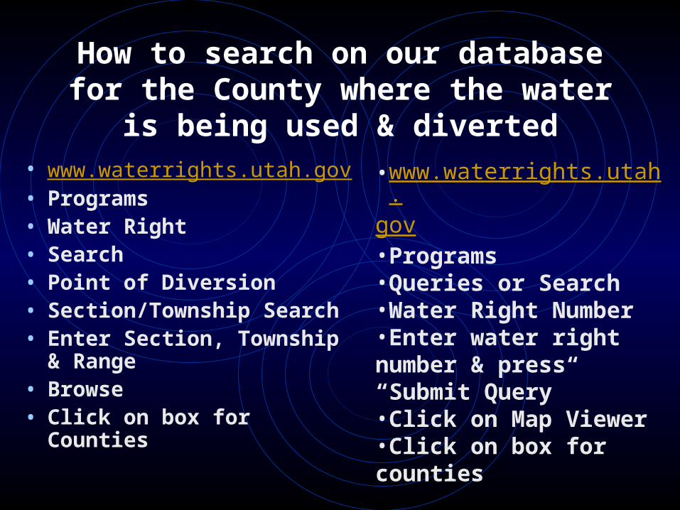
How to search on our database for the County where the water
is being used & diverted• www.waterrights.utah.gov• Programs• Water Right• Search• Point of Diversion• Section/Township Search• Enter Section, Township
& Range• Browse• Click on box for Counties
•www.waterrights.utah.gov•Programs•Queries or Search•Water Right Number•Enter water right number & press “Submit Query”•Click on Map Viewer•Click on box for counties
Only use this method if the POU & POD is correct!
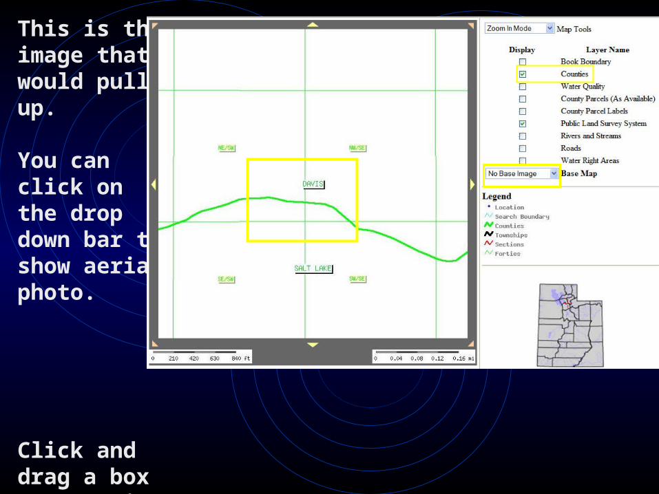
This is the image that would pull up.
You can click on the drop down bar to show aerial photo.
Click and drag a box to zoom in.
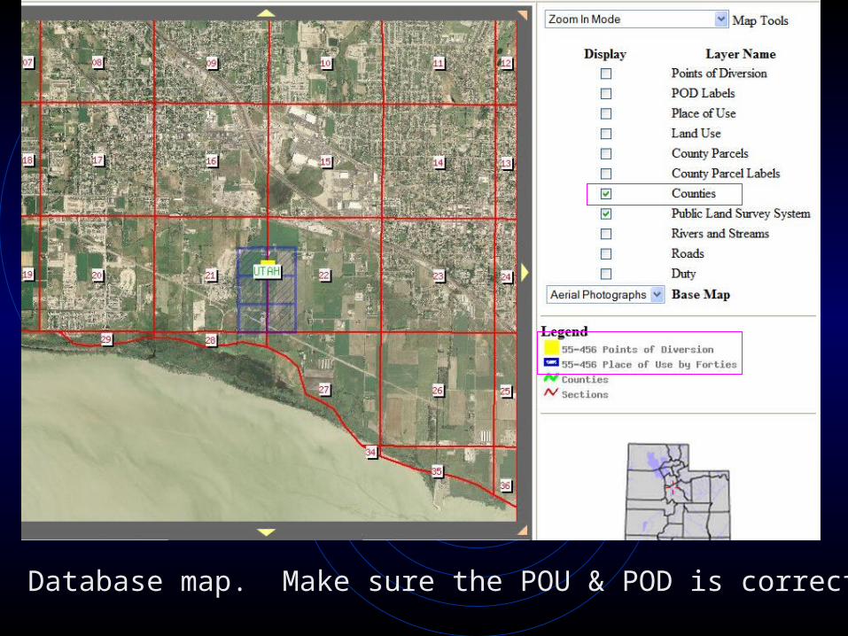
Database map. Make sure the POU & POD is correct!
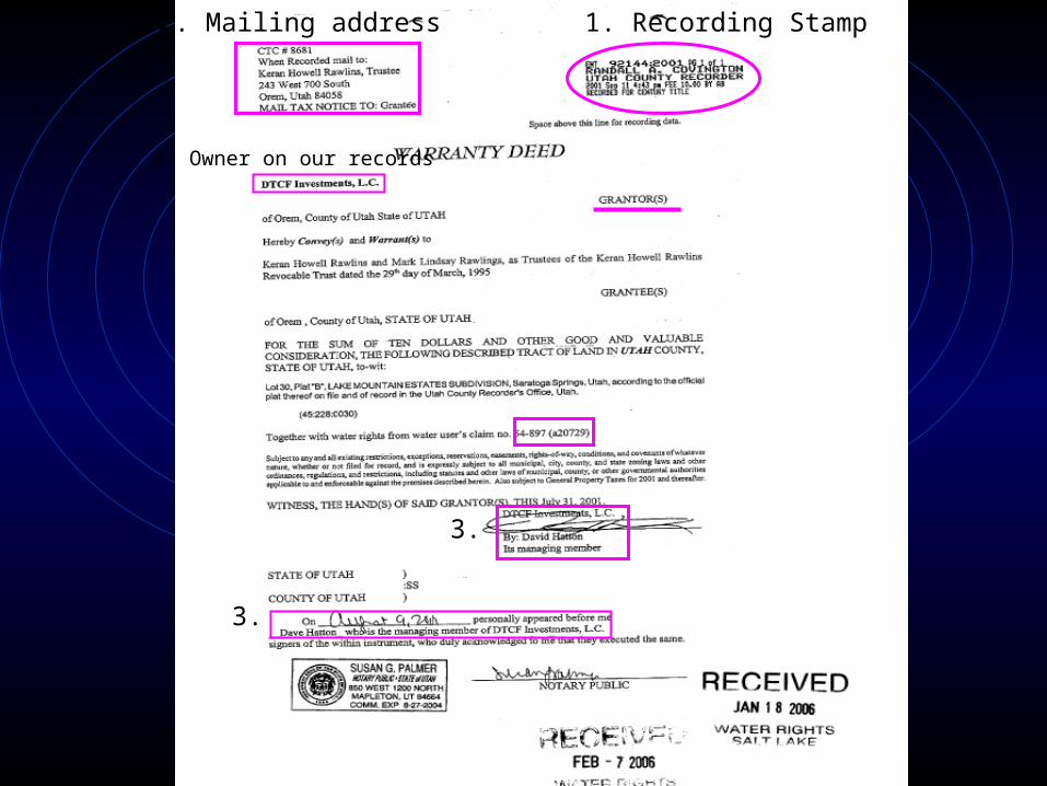
2. Mailing address 1. Recording Stamp
3. Owner on our records
3.
3.
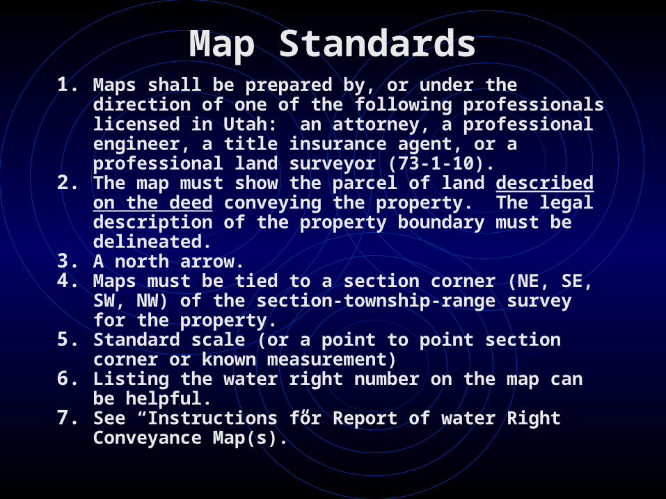
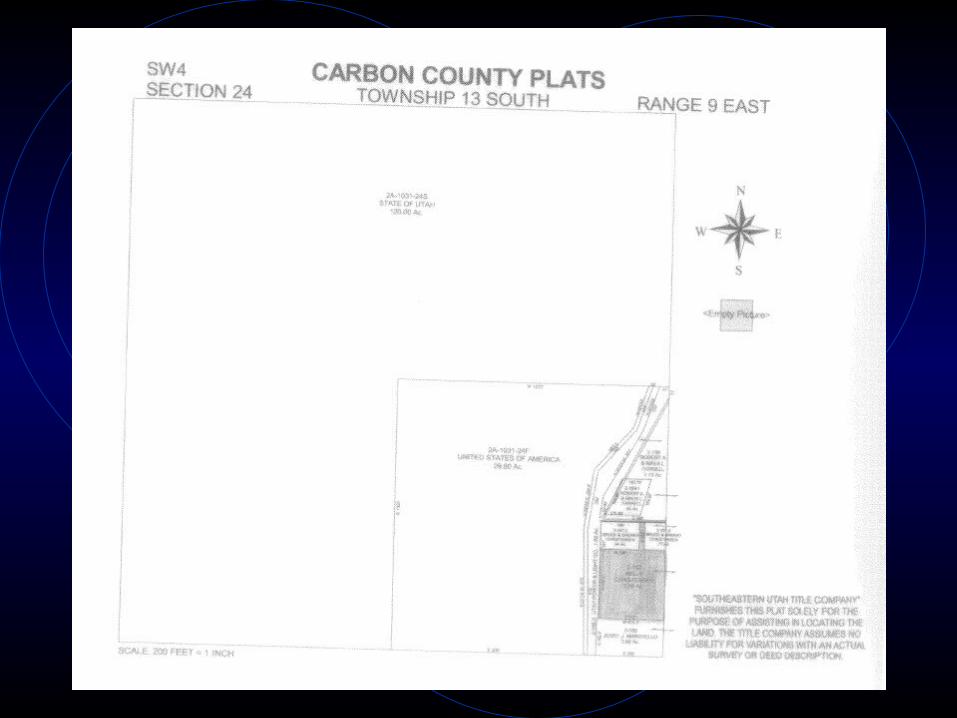
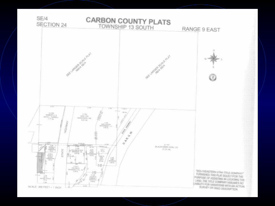
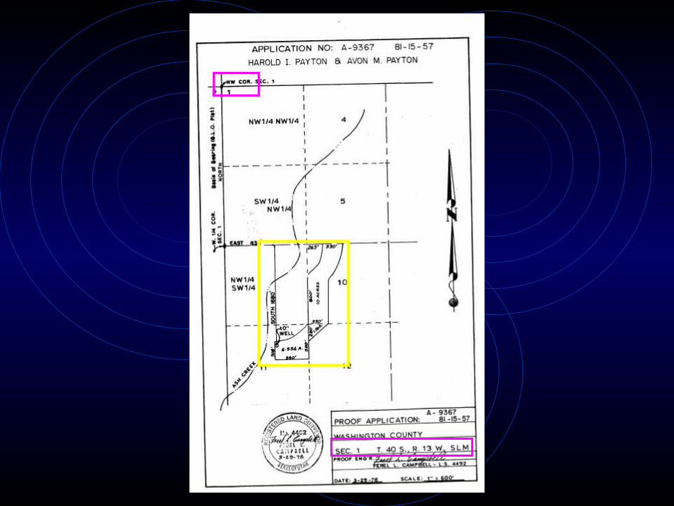
Map Standards1. Maps shall be prepared by, or under the
direction of one of the following professionals licensed in Utah: an attorney, a professional engineer, a title insurance agent, or a professional land surveyor (73-1-10).
2. The map must show the parcel of land described on the deed conveying the property. The legal description of the property boundary must be delineated.
3. A north arrow.4. Maps must be tied to a section corner (NE, SE,
SW, NW) of the section-township-range survey for the property.
5. Standard scale (or a point to point section corner or known measurement)
6. Listing the water right number on the map can be helpful.
7. See “Instructions for Report of water Right Conveyance Map(s).”
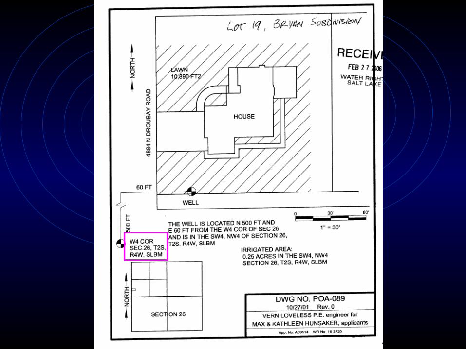
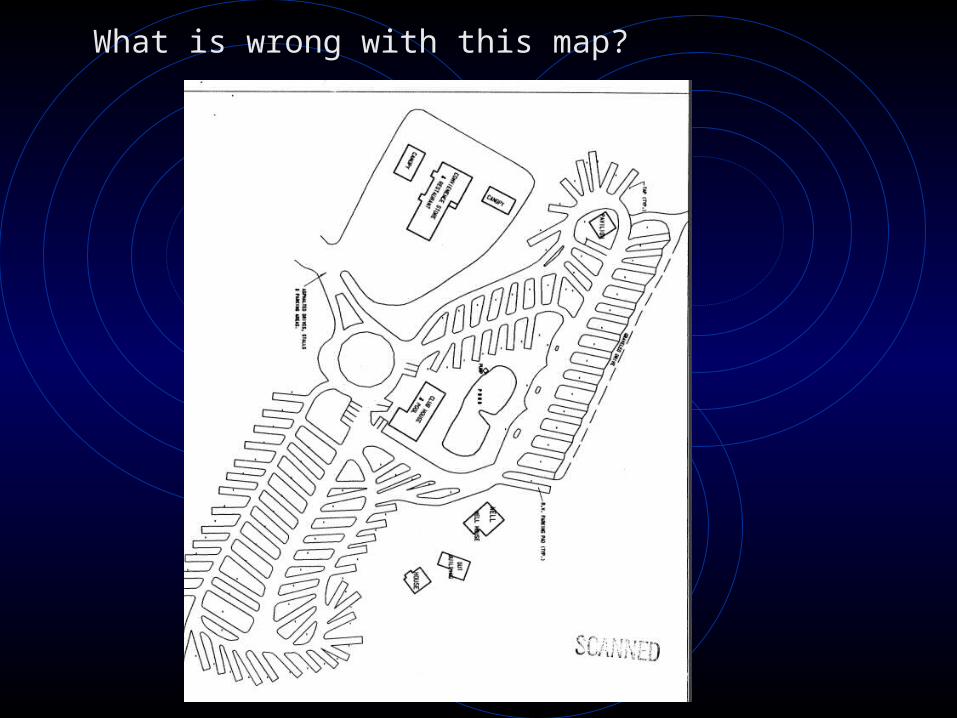
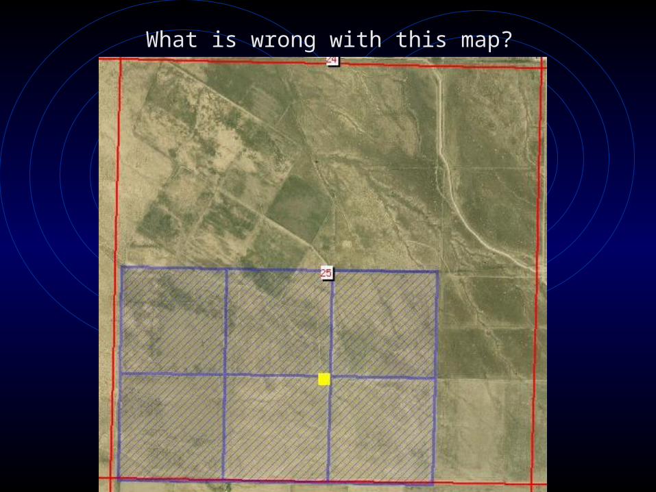
What is wrong with this map?
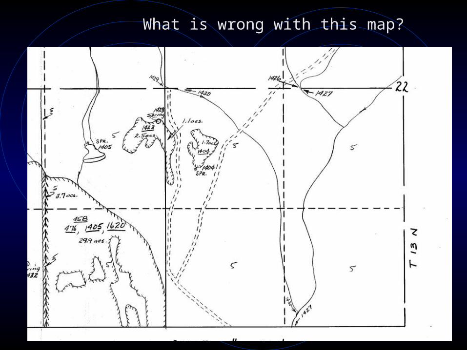
What is wrong with this map?
What is wrong with this map?

What can we do to help?
• Assist the public and professionals in understanding and complying with the statutes and rules regarding title.
• Helping them understand the process for updating ownership and how to access our documents online (the form, scanned documents etc.).
• Do not provide the documents used in updating ownership (maps or deeds).
• Try to be patient!
Why?• To understand the importance of
correct documents.• To review all documents carefully• To help the applicant/professional
submit correct documents.• Increase efficiency with the ROC
process, which reduces backlog.• Better relationship between Water
Right Staff and professionals/applicants.
• QUESTIONS?


![Lect.No.15 (Second Semester) Water Conveyance Structures ... · Water & Hydraulic Structures Branch / 3rd Class [Hydraulic Lectures] Lect.No.15 (Second Semester) Water Conveyance](https://img.pdfslide.us/doc/110x75/5f9a6c39a9e65476da768ef8/lectno15-second-semester-water-conveyance-structures-water-hydraulic.jpg)