Embed Size (px)
Citation preview
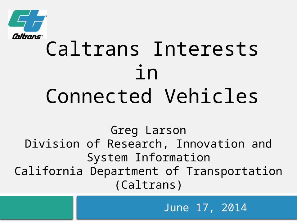
Greg LarsonDivision of Research, Innovation and System
InformationCalifornia Department of Transportation
(Caltrans)
June 17, 2014
Caltrans Interests in Connected Vehicles
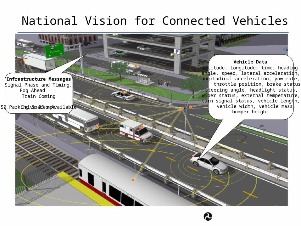
National Vision for Connected Vehicles
Vehicle Data latitude, longitude, time, heading angle, speed, lateral acceleration,
Infrastructure Messages Signal Phase and Timing,
Fog Ahead Train Coming Drive 35 mph
50 Parking Spaces Available
longitudinal acceleration, yaw rate, throttle position, brake status,
steering angle, headlight status, wiper status, external temperature,
turn signal status, vehicle length, vehicle width, vehicle mass, bumper height
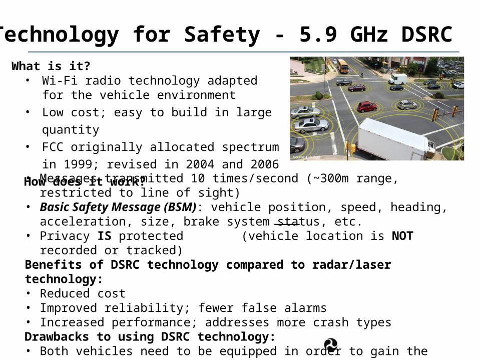
Technology for Safety - 5.9 GHz DSRC What is it? • Wi-Fi radio technology adapted for the
vehicle environment• Low cost; easy to build in large quantity• FCC originally allocated spectrum in 1999;
revised in 2004 and 2006
How does it work? • Messages transmitted 10 times/second (~300m range, restricted to line of sight)• Basic Safety Message (BSM): vehicle position, speed, heading, acceleration,
size, brake system status, etc.• Privacy IS protected (vehicle location is NOT recorded or tracked)Benefits of DSRC technology compared to radar/laser technology:• Reduced cost• Improved reliability; fewer false alarms• Increased performance; addresses more crash typesDrawbacks to using DSRC technology:• Both vehicles need to be equipped in order to gain the benefit• Requires back-office security infrastructure
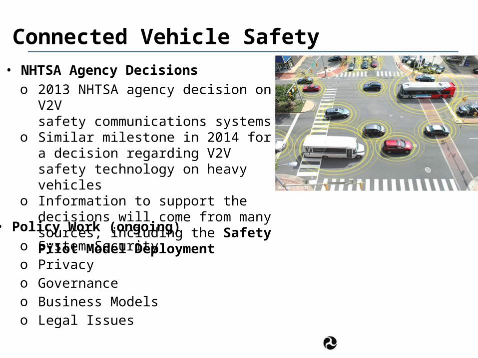
Connected Vehicle Safety
• NHTSA Agency Decisions o 2013 NHTSA agency decision on V2V
safety communications systemso Similar milestone in 2014 for a decision
regarding V2V safety technology on heavy vehicles
o Information to support the decisions will come from many sources, including the Safety Pilot Model Deployment
• Policy Work (ongoing) o System Securityo Privacyo Governanceo Business Modelso Legal Issues
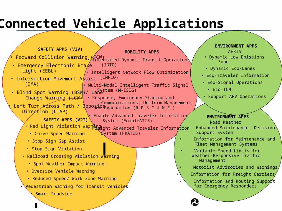
Connected Vehicle Applications
SAFETY APPS (V2V)
• Forward Collision Warning (FCW)
• Emergency Electronic Brake Light (EEBL)
• Intersection Movement Assist (IMA)
• Blind Spot Warning (BSW)/ Lane Change Warning (LCW)
• Left Turn Across Path / Opposite Direction (LTAP)
SAFETY APPS (V2I)
• Red Light Violation Warning
• Curve Speed Warning
• Stop Sign Gap Assist
• Stop Sign Violation
MOBILITY APPS
• Integrated Dynamic Transit Operations (IDTO)
• Intelligent Network Flow Optimization (INFLO)
• Multi-Modal Intelligent Traffic Signal System (M-ISIG)
• Response, Emergency Staging and Communications, Uniform Management,
and Evacuation (R.E.S.C.U.M.E.)
• Enable Advanced Traveler Information System (EnableATIS)
• Freight Advanced Traveler Information System (FRATIS)
ENVIRONMENT APPS AERIS
• Dynamic Low Emissions Zone
• Dynamic Eco-Lanes
• Eco-Traveler Information
• Eco-Signal Operations
• Eco-ICM
• Support AFV Operations
ENVIRONMENT APPS Road Weather
• Enhanced Maintenance Decision Support System
• Information for Maintenance and Fleet Management Systems
• Variable Speed Limits for • Railroad Crossing Violation Warning Weather-Responsive Traffic
Management• Spot Weather Impact Warning
• Oversize Vehicle Warning
• Reduced Speed/ Work Zone Warning
• Pedestrian Warning for Transit Vehicles
• Smart Roadside
• Motorist Advisories and Warnings
• Information for Freight Carriers
• Information and Routing Support for Emergency Responders
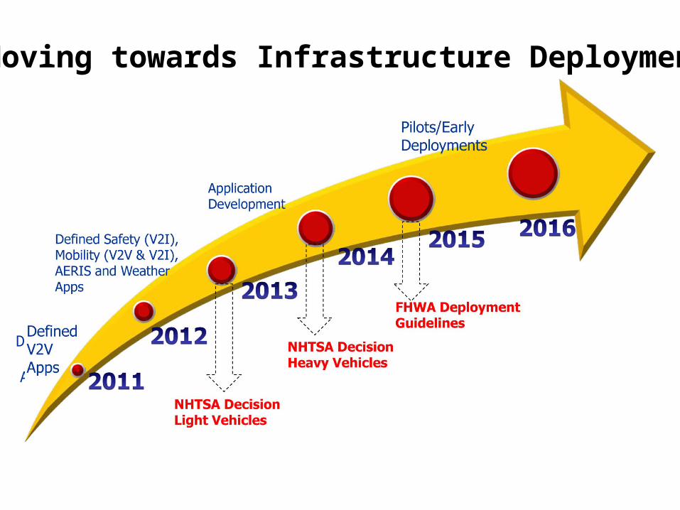
Moving towards Infrastructure Deployment
Pilots/Early Deployments
Application Development
Defined Safety (V2I), Mobility (V2V & V2I), AERIS and Weather Apps
FHWA Deployment
Defined V2V NHTSA Decision
Guidelines
Apps
NHTSA Decision
Heavy Vehicles
Light Vehicles
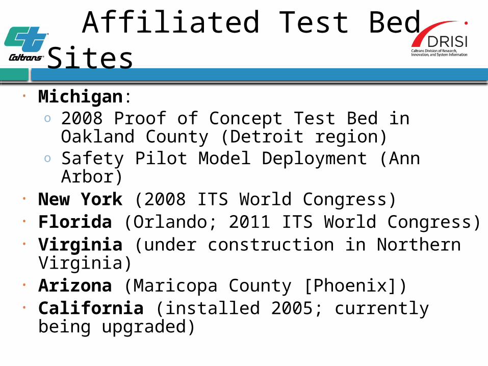
Affiliated Test Bed Sites
• Michigan:o 2008 Proof of Concept Test Bed in Oakland
County (Detroit region)o Safety Pilot Model Deployment (Ann Arbor)
• New York (2008 ITS World Congress)• Florida (Orlando; 2011 ITS World Congress)• Virginia (under construction in Northern Virginia)• Arizona (Maricopa County [Phoenix])• California (installed 2005; currently being upgraded)
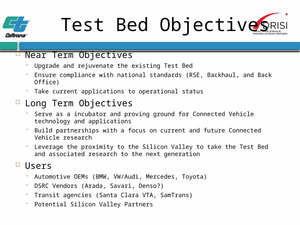
Test Bed Objectives Near Term Objectives
Upgrade and rejuvenate the existing Test Bed Ensure compliance with national standards (RSE, Backhaul, and Back Office) Take current applications to operational status
Long Term Objectives Serve as a incubator and proving ground for Connected Vehicle technology
and applications Build partnerships with a focus on current and future Connected Vehicle
research Leverage the proximity to the Silicon Valley to take the Test Bed and
associated research to the next generation
Users Automotive OEMs (BMW, VW/Audi, Mercedes, Toyota) DSRC Vendors (Arada, Savari, Denso?) Transit agencies (Santa Clara VTA, SamTrans) Potential Silicon Valley Partners
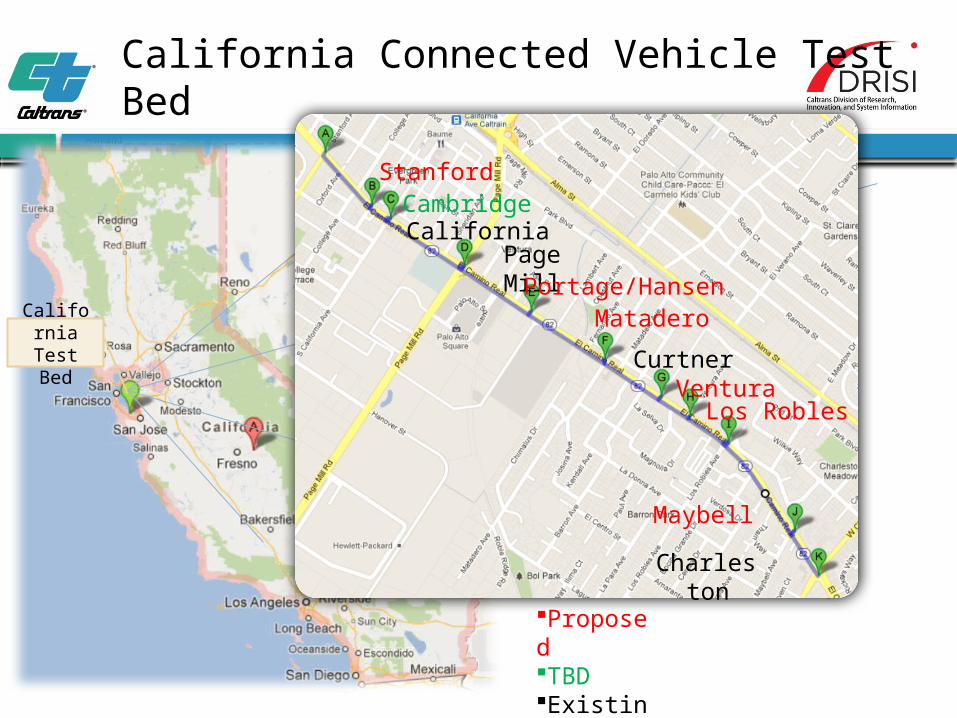
California Connected Vehicle Test Bed
California Test Bed
Proposed TBDExisting
Stanford
Charleston
Cambridge California
Page MillPortage/Hansen
Matadero
CurtnerVentura
Los Robles
Maybell
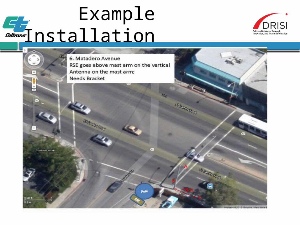
Example Installation
11
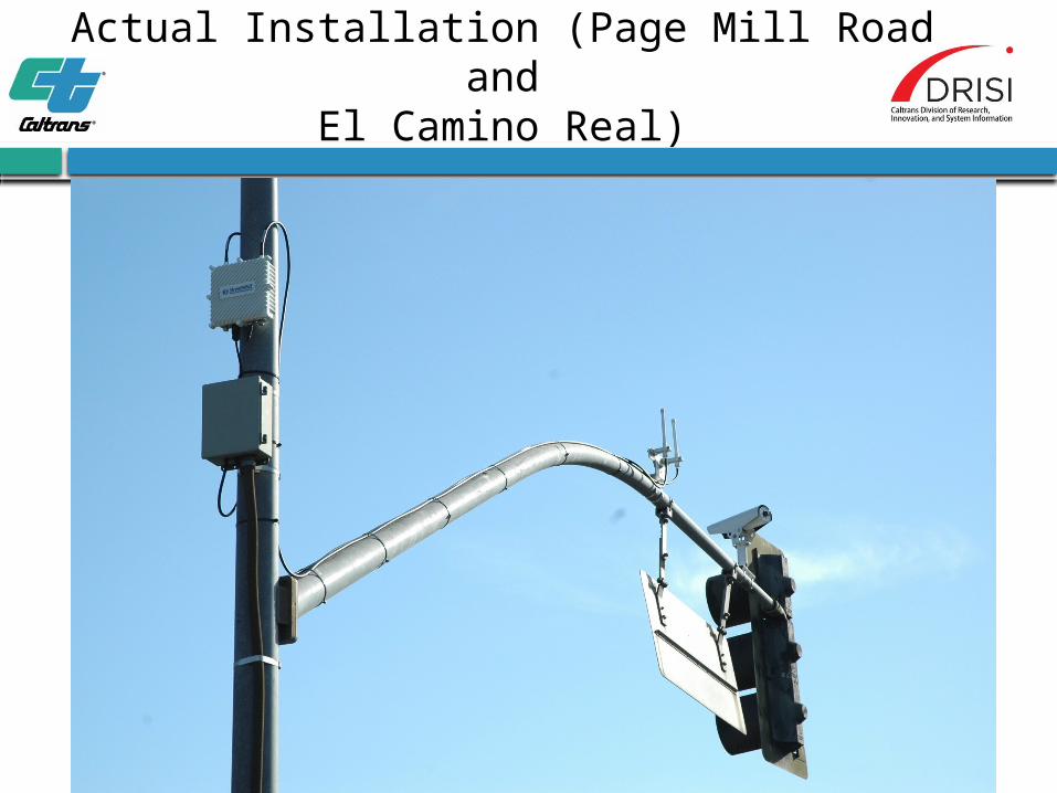
Actual Installation (Page Mill Road andEl Camino Real)
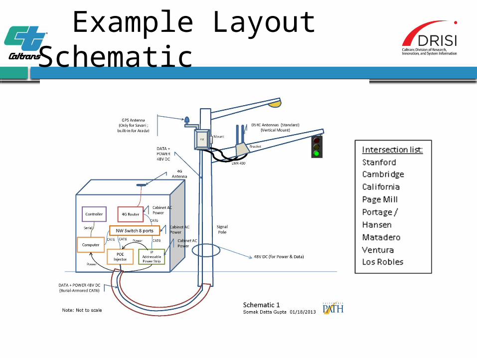
Example Layout Schematic

Connected Vehicles set the stage for Vehicle
Automation!Vehicle Data
latitude, longitude, time, heading angle, speed, lateral acceleration,
Infrastructure Messages Signal Phase and Timing,
Fog Ahead Train Coming Drive 35 mph
50 Parking Spaces Available
longitudinal acceleration, yaw rate, throttle position, brake status,
steering angle, headlight status, wiper status, external temperature,
turn signal status, vehicle length, vehicle width, vehicle mass, bumper height
Questions and Discussion
For more information, please visit:
www.dot.ca.gov/research
Caltrans Improves Mobility Across California