Embed Size (px)
Citation preview
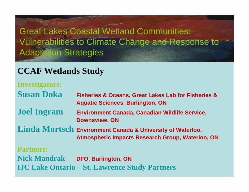
Great Lakes Coastal Wetland Communities: Vulnerabilities to Climate Change and Response to Adaptation Strategies
CCAF Wetlands StudyInvestigators:Susan Doka Fisheries & Oceans, Great Lakes Lab for Fisheries &
Aquatic Sciences, Burlington, ON
Joel Ingram Environment Canada, Canadian Wildlife Service, Downsview, ON
Linda Mortsch Environment Canada & University of Waterloo, Atmospheric Impacts Research Group, Waterloo, ON
Partners:Nick Mandrak DFO, Burlington, ONIJC Lake Ontario – St. Lawrence Study Partners
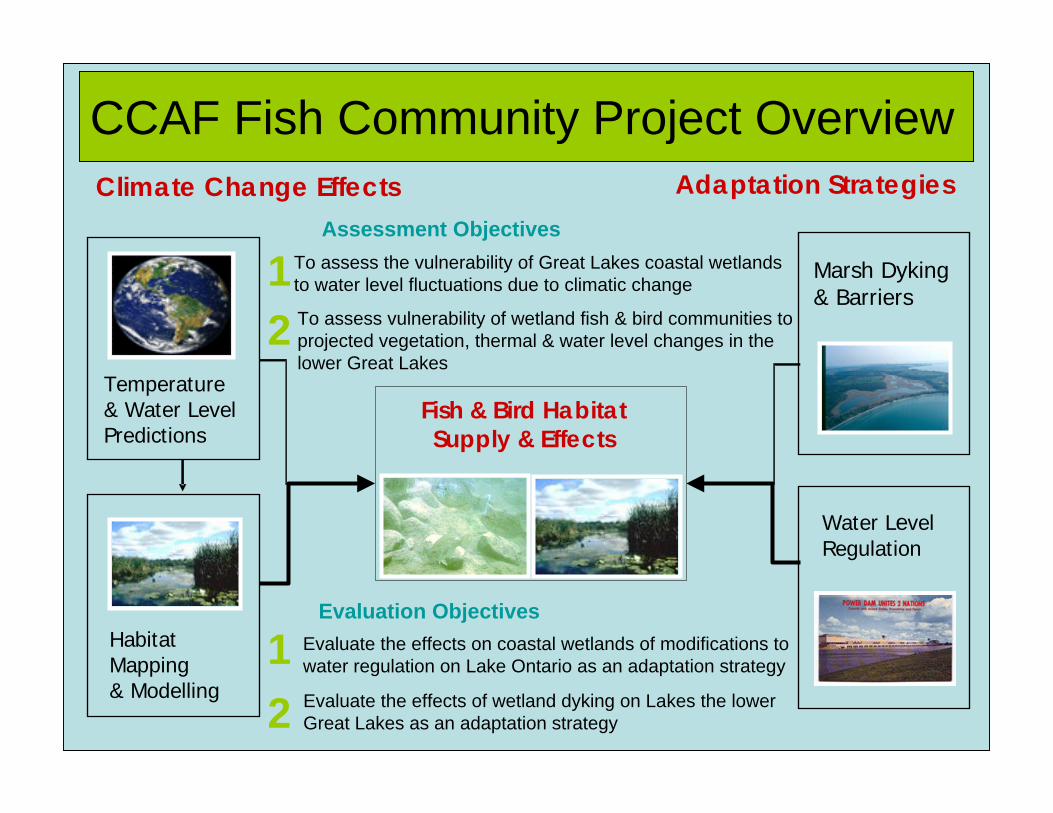
Temperature & Water Level Predictions
Habitat Mapping& Modelling
Fish & Bird Habitat Supply & Effects
Water Level Regulation
CCAF Fish Community Project Overview
Marsh Dyking& Barriers
Evaluation ObjectivesEvaluate the effects on coastal wetlands of modifications to water regulation on Lake Ontario as an adaptation strategy
Evaluate the effects of wetland dyking on Lakes the lower Great Lakes as an adaptation strategy
Adaptation StrategiesClimate Change EffectsAssessment Objectives
To assess the vulnerability of Great Lakes coastal wetlands to water level fluctuations due to climatic change
To assess vulnerability of wetland fish & bird communities to projected vegetation, thermal & water level changes in the lower Great Lakes
12
21
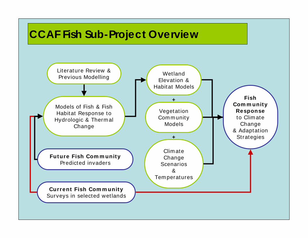
Fish CommunityResponseto Climate Change
& Adaptation Strategies
Wetland Elevation &
Habitat Models
Climate Change
Scenarios &
Temperatures
Current Fish CommunitySurveys in selected wetlands
Models of Fish & Fish Habitat Response to
Hydrologic & Thermal Change
Literature Review & Previous Modelling
+
Vegetation Community
Models
+
Future Fish CommunityPredicted invaders
CCAF Fish Sub-Project Overview
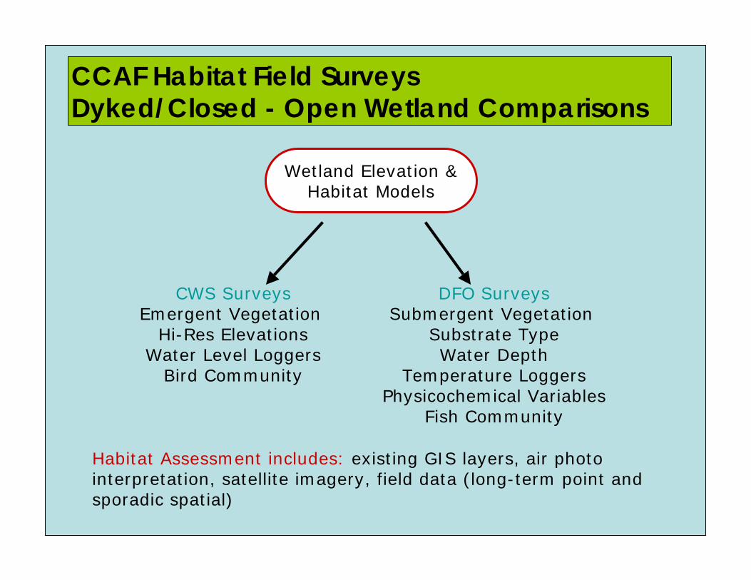
Wetland Elevation & Habitat Models
CCAF Habitat Field Surveys Dyked/Closed - Open Wetland Comparisons
CWS SurveysEmergent Vegetation
Hi-Res ElevationsWater Level Loggers
Bird Community
DFO SurveysSubmergent Vegetation
Substrate TypeWater Depth
Temperature LoggersPhysicochemical Variables
Fish Community
Habitat Assessment includes: existing GIS layers, air photo interpretation, satellite imagery, field data (long-term point and sporadic spatial)
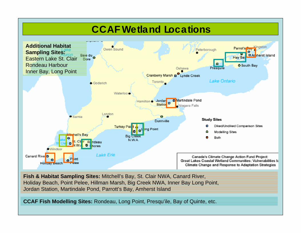
CCAF Wetland Locations
Fish & Habitat Sampling Sites: Mitchell’s Bay, St. Clair NWA, Canard River, Holiday Beach, Point Pelee, Hillman Marsh, Big Creek NWA, Inner Bay Long Point,Jordan Station, Martindale Pond, Parrott’s Bay, Amherst Island
Additional Habitat Sampling Sites: Eastern Lake St. ClairRondeau HarbourInner Bay, Long Point
CCAF Fish Modelling Sites: Rondeau, Long Point, Presqu’ile, Bay of Quinte, etc.
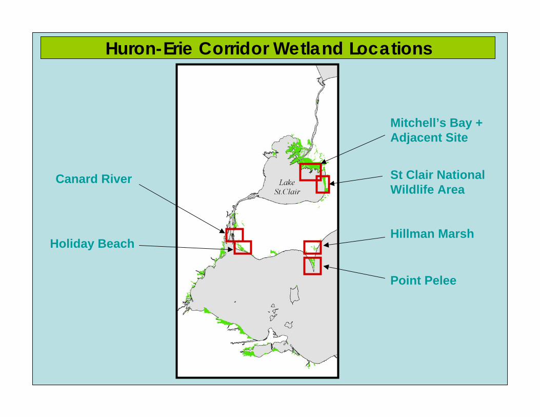
Huron-Erie Corridor Wetland Locations
Mitchell’s Bay + Adjacent Site
St Clair National Wildlife Area
Hillman Marsh
Point Pelee
Canard River
Holiday Beach
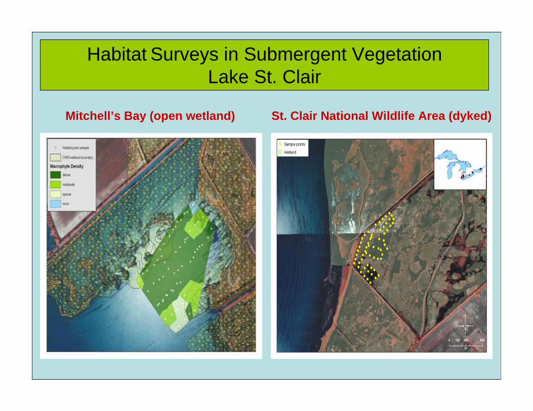
Habitat Surveys in Submergent Vegetation for Assessing Fish Habitat
Mitchell’s Bay (open wetland)
Habitat Surveys in Submergent Vegetation Lake St. Clair
St. Clair National Wildlife Area (dyked)
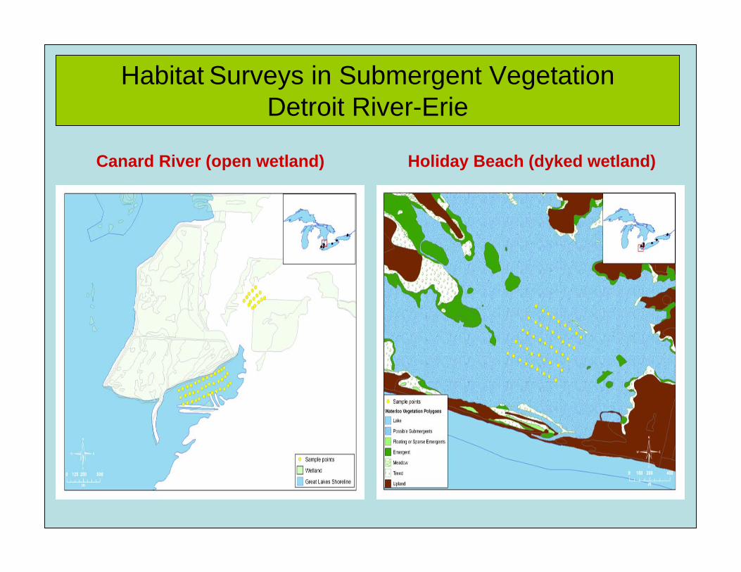
Habitat Surveys in Submergent Vegetation Detroit River-Erie
Canard River (open wetland) Holiday Beach (dyked wetland)
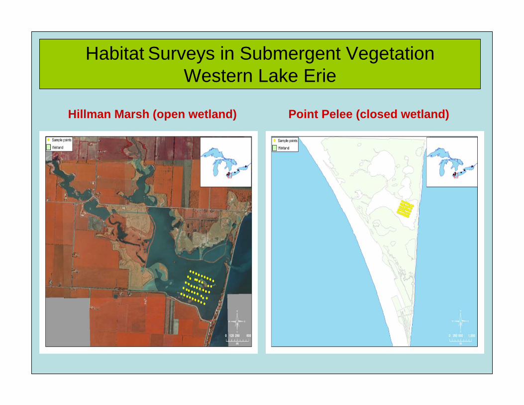
Hillman Marsh (open wetland) Point Pelee (closed wetland)
Habitat Surveys in Submergent Vegetation Western Lake Erie
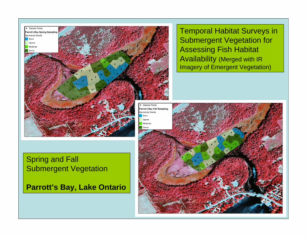
Temporal Habitat Surveys in Submergent Vegetation for Assessing Fish Habitat Availability (Merged with IR Imagery of Emergent Vegetation)
Spring and Fall Submergent Vegetation
Parrott’s Bay, Lake Ontario
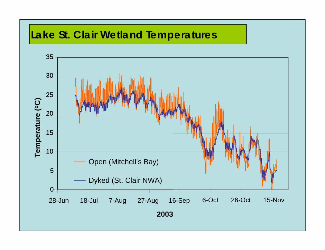
Lake St. Clair Wetland Temperatures
0
5
10
15
20
25
30
35
0
5
10
15
20
25
30
35
28-Jun 18-Jul 7-Aug 27-Aug 16-Sep 6-Oct 26-Oct 15-Nov
Open (Mitchell’s Bay)
Dyked (St. Clair NWA)
2003
Tem
pera
ture
(oC
)
02468101214161820
Spec
ies
Ric
hnes
s
0246810121416
Lake St. Clair
Detroit River
West Erie
East Erie
WestOntario
East Ontario
02468
1012141618
02468101214161820
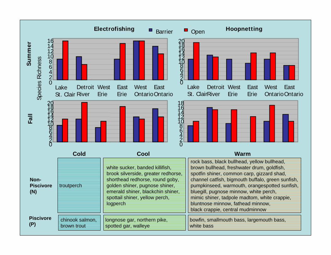
Barrier OpenElectrofishing HoopnettingS
um
mer
Fall
Lake St. Clair
Detroit River
West Erie
East Erie
WestOntario
East Ontario
bowfin, smallmouth bass, largemouth bass, white bass
white sucker, banded killifish, brook silverside, greater redhorse, shorthead redhorse, round goby, golden shiner, pugnose shiner, emerald shiner, blackchin shiner, spottail shiner, yellow perch, logperch
WarmCool
longnose gar, northern pike, spotted gar, walleye
chinook salmon, brown trout
Piscivore(P)
rock bass, black bullhead, yellow bullhead, brown bullhead, freshwater drum, goldfish, spotfin shiner, common carp, gizzard shad, channel catfish, bigmouth buffalo, green sunfish, pumpkinseed, warmouth, orangespotted sunfish, bluegill, pugnose minnow, white perch,mimic shiner, tadpole madtom, white crappie, bluntnose minnow, fathead minnow, black crappie, central mudminnow
troutperchNon-Piscivore(N)
Cold

Wetland polygons or grids(define emergent vegetation)
Fish Habitat Layers – Presqu’ile Bay, Lake Ontario
Submergent Vegetation(habitat surveys or models; not shown)
Elevation (80-52m)
Substrate Type(habitat surveys or assigned by shoreline characteristics)
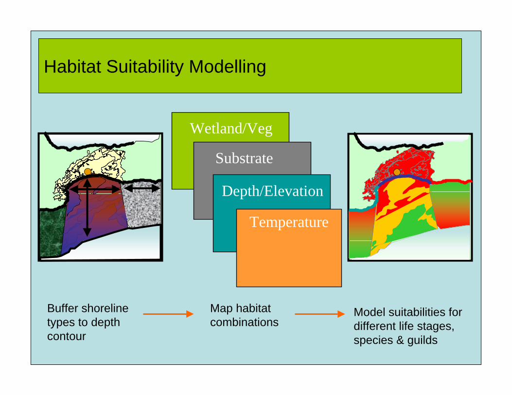
Wetland/Veg
Substrate
Depth/Elevation
Buffer shoreline types to depth contour
Map habitat combinations
Model suitabilities for different life stages, species & guilds
Habitat Suitability Modelling
Temperature
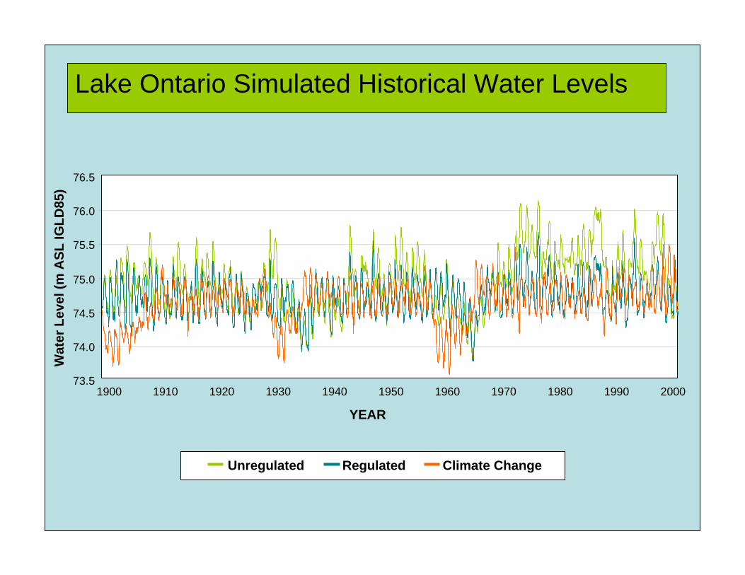
Lake Ontario Simulated Historical Water Levels
73.5
74.0
74.5
75.0
75.5
76.0
76.5
YEAR
Wat
er L
evel
(m A
SL IG
LD85
)
Unregulated Regulated Climate Change
1900 200019501910 1920 1930 1940 1960 1970 1980 1990
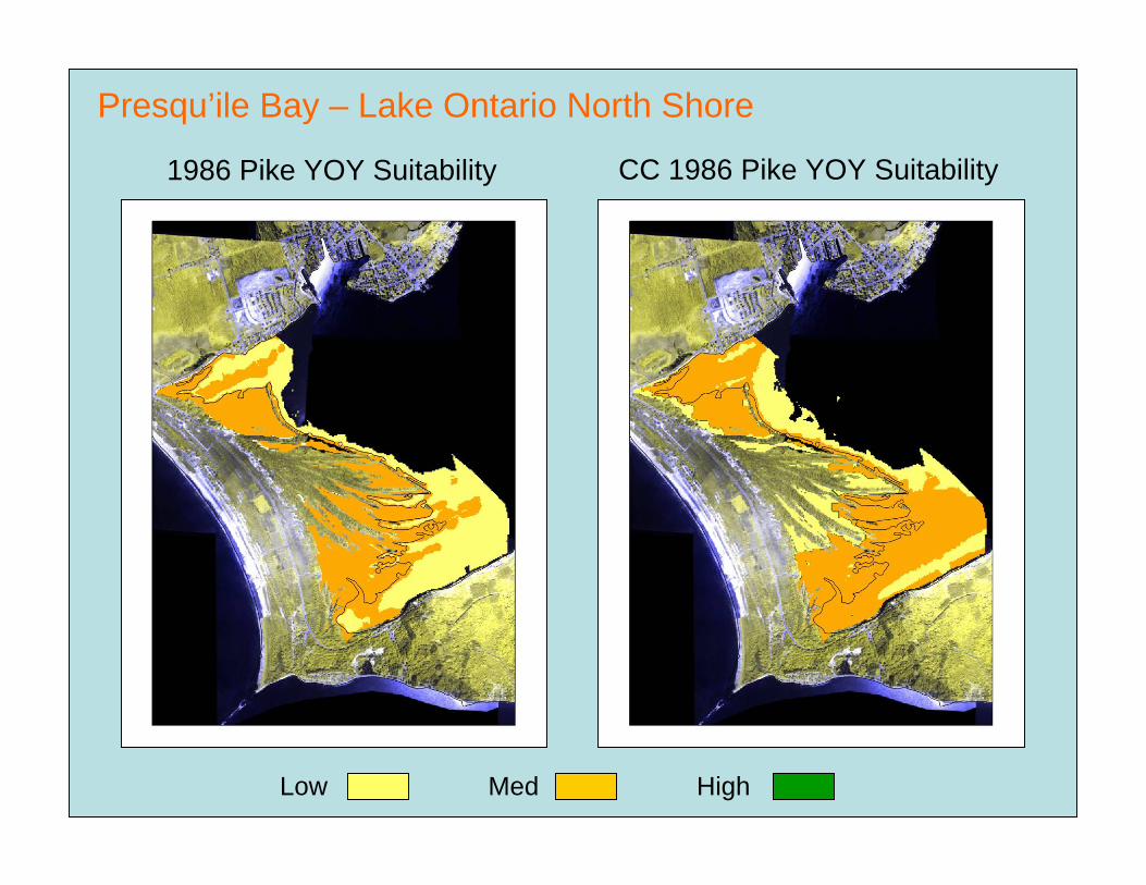
Presqu’ile Bay – Lake Ontario North Shore
1986 Pike YOY Suitability CC 1986 Pike YOY Suitability
Low Med High

Presqu’ile Bay – Lake Ontario North Shore
1999 Pike YOY Suitability CC 1999 Pike YOY Suitability
Low Med High
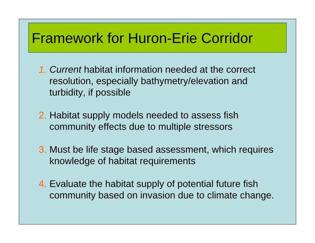
Framework for Huron-Erie Corridor
1. Current habitat information needed at the correct resolution, especially bathymetry/elevation and turbidity, if possible
2. Habitat supply models needed to assess fish community effects due to multiple stressors
3. Must be life stage based assessment, which requires knowledge of habitat requirements
4. Evaluate the habitat supply of potential future fish community based on invasion due to climate change.
Acknowledgements
GIS Support: Carolyn Bakelaar, Charlene Rae
Field & Lab Support:Lynn Bouvier, Jason Barnucz, Matt Stuart, Kathy Seifried, Cindy Chu, Kris VandeSompel
Modelling SupportJim Moore, JEMSysCharles K. Minns, DFO