Embed Size (px)
Citation preview
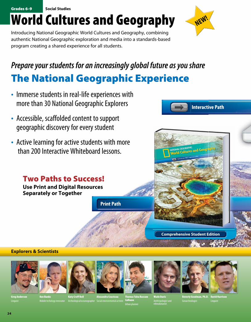
World Cultures and Geography NEW!
Introducing National Geographic World Cultures and Geography, combining authentic National Geographic exploration and media into a standards-based program creating a shared experience for all students.
Prepare your students for an increasingly global future as you share
The National Geographic Experience• Immerse students in real-life experiences with
more than 30 National Geographic Explorers
• Accessible, scaffolded content to support geographic discovery for every student
• Active learning for active students with more than 200 Interactive Whiteboard lessons.
Two Paths to Success! Use Print and Digital Resources Separately or Together
Thomas Taha Rassam Culhane
Urban planner
David Harrison
Linguist
Alexandra Cousteau
Social environmental activist
Beverly Goodman, Ph.D.
Geoarcheologist
Katy Croff Bell
Archeological oceanographer
Wade Davis
Anthropologist and ethnobotanist
Ken Banks
Mobile techology innovator
Fredrik Hiebert
Archeologist
Greg Anderson
Linguist
Explorers & Scientists
Interactive Path
Comprehensive Student Edition
Print Path
NGS_JOB_2700 9781285020976 » K12 » 2012–13 CATALOG » National Geographic Learning
24
Social Studies
NGS_JOB_2700 9781285020976 » K12 » 2012–13 CATALOG » National Geographic Learning
Grades 6–9
9781285020976_1213_024-034_WCG.indd 24 6/25/12 11:45 AM
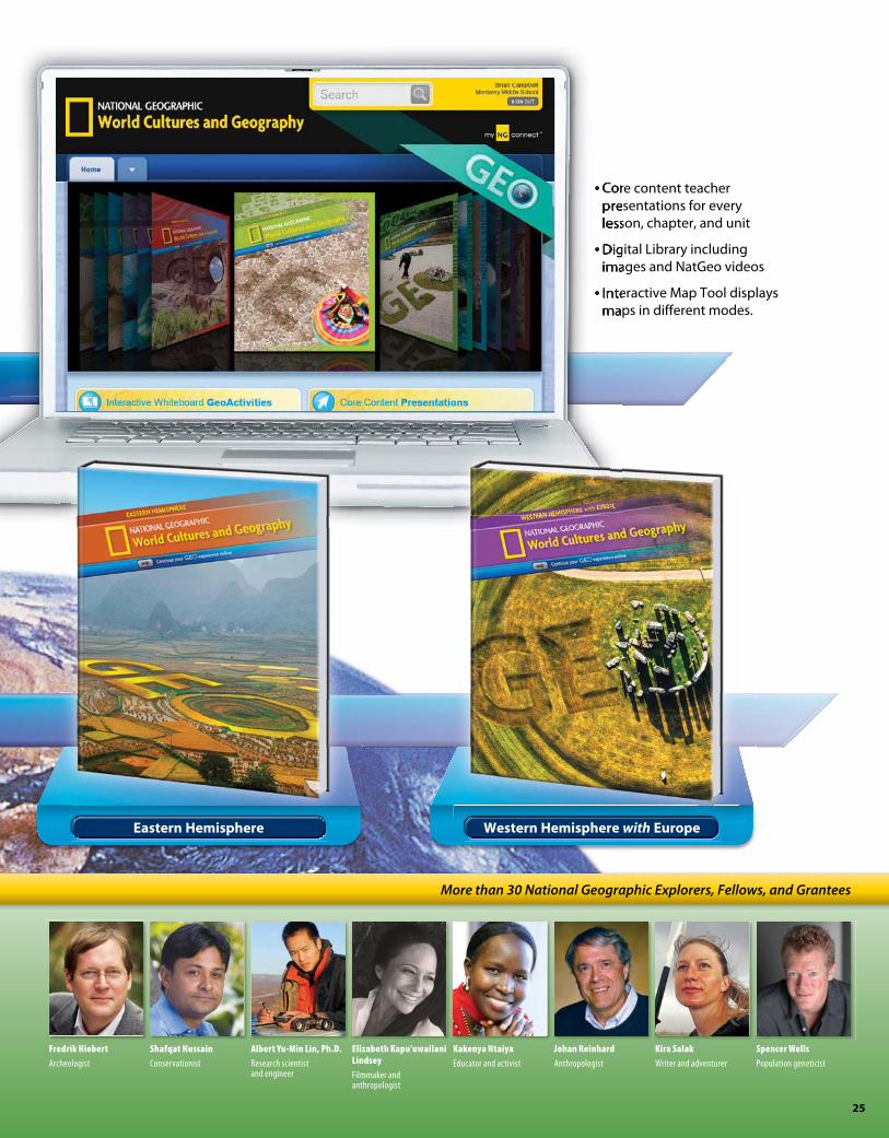
• Core content teacher presentations for every lesson, chapter, and unit
• Digital Library including images and NatGeo videos
• Interactive Map Tool displays maps in different modes.
Spencer Wells
Population geneticist
David Harrison
Linguist
Fredrik Hiebert
Archeologist
Shafqat Hussain
Conservationist
Kakenya Ntaiya
Educator and activist
Kira Salak
Writer and adventurer
Albert Yu-Min Lin, Ph.D.
Research scientist and engineer
Johan Reinhard
Anthropologist
Elizabeth Kapu’uwailani Lindsey
Filmmaker and anthropologist
More than 30 National Geographic Explorers, Fellows, and Grantees
Interactive Path
Eastern Hemisphere Western Hemisphere with Europe
Core content teacher presentations for every lesson, chapter, and unit
Digital Library including images and NatGeo videos
Interactive Map Tool displays maps in different modes.
• Core content teacher presentations for every lesson, chapter, and unit
• Digital Library including images and NatGeo videos
• Interactive Map Tool displays maps in different modes.
NGS_JOB_2700 9781285020976 » K12 » 2012–13 CATALOG » National Geographic Learning NGS_JOB_2700 9781285020976 » K12 » 2012–13 CATALOG » National Geographic Learning
25
9781285020976_1213_024-034_WCG.indd 25 6/25/12 11:45 AM

Comprehensive Student Edition Units
The Essentials of Geography
North America
Central America and the Caribbean
South America
Europe
Russia & the Eurasian Republics
Sub-Saharan Africa
Southwest Asia & North Africa
South Asia
East Asia
Southeast Asia
Australia, the Pacific Realm & Antarctica
World Cultures and GeographyVisually Appealing, Engaging, Active, and Relevant
NEW!
Comprehensive Student Edition Units
ComprehensiveStudent Edition (Survey)
Active Learning• Students engage with over 300 maps,
graphs, and charts
• Before You Move On informally tests comprehension
• Striving readers access differentiated text in the Student eEdition.
Engaging• Each unit opener
features a National Geographic Explorer
• Students link to video clips to build background
• Online World Atlas provides maps of Southeast Asia.
Comprehensive Student Edition Units
The Essentials of Geography
North America
Central America and the Caribbean
South America
Europe
Russia & the Eurasian Republics
Sub-Saharan Africa
Southwest Asia & North Africa
South AsiaComprehensiveComprehensive
Unit 11 Opener, Southeast Asia
Available in both English and Spanish
NGS_JOB_2700 9781285020976 » K12 » 2012–13 CATALOG » National Geographic Learning NGS_JOB_2700 9781285020976 » K12 » 2012–13 CATALOG » National Geographic Learning
26
Social StudiesGrades 6–9
9781285020976_1213_024-034_WCG.indd 26 6/25/12 11:45 AM

Relevant• Focus on current
events
• Highlighted vocabulary
• Map Labs for ongoing assessment
• Reading strategies to ensure comprehension.
Digital Library• GeoVideos to introduce
each unit
• Audio clips to exemplify the region
• Stunning images from National Geographic.
Maps and Graphs• Online World Atlas and
maps for projection and online use
• Interactive Map Tool displays different approaches to regions.
Unit 8, Southwest Asia and North Africa
Eastern HemisphereStudent Edition
Western Hemisphere with EuropeStudent Edition
Additional Student Edition VersionsSee pages 30–31 for more information.
NGS_JOB_2700 9781285020976 » K12 » 2012–13 CATALOG » National Geographic Learning NGS_JOB_2700 9781285020976 » K12 » 2012–13 CATALOG » National Geographic Learning
N AT I O N A L G E O G R A P H I C L E A R N I N G | 888 915 3276 | N G L . C E N G AG E . CO M 27
9781285020976_1213_024-034_WCG.indd 27 6/25/12 11:45 AM

World Cultures and GeographymyNGconnect.com
Students Start their Online Experience
for Students• Student eEdition• Interactive Map Tool• Magazine Maker• Connect to
NationalGeographic.com
• GeoJournal• myAssignments• Maps and Graphs
Student eEdition with Differentiated TextStudents may access the text at a modified readability level
Interactive Map ToolStudents select regions from online maps to explore and control the experience
Two-Page Lesson with Interactive FeaturesStudents interact with student eEdition pages with highlighted vocabulary and an assortment of rollovers
Student Home Page(Survey Edition shown)
myNGconnect.comG
NGS_JOB_2700 9781285020976 » K12 » 2012–13 CATALOG » National Geographic Learning NGS_JOB_2700 9781285020976 » K12 » 2012–13 CATALOG » National Geographic Learning
28
Social StudiesGrades 6–9
9781285020976_1213_024-034_WCG.indd 28 6/25/12 11:45 AM

for Teachers• Teacher’s eEdition • Core Content
Presentations• Online Lesson Planner• Interactive Whiteboard
GeoActivities
• Guided Writing• Professional Development• Maps and Graphs• Digital Library• Magazine Maker
Strategies for DifferentiationTips for differentiated instruction for a variety of student populations
Active Options for Active LearnersTools for every two-page lesson at point of use
National Geographic Digital Library Images Beautiful images of all regions of the world
Digital Library Original VideosExplorer videos to enrich the classroom experience
Teacher Home Page(Survey Edition shown)
Teachers Start their Online Experience
NGS_JOB_2700 9781285020976 » K12 » 2012–13 CATALOG » National Geographic Learning NGS_JOB_2700 9781285020976 » K12 » 2012–13 CATALOG » National Geographic Learning
N AT I O N A L G E O G R A P H I C L E A R N I N G | 888 915 3276 | N G L . C E N G AG E . CO M 29
9781285020976_1213_024-034_WCG.indd 29 6/25/12 11:45 AM

Eastern Hemisphere Units
The Essentials of Geography
Europe
Russia and the Eurasian Republics
Sub-Saharan Africa
Southwest Asia and North Africa
South Asia
East Asia
Southeast Asia
Australia, the Pacific Realm & Antarctica
World Cultures and Geography Eastern Hemisphere
Student Book• Engaging maps, images, audio, and
interactive lessons
• Up-to-date content and links to National Geographic
• Clear and focused organization with two-page lessons.
A world map introduces the physical world to students before they study Eastern Hemisphere regionsStudent Book
Eastern Hemisphere Units
The Essentials of Geography
Europe
Russia and the Eurasian Republics
Sub-Saharan Africa
Southwest Asia and North Africa
South Asia
East Asia
Southeast Asia
Australia, the Pacific Realm & Antarctica
Explore East Asia• Each unit opener
features a National Geographic Explorer
• Students link to an interview with the Explorer from within the digital library and the Student eEdition.
Unit 7 Opener, East Asia
NGS_JOB_2700 9781285020976 » K12 » 2012–13 CATALOG » National Geographic Learning NGS_JOB_2700 9781285020976 » K12 » 2012–13 CATALOG » National Geographic Learning
30
Social StudiesGrades 6–9
9781285020976_1213_024-034_WCG.indd 30 6/25/12 11:46 AM

Western Hemisphere with Europe Units
The Essentials of Geography
North America
Central America and the Caribbean
South America
Europe
Russia and the Eurasian Republics
Western Hemisphere with Europe
Western Hemisphere with Europe Units
Student Book• Includes regional units relevant to
Western Hemisphere curriculum
• Students make inferences about their lives and the lives of students in other countries
• Rich time lines provide a sense of ancient civilization.
Student Book
Western Hemisphere with Europe Units
The Essentials of Geography
North America
Central America and the Caribbean
South America
Europe
Russia and the Eurasian Republics
Europe• Students meet National
Geographic Explorers engaged in regionally relevant projects
• History and culture are introduced in the “Step into History” invitation
• The effects of the region’s geography on its economy and culture are highlighted.
Unit 5 Opener, Explore Europe
NGS_JOB_2700 9781285020976 » K12 » 2012–13 CATALOG » National Geographic Learning NGS_JOB_2700 9781285020976 » K12 » 2012–13 CATALOG » National Geographic Learning
N AT I O N A L G E O G R A P H I C L E A R N I N G | 888 915 3276 | N G L . C E N G AG E . CO M 31
9781285020976_1213_024-034_WCG.indd 31 6/25/12 11:46 AM
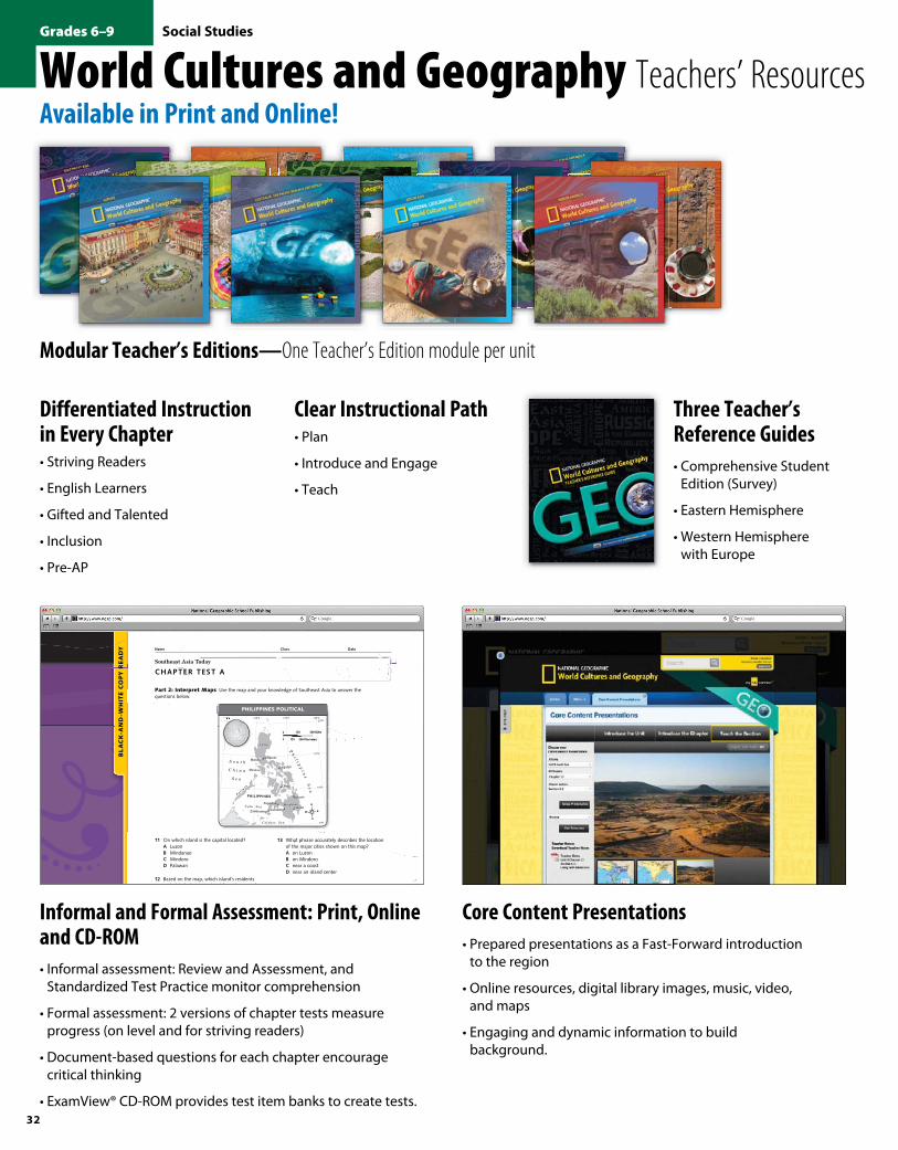
World Cultures and Geography Teachers’ ResourcesAvailable in Print and Online!
Modular Teacher’s Editions—One Teacher’s Edition module per unit
Clear Instructional Path• Plan
• Introduce and Engage
• Teach
Differentiated Instruction in Every Chapter• Striving Readers
• English Learners
• Gifted and Talented
• Inclusion
• Pre-AP
Core Content Presentations• Prepared presentations as a Fast-Forward introduction
to the region
• Online resources, digital library images, music, video, and maps
• Engaging and dynamic information to build background.
Three Teacher’s Reference Guides• Comprehensive Student
Edition (Survey)
• Eastern Hemisphere
• Western Hemisphere with Europe
Informal and Formal Assessment: Print, Online and CD-ROM• Informal assessment: Review and Assessment, and
Standardized Test Practice monitor comprehension
• Formal assessment: 2 versions of chapter tests measure progress (on level and for striving readers)
• Document-based questions for each chapter encourage critical thinking
• ExamView® CD-ROM provides test item banks to create tests.
BL
AC
K-A
ND
-WH
ITE
CO
PY R
EA
DY
© NGSP & HB
Name Class Date
Chapter test aSoutheast Asia Today
Part 2: Interpret Maps Use the map and your knowledge of Southeast Asia to answer the questions below.
120°E 125°E115°E 130°E20°N
15°N
10°N
5°N
Mindanao
P al aw a
n
Mindoro
Luzon
PHILIPPINES
Ph
i l i pp
in
e S
ea
S o u t h
C h i n a
S e a
Celebes Sea
Sulu Sea
Manila
Davao
Butuan
Pagadian
Zamboanga Cotabato
Cebu
Legazpi
Antipolo
N
S
EW
0 300 Kilometers
0 300 Miles
150
150
0 300 Kilometers300 Kilometers300 Kilometers300 Kilometers300 Kilometers300 Kilometers300 Kilometers300 Kilometers300 Kilometers300 Kilometers300 Kilometers300 Kilometers300 Kilometers
0 300 Miles300 Miles300 Miles300 Miles300 Miles300 Miles300 Miles300 Miles
150150150
150150150
0 300 Kilometers
0 300 Miles
150
150
115°E115°E115°E115°E115°E
NGWG_TE_U11_C22_EM_M003NGM66 219 Philippines PoliticalFirst Proof05/06/11
PhIlIPPInes PolItIcal
11 On which island is the capital located?a LuzonB MindanaoC MindoroD Palawan
12 Based on the map, which island’s residents probably feel most isolated from the rest of the country?a LuzonB MindanaoC MindoroD Palawan
13 What phrase accurately describes the location of the major cities shown on this map?a on LuzonB on Mindoro C near a coastD near an island center
constructed Response Use complete sentences to write the answer in the space provided.
14 For years, rebels on the island of Mindanao have wanted independence from the Filipino government. What geographic reasons help explain their feelings?
© NGSP & HB Southeast Asia Today Chapter test a 91
088-099_FA99999_U11C22_F.indd 91 7/26/11 10:56 AM
RB088-RB099_TE90128_U11C22.indd 91 7/26/11 10:58 AM
NGS_JOB_2700 9781285020976 » K12 » 2012–13 CATALOG » National Geographic Learning NGS_JOB_2700 9781285020976 » K12 » 2012–13 CATALOG » National Geographic Learning
32
Social StudiesGrades 6–9
9781285020976_1213_024-034_WCG.indd 32 6/25/12 11:46 AM

World Cultures and Geography Teachers’ ResourcesAvailable in Print and Online!
Teach students about the advances of the Green Revolution in India in a two-page lesson
Interactive Whiteboard Activities• Over 200 activities are available for both
SMART™ and Promethean systems
• Engaging games and reviews ensure comprehension
• Scripts for the teacher suggest ways to implement activities.
Unit 9, Chapter 17
Three Teacher’s Reference Guides• Comprehensive Student
Edition (Survey)
• Eastern Hemisphere
• Western Hemisphere with Europe
NGS_JOB_2700 9781285020976 » K12 » 2012–13 CATALOG » National Geographic Learning NGS_JOB_2700 9781285020976 » K12 » 2012–13 CATALOG » National Geographic Learning
N AT I O N A L G E O G R A P H I C L E A R N I N G | 888 915 3276 | N G L . C E N G AG E . CO M 33
9781285020976_1213_024-034_WCG.indd 33 6/25/12 11:46 AM

World Cultures and Geography ComponentsA powerful program connecting students to the world through rich National Geographic assets, with activities to connect instruction to the world, and accessibility for all students!
Student Components Print Online Teacher Components Print Online
Comprehensive Student Edition (Survey) • • Teacher’s Modular Editions • •Eastern Hemisphere Student Edition Teacher’s Reference Guides • • Teacher’s Reference Guides • •
Western Hemisphere with Europe Student Edition • •Informal and Formal Assessments and Rubrics • •ExamView® CD-ROM •
myNGconnect.com Student Resources: Interactive Map Tool, National Geographic Digital Library, Charts & Infographics, Graphic
Organizers, Guided Writing, Writing Templates, GeoJournal, myAssignments, Magazine
Maker, Connect to National Geographic
•myNGconnect Teacher Resources: Core Content Presentations, Lesson Planner, Interactive Whiteboard GeoActivities,
Magazine Maker, Connect to National Geographic, Maps and Graphs, National
Geographic Digital Library
•
Order Information
Student Editions With the purchase of 25 student print editions, all online resources including 25 Student eEditions (6-year licenses) and Teacher ‘s eEditions are free.
Comprehensive (Survey)Student Edition 978-07362-89986
Spanish Student Edition 978-07362-90197
myNGconnect : 6 year license (Student eEdition and all student and teacher online resources)Minimum purchase of 25 Student print editions or 25 eEditions is required for access to myNGconnect
978-07362-92757
Eastern HemisphereStudent Edition 978-07362-90005
myNGconnect: 6 year license (Student eEdition and all online resources) Minimum purchase of 25 Student print editions or 25 eEditions is required for access to myNGconnect
978-07362-92771
Western Hemisphere with EuropeStudent Edition 978-07362-89993
myNGconnect: 6 year license (Student eEdition and all online resources) Minimum purchase of 25 Student print editions or 25 eEditions is required for access to myNGconnect
978-07362-90012
Teacher’s Editions Comprehensive (Survey) Eastern HemisphereWestern Hemisphere
with EuropeTeacher’s Edition Set 978-07362-90166 978-07362-90180 978-07362-90173
The Essentials of Geography 978-07362-90012 978-07362-90012 978-07362-90012
North America 978-07362-90029 978-07362-90029
Central America and the Caribbean 978-07362-90036 978-07362-90036
South America 978-07362-90043 978-07362-90043
Europe 978-07362-90050 978-07362-90272 978-07362-90050
Russia and the Eurasian Republics 978-07362-90067 978-07362-90289 978-07362-90067
Sub-Saharan Africa 978-07362-90074 978-07362-90296
Southwest Asia and North Africa 978-07362-90081 978-07362-90302
South Asia 978-07362-90098 978-07362-90319
East Asia 978-07362-90104 978-07362-90326
Southeast Asia 978-07362-90111 978-07362-90333
Australia, the Paci�c Realm, and Antarctica 978-07362-90128 978-07362-90340
Teacher’s Reference Guide 978-07362-90135 978-07362-90159 978-07362-90142
ExamView® CD-ROM 978-07362-93952 978-07362-93952 978-07362-93952
Start Your Experience
NGS_JOB_2700 9781285020976 » K12 » 2012–13 CATALOG » National Geographic Learning
34
Social StudiesGrades 6–9
9781285020976_1213_024-034_WCG.indd 34 6/25/12 11:46 AM


![[Clarinet_Institute] Rosanov, Sergey - Technical Studies.pdf](https://img.pdfslide.us/doc/110x75/577c80ed1a28abe054aabe39/clarinetinstitute-rosanov-sergey-technical-studiespdf.jpg)