Embed Size (px)
Citation preview
GLORIA - Geological Long-Range Inclined Asdic Roger Searle
GLORIA (Geological Long-Range Inclined Asdic – a dou-ble acronym!) was developed [1] at the National Institute of Oceanography beginning in 1965, with sea trials in 1969 and the first scientific papers appearing in 1970. The tech-nical development was led by Stuart Rusby [2], aided by Roger Edge, Jack Revie, Mike Somers and others.
As the name suggests, the objective was to under-take long-range imaging of geological features of the seafloor. A sonar frequency of ~6 kHz was used to avoid extensive attenuation and achieve an initial range of up to 14 km. Importantly, the system used chirp technology to enhance the sig-
nal: a long, swept FM pulse was transmitted, with the return signal compressed by the same FM pattern, thus achieving high power with fine resolution.
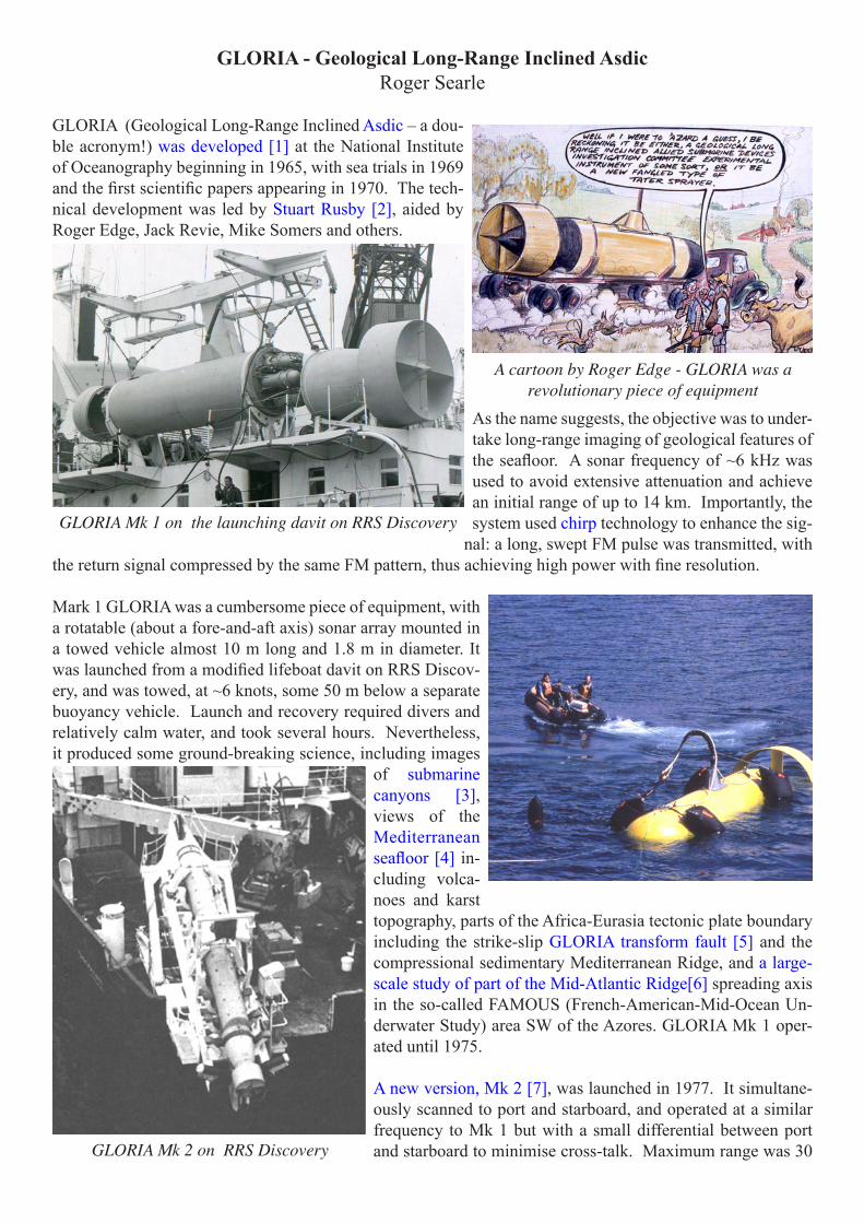
Mark 1 GLORIA was a cumbersome piece of equipment, with a rotatable (about a fore-and-aft axis) sonar array mounted in a towed vehicle almost 10 m long and 1.8 m in diameter. It was launched from a modified lifeboat davit on RRS Discov-ery, and was towed, at ~6 knots, some 50 m below a separate buoyancy vehicle. Launch and recovery required divers and relatively calm water, and took several hours. Nevertheless, it produced some ground-breaking science, including images
of submarine canyons [3], views of the Mediterranean seafloor [4] in-cluding volca-noes and karst topography, parts of the Africa-Eurasia tectonic plate boundary including the strike-slip GLORIA transform fault [5] and the compressional sedimentary Mediterranean Ridge, and a large-scale study of part of the Mid-Atlantic Ridge[6] spreading axis in the so-called FAMOUS (French-American-Mid-Ocean Un-derwater Study) area SW of the Azores. GLORIA Mk 1 oper-ated until 1975. A new version, Mk 2 [7], was launched in 1977. It simultane-ously scanned to port and starboard, and operated at a similar frequency to Mk 1 but with a small differential between port and starboard to minimise cross-talk. Maximum range was 30
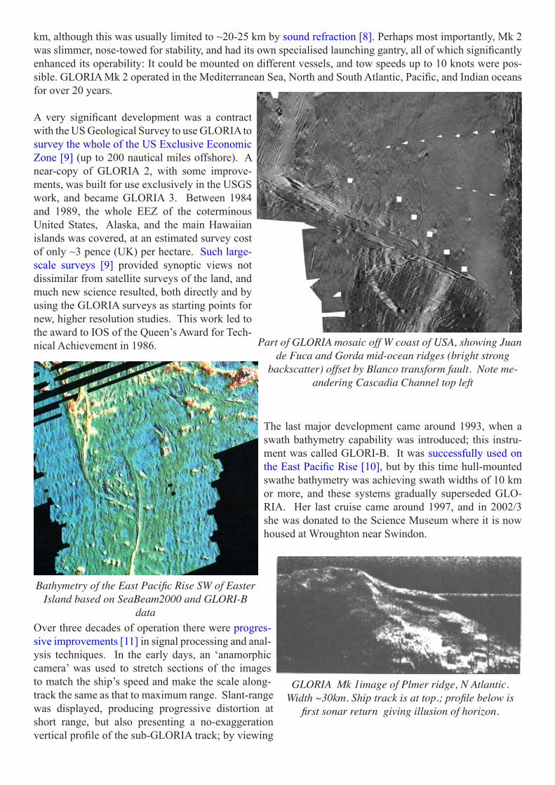
A cartoon by Roger Edge - GLORIA was a revolutionary piece of equipment
GLORIA Mk 1 on the launching davit on RRS Discovery
GLORIA Mk 2 on RRS Discovery
km, although this was usually limited to ~20-25 km by sound refraction [8]. Perhaps most importantly, Mk 2 was slimmer, nose-towed for stability, and had its own specialised launching gantry, all of which significantly enhanced its operability: It could be mounted on different vessels, and tow speeds up to 10 knots were pos-sible. GLORIA Mk 2 operated in the Mediterranean Sea, North and South Atlantic, Pacific, and Indian oceans for over 20 years. A very significant development was a contract with the US Geological Survey to use GLORIA to survey the whole of the US Exclusive Economic Zone [9] (up to 200 nautical miles offshore). A near-copy of GLORIA 2, with some improve-ments, was built for use exclusively in the USGS work, and became GLORIA 3. Between 1984 and 1989, the whole EEZ of the coterminous United States, Alaska, and the main Hawaiian islands was covered, at an estimated survey cost of only ~3 pence (UK) per hectare. Such large-scale surveys [9] provided synoptic views not dissimilar from satellite surveys of the land, and much new science resulted, both directly and by using the GLORIA surveys as starting points for new, higher resolution studies. This work led to the award to IOS of the Queen’s Award for Tech-nical Achievement in 1986.
The last major development came around 1993, when a swath bathymetry capability was introduced; this instru-ment was called GLORI-B. It was successfully used on the East Pacific Rise [10], but by this time hull-mounted swathe bathymetry was achieving swath widths of 10 km or more, and these systems gradually superseded GLO-RIA. Her last cruise came around 1997, and in 2002/3 she was donated to the Science Museum where it is now housed at Wroughton near Swindon.
Over three decades of operation there were progres-sive improvements [11] in signal processing and anal-ysis techniques. In the early days, an ‘anamorphic camera’ was used to stretch sections of the images to match the ship’s speed and make the scale along-track the same as that to maximum range. Slant-range was displayed, producing progressive distortion at short range, but also presenting a no-exaggeration vertical profile of the sub-GLORIA track; by viewing
Part of GLORIA mosaic off W coast of USA, showing Juan de Fuca and Gorda mid-ocean ridges (bright strong
backscatter) offset by Blanco transform fault. Note me-andering Cascadia Channel top left
GLORIA Mk 1image of Plmer ridge, N Atlantic. Width ~30km. Ship track is at top.; profile below is
first sonar return giving illusion of horizon.
Bathymetry of the East Pacific Rise SW of Easter Island based on SeaBeam2000 and GLORI-B
data

images from far to near range, this profile appeared as a ‘horizon’ and could aid interpretation considerably. With the advent of digital recording in the early 1980s, slant-range correction was introduced, while a variety of corrections and enhancements were applied to improve image clarity and interpretation, including the use of swath bathymetry [12] to fill the blank zone around the sonar nadir, and ‘draping’ [13] the sidescan image over topography.
GLORIA made major contributions to most areas of ocean floor geology. By imaging individual transform faults and axial volcanic zones she helped map tectonic plate boundaries to kilome-tre-scale precision. She displayed the extent and nature of the rich ‘tectonic spreading fabric’ [14] produced by the ubiquitous faulting at mid-ocean ridge axes. She revealed details of underwater volcanoes [15], from giant cones many kilome-tres in diameter to the linear volcanic ridges that characterise spreading centres. She showed the extent of vast underwater channels [16] and sedi-ment slides [17] and great fields of giant ‘sedi-ment waves’ produced by seabed currents.
The final ‘legacy’ is the extent to which many GLORIA images and studies continue to be used as the basis for new, higher resolution investigations [18].
Selected references[3,16] Belderson, R. H., and N. H. Kenyon (1980), The equatorial Atlantic mid-ocean canyon seen on a sonograph,
Marine Geology, 34, M71-M81.[9] Gardner, J.V., Field, M.E., Twichell, D.G., 1996. Geology of the United States’ Seafloor. The View from GLORIA.
Cambridge University Press, Cambridge, UK, 371pp.[4] Kenyon, N. H., A. H. Stride, and R. H. Belderson (1975), Plan views of active faults and other features on the
lower Nile cone, Geol. Soc. Am. Bull., 86, 1733-1739.[18] Klaucke, I., D. G. Masson, N. H. Kenyon, et al. (2004), Sedimentary processes of the lower Monterey Fan chan-
nel and channel-mouth lobe, Marine Geology, 206(1-4), 181-198.[10] Korenaga, J., and R. N. Hey (1996), Recent duelling propagation history at the fastest spreading center, the East
Pacific Rise, 26ø-32øS, Journal of Geophysical Research, 101(B8), 18023-18041.[1] Laughton, A.S., Whitmarsh, R.B., Rusby, J.S.M., Somers, M.L., Revie, J.A., McCartney, B.S., Nafe, J.E., 1972. A
continuous East-West fault on the Azores-Gibraltar Ridge. Nature 237, 217-220.[1] Laughton, A. S. (1981), The first decade of GLORIA, Journal of Geophysical Research, 86, 11,511 - 511,534.[17] Masson, D.G., van Niel, B., Weaver, P.P.E., 1997. Flow processes and sediment deformation in the Canary debris
flow on the NW African continental rise. Sedimentary Geology 110, 163-179.[2] Rusby, S. (1970), A long range side-scan sonar for use in the deep sea (G.L.O.R.I.A. project), Int. Hydrogr. Rev.,
47(2), 25-39.[8, 11, 14] Searle, R. C., and A. S. Laughton (1977), Sonar studies of the Mid-Atlantic Ridge crest near Kurchatov
Fracture Zone, Journal of Geophysical Research, 82, 5313-5328.[15] Searle, R.C., 1983. Submarine central volcanoes on the Nazca Plate -- high-resolution sonar observations. Marine
Geology 53, 77-102.[11]Searle, R. C., T. P. Le Bas, N. C. Mitchell, et al. (1990), GLORIA Image Processing: The State of the Art, Marine
Geophysical Researches, 12, 21-39.[12] Searle, R. C. (1992), Near real-time merging of GLORIA and Hydrosweep pseudo-sidescan images, Geophysical
Research Letters, 19(11), 1137-1140.[7] Somers, M.L., Carson, R.M., Revie, et al., 1978. GLORIA II - An improved long range sidescan sonar, Proceed-
ings of the IEEE/IERE sub-conf on Offshore Instrumentation. BPS Exhibitions Ltd., London, pp. 16-24.[9,13] Taylor, J., J. A. Dowdeswell, N. H. Kenyon, et al. (2000), Morphology and Late Quaternary sedimentation on
the North Faeroes slope and abyssal plain, North Atlantic, Marine Geology, 168(1-4), 1-24.[6] Whitmarsh, R. B., and A. S. Laughton (1976), A long range sonar study of the Mid-Atlantic Ridge crest near 37°N
(FAMOUS area) and its tectonic implications, Deep-Sea Research, 23, 1005-1023.
GLORIA Mk 2 image of giant sediment waves built by ben-thic currents on the Blake-Bahama Plateau, W. Atlantic.