Embed Size (px)
Citation preview
SOIL 4213 http://npk.okstate.edu/documentation/various/index.htm
Global Positioning System
Wesley M. Porter
GPS
• Three Segments:
– Space
– Control
– User
Space Segment
• Satellite constellation consisting of approximately 31
satellites in 6 orbital planes (currently 30 operational).
• The satellites are identified by space vehicle number
(SVN) or pseudo random noise (PRN).
• With the constellation geometry, 4-10 satellites can be
seen anywhere in the world with an elevation of at least
10°.
• Have an orbital altitude of about 12500 miles.
• Clear of the atmosphere so they will orbit according to
very simple mathematics.
• Space segment provides ranging signals and data
messages to user equipment.
• The satellites have a nominal orbital period of ~12 hours.
Control Segment
• Consists of three parts: Monitor Stations, Ground Antennas,
and the Master Control Station.
• Monitor stations are remotely operated. They track and monitor the
GPS satellites, checking both their operational health and their exact
position in space. There are five such stations: Hawaii, Ascension
Island, Diego Garcia, Kwajalein, and Colorado Springs.
• Positions are precisely known and stations are equipped with dual
frequency receivers logging both L1 and L2 signals.
• The master ground station transmits corrections for the satellites
ephemeris constants and clock offsets back to the satellites
themselves. The satellites can then incorporate these updates in the
signals they send to GPS receivers.
• Errors in orbit are measured, corrected for, and sent back to the
satellite by the DOD to increase the accuracy.
User Segment (Receivers)
• Provides navigation, guidance, surveying, tracking, etc.
• On the ground all GPS receivers have an almanac
programmed into their computers that gives them real-
time satellite location.
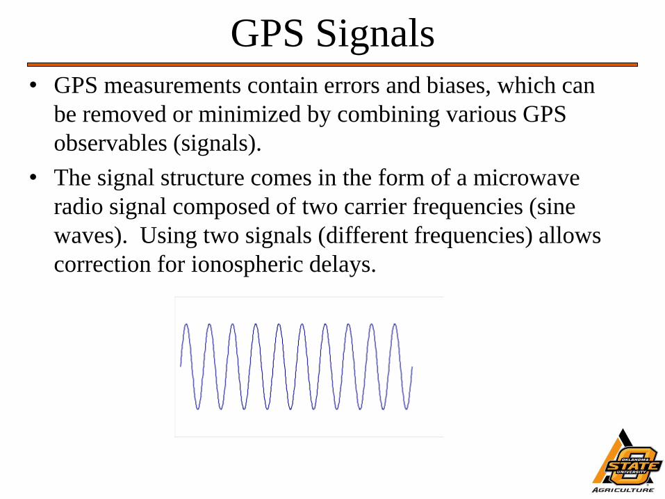
GPS Signals
• GPS measurements contain errors and biases, which can
be removed or minimized by combining various GPS
observables (signals).
• The signal structure comes in the form of a microwave
radio signal composed of two carrier frequencies (sine
waves). Using two signals (different frequencies) allows
correction for ionospheric delays.
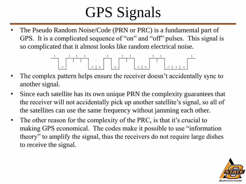
GPS Signals • The Pseudo Random Noise/Code (PRN or PRC) is a fundamental part of
GPS. It is a complicated sequence of “on” and “off” pulses. This signal is
so complicated that it almost looks like random electrical noise.
• The complex pattern helps ensure the receiver doesn’t accidentally sync to
another signal.
• Since each satellite has its own unique PRN the complexity guarantees that
the receiver will not accidentally pick up another satellite’s signal, so all of
the satellites can use the same frequency without jamming each other.
• The other reason for the complexity of the PRC, is that it’s crucial to
making GPS economical. The codes make it possible to use “information
theory” to amplify the signal, thus the receivers do not require large dishes
to receive the signal.
GPS Signals-Carriers
• The L1carrier is 1575.42 MHz and carries both the
status message and a pseudo-random code for timing.
It has a wavelength of 19 cm (7.5 inches).
• The L2 carrier is 1227.60 MHz and is used for the
more precise military pseudo-random code. It has a
wavelength of 24.4 cm (9.6 inches).
GPS Signals-PRC
• There are two types of PRC. This first is called the
C/A (Coarse Acquisition) code. It modulates the L1
carrier. It repeats every 1023 bits and modulates at a
1.023 MHz rate (Mbps). The C/A code is the basis
for civilian GPS use.
• The second PRC is called the P (Precise) code. It
repeats on a 7-day cycle and modulates both the L1
and L2 carriers (P1 and P2) at a 10.23 MHz rate.
This code is intended for military users and can be
encrypted (Y code).
GPS Signals-Navigation Message
• There is a low frequency signal added to the L1 codes
that gives information about the satellite’s orbits, their
clock corrections and other system status.
• Transmission of the complete message takes 12.5
minutes.
GPS Signals-Pseudo range
Measurements • Pseudorange is a measure of the range between the
satellite and receiver.
• These ranges are used to locate the receiver via
trilateralization.
• Either P or C/A code can be used.
• It is called pseudo range because we know it contains
errors and is thus not the true range.
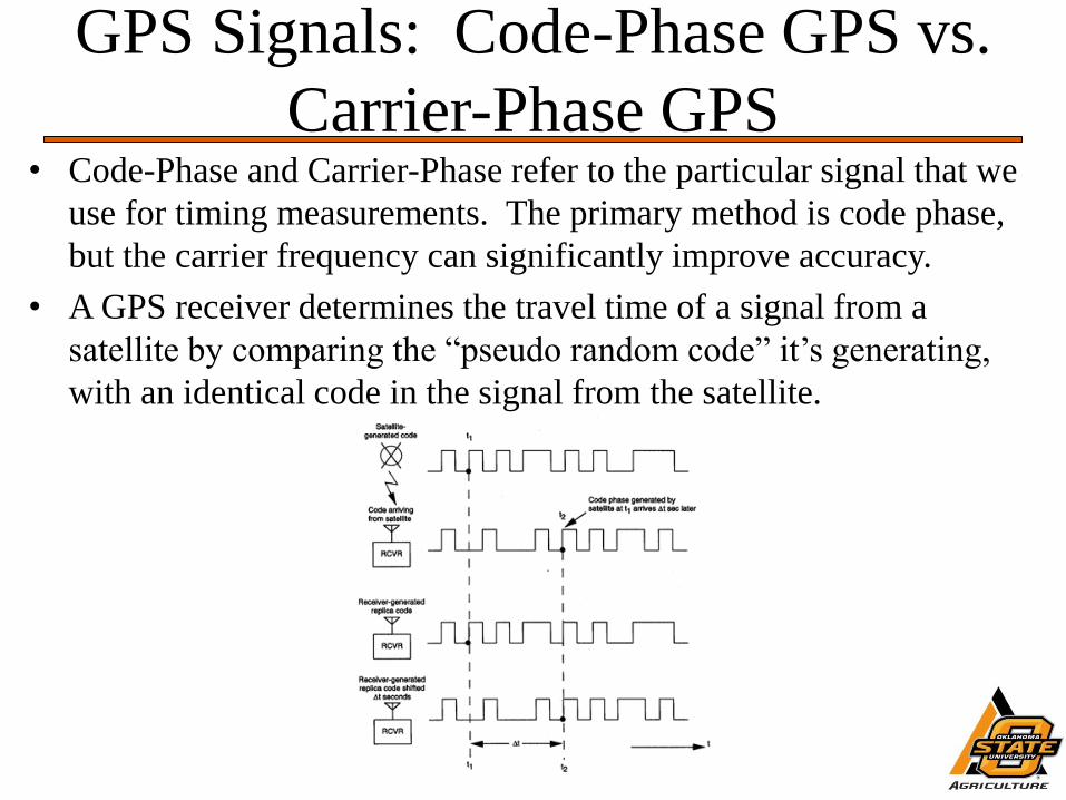
GPS Signals: Code-Phase GPS vs.
Carrier-Phase GPS • Code-Phase and Carrier-Phase refer to the particular signal that we
use for timing measurements. The primary method is code phase,
but the carrier frequency can significantly improve accuracy.
• A GPS receiver determines the travel time of a signal from a
satellite by comparing the “pseudo random code” it’s generating,
with an identical code in the signal from the satellite.
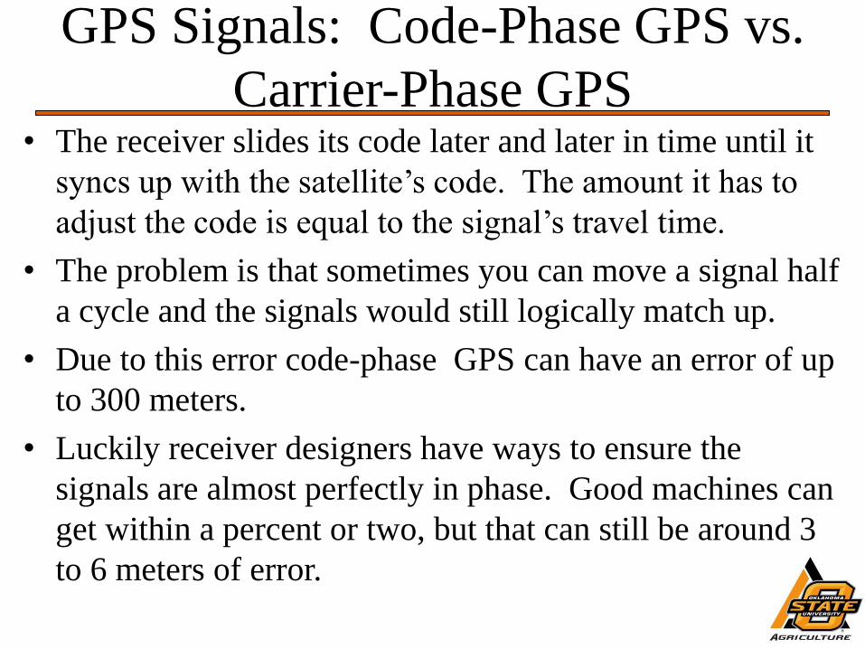
GPS Signals: Code-Phase GPS vs.
Carrier-Phase GPS • The receiver slides its code later and later in time until it
syncs up with the satellite’s code. The amount it has to
adjust the code is equal to the signal’s travel time.
• The problem is that sometimes you can move a signal half
a cycle and the signals would still logically match up.
• Due to this error code-phase GPS can have an error of up
to 300 meters.
• Luckily receiver designers have ways to ensure the
signals are almost perfectly in phase. Good machines can
get within a percent or two, but that can still be around 3
to 6 meters of error.
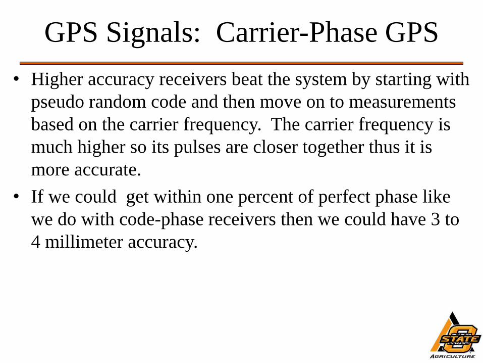
GPS Signals: Carrier-Phase GPS
• Higher accuracy receivers beat the system by starting with
pseudo random code and then move on to measurements
based on the carrier frequency. The carrier frequency is
much higher so its pulses are closer together thus it is
more accurate.
• If we could get within one percent of perfect phase like
we do with code-phase receivers then we could have 3 to
4 millimeter accuracy.
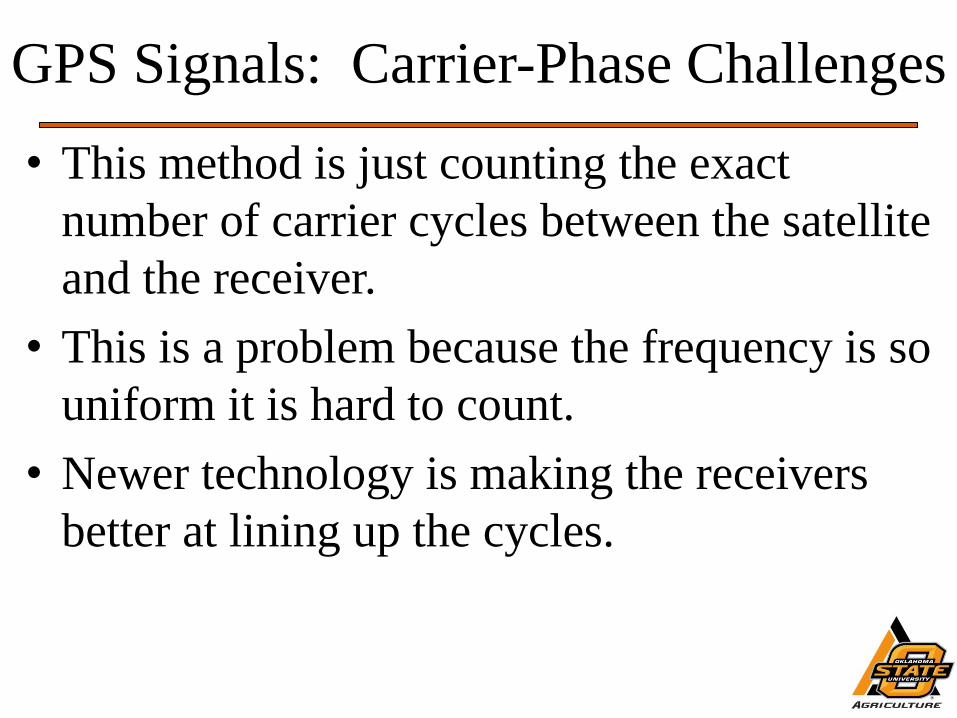
GPS Signals: Carrier-Phase Challenges
• This method is just counting the exact
number of carrier cycles between the satellite
and the receiver.
• This is a problem because the frequency is so
uniform it is hard to count.
• Newer technology is making the receivers
better at lining up the cycles.
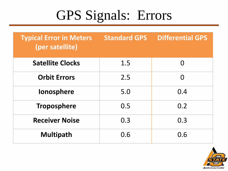
GPS Signals: Errors
Typical Error in Meters (per satellite)
Standard GPS Differential GPS
Satellite Clocks 1.5 0
Orbit Errors 2.5 0
Ionosphere 5.0 0.4
Troposphere 0.5 0.2
Receiver Noise 0.3 0.3
Multipath 0.6 0.6
GPS Signals: Errors-Ephemeris
• Even though satellite positions are constantly monitored, slight
position or ephemeris errors can occur between monitoring times.
• Orbital data are constantly being transmitted by the satellites in the
Navigation Message.
• Receivers maintain an “almanac” of this data for all satellites and
update their almanacs as new data comes in.
• Ephemeris errors affect all users the same regardless of where they
are.
• Since the range error due to ephemeris errors is similar for users
who are close to each other, they can be essentially removed
through differencing observations.
GPS Signals: Errors-Clock
• Even though the satellites clock systems are very sophisticated they
do account for some tiny errors in the system.
• The atomic clocks that satellites use are very, very precise but not
perfect. Minute discrepancies can occur, and these translate into
travel time measurement errors.
• Satellite clock error can range from 8.64 to 17.28 ns/day translating
to errors of 8.5 to 17 ft.
Receiver Errors: Clock
• Receiver clock errors are a bias unique to each receiver.
• Since it would be too expensive to put atomic clocks in receivers,
designers use an extra satellite measurement to increase the time
accuracy.
• Four range measurements are used instead of three to increase the
timing accuracy to that of an atomic clock.
• However, this means that the receiver will need four channels to
perform the measurements through.
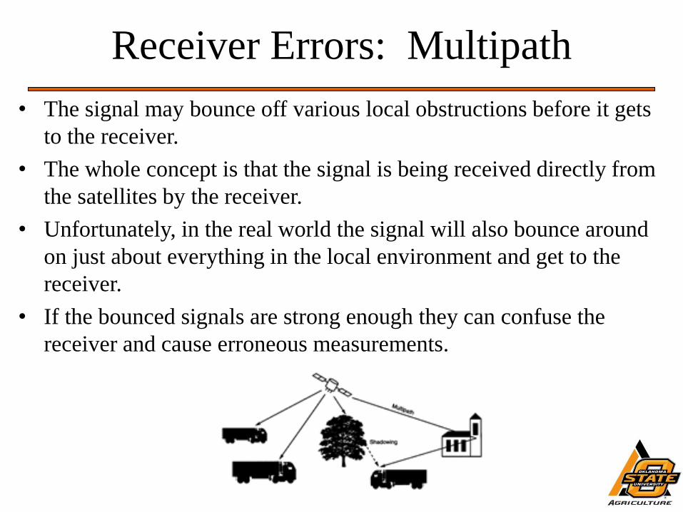
Receiver Errors: Multipath
• The signal may bounce off various local obstructions before it gets
to the receiver.
• The whole concept is that the signal is being received directly from
the satellites by the receiver.
• Unfortunately, in the real world the signal will also bounce around
on just about everything in the local environment and get to the
receiver.
• If the bounced signals are strong enough they can confuse the
receiver and cause erroneous measurements.
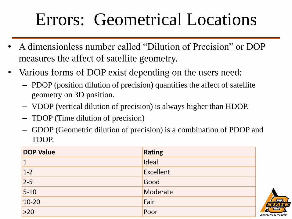
Errors: Geometrical Locations
• A dimensionless number called “Dilution of Precision” or DOP
measures the affect of satellite geometry.
• Various forms of DOP exist depending on the users need:
– PDOP (position dilution of precision) quantifies the affect of satellite
geometry on 3D position.
– VDOP (vertical dilution of precision) is always higher than HDOP.
– TDOP (Time dilution of precision)
– GDOP (Geometric dilution of precision) is a combination of PDOP and
TDOP.
DOP Value Rating
1 Ideal
1-2 Excellent
2-5 Good
5-10 Moderate
10-20 Fair
>20 Poor
Differential GPS
• Many of the errors associated with GPS have been addressed with
differential correction.
• DGPS receivers have an integrated antenna to receive a correction
signal and the on-board processing to apply the correction message
to the GPS signal.
• Types of DGPS:
– WAAS
– Coast Guard Beacon
– GLONASS
– OmniStar
– StarFire
– RTK
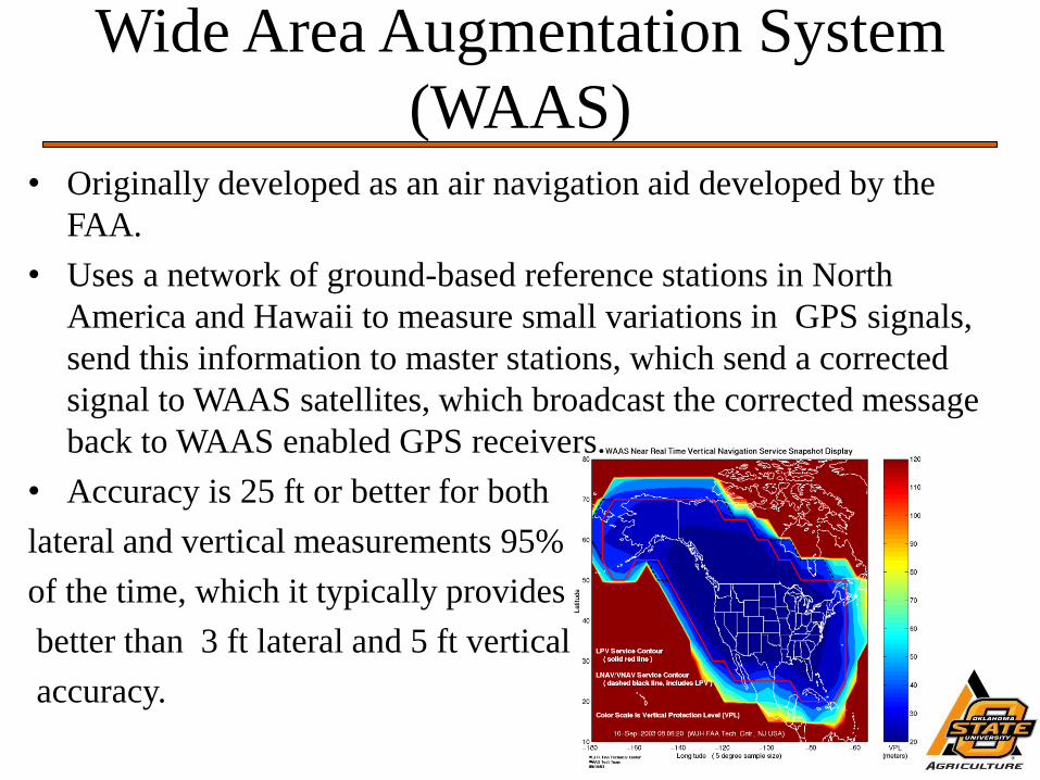
Wide Area Augmentation System
(WAAS) • Originally developed as an air navigation aid developed by the
FAA.
• Uses a network of ground-based reference stations in North
America and Hawaii to measure small variations in GPS signals,
send this information to master stations, which send a corrected
signal to WAAS satellites, which broadcast the corrected message
back to WAAS enabled GPS receivers.
• Accuracy is 25 ft or better for both
lateral and vertical measurements 95%
of the time, which it typically provides
better than 3 ft lateral and 5 ft vertical
accuracy.
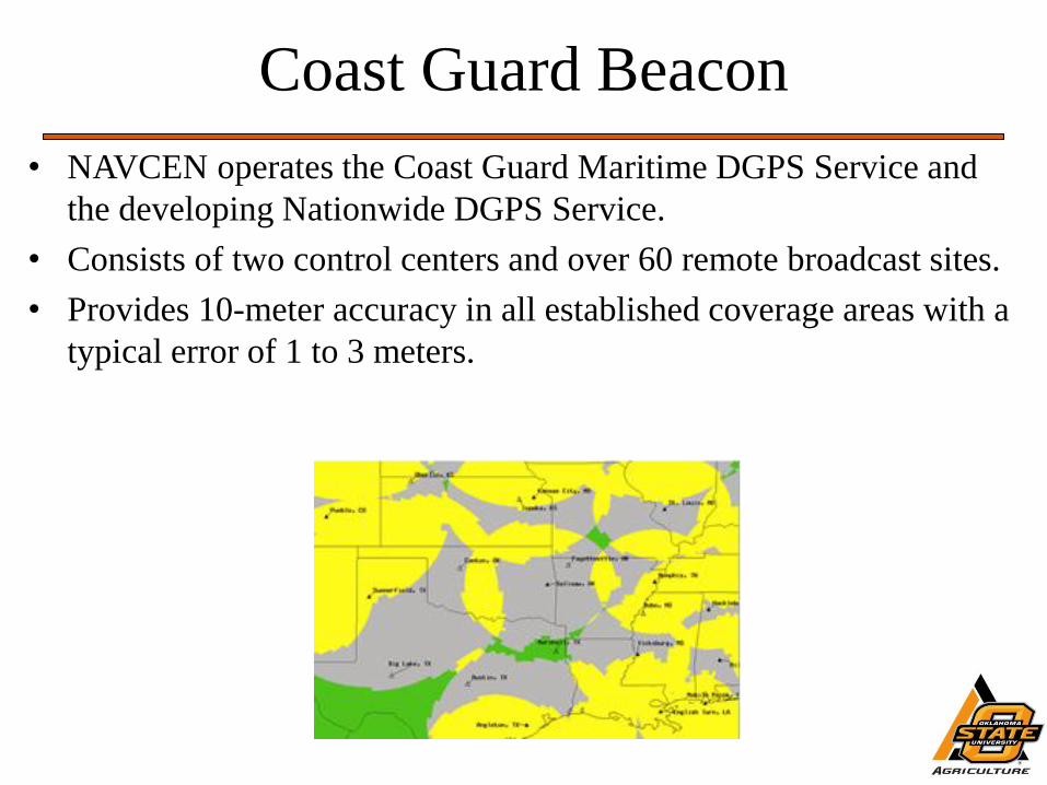
Coast Guard Beacon
• NAVCEN operates the Coast Guard Maritime DGPS Service and
the developing Nationwide DGPS Service.
• Consists of two control centers and over 60 remote broadcast sites.
• Provides 10-meter accuracy in all established coverage areas with a
typical error of 1 to 3 meters.
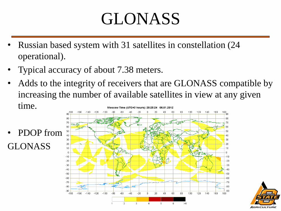
GLONASS
• Russian based system with 31 satellites in constellation (24
operational).
• Typical accuracy of about 7.38 meters.
• Adds to the integrity of receivers that are GLONASS compatible by
increasing the number of available satellites in view at any given
time.
• PDOP from
GLONASS
OMNISTAR
• Private industry correction service.
• Worldwide coverage, 70 reference stations around the globe, and 3
network control centers.
• Based on the subscription purchased the accuracy can be between
15 cm to 1 m.
• Typically used on Trimble devices for Agricultural and Surveying
needs.
• Subscriptions are around $1,000/year.
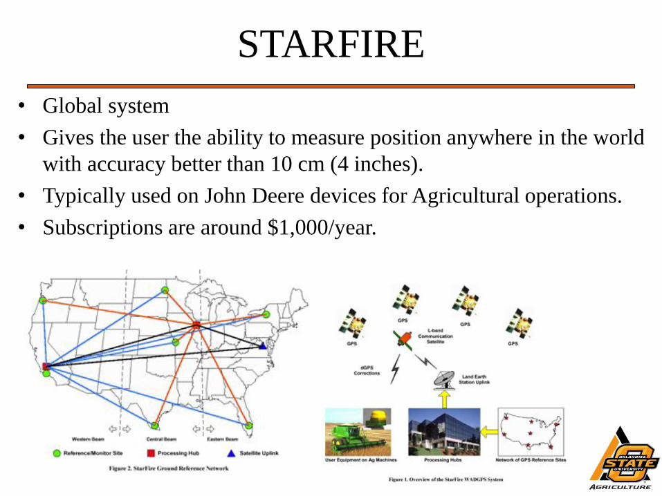
STARFIRE
• Global system
• Gives the user the ability to measure position anywhere in the world
with accuracy better than 10 cm (4 inches).
• Typically used on John Deere devices for Agricultural operations.
• Subscriptions are around $1,000/year.
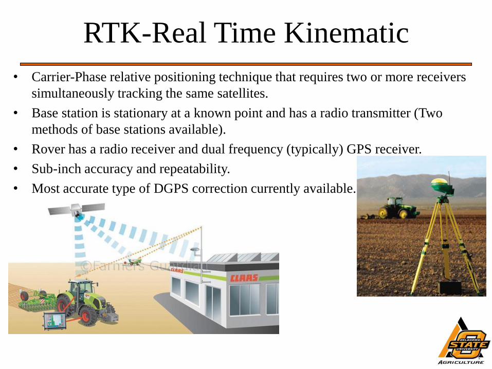
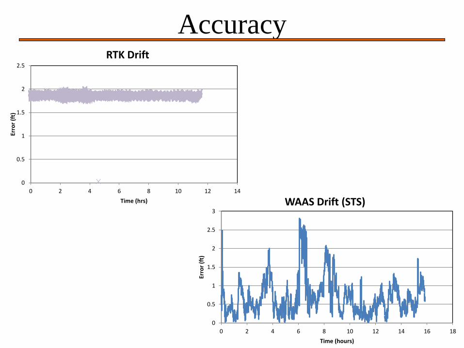
RTK-Real Time Kinematic
• Carrier-Phase relative positioning technique that requires two or more receivers
simultaneously tracking the same satellites.
• Base station is stationary at a known point and has a radio transmitter (Two
methods of base stations available).
• Rover has a radio receiver and dual frequency (typically) GPS receiver.
• Sub-inch accuracy and repeatability.
• Most accurate type of DGPS correction currently available.
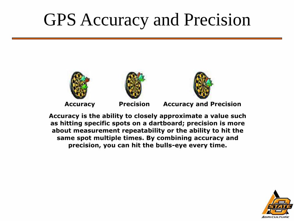
GPS Accuracy and Precision
Accuracy
Precision
Accuracy and Precision
Accuracy is the ability to closely approximate a value such
as hitting specific spots on a dartboard; precision is more
about measurement repeatability or the ability to hit the
same spot multiple times. By combining accuracy and
precision, you can hit the bulls-eye every time.
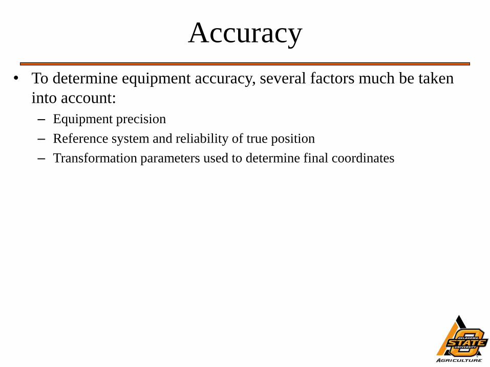
Accuracy
• To determine equipment accuracy, several factors much be taken
into account:
– Equipment precision
– Reference system and reliability of true position
– Transformation parameters used to determine final coordinates
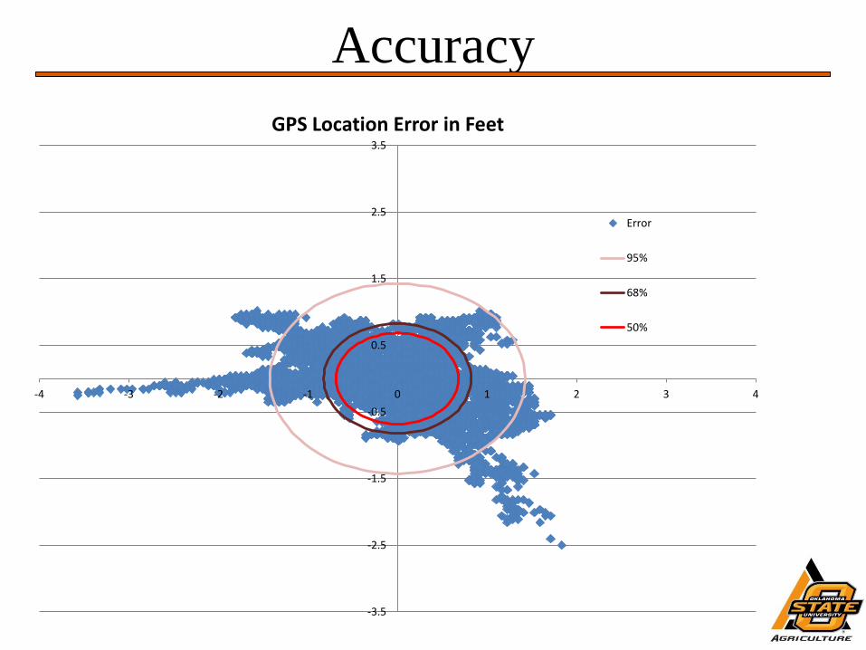
Accuracy
-3.5
-2.5
-1.5
-0.5
0.5
1.5
2.5
3.5
-4 -3 -2 -1 0 1 2 3 4
GPS Location Error in Feet
Error
95%
68%
50%
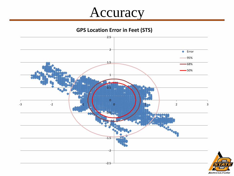
Accuracy
-2.5
-2
-1.5
-1
-0.5
0
0.5
1
1.5
2
2.5
-3 -2 -1 0 1 2 3
GPS Location Error in Feet (STS)
Error
95%
68%
50%
Accuracy
0
0.5
1
1.5
2
2.5
3
0 2 4 6 8 10 12 14 16 18
Erro
r (f
t)
Time (hours)
WAAS Drift (STS)
0
0.5
1
1.5
2
2.5
0 2 4 6 8 10 12 14
Erro
r (f
t)
Time (hrs)
RTK Drift
Homework
• Write a short paragraph on “Selective Availability”. Give your
interpretation on what it is and how it might be similar to or
different from Light Squared. Due Friday 2-17-12.