Embed Size (px)
Citation preview
Glaciers and Glacial Deposits
Glaciers
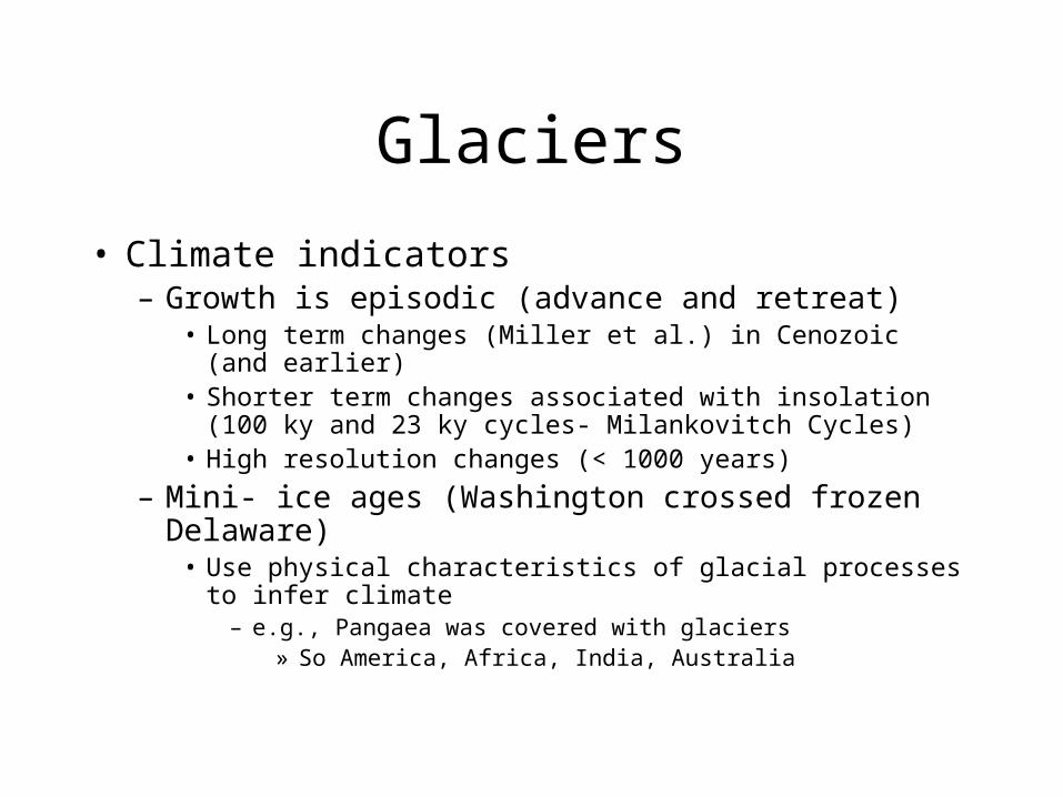
• Climate indicators– Growth is episodic (advance and retreat)
• Long term changes (Miller et al.) in Cenozoic (and earlier)• Shorter term changes associated with insolation (100 ky and
23 ky cycles- Milankovitch Cycles)• High resolution changes (< 1000 years)
– Mini- ice ages (Washington crossed frozen Delaware)• Use physical characteristics of glacial processes to infer
climate– e.g., Pangaea was covered with glaciers
» So America, Africa, India, Australia
Types of Glaciers
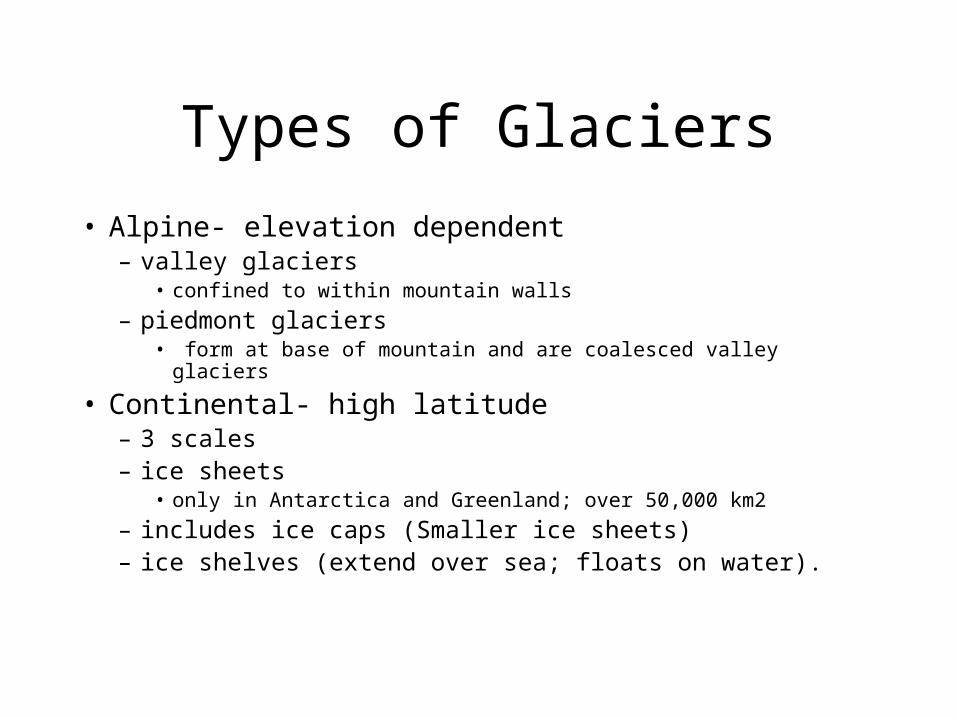
• Alpine- elevation dependent– valley glaciers
• confined to within mountain walls
– piedmont glaciers• form at base of mountain and are coalesced valley glaciers
• Continental- high latitude– 3 scales– ice sheets
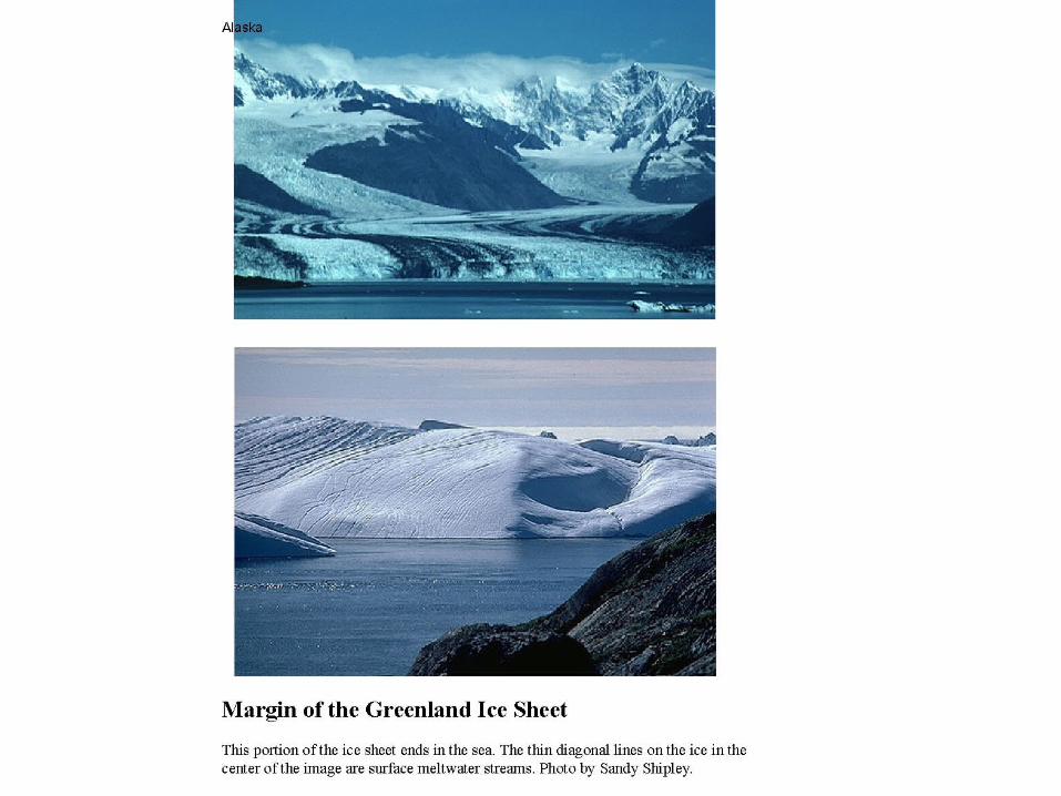
• only in Antarctica and Greenland; over 50,000 km2
– includes ice caps (Smaller ice sheets)– ice shelves (extend over sea; floats on water).
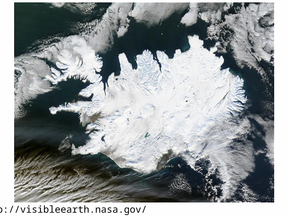
http://visibleearth.nasa.gov/
Growth
• Function of water budget and mass balance – add snow, keep it through summer
• above snow line! or cold summer temps like poles
– begin to build glacier as snow becomes more dense (Snow->Firn ->then glacial ice)
– CAN’T GROW W/O SNOW!– Add snow; lose snow
• Balanced if acc. = ablation
• Growth if accumulation > ablation
Growth
• Balance between amount of ppt (growth) and amount of melt (ablation)– add ppt, more glacier/ advance/ Wax– ablation- water melts down snout of glacier,
thinning and retreating• ablate, less glacier / retreat/ Wane
Growth/ Motion
• Glacial motion– 1x10 cm/s to 2x10 cm/s (max ~ 1 m/day)– flows as high-viscosity fluid; – SQUEEZED
• fastest flow on top; lower towards base and walls
• entrains sediments
Environments
• 4 environments to describe glacier itself• basal (subglacial) zone
– in contact with bed
• supraglacial zone– upper surface of the glacier
• ice- contact zone– around margin of glacier
• englacial zone– within glacial interior
Surrounding environments
• Proglacial– area around glacier but not in contact
– influenced by melting ice• Outwash plain
– glaciolacustrine, glaciofluvial, glaciomarine
• Periglacial– non-glacial phenomena that function in cold climates
– permafrost
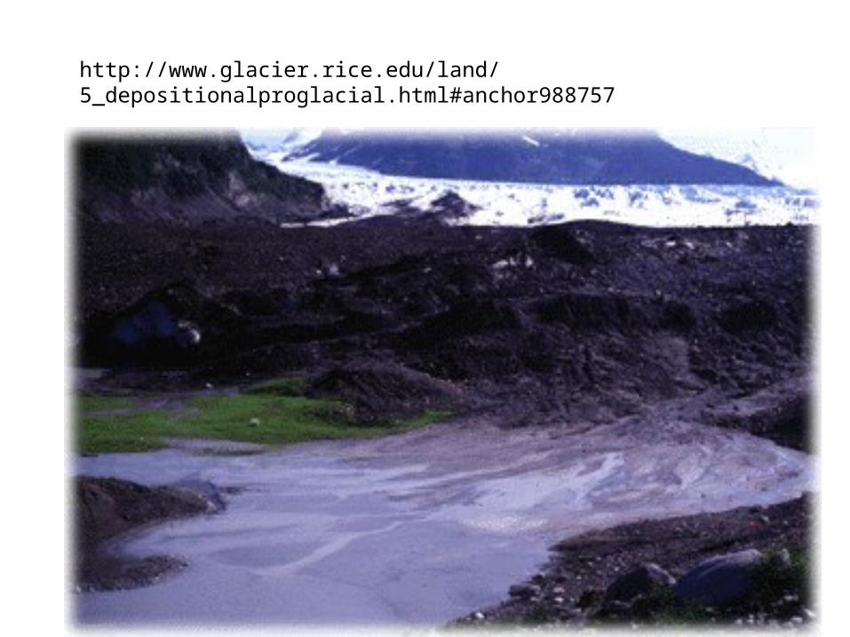
http://www.glacier.rice.edu/land/5_depositionalproglacial.html#anchor988757
Life History
• Glacier builds, begins to move• Glacier erodes and entrains sediments
– Glaciers rework its own sediment as glacier advances and retreats
– Most sediment is incorporated as glacier moves along • Sediments are usually compositionally and texturally
immature
– Traverses hills, previously deposited moraines– Rocks at base are scoured
• scratches bedrock; striations // to flow
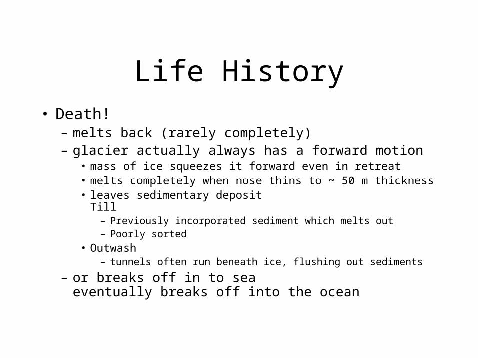
Life History• Death!
– melts back (rarely completely)– glacier actually always has a forward motion
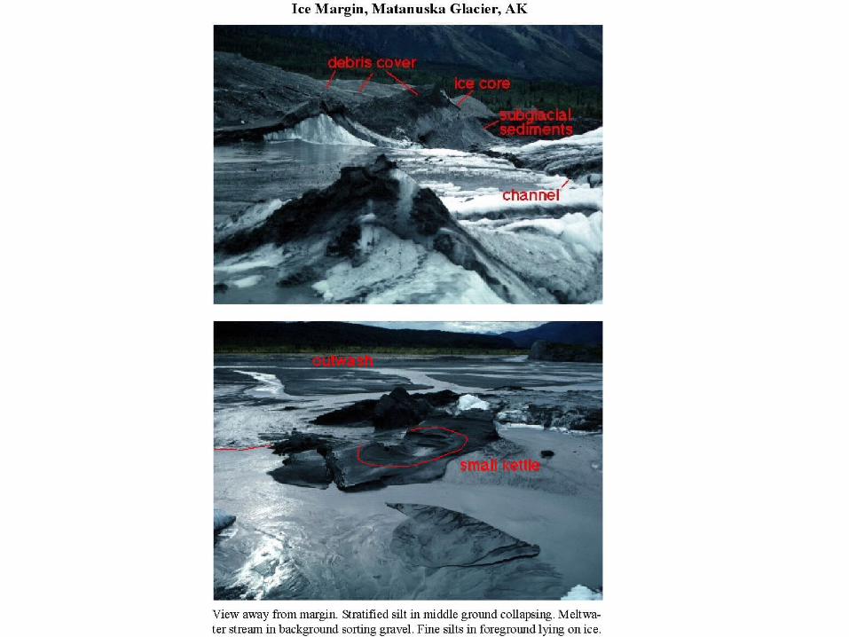
• mass of ice squeezes it forward even in retreat• melts completely when nose thins to ~ 50 m thickness• leaves sedimentary deposit
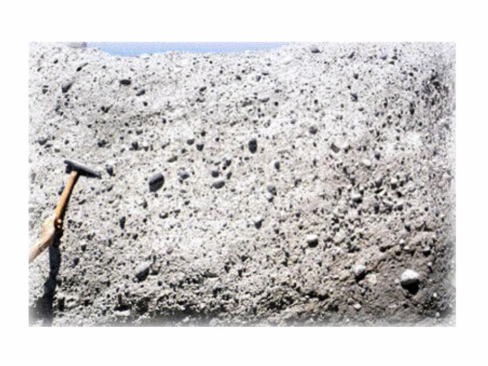
Till– Previously incorporated sediment which melts out– Poorly sorted
• Outwash– tunnels often run beneath ice, flushing out sediments
– or breaks off in to seaeventually breaks off into the ocean
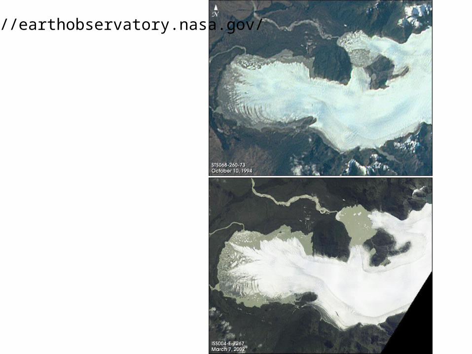
http://earthobservatory.nasa.gov/
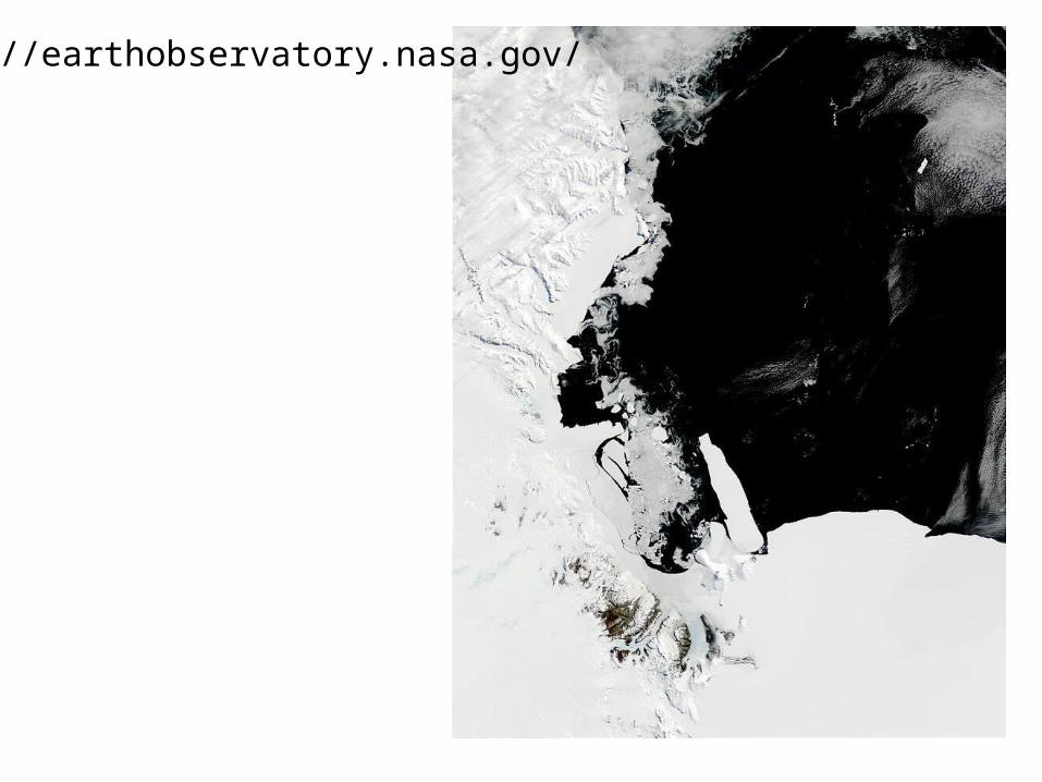
http://earthobservatory.nasa.gov/
Erosion Processes
• Glaciers affect land surface by eroding it and/or leaving landforms behind
• Erosion– scrapes up sediment– erodes rock
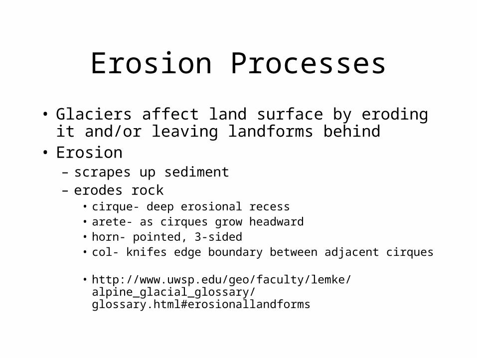
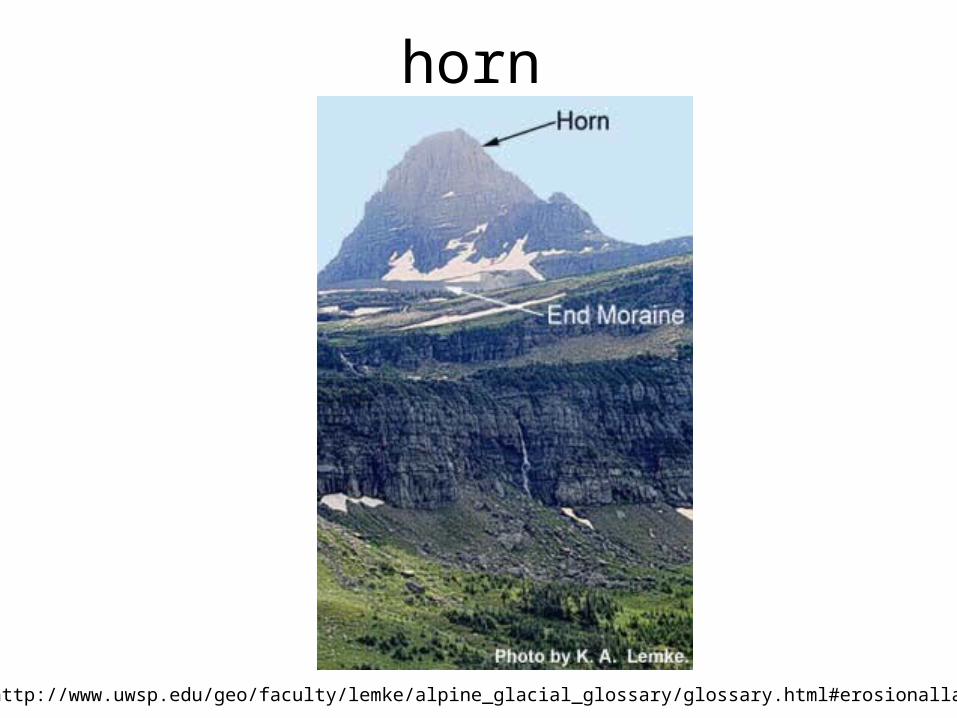
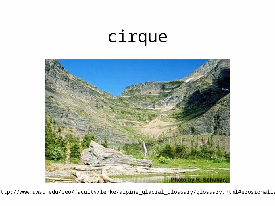
• cirque- deep erosional recess• arete- as cirques grow headward• horn- pointed, 3-sided• col- knifes edge boundary between adjacent cirques
• http://www.uwsp.edu/geo/faculty/lemke/alpine_glacial_glossary/glossary.html#erosionallandforms
horn
http://www.uwsp.edu/geo/faculty/lemke/alpine_glacial_glossary/glossary.html#erosionallandforms
cirque
http://www.uwsp.edu/geo/faculty/lemke/alpine_glacial_glossary/glossary.html#erosionallandforms
arete
http://www.uwsp.edu/geo/faculty/lemke/alpine_glacial_glossary/glossary.html#erosionallandforms
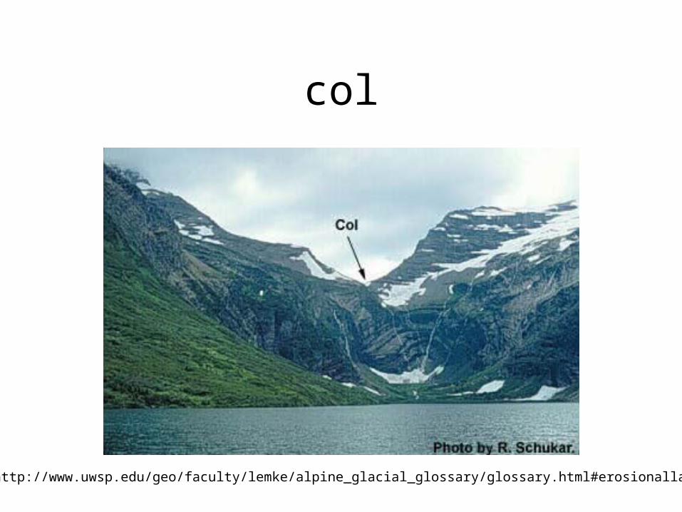
col
http://www.uwsp.edu/geo/faculty/lemke/alpine_glacial_glossary/glossary.html#erosionallandforms

Hanging valley
http://www.uwsp.edu/geo/faculty/lemke/alpine_glacial_glossary/glossary.html#erosionallandforms
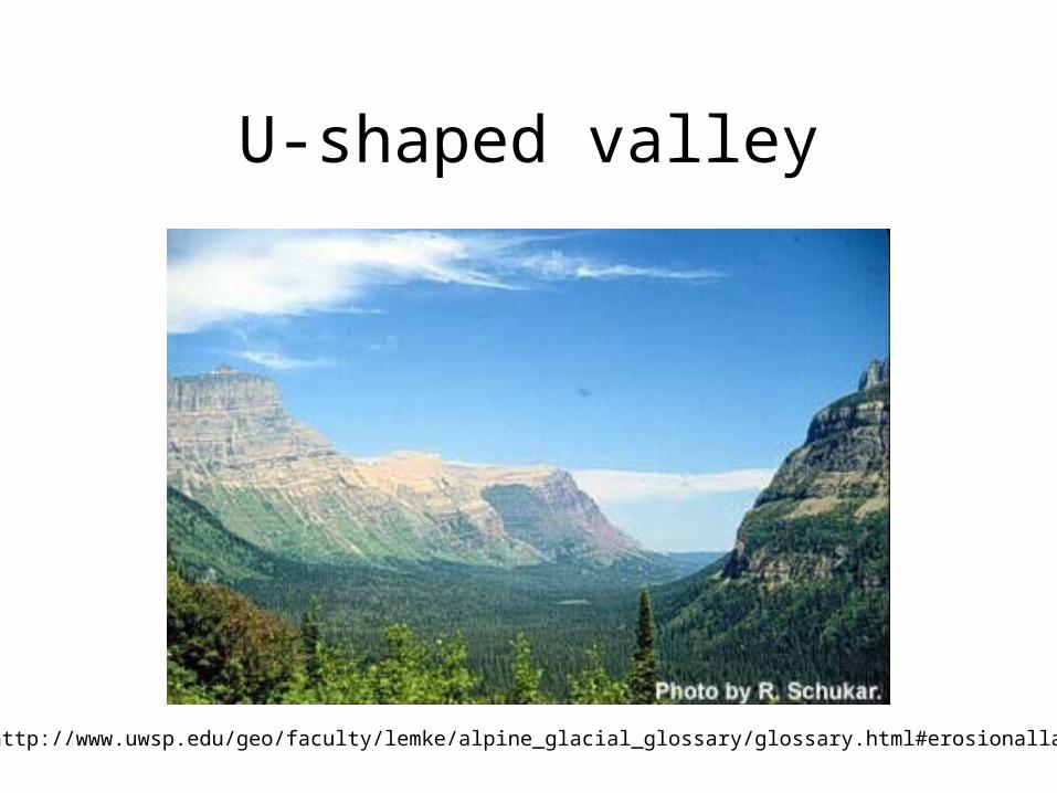
U-shaped valley
http://www.uwsp.edu/geo/faculty/lemke/alpine_glacial_glossary/glossary.html#erosionallandforms
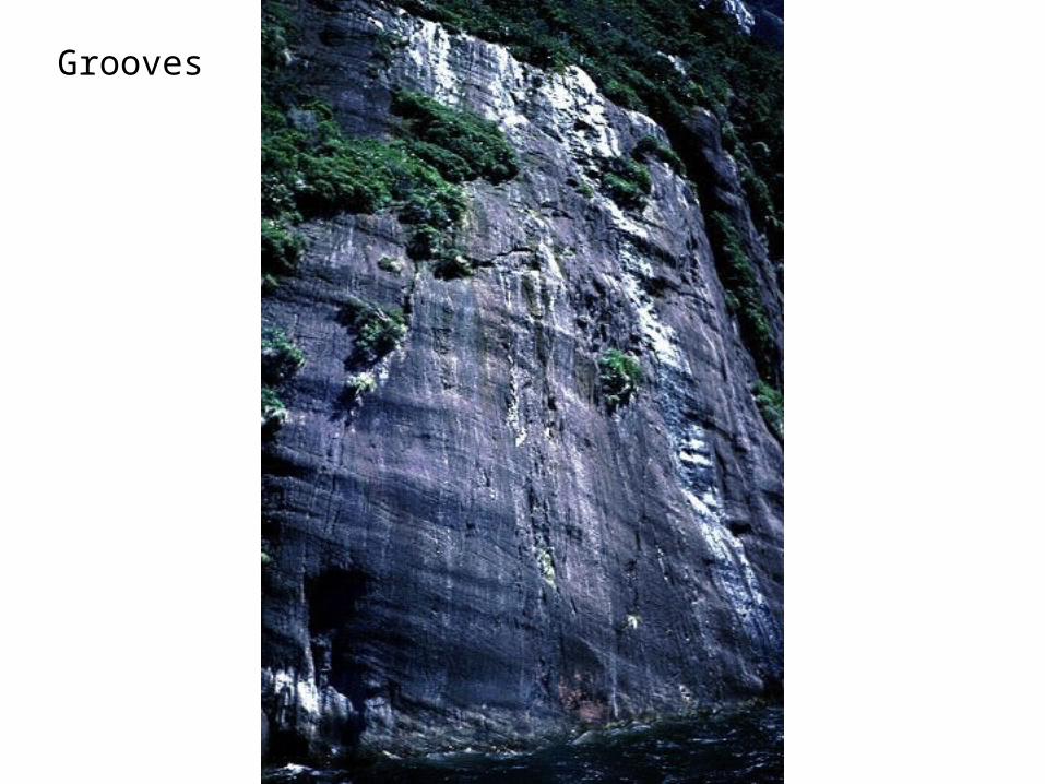
Grooves
• Till– material deposited as glacier retreats– gravel, pebbles, sand, mud– rocks are ground as glacier moves
Glacial Deposits -Till
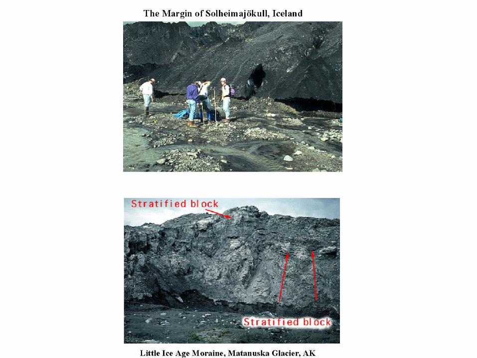
Glacial Deposits- Moraines– End moraine
• when glacier stalls (low accumulation relative to ablation), glacier continues to move debris to melting snout; this is the accumulation
– Lateral• Marginal• debris is concentrated along edges of glacier
– bound by wall
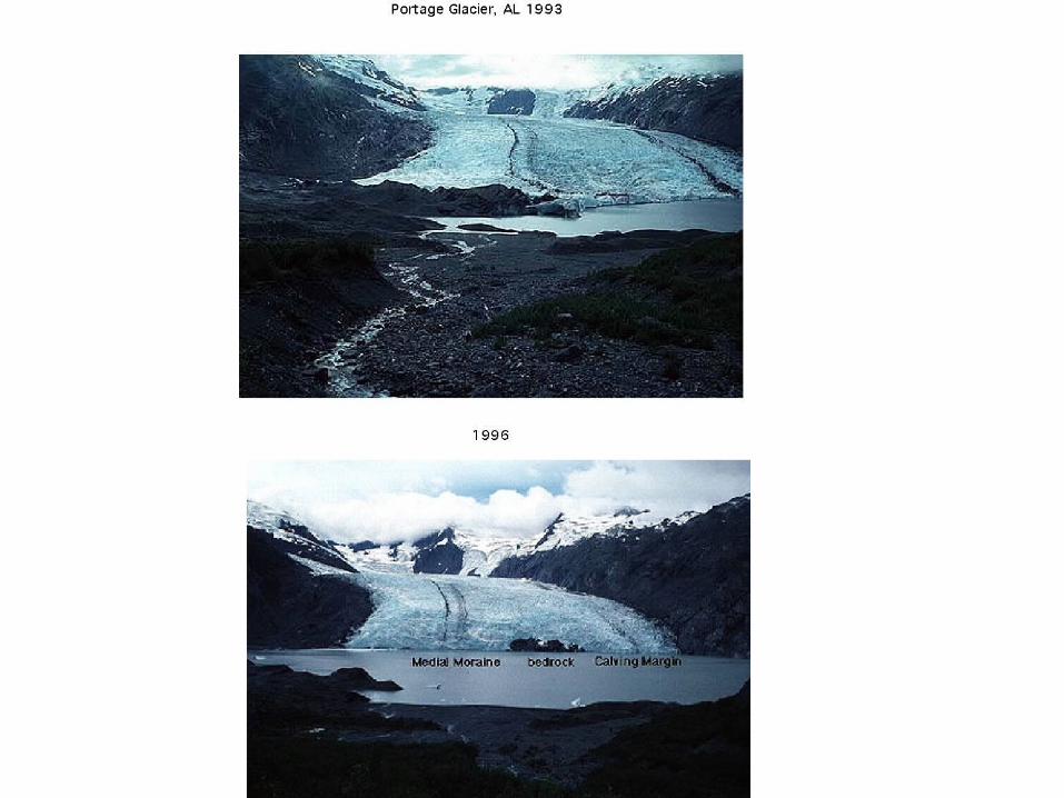
– Medial• where lateral moraines join, can form in middle
– Ground• sheet of debris developed during retreat
– Recessional• like end, but occurs during retreat
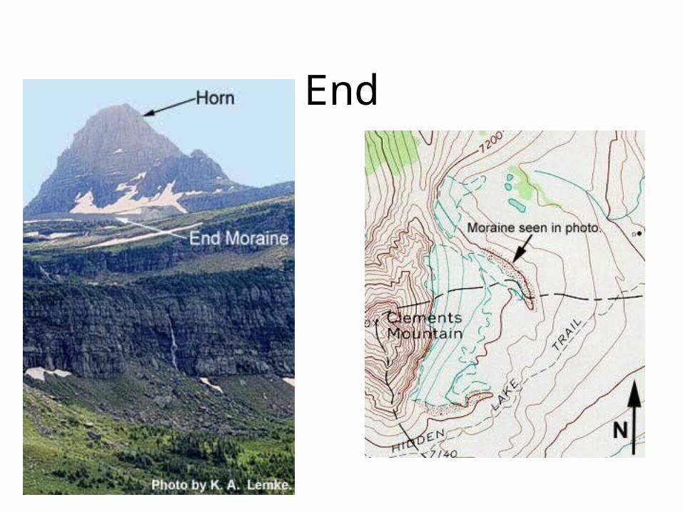
End
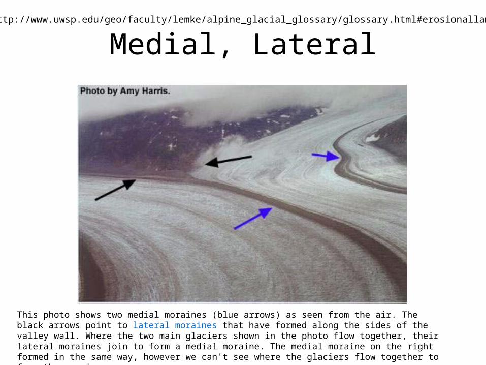
Medial, Lateral
This photo shows two medial moraines (blue arrows) as seen from the air. The black arrows point to lateral moraines that have formed along the sides of the valley wall. Where the two main glaciers shown in the photo flow together, their lateral moraines join to form a medial moraine. The medial moraine on the right formed in the same way, however we can't see where the glaciers flow together to form the moraine.
http://www.uwsp.edu/geo/faculty/lemke/alpine_glacial_glossary/glossary.html#erosionallandforms
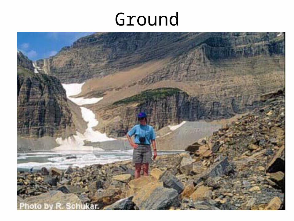
Ground
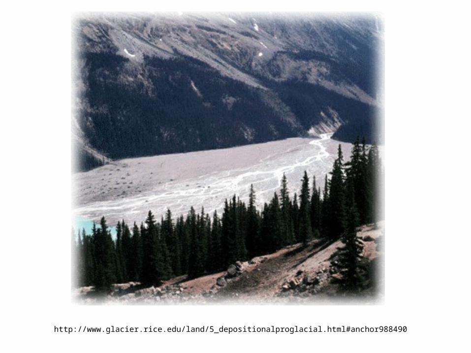
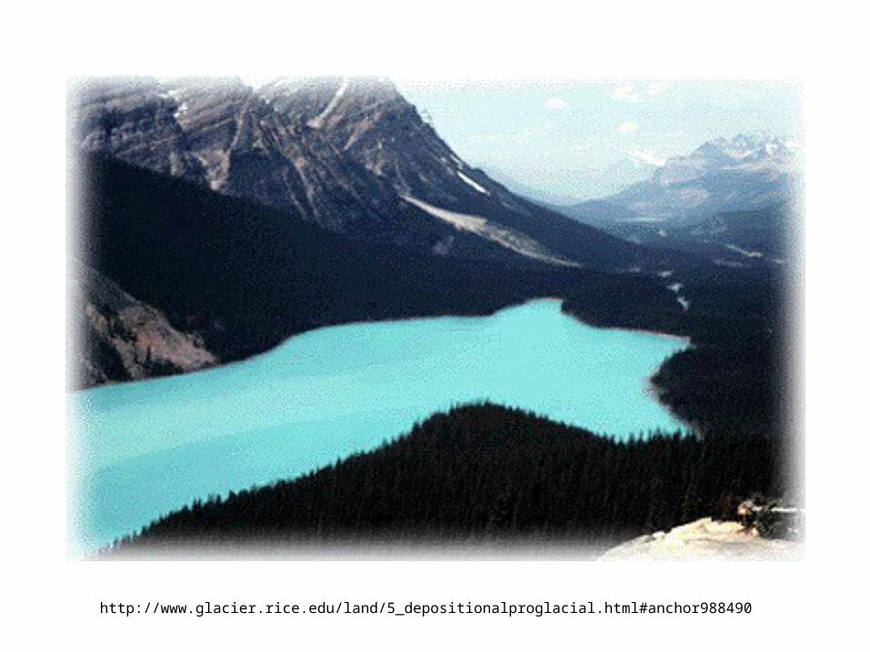
Rivers and Lakes
• Rivers– Generally braided streams, especially near
glacial front• lots of coarse but fines also present too
http://www.glacier.rice.edu/land/5_depositionalproglacial.html#anchor988490
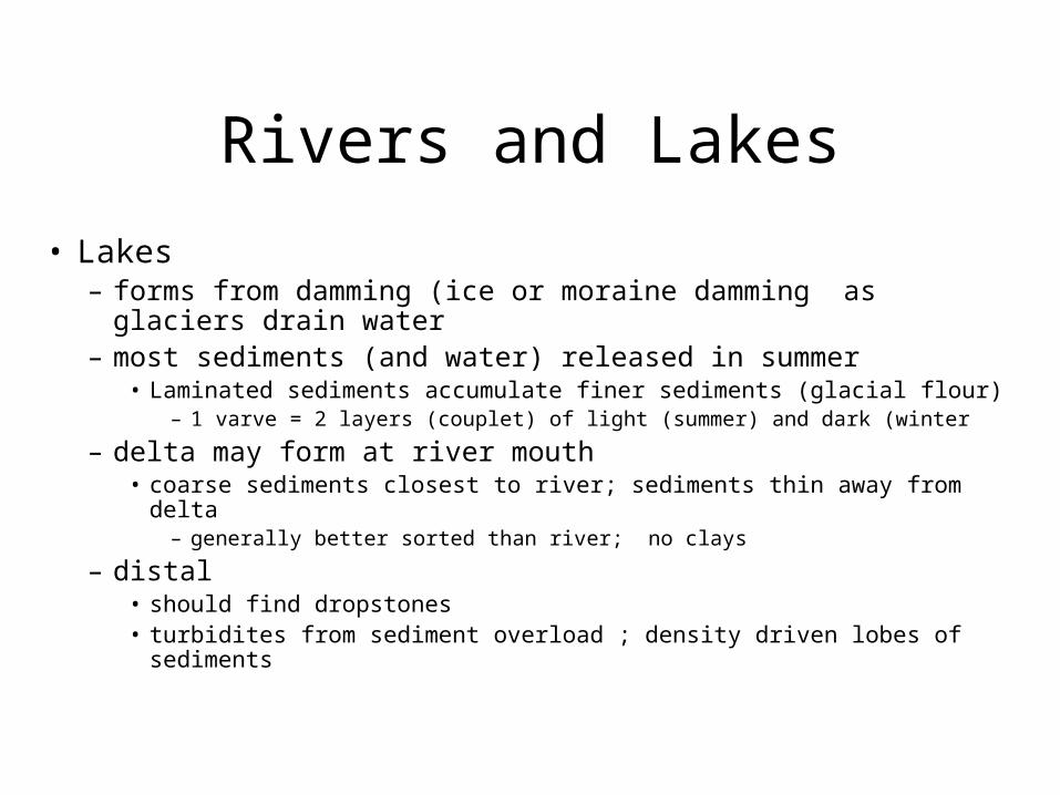
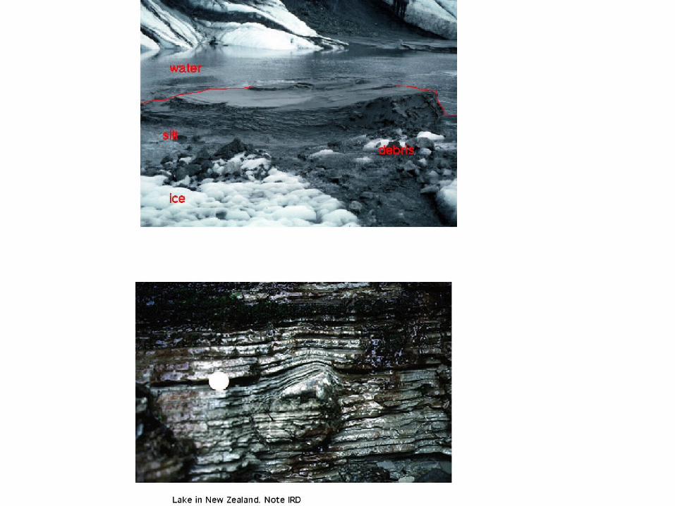
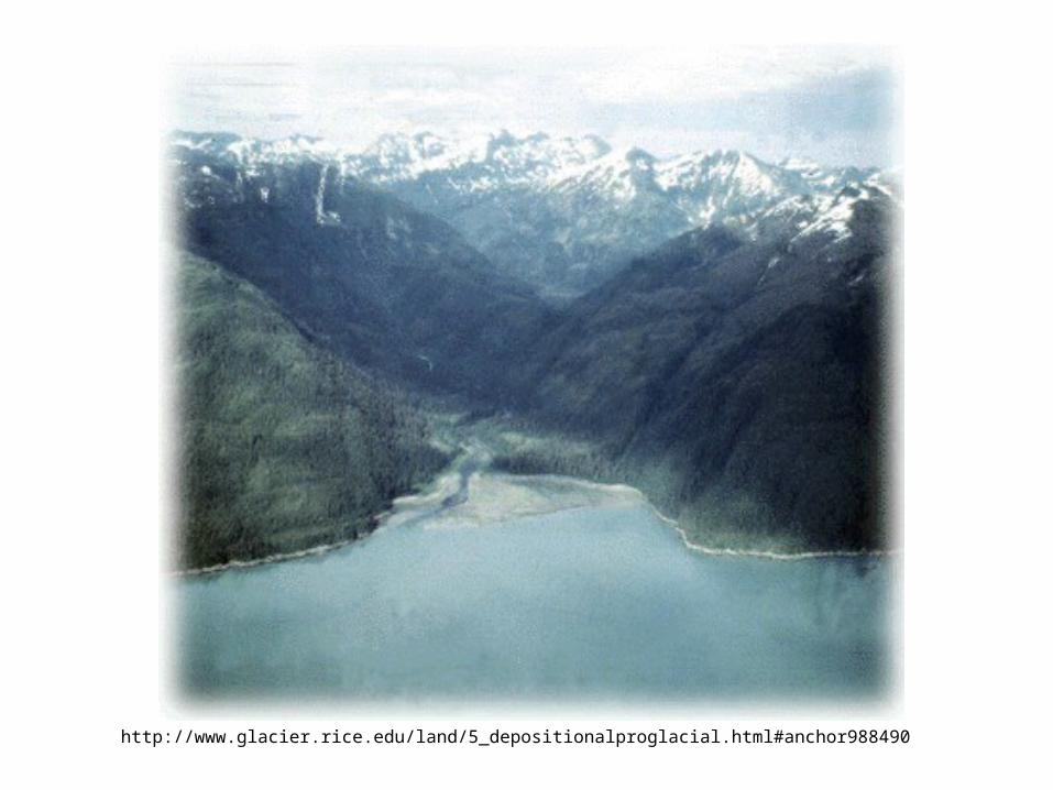
Rivers and Lakes
• Lakes– forms from damming (ice or moraine damming as glaciers
drain water– most sediments (and water) released in summer
• Laminated sediments accumulate finer sediments (glacial flour)– 1 varve = 2 layers (couplet) of light (summer) and dark (winter
– delta may form at river mouth• coarse sediments closest to river; sediments thin away from delta
– generally better sorted than river; no clays
– distal• should find dropstones• turbidites from sediment overload ; density driven lobes of sediments
http://www.glacier.rice.edu/land/5_depositionalproglacial.html#anchor988490
http://www.glacier.rice.edu/land/5_depositionalproglacial.html#anchor988490
Eolian
• Winds attack deposits on outwash plains– lead to loess deposits– most effective after glacial melt and before re-
vegetation– cap the facies by reworking glacial sediments
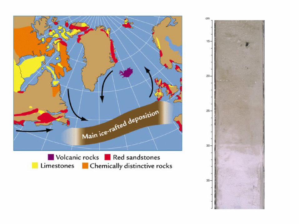
Glacial- marine
• little reworking– when glacier meets sea it dumps load– sediments can fall out of melting glaciers (IRD)
• IRD- Ice Rafted Debris
– silty freshwater plume rides over denser, saline water
– sediments settle out of suspension• turbidity current
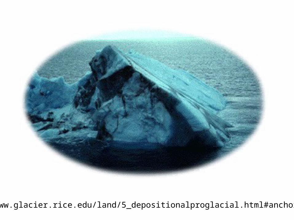
http://www.glacier.rice.edu/land/5_depositionalproglacial.html#anchor988757
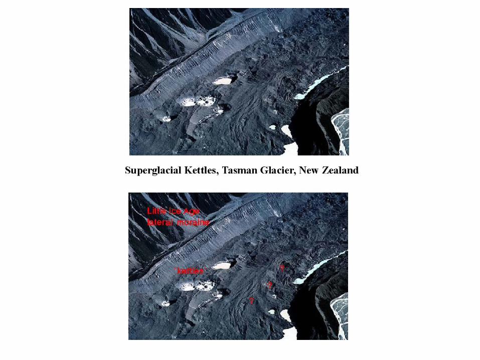
Other glacial features• Kettles- small lakes
– small piece of ice breaks off and is covered by sediments, then melts
• Eskers- – water flow thru tunnels stops and deposits seds; tunnel eventually
collapses; leaves snakey deposits which remain after ice has melted; coarse seds accumulate under tunnels; often well- sorted (fluvial- like)
• Drumlin– tear-drop shaped mounds; glacier deposits material and then rides
over it; // to flow
• Glacial erratics – boulders and other rocks which don’t match regional lithology
(carried in)
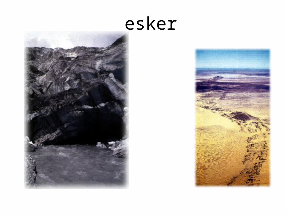
esker
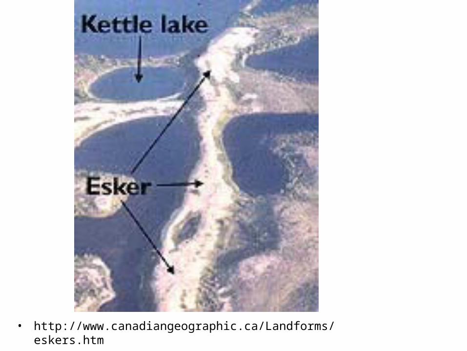
• http://www.canadiangeographic.ca/Landforms/eskers.htm
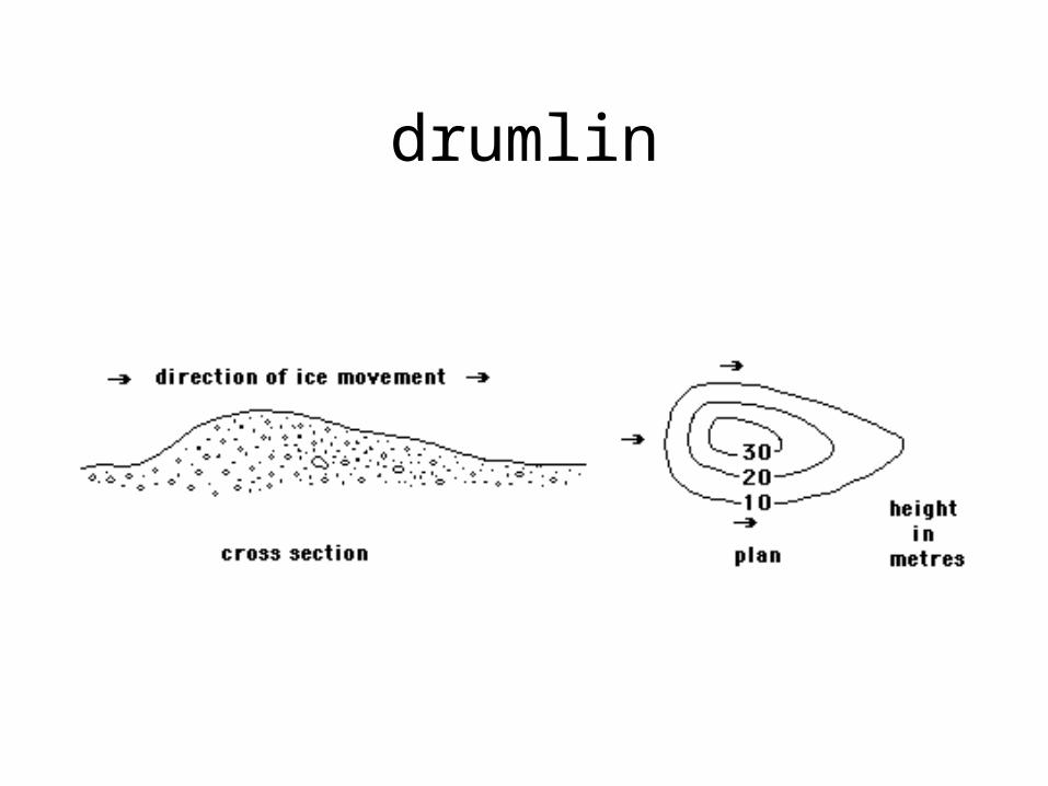
drumlin
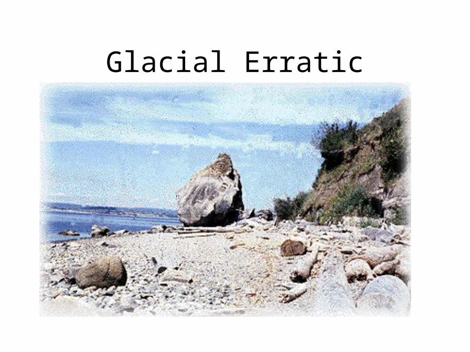
Glacial Erratic
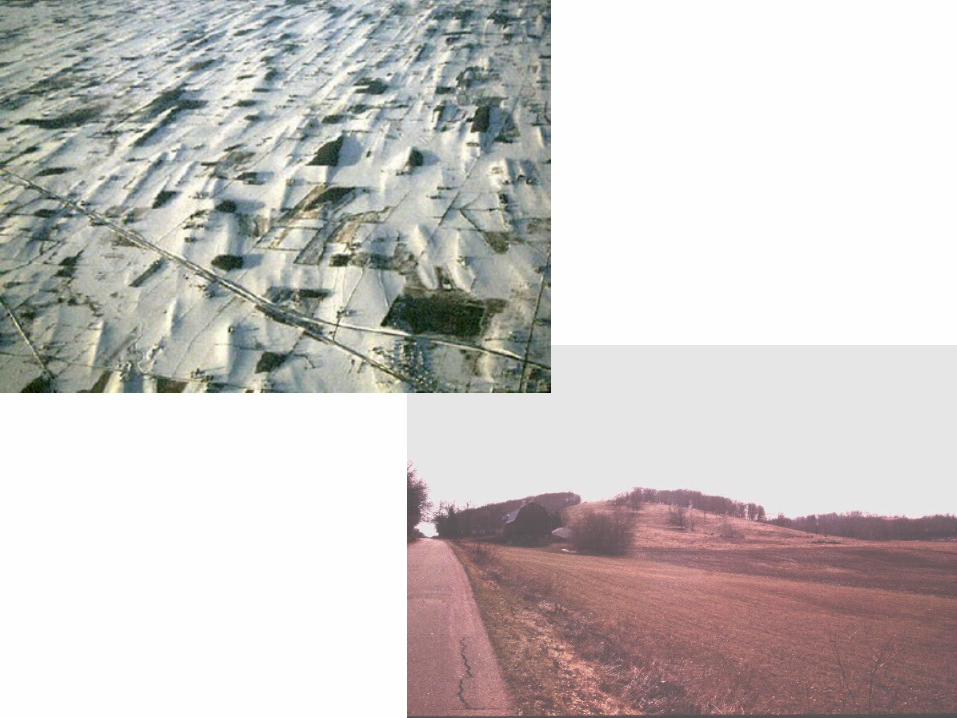
Proglacial area
• just in front of glacier– ice contact environment– sediments are released form melting at front of ice
• there is very little integrated drainage– small lakes, mudflows, river deposits – sediments are a jumbled mess!
• sorting improves with more distal areas – lakes, rivers, deltas
• At most distal regions– cap of eolian sediments– dunes, ripples
Facies- ON LAND• Diamict
– poorly sorted glacial deposits
• Diamictites– consolidated diamict
• Unstratified diamictites– land-based deposit– pebbles are often dominant– may be aligned with long axes dipping upstream– often bimodal (pebbles and matrix of sand, silt, clay)
• Stratified diamictites– ice contact sediments– transported by meltwater (braided streams)– Unimodal
• Till
Differentiating from Non- glacial
• Glaciofluvial braided streams– Very hard to differentiate from non-glacial streams
• Glaciolacustrine– Look for
• range in particle size reflecting seasonal contributions• possible slumps close to glacier• Varves
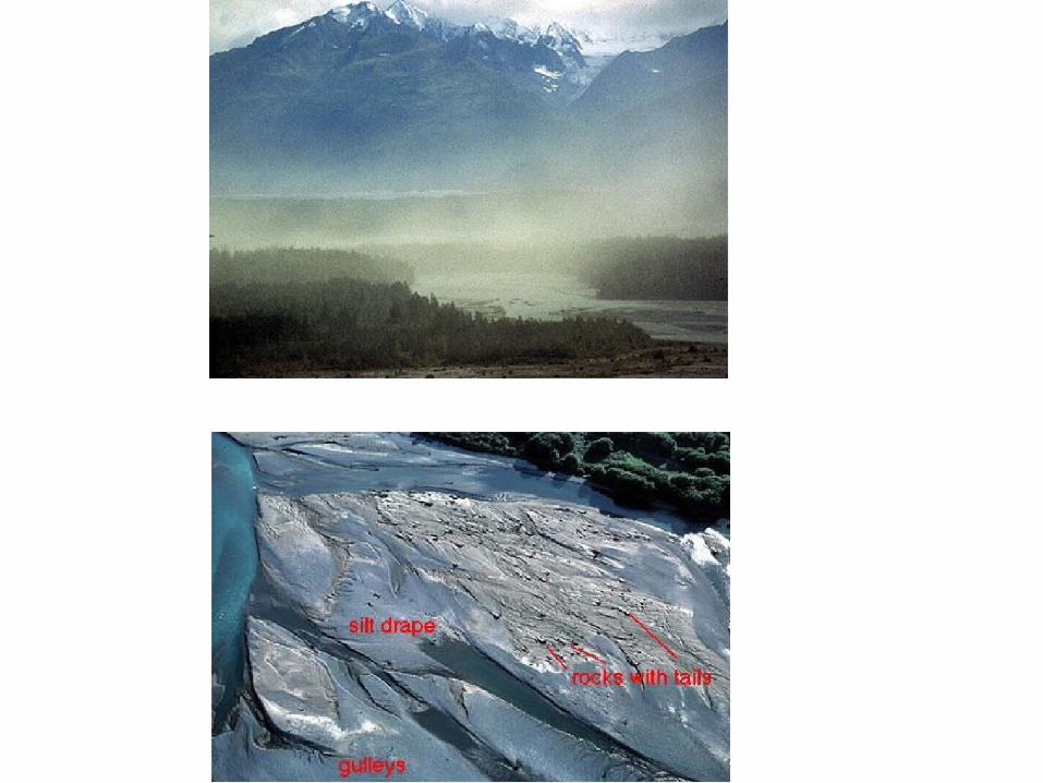
• Other clues to glacial environment– outwash plains
• dunes may be present (sands picked up by winds)
– loess- deflation of angular grains of silts; unstratified
Facies- AT SEA
• Proximal– glacier margin in direct contact with sea– submarine fans (delta- like)
• coarse cobbles, gravels at top of fans
• sands, gravels in stream channels
• IRD – scattered
• muds, sands- suspended seds which settle out
• Distal facies– away from direct contact with glacier– icebergs melt– IRD- fine and coarse– iceberg grounding
• icebergs touch bottom and erode and rework it– some stratification
– marine fossils
– IRD=glaciomarine drift
Vertical Facies Succession
• Advance/ retreat of glaciers leads to destruction/ reworking of previously deposited sediments
• Vertical accumulation– best way to differentiate is regional pattern. – common to northern US,
• saw advance/ retreat of glacers in Pleistocene at ~ 100 ky periods with wiggles at 23 ky.